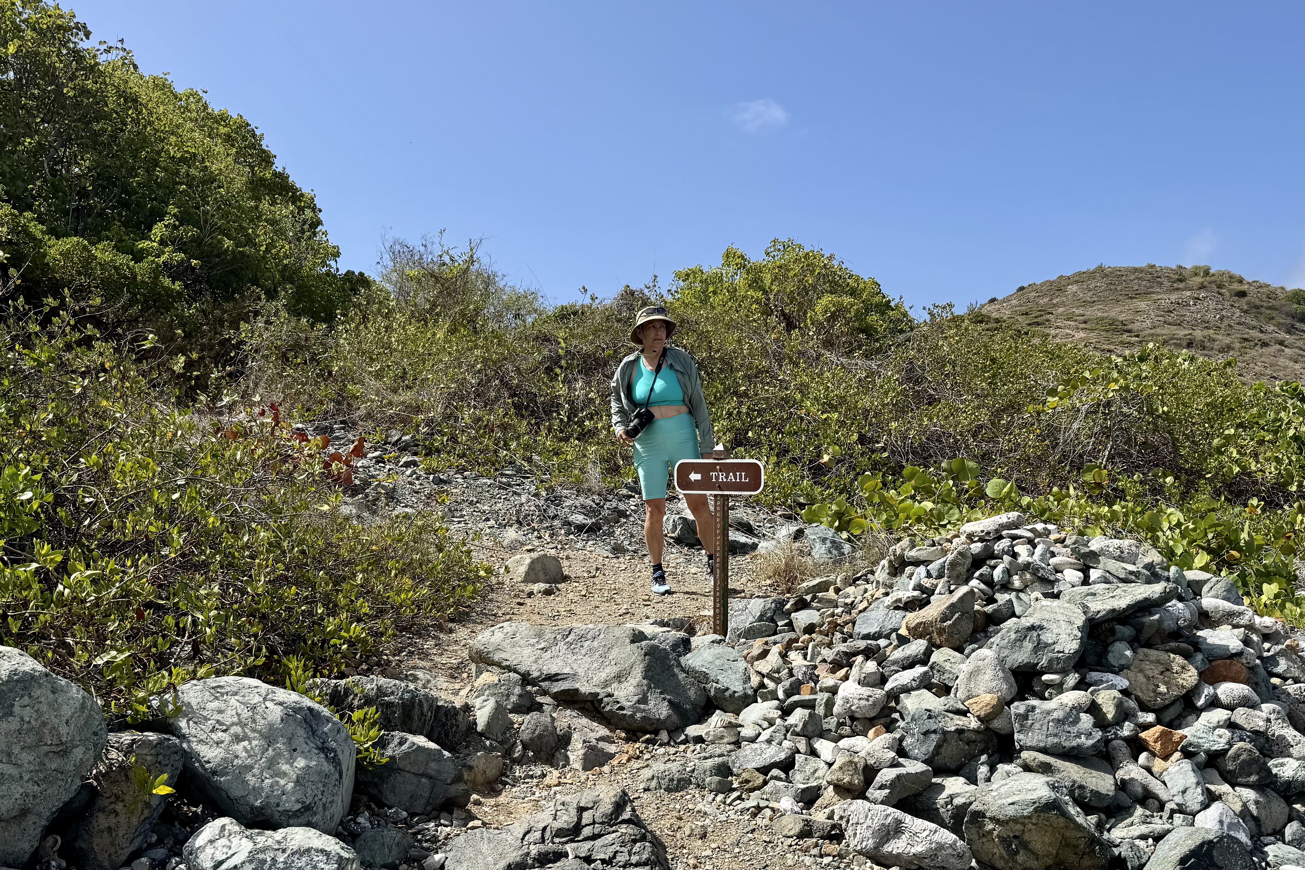
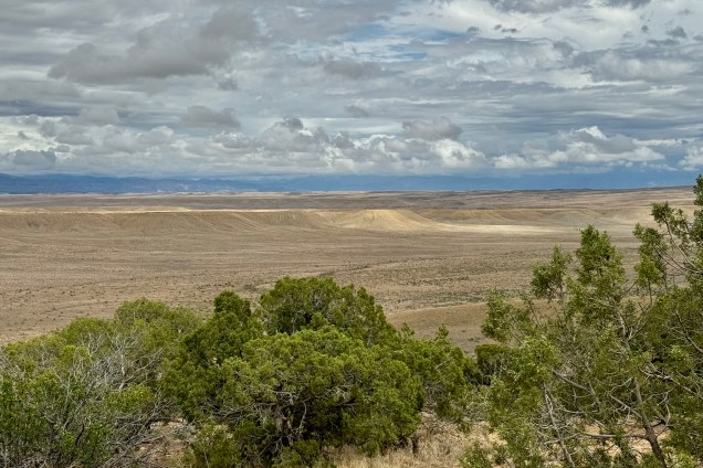
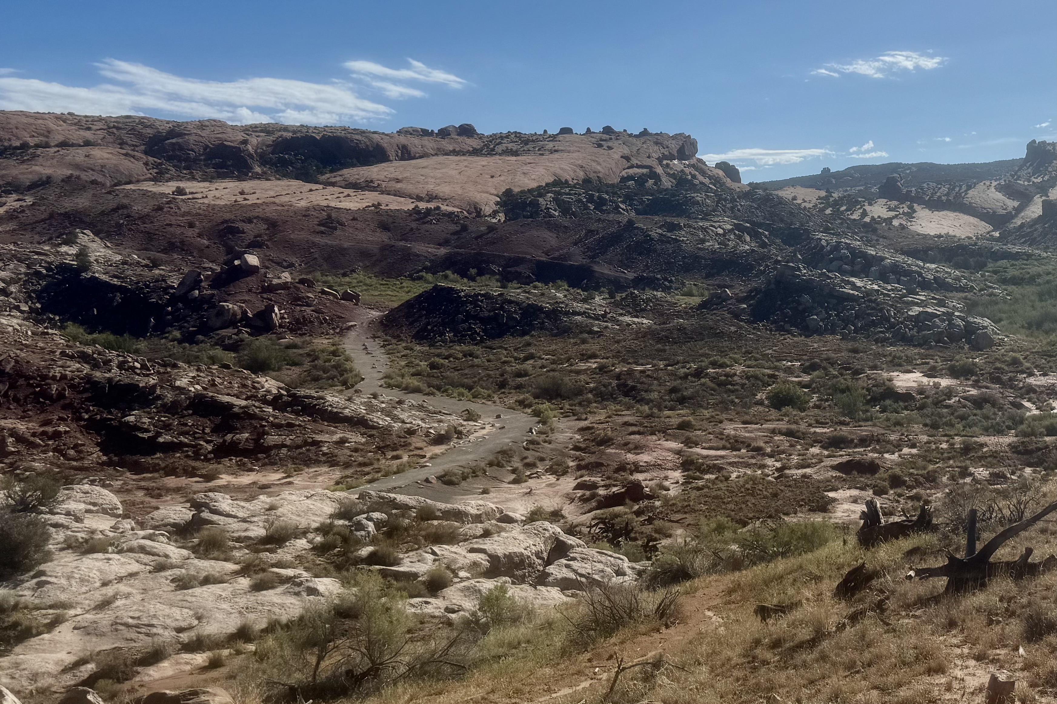
We had three more full days to explore St. John’s and the Virgin Islands National Park and I definitely wanted to fill them primarily with snorkeling and hiking. Our choice for Day #6 was the Salt Pond Bay Coral Reefs and the Rams Head hike, accessed from the beach on Salt Pond Bay. We had hoped for a more “private” snorkeling adventure and opted to head east and south to the Salt Pond Reef in the south west part of St. John’s betting that the the driving distance and the 1/2 mile hike in would deter any crowds.
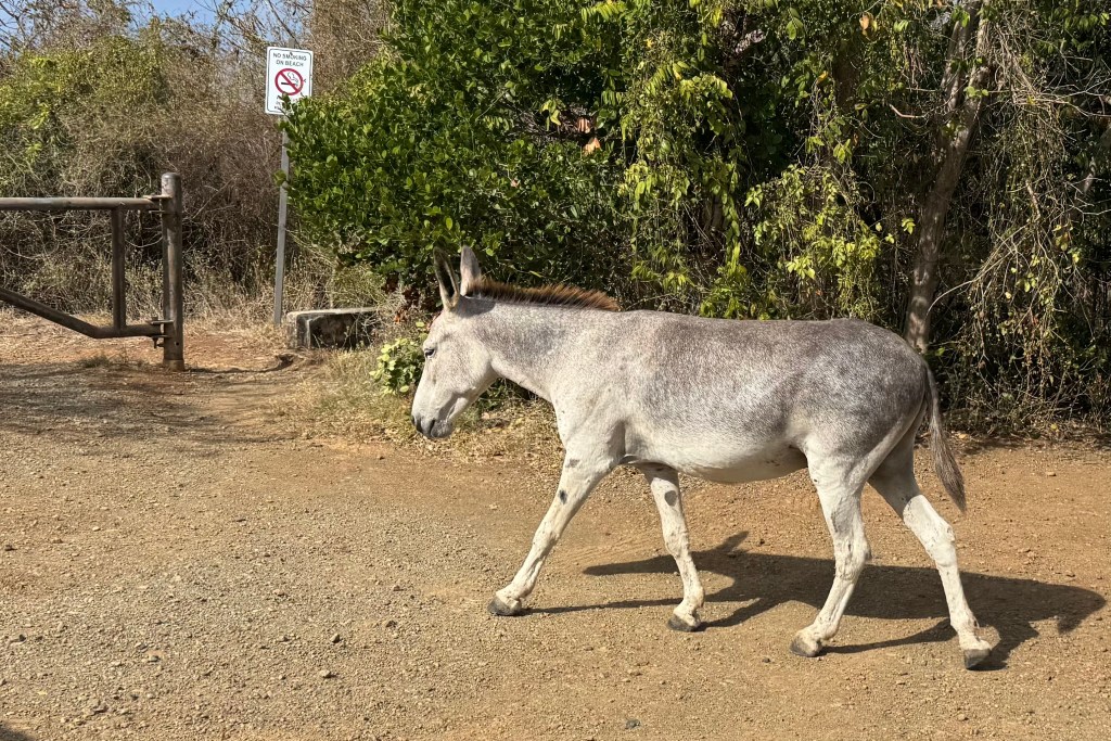
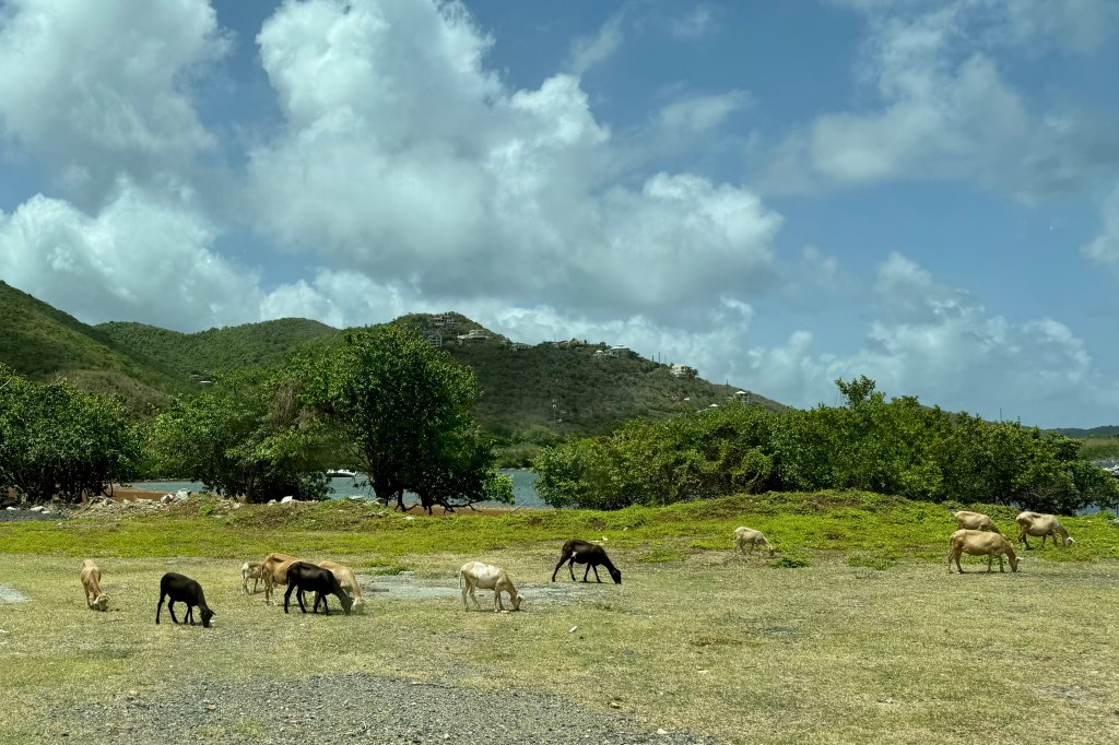
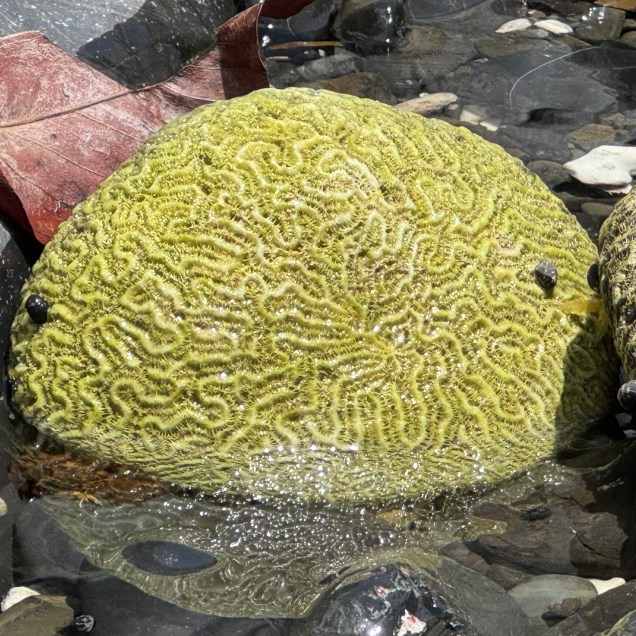
Domesticated EquineSalt Pond
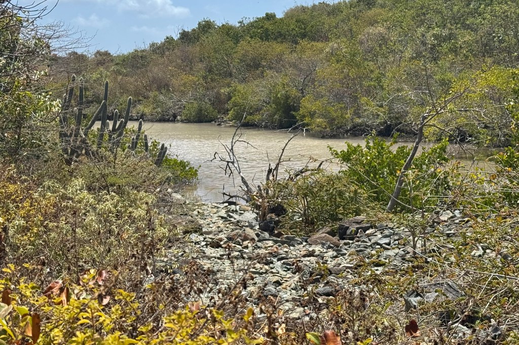
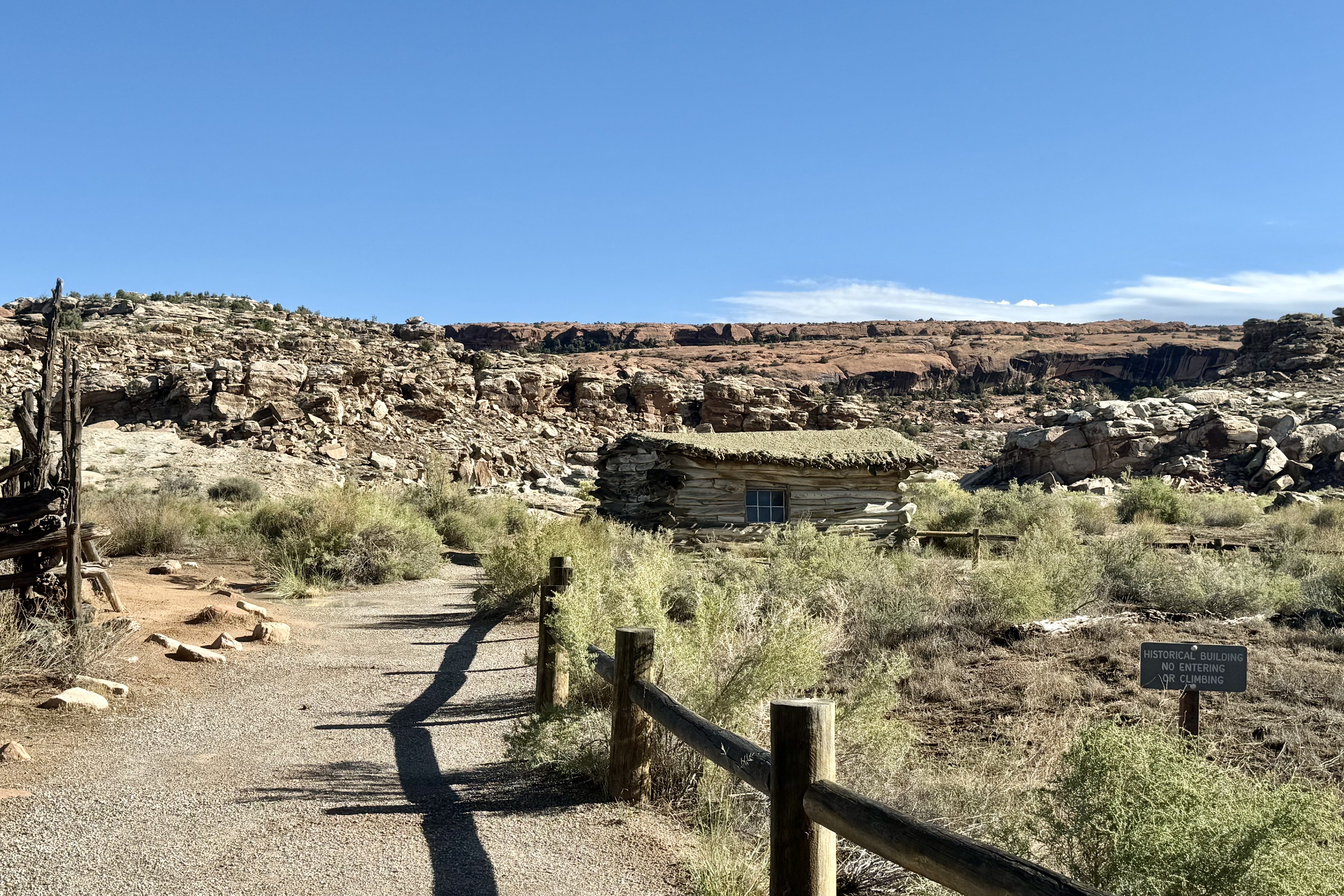
We were greeted at the trail head by a couple of the permanent wild residents of St. John’s. – a couple of stubborn and unpredictable domesticated equines (aka burros and donkeys) sauntering down the trail to Salt Pond Bay. Eventually they veered off into the scrub along the trail but I kept my eye out unsure of where they might pop up again. We made our way down the full sun, rocky, dusty half mile trail to Salt Pond Beach. We came upon Salt Pond just before we approached the shoreline with a sandy strip separating the salt pond from the bay itself. Historically residents would harvest salt from ponds like this .
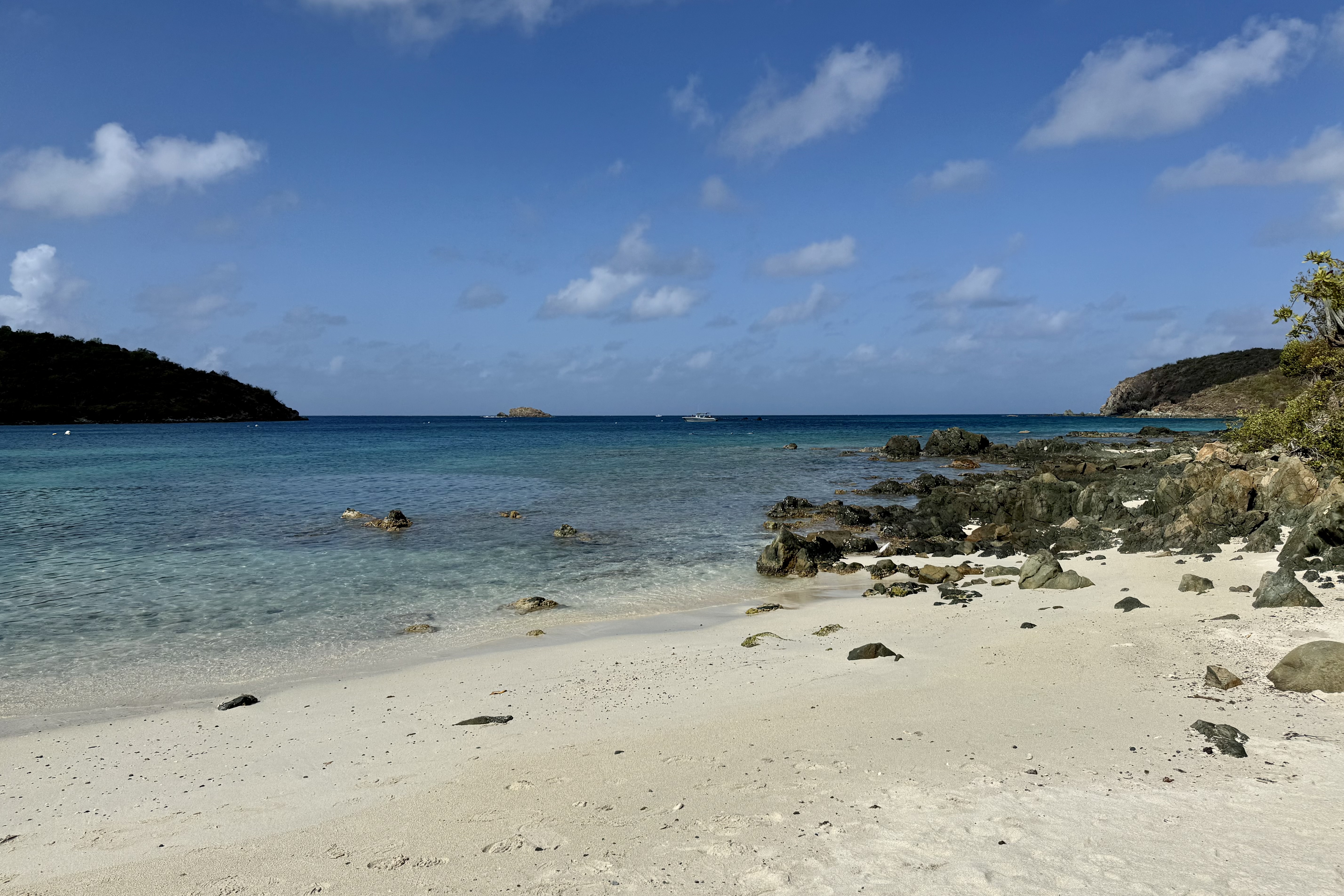
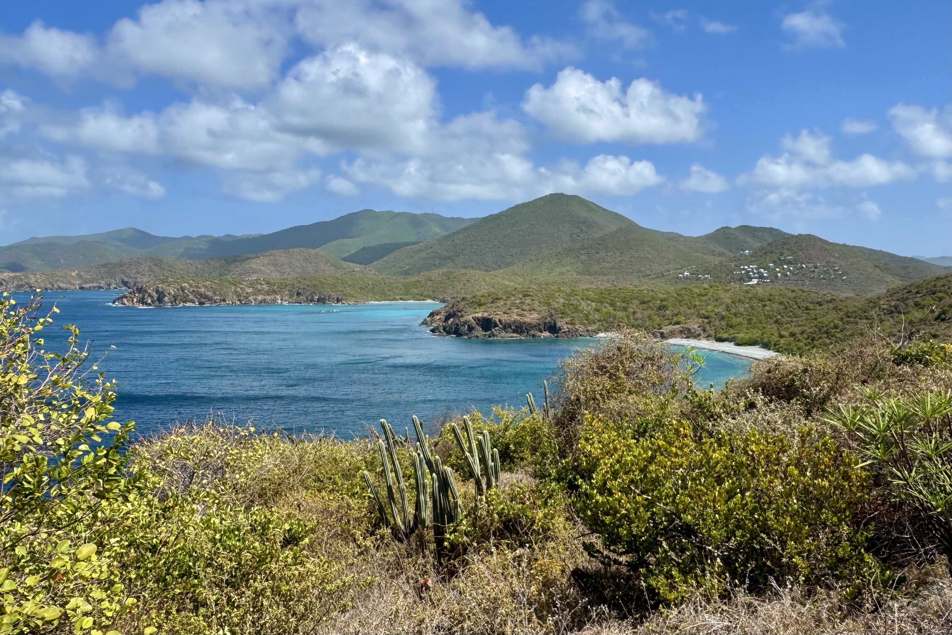
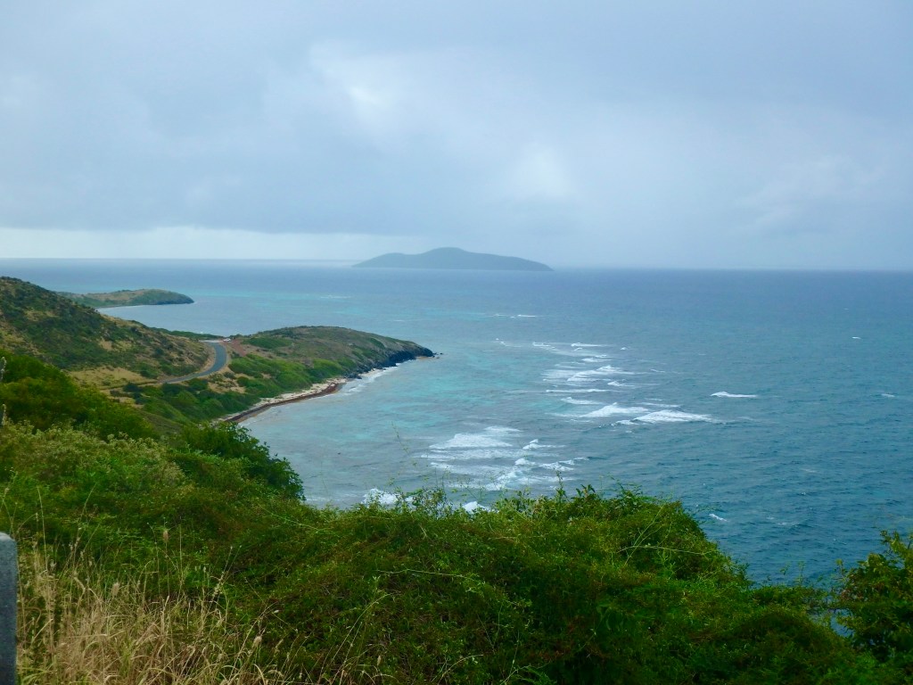
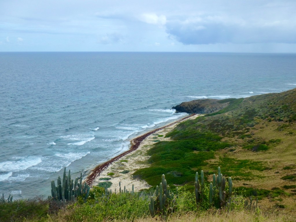
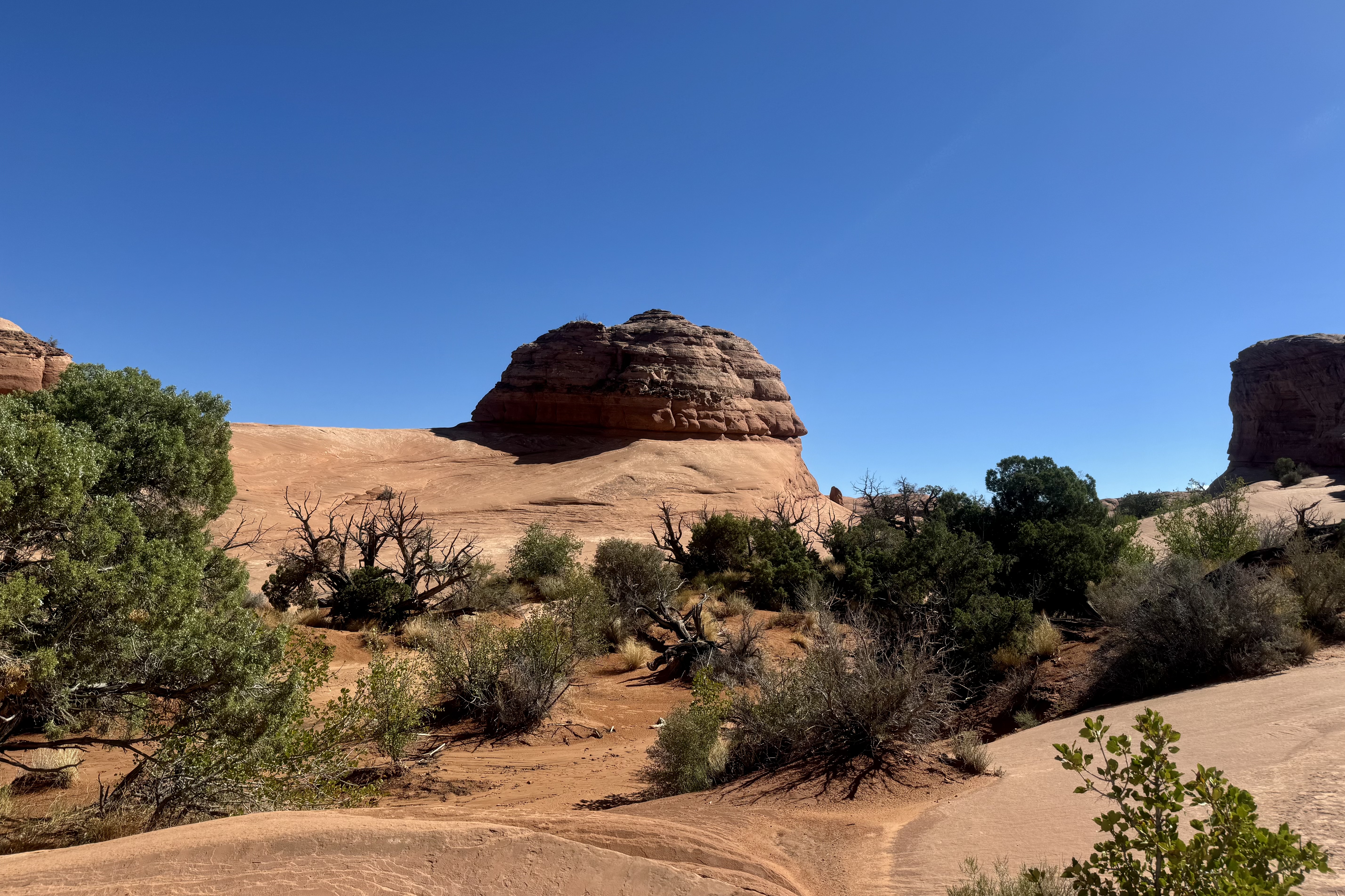
In that the day was heating up and it was already 9:15am, we opted to make our way east and across Salt Pond Bay and the sand beach. This section was easy until I reached “blue cobblestone beach, ” the nickname for the shoreline here of volcanic stones that have a bluish-gray tint. Now it was slow careful steps so as not to roll an ankle on these rolling shifting stones with each step a bit of a wobble and a clatter. But once back on firmer ground the trail began to climb up, mostly in full sun, through dry coastal scrub, a plethora of the very phallic Turk’s Cap Barrel Cacti, and views of the Caribbean’s turquoise waters.
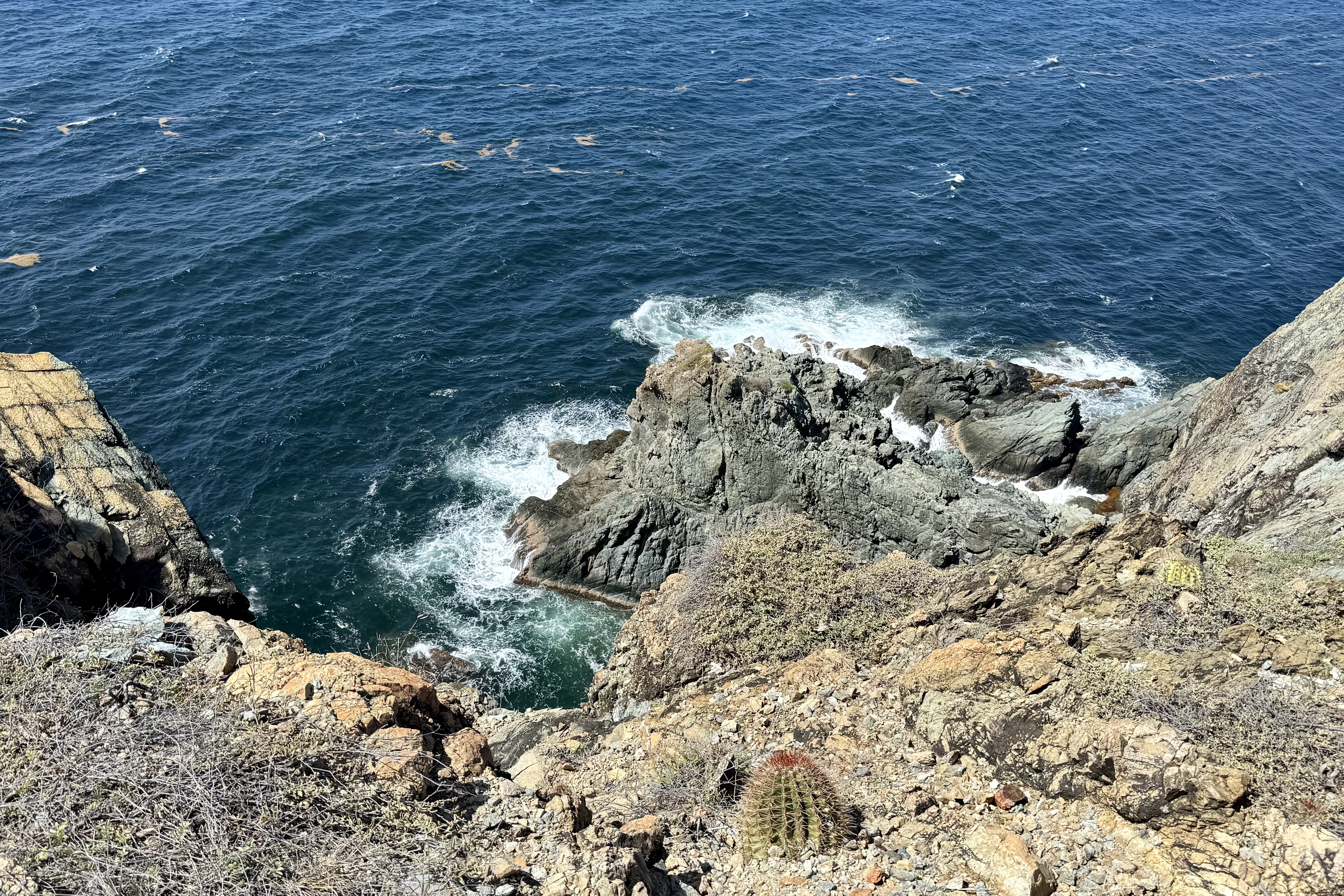
This is windswept terrain was at its best and the wind sweeping across the trail at times tried its best to blow me over. Ram Head can best be described as a dramatic headland jutting into the sea and the reward for this close to one mile hike is a 360-degree view of the surrounding waters. Salt Pond Bay was sparkling with sapphire and ultramarine hues and the Atlantic sported a shimmering deeper blue color. It was an exhilarating experience standing atop the “ Ram” with the wind sweeping across the “Head” and the ways crashing below.
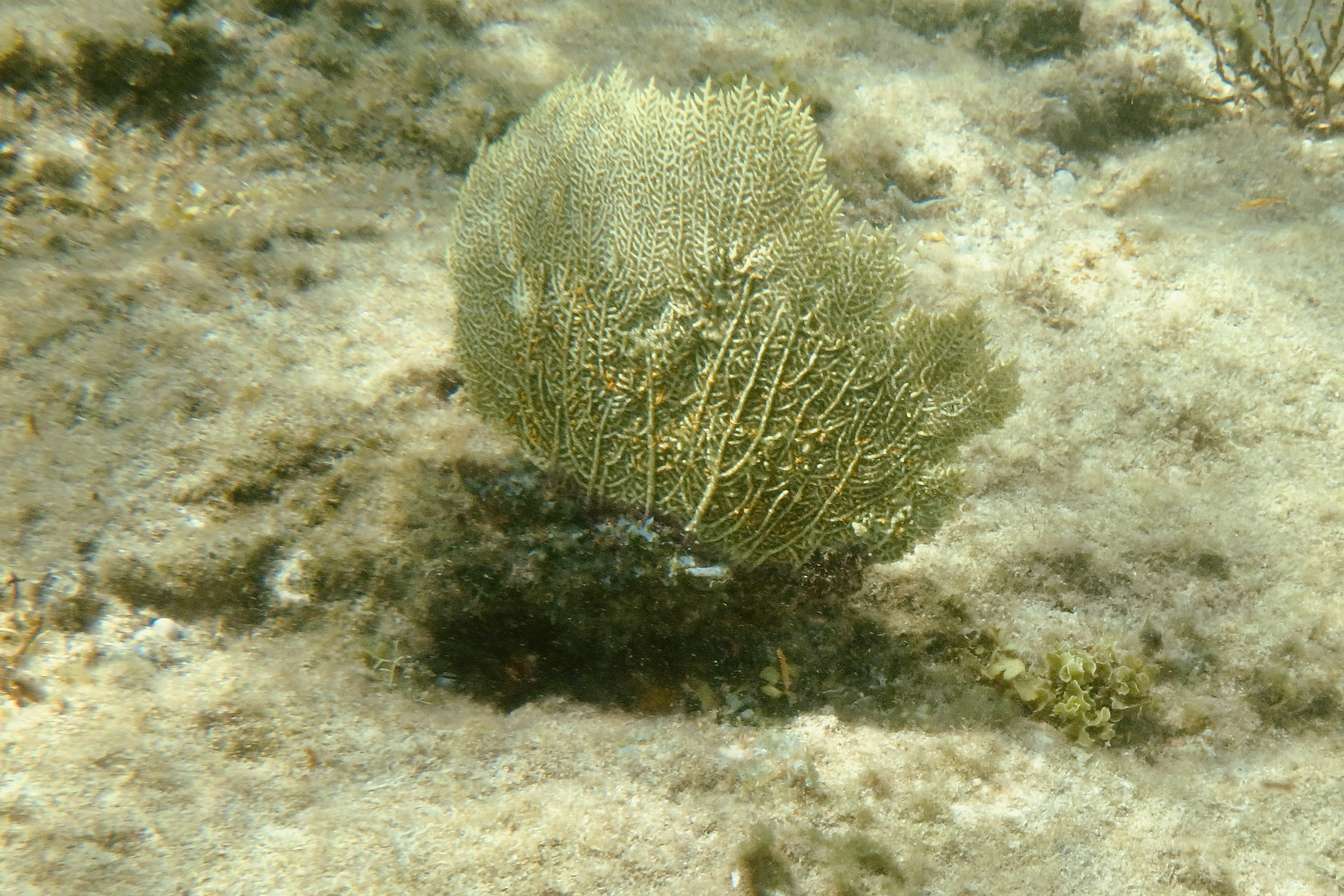
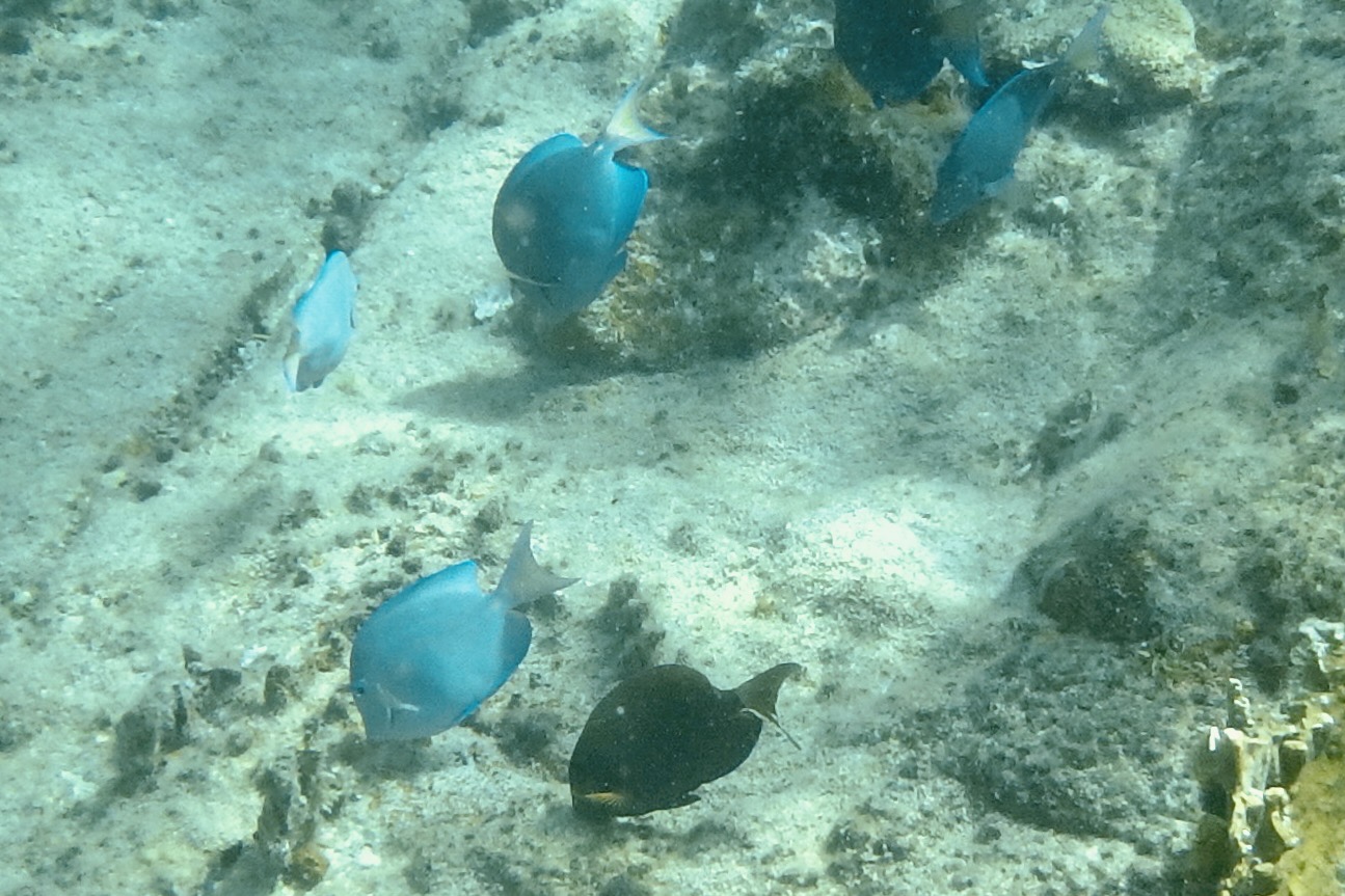
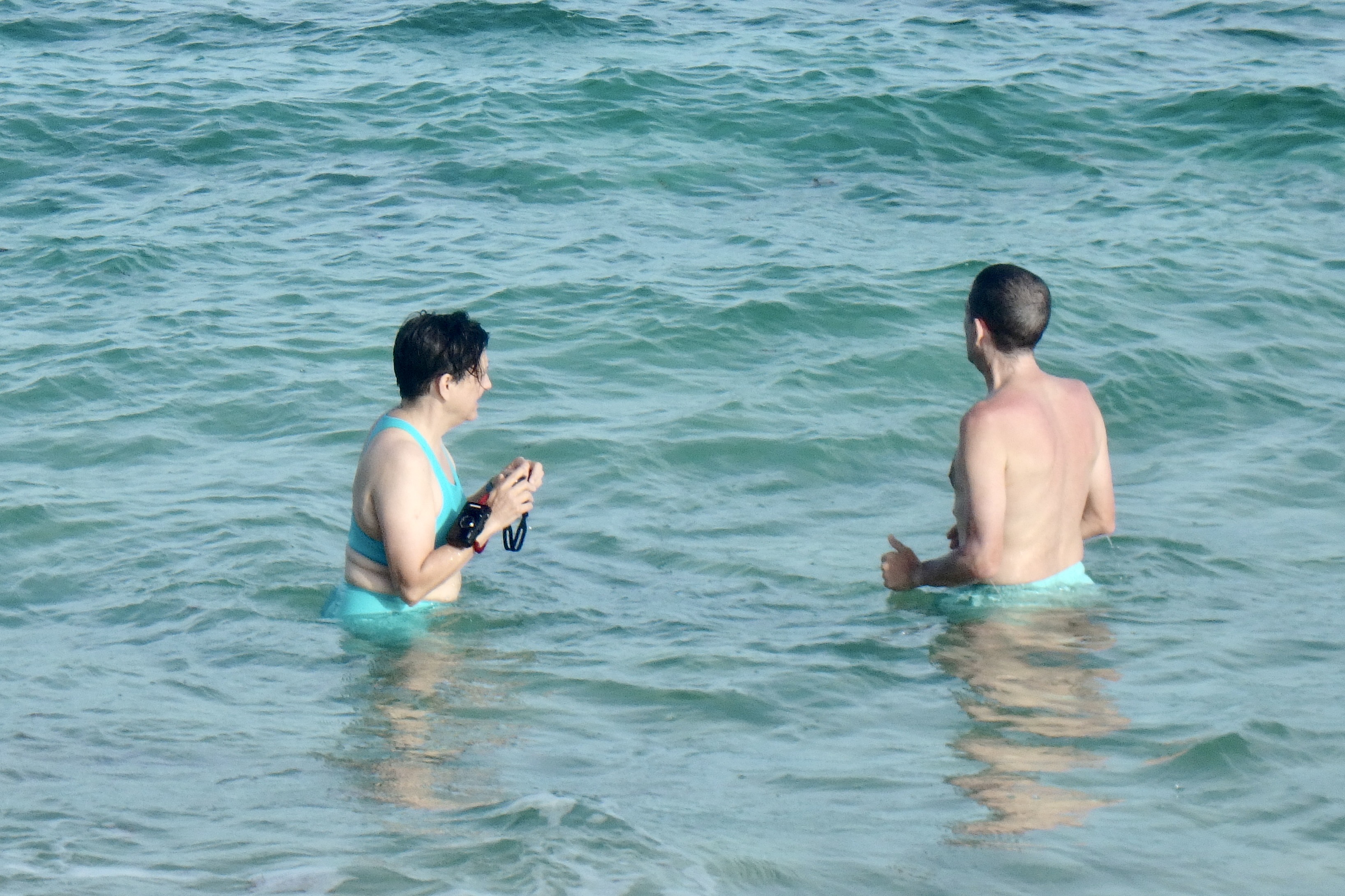
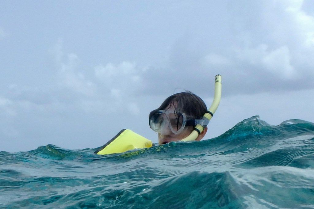
Our hunch was right and we were fortunate that we didn’t have to share this bay with an overdose of other snorkelers. It was now time for snorkeling and time to face the awkward task of entry into this underwater world. It should be easy from this sandy beach but donning the gear was not without its comedic side. Do I sit on the beach and don the fins? But I recollect that when walking in them previously, I waddled like a penguin. So I waded out into shallow water at the beach midpoint and plunked myself down. It seemed to be going well as I struggled to put on penguin shoe #1 until a small wave arrived and not only moved me around but swept the other one towards shore. I somehow eventually managed to secure both flippers on to my feet, secure the mask to my face, and get the snorkel into my mouth. I quite ungracefully tried a dolphin dive into the water resulting in getting a snorkel full of water and a mask that became an indoor pool for my face. Seems I forgot to push up the forehead hairs thus breaking the seal. But eventually success! I was cruising along toward the rocky ledges of shoreline and its coral gardens and reef fish. Parrot fish and blue tang abounded and I was enjoying the metronome of sea fans. It was exhilarating.
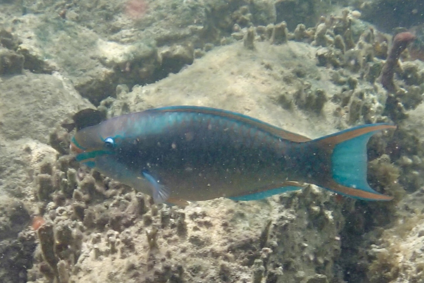
Exiting in the middle with its grassy beds, I was quite content with my adventure until I compared notes and my lame photos with Tasia’s and my few blue tang and blue parrot paled compared to her exquisitely captured images of a Longspine Squirelfish, a Threespot Damselfish, a Gray Angelfish, a Parrotfish, an Ocean Surgeonfish with an Foureye Butterflyfish, a school of Dwarf Round Herring, a Moon Jellyfish and a Hawksbill Sea Turtle. Clearly she is the expert photographer and I definitely qualify as the inexpert…though I am quite good at using Google Images to identify the fish she captured!
Following a very satisfying hiking and snorkeling adventure it was time to cruise on to Cruz Bay heading up route 107 to Coral Bay. I kept trying to film us traversing the road to hopefully capture a video and pictures of the road as it rises and falls along dry scrubby hillside replete with its uneven pavement, potholes and washed out edges as well as the occasional donkey or goats along the roadside. Not too captivating footage resulted. Passing through Coral Bay, a quiet village, we continued on route 10 twisting and climbing and dipping up and down the mountainside until we arrived in Cruz Bay and headed up to our villa for a chill afternoon and preparation for dining out.
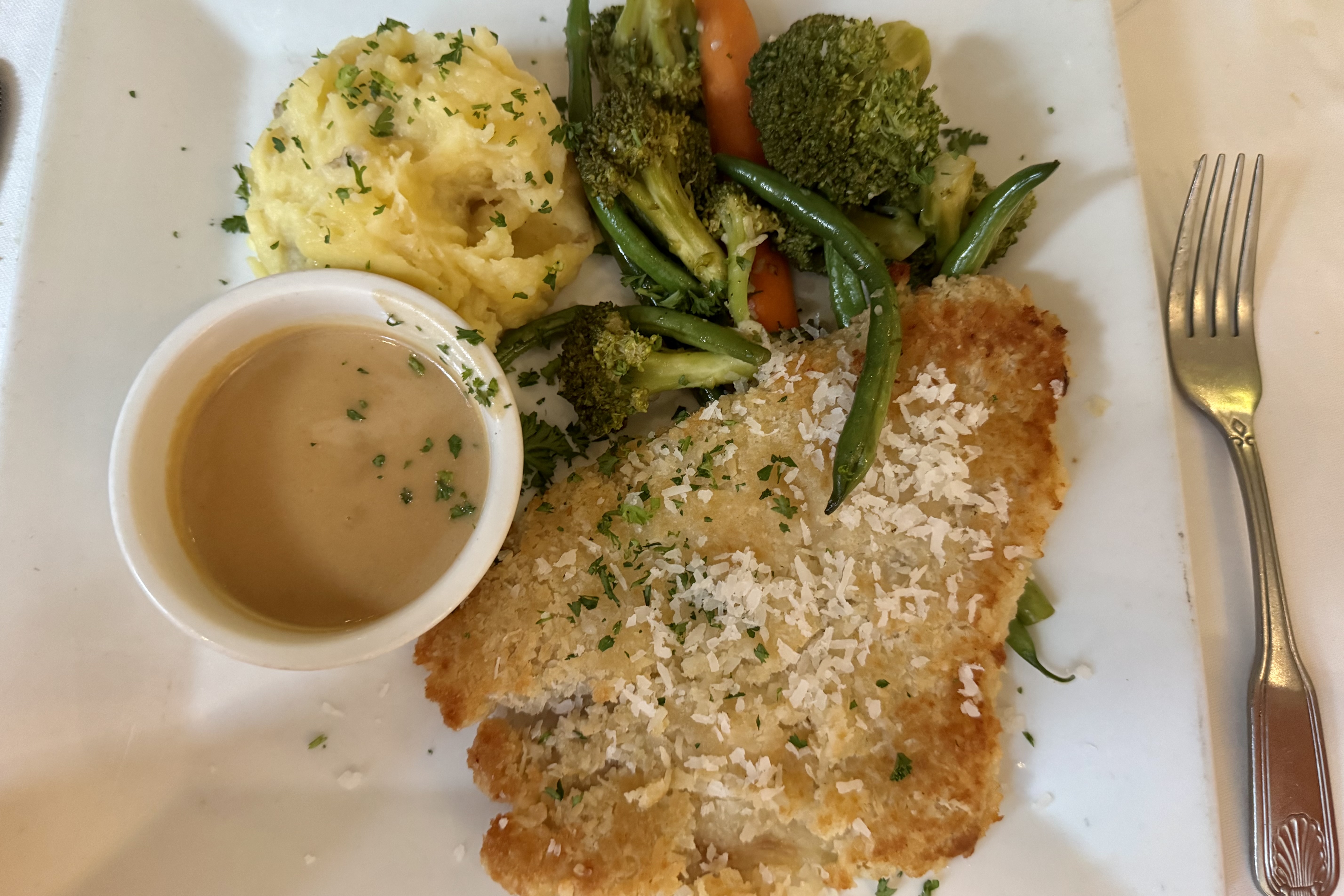
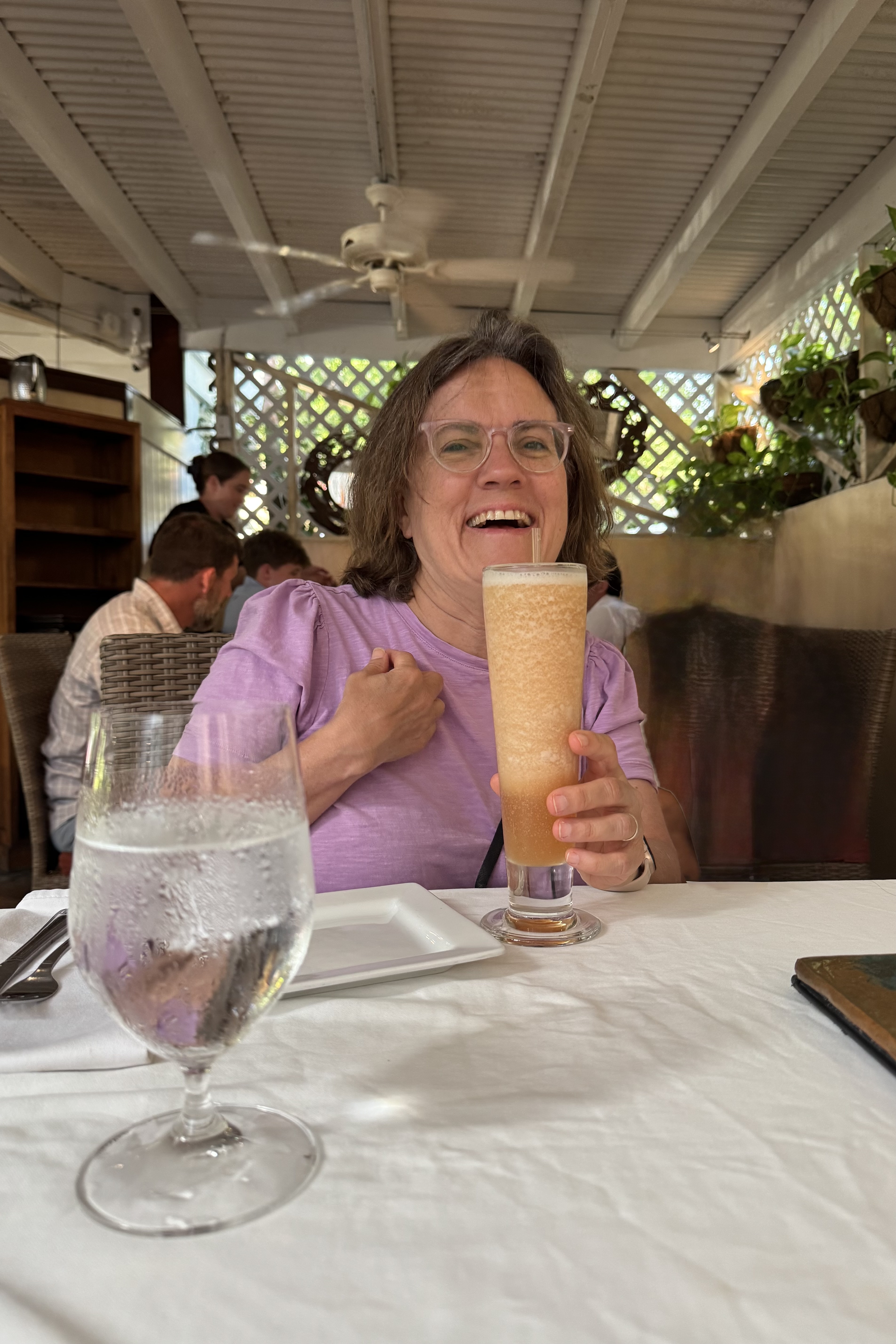
Our dining choice was Morgan’s Mango Restaurant which features a Caribbean vibe as well as Caribbean food. They claim a bit of a mix of Creole, Bahamian, Cuban, Jamaican, Haitian, Puerto Rican and Mayan. I am not sure which cuisine inspired my “coconut panko encrusted fresh grouper sautéed in organic cold-pressed coconut oil until crisp on the outside & moist within— served with a white wine, coconut, lemongrass reduction a unique Caribbean blend of a potato/yuca mash & fresh seasonal vegetables.” Whichever island was the inspiration for our dishes , they were exceptional…and when sated it was then onward to the villa for a swim and relaxing poolside beneath a sky blanketed with stars.
I was quite grateful for the air cooled bedrooms in our Judith Fancy villa but, as I emerged from it the second morning, I was so much more appreciative of the balmy breeze, salt tinged air, the wide blue sky and the blazing island sun. But no tarrying on our only other full day in St. Croix. We had decided the day’s adventure would be hiking the Trumbull Trail to the Annaly Bay tide pools and needed to get on the road if we hoped to reach the pools at low tide.
The difficulty rating of the the Trumbull Trail is a relative thing and despite reviews of it being easy ( rated a stroll in the park that young strong legs make it out to be) or moderate (rated by most middle of the pack hikers)but for an 81 year old 4’11” female it was an adventure that left me so acutely aware of the withering of my formally very strong Ironman legs despite the fact that I regularly do weights for leg strengthening. But with walking stick in hand, I was oft times sandwiched between Nick and Tasia to hopefully catch any forward or backward stumbling, skidding on loose gravel, missteps, trips or other lost footings. I have never been the most coordinated person nor been known for my graceful movements. For me it was a rough, somewhat punishing experience of a trail being outfitted with tripping roots and skidding rocks, lots of short steep up and down on a very narrow ribbon of gravel, rock and roots. I also have to admit that I did not have the wisdom to wear my hiking boots. The sign at the trailhead speaks a lot about the trail upkeep .
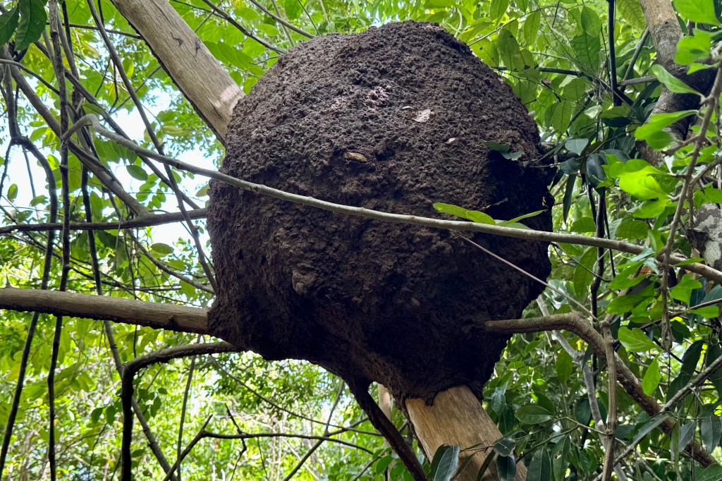
Trumbull TrailheadTermite NestSpiny Hercules Club TreeTrumbull Trail Terminus
My walking stick worked overtime. I crept along like a determined little arthritic mountain goat and I lost track of how many times I nearly stumbled. But, Nick and Tasia were always there to provide emergency arm assists. Luke was my temporary hiking sherpa though I am sure he would have much preferred to be daypack free. I gratefully accepted any helping hand which was offered knowing I was not as spry and agile as I envisioned myself to be i.e. that vision is of a gazelle over the terrain. Thankfully the thick tree coverage shaded much of the trail but it also blocks almost any breeze. The sweat factor might be described as a full body drip exacerbated by my wearing SFP gear with long sleeves and long pants.
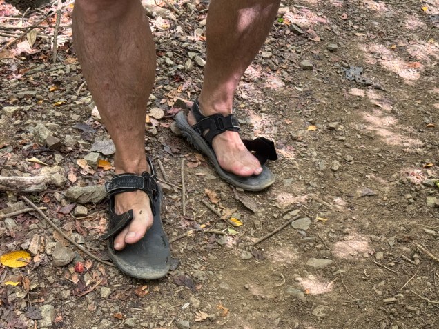
Many reviews of this hike suggested good footwear but heartbreakingly, mid-hike one of Nick’s old Merrill sandal straps snapped ( definitely not an ideal situation on a trail that would not be considered well groomed) . So he began joking about it, only to have a strap on the other sandal give out on the return trip. He the coined them as his “fop-flips. I am wondering if the next time I see him hiking with sandals if it will be the old Merrill’s “repaired” with string, twist ties and silver tape.
Flop-Flips
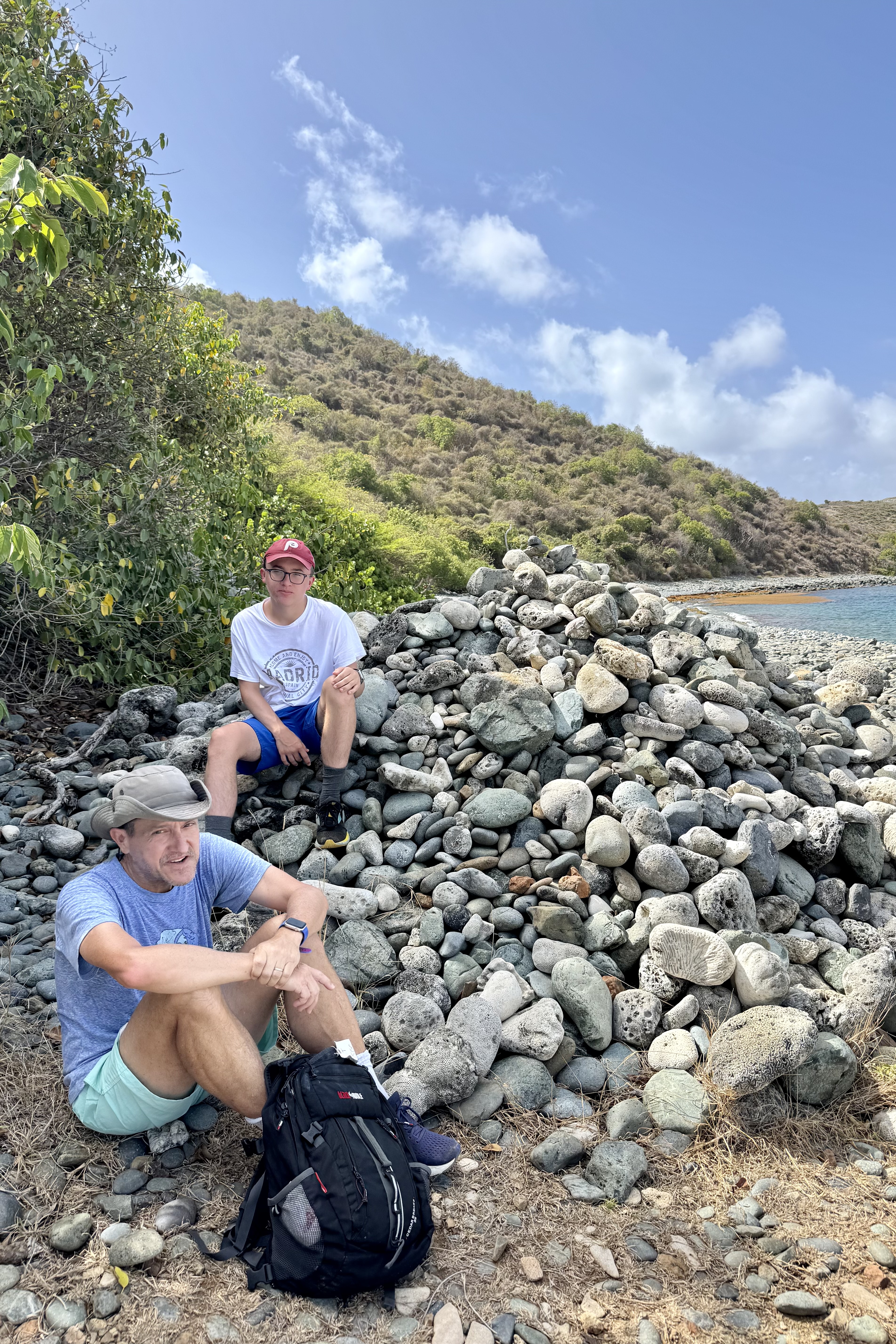
In short and succinctly put – rocks, roots, humidity, sweat . . . perfection! It was a great hike of 1 hr 30 minutes to the stony beach which would eventually lead to the tide pools. The round trip was a 4.25 mile workout.
I had to think twice about making the scramble over the lava rocks to the tide pools as I could see some very jagged rock and ledges which I would need to climb up and over to access the pool. This was flirting with danger such as a twisted ankle, a lacerating trip on the jagged lava rock, the choose-your-own adventure nature of the scramble, or a fracture of my osteoporotic bones… It would be a tough sweaty brutal carry out of my damaged body as there is no cell service and no easy rescue.
So I let my imagination run wild and decided that this could be just one bad step away from catastrophe (and for those who know me well, I tend to err on the side of reckless decisions) and opted to stay on the beach and piddle around in the sea gardens there. I also reminded myself that there was a repeat of the previous hiking adventure in reverse awaiting. Though disappointed in not getting to see the grand finale of this hike, I recalled that I had been to magnificent tide pools in Cannon Beach Oregon just last year.
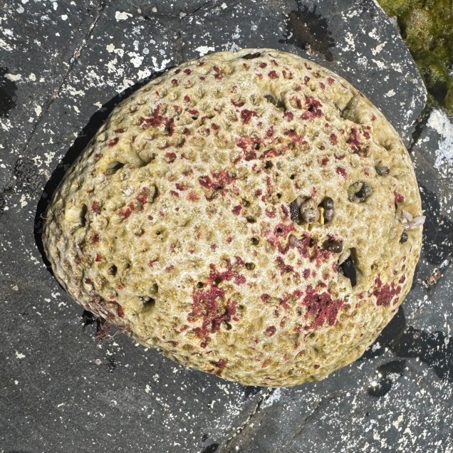
The sun was intense and the marine gardens at the edge sea were intriguing. I plopped myself in the water with a rock as my backrest and sat mesmerized by the miniature pools of flickering water surrounding me. They were teeming with a variety of marine algae both glimmering pink-hued and brown algae looking like ruffled paper, shells, corals , black snails…
The family reappeared about and hour and a quarter later having had an exhilarating experience, though Nick did loose a bit of his dignity in an encounter with the lava obstacle course and was bemoaning the jarring his body took and the decorative lacerations on his appendages. Can we blame it on the “flop-flip? On the hike out from the beach we were all to glad to bail on the final section out to the official trail head, bypassing some of the jungle slog, and take the unofficial backdoor out to the car. The landscape changed from rocky sandy slopes to a “spa brochure “ walk through the Carambola Beach Resort.
With still a few hours remaining for adventure, Nick , Tasia, and I opted for a drive to the farthest eastern point on the island and the eastern most point of the US. The sole purpose was for me to say I had been to eastern most point in the US. It is a popular sunrise adventure but I did not feel compelled to be at the eastern most part of the US at sunrise. Luke and Miriam were of the mindset that a vacation is for resting and opted out. However it was much more than a bag another first experience. The vast ocean surrounded in every direction.
Point Udall was named in honor of the politician Stewart Udall in 1968. Topping this spot it is a geometric stone structure of spike-like pillars, the Millennium Monument. It is a modern looking stone compass built for the millennium to commemorate the dawn of a new century. It was the place to be on 01/01/2000 as the compass marked the azimuth of the first U.S. sunrise of that year.
View from Point UdallMillennium MonumentView from Point Udall
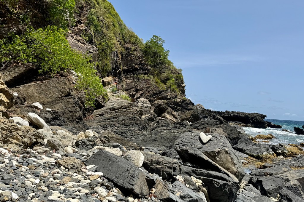
After milling about for a bit, we saw the trailhead for the Jack & Isaac Trail. Needing to stretch my limits further with another hike, I was hoping my body would forget that I had already hiked today. The trail cut downward on a well worn relatively obstacle free path through windswept terrain similar to the tropical desert on Buck Island. As I trudged along what lay before me was stunning. The landscape of Issac and Jack’s Bays was a ribbon of white sand between the brilliant turquoise of water and the verdant greens of the hills. At the second egress for Isaac’s bay we doffed anything we did not want to get wet and plunged into this cool salty blue sea. Afterwards we hiked back partially on the beach. I was so grateful to have the energy to be able to experience the immersion into this postcard perfect scene.
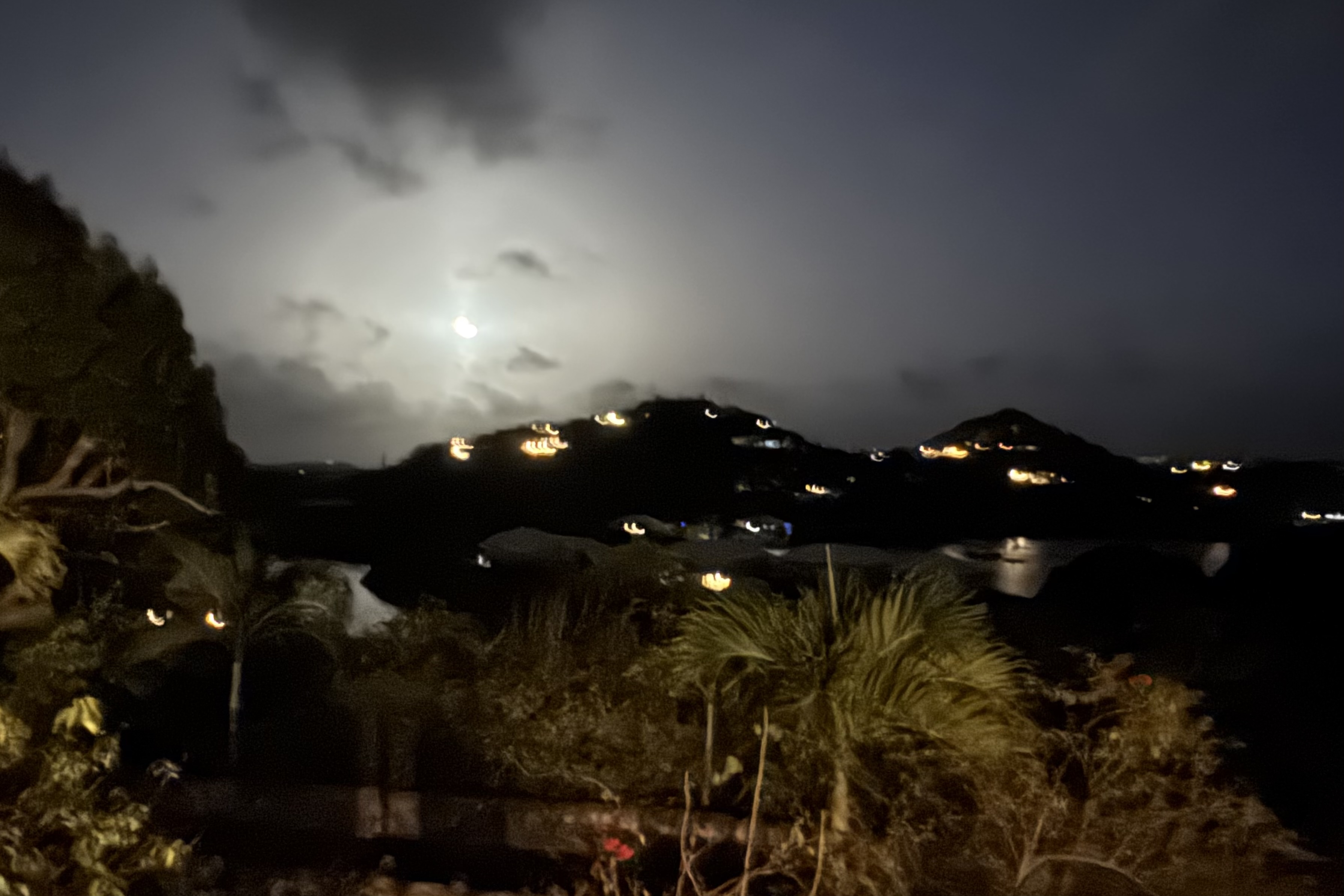
There was one last adventure to be had which basically turned out to be a real dud. A walk to “Bio Bay” from our Judith Fancy VRBO was undertaken to hopefully experience the Salt River Bay glow. When the water is agitated the bioluminescent organisms (fireworms, jellies, and marine planktons) light up.I had seen this in the Florida Everglades and was anticipatory of a similar experience. I at first thought I saw the water light up but upon a closer look it was only the moonlight reflecting on the ripples. So Nick was glad to oblige us by wading in and agitating the water. Nothing. Throwing rocks, nothing. More agitation, nothing, So we eventually called it a day and meandered on back to our lodging.
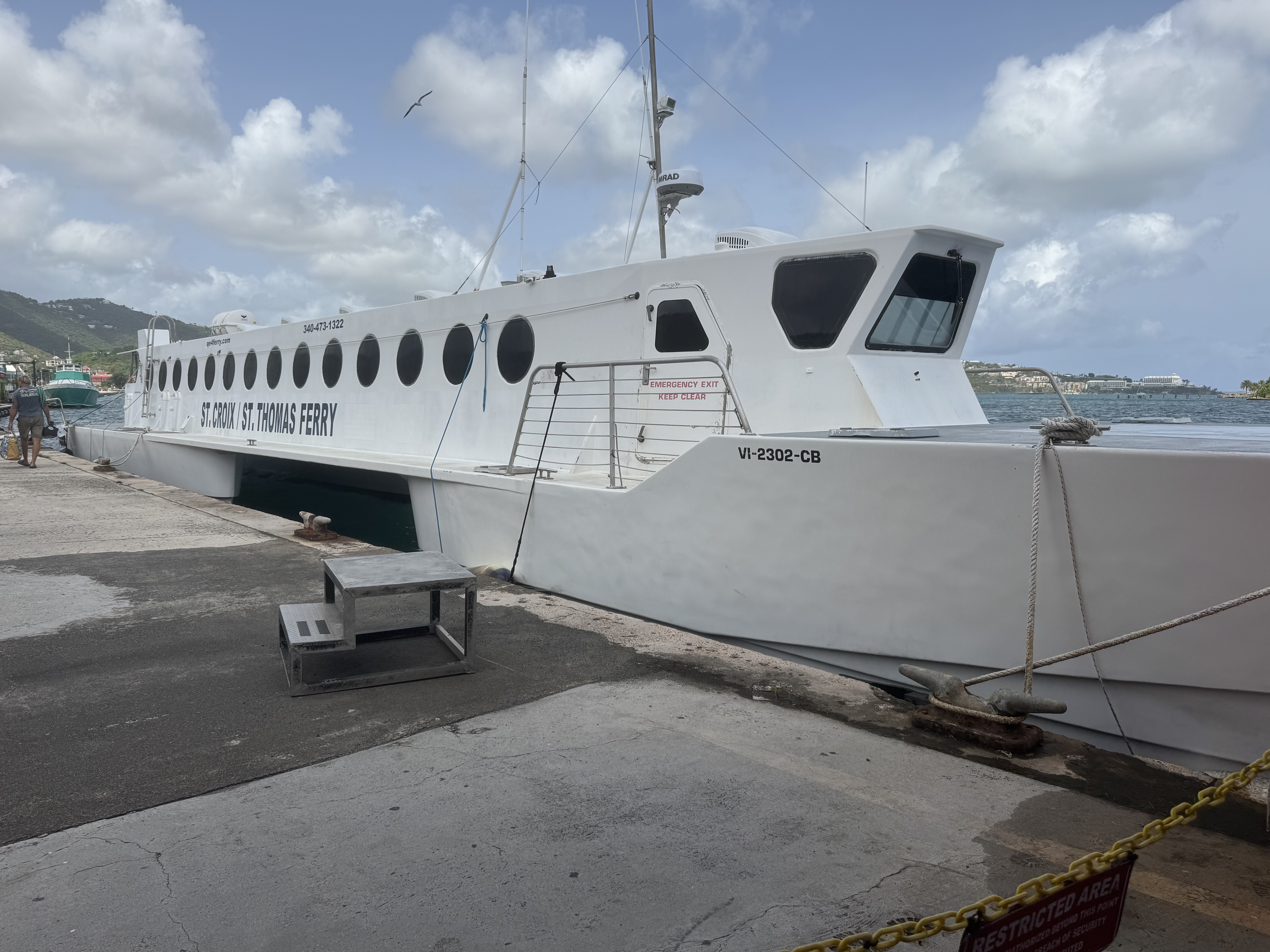
We were departing for Gallows Bay, St. Croix from the Blyden Ferry terminal in St. Thomas ( a 40 mile trip) and arrived there with a fair amount of time to spare before our three pm departure. The terminal is definitely NOT fancy and decidedly HOT. We parked ourselves on the uncomfortable wooden benches and I could not help thinking this is more akin to a greyhound bus station in the wrong part of town rather than what my conception of a Caribbean cruise terminal would be like.
The QE IV is a high speed catamaran and as it plowed the Caribbean Sea on this relatively calm journey (per the captain, the swells were mild), I was grateful for this relative mildness. The slap of the water on the windows was very enlivening and definitely not of the sea sickness level. The vibrant soundtrack on this voyage was a mixture of the hum of the engines, the occasional creak, and the thump, splat, slap of a sheet of water as it flings itself against the window. WHAP and then it dribbles down the glass. Repeat for two hours.
Docking was at the Gallows Bay terminal in Christiansted ! By the time we collected our luggage and made our way roadside, there was not a livery service vehicle to be seen. We needed to pick up a rental car at the airport and had decided that since taxis charge per person, it was best that only Nick and I make our way there. Having had minimal luck ordering a taxi, the ferry captain arranged for an open-air taxi, aka “safaris” to come. Before long a regular taxi showed up and being opportunistic we hopped in it as there was no guarantee when the hypothetical safari vehicle would arrive.
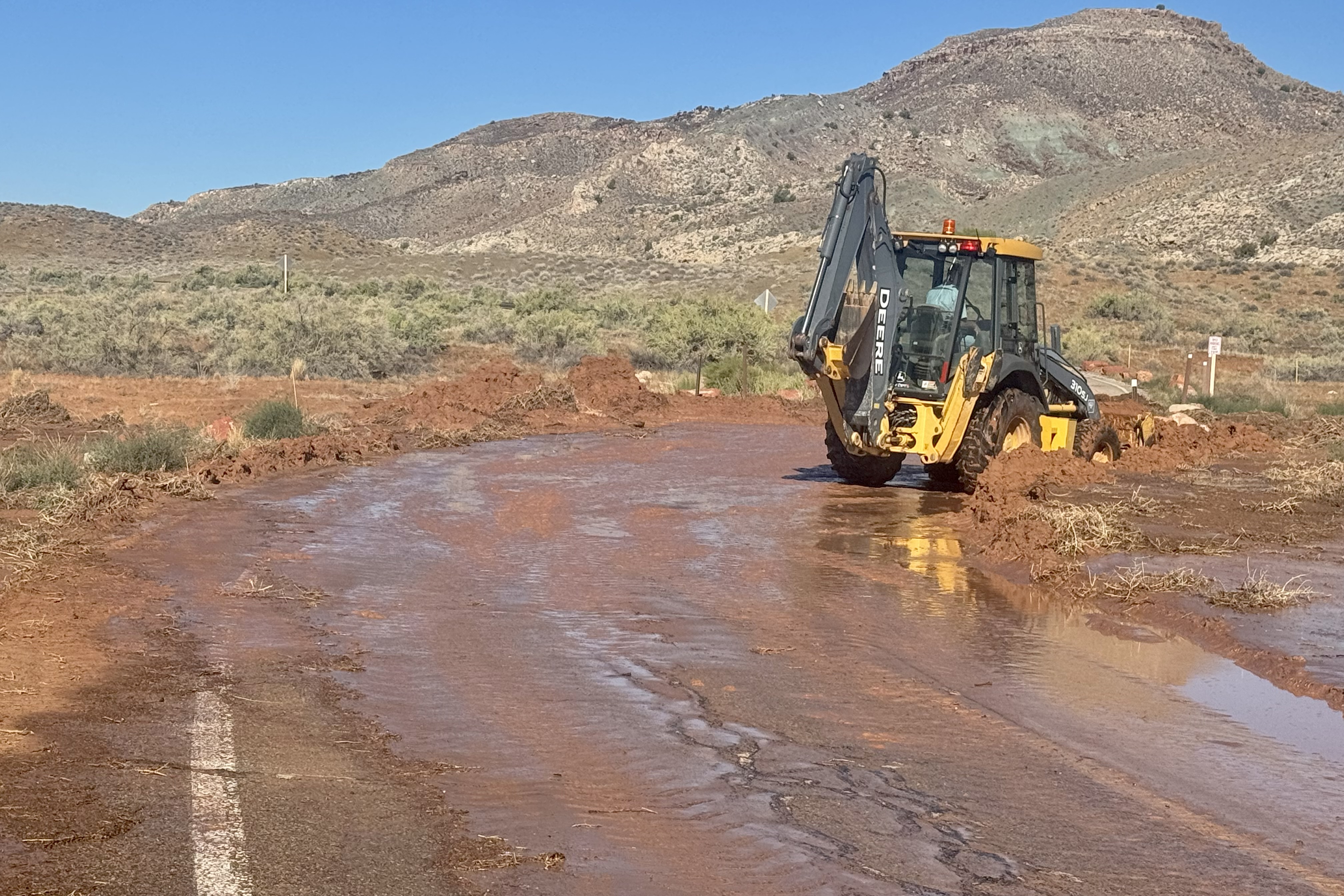
I have had a Caribbean dreamscape over the years about it being a paradise in which I would be immersed in the salt-air, my skin kissed by the trade winds, and floating in turquoise waters above technicolor reef just offshore… a true tropical paradise. But upon arrival, the sun was intense and I was immersed in steam bath humidity. On the drive to the airport there were abandoned building, shuttered storefronts, crumbing facades, pot holed roads winding through scrubby vegetation… the scene definitely was not of the picture perfect postcard or the polished resort variety. The driver took us through the industrial area further dashing any preconceived notion I had about this being a carefree tropical island of unsurpassed beauty. In the area of Limetree Bay was the remaining skeleton of the original Hess oil massive refinery which went “dead” in 2021 because of toxic emissions, health concerns, foul odors, EPA violation resulting in devastating losses of jobs and an economic catastrophe .
Picking up the rental car, a 4-door Jeep Wrangler was seamless and Nick soon was behind the drivers wheel and getting used to the driving on the left-hand side of the pot-holed roads. I thought getting a jeep was basically a lark but in actuality a necessity given the roads. I had hope his long term memory of driving on the left in Australia was an asset and would kick in but since, unlike in the English tradition, with the steering column on the right , the steering column was in the normal American style on the left side adding another challenge on these narrow, rough and unpredictable roads.
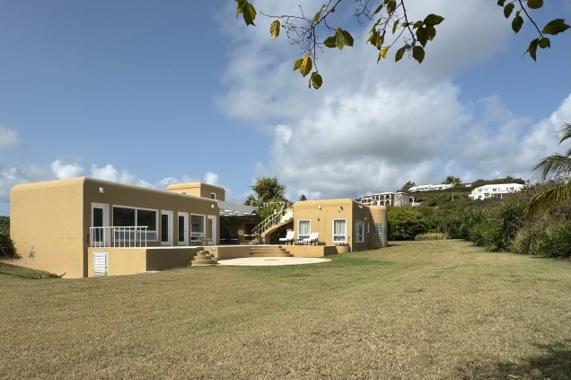
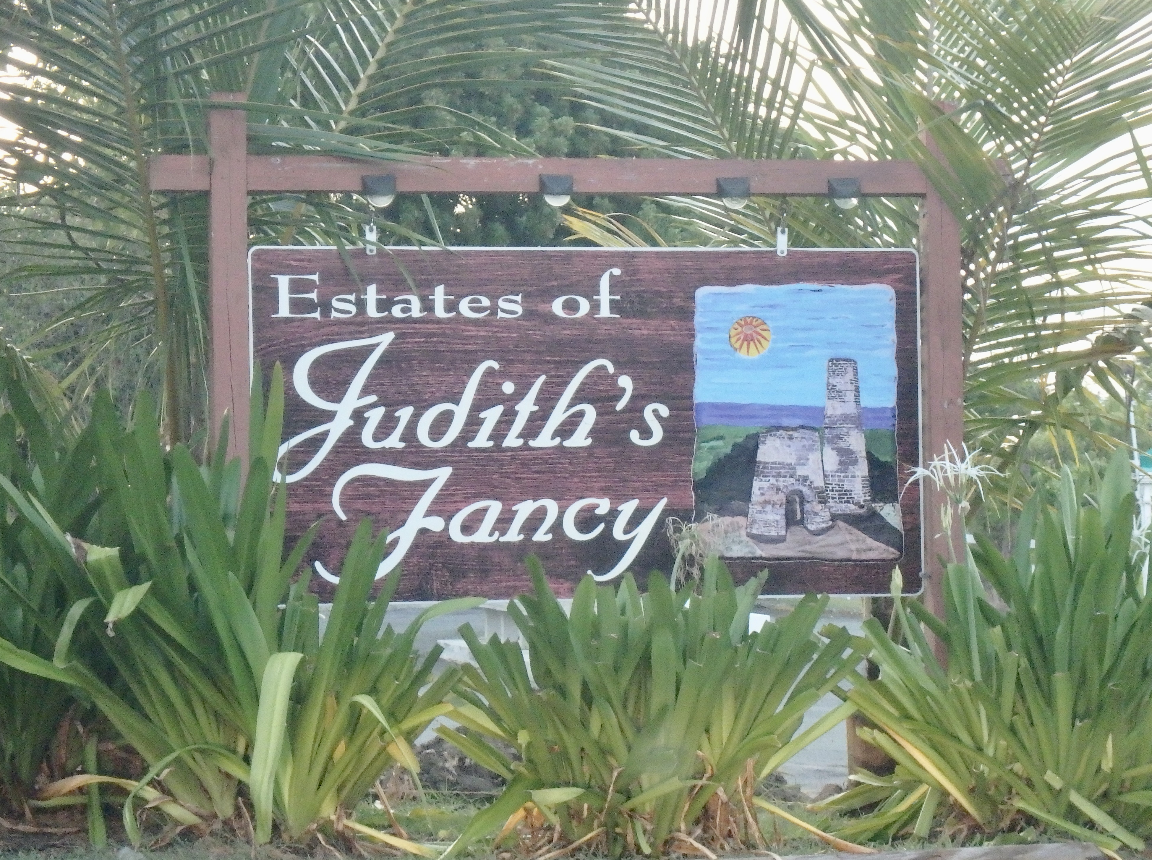
Finally, gathering up the family at the ferry terminal, we made out way to our VRBO coined an “Island Vibe Retreat” in “Judith Fancy, ” a gated residential community built on the 18th century Judith Fancy Sugar Plantation. It was named after Judith, a free woman of color, and considered a prized and “stylish” manor i.e fancy . Ruins of the old sugar mill remain and were visible from the courtyard of the house. Similar ruins of many of the old rum and sugar plantations exist throughout the island.
This was a true Caribbean style indoor/outdoor living space with a large courtyard for dining . Off of this open-air central courtyard were 3 bedrooms with en-suites, (the only air conditioned rooms) a living room, dining room, kitchen. and laundry room all with their own separate locks and keys. From the front it would seem that this was a secure fortress but in reality one could access all of the rooms by going around the side or back. Hence, Luke became the keeper of the keys and had the sacred responsibility of opening and locking every single room every time we went out. Given that Luke can be highly anxious and extra cautious this job suited him well. A favorite spot was a rooftop patio, with its gentle breezes in the evening after the sweltering sun vanished below the horizon.
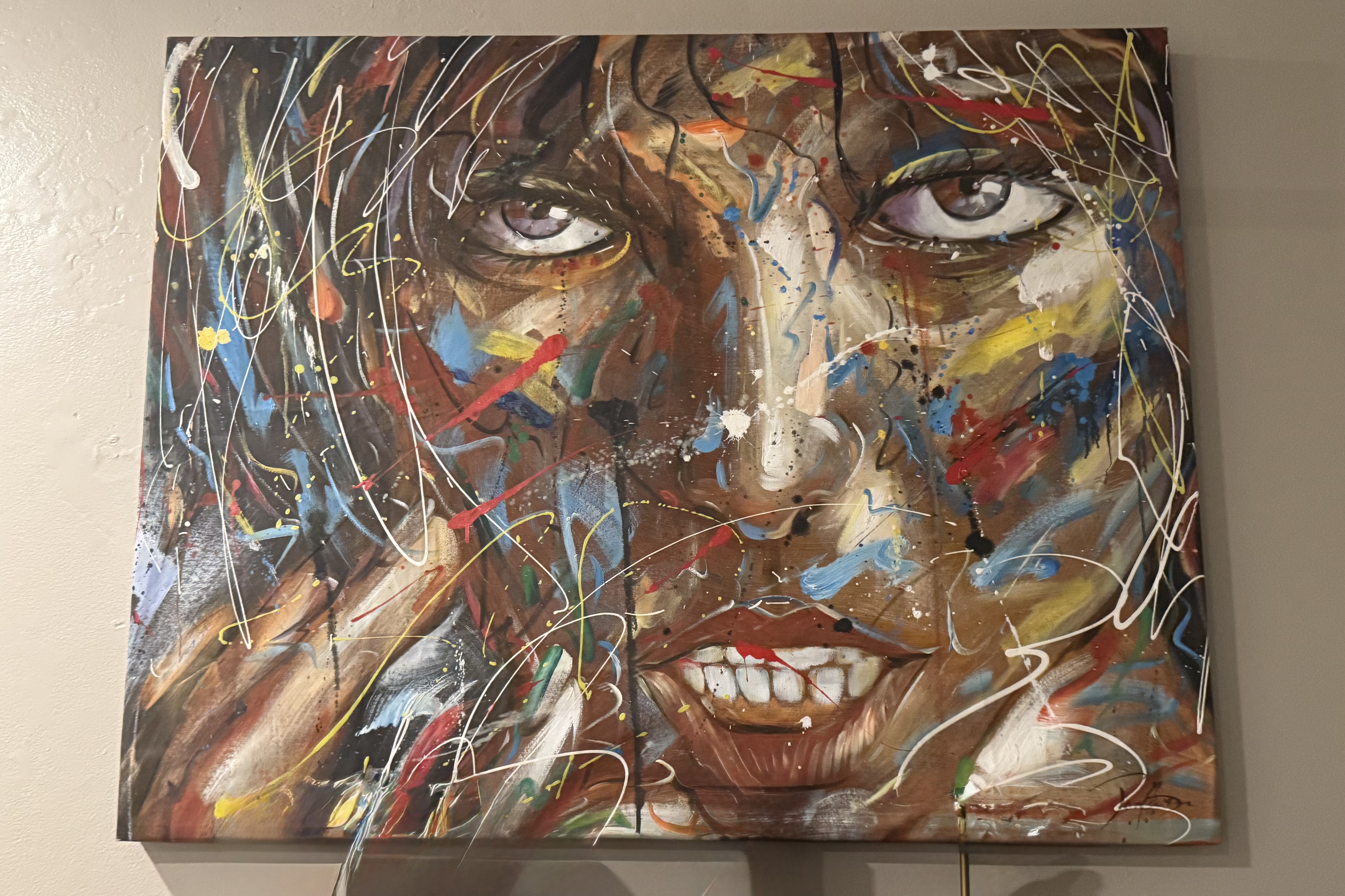
However, the main rooms did not scream calypso or reggae vibes and definitely were not of the Caribbean vibe. A striking painting that graced the living room definitely burst with color and emotion but in my mind did definitely not “fit” the Caribbean setting and I found it slightly unsettling and unnerving with its splattered streaked paint. It would best suited for a Miami art museum. I was relieved to spend all of my stay in the outdoor parts of the house as viewing it once was enough.
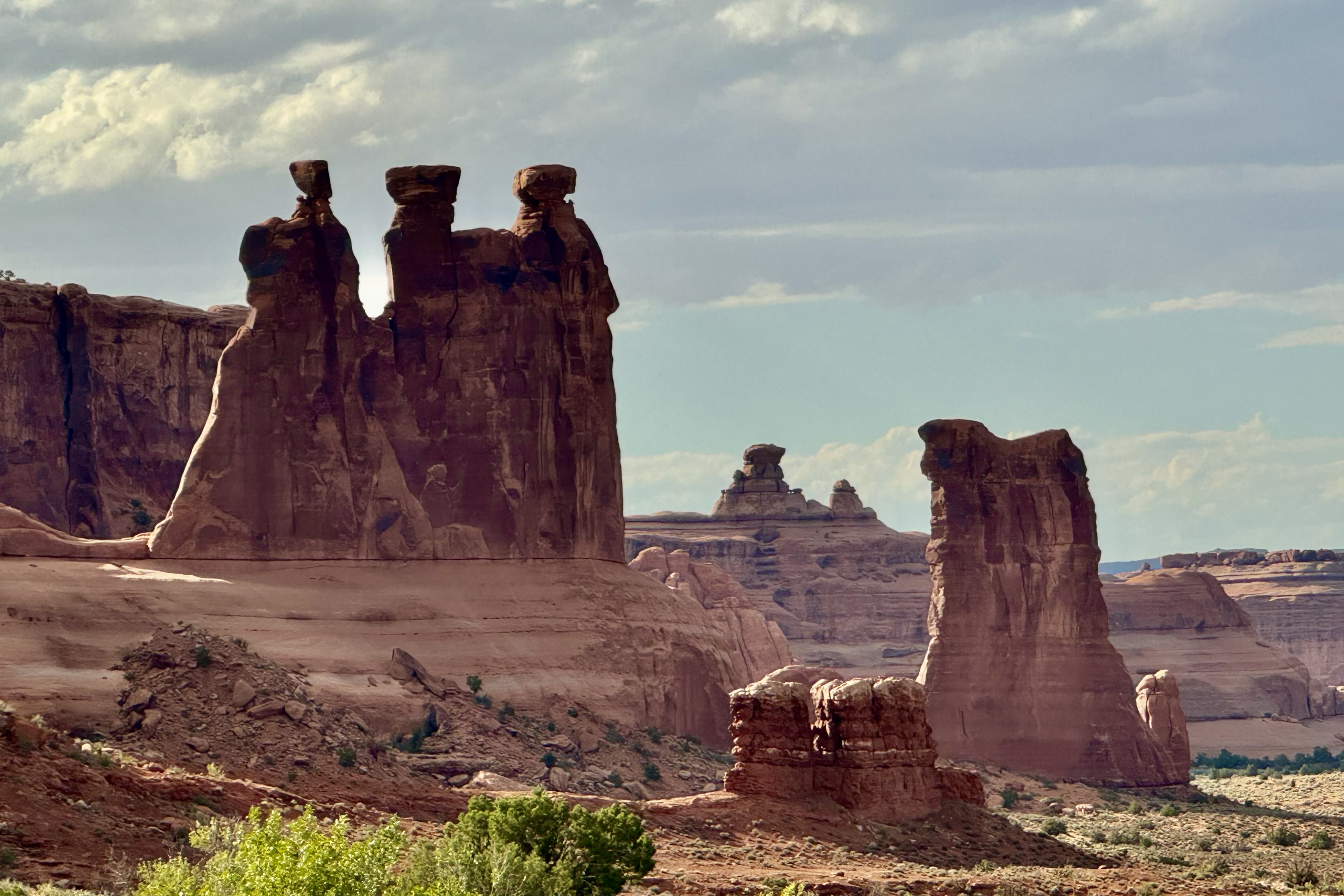
The premier event that I planned on St. Croix was a sailing and snorkeling excursion to Buck Island, described as a “marine garden” established by John F. Kennedy in 1961 and is designated a National Monument . It is a no-take marine protected area in the Caribbean Sea. Buck Island itself is physically protected by a flourishing elkhorn reef formed by elkhorn coral (branches fan out like the antlers of an elk and are brown in color.) With Captain Carl was at the helm, weathered by years of sailing under the Caribbean sun, and after an engine assisted sail out of the harbor on this 42-foot Trimaran (Teroro II), we sped towards our destination under sail power only. I note this because all the other companies going to Buck Island tend to use motorized vessels and I opted for the less polluting choice.
The sail was invigorating as Captain Carl pointed homes along a rocky headland, Pull Point, including one home frequently visited by Joe Biden that was owned by a longtime fiend of his and another where the physicist Robert Oppenheimer often stayed with friends …plus other interesting trivia. I would have been much more interested in learning about elkhorn coral and parrot fish than the vacation spots off famous people! The sea was various shades of blue and upon approaching Buck Island it took on that stunning turquoise color. Seems the recipe for this color palette is sunlight, water clarity, depth, and a white sandy floor! Anchoring on the western side of the Island, we would commence our first snorkeling adventure.
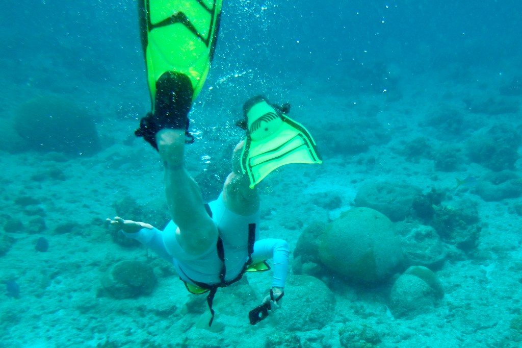
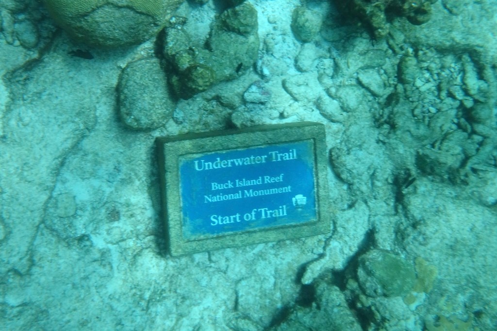
Our first stop was proximate to the underwater trail. Provided with snorkleing gear and with Captain Carl as our guide, we entered a shallow lagoon and followed a series of submerged plaques identifying surrounding marine life and coral formations. Sounds lovely and serene and it might well have been for the others. BUT, since I was not a skilled snorkeler, I was about to embark on a not so gentle glide through the water and definitely not an effortless and graceful adventure. My primary take away from this experience was definitely a lot of sputtering and choking on sea water.
Feeling quite fashionable in my mask and snorkel in my new swim togs, I finally managed to get the flippers on while bobbing around in the water and then, somehow miraculously, I was able to get the mask on my face and relatively water tight, thus avoiding bathing my eyes in sea water. I followed our group and guide towards the trail and naturally I was trailing the group and trying to keep up, see what was below, and keep an eye out for the red and white life ring being dragged forward by Captain Carl. Every time I saw an underwater marker I had this unconscious need to peer at it closer and plunged my face deeper and of course sucked in vast amounts of sea water. Not once, lesson learned, but several time over the course of the course!. I was desperately trying to enjoy this journey through coral gardens, grottoes and a reef teaming with marine life but secretly was glad that I did not get lost in a coral cavern and made it back to the boat.
I had resurrected my trusty Olympus waterproof and shockproof camera so I would capture dazzling the underwater world of tropical fish and coral. Seems I was better a capturing butts and flippers than fish. As for the fish, they remained a a speck in the distance.
Subsequently, we then sailed over to Buck Island’s Turtle Beach and had about 1.5 hours to spend there. Not one for lying on the beach and not wanting a repeat that snorkel experience again this day, I opted for hiking the trail on Buck Island with Tasia, Nick, and Luke. Forewarned about a massive bees nest at the trailhead which we thankfully avoided. and after picking our way across slimy rocks, the hike was short (1.28 miles) but also challenging as it winds up a dry rocky hillside through native vegetation including cacti, sea grapes and turpentine trees. I was surprised by the feeling that I was hiking in a wild, Caribbean desert and dry forest, something I did not associate with tropical islands. And as with desert hiking, by the time I reached the overlook it looked like I had opted for the bathing on the beach option. The path was narrow and a bit rugged for my tendency to find every “trippin” rock and root”but I did stay upright. . It was replete with buzzing insects and hermit crabs toting around there borrowed shells. Turk’s Cap Cactus were of special interest named for its red “cap” that resembles a Turkish fez and the crown sporting small tubular pink flowers.
Atop, the reward was stunning views of the reef, resembling a necklace surrounding the Island, rolling hills and the distant shoreline of St. Croix.. What a contrast this day was with both hiking over this cactus studded Island and swimming in coral garden teaming with marine life.
It ended at the beach with a short walk back to Captain Carl’s salt-sprayed sailing craft and a breezy ride “home” to relax, enjoy a simple dinner in the outdoor dining area , and then a short walk to a beach access near our VRBO. I had hope to dip my toes in the water as I imagined a tropical sandy beach but found it was rocky, coral strew and draped with a thick mat of seaweed (sargassum) to wade through. Not tonight. The view by night though from the beach of St. Croix glowing across the water however was quite a lovely site.
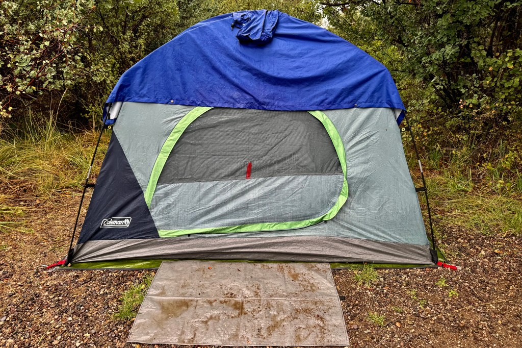
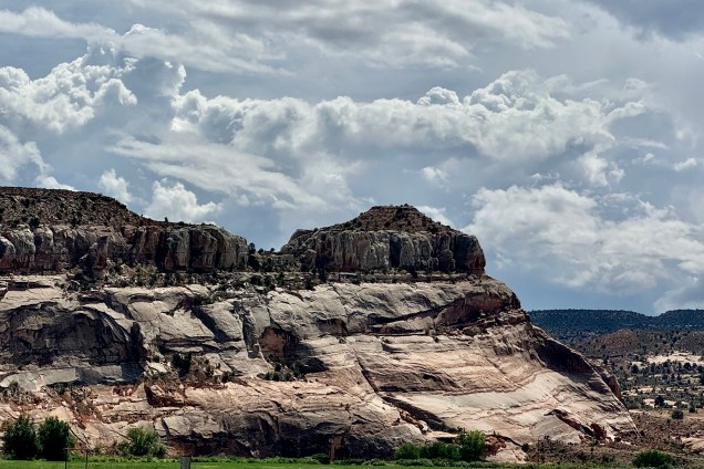
Having now spent three cushy nights in motels, it was time to quit babying myself and prepare to be back in the tent and camping. Actually I am preferring my cozy sleeping bag and cot in the tent to a motel room and their pillow top beds — except when the rainfly leaks and I get rained on in the middle of the night. A stop at a grocery store on the way out was in order to have enough food for the next four nights of camping in national parks. After a resupply in Colorado Springs, I made my way out of town. and by now I was driving in Garden of the God’s territory meaning towering red sandstone formations and landscape that became incrementally more beautiful the further southwest I traveled.
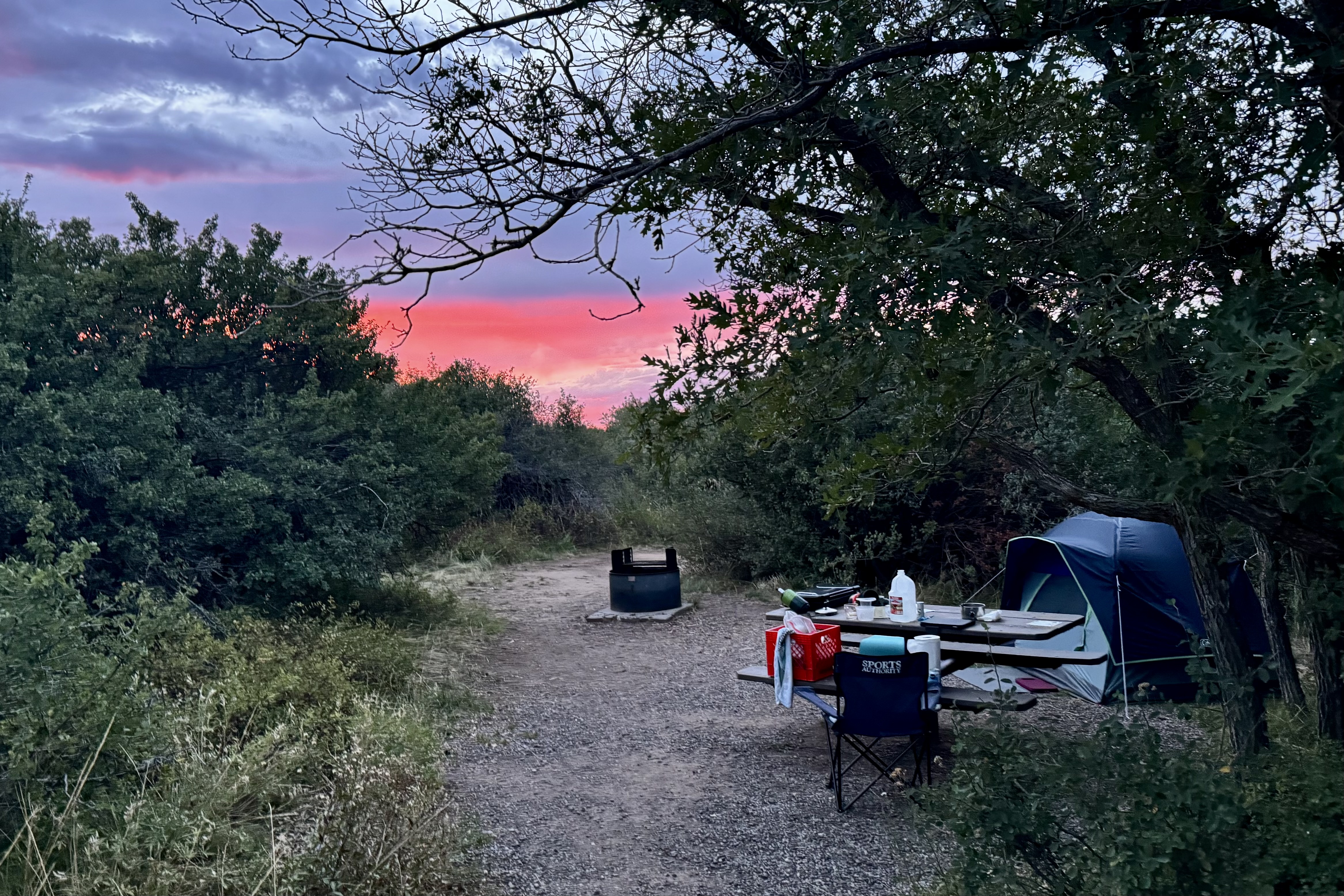
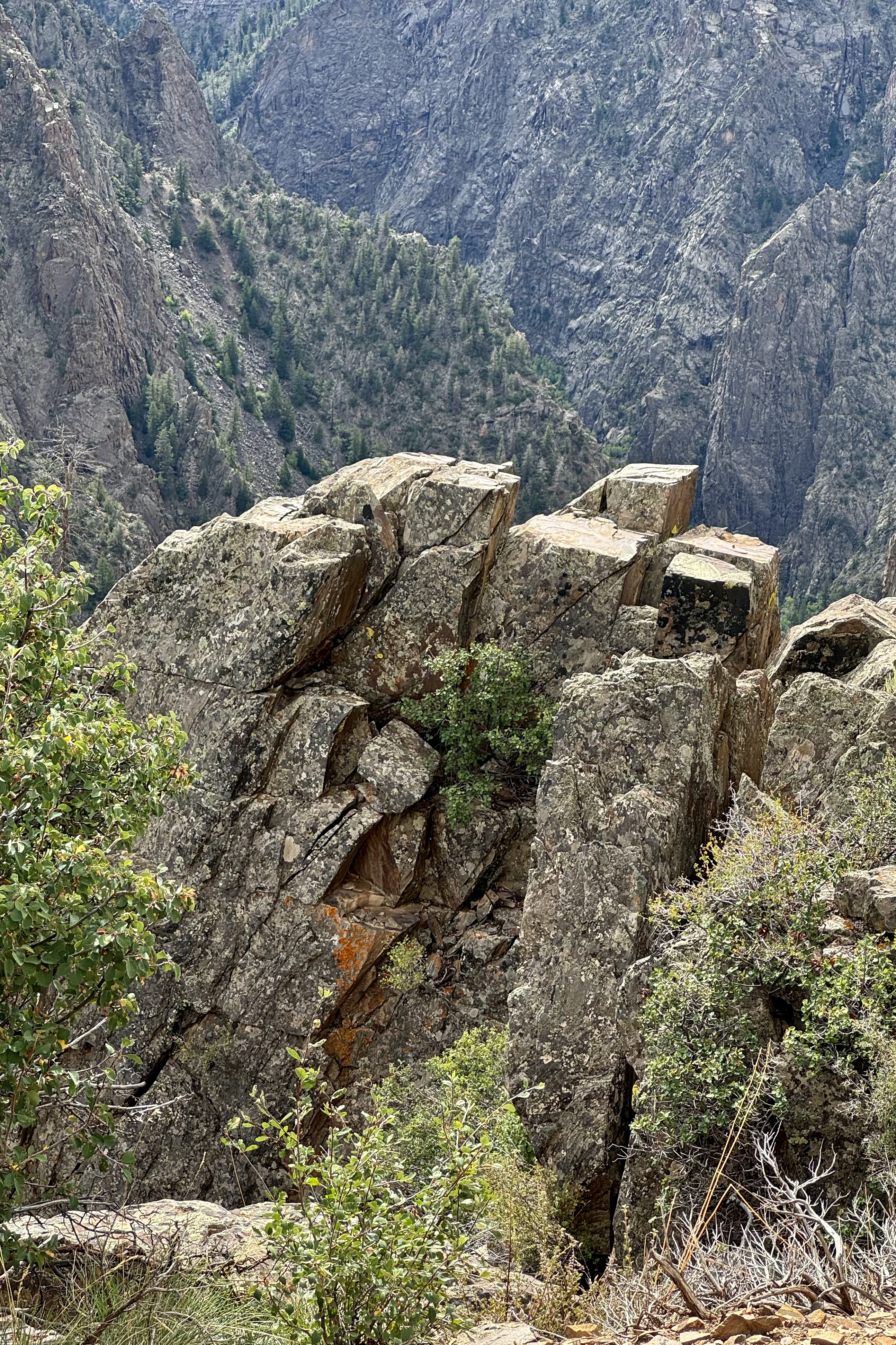
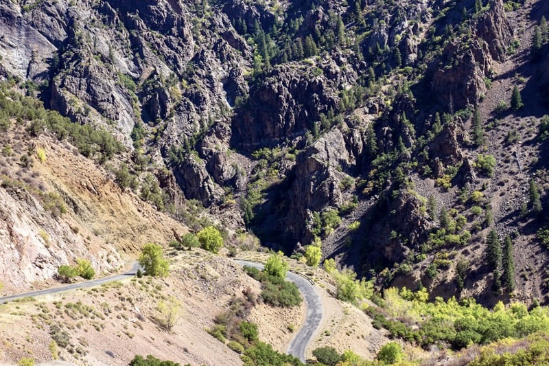
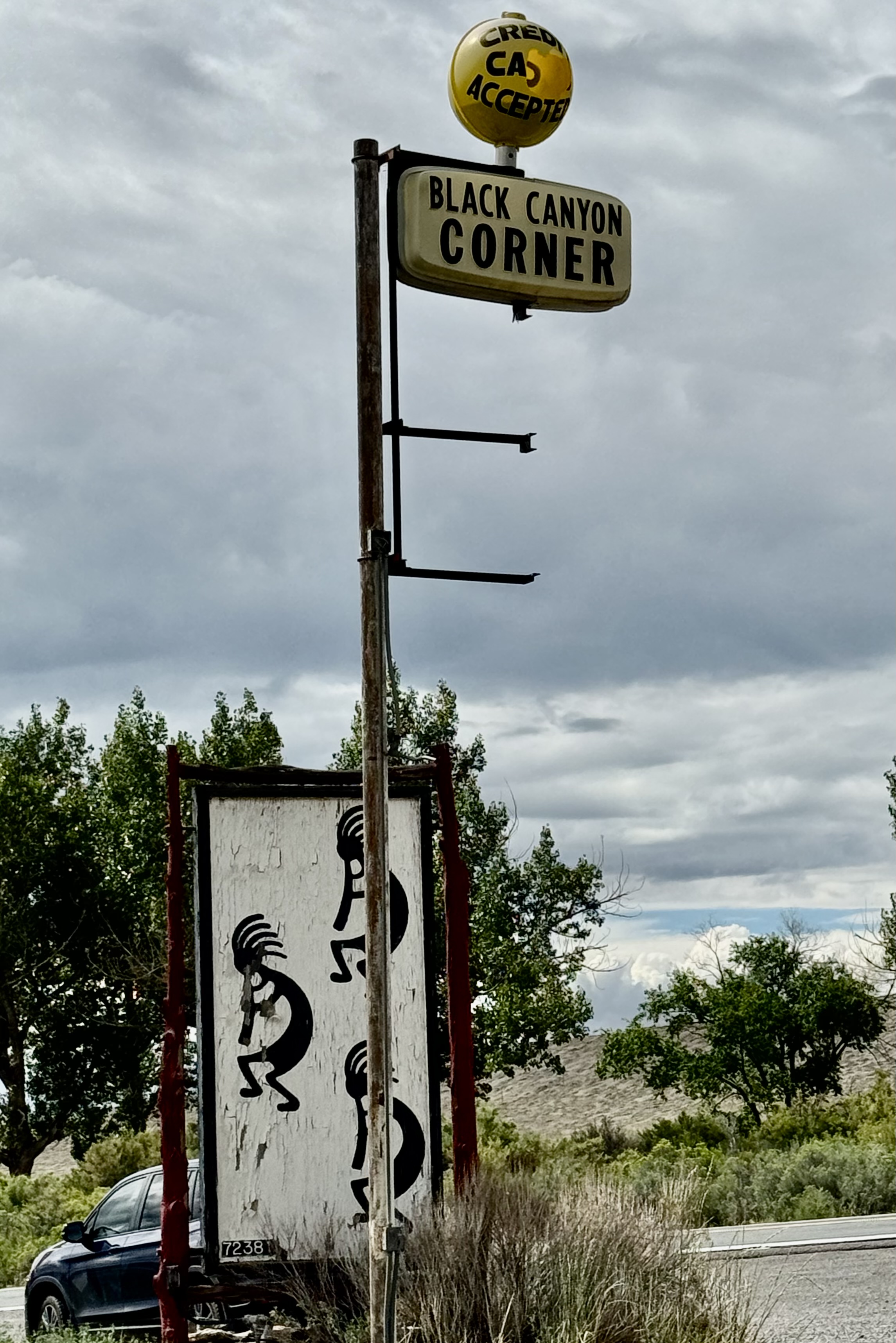
One of the downsides of traveling to the national parks now (or most areas as well) is that it is the “high tourist season” as well as the “high road construction season”. Quite often the two clash! Whether it is the turnpikes, interstates, or the secondary roads, there were not many stretches that I traveled where major road work wasn’t a huge barrier to maximizing quality time outside of my vehicle. I was in Colorado headed to the south rim of Black Canyon on the Gunnison National Park via Route 50 and had to wait almost an hour for a pilot car to lead a line of cars through the area being “refurbished.” This of course was the time when the major road through Gunnison was also getting a shiny thick new layer of black asphalt and this provided a great olfactory experience of the aroma of fresh asphalt which had just been laid on the road about 100 feet from the campground. Most campsites were pretty squeezed but the one I had selected was quite roomy though I opted out of putting my tent on the area designated for a tent pad on the back of the site (more privacy) as it was clay and definitely would be a slick mess to slip and slide around on should it rain.
With many open site, up pulled a “loud family in training” right across from me, meaning there have been worse on this trip but they were practicing to compete for first place. In an amble about the campground I did not hear any other clearly audible conversation. It wasn’t even the ongoing noise that annoyed me (one comes to expect it) but soon the dad strung up several strings of lights running off a portable power pack (no electricity in this campground) . It wasn’t quite as bright as the Vegas Strip , but Black Canyon of the Gunnison National Park has been certified as an International Dark Sky Park due to its exceptional skies and lighting practices. This guy was putting so much wattage into the air , that it definitely compromised the quality of star gazing that evening.
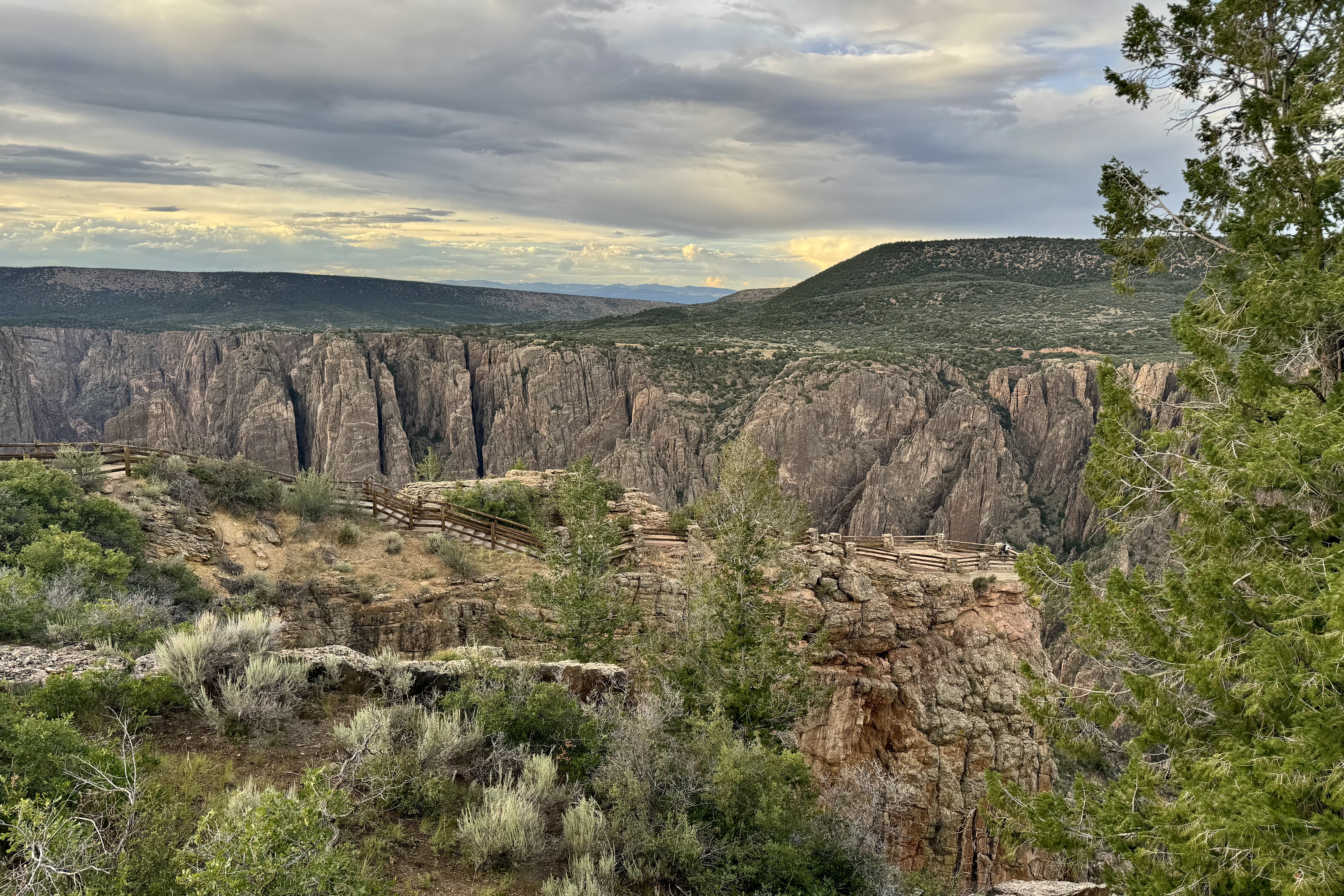
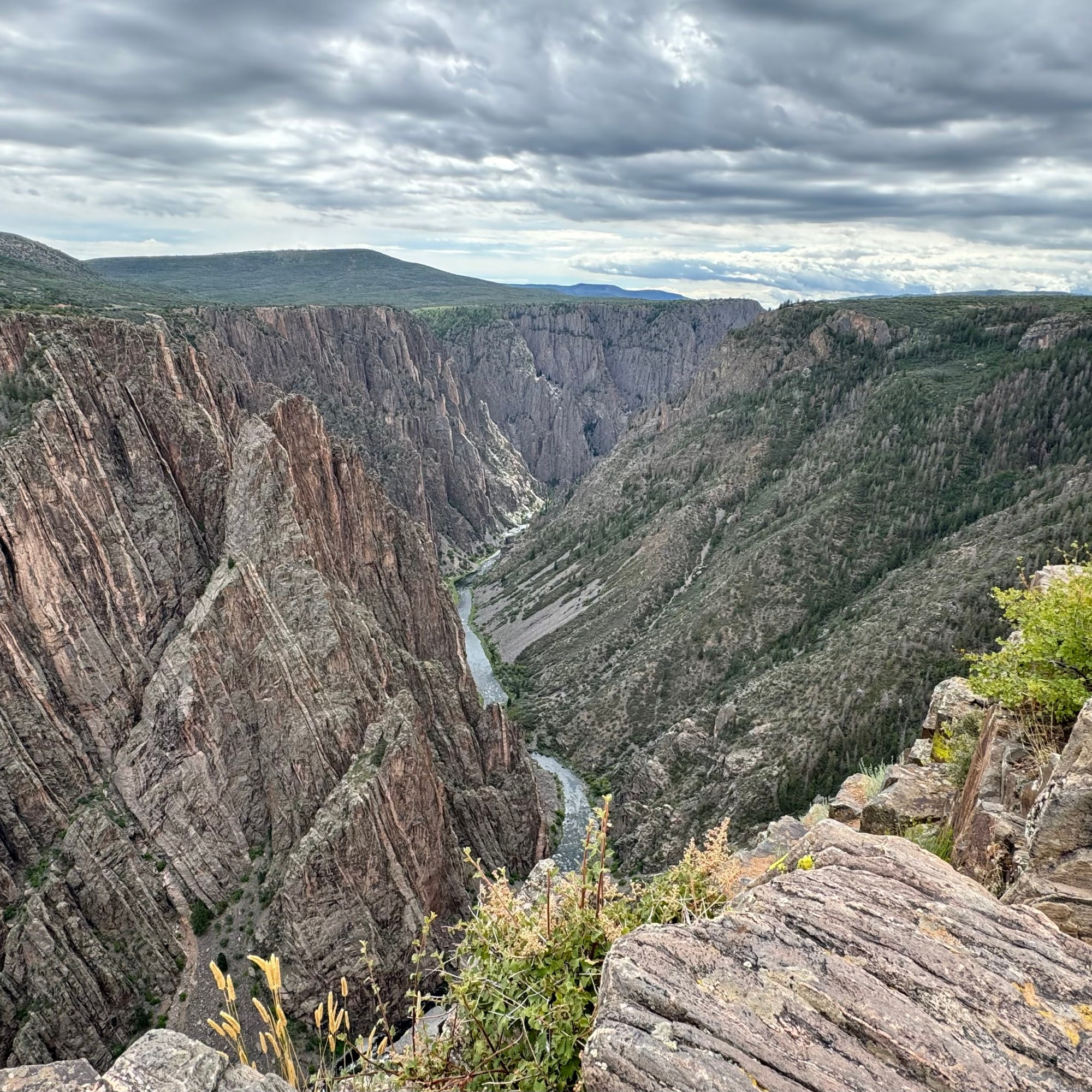
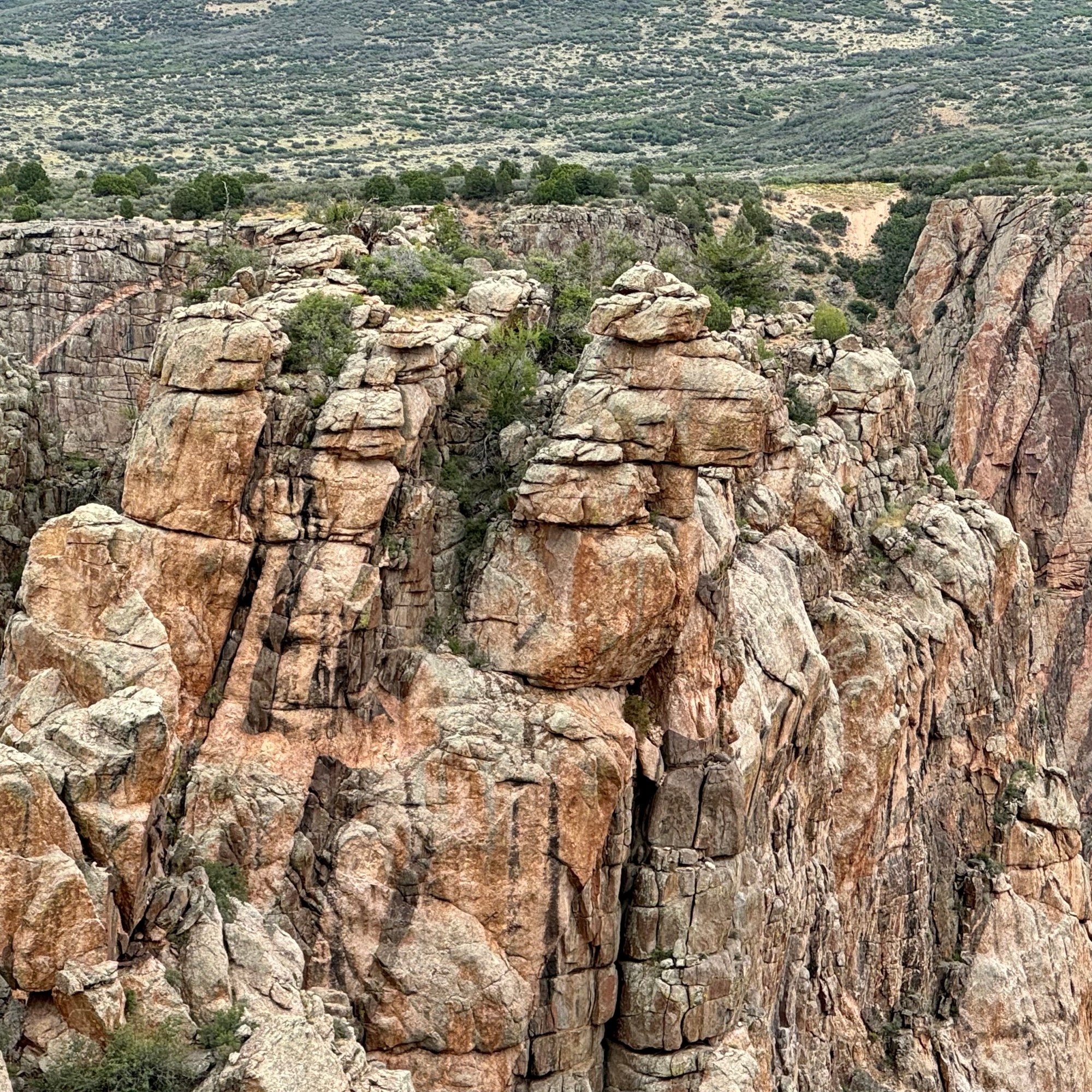
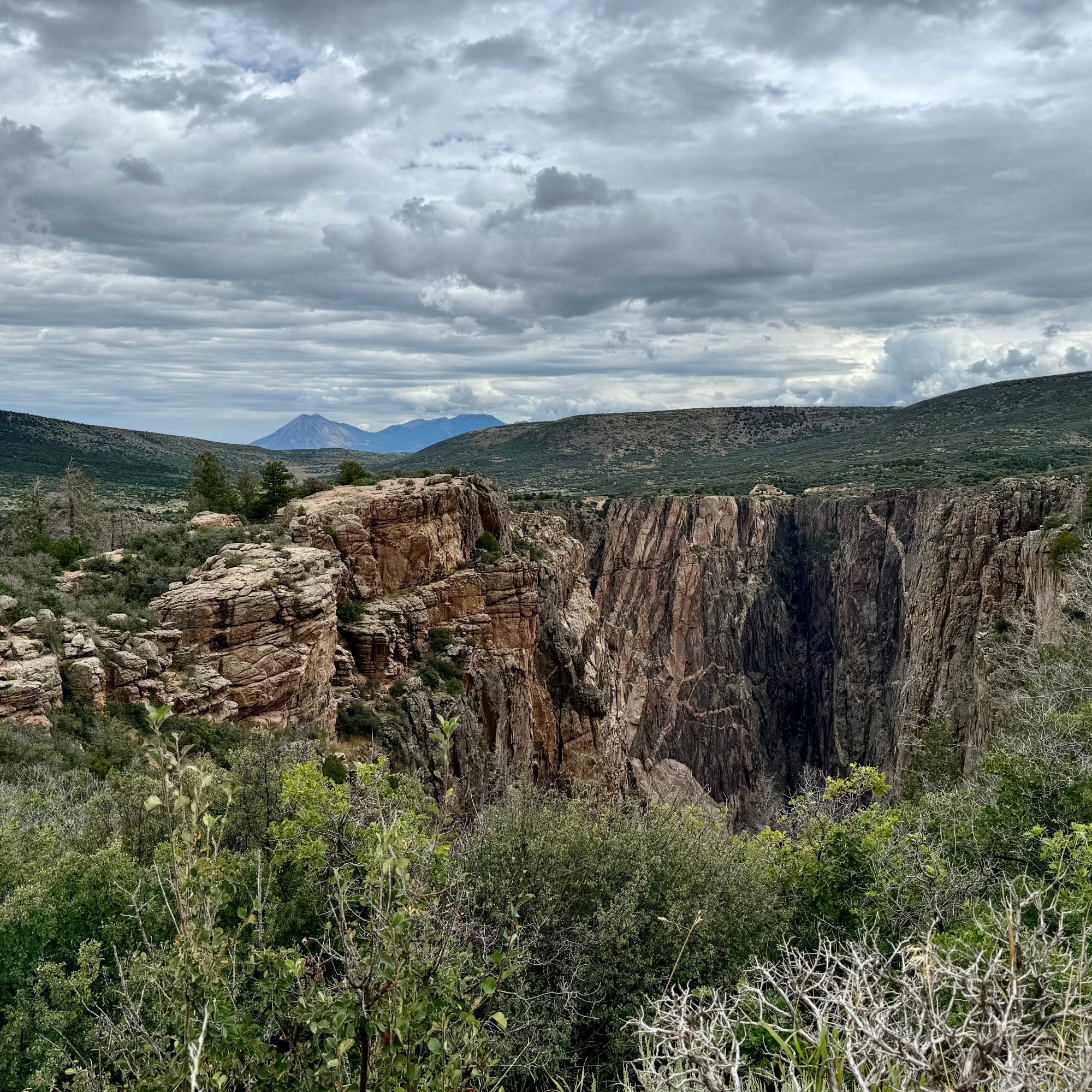
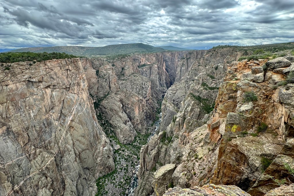
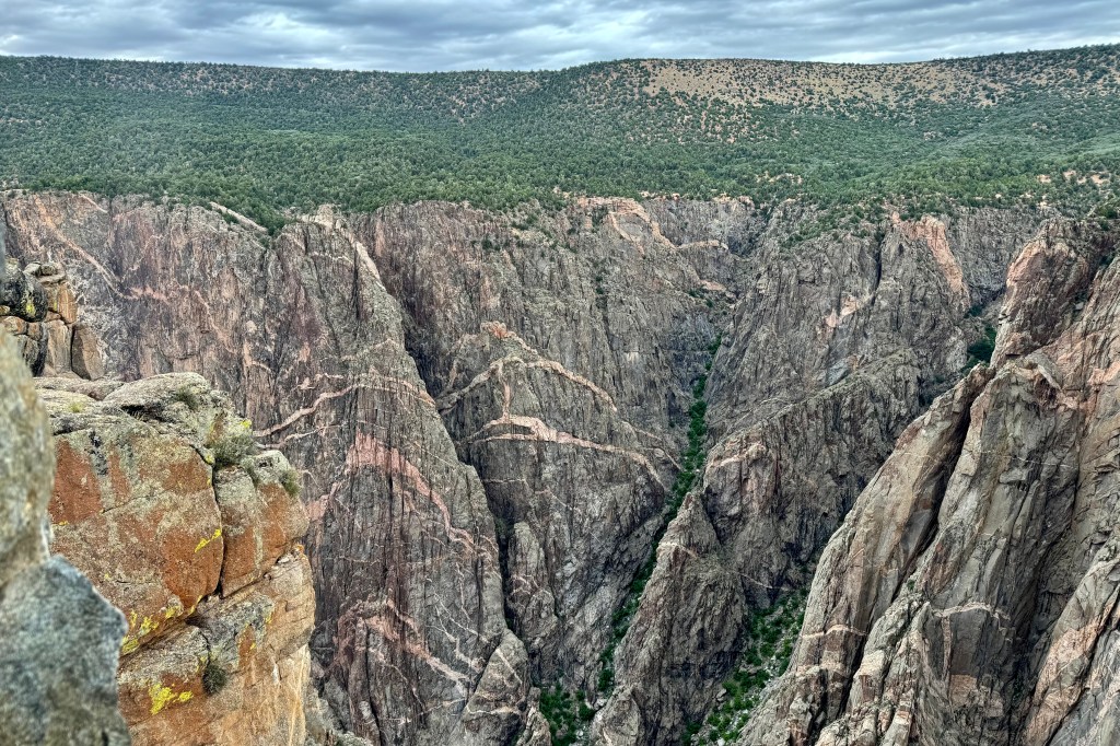
Is it all in the name? It’s moniker ” Black Canyon” is not derived from the color of it’s rocks but because the canyon is so narrow and so deep, reaching a depth of 2,722 feet, that sunlight barely reaches parts of the gorge each day (33 minutes), thus giving off an almost-spooky aura. With such an ominous designation, you might guess it is one of the least known and one of the lesser-visited national parks in the country. It ranks 47 out of 63 overall in annual visits. The Great Smokey Mountains has 13.3 million annual visits whereas Gunnison has 357,00
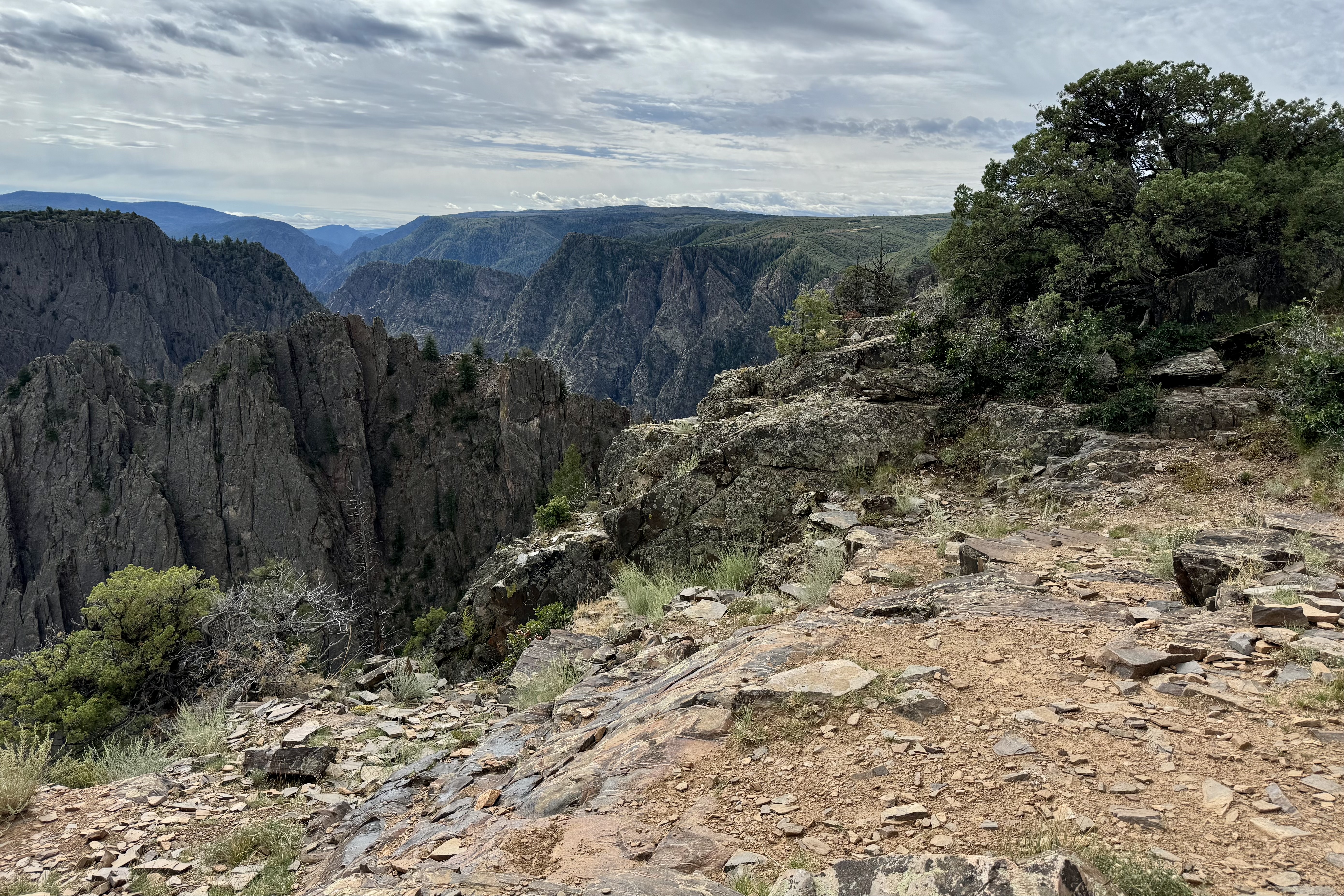
The next morning, I awoke to the patter of rain on tent but, but fortunately it stopped relatively soon so I did not have to figure out Plan B. I was able to quickly get breakfast and get on the road. I arrived at the already crowded visitor’s center and made a plan to drive the 7 mile south rim road and explore most of its different views. But first I wanted to hiked a portion of the Rim Rock Trail before I wore myself out oohing-and-ahhing at the magnificence of this canyon, 7000 ft above sea level.
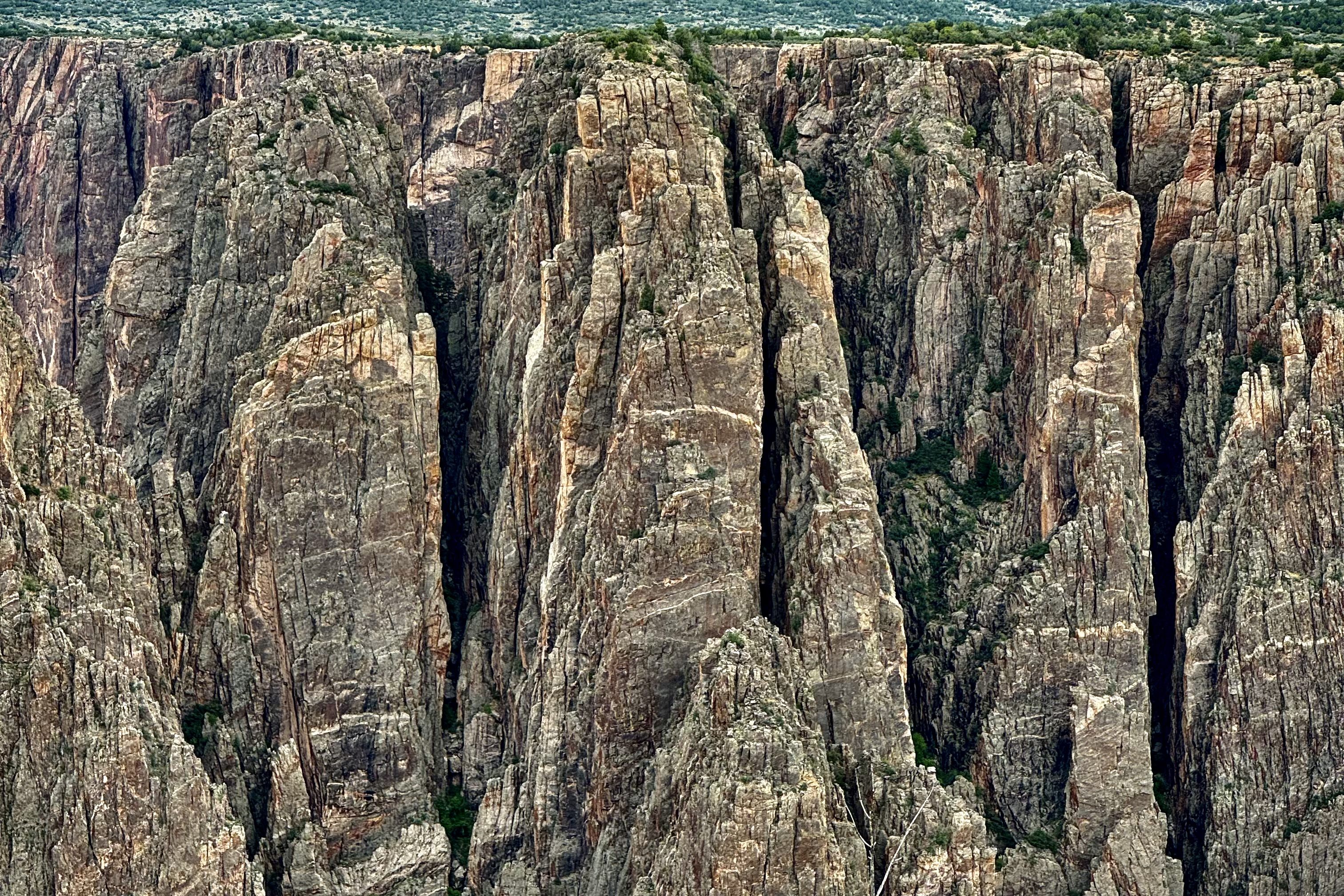
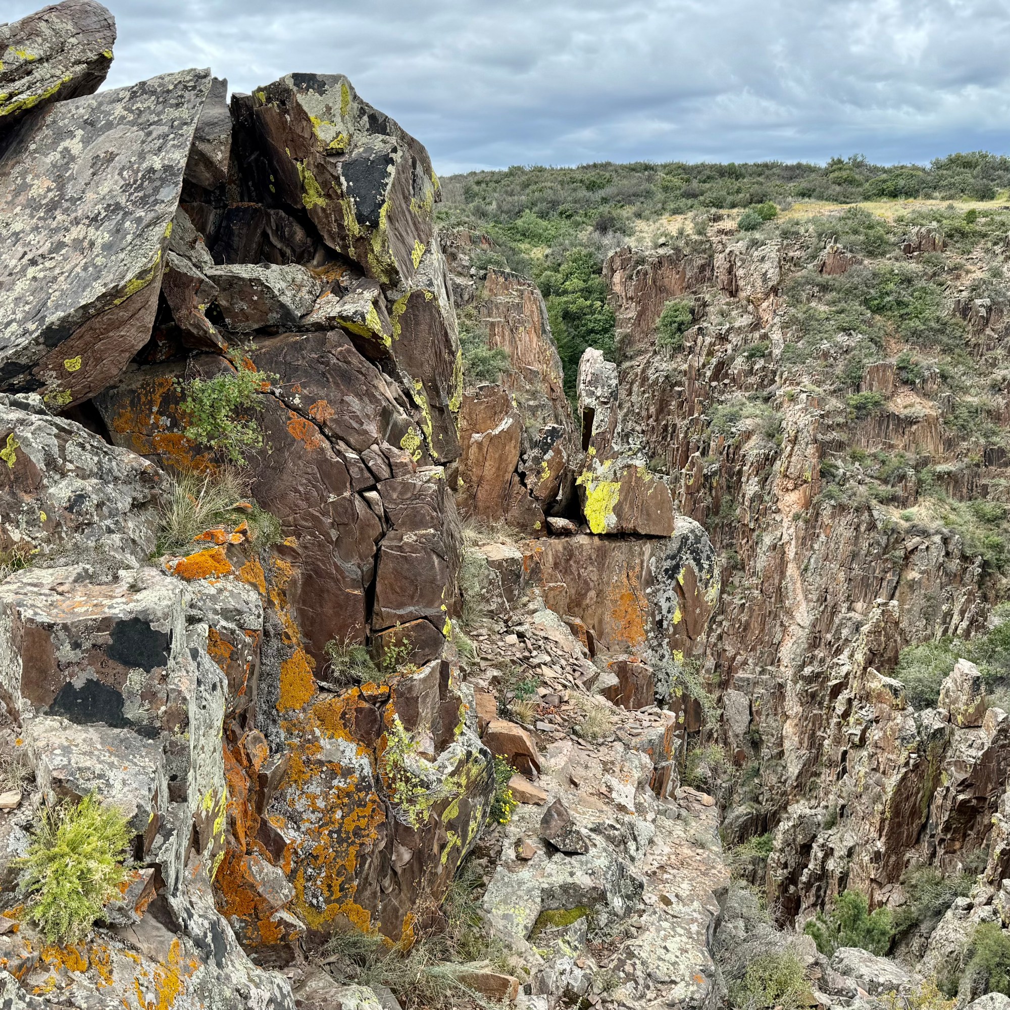
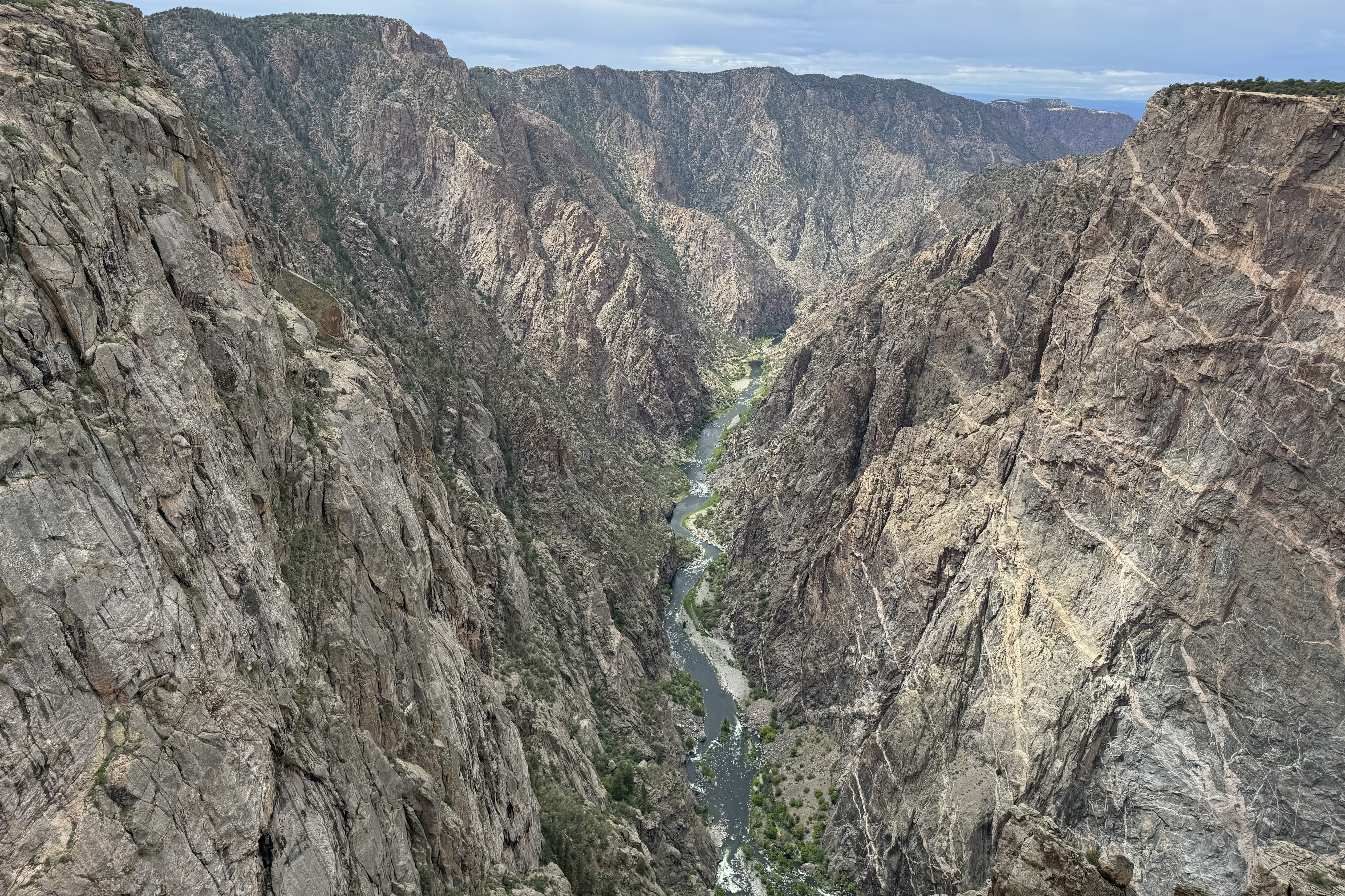
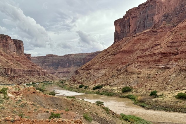
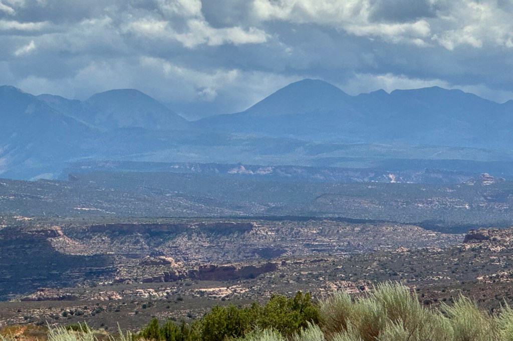
Hiking the rim from the visitors center to Tomichi Point was but a half mile and though it is described as relatively flat with some stairs and uneven ground, I found it a bit unnerving given the closeness to the “endless” drop of the canyon, so proceeded with great caution. I was stunned by the sheer depth of the canyon walls and narrowness of these canyon walls, the glimpses of the Gunnison River, the canyon ridges and rock spires that jut into Black Canyon, and panoramic vistas of the West Elk Mountains.
Not want to be miss out on any demarcated views , I motored on and began the routine of stoping at each pullout to and hiking each short trail to the viewing platforms. I began to develop a cadre of acquaintances as I kept running into the same gazers at each pullout. starting with Pulpit Rock.
Pulpit Rock .
Cross Fissures Overlook
Rock Point
Chasm View
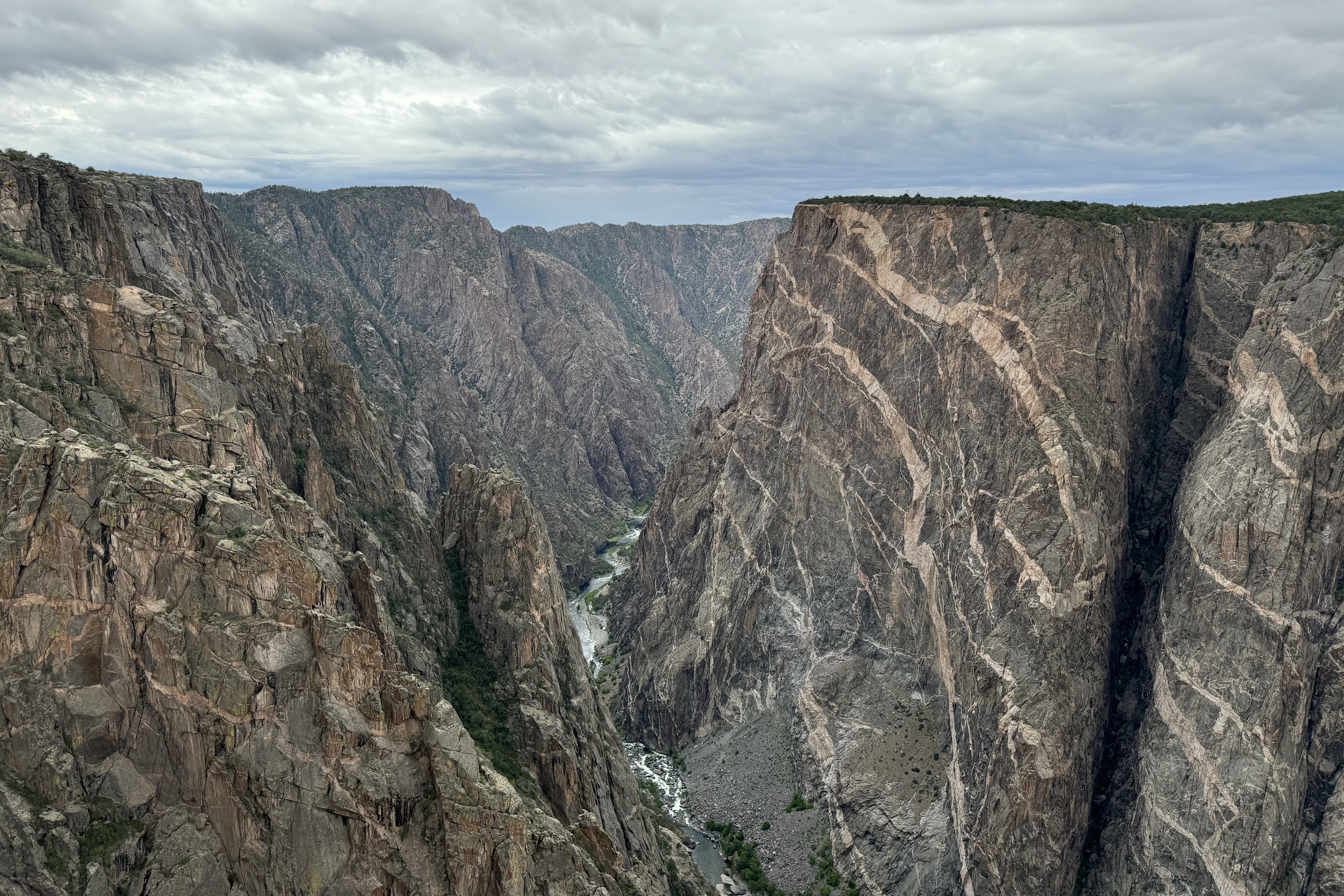
Painted Wall
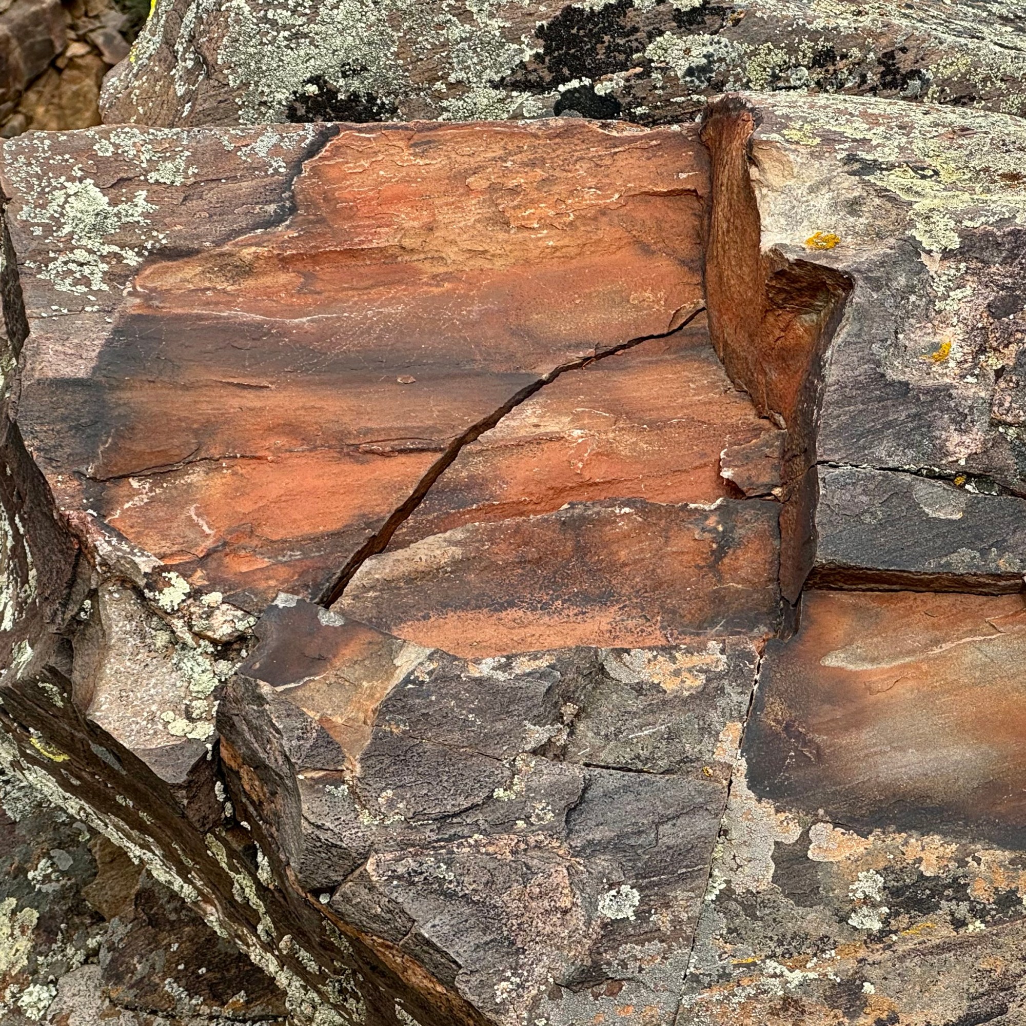
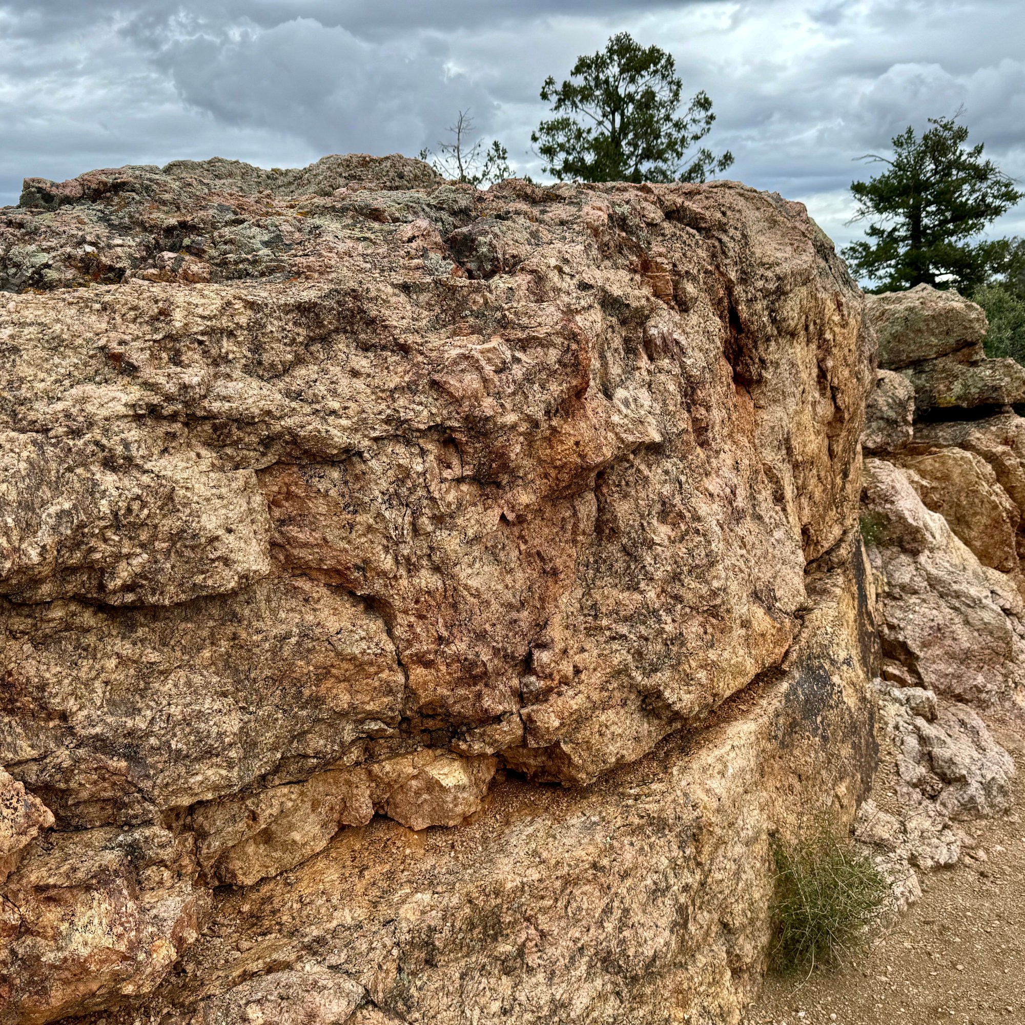
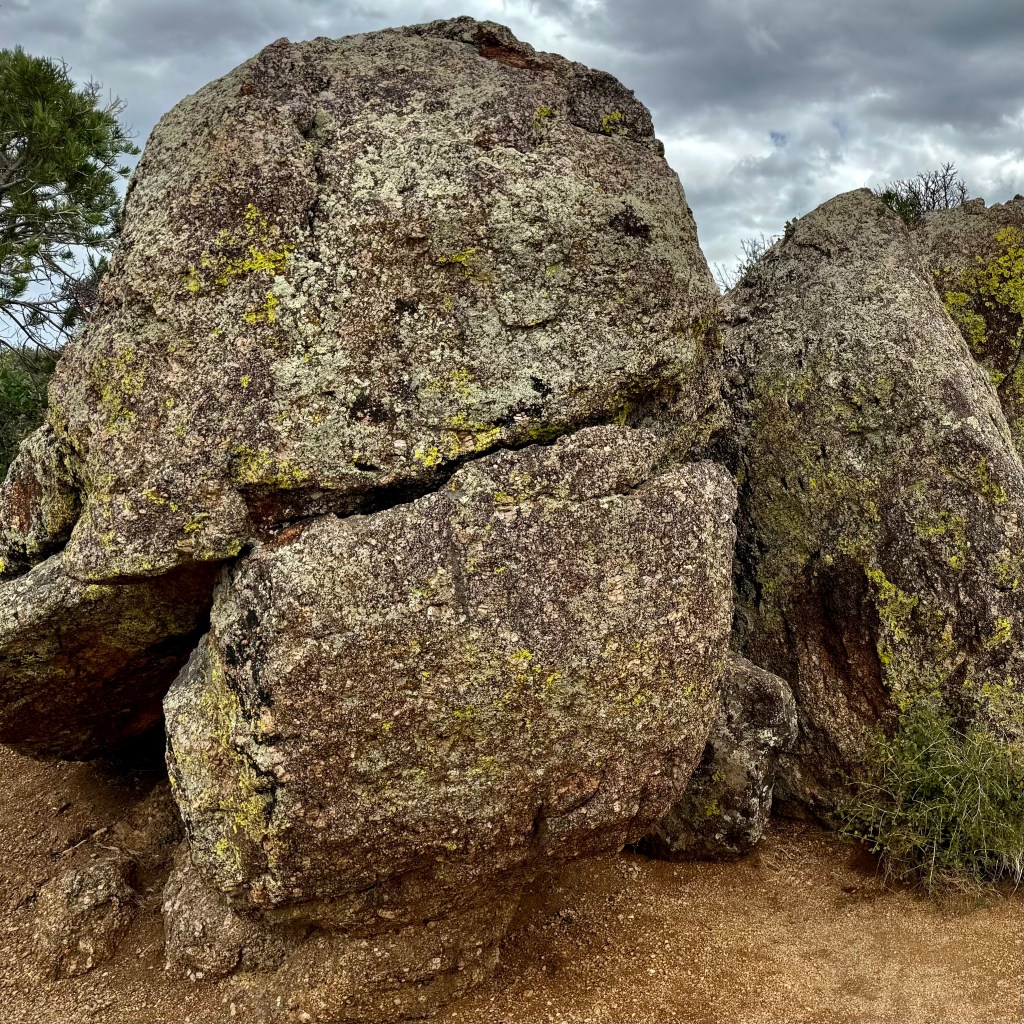
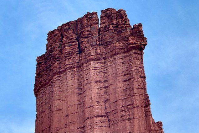
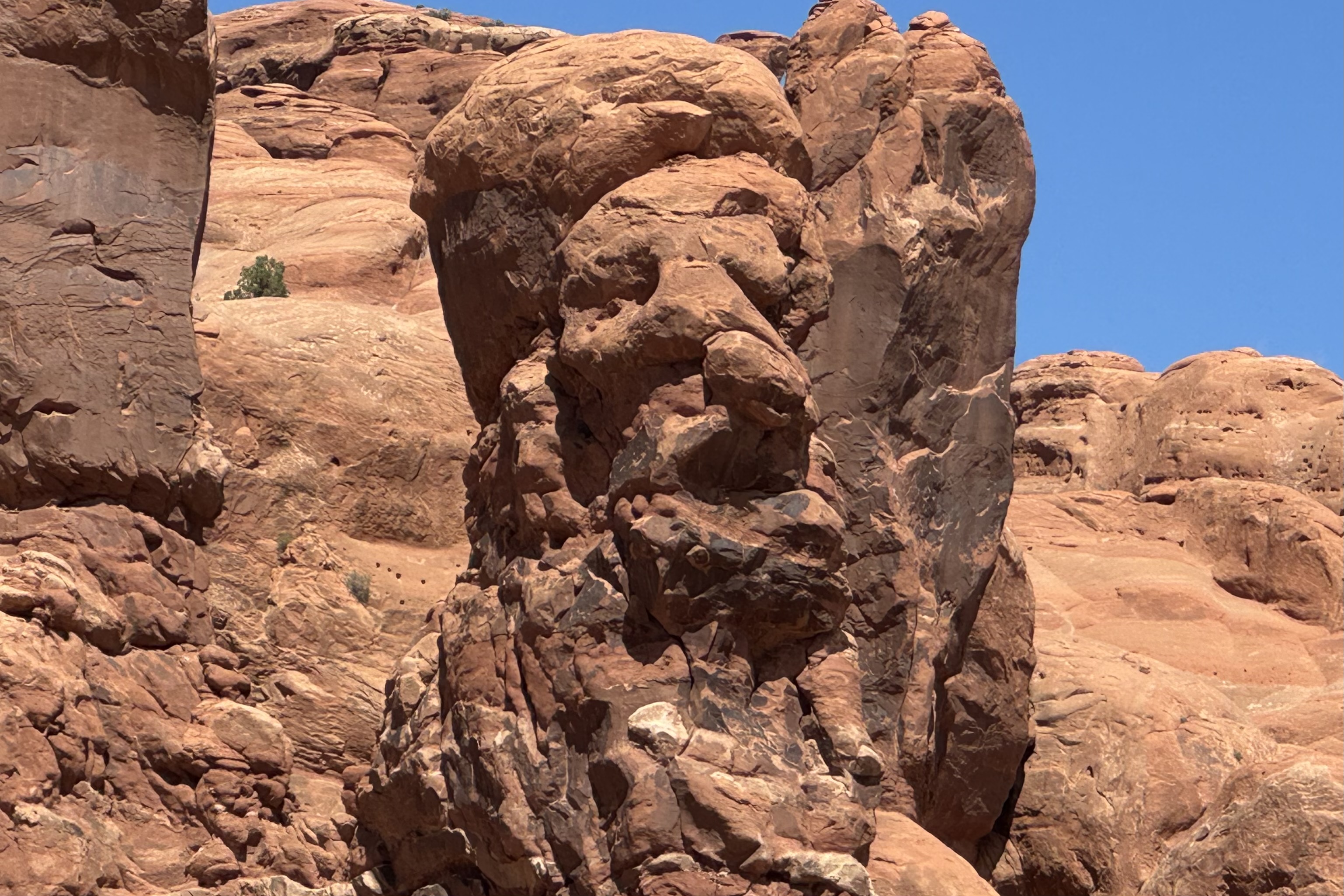
Standing 2,250 feet tall from the river to rim, Black Canyon’s Painted Wall is the tallest cliff in Colorado and it has been compared to the Washington Monument standing 555 feet and the Empire State Building at just 1,250 feet. Only Burj Khalifa in Dubai which is the world’s tallest building at 2,717 ft. has beat this massive cliff out.. Jackson Polluck and the many other abstract artist definitely were centuries behind the artistry of the natural forces of nature. My imagination went into high gear when coming upon some of the rocks lining the trail out to the painted wall and I started anthropomorphizing many of rocks and seeing cuddly rock creatures. Can you?
Cedar Point Nature Trail
Sunset View and High Point
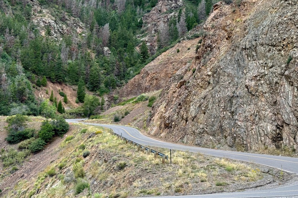
At the end of the rim road and with plenty of time for additional adventure, I opted to drive the East Portal Road to Gunnison Dam. The road is paved and two-way but windy and steep, narrow and twisty, and tight curves with a 16 % grade in few places. If you have read previous blogs you know this is my favorite kind of driving. My heart beat rapidly with the sheer excitement of this challenging drive. I managed to avoid burning out my brakes. It ended in the Curecanti National Recreation Area. I had intended to dip my toes in the Gunnison but some how was not motivated at that point to do so.
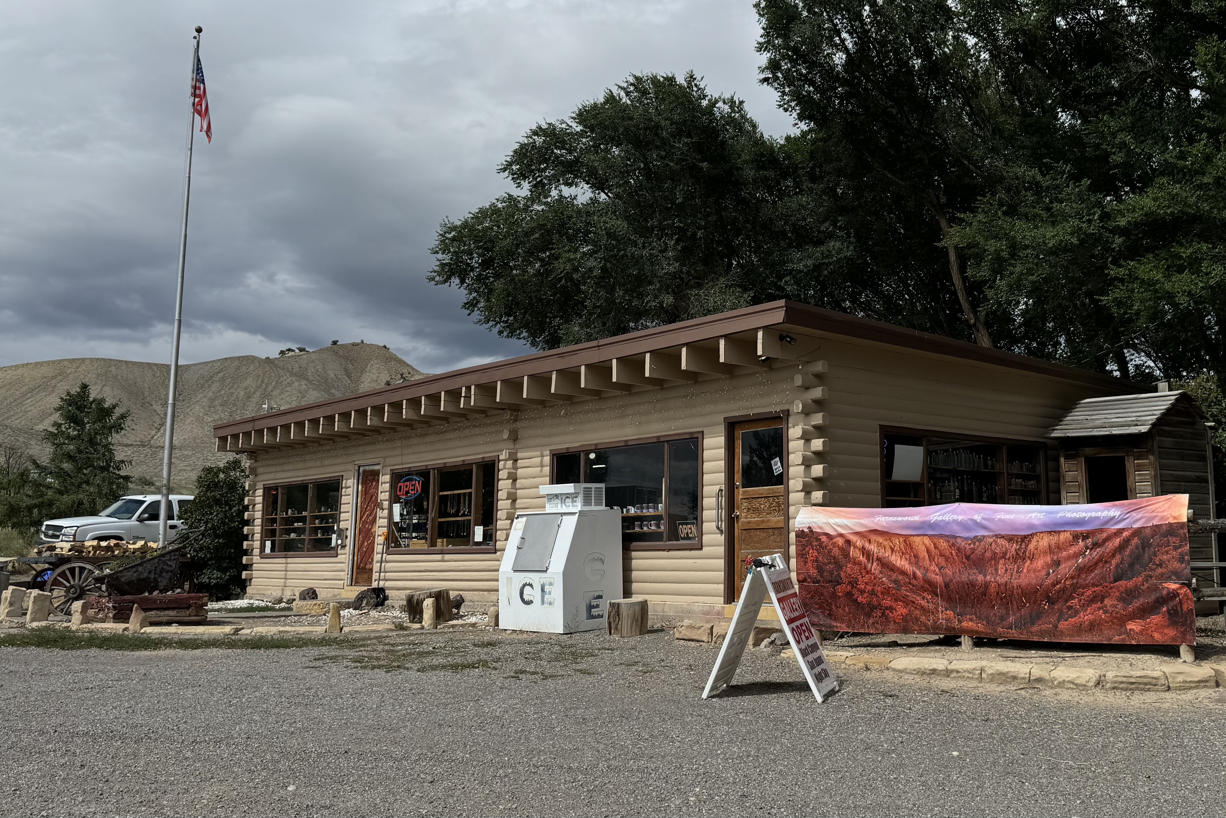
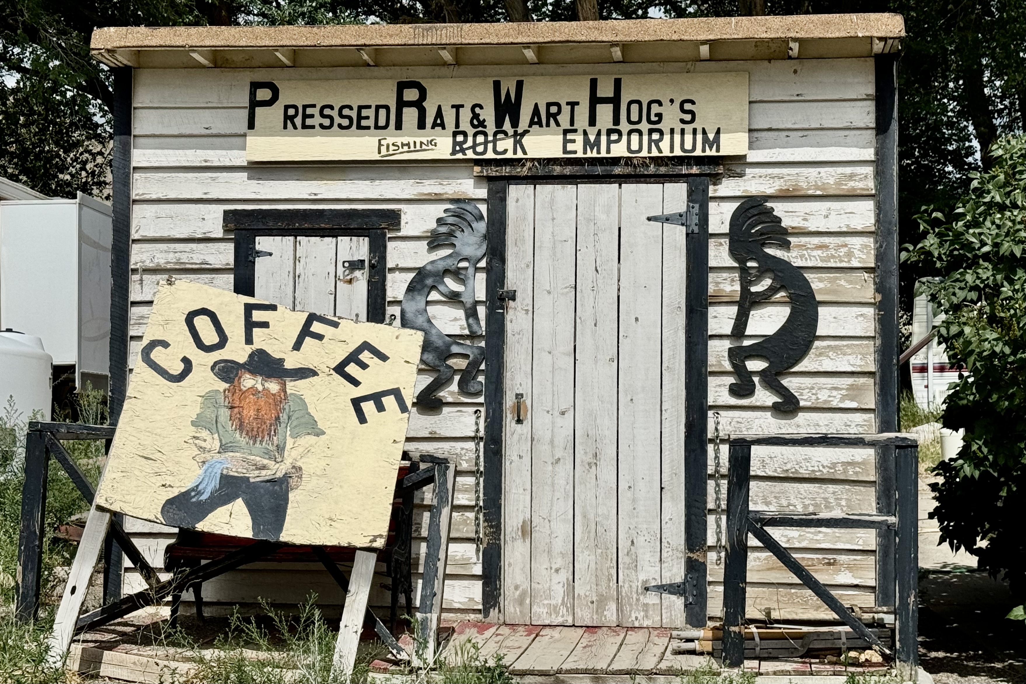
Since I clearly had not had enough of driving twisty mountain roads, I drove down about 5 miles to route 50 to get ice so my groceries would not spoil. The store definitely had character. .
It had been an excellent day with so much strong and bold scenery. It was time to head back up to settle into camp. Cook. Write. Organize and enjoy the sunset all the while again inhaling the wafting fragrance of hot tar.
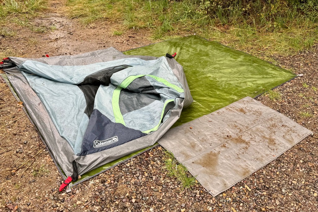
Friday, August 23 I woke another drenching rain. The tents raincoat (a poncho I had in the car) which I draped over the netting and under the oozing rainfly had kept the inside of the tent mostly dry and me mostly dry. The rain finally let up and I was able to get breakfast and coffee but figured there was no time for lingering as I wanted to try and break down camp before the rain started again. It wasn’t to be. A constant drizzle began so I was resigned to breaking everything down and wrapping it up, mud and rainwater as well. The tent must have weighed an extra 5 pounds. I was so very wet and bedraggled and I finally got loaded up and was off by 10:15.
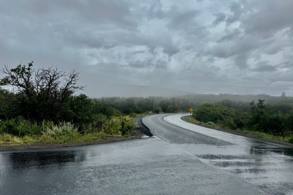
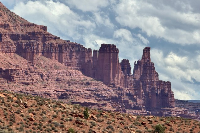
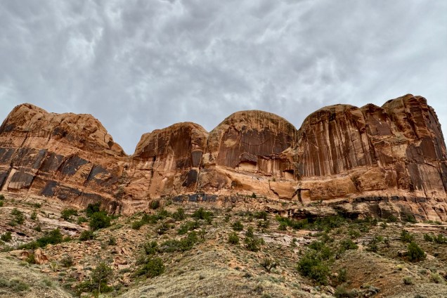
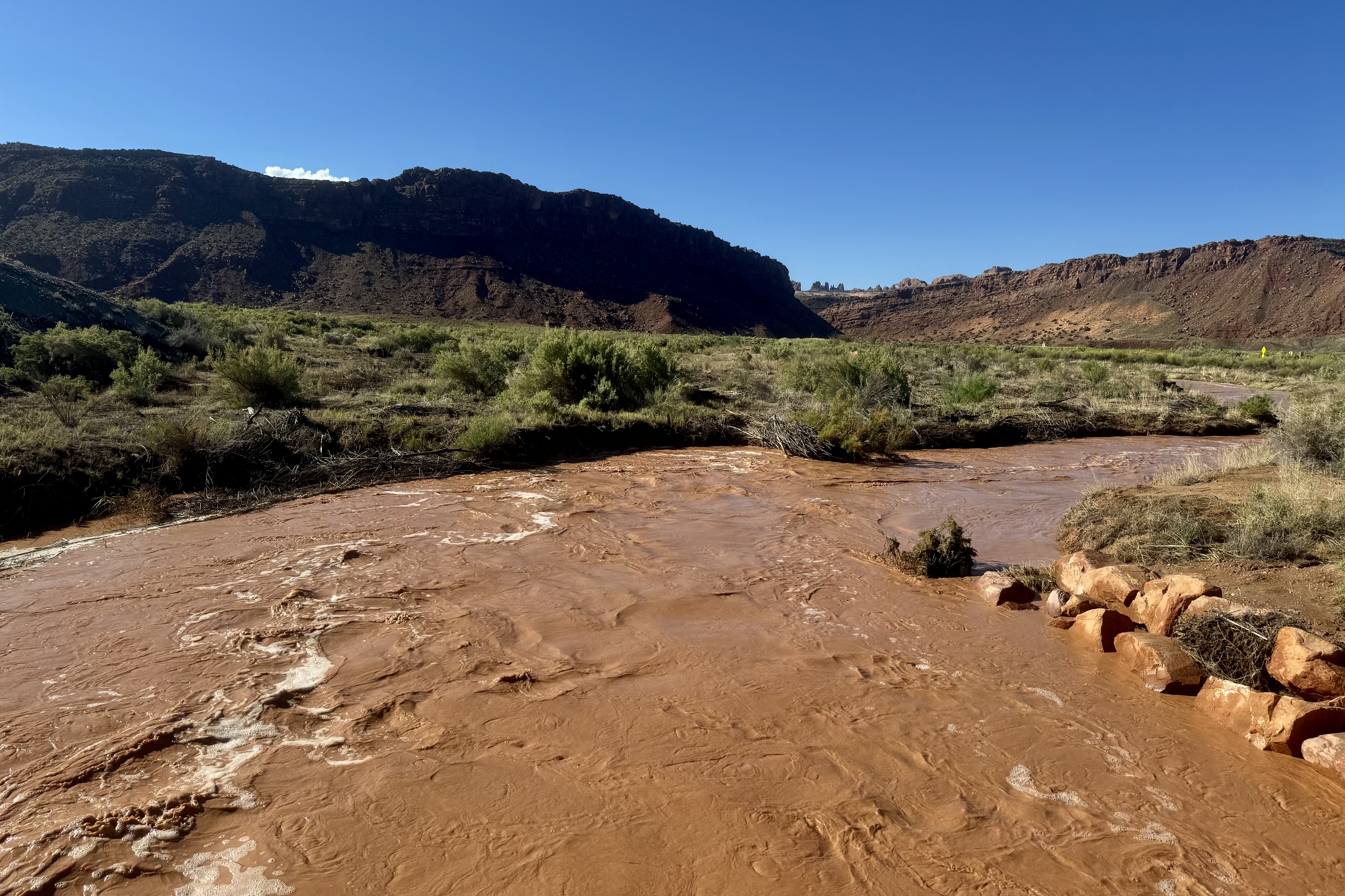
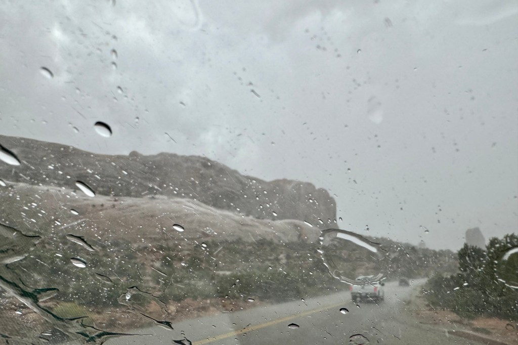
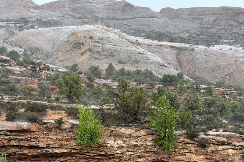
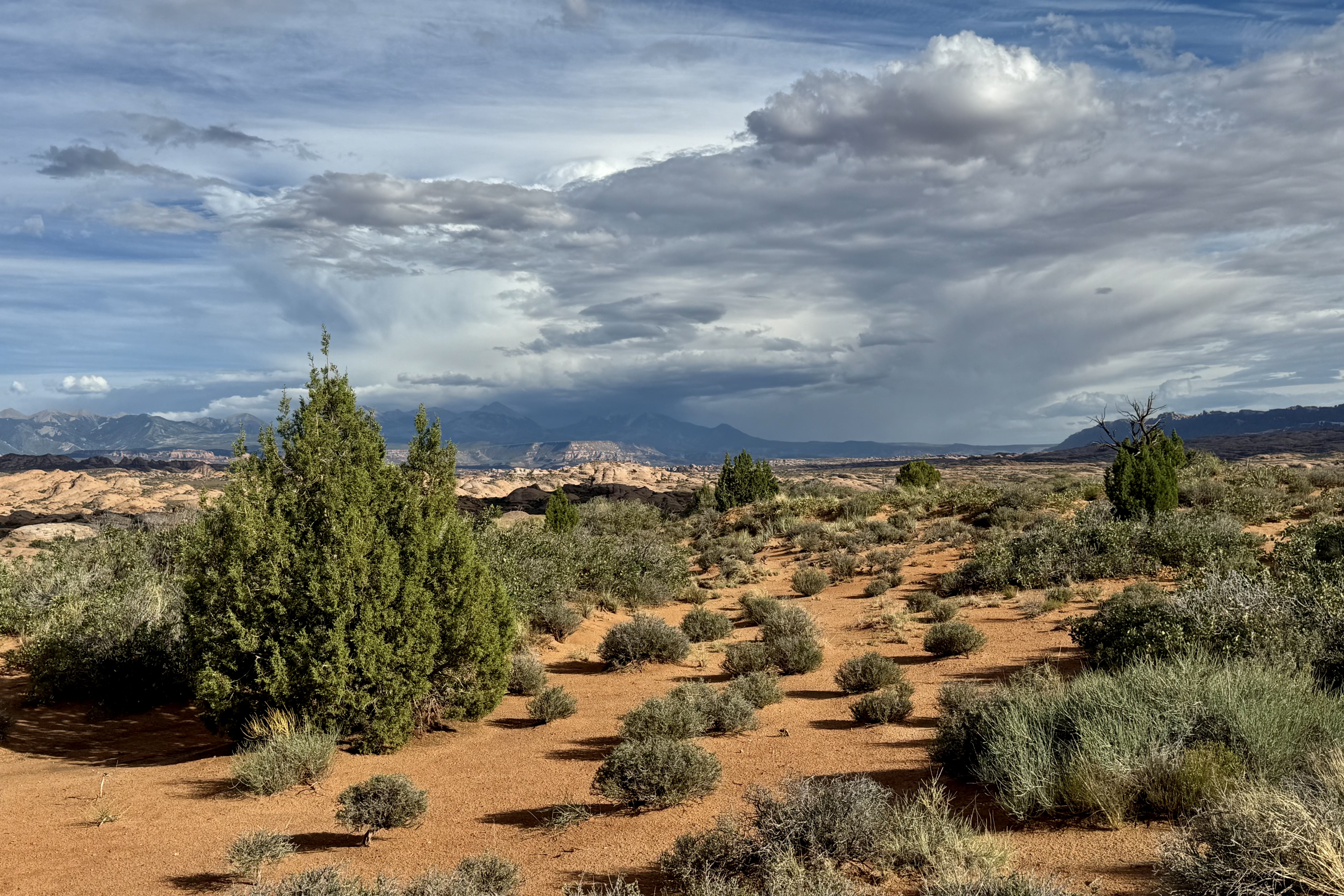
I did not have a terribly long drive so I decided to take what I hoped was a more scenic route to Arches National Park in Utah. As I traveled further west the landscape became more desert like and was colored mostly in tans, yellows, and browns etc. My route took me down #143 and before long I was in canyon lands with massive rock formations of all sizes and shapes and colors. It ran along the Colorado River and curve after curve got more colorful, fanciful and gorgeous.
I arrived at Arches Visitors Center Friday 23rd around 4:00pm and learned the campground was 19 miles up the scenic road and would slow going and take about 45 minutes. I was getting somewhat concerned as I saw some rather ominous looking clouds on the horizon and hoped I could beat any impending storm.
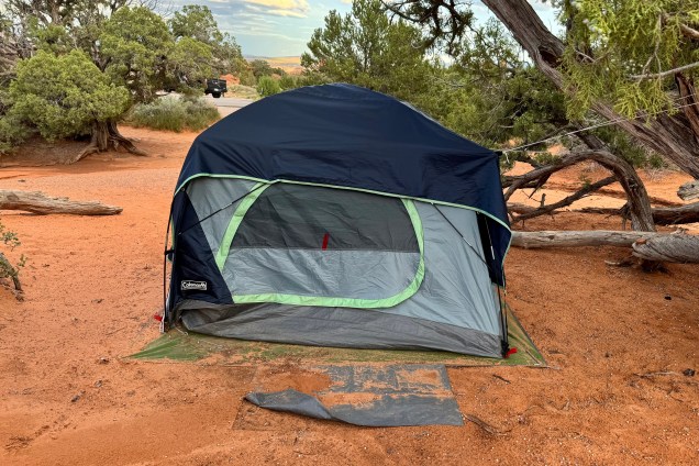
Fortunately, it was still sunny upon arrival at the campground and I set about trying to dry out the tent, fly, ground cover, tent rain coat and any other sodden item. Though sunny I could hear the rumbling of thunderstorms much closer. So I shifted into fast forward and basically just dumped everything into the tent that I would want for the evening.
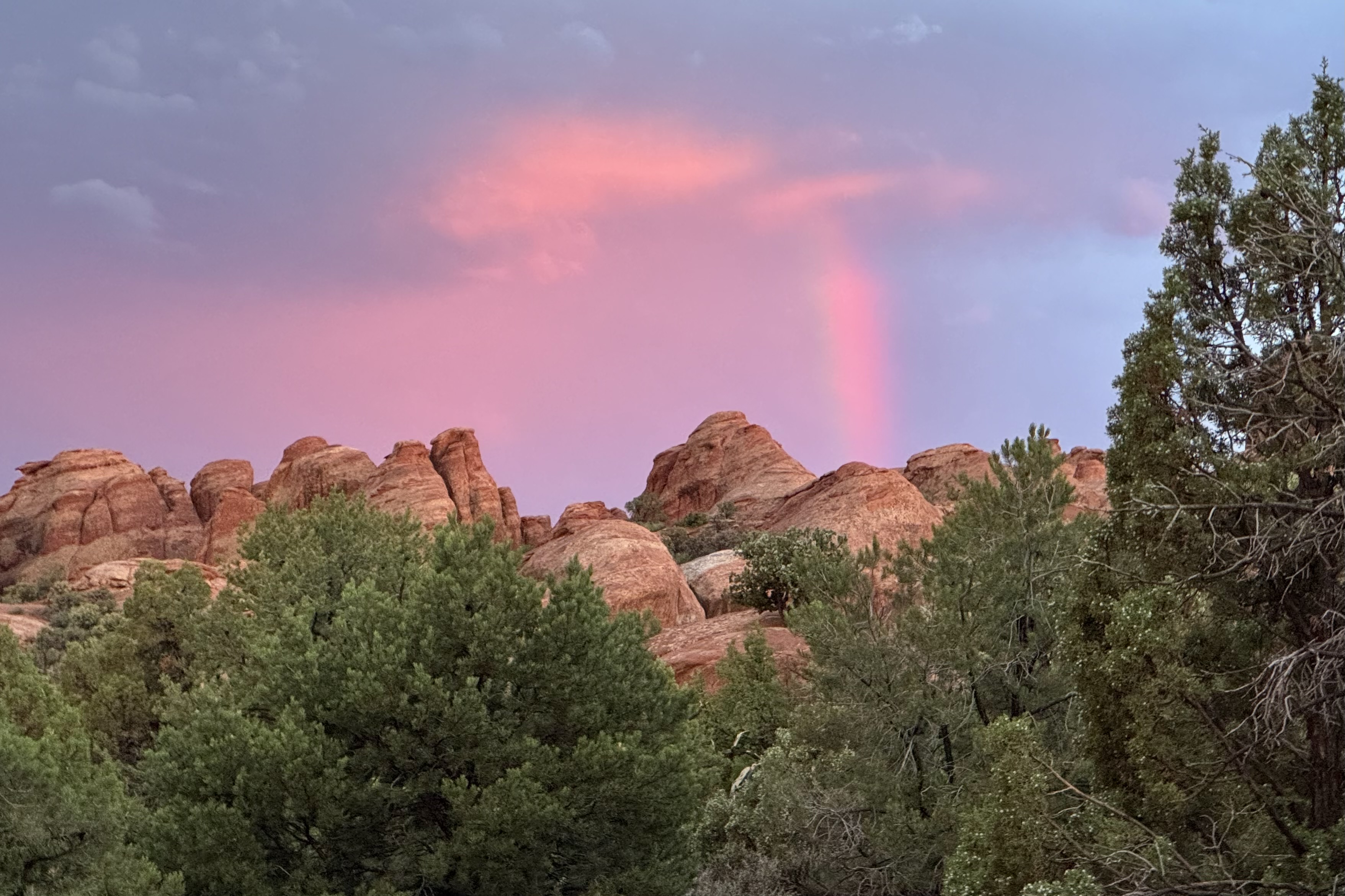
Then, first a strong wind gust and then the rain blasted in so quickly that I ducked into the tent but was wondering if perhaps I should have rode it out in the car. But there I was in this flimsy nylon cloth shelter with its compromised polyurethane coating, feeling scared (I don’t scare easily) and fearful, since it felt so close I was sure that the lightening and its companion thunder were about to both fry me and deafen me. I was certain a tree would come crashing down on my not so safe place and the tent would sail away with me in it to OZ. Of course, if it had not been laden with me and all my stuff, it would have blown away. This massive storm raged on for at least a half hour or more and the thunder was so loud and so close as was the lightening, all of that time. Talk about powerlessness. I could not do anything but just sit there and be frightened.
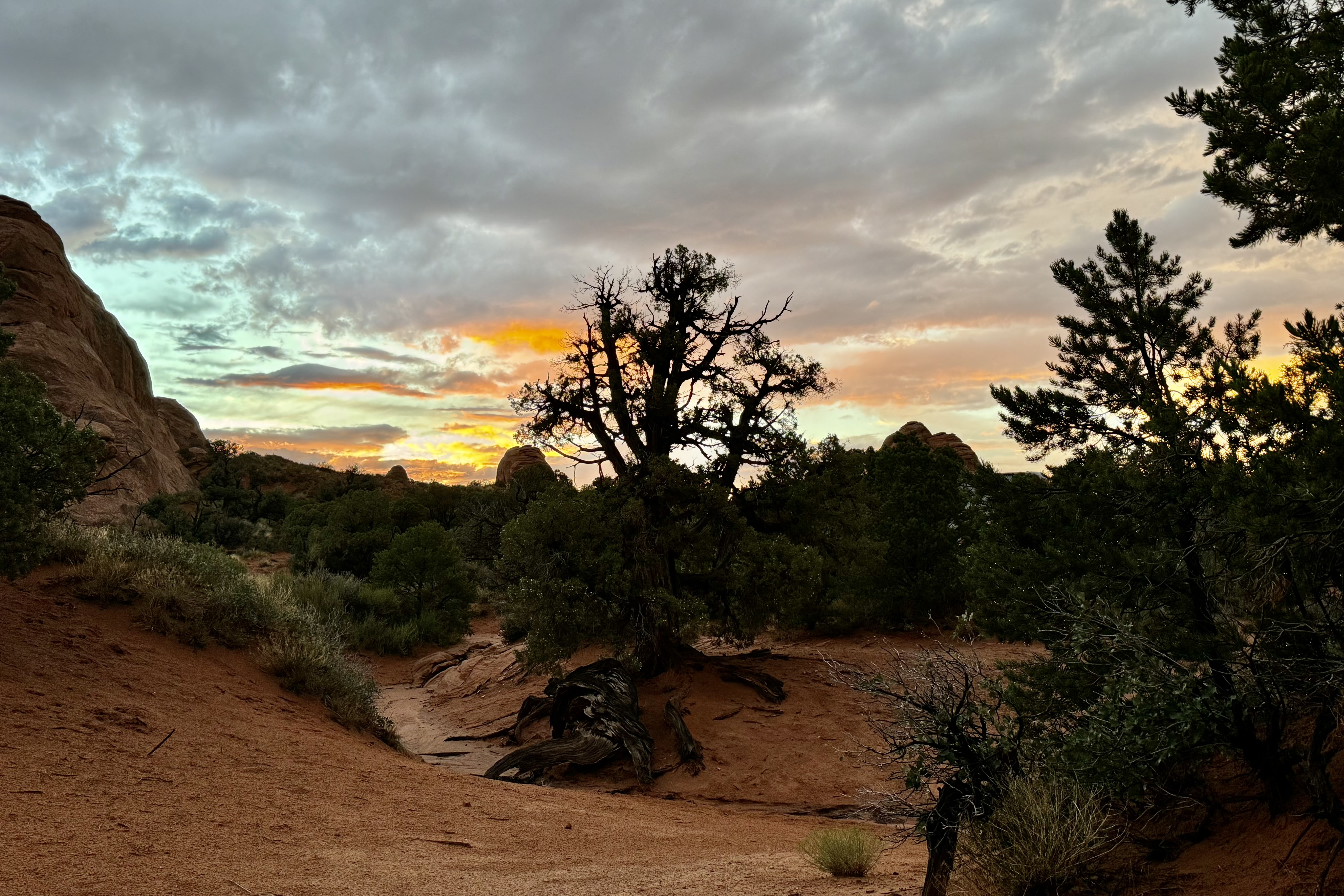
The stormed moved on over the distance plateau and valley. Mother/Father Nature subsequently pretended it did not just have a out-of-control rage in the last hour but subsequently served up a beautiful sunset as a peace offering.
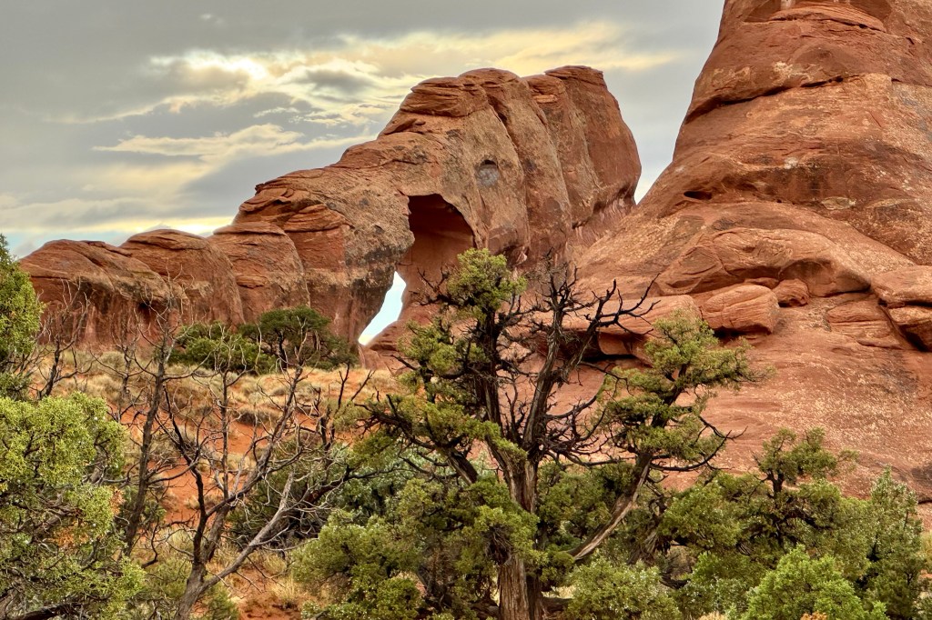
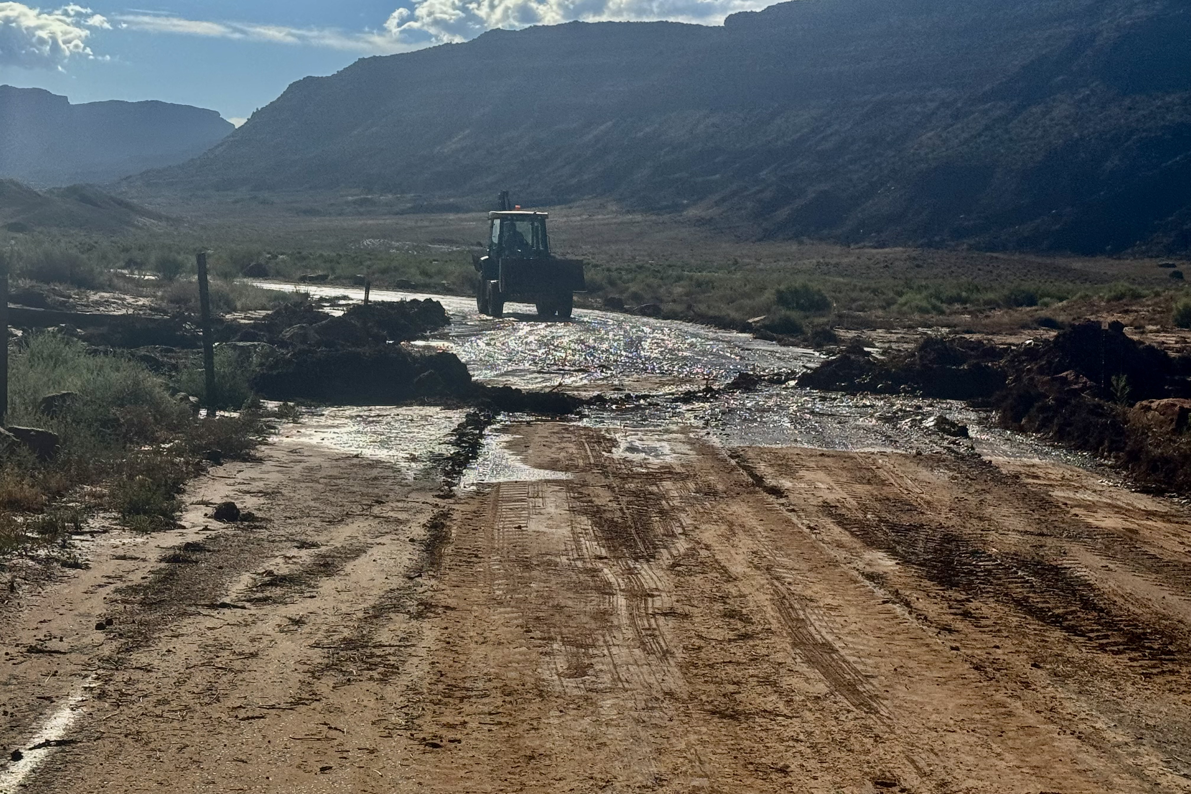
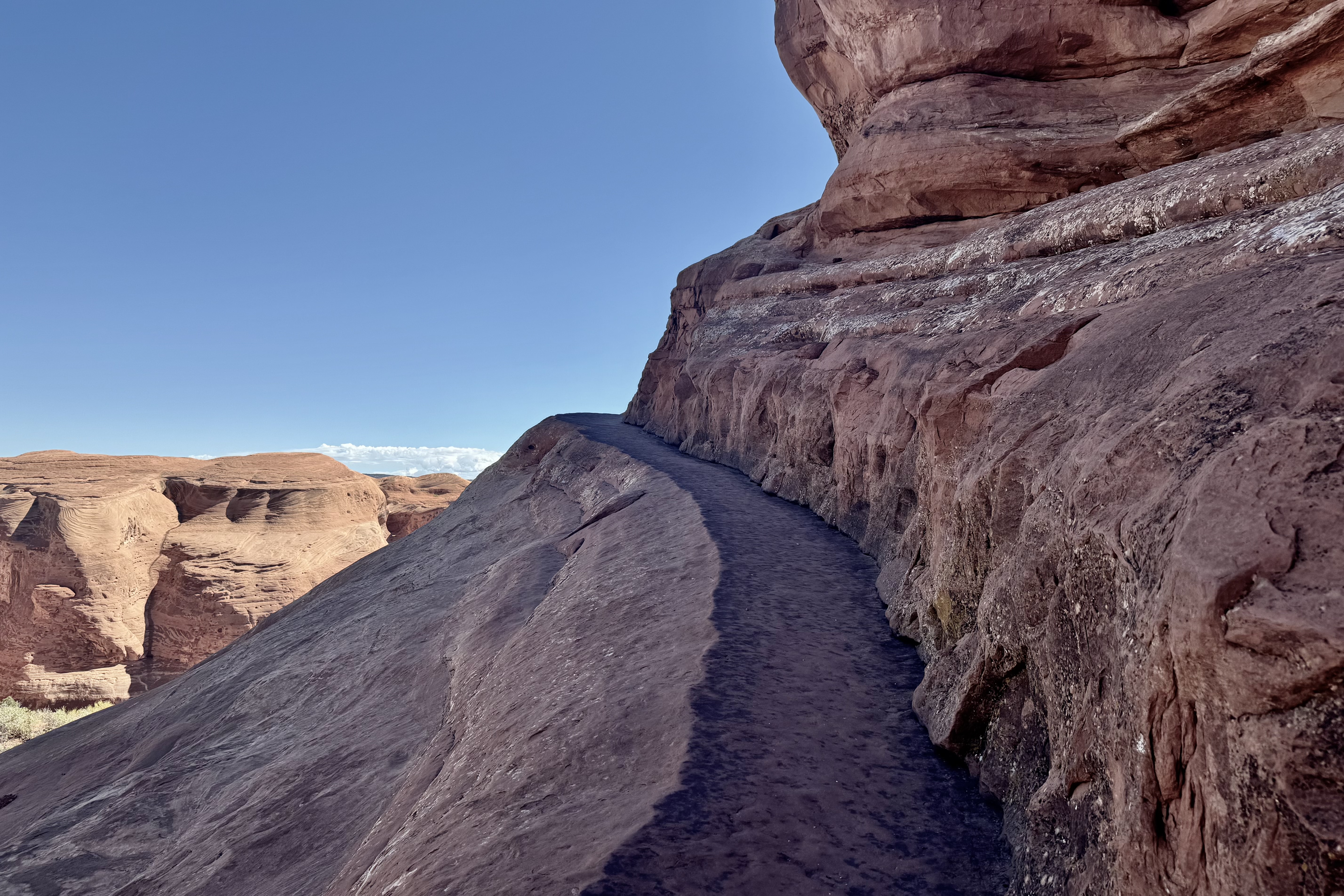
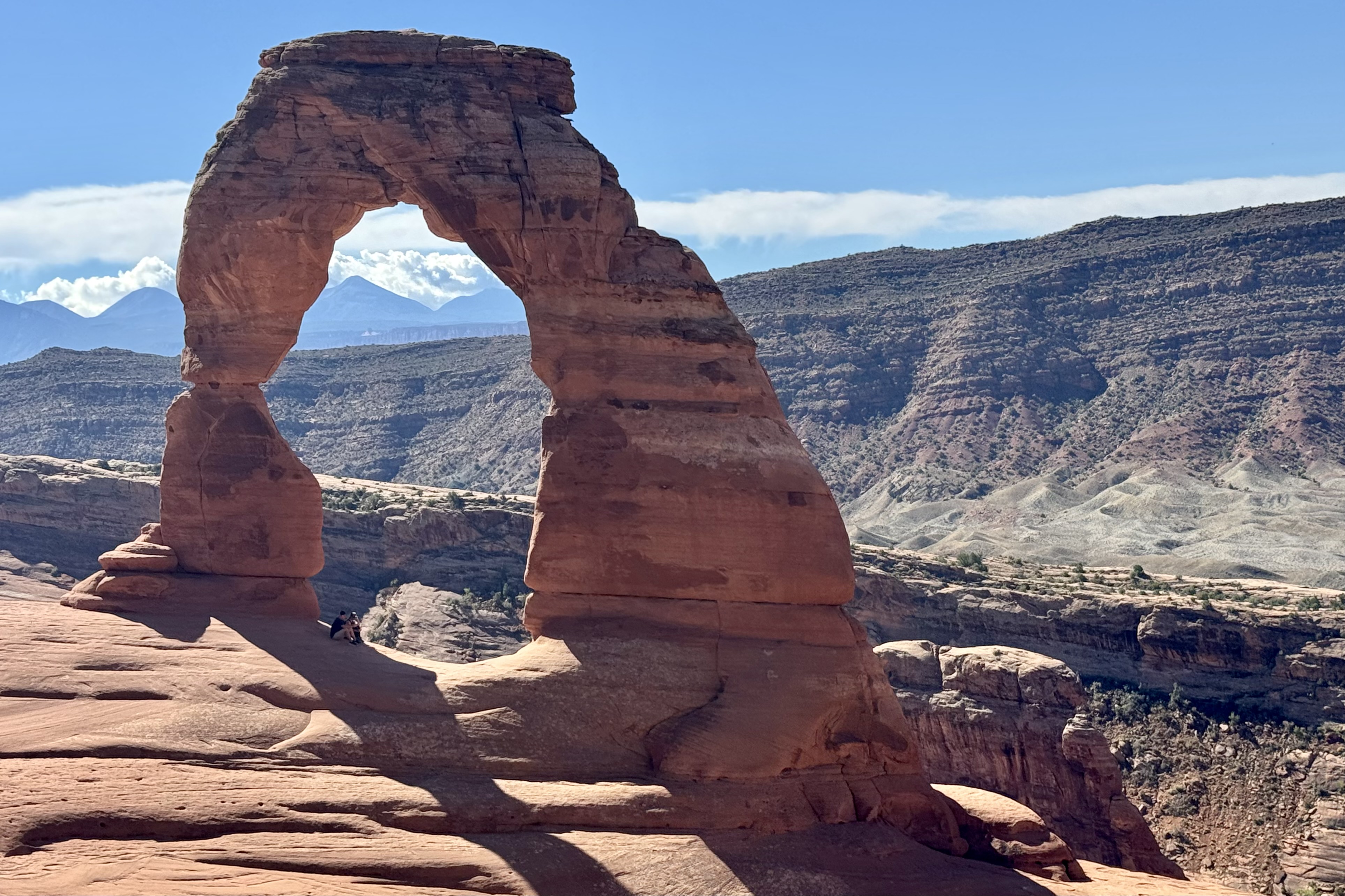
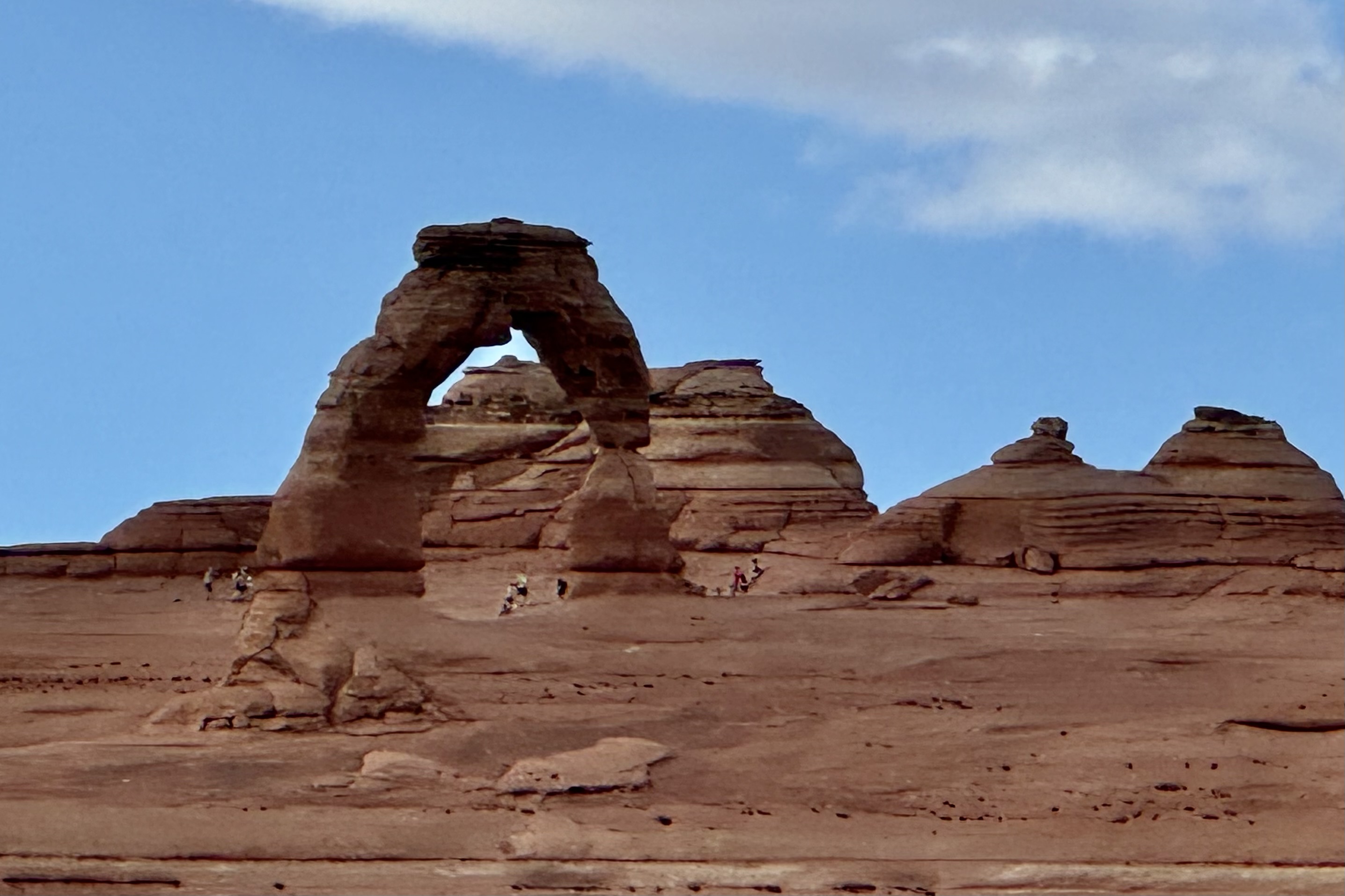
On Saturday 24th I was up and out early to hopefully get ahead of the crowds hiking the iconic Delicate Arch Trail. It was a halcyon day and I was psyched to commence the most prized hike of the entire trip. Delicate Arch is the largest free-standing arch in the park and so named because it is “the most delicately chiseled arch in the entire area.” But as I made my left turn to head down the 1.25 mile down to the trail head, I was met at the entrance of the access road with a Road Closed sign. A hiker who had walked the road down and was returning said that there was several feet of red dirt/clay across the road from the deluge of the previous evening and it would be 2-3 hours or more before the road would be opened. If I waited until then (it was already 9:00 am) it would be unbearably hot before I finished since I am the tortoise in the tortoise and the hare race.
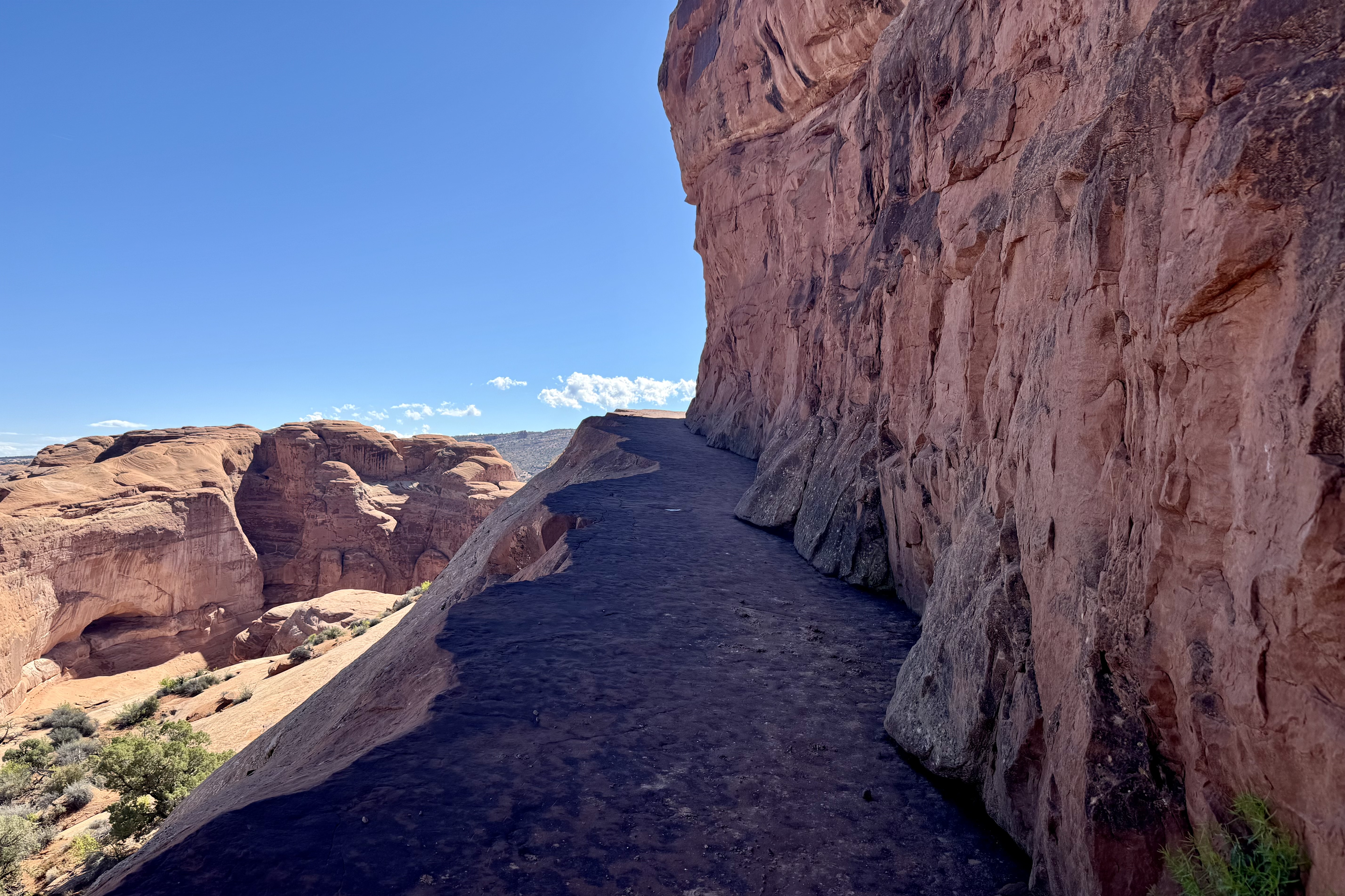
So my natural choice was to walk 1.25 miles down the road to the trail head, 1/2 gallon of water in hand. I would worry about the 1.25 mile uphill climb after the strenuous hike i.e could hopefully hitchhike back up. Around 30 minutes later I was ready for the 3.2 mile hike on what is rated as a strenuous trail. The beauty of this choice is that there was hardly anyone hiking yet (no crowds like the normal disneyesque size queue hiking here today) so I encountered only a few more adventurous duos passing me by . This was an exposed trail with no shade. As it began it was quite a well defined trail and soon crossed a bridge over Salt Wash. But soon thereafter I encountered steep grades, rock steps, red rock slabs, areas of open slope of steep slick rock with exposure to heights, and for the final hurrah a ledge with steep drop-off.
The final trek down to the Delicate Arch itself was along open relatively steep slickrock and even I would admit it felt quite dangerous especially with a brisk wind. I had gotten this far so I was not about to waiver now . Most of the other hikers were much younger than myself and when I finally made it out to under the arch and turned around, I received a rousing cheer from my hiker fan base and assists.
Hiking out was quite enjoyable, until about a half hour and over half way down, when I could see that the road was open. It would not be long before the large volume of hikers would be scrambling up the trail. Shortly, a couple of young women who I had been interacting with “up top” came upon me and asked if my car was down at the trailhead or up top on the road. Since their car was up there too, they offered to hike up and get their car and come down and pick me up. I heartily agreed and it wasn’t long before they were back. They did the hitchhiking up so I soon retrieved my car to begin my “Arch Walk” (kind of like an art walk) via auto of other areas of the park.
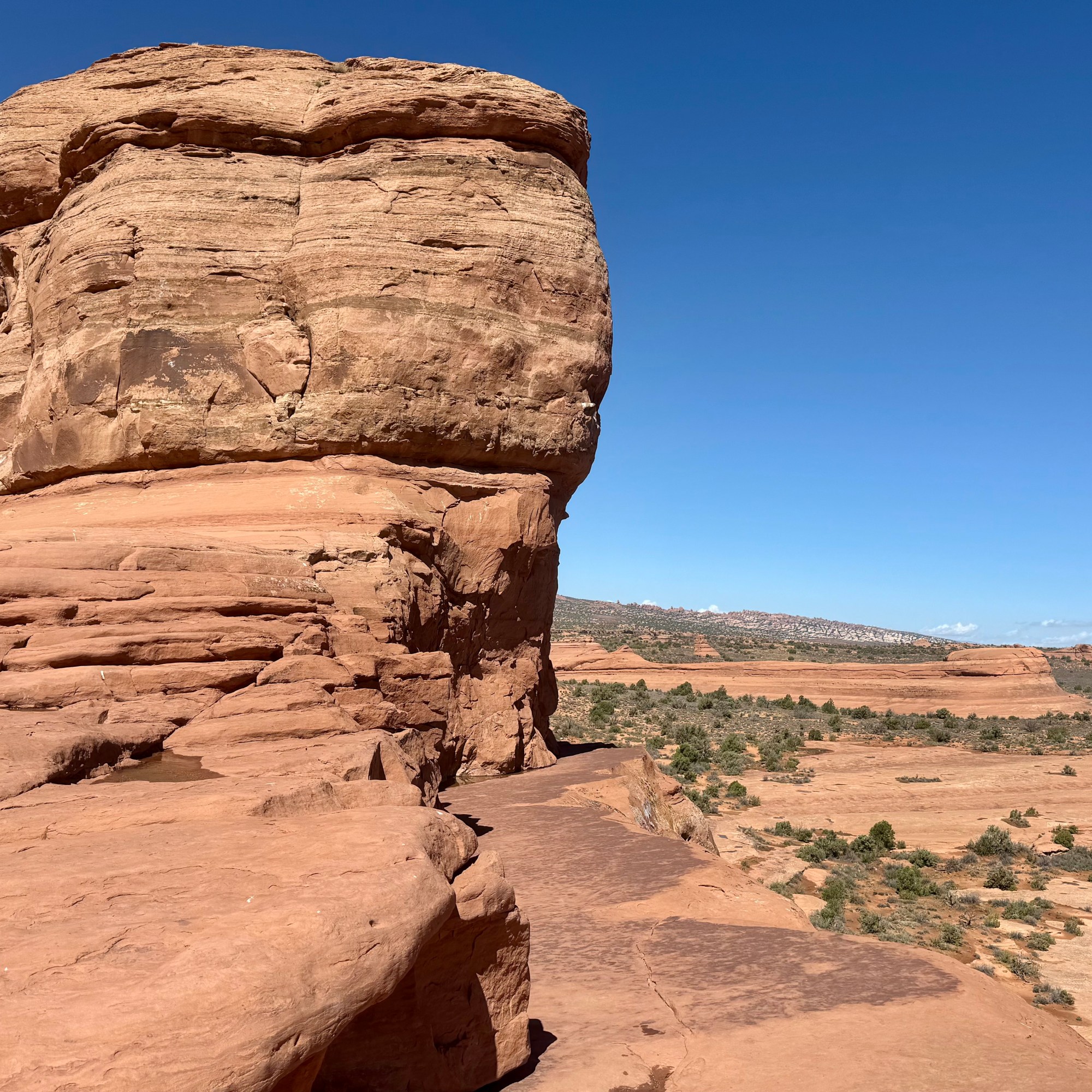
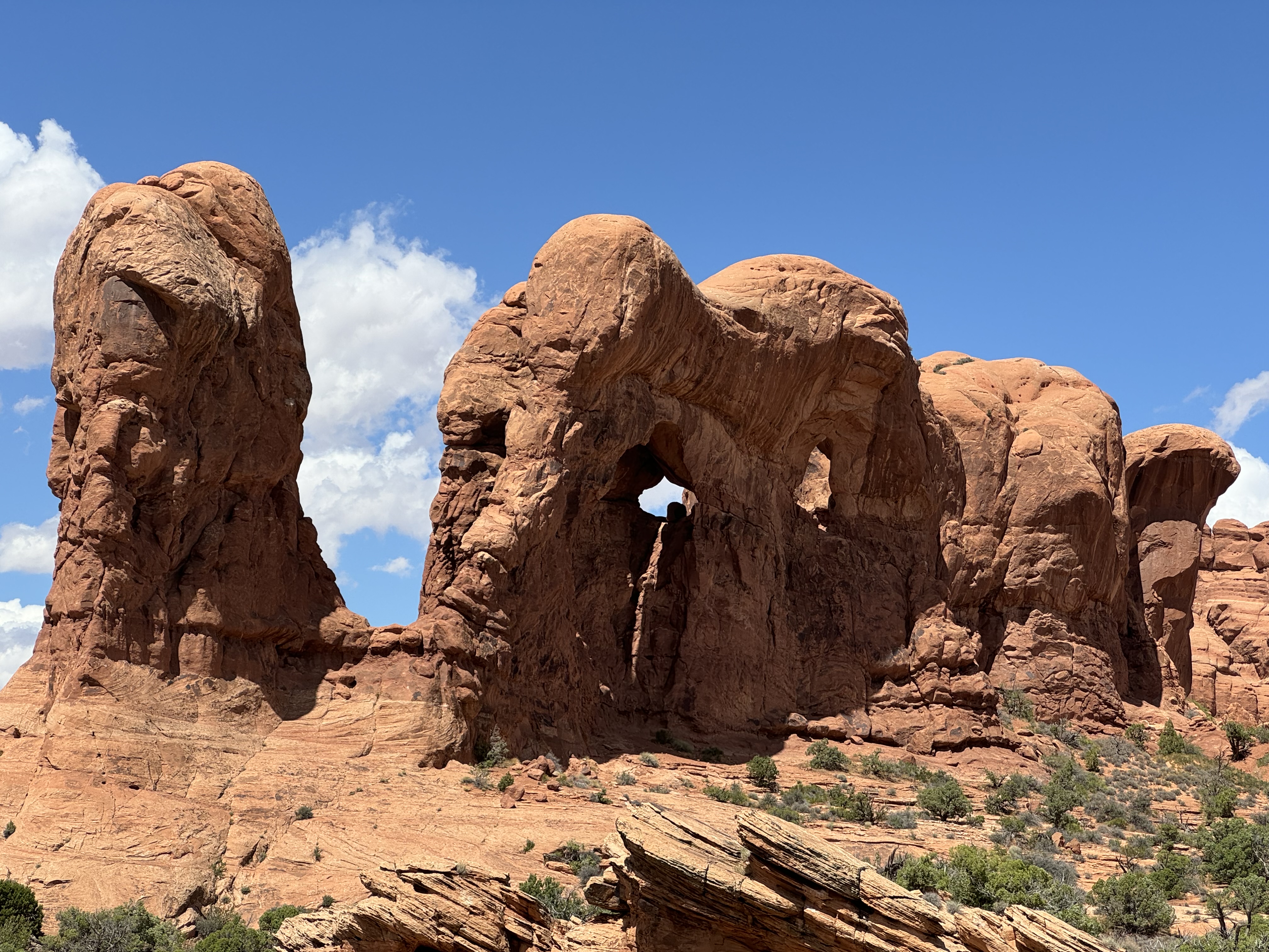
Much like in Gunnison, I traveled the length of the park road to view many of the acclaimed arches and do what walking my legs would still accommodate, after my so very inspiring Delicate Arch hike, starting with Panorama Point and North and South Windows Trails. Can you see or imagine what the rock formation namers saw in their names of the formations?
Panorama Point
Elephant Butte, the Buccaneer, and the Double Arch on Windows Road
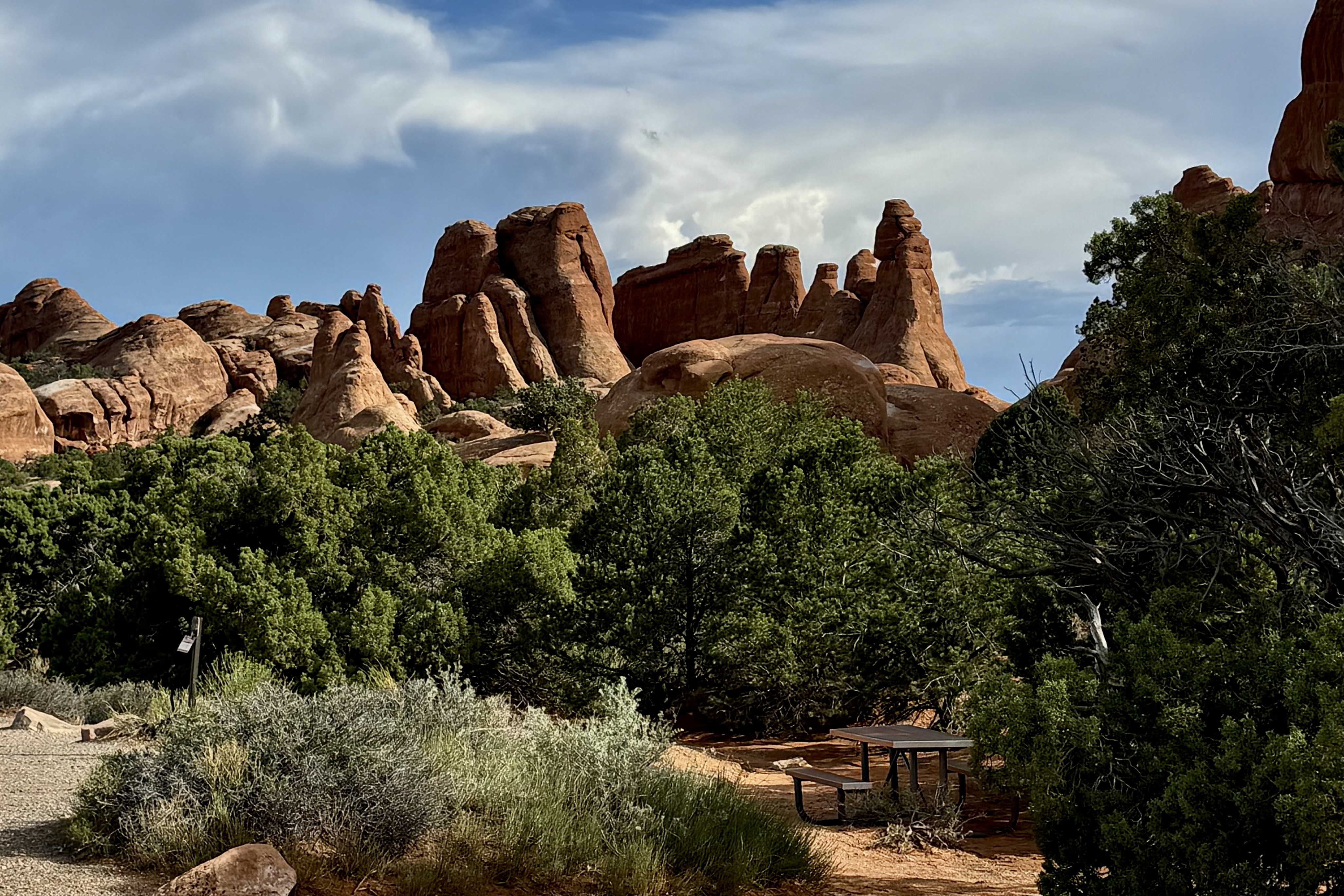
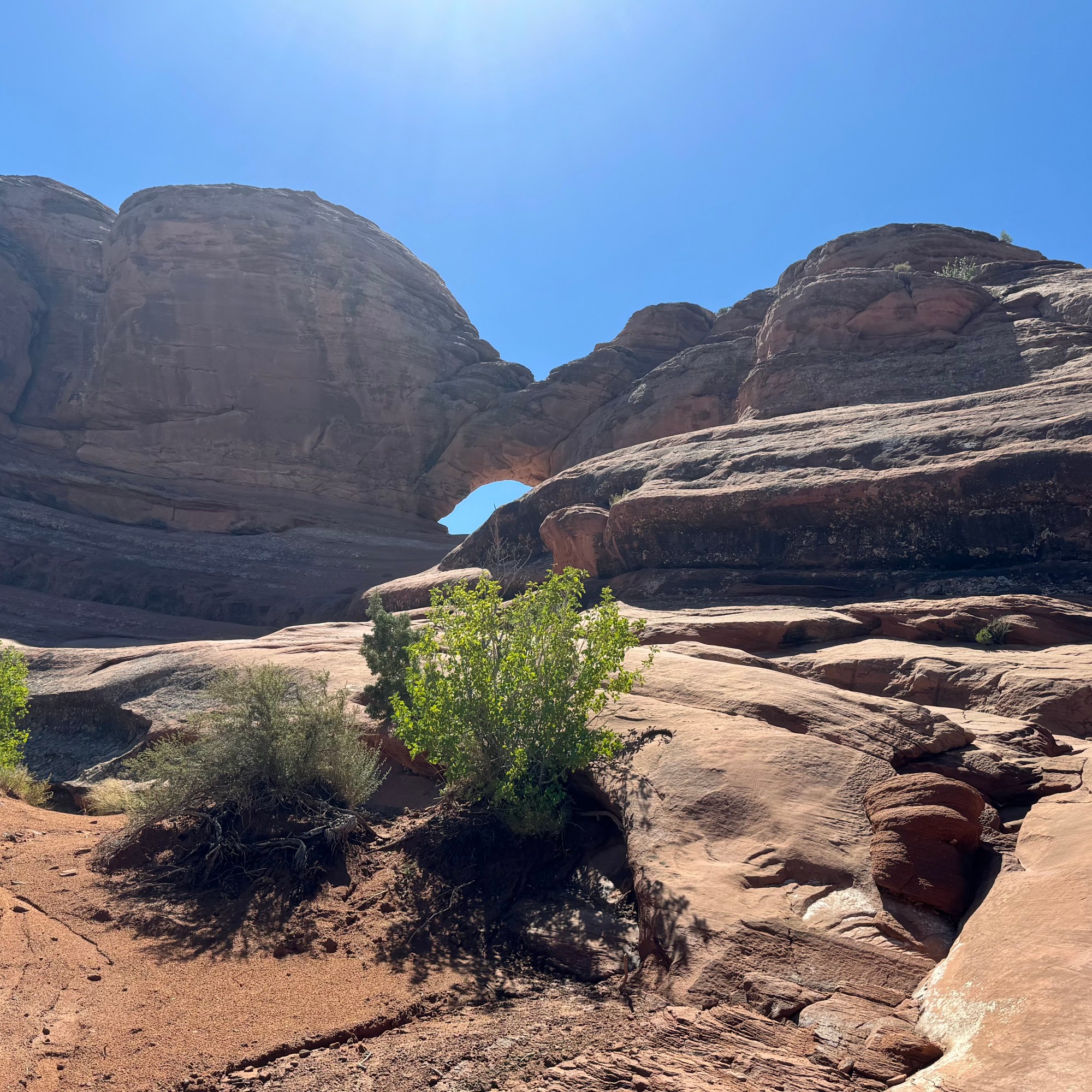
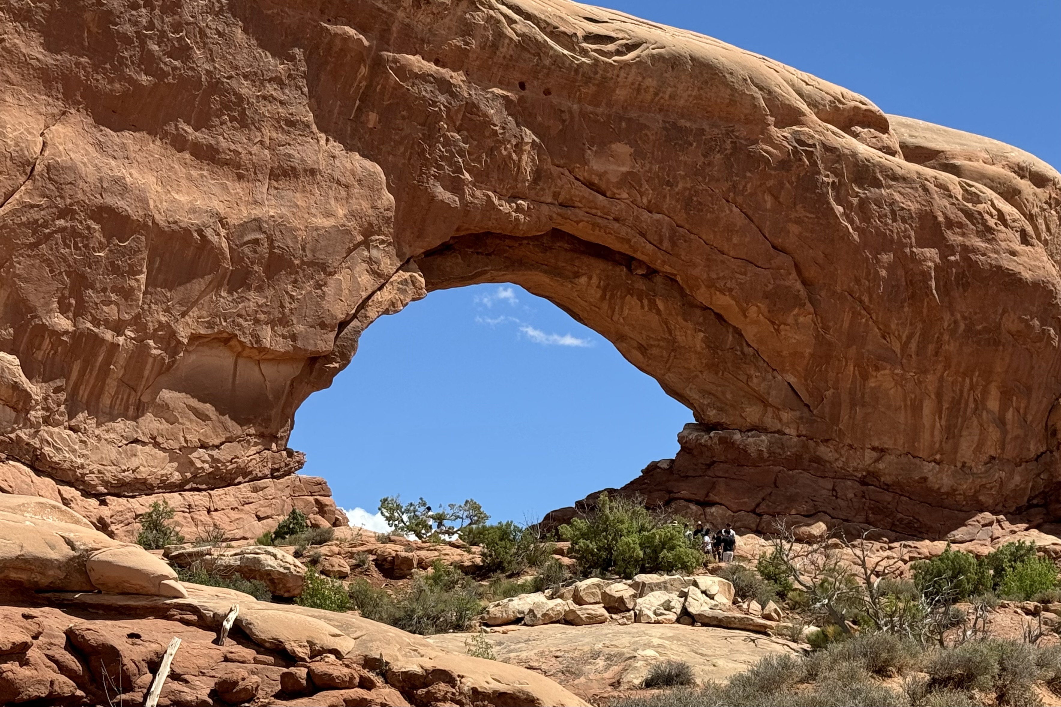
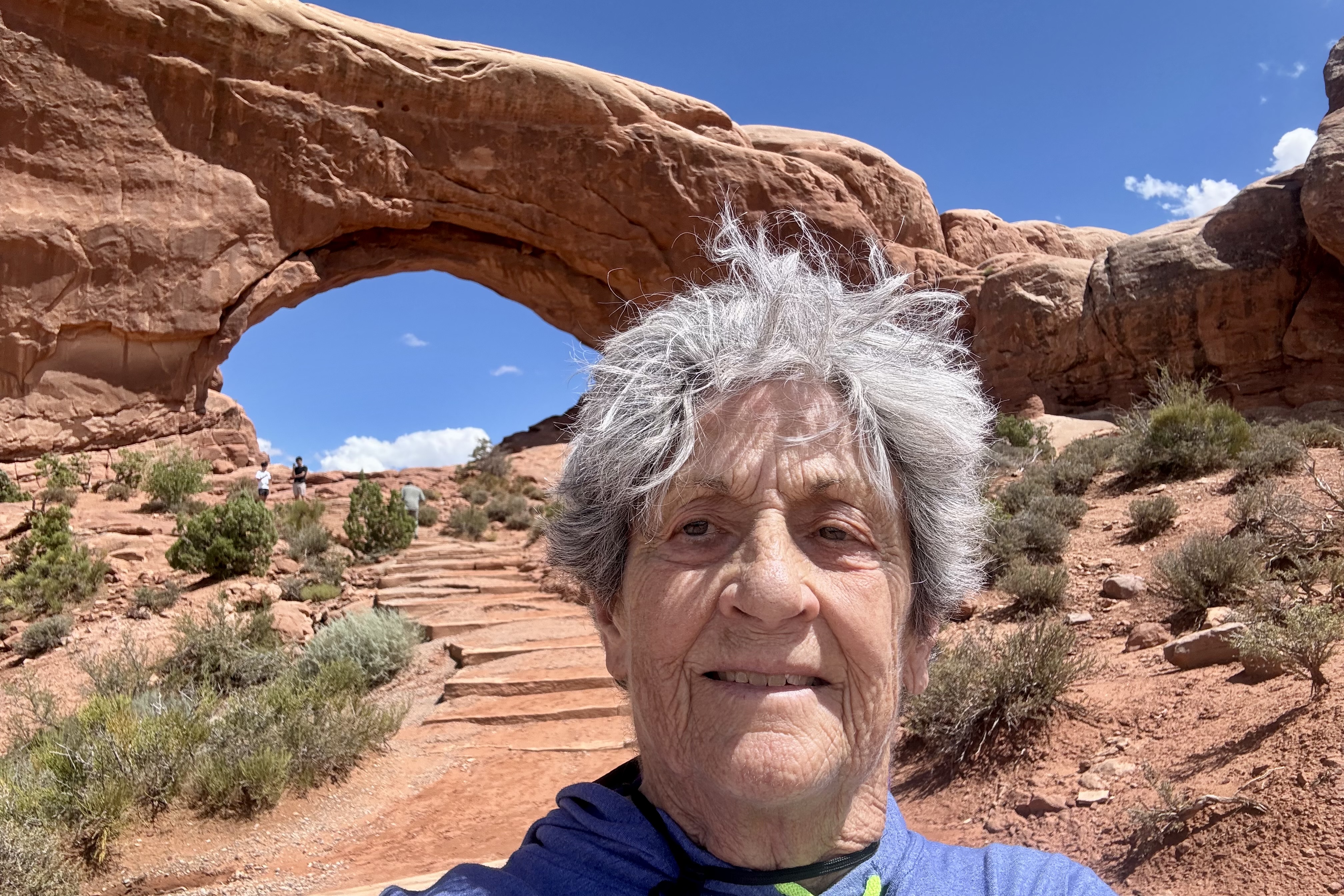
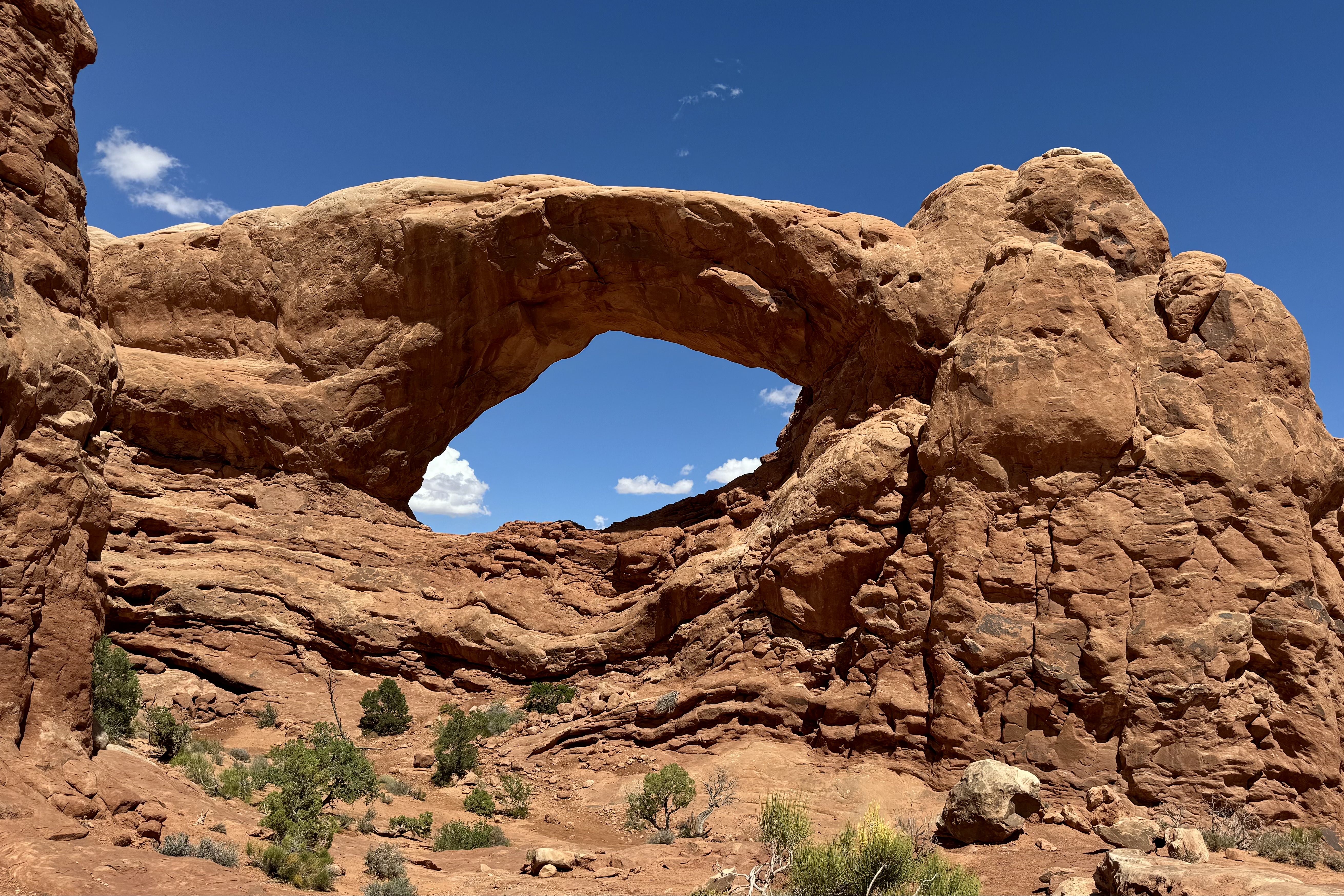
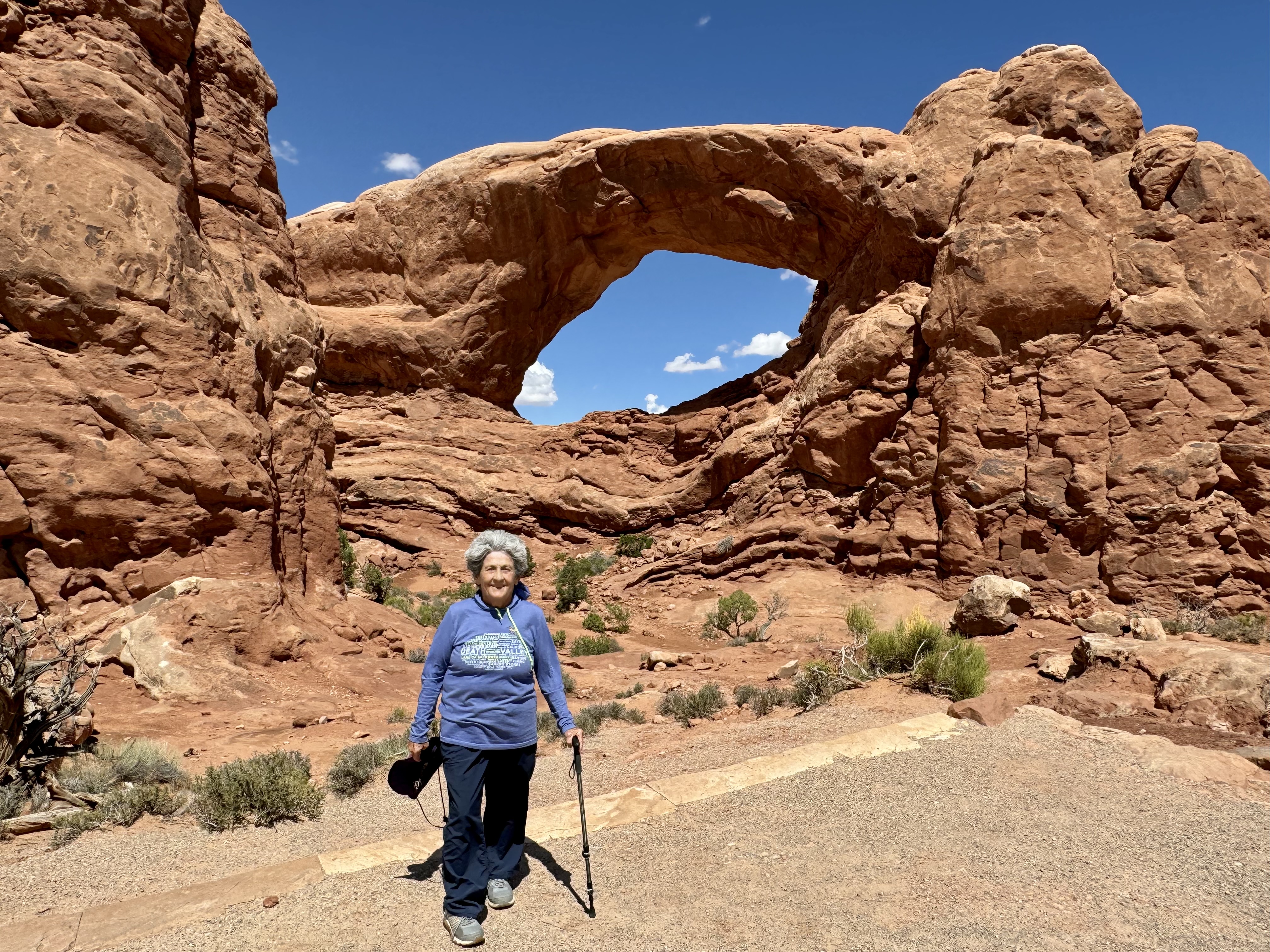
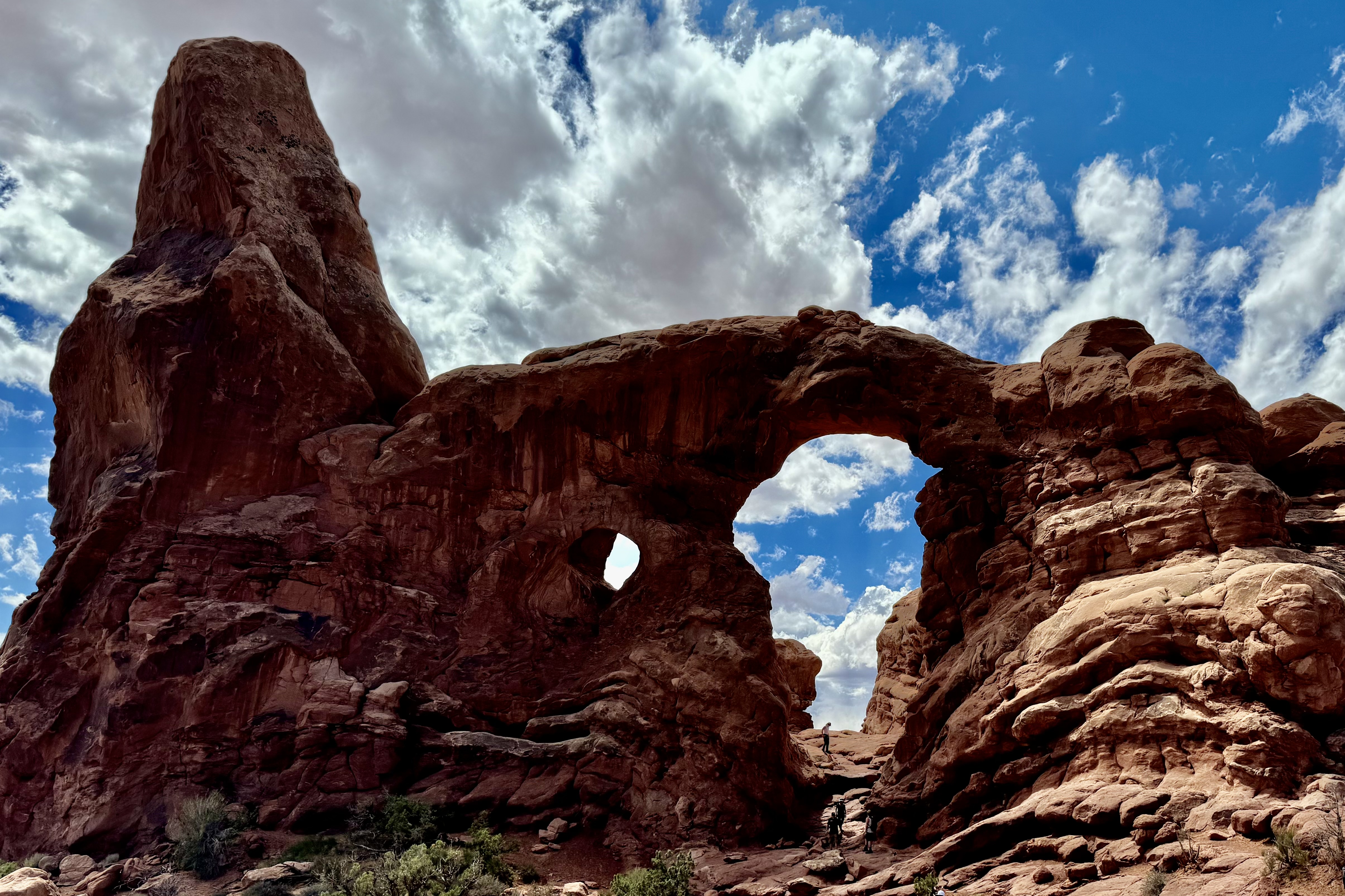
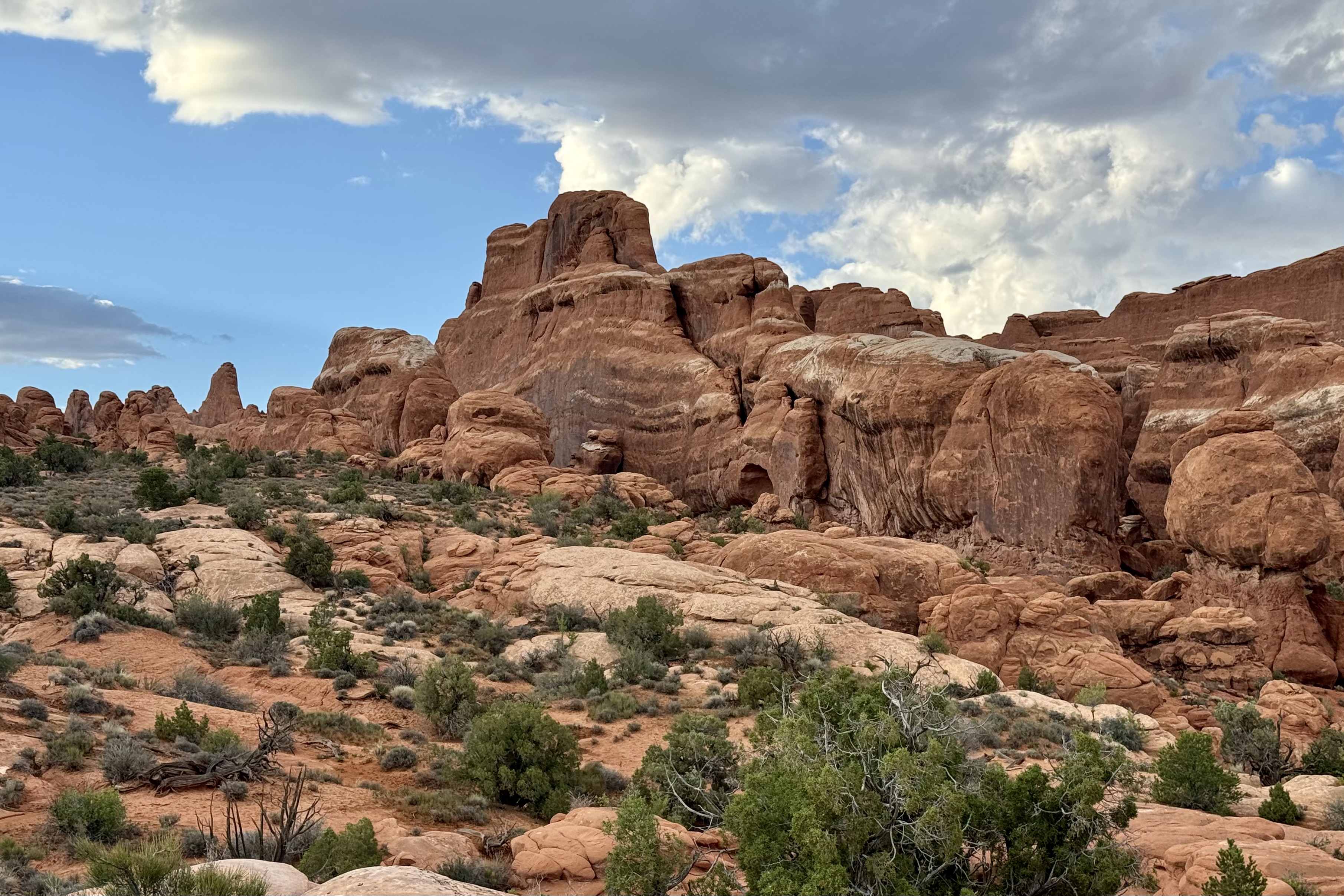
I loved the Windows section of Arches. Many consider it to be the heart of Arches. There is a significant concentration of arches and I found it to be quite a beautiful location in the park to hike about. South window, North Window, and Turret Arch, Elephant Butte, Cove of Caves, and Adam and Eve in the Garden of Eden are just a few of the -inspiring arch formation I found on the Windows Trail and Road.
South Window, North Window, Turret Arch, Elephant Butte, Cove of Caves, andAdam and Eve in the Garden of Eden
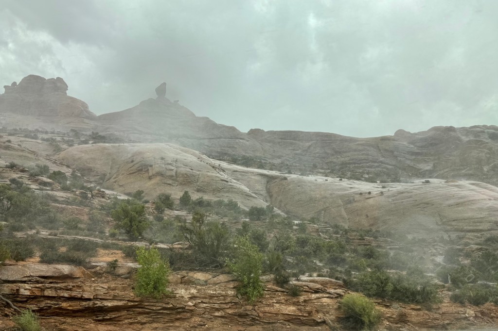
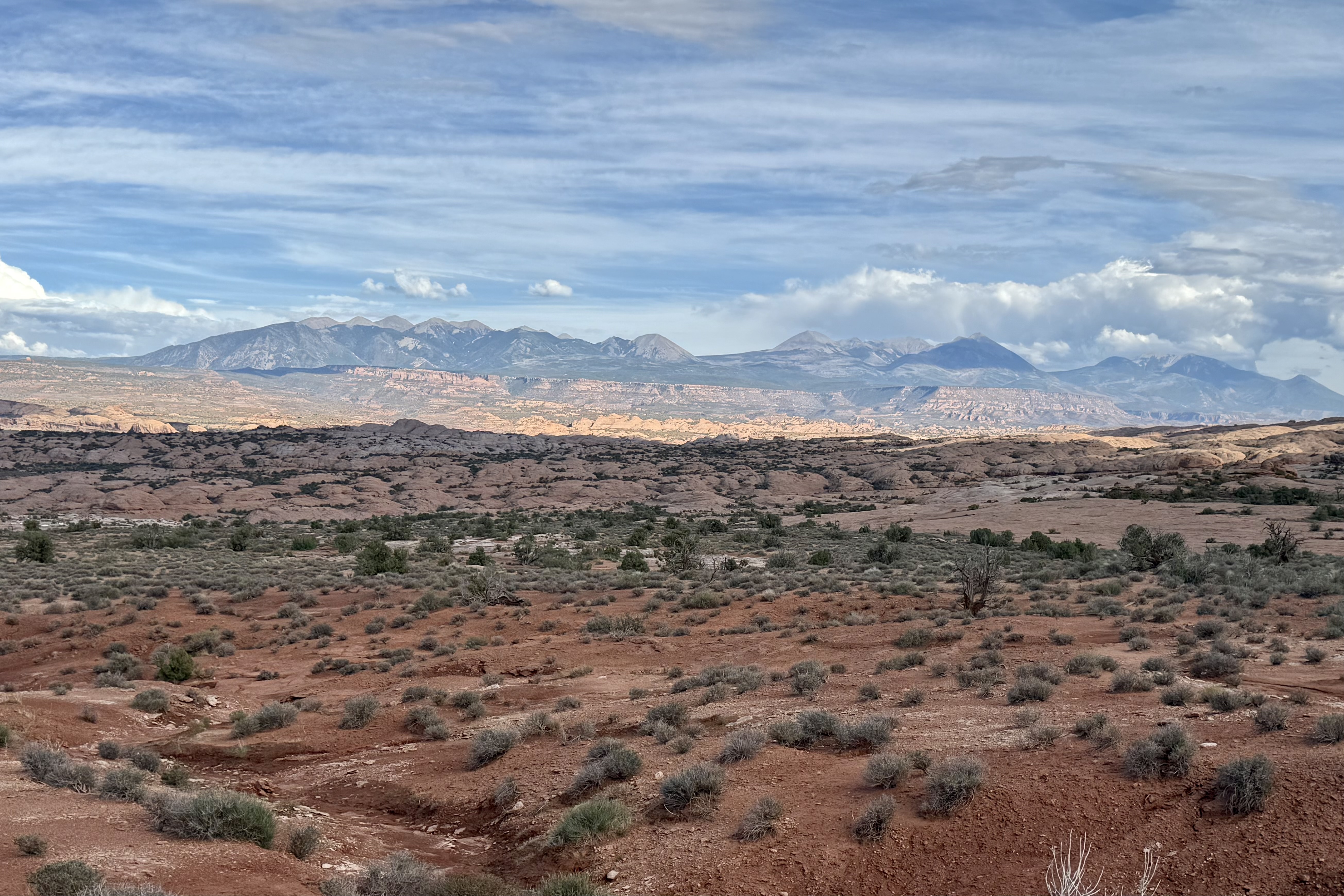
I knew it was about time to drive into Moab Drove to shop for ice, grocery supplies and gas. Having made that decision I was quite pleased that the storms for the day hit when I was enroute through the park.
Upon my return I continued on my mission to visit the vita as many pullouts as possible … how tragic it would be if I missed something truly remarkable.
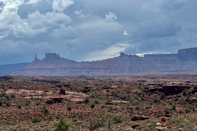
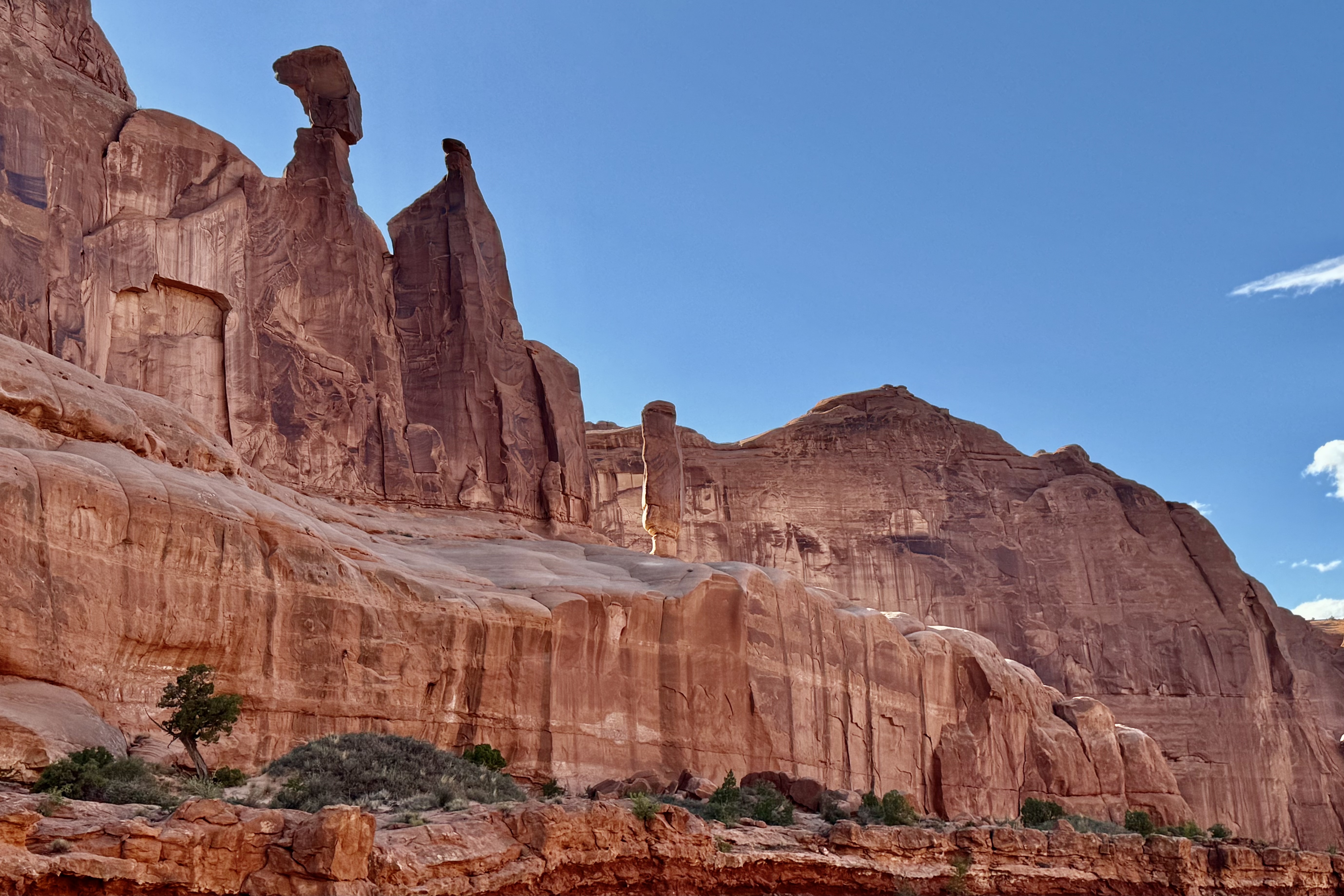
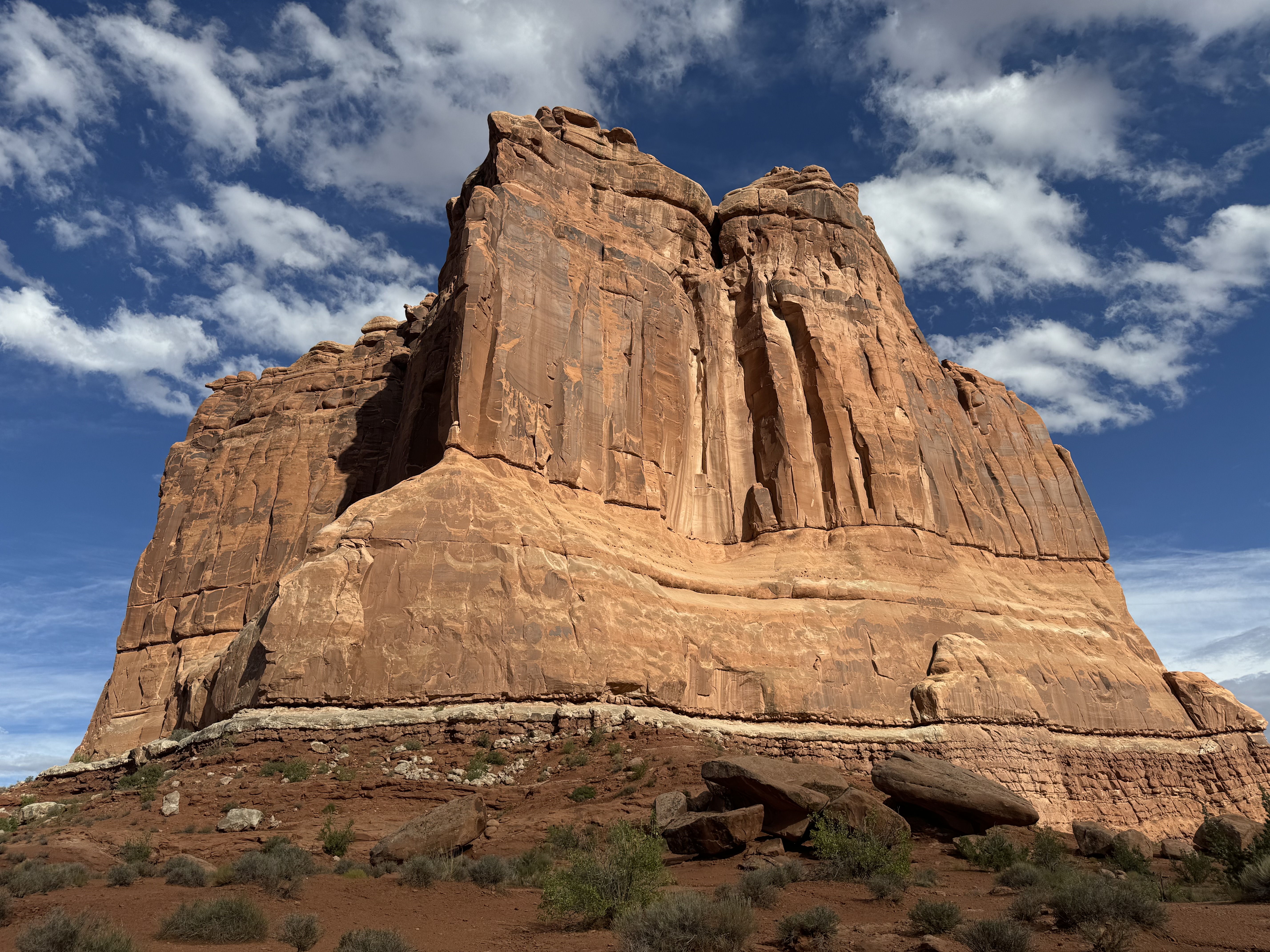
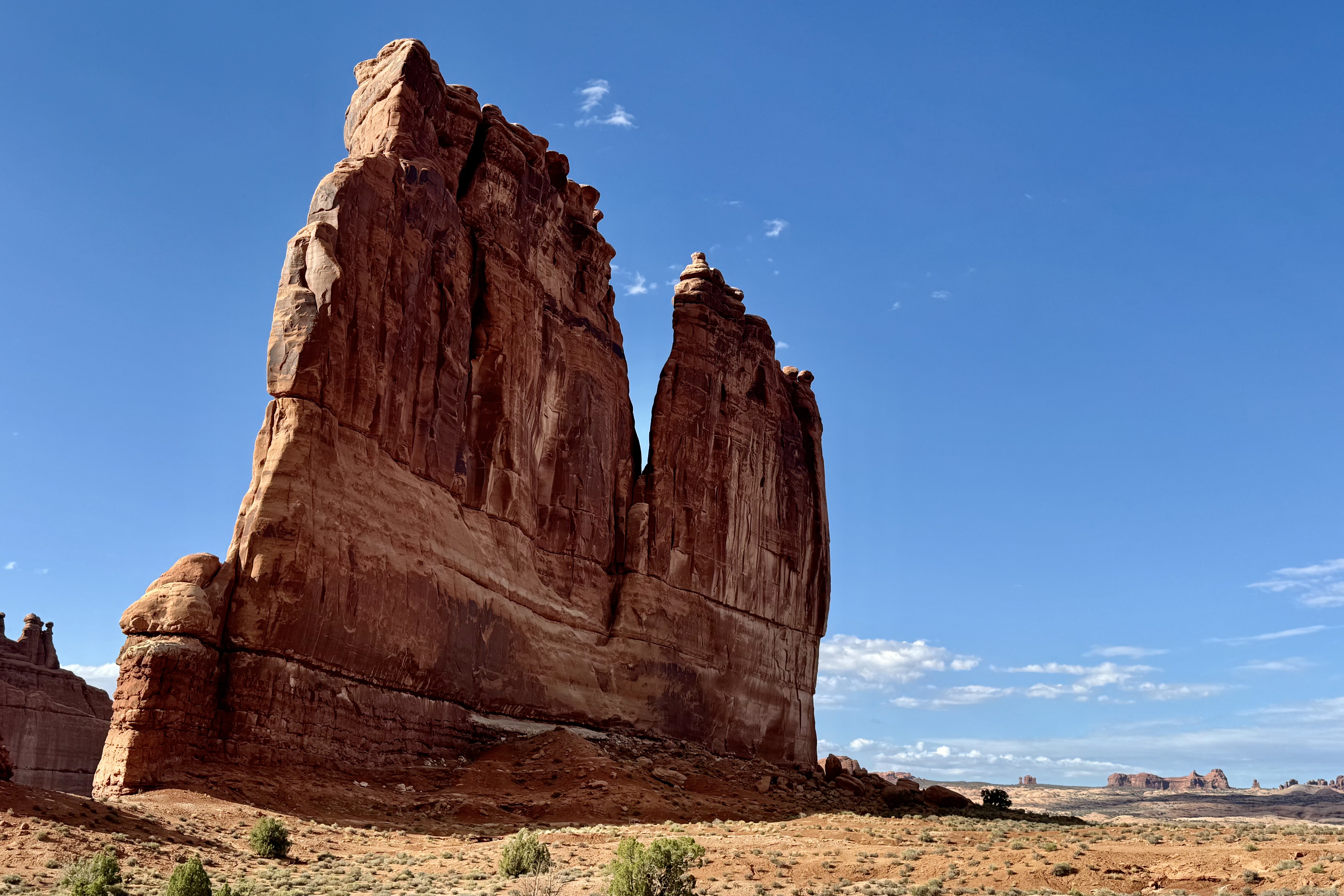
Park Avenue, Queen Nefertiti, LaSalle Mountains , Three Gossips, Courthouse Towers and Tower of Babel.
Further on down the road and in spite of the ever present threatening weather, I continued my pursuit of additional vistas including the Petrified Dunes, Fiery Furnace, and for some masochistic reason I drove up to the viewpoints for Delicate Arch to get a view of it from the opposite side . I hiked the one mile round trip slightly strenuous steep climb up to the Upper Viewpoint. Most of the other hikers were quite disappointed about the distance to the arch and that it’ is’s separated by a canyon and not accessible to walk to. This day was a 24,000 step and 9 mile day of splendor!
By the time I got back to the campsite it was 7:30. I thought my site had been vandalized but soon realized that it had been vandalizes indeed — by the wind. Fortunately that was the culprit. It was getting dark out and I still needed to prepare dinner so I opted for the cold variety. Once I piled everything into the car for the night (total disarray), I retreated to my tent and to then had clean off most everything in tent from a dusting of red sand. I finally went to sleep with constant gusts of the wind battering the tent. I must have been totally exhausted to manage to have slept through an extremely gusty night.
Peeking out of my wind blown tent, I could see thunder and storm clouds in all directions. So I bounded out of the tent and it was clear that the wind had tried to break camp for me. Hoping to avoid the red mud slicks that would occur and to escape having a tent wet and stained red if it rained (the wind at least had dried everything with its powerful swirls), I had better move quickly . As the rumbles kept happening and getting closer, I rushed about just flinging everything into car which was already a jumble. When done I settled down with my first cup of coffee and observed that I had escaped the storms that were all around. They had headed elsewhere to flood some other unsuspecting area. Before I headed on to Bryce Canyon, I thought I would take a “last stand” and hike Devil’s Garden Trail. I was dragging along and I actually acknowledged that I was “burned out” from yesterday’s mega adventure and I best do an about face and get back on the road.