Marble Slides, Mosaics au Natural, and Jackasses

Mosaic Canyon “Breccia” and Marbleized Rock Walls

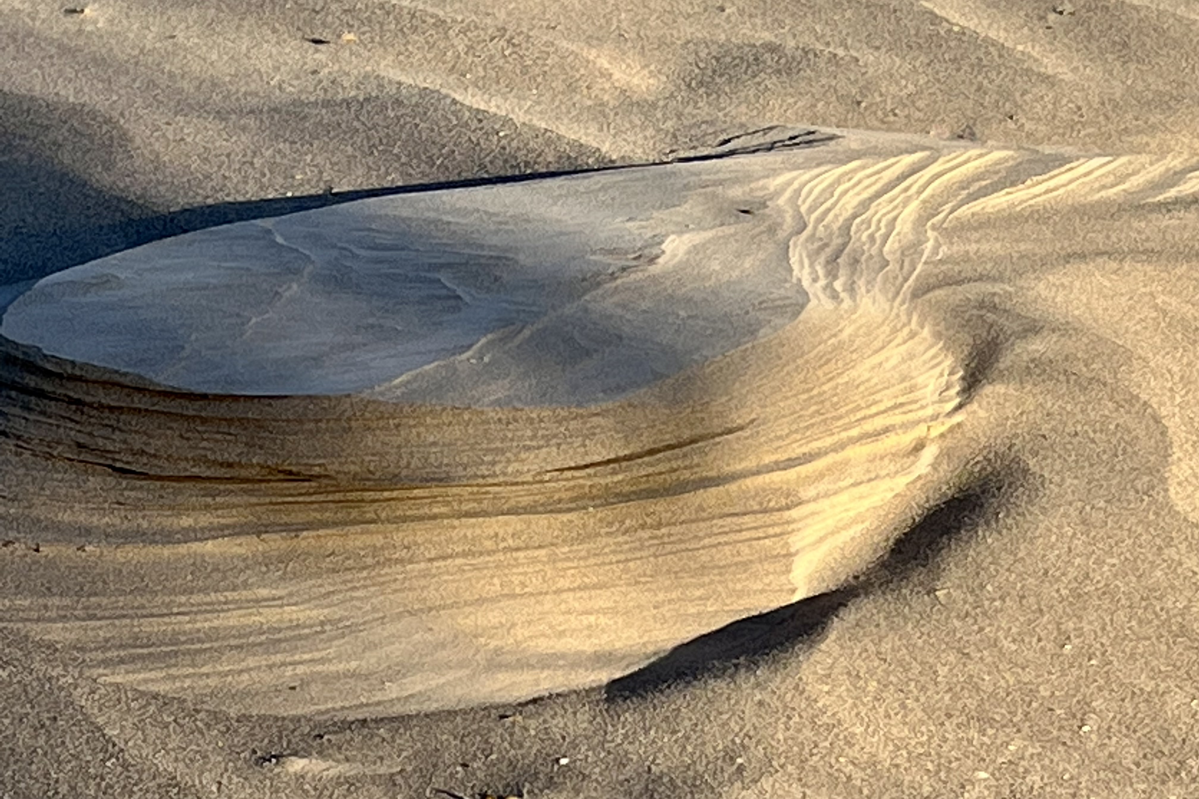
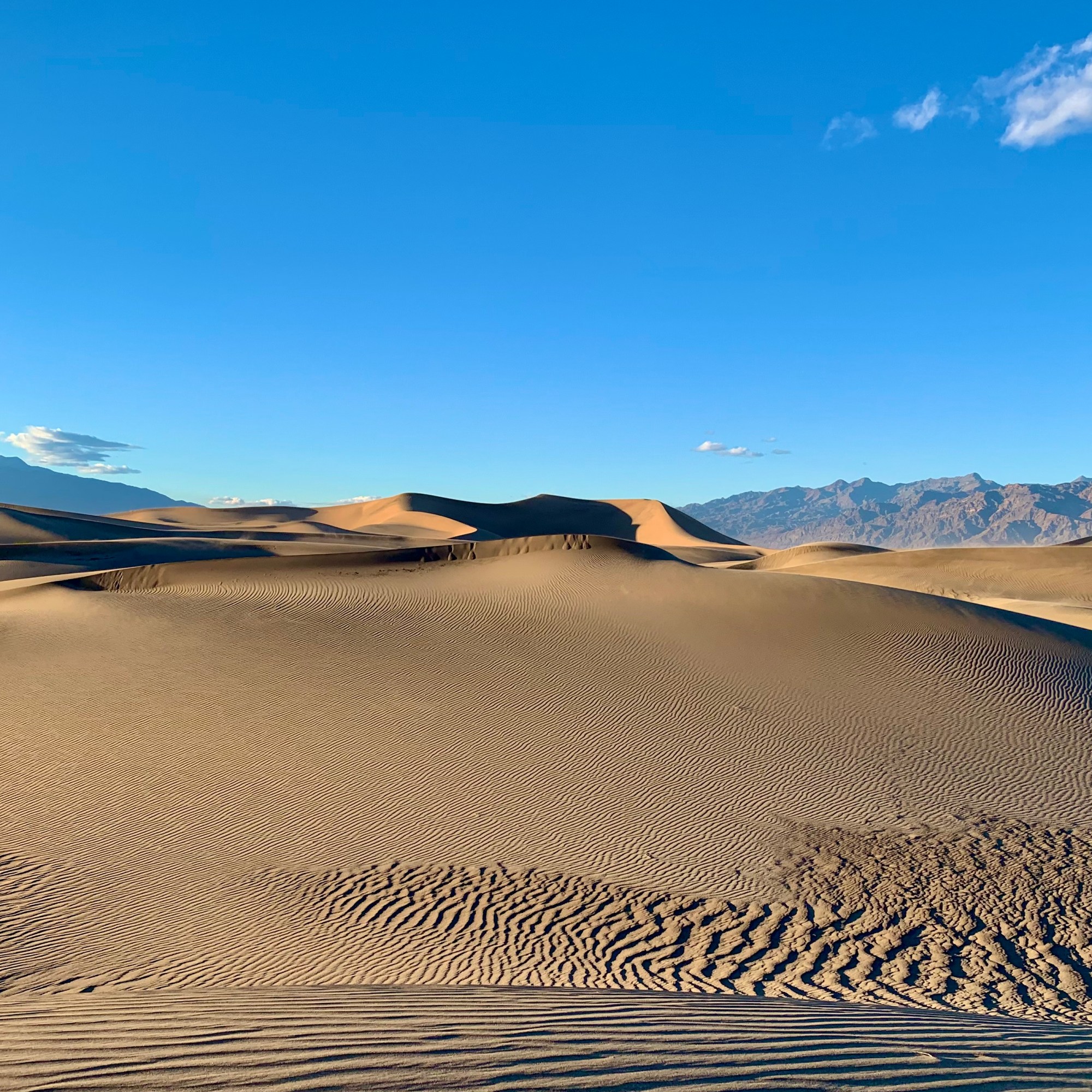
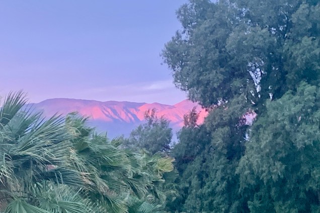
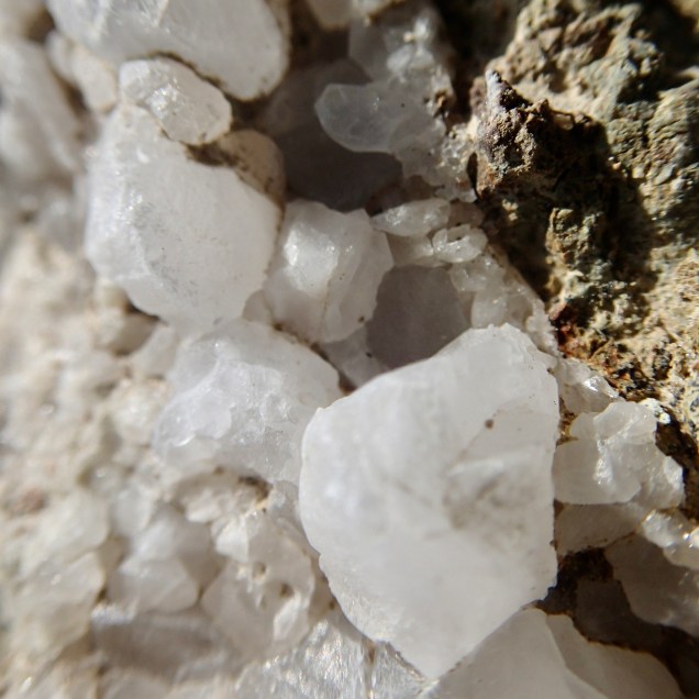
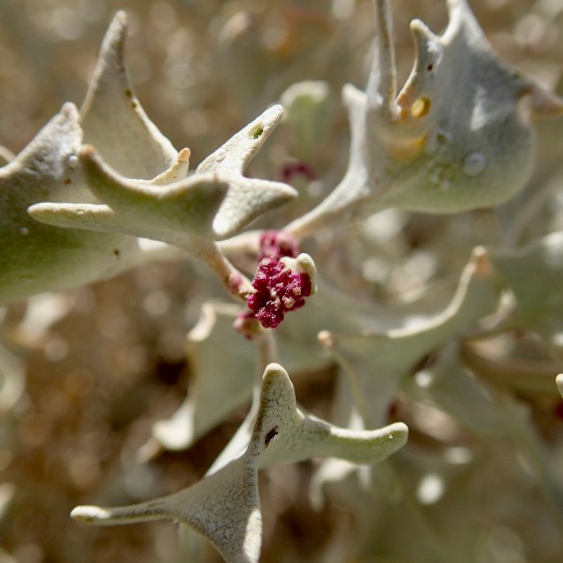
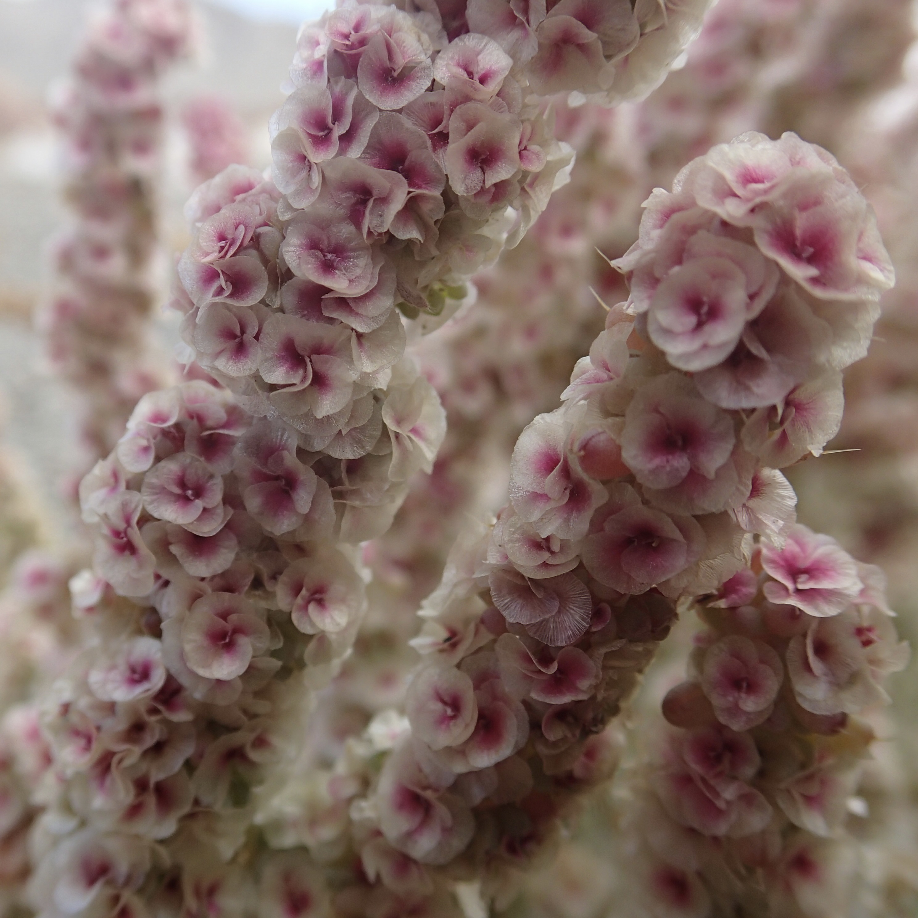
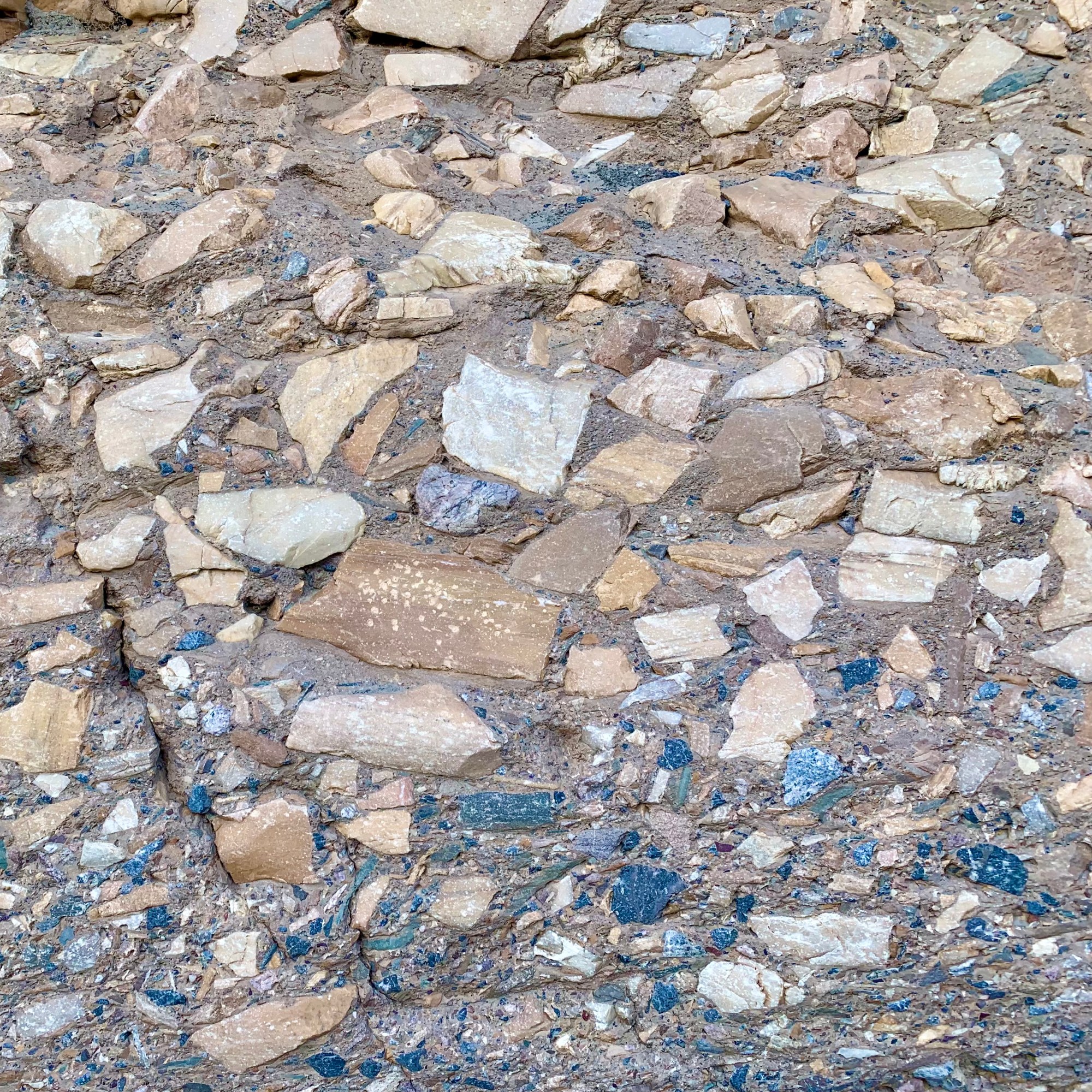
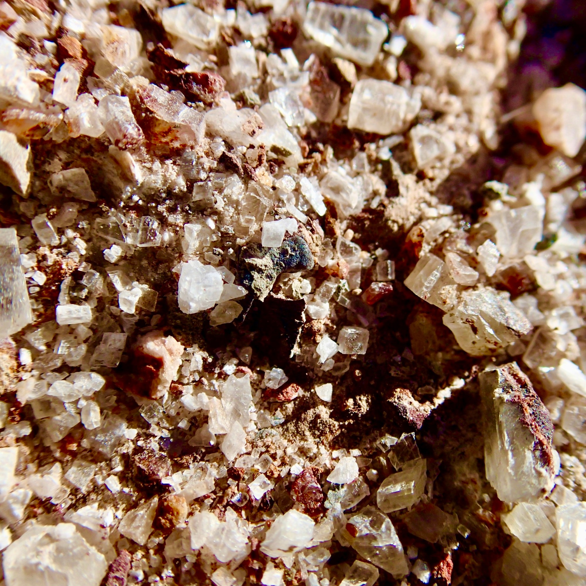
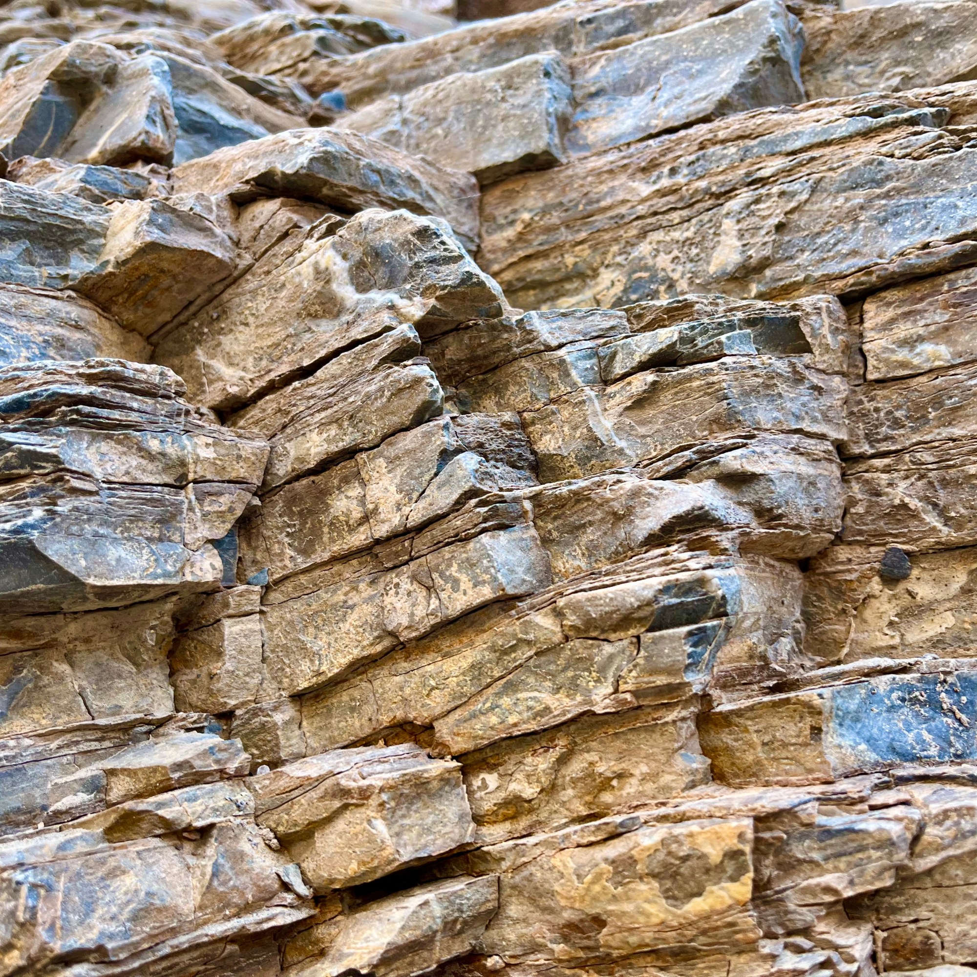
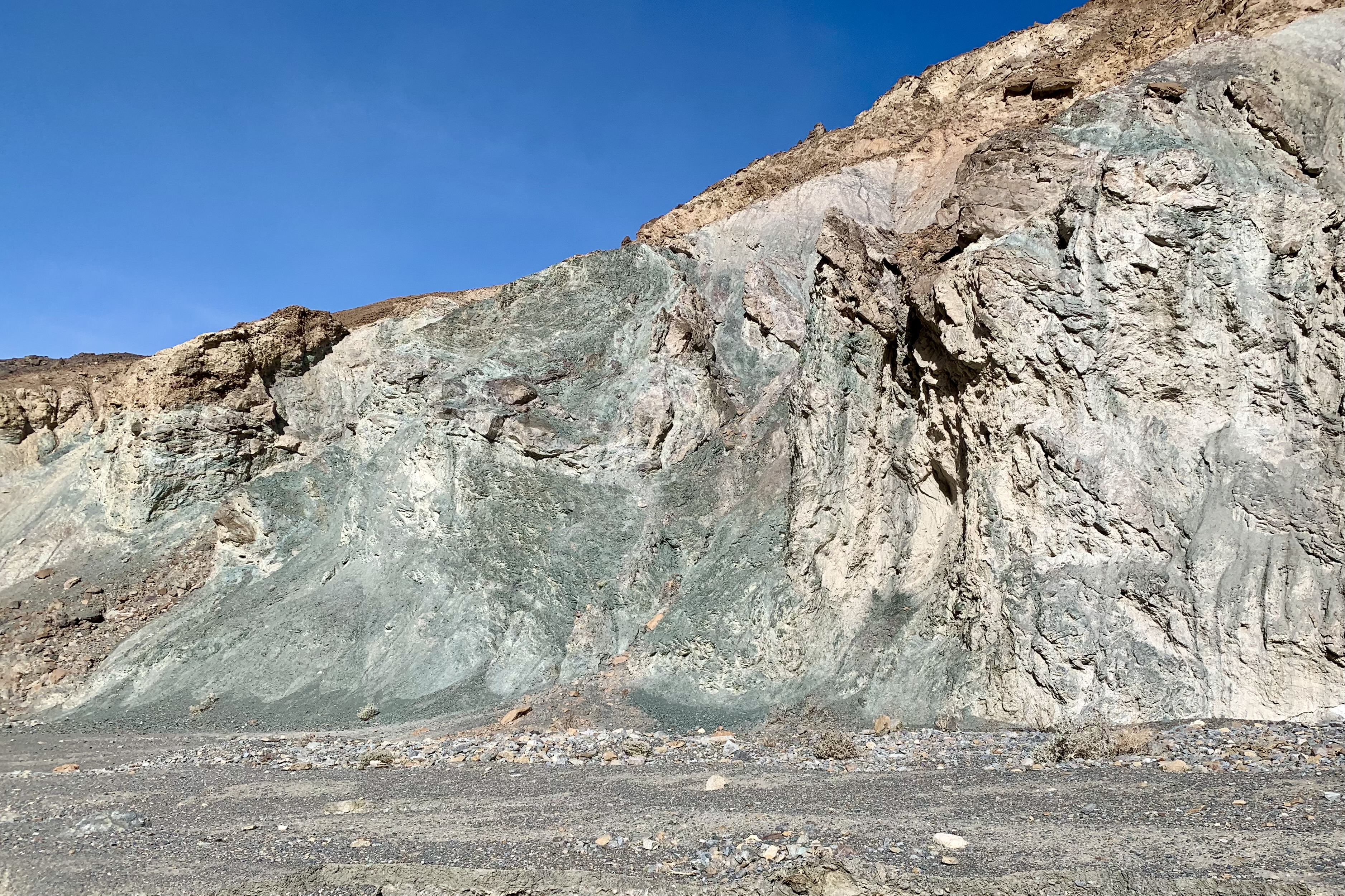
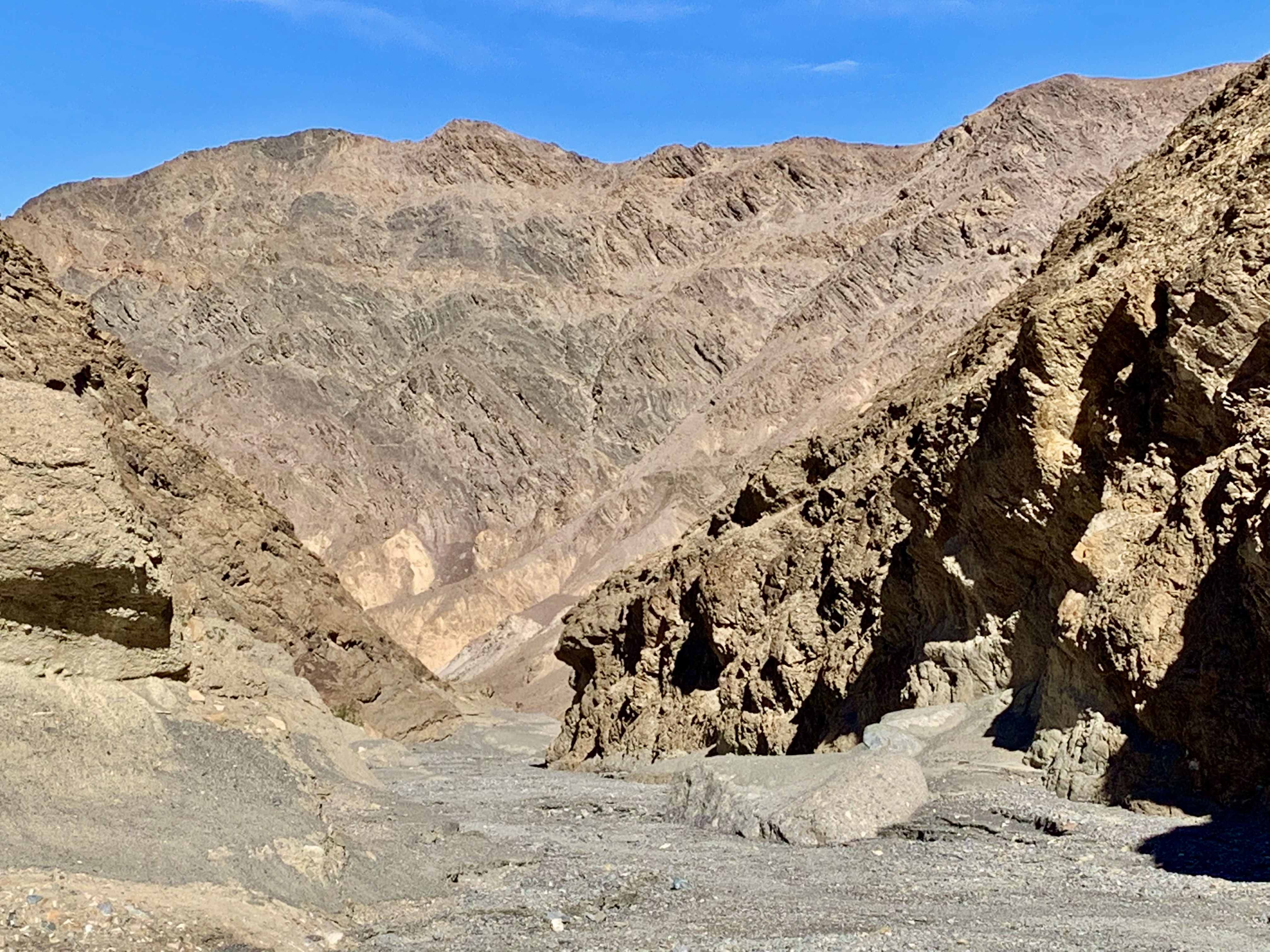
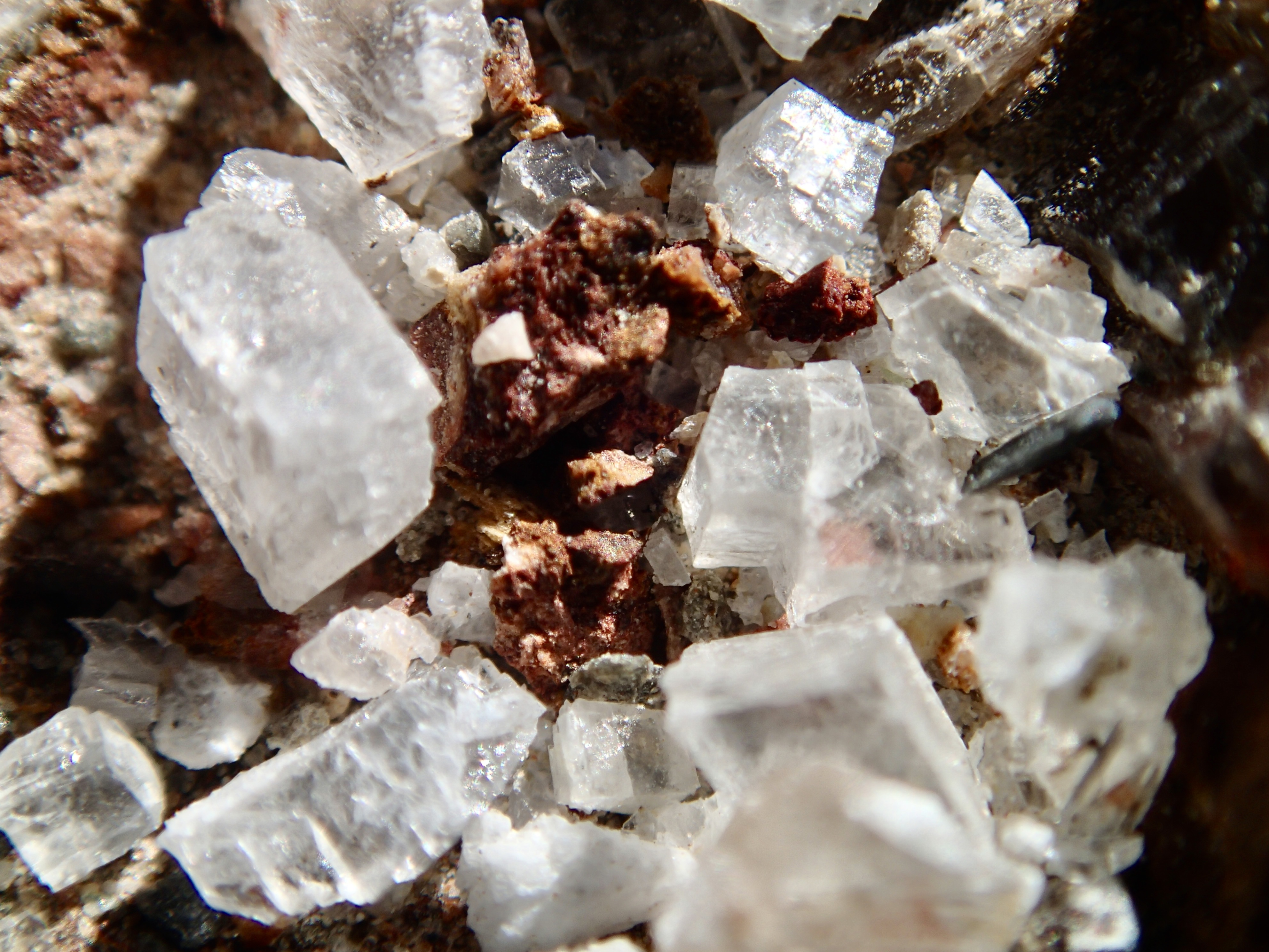
Keeping with the theme of “art” (as in Artist’s Drive and Artist’s Palette of the day before), we opted to hike  the Mosaic Canyon Trail.  The surrounds on this hike are quite stunning. Mosaic Canyon “Breccia” (the Italian word meaning “fragments”) are rock formations in which tiny broken shards, the jagged offspring of an assortment of parent rocks, have been imbedded in the canyon walls and floor over the eons and this amalgamation has been fused by nature’s superglue. The mosaic conglomerates and smooth marbleized rocks are quite the spectacular duo and yet another example of the geological variability and complexity of Death Valley National Park (DVNP). 

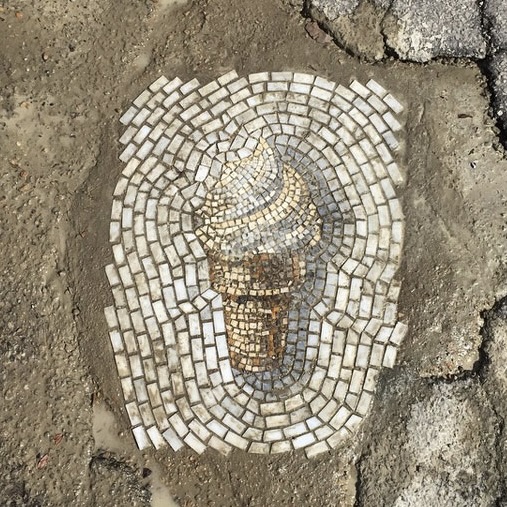
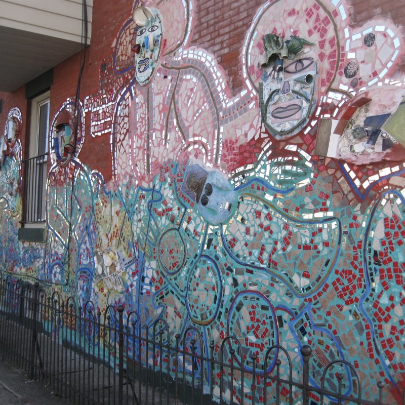
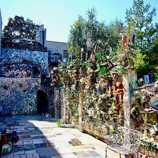
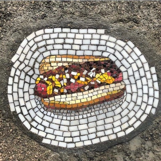
Mosaics can be found through history ranging from todays pixelated computer “mosaic” images and on back to the famous mosaics of the Byzantine Empire and the religious images in elephantine Roman Catholic Cathedrals. They are awe inspiring but, honestly, I gravitate much more towards these modern word mosaics such as those created in the pothole images in midst of urban road decay by Jim Bachor in such cities as Chicago, New York, ND Washington D.C. or the work of Isaiah Zagar who  brings mosaic art  to store fronts and  building walls on the streets of his hometown of Philadelphia.  Like the walls and bed of Mosaic Canyon where the mosaics can be walked on and touched, these modern world mosaics are much more akin to the natural world.  

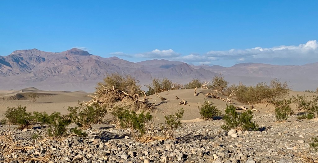
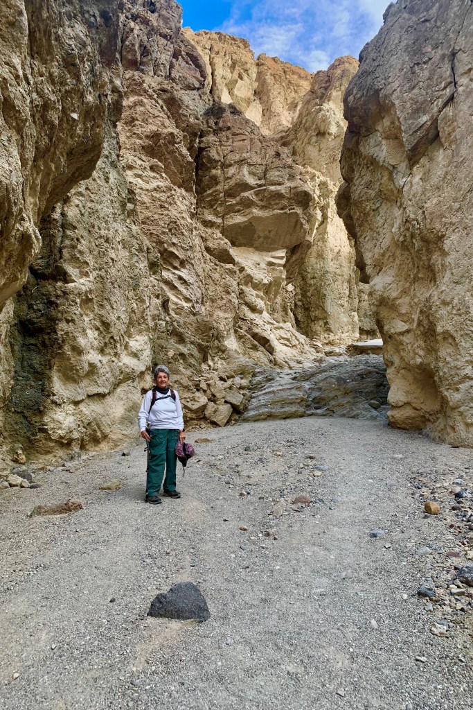
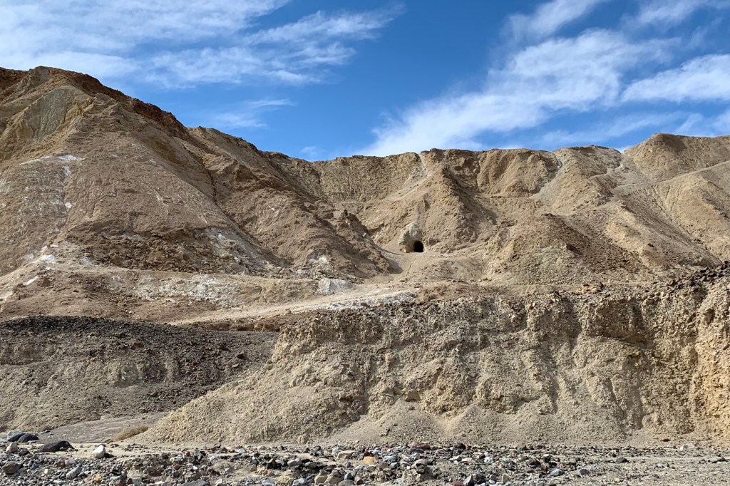
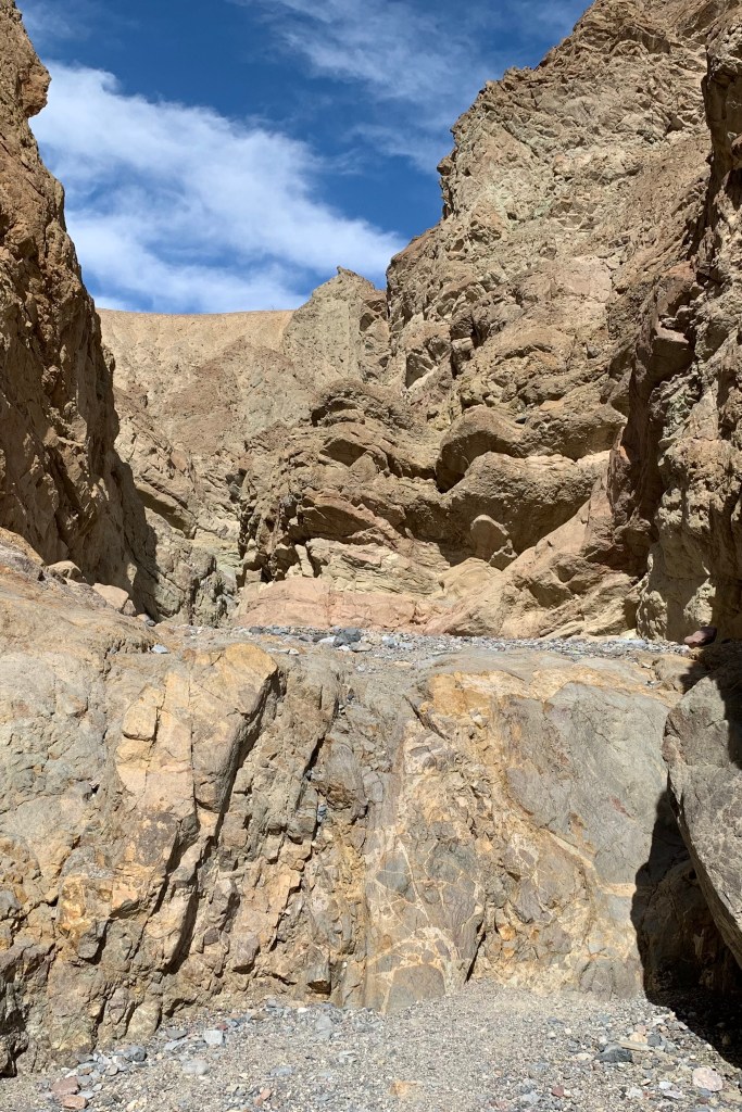
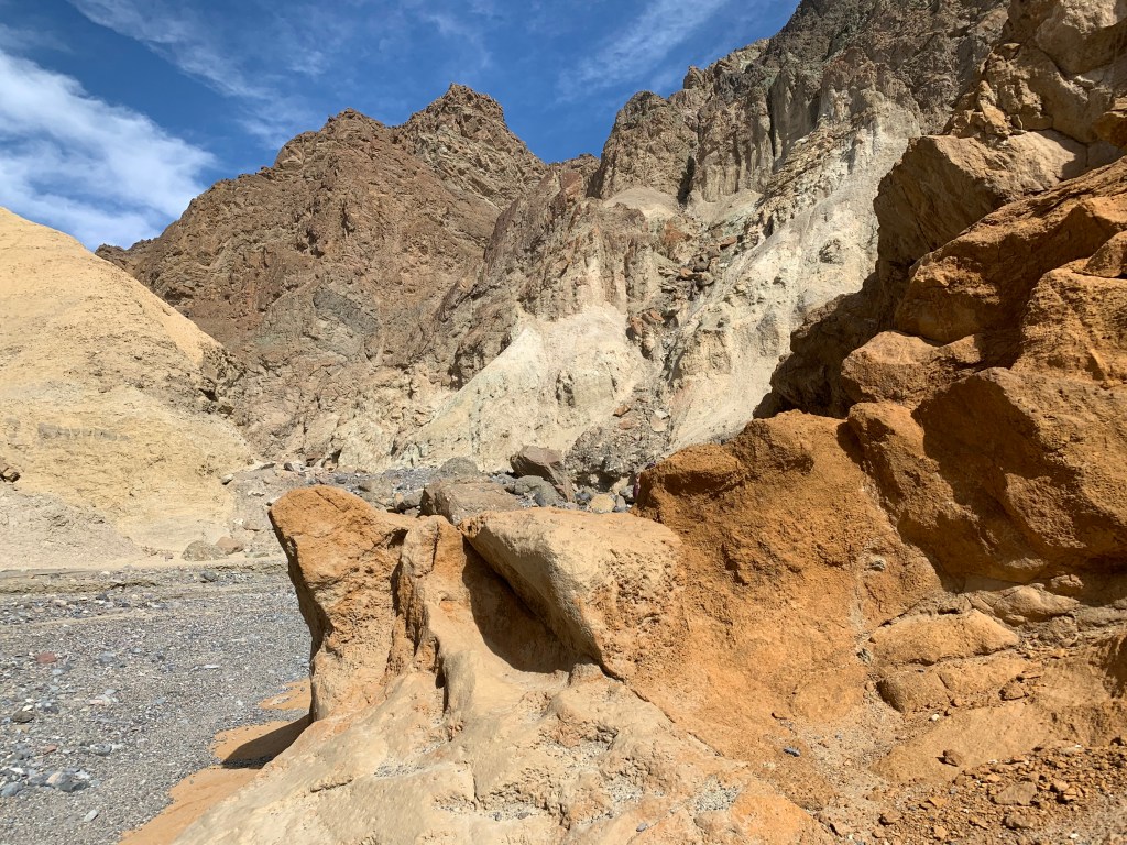
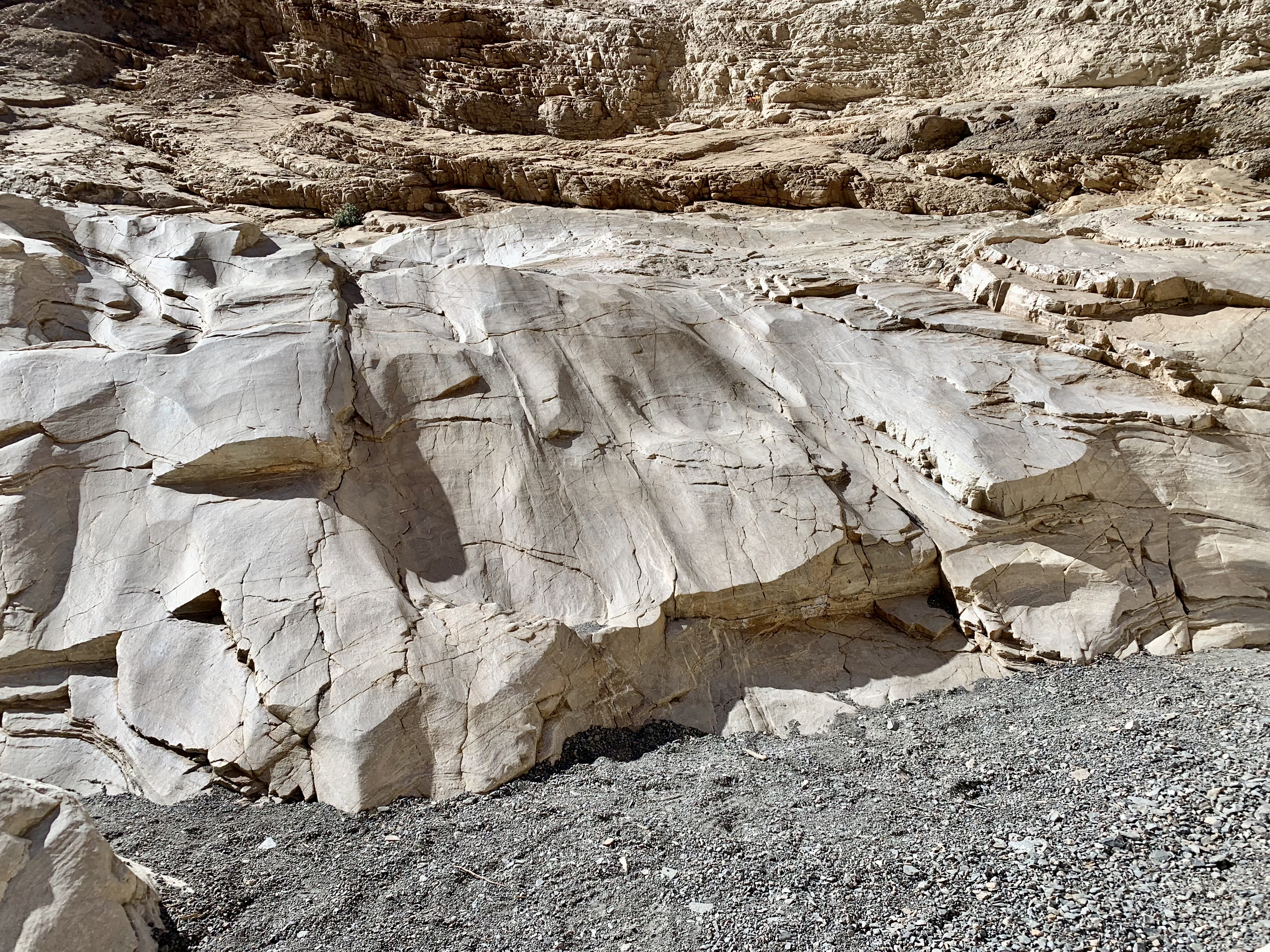
After driving through a “blinding” dust storm getting to the trailhead, this hike did not disappoint.    This trail should never be about a race to the finish, an out-and-back, but be enjoyed and appreciated for the beauty that surrounds and the geological museum that it is.  First, the artful striations and variegated veins in the rock and  the  variety of geometrics, textures, and multitude of colors are evidence early upon approaching the canyon and will delight an observant wanderer.  Secondly, once you enter the canyon the marble walls of Noonday Dolomite, at points, make for an accordion like passageway, having been expanded and contracted by the force of erosion.  This resulted in a  narrowing and widening of the canyon walls and a slick rock experience for you to enjoy and is another example of Mother natures incredible handiwork.

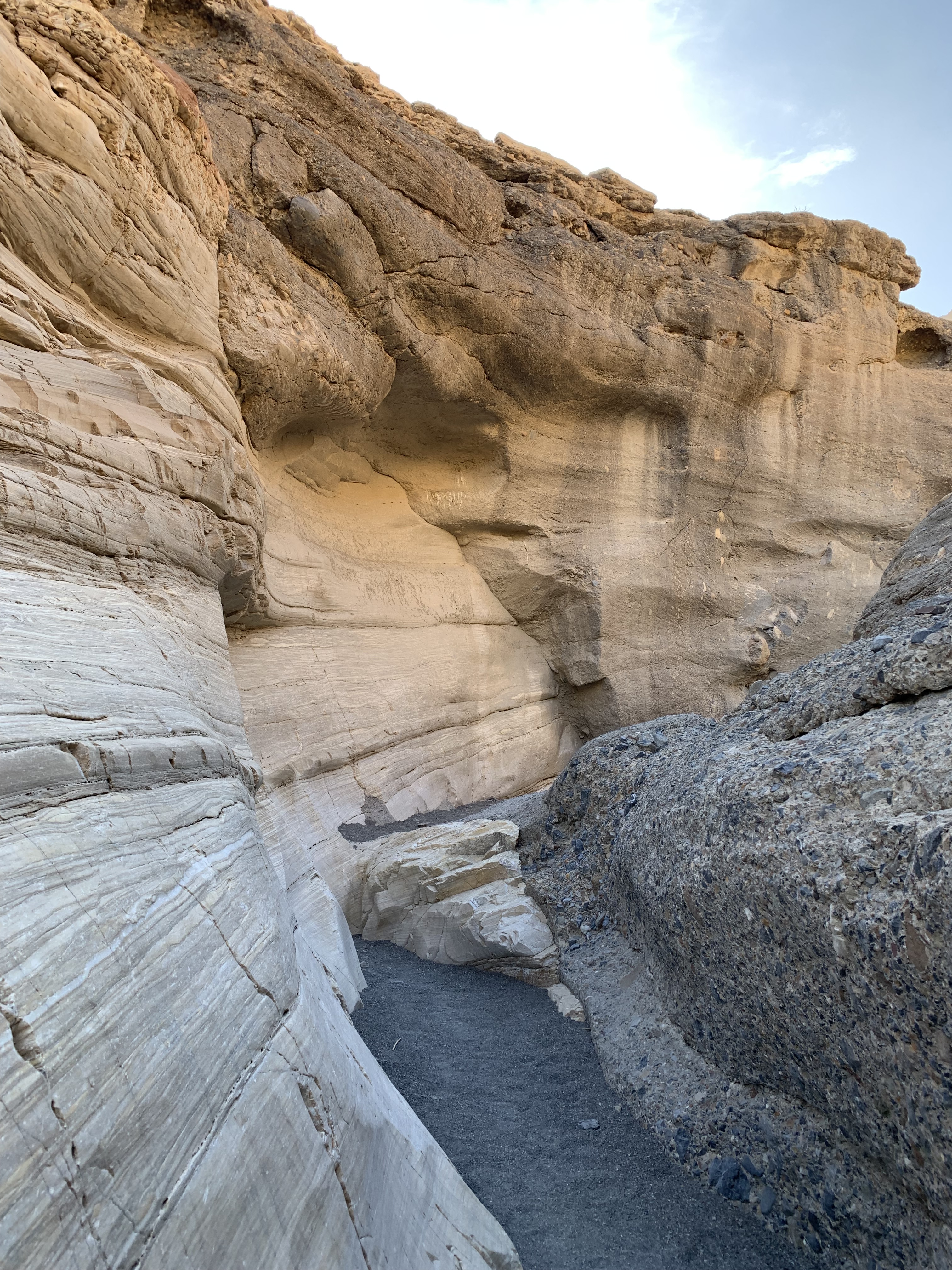
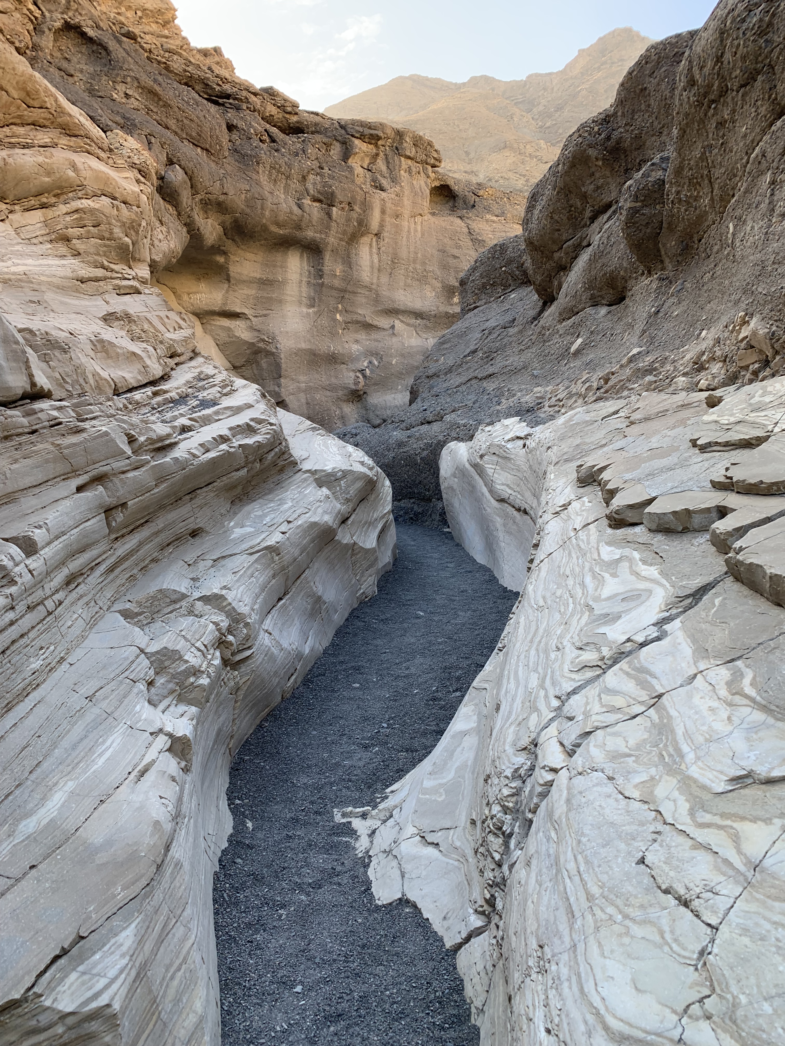
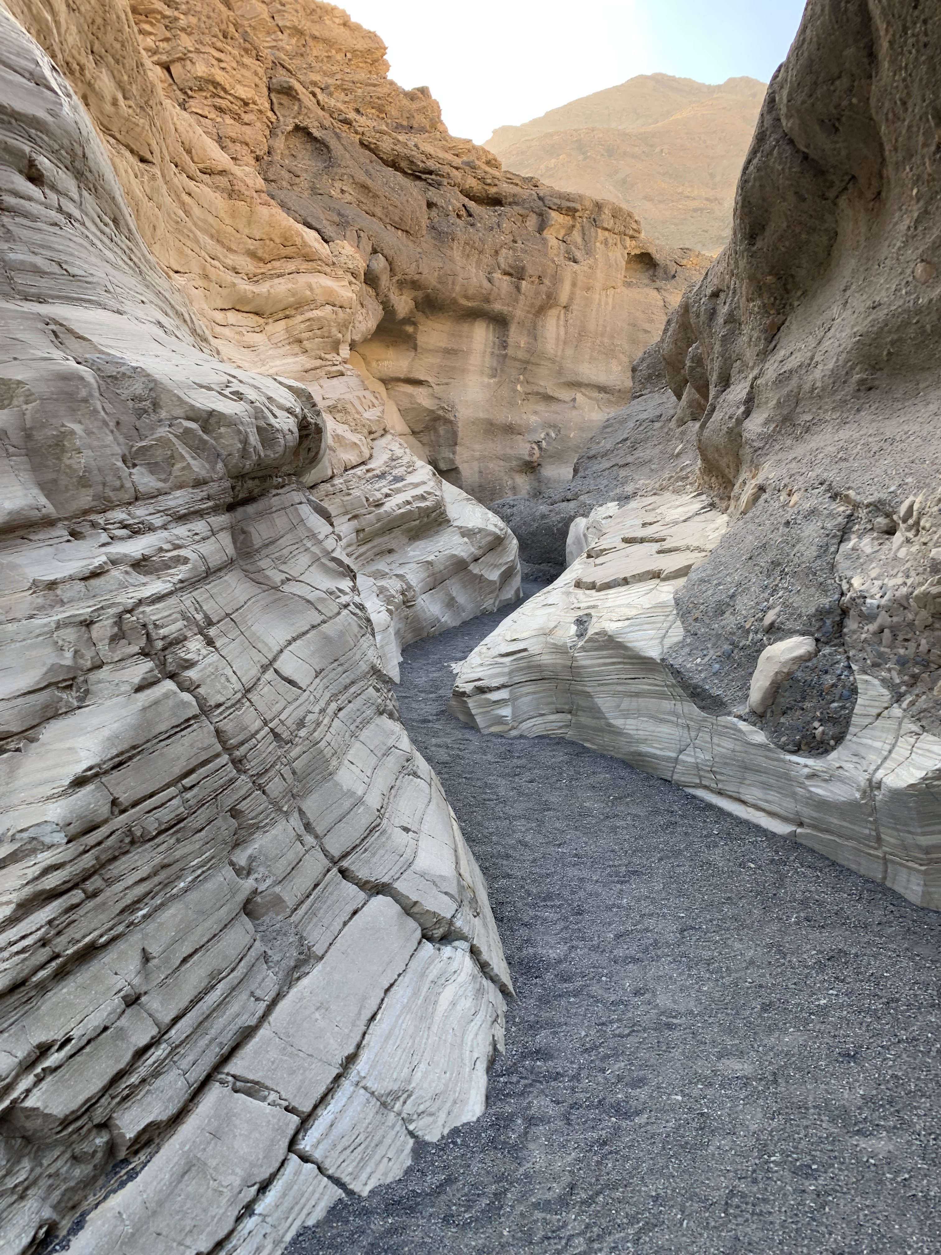
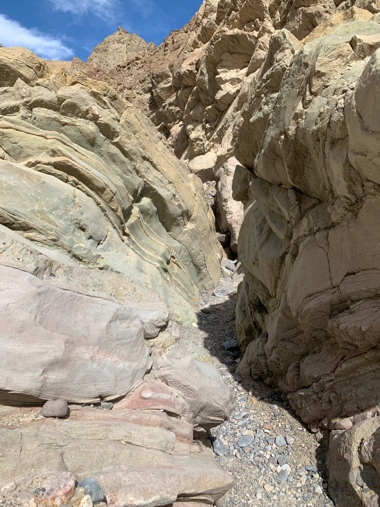
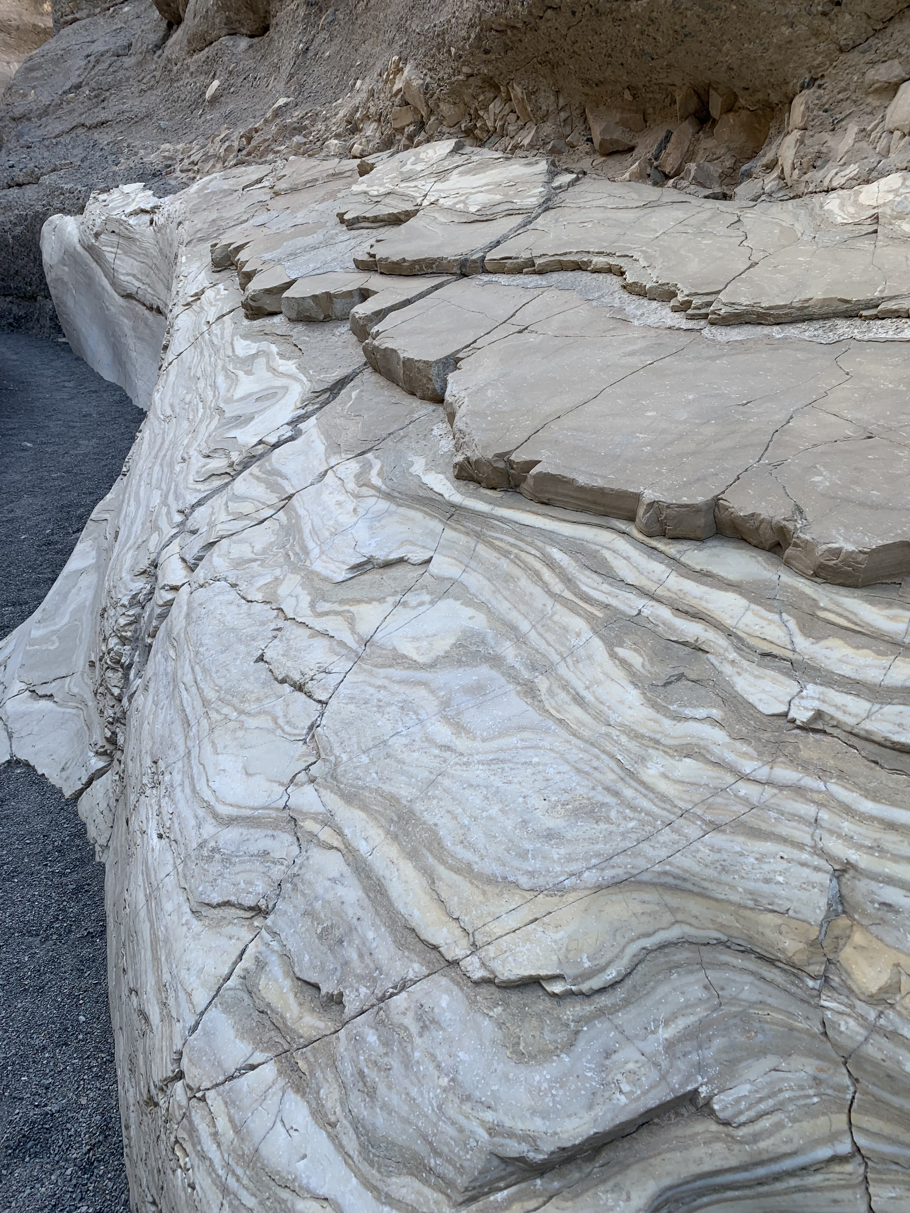
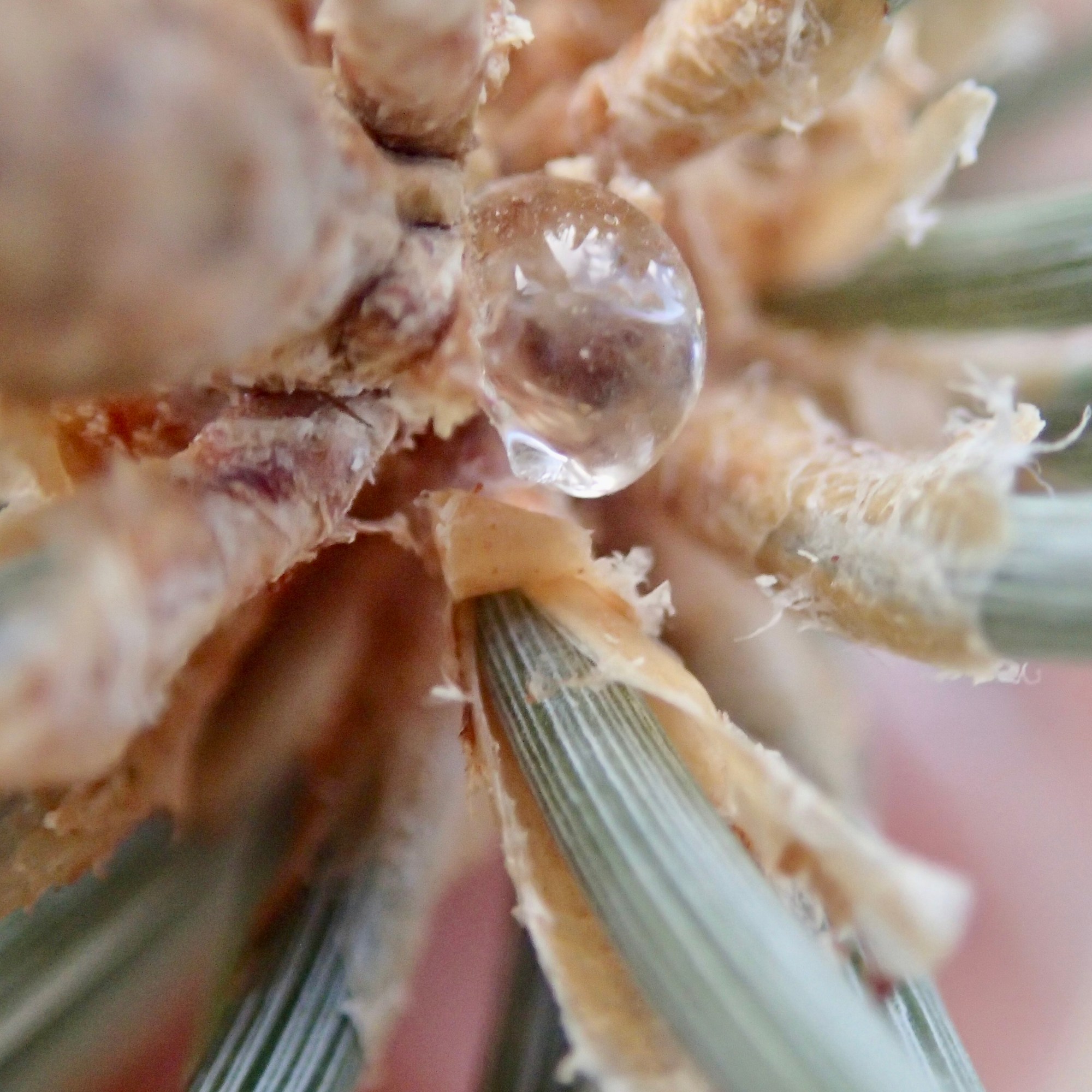
After entering the canyon via a rocky wash, we are greeted almost immediately by these mosaic conglomerates and smooth marbleized walls and slick chutes in this winding narrows. Mosaic Canyon has been/is the site of frequent flash floods polishing the walls smooth, having been scoured often by debris-laden flood water. I found this section quit stunning.

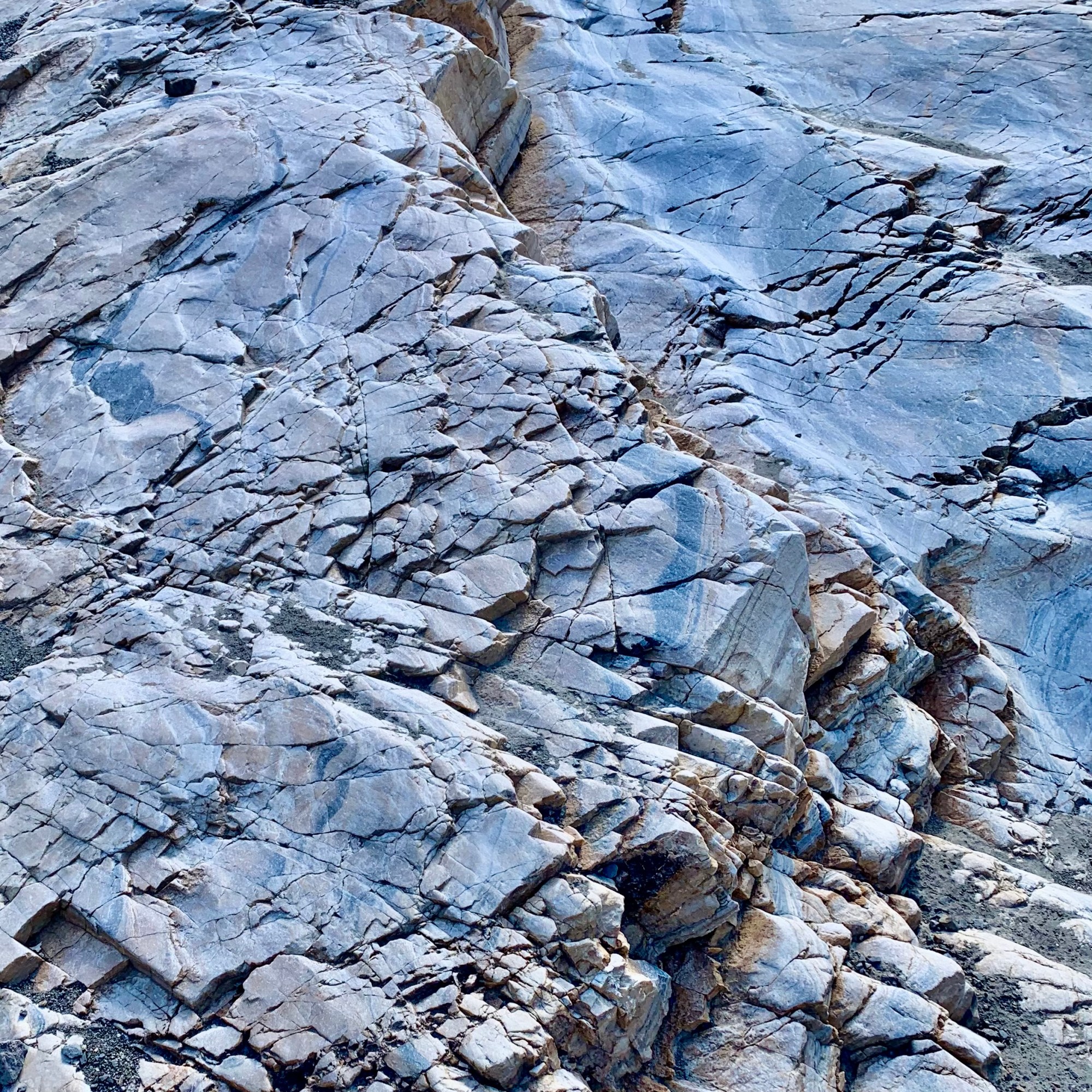
Next we encounter a slick marble slab residing at an angle that was just steep enough and slick enough to disallow one walking straight up, thus needing to scramble by finding minute hand and food holds to negotiate it.The flip side of this was that upon the return trip one can slide right down it.

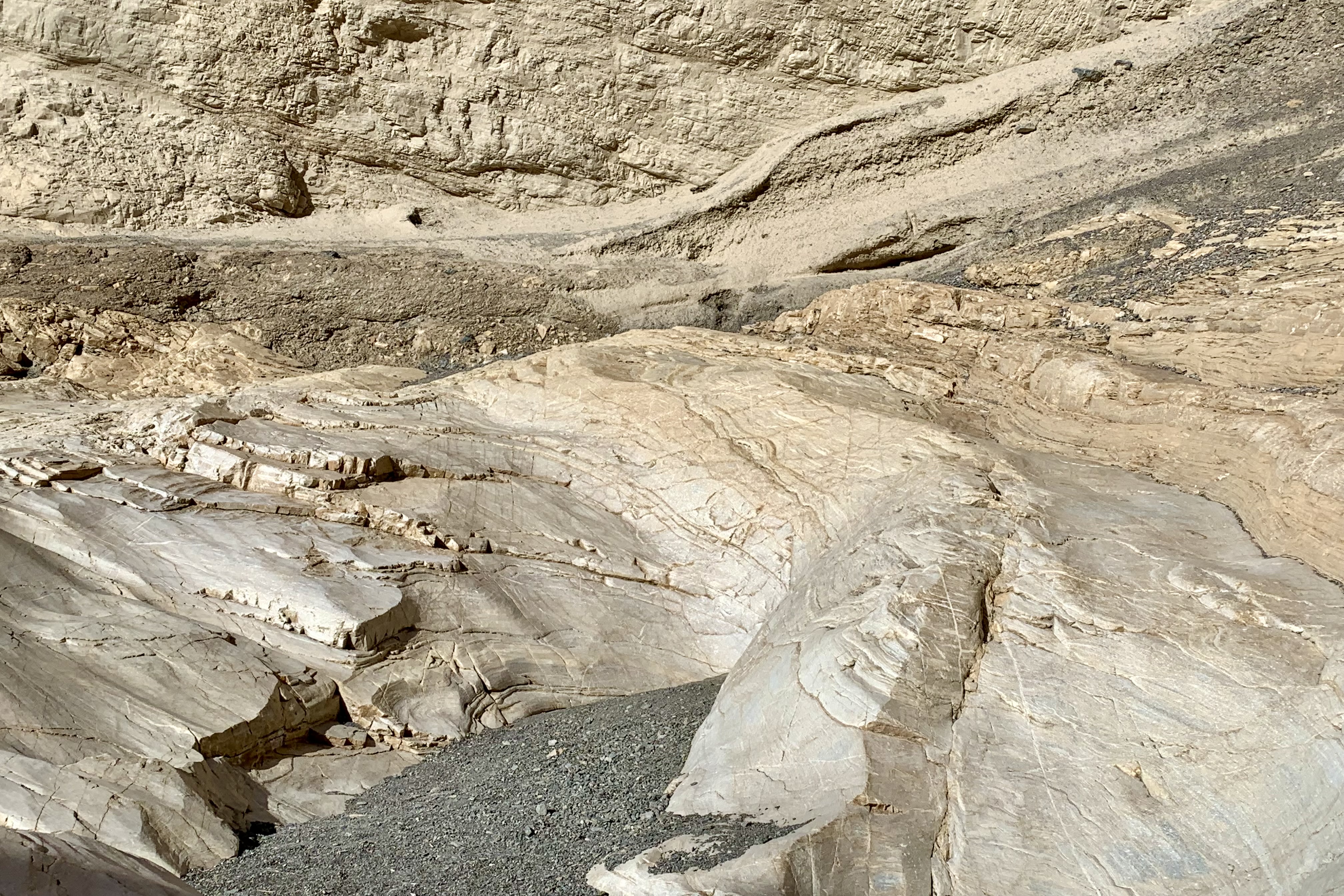
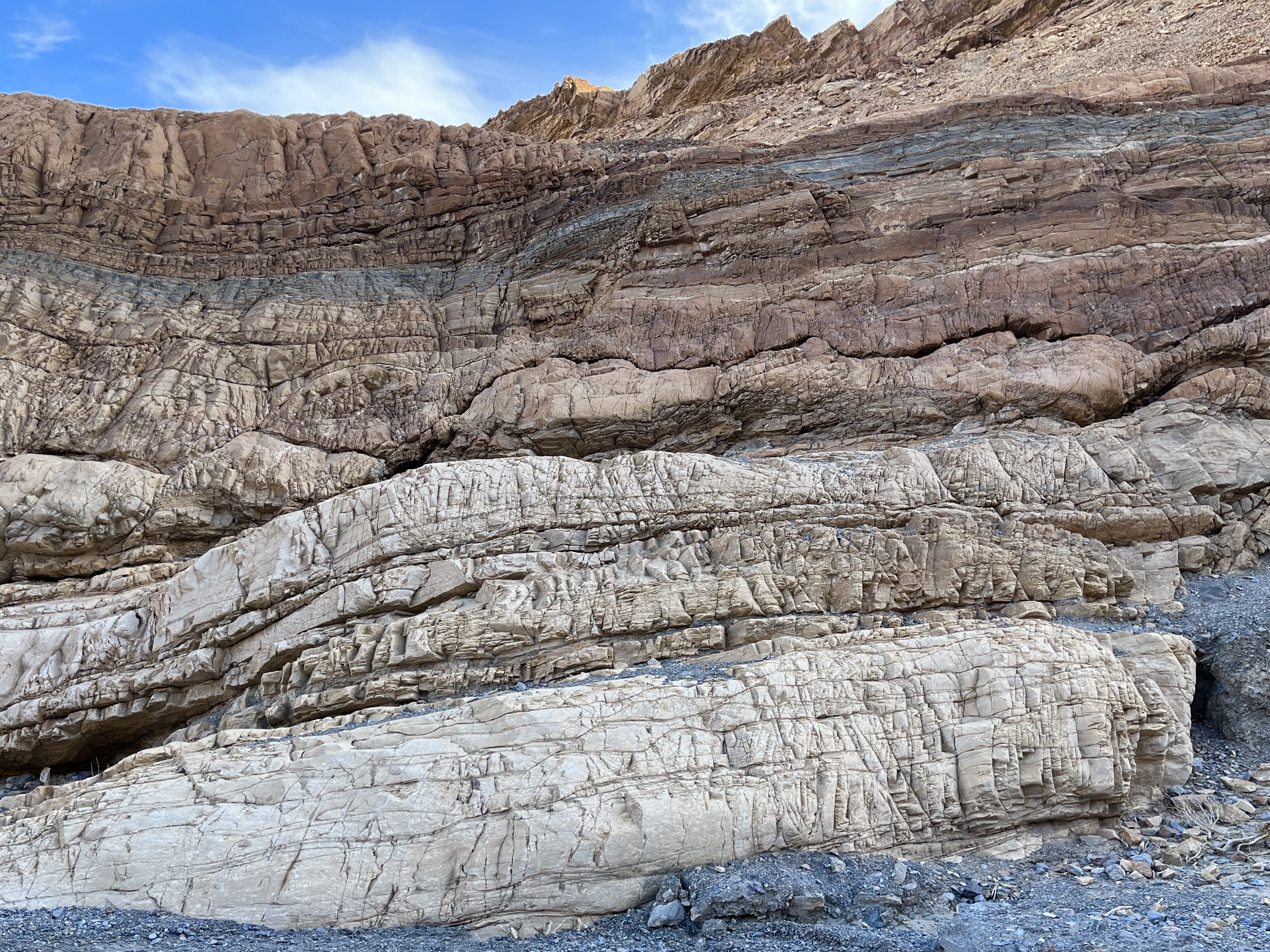
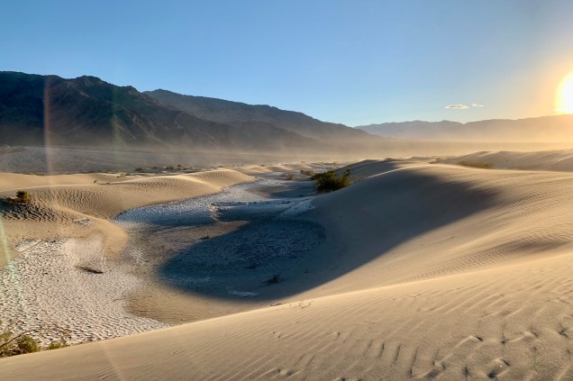
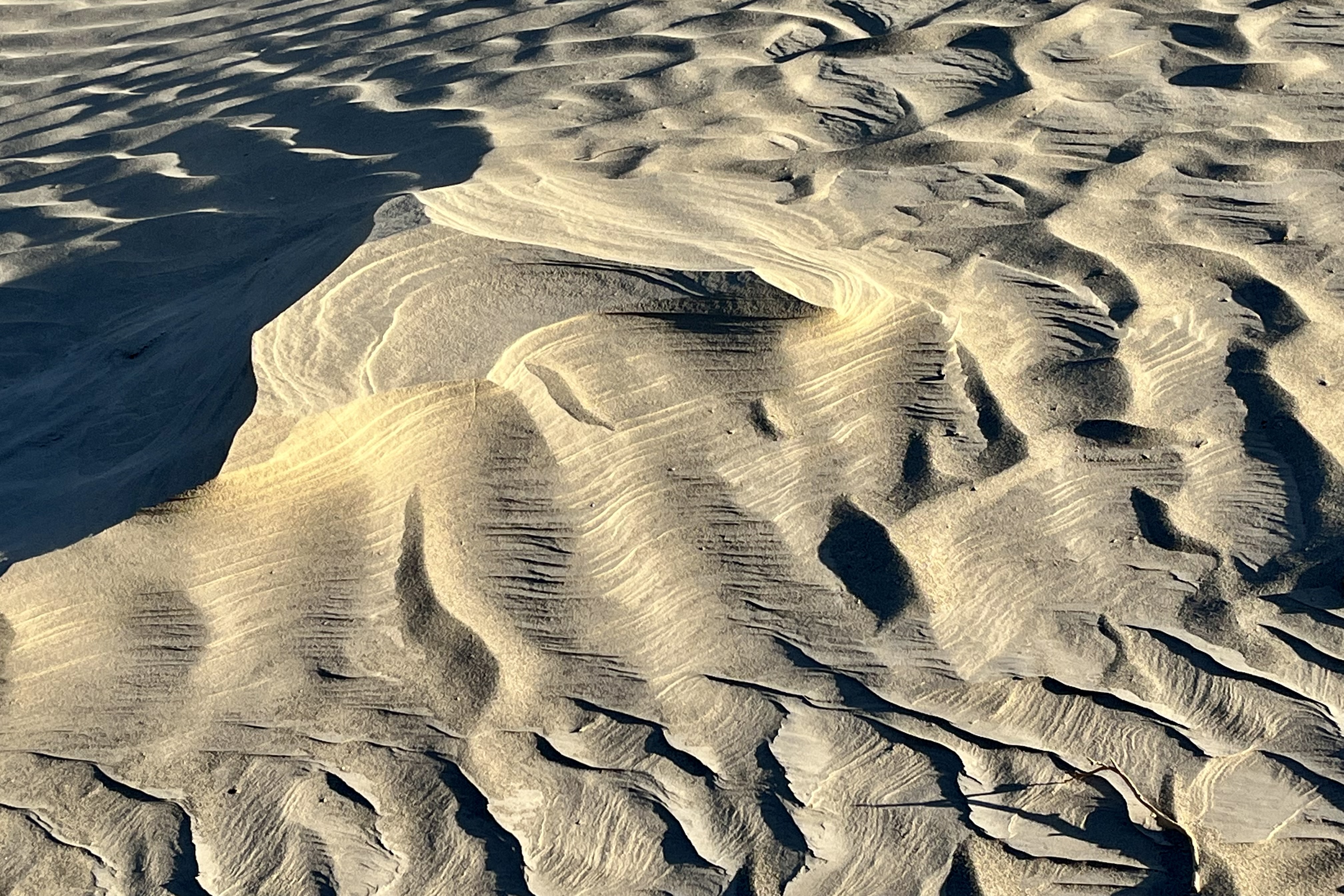
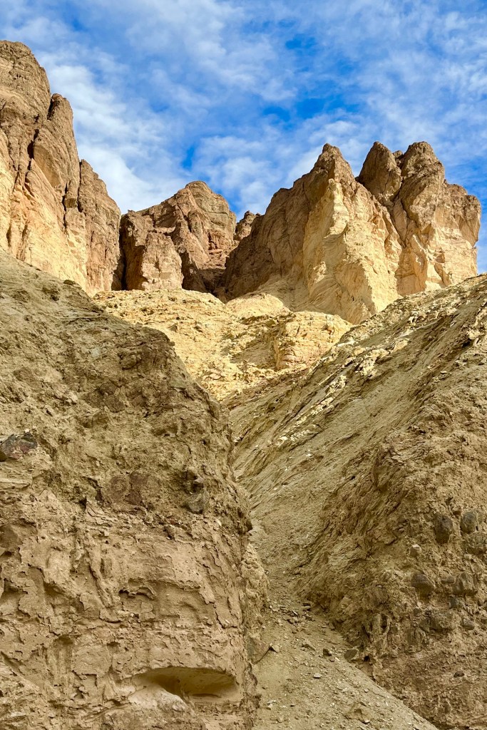
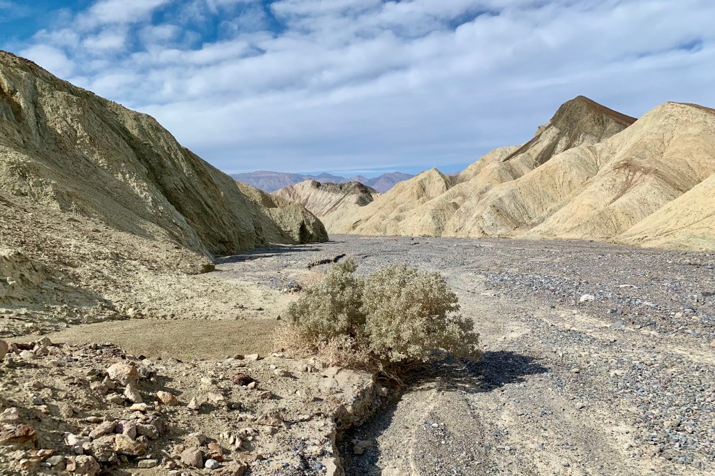
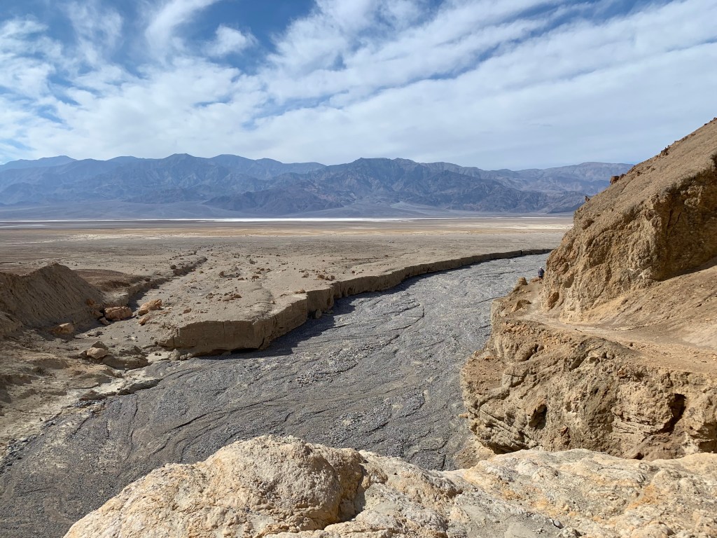
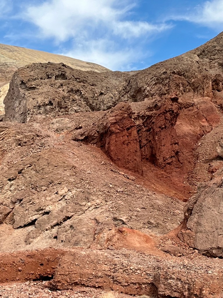
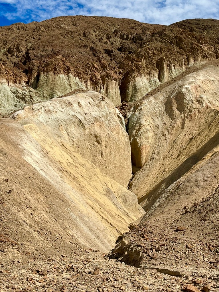
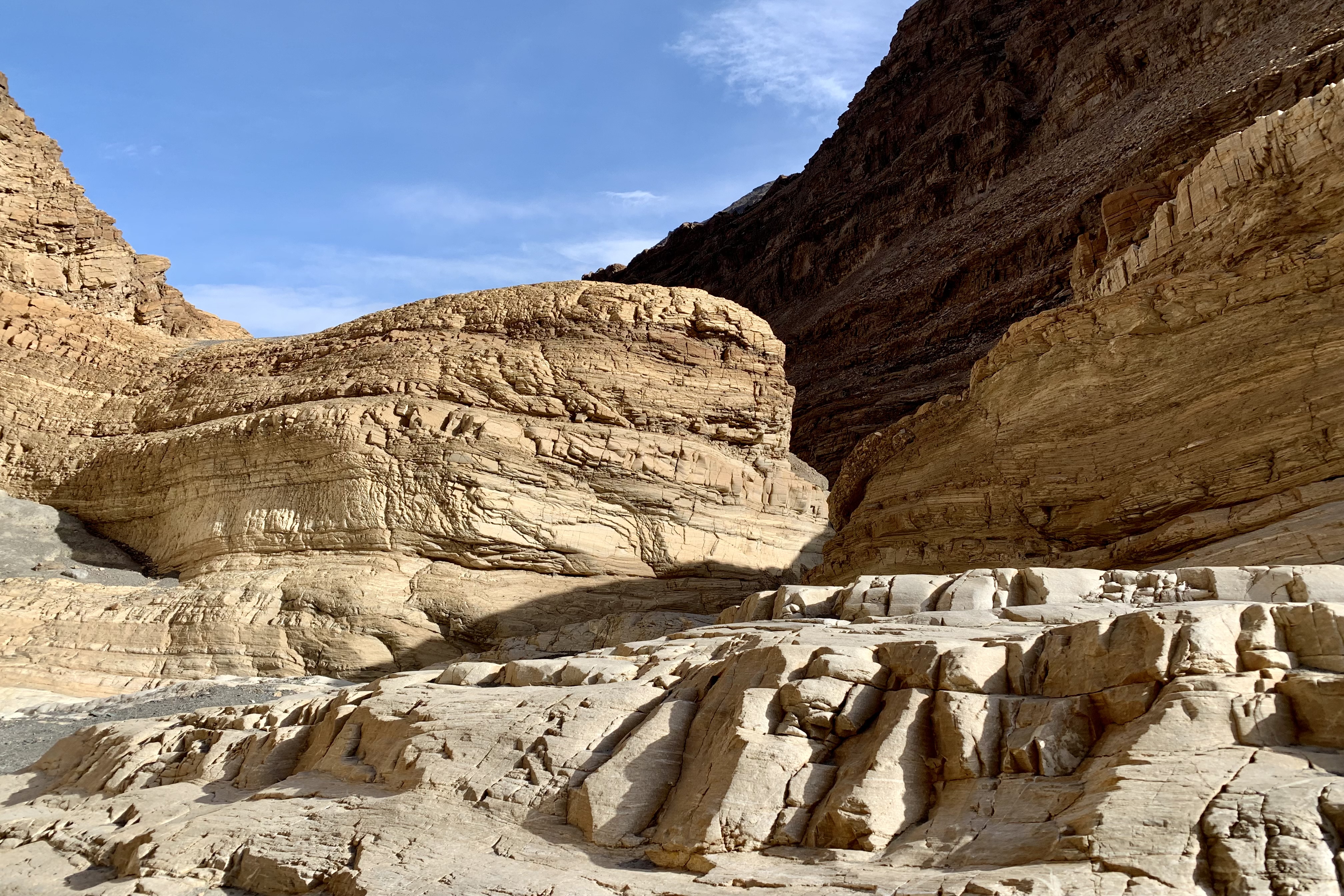
Soon the canyon opened into a large wash marking the end of the lower canyon and a very gradual uphill  followed as we wound our way through a massive gravelly wash with a butte rising in the middle of it.   As there was no specific defined trail, we gravitated towards the edges and walls viewing many of the rock formations at close range.  These formations were beauteous…many of deeply rich color, streaked, opalescent, crystalline conglomerates. Eventually the massive wash narrowed again until we reached a boulder jam at approximately 1.3 mi into the canyon. This jam marked the end of the hike for me (and many other trekkers) as hiking further up canyon involved significant scrambling to get beyond the jam.  The return trip was equally enjoyable marveling at the geology of the area, rambling between towering, sun-splashed walls.

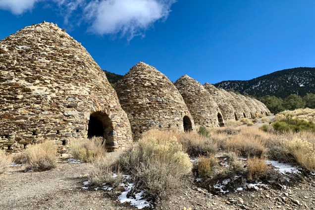
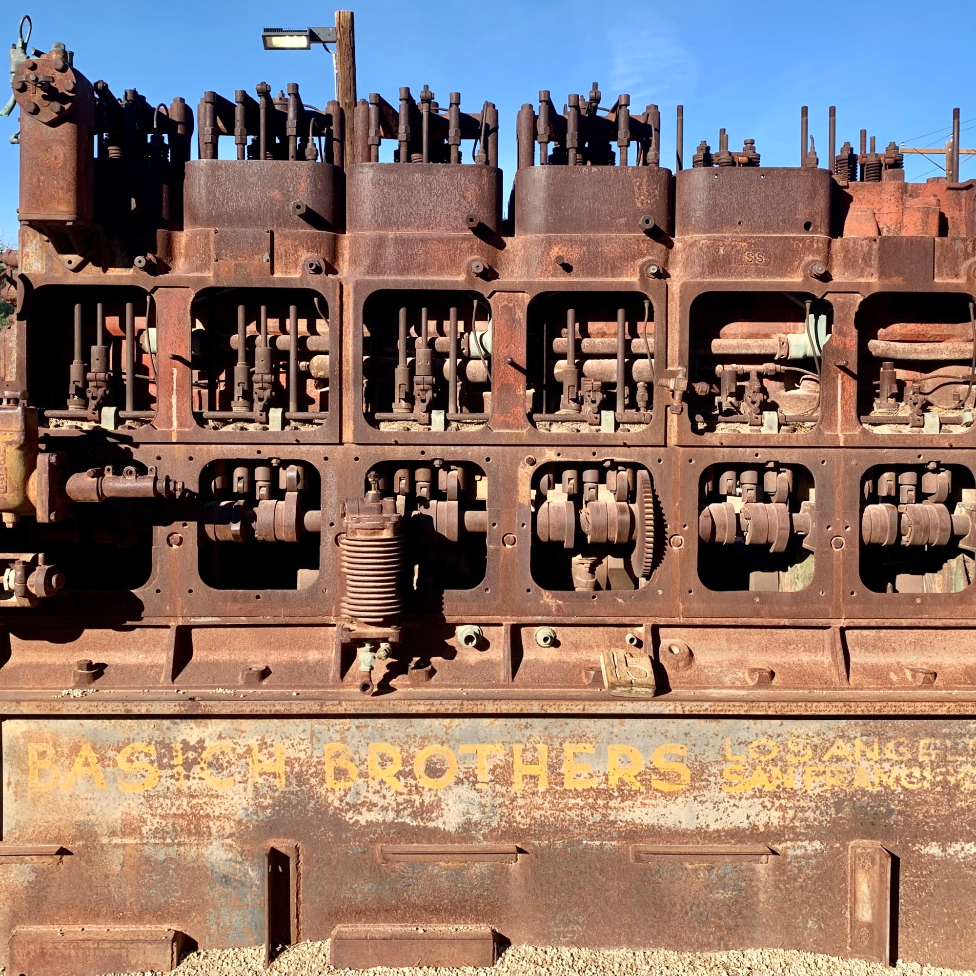
Wildrose Charcoal Kilns

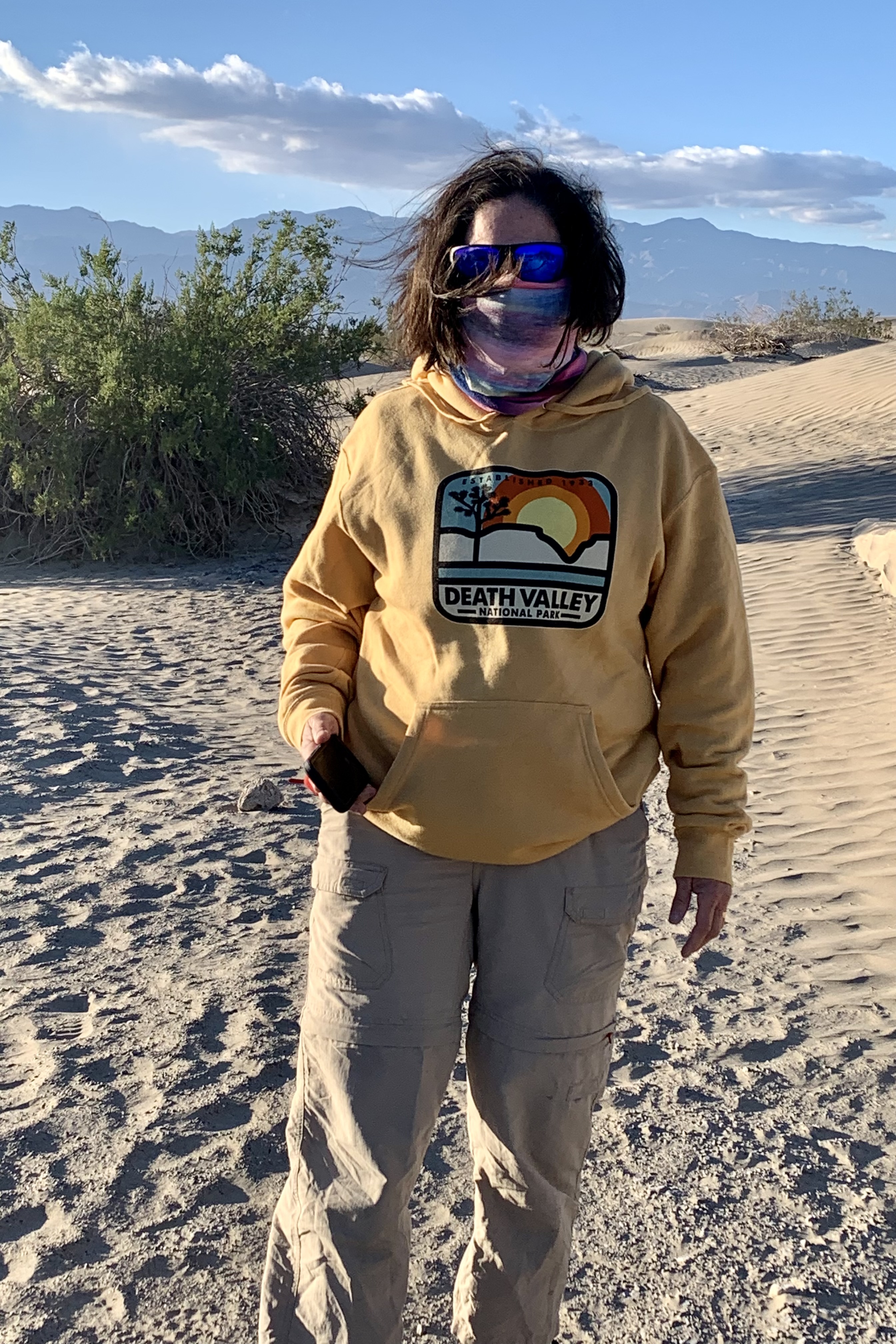
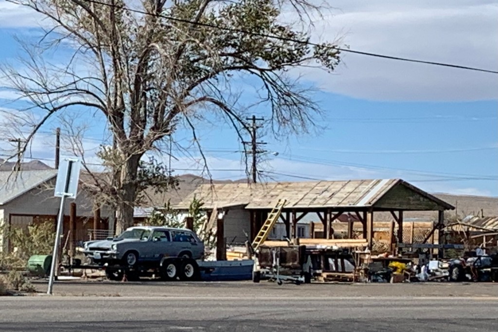
We did not anticipate that our next adventure would be quite the change of pace going from the desert canyon warmth to snow on the mountains. Leaving Mosaic Canyon, we stopped in Stovepipe Wells before heading up to the Charcoal Kilns. A delightful discovery was that the General Store there had much better merchandise than at the Furnace Creek General Store. So I decided to be generous with myself and get a hoodie and a T. Now the downside was that this purchase set off a potential fraud alert by my bank and when I tried to purchase gas later the card was refused. Normally this would not be a big deal but we were in an area where there is no cell service so to get it removed and be able to get gas. Same thing happened to Tasia’s card as she was also generous earlier with herself. So we had to find a wi-fi connection. That is one kind of adventure I could do without. The shop keeper did share that it happens quite frequently there!

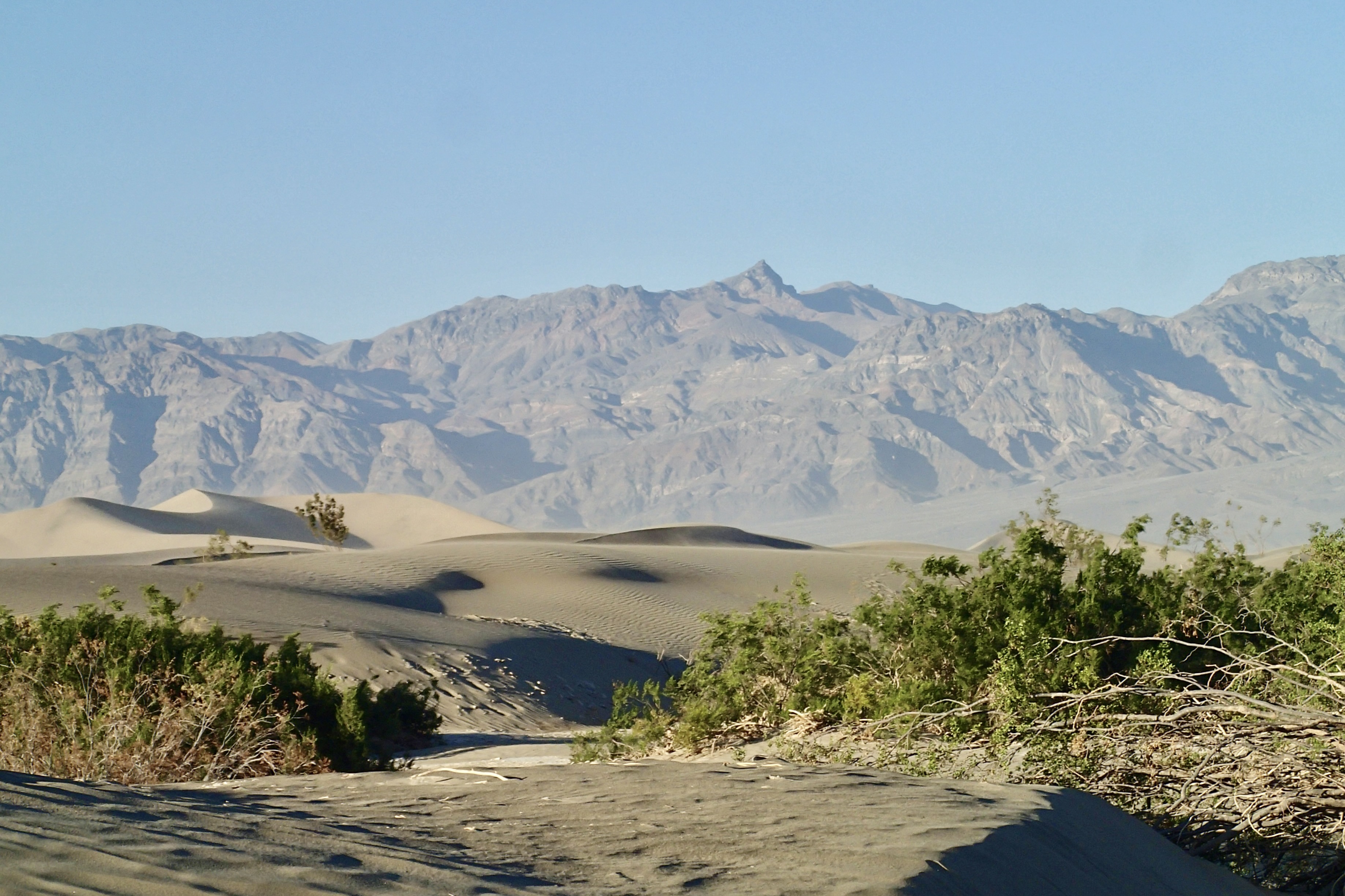
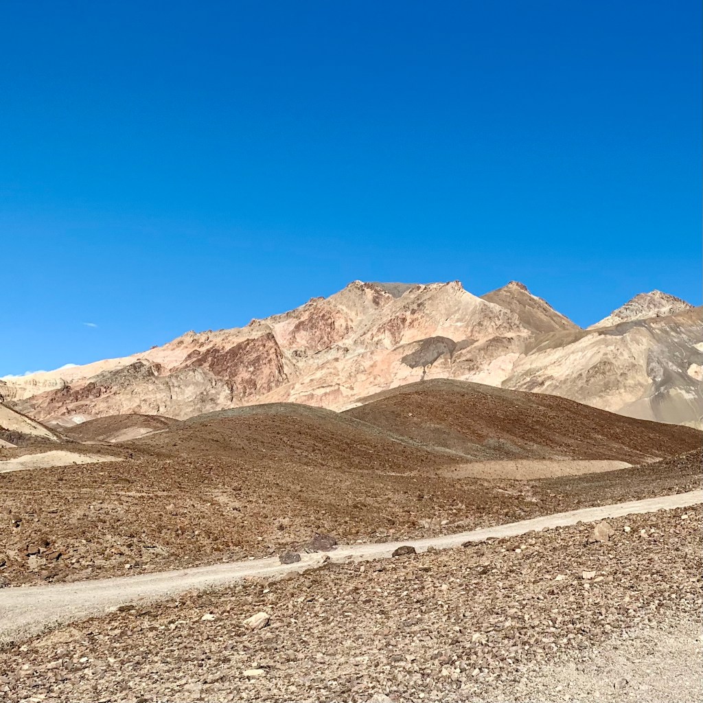
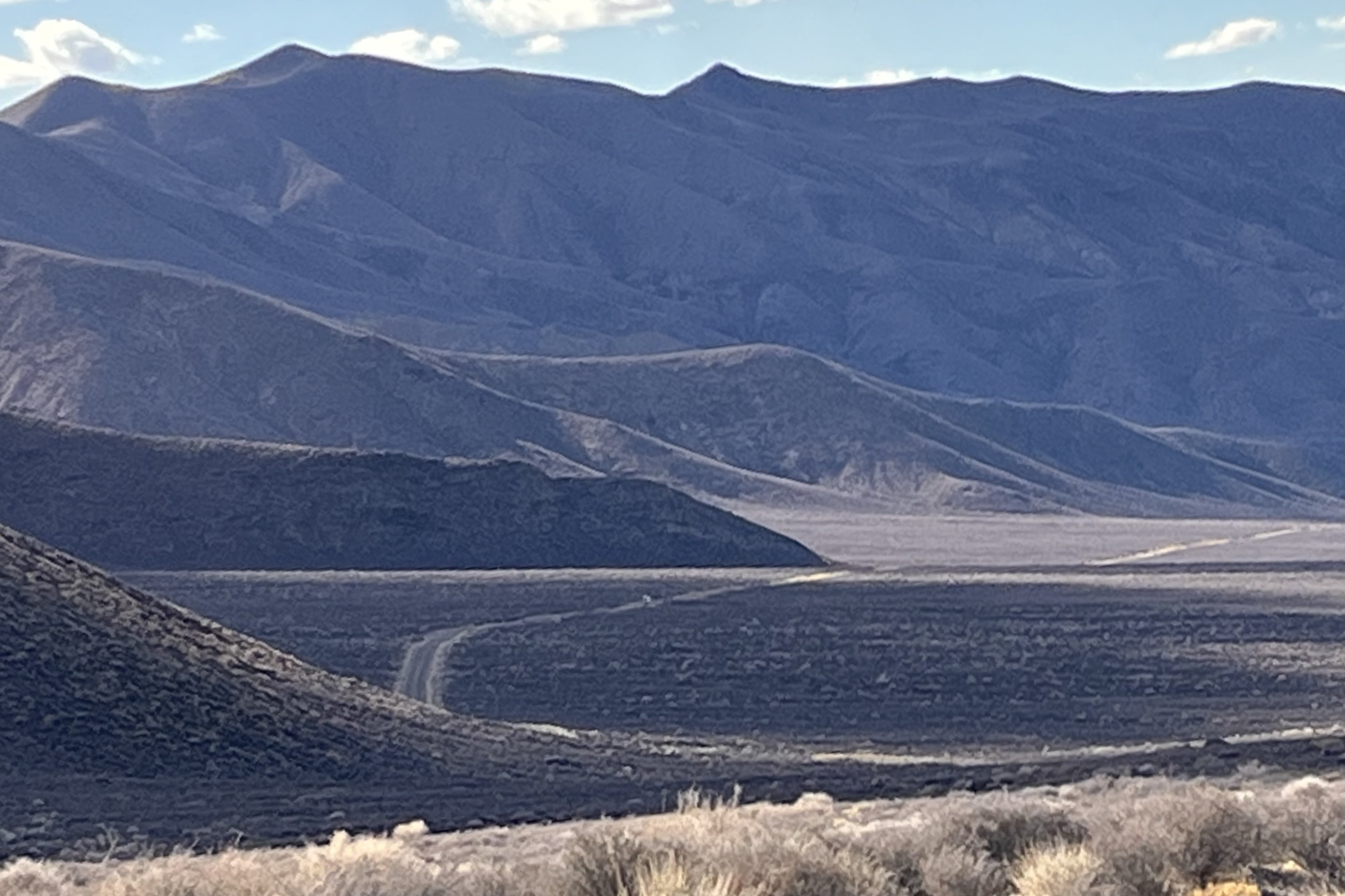
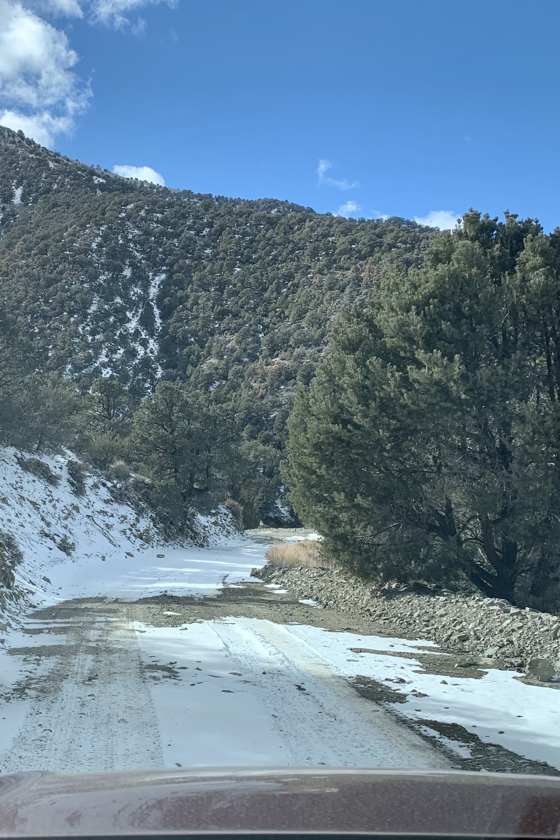
But that definitely was not the real adventure. We headed west on Highway 190 (33.56 miles from Furnace Creek) to Emigrant Canyon Road adding another 28.2 miles to Wildrose and the Charcoal Kilns. The drive itself was quite exciting, though I am sure some might not consider it so. The road was described as winding “past steep grassy slopes and low rocky cliffs, across the Harrisburg Flats, climbing to a high point of 5,318 feet at the summit.” Once there, the sign stating that this would be a “rough, narrow, winding road and vehicles longer than 25 feet not allowed” should have been a clue about the true personality of this road. It would be more realistic to state that the road is a challenge to drive.  It is a narrow two lane road which has no shoulders.  The higher we got the more the road slithered like a snake, inclined and declined, was rockingly uneven with steep drop-offs, tight turns, very few guardrails, hairpin turns and blind corners. I was quite relieved that at the hair raising spots, we met no traffic. Needless to say I did not get any pictures of this driving adventure. There are also sections where the landscape is much more open with views over wide plains and of the mountains on both sides of this valley.

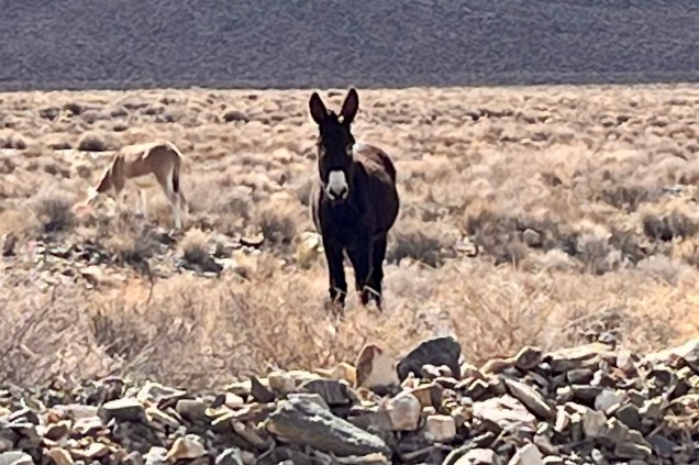
To add one more element of suspense there were signs warning about burros on the road. It seems that the wild invasive burros frequenting the area are remnants of the burros brought in by early prospectors.  I would like to think perhaps they are the distant cousins of the “20 mule team” burros but the sad part is that they are destructive to the fragile desert ecosystem  and harm native species.

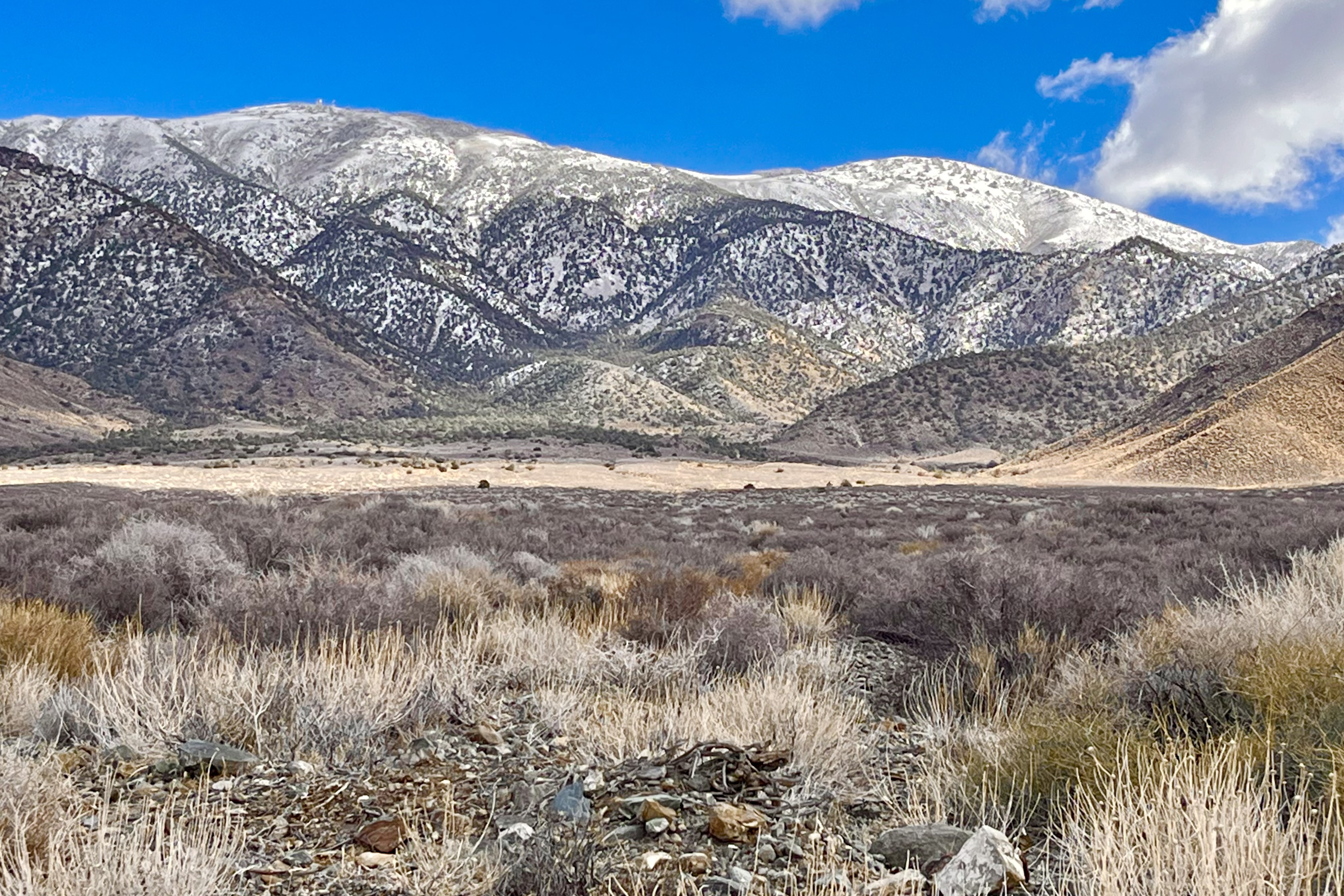
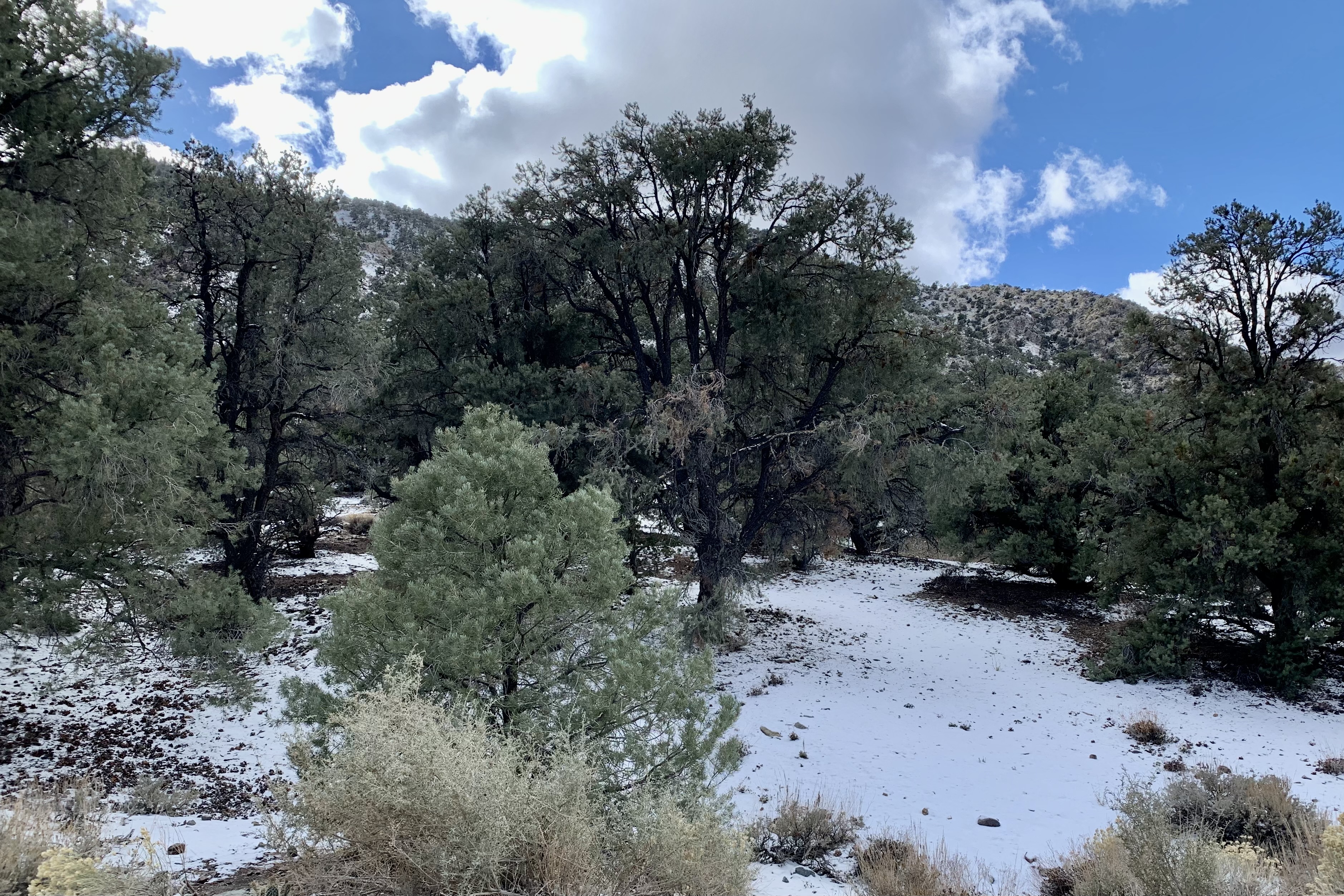
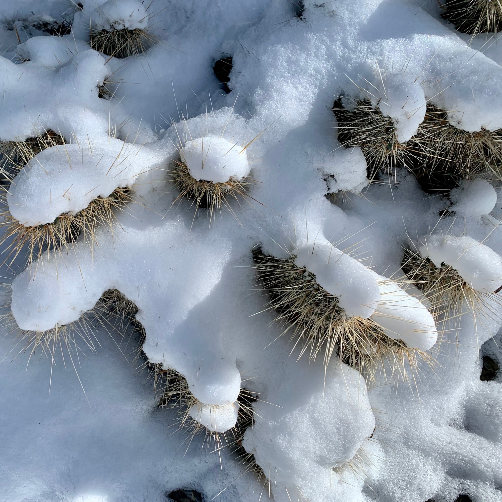
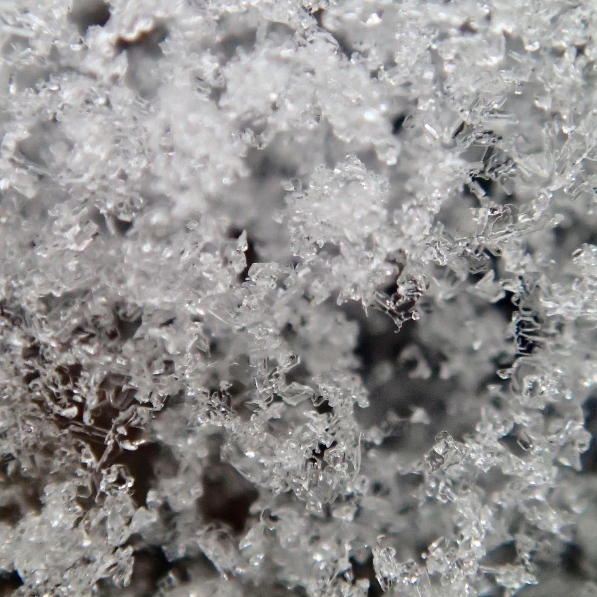
Driving towards Wildrose we could see that there appeared to be snow up on the mountain peaks. As the road climbed to a higher altitude the surrounding landscape became much different. What an anomaly when starting out in the Valley that brags about the hottest temps on record to be heading toward snowy peaks.  Soon we found ourselves in a Pinyon Pine and Juniper forest as we arrived at the kilns.  The  welcoming committee served gusting wind, snow and an ambient temperature of 33 degrees. What was being considered was hiking towards Telescope peak was now NOT being considered.  I was by  no means dressed cozily enough to consider that option as I have on several occasions while hiking flirted with hypothermia and said “no thank you very much.  Not on my dance card today! “

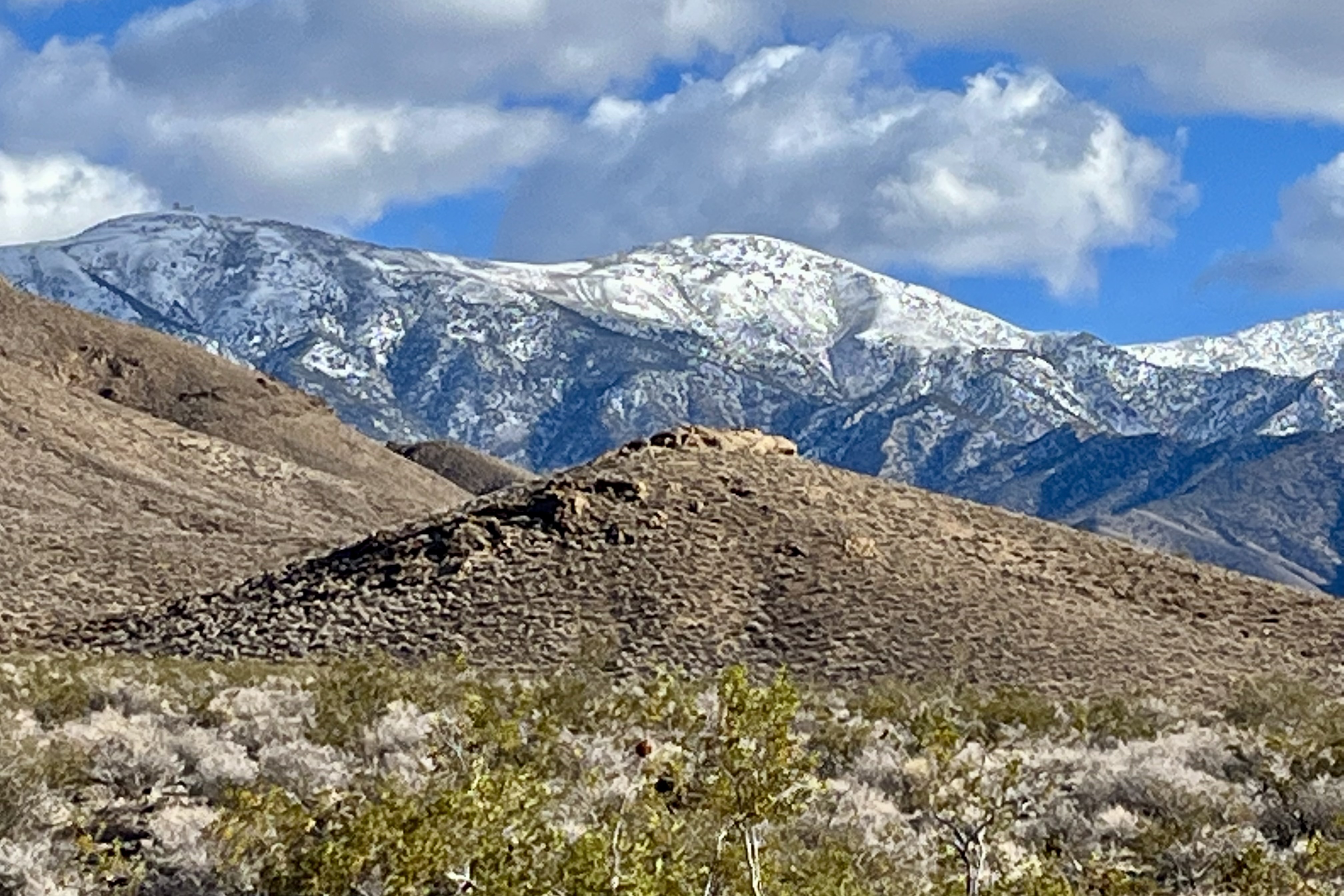
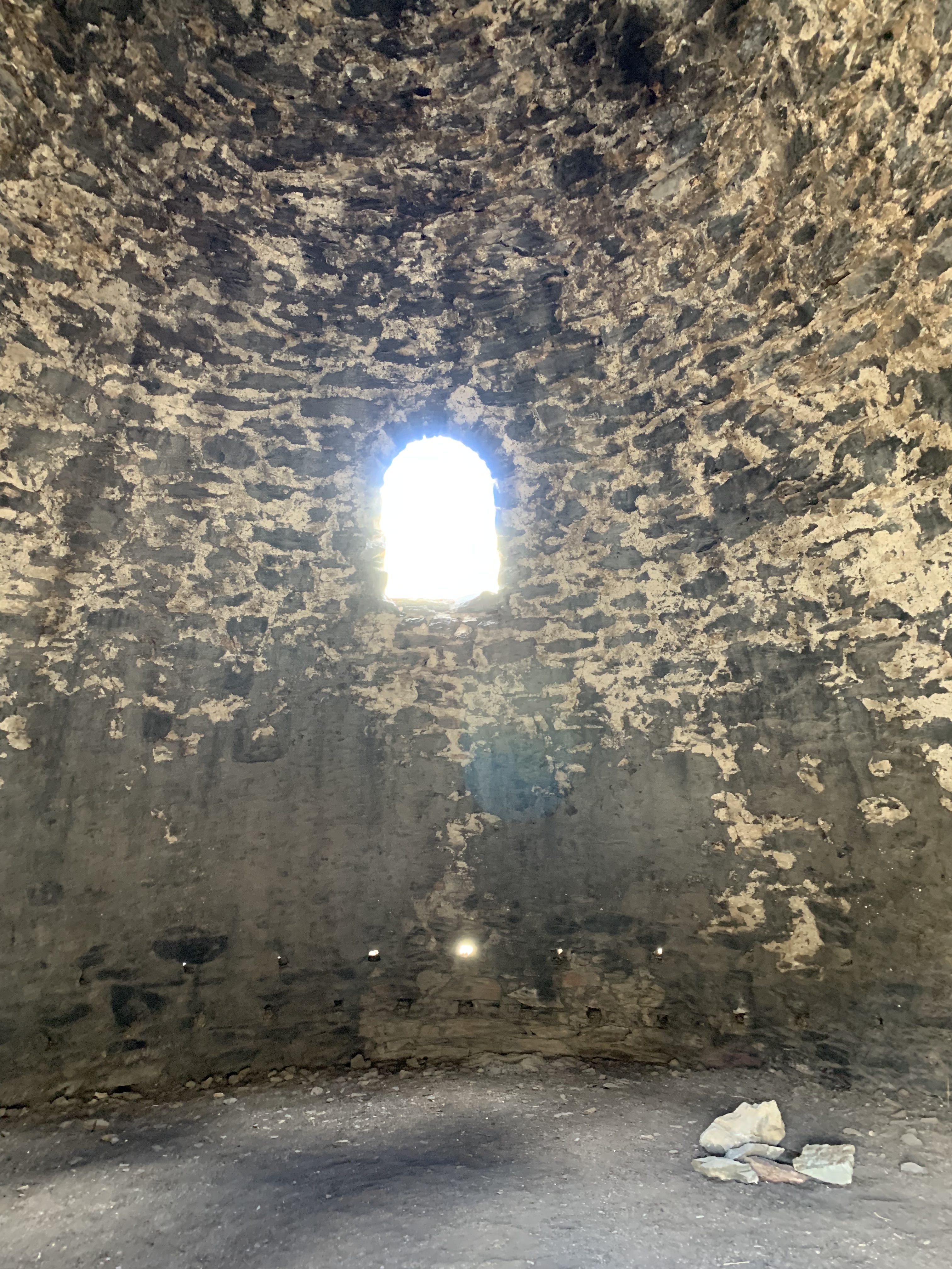
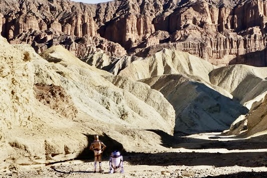
So, it was to be a short tour of the kilns and then head back down . These Charcoal Kilns are ten beehive shaped masonry structures about 25 feet high. I found them strange enough looking that I am surprised that they did not make a guest appearance in a Star Wars Episodes as so many other spots in DVNP have. These kilns produced a source of fuel (charcoal) suitable for use in two smelters near the lead-silver mines 25 miles distant. Charcoal was transported to the smelters by jackass pack-trains. I would like to think that the 20 mule team hauling borax in the Mojave desert had flexible working conditions and garnered the occasional trip up to the cool mountain air to transport charcoal. The kilns were giant airtight ovens pyroltizing pine to charcoal. That charcoal is not the modern briquette used in our “old fashioned barbecue grills” but a much more porous form of carbon prepared by charring wood in a kiln from which air is extruded. In the 19th century and earlier, charcoal was used for a furnace fuel because it burned with the greater heat that was needed for the refining of ores. Guess back then environmental pollution wasn’t an issue. Now rarely is it fuel for either homes or barbecue grills which now often rely on natural gas. No longer is your char-grilled steak charred by charcoal.

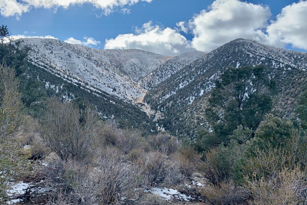
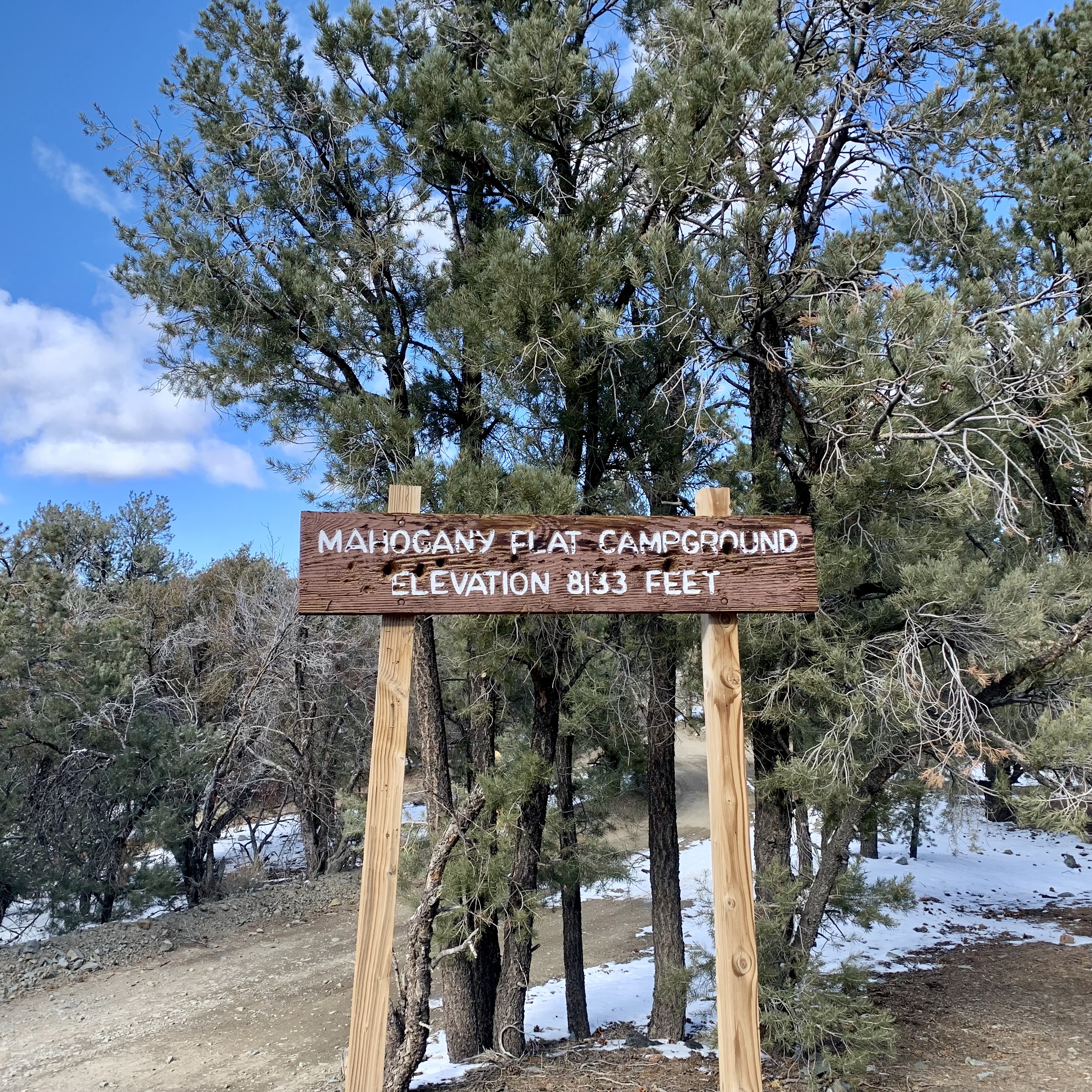
Thinking about leaving, I eagerly eyed the  road that would take us up to Mahogany Fat Campground  at 8200 ft. The sign indicated that this dirt road access needed high-clearance vehicles, 4×4 required.  Not wanting to miss what would be most likely great views,  I decided that my all wheel drive Crosstrek would love the challenge. Tasia was a bit skeptical but she knew enough that once my mind is set on a destination, I was unlikely to alter course.  I reassured her that we could always turn round need be. My hunch paid off and though it was a bit rutty, muddy, rocky and snowy we made it up and back down and didn’t bottom out or rip up the undercarriage. We only slithered a bit. And we were rewarded with exceptional views.

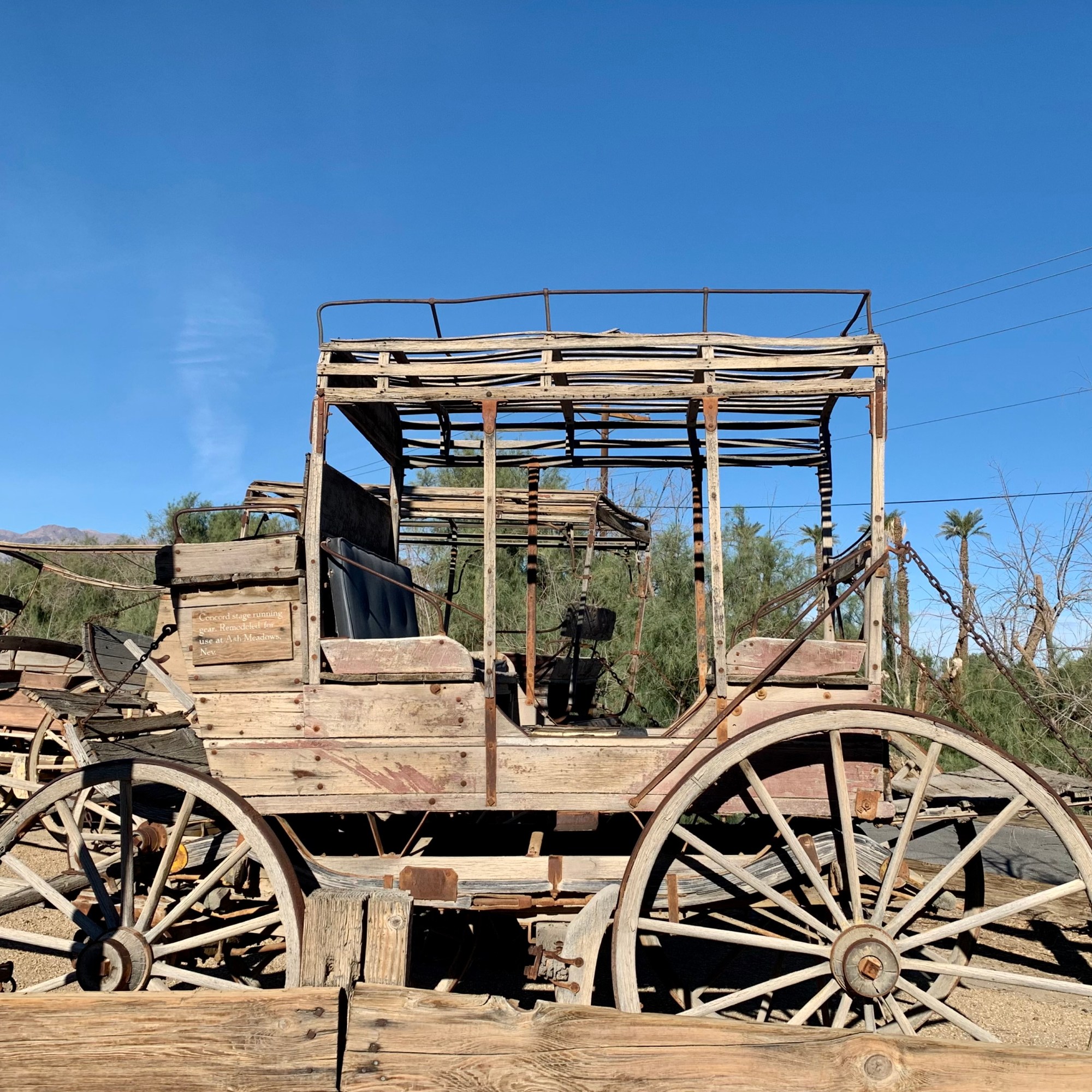
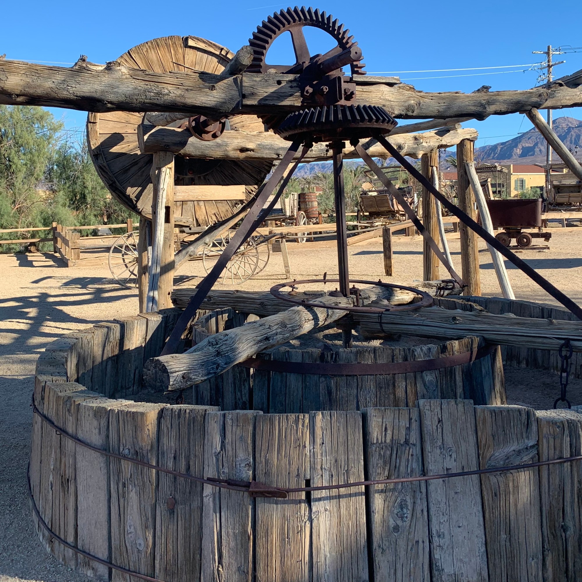
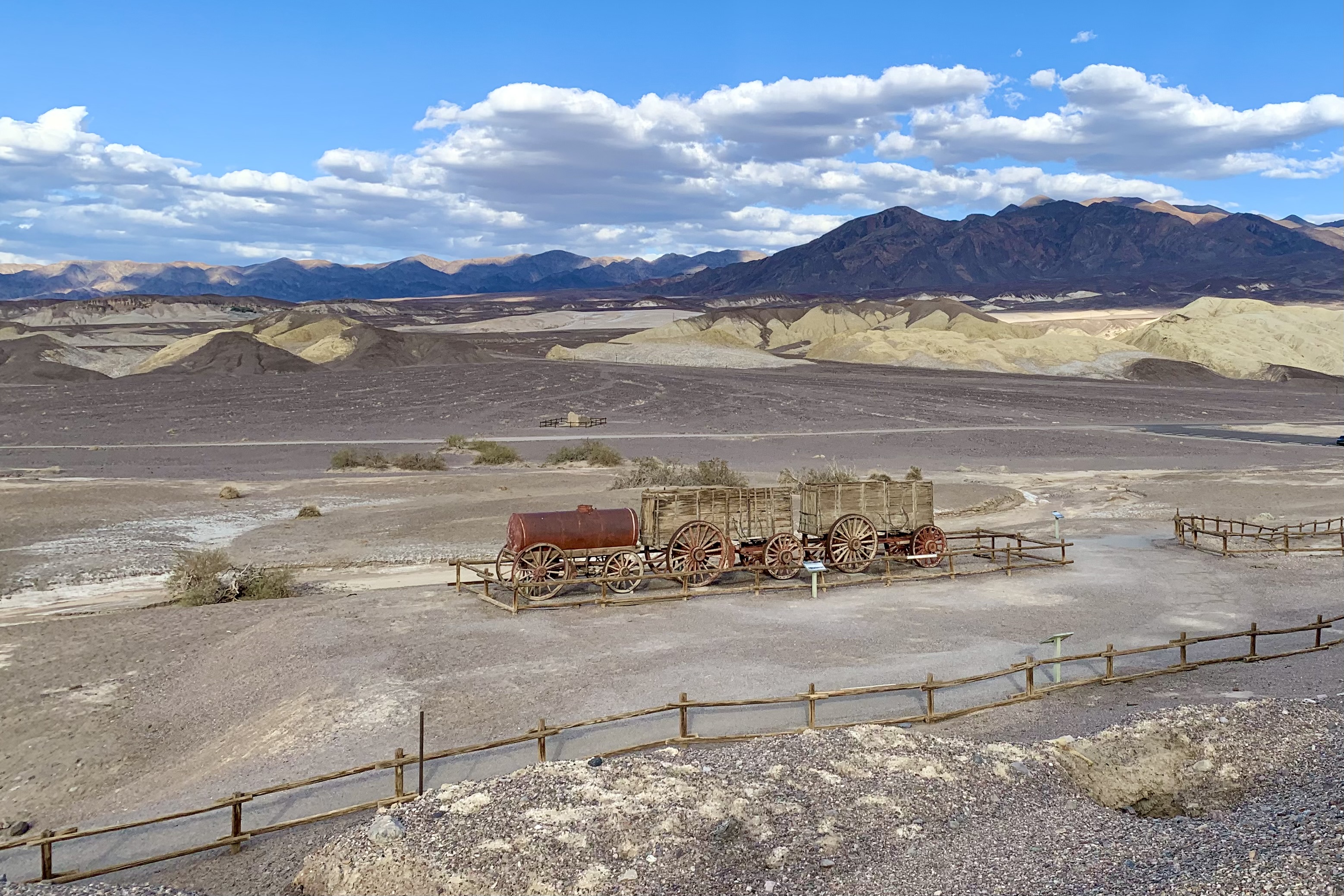
On our final morning in DVNP before we bade  farewell, we cruised the Borax Museum.  If you have a keen interest in the Borax Mining Operation in Death Valley in the 1800’s you will be fascinated.  Now I am not a big museum fan but cruised the exhibits and of the  66 items I would put on a menu would be the 20 Mule team Wagon Train, Panamint Valley Stage Coaches, Old Dinah… what is most fascinating is seeing what could be accomplished with  basically iron and wood and methods  we would definitely think of as pre-historic today.

Zabriskie Point

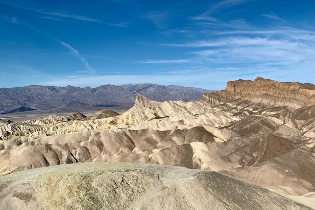
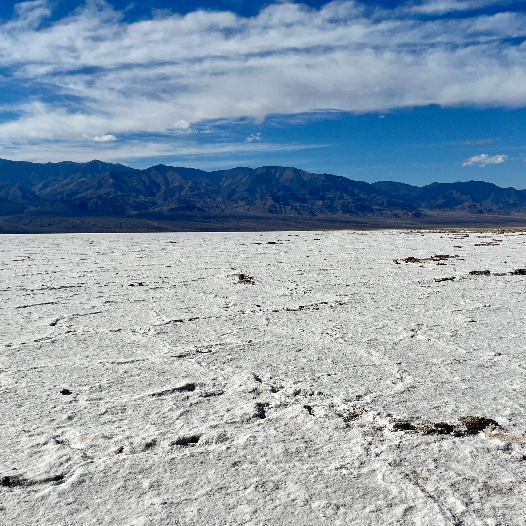
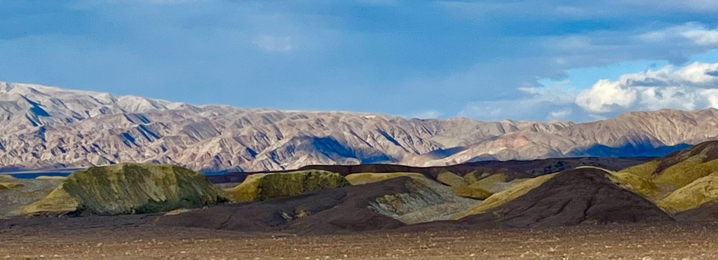
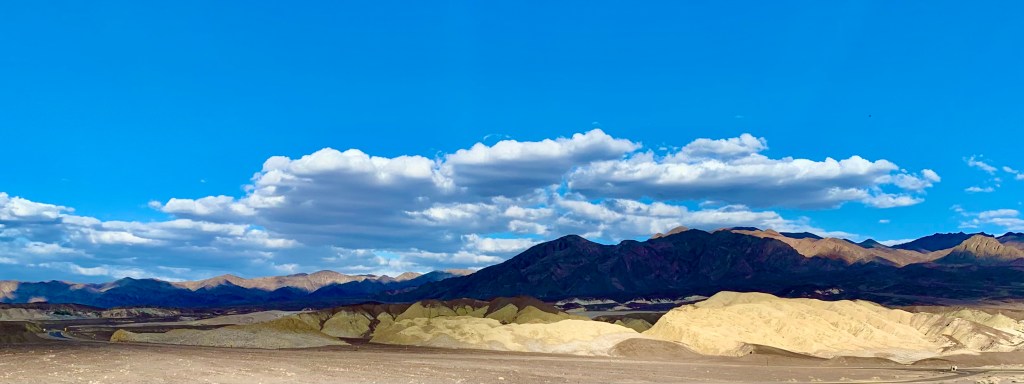
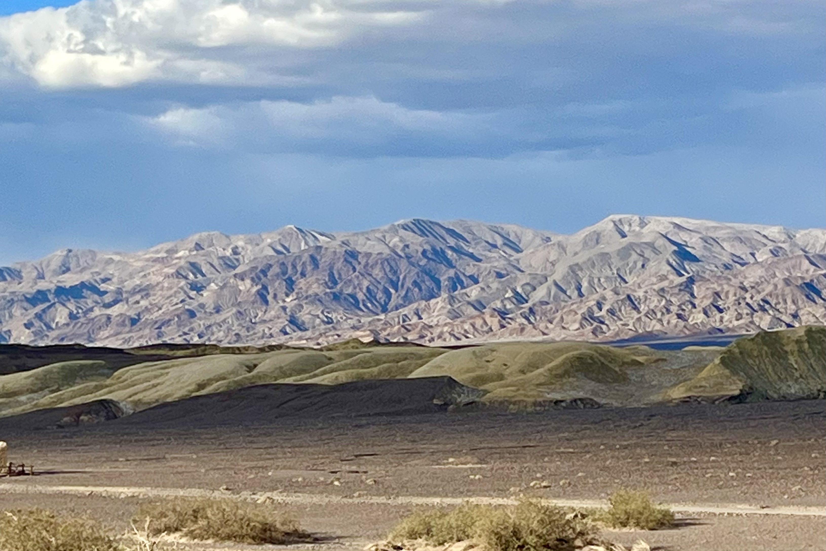
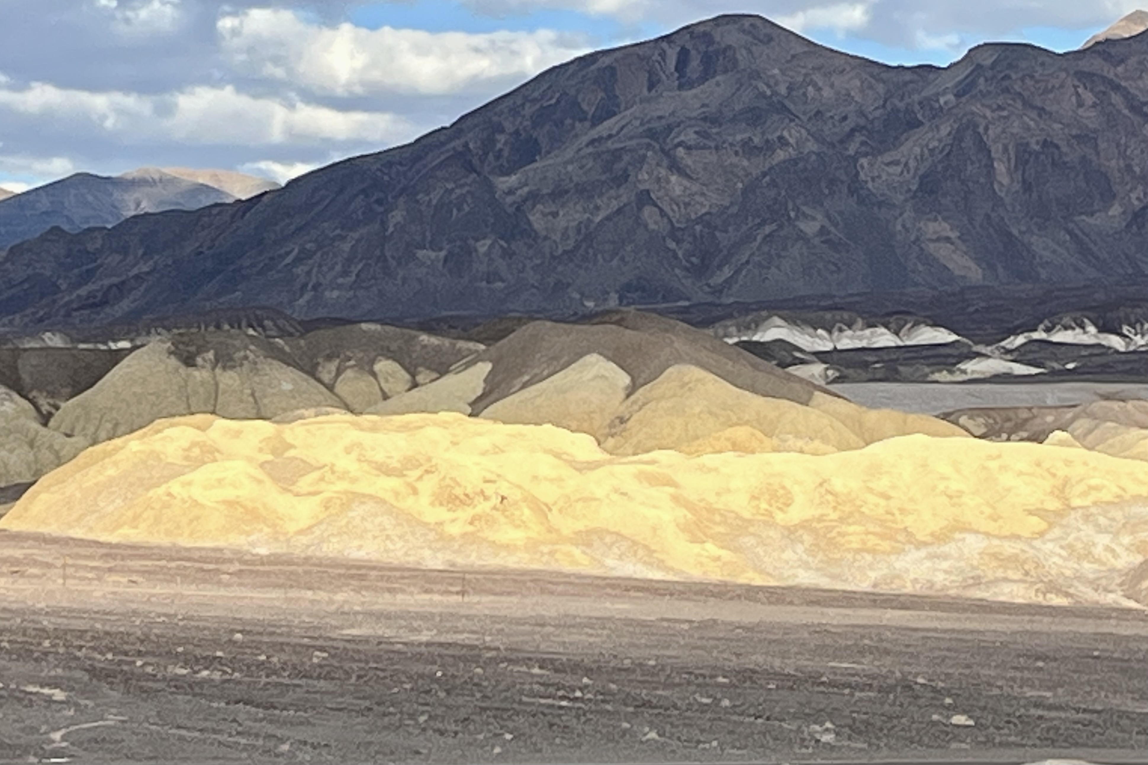
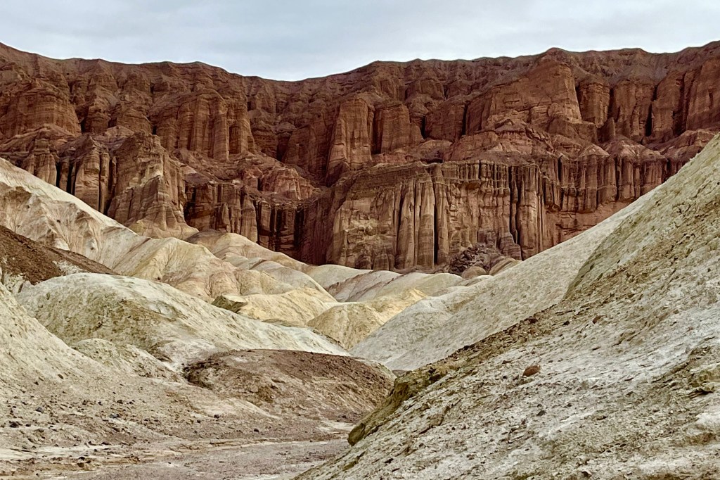
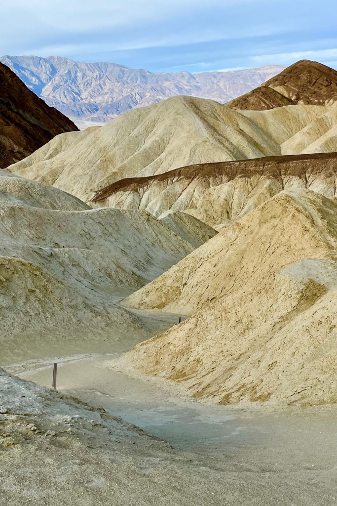
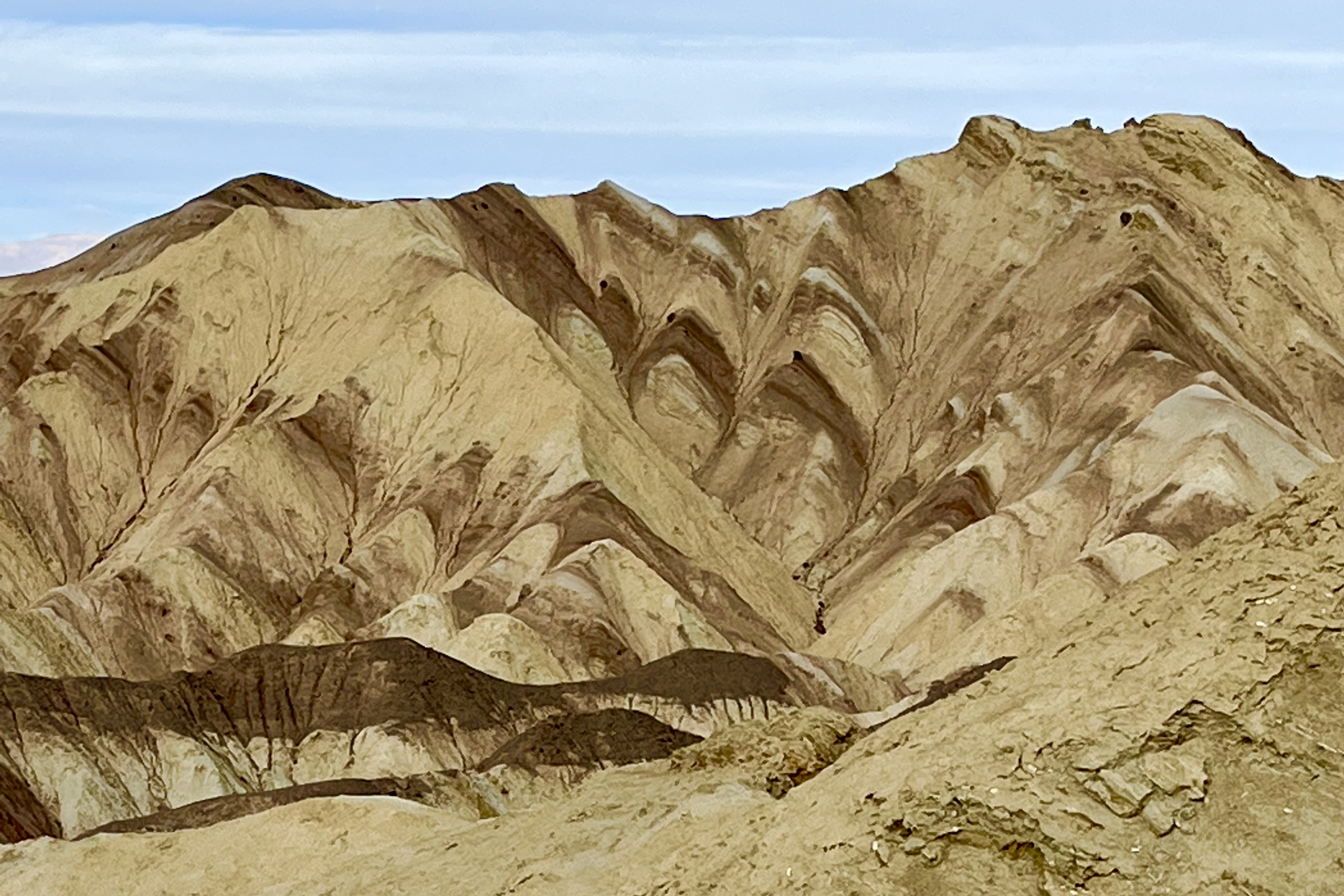
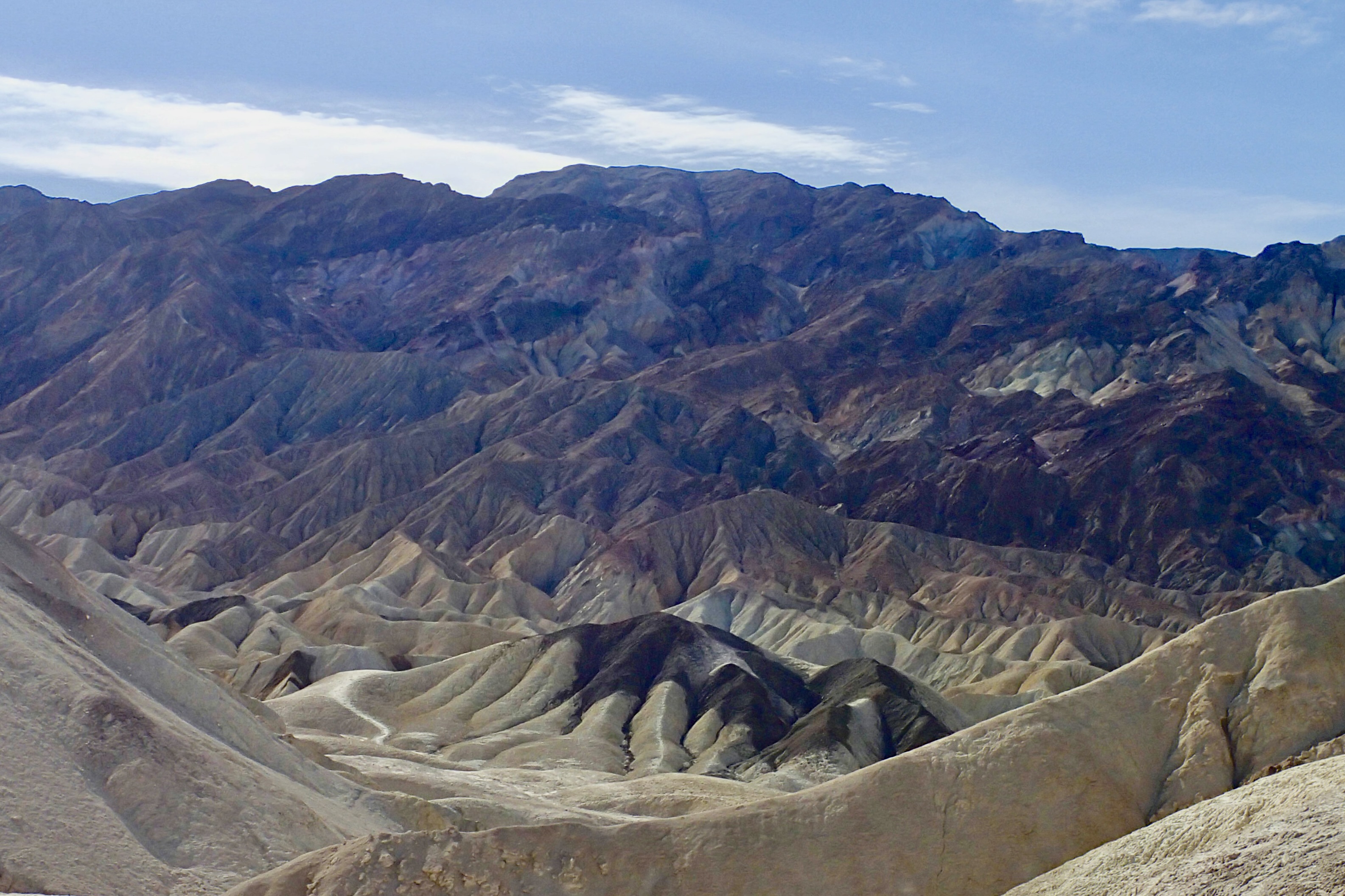
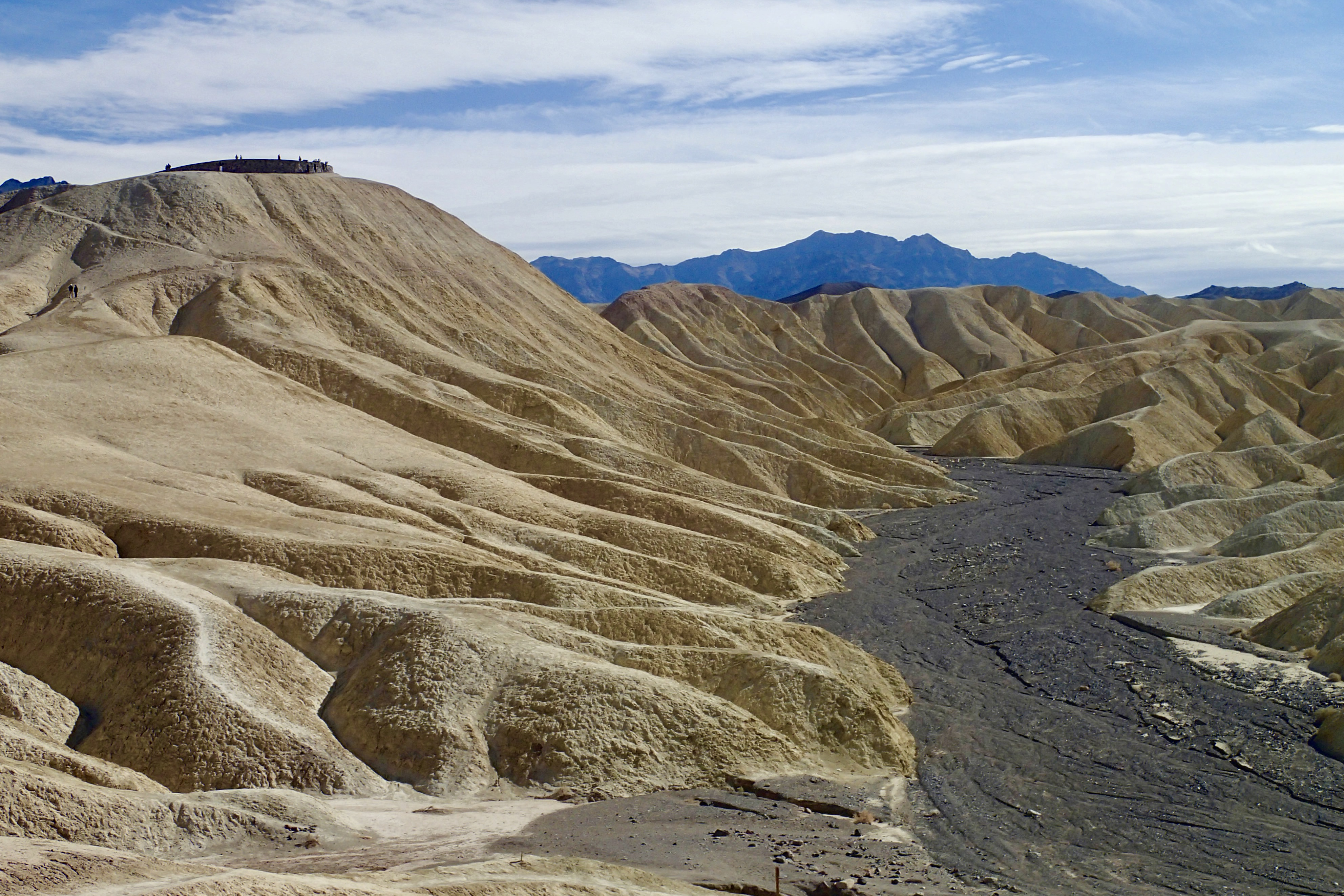
We skipped Zabriskie point at the outset of the trip (saw a very crowed parking lot) but chose it as our farewell stop on our Death valley tour. Probably the most iconic photo shoot spot in Death Valley is from the landing at Zabriskie Point. At 710 feet elevation it provides an elevated vista which affords breathtaking views to gaze, gape, be amazed, wonder, marvel, and be awed by the splendor of the yellow sand brown hills of the badlands below and beyond the salt flats covering the floor of Death Valley. The most prominent feature on this landscape, viewed from Zabriskie Point, is Manly Beacon. This view is so filed with the rich colorful shades of toffee, wheat, honey, caramel , butter, chocolate, almond, baked potato, dijon mustard, baked bread , bitter chocolate, ginger ale, maple syrup, coffee, brown sugar, brownie, cocoa, mocha … Perhaps you think I am in a grocery store as I am describing the vista or even that I am incredibly hungry as I write, so I will spare you any more food images, but hopefully I have aptly described some of the hundreds of shades of rich colors of these eroded hills! They are absolutely gorgeous! The dark, colorful mountains of the Amargosa Range contrast with the hills of the golden badlands below and Manly Beacon; with the cliffs of Red Cathedral; and, with the white mirage-like salt flats beyond.

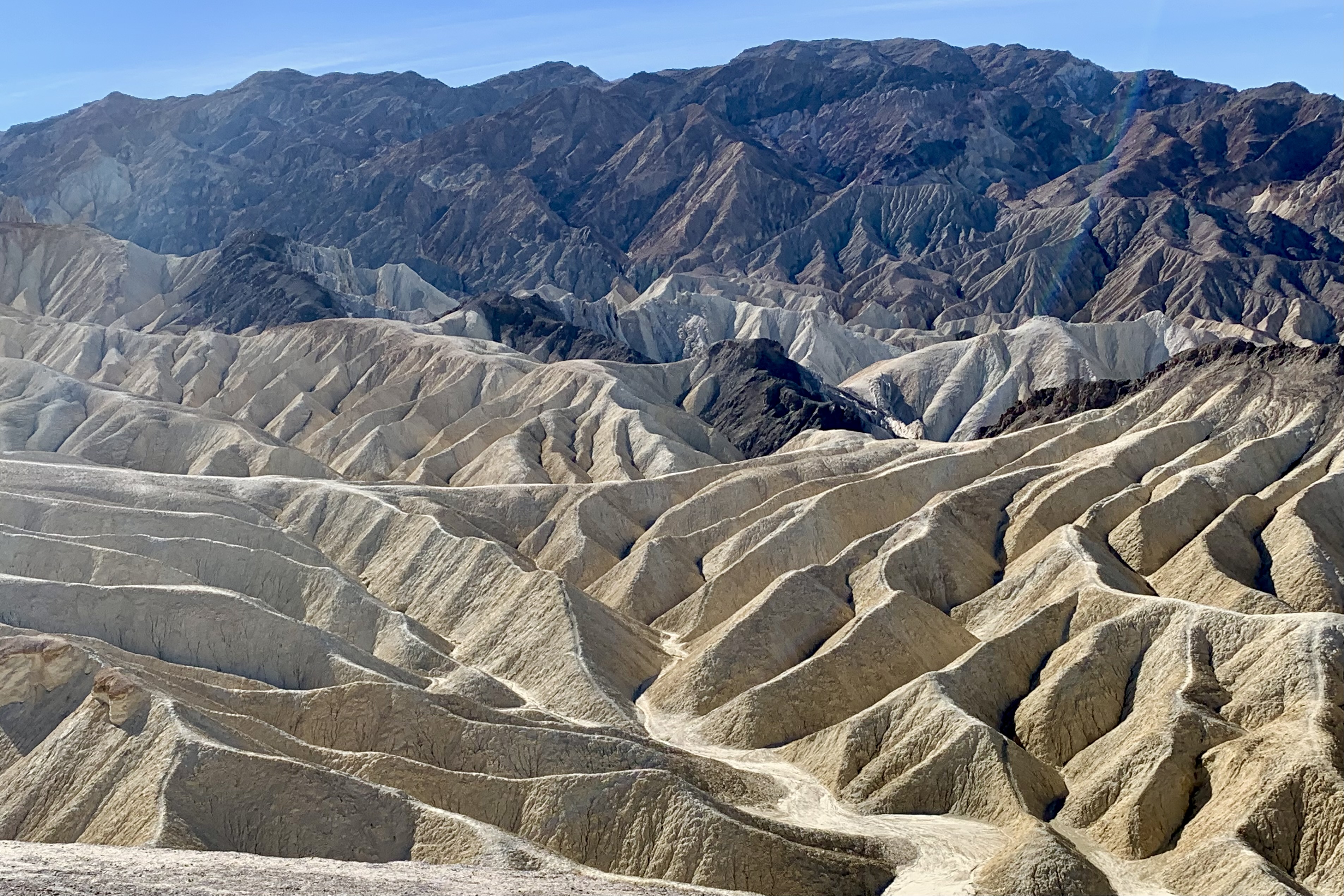
It seemed to me especially imposing and magnificent (and alien) after hiking the Golden Canyon and Gower Gulch Trail which skirt this massive structure of manly Beacon.  Of keen interest to me, while up there,  was pinpointing the spot at the tip of the Badlands Loop Trail  where we stood peering up at Zabriskie Point (1st picture below) and viewing the land beyond that I had both laboriously and enjoyably hiked.  

Salty Sand, Muddy Fairways, and an Impressionist’s Palette: More Adventures in Death Valley NP

Climbing the Mesquite Flats Sand Dunes was not necessarily a must-do hike on our park itinerary but a visit of some form was a must. I know very little about “dune geography” but one can find crescent, linear and star shaped dunes here which could be readily recognized. Also of interest to me also was the fact that the dunes are named for the mesquite tree which dotted the dunes and that these trees are forced do a “ Twist and Grow” to avoid being buried alive. Perhaps this is the plant world’s slow motion rendition of what might be interpreted as frantic survival gesticulations whenever the “Twist and Shout” rock and roll hit from the early 60’s is played.

Having attempted sand dune hiking in the past, I had a hunch I did NOT want to have to work that hard and after climbing one of the dunes, that hunch was confirmed. I had no great need to be a masochist this afternoon. So after the heavy foot and calve workout needed to climb just one dune, and having spotted the highest dune (which is said to rises about 100 feet above valley floor ) and then when up there, on this adolescent dune, seeing an ostensibly endless sandbox with row upon row of dunes in the distance, I was satisfied. I did not have to do a roller coaster walk up and down the lower layers of shifting sands to reach that big “mother dune.”

Another huge factor was the wind. In this undulating sea of sand, this day’s wind had the capacity to sandblast any exposed part of our bodies and I did not want to look like my face just had a chemical peel. Since there was no specific trail to follow and we could wander wherever our whim, or better stated, the wind took us, there was an area between two ridges of dunes in which the sand had dried and formed hard clay on the desert floor and was cracked in polygon shaped patterns. It was a great surface for a hike, and actually I found that it was a more interesting walk, exploring the multiplicity of shapes and patterns in this clay canvas, the surface pocked and pitted and littered with “shattered pottery shards. ” No hidden cameras were need to track the roaming habits of the area wildlife as many telltale tracks were cast in this sheet of sun baked earth.

Attention Star Wars Fans: Parts of Star Wars: Episode IV – A New Hope were filmed at the Mesquite Flat Sand Dunes. The Mesquite Flat Sand Dunes star as the deserts of Tattooine that R2-D2 and C-3PO crossed in this classic Star Wars film. 

The Badwater Basin’s claim to fame is that of being the lowest point in North America, at a depth of 282 ft below sea level. We naturally had to do it just to say “have been there and done that” but I was not relishing the time of day nor the bevy of people I anticipated partaking in this must-do-hike on the Badwater Salt Flat.

So far the park visitor population has been at this point quit low, seeing very few people on the roads or hikes. This rang true here as well. Though there was considerably more people at this easy to drive up to attraction and quite a few folks traversing these flats, I am sure, by high season standards, the sum would be considered paltry. The salt flats are composed primarily of sodium chloride, i.e. table salt, which I decided not to take any of it with me to sprinkle on my next meal as it appeared to be laced with mud in addition to some calcite, gypsum, and borax. Tasia’s pictures of the crystalline structure of the salt, peppered with calcite, gypsum, and borax made for some beautiful photographs.

Historical lore floats the story that Badwater Basin earned its name when a mule refused to drink the water from the spring-fed pool which we could still see near the present-day boardwalk. I can’t blame that mule because I would not want to be drinking “bad” i.e. salty water. However the water is not truly “bad,” just very salty. Despite the high level of salinity, I was surprised to see organisms and salt tolerant plants thriving near there (though definitely not the oasis that we are told we deserve in the Inn at Death Valley literature.) Formerly a lake, Lake Manly, which evaporated 20,000 years ago, this area is replete with a great variety of intriguing geometric salt encrusted pentagons, hexagons, and octagons which form when groundwater rises up through the salt deposits and evaporates. It was an easy hike out and back on this smooth salt trail but much to my dismay even this surface is not safe from a graffiti generator.

Devils Golf Course, in this vast salt pan of the valley, has been eroded by wind and rain into a sea of jagged salty muddy spires. It stated in a guidebook back in the ’30s that only the devil could play golf on such a surface.” I understand the devil metaphor as it is definitely one of the most hellish, forbidding and demonic “attractions” I have seen in Death Valley. The area is incredibly serrated so that this salt slab is extremely difficult or more likely impossible to walk on since the cones are craggy, barbed, spiked, scabrous and stick straight up. I chose each footfall gingerly, as I imagine lack of caution would result in a fall that would result in shredded skin on whatever body part made contact. Why the concept of “golf course” would emerge from any mind in this landscape behooves me to comprehend. In my wildest imagination, I hypothesized that a ludicrous possibility could be that a golf obsessed land developer actually was casing Death Valley National Park (DVNP) for a potential links there (which of course eventually happened at the Furnace Creek Area) !!!

It is definitely more otherworldly than the salt flats we traversed at Badwater ( with its miniature spires edging the well worn salt flat trail) but both are choice examples of the diversified terrains in Death Valley National Park. From a distance, the crystalline salt clusters look dazzling and delicate, but when touched I discovered that are hard and prickly. It reminded me of the jagged coral on reefs when snorkeling,

I was wondering what made these hardened mud salt encrusted spikes so much larger that those we saw at Badwater Basin. I learned that Badwater, being so low periodically floods, then dries. Devil’s Golf Course is several feet above flood level so there is not the eroding and the smoothing effects of flood waters or but I think it more interesting to think that perhaps Lucifer reigns over it protecting his territory. The pinnacles form when salty water rises up from underlying muds. The spires grow is quite slow (again a similarity to the growth patterns of coral) estimated at perhaps an inch in 35 years. Wind and rain continually sculpt the salty spires into fascinating shapes and they form fantastic, intricately detailed pinnacles. I don’t think many sculptures could replicate these intricate patterns.

Artist’s Palette is a prismatic topography on the west face of the Black Mountains in the Armagosa range. It is famous for the natural color palette, when a very artistic Mother Nature creatively brushed the face of these rocks in pastel hues of mauve, rose, teal cornsilk, vanilla… or perhaps when Monet or one of the other Impressionists took a working vacation in Death Valley. The science however is less romantic. These colors are caused by the oxidation of different metals found in the rock formations with the compounds of iron leaching the reddish, pinks and yellow shades;  the decomposition of mica yielding the greenish tints; and manganese minerals produce a lavender hue. This striking array of color is nestled into the surrounding mountains landscape which is dressed in hues of rose, ochre, and gold.

Artist’s Drive rises above Badwater Basin and then winds its way 9  miles through scenic canyons and hills. On one side, you get sweeping views into the white salt pan valley (which often appeared to me like a mirage of an elongated desert water hole)  and on the other, views of the hills, delicately shaded.  I enjoyed Artist’s Drive not only for it’s signature kaleidoscope array of colors but also I loved driving this narrow winding paved road  through its dips and tight blind curves. This drive is definitely a trump card with its feel of riding a gentle roller coaster of dunks and hairpins. There’s not much vegetation along the drive other than  an occasional  creosote bush but its majesty and out-and-out otherworldly beauty made it yet another otherworldly site for  the Star Wars filming of scenes from A New Hope.

The Harmony Borax operation was big business in Death Valley. That was way back when, by some happenstance, a very clever person figured that a team of 20 mules, hitched to a double wagon, was a very efficient way to haul the mined borax on the long overland route, 165 miles to the town of Mojave. And down the road a very clever marketer floated the romantic image of the “20-mule team” (which persists to this day). I clearly remember the TV advertisements when I was just a kid in the 50’s, that became the symbol of the borax industry in this country. The round trip between Death Valley and Mojave took up to 30 days. I figure that those poor beast of burden plodded on through the desert averaging about 11 miles per day! At the Harmony Borax works, we took the paved loop interpretive trail where you can see adobe ruins and a 20-Mule Team wagon.

Before visiting the Harmony Borax Works we ended up inadvertently on a drive through Mustard Canyon, a dirt road in the middle of Death Valley which runs adjacent to the plain where Borax Crystals were collected. Mustard Canyon Road is lined with low-rise, yellowish, mustard-colored dirt and rock hills,  colored by salt and oxidized minerals. This drive, though beautiful,  was much more intense and anxiety producing than it need have been.  It is very narrow road with many blind curves and since we had no idea it was one-way,  Tasia was imagining that we would meeting a car head and meet our fate on every next blind curve. I offered to re-drive it once we knew it was one-way but she much preferred to live with her anxiety hang-over. 

The 20 Mule Team Borax – Death Valley Days Classic TV Commercial https://www.youtube.com/watch?v=qC0H6mPyfZA

Hottest, Saltiest, Lowest, BUT not the Deadliest: Death Valley National Park

Visiting Death Valley National Park (DVNP) was never one of my dream destinations. I can’t think of too many individuals who would be enthralled by the thought of visiting a place called Death Valley though, I am sure, there would be a select few who would be infatuated by such a macabre sounding destination. So in my quest to visit all of the national parks, it never got to the top of my bucket list of parks to visit until I had only 10 parks left to set my foot in and spend a few hours or a few days. Virtually all of the parks I have visited astonish me with their striking beauty and uniqueness. So the decision was made…2022.

This land of extremes (hottest, driest, lowest place in North America according to then DVNP Guide) ranks 16th in attendance of the 63 National Parks so I guess its name is not necessary a STOP or Do Not Enter sign. It got 1.1 million visitors in 2021. Even the Badlands NP in South Dakota numbers #28, with a name that might frighten off the high-anxiety crowd. DVNP is the largest National Park in the United States, NOT counting those in Alaska. The hottest recorded temperatures on Earth have been at Death Valley. The perfect combo of sand and rocks (which make up the vast majority of the desert floor) radiate a large amount of heat: hot air is trapped in the valley bordered by high mountain ranges, and a low average rainfall (two inches vs 10 in most global deserts.)

A bit of background information: What’s in a name? A large group of emigrants from Salt Lake City heading to the California gold fields were lost in this valley in the mid-1800s. The group broke up trying different routes, but  two families with children had patiently remained, waiting for scouts to save them. Only one man had perished during their long wait, but as this group made their way west over the mountains, someone is said to have proclaimed “Goodbye, Death Valley,” giving the valley its morbid name once they made their way out. Probably naming it that while in there might have been considered bad luck… if it already wasn’t bad enough.

For some reason, I feel compelled to talk about death in Death Valley.  It is by no means the most dangerous national park. One might imagine it would record a record number of deaths given the desolation and extremes of temperatures. These have occurred but tend to garner more press attention that the fact that  more deaths occur because of car crashes than heat. There are long stretches of paved roads which might just encourage some drivers to envision themselves on a  drag strip and decide to set a personal speed record. Currently it is ranked around 10 in recorded deaths per capita national park visitation. All too soon though, and the current emerging trend that causes many park deaths, will be deaths from falls that occur as a result of taking selfies near treacherous terrain. I must admit I did a few of those but not too near the edge! Note my moments of sanity when taking selfies below on stable solid ground…and on that note, I shall move on from this grim topic to one a little less moribund. 

Upon approaching the boundary of Death Valley National Park the sculptured hills and terrains and its natural beauty, uniqueness, vastness began to emerge. It was clear that many surprises awaited us. Around every bend was a different palette of colors on a landscape of mountains, undulating hills, canyons, and salt flats… After taking the requisite photo in front of the DVNP sign we headed towards the Furnace Creek Area and The Ranch at Death Valley where we would be staying for three nights. 

Hotel options are scarce in and near Death Valley (more so with so many entrances still closed off). I was excited however about our stay at the Ranch. From a macrovision standpoint The Ranch at Death Valley was lovely and the resort facilities plentiful, but upon approaching the 700 building, where out room was located, via some confusing one way streets, it appeared much more like a very ordinary looking older two-story motel with our room on the second floor. We climbed the well worn stairs, which took us into the well worn and stained carpeted dark hallway.  The room, somewhat rough at the edges, was adequate until the toilet would not stop emitting a screeching sound, the shower knob fell off in my hand making it quite challenging to regulate the water temperature, the garbage was not emptied for the entire three day stay, AND even worse, no restocking of the coffee packets, bad coffee that they are.  The roster of services we received at check-in so stated that there would be no in room services during ones stay. Now I understand that with inflation hotel prices have gone up, eco-friendly hotels no longer change sheets and towels every day, but for $245.00 per night I should not have to service my own room. With the absurd room prices and food prices here, I would just about be spending my entire month Social Severity check for three days, “servicing “ my own sleep and food needs. 

Now that I am on a rant, I will grouse about the food options. There is not much competition around, so guess they hope to capture your whole paycheck. The main restaurant “The Last Kind Words Saloon” had a nice American menu with not so nice prices. We checked that off as an option as the cheapest dinner dish was a pesto pasta for $41.00. Now at the pool bar I could get a $21.00 deli sandwich, $14.00 crudite, or $15.00 chips and salsa. I wonder if I could have asked them to deliver some chips and salsa from the Saloon as over there they were only $10.00. Nope not dining here. Since our room was convenient to the golf course, I considered that option and the 19th hole Bar and grill had a $19.00 Back Nine Burger or a $16.00 Divit Dog. NO! Next, the Ranch 1849 Restaurant Buffet (all you can eat ) looked like the best bargain for $34.00 until we cruised it and one look at the well done veggies, dried out meats, salad concoctions that rivaled our compost bucket in the kitchen screamed NO! I thought perhaps the food had been sitting there since 1849. Succinctly put, it was some of the crappiest looking food I have seen since I gave up going to crappy buffets years ago. I didn’t even bother to check out the Inn Dining Room at the Oasis of Death Valley on the ritzier end of town since the chef would not post a dinner menu online…But I have been told that “my trip is not complete without a meal in the beautiful and historic Inn Dining Room, especially true now that this restaurant has undergone a major redesign.” I think I can live with that! http://(https://www.xanterra.com/stories/the-inn-at-death-valley-desert-dining-dream/)

The last two options were The Ice Cream Parlor or buying something at the General Store.  Now I could go for ice-cream but really!!!  @ $7.00 for a single scoop. They did have what I consider a kids menu (hamburgers, hot dogs, grilled cheese) at the adult prices of $18.00-$22.00.  All hail to the winner: the General Store. It’s not that I can’t afford these restaurant meals.  But, I prefer not to be held hostage by closed roads and the relative remoteness of the park (which I could avoid by choosing  perhaps a long drive out of the park and back up to Beatty). With the price of gas, I could drop the $75.00 on a rib eye steak and save time and energy.  BUT mostly I prefer not to be at the mercy of the wealthy billionaire owner of Xanterra that operates  the Death Valley Hotels and restaurant concessions .  So it was  a cold meal as one of those tiny motel microwaves are NOT provided in the rooms. So $36.00 bought us 2 yogurts, two sandwiches, a bag of cranberry crunch for our dinner and breakfast and pint of milk for morning coffee   I have learned that if you lace the coffee colored water coming out of the motel pots with a half packet of Starbuck’s via, you get a pretty decent cup of coffee. 

Skip ahead if you are not interest in some background for my pique, displeasure, grudge, irritation, resentment etc!! The Inn, and the associated Ranch, Restaurants and Retail are owned by Xanterra and not operated by the federal government. Three of four lodges in Death Valley are privately owned and not subject to national park oversight.  Most room rates and food prices at these facilities do not have to be approved by the National Park Service Companies. Xanterra, I am about 99% sure, paid for the $100 million-dollar renaissance at the end of 2018 of The Oasis at Death Valley ( to win bids parks concessionaires are required to spend more of their own money for improvements and new buildings). Xanterra Travel Collection is a privately owned American park and resort management company controlled by entertainment magnate Philip Anschutz. Denver-based billionaire Anschutz.  “You don’t come to Death Valley because abundant life flourishes here. Which is exactly why an oasis in the middle of it is so special. Only here can you enjoy two distinct hotel experiences that have undergone a $100 million renaissance – the historic, serene, and peaceful Four Diamond Inn at Death Valley and the family-friendly, adventure-focused Ranch at Death Valley – the energetic epicenter of this True American Oasis located in Death Valley National Park. The Oasis at Death Valley in Furnace Creek is situated in a lush oasis surrounded by the vast and arid desert of Death Valley National Park —https://www.oasisatdeathvalley.com/ . I definitely missed the boat as I thought I was coming to Death Valley to experience the vast desert and its natural wonders not a man-made oasis.

Golden Canyon/Gower Gulch /Badlands Loop

The sunrise was splendid on our first morning, dressing out the mountains in mauves and pinks, and viewed from our hotel balcony. After our Starbuck’s laced brown water, it was time to think HIKE! Read on if you hanker a hike up a huge gold-toned monolith. This might just be the hike for you OR read on because you are loving reading about Tasia’s and my adventures on this DVNP trek. Daughter Tasia was in charge of researching and  choosing the hikes we would include on our Death Valley “itinerary.”  She opted for some of the more popular moderate hikes given that they seemed to match my hiking abilities and are popular for obvious reasons.    Golden Canyon was termed a  must-do-hike by many a visitor to Death Valley National Park.  This mix-and-match set of trails, which initially cuts through the many shades of the brilliant yellow-gold barren eroded land of Gold Canyon, connects to the other trails of  Red Cathedral, Zabriskie Point, and Gower Gulch making this a perfect choice for our first DVNP hiking adventure.   What fit the bill for us was a loop starting at Golden Canyon.  I am a hiker who likes to get the tougher and uphill part of the hike over with first – but I can say this now, though I definitely did not know that when we started out. We proceeded to the Badlands Loop, and returned via Gower Gulch for 5.7 miles.

The Golden Canyon where R2D2 got zapped by Jawas, was on the wider side as a road once went through the canyon but was knocked out in 1976 by a rainstorm. I kept looking for the “footprints” of good old R2D2, who had lumbered about but none were to be found in Tatooine Canyon. They were probably scoured by the winds in the passageways in this canyon. The high canyon walls are made up of golden sandstone and red mudstone walls. Waves of reddish brown mudstone appeared as the foreground for the peaks of the Red Cathedral shortly after entering the canyon. What was quite striking during this first hike is the bareness of the hills, mostly devoid of vegetation.

We followed the Gower Gulch Trail that forks near the base of the “shark fin” shaped Manly Beacon (this towering pinnacle was named for William Manly, one of the ’49er pioneers who slogged though the area and actually lived to tell about it). I found it challenging as, at times, a very narrow path cliffside, and the few steepish ascends and descends (mostly up to Manly Beacon). Leaving the wide, rocky canyon behind we walked among the light yellow mudstone hills. Here, the path narrows and winds up and up around Manly Beacon for a 180 degree view. The panoramas heading up to Manly Beacon and of course on top are quite exceptional. I was prompted to turn around for a peek-a-boo look (and photo) about every 150 feet getting an even better view of the Badwater Basin and Panamint Mounts across the basin. I found the hike challenging as, at times, a very narrow path cliffside, and the few steepish ascends and descends (mostly up to Manly Beacon).

Beyond Manly Beacon, the trail descends mudstone slopes towards Gower Gulch. But first we opted to take the Badlands Loop Trail traversing a myriad of undulating, fluted, grooved, rutted, conical, and domed mudstone hills arrayed in many shades such as goldenrod, wheat, banana, beige, buff, fawn, vanilla, sand, taupe, brown, cinnamon, mandarin, rust…  This area is classic badlands (defined as deeply eroded barren fantastically formed hills ).  It was quite a sweet experience of  complete immersion in a very surreal arid terrain.

The Badlands Loop eventually descended into Gower Gulch, a wide loose gravel filled wash which had no defined trail and we basically enjoyed wandering down the steady downhill and eventually out of the mountains. I was awed by the array of color from oxidized volcanic mineral deposits in the sediments on the walls of Gower Gulch .  The wash passes several Borax (called the “white gold “ of miners) mines.

When we neared the terminus there was a tall dry falls to negotiate a path down and then the grand finale of some slick rock chutes of polished stone through the narrows of lower Gower Gulch. You are thus delivered into the expansive sweep of Death Valley and the final traverse, mostly flat, to the trail head parking lot.  On my, what a halcyon morning we had ! 

.

Dead Lakes, Shuttered Saloons, and a Lady in Red en route to Death Valley

The Long Branch Saloon, Luning NV

With great anticipation, Tasia and I backed  out of the driveway around 10:00 am, October 31st, heading southward from Ashland Oregon towards Death Valley California, via Reno Nevada. But not until…  Since I mostly travel by airplane, I had packed light though I did throw a few extra things into the car such as a heavier coat and hiking boots.  But all too soon, when I realized the much larger capacity for STUFF, we made several trips in and out, adding just one more thing untilI I actually decided to take my big body pillow (named Hugly) and seat belted it into the back seat to enjoy the scenery.  It was time to draw the line before I packed the coffee pot, Soda Stream and microwave. 

I have not done any significant road trips since I had driven across country, when moving from Venice Florida to Oregon, and then driving on up to my second home in Alaska. Knowing that COVID, politics, and inflation have significantly altered the “landscape”of travel, including how things are now done AND how much things cost, I was in for some pleasant and unpleasant surprises. I had made a reservation for a hotel in Sparks NV, anticipating it was about the halfway point. Previous to leaving, I had become quite puzzled by the routing that all of the map apps I had checked recommended (Google, AAA, iMaps ). We would be heading over and down to the east side of the park through the Nevada desert and entering the park via Route 373/127 to 190. The night before leaving, in the process of checking for any last minute information, I saw an ALERT that due to a massive flood in August, many of the park roads, even after two months, were still impassible and the park could not be entered from the California side. Hence the circuitous routing down through NV, also bypassing the northern and closest Nevada route # 374 entrance. This naturally added an extra 80-90 miles to the trip so Sparks was certainly NOT half way. I guess a few miles extra on the road is not much of an inconvenience since I was not one of those 1000 people stranded in the park with my car mired in the mud in August.

Driving day #1: The advent of the interstate road system allows drivers to tear on through the these corridors, getting a macro-view of the countryside. For many, a myriad of reasons make this a sensible choice. But I have often asked myself what am I missing out on in my rush to the “finish line.” Is not part of the joy of traveling the journey and not just the destination. So I often take all the back roads and avoid interstate travel as much as possible. Fortunately after the first 75 miles, our routing was not on the interstate corridor of I-5 with its massive volume of semi-truck traffic and on which most drivers preferring to go minimally 10-15 miles over the speed limit. Now I am not actually opposed to going over the speed limit but I don’t care to dole out my whole months retirement income on a speeding ticket so I keep to, at most, 4-7 mph over, so as to preserve my sanity. Of course even then, a fast approaching vehicles behind will find it necessary to ride my tail until the other cars in the other lanes are all done jockeying for their position to get around the pokey Subaru going 70 (Speed Limit 65mph) . I don’t find this as much on the backroads and thus I arrived in the Reno area with my nerves not so badly frayed since the trip was on the rural two lane highways through small towns. We had to succumb to the interstate near Reno, exiting at the Golden Nugget Hotel and Casino (which we definitely were not staying at) but we did not head towards that area as I would have anticipated, but turned left and were immediately in a warehouse district with a multitude of big tractor trailers on each side of this newly renovated Best Western Plus Sparks-Reno Hotel. I am curious as to how they were able to photograph the facility and not get any of the surrounds.

Tasia and I were not feeling motivated to either sit in our hotel room (which was actually quite nice) and admire the mural of the city of Reno on the wall (pasted above for you to enjoy) since visiting the city and casinos here was not on our dance card. Nor were we motivated to walk about and admire the big rigs in our neighborhood. So we set out for a late-ish afternoon 150 mile round trip drive to South Lake Tahoe. Having never been there, it seemed like a splendid idea but we were going to have to high tail it as we would barely make it down there before sunset. But that we did, and after a slow drive along the lake enjoying the towns and houses rimming the lake, we arrived at a high vista point with enough sunlight left to genuinely appreciate the beauty of this lake. It was definitely a worthwhile “side trip” to add on to a low mileage day (350). Given inflation, I was gritting my teeth having heard about the exorbitantly high California gas prices and it was time to fill the tank, and in a resort town no less. One of the pleasant surprises was that in most places it was actually cheeper than in our area of Southern Oregon. Of course cheeper does not mean cheap, but I found I was paying between $4.79-5.49. All of this is a prelude to my rationalization that it would not cost much to go on this boondoggle driving adventure.

Lake Tahoe Visit Point, South lake Tahoe

Driving Day #2 : Avoiding interstate travel provides a lot of pleasure, experiencing some of the joys of the lesser roads traveled in todays world of traveling at stressful high speeds and weaving in and out between the massive piggy back trucks hauling all those Fed-Ex packages or Amazon prime purchases. So it was a pleasureful day of traveling from Sparks down to Death Valley and taking the time to explore the side “streets” of the typical highway bergs that existed before being cut off because of the rise of the limited access speedways. Its hard to fathom that the dying towns, the already deceased ghost towns, the dead lakes, and the abandoned mines which supported the towns and ghosts towns were thriving residential and commercial centers in earlier times.

Walker Lake Nevada, A High Desert Lake

Driving down Highway 95, Walker Lake, a high desert lake,  was a surreal sight in this arid desert scenery. It initially appeared to me as a mirage on the horizon as it came into view. The wind was brisk and a pulsating fog appeared on the steep rocky western shore of the lake. Upon driving  closer, the  mist rising off of it and the view of this ephemeral  lake nestled between rugged mountains in this desert valley corridor, was quite enticing.  Since I would soon need a break,  I somewhat impulsively pulled off the highway at Tamarack Beach  into the Walker Lake State Recreation Area. We clattered down the rutty gravel road with the dual purpose of using the outhouse ( always a crap shoot- pun intended- it was well maintained) and exploring the lakeshore. Thick slick muck covered with salt on the shoreline replaced what I thought would be a sandy beach and my shoes collected a good sample as I sunk in. I eventually proceeded to get the salty muck all over the floor of car, my jeans, my purse and anything else that got near those newly adorned trail shoes. From the lakeshore Walker Lake looked far less appealing when up close than it did from the highway. You would not know this or any of the following things from the government and local websites. 

In case you are still eager to have a camping or a day outing to this lake on your next vacation, keep in  mind a few of things. Timing is everything. I read that every summer the shores are infested with many many thousands of orb weaving spiders, vying for space on your campsite, intent upon attaching their spiral wheel-shaped webs too every available surface (i.e. plants, campers, picnic tables, you) onto which their sticky legs will attach. Guess they are the impatient sort because it seems this infestation is much more in keeping with the spirit of Halloween rather than infiltrating the area for summer vacationers. But since I was there the day after Halloween, I was mighty glad they vacationed in the summer. Since there are not  many natural predators for the spiders anymore, with the disappearance of species needing a healthy lake,  I can only imagine it will get even creepier. 

This lake, is fed from the north by the Walker River but too much damming and water diversion for agriculture has taken its toll. It has lost 90% of its volume and is considered a terminal lake, meaning that the lake elevation is low and there are no natural outflows other than evaporation, aka a DEAD lake. Any water comes mostly from spring snowmelt running down from the Sierra Nevada. Because water levels have declined so dramatically, the total dissolved solid levels in Walker Lake have increased and salinity as well to the point where it can no longer support its native fish and wildlife populations. As agriculture thrives, the lake dies.

An environmental cleanup of Walker was undertaken about 10 years ago. After a removal action, a 6.5 mile fence was erected around the impact area and the northern part of the Hawthorn Army Depot. The fence is to keep unauthorized personnel out of the impact area of this historical  munitions range on the land side and the second is to keep a wild horse herd from wandering onto Highway 95.  So unless you are eager for the possibilities of a lake funeral, being trampled by wild horses or blown up by unexploded ordnance you might reconsider this designation.

Hawthorn Army Depot Protected by a 5 Strand Barbed Wire Fence.

Shortly after being back on the road, we noticed that we were traveling through the  Hawthorne Army Depot which stores war reserve ammunition to be used after the first 30 days of a major conflict (meaning the first thirty days are stored on ship or base) and the depot will resupply as needed. It is the largest such facility on earth. Established in 1930, the Hawthorne Army Depot continues to be a vital element to the storage, renovation and issuing of weapons, equipment and ammunition for all branches of the military. I found it a tad unnerving to know that on both side of the road there were munitions bunkers which I am sure are well secured and guarded but the barbed wire fence sure did not looked veery imposing.

I was dumbfounded to discover that this munitions facility is managed by an independent contractor. Since it is run by civilian contractors, much of the land surrounding the depot is now deserted as the civilians and military personnel who once lived beside the post now have moved. Babbitt NV, a now-abandoned town established for military housing  encompassed approximately 40 blocks and 584 duplexes by the end of World War II with all duplexes on the same 10 room plan, with 4 bedrooms, 2 bathrooms, 2 kitchens, and two living rooms. Was this perhaps the prelude to the cookie-cutter neighborhoods and the tract housing of Levittowns built after World War II for returning white veterans and their new families. 

Our next adventure was the town of Luning. It’s main street – Plymire Street – is named after a long-time resident, Dr. Fred A. Plymire. After 20 years in Luning, Dr. Fred returned to California, retired there and died in 1929 at Napa State Hospital in “general paralysis of insane.” Hopefully Luning residents have fared much better, at least mentally if not economically than their patron. Luning had an active railroad loading facility for many years. Magnesium ore was trucked to Luning and transferred to railroad cars. We particularly admired the now shuttered Long Branch Saloon but were also very pleased to hear that, the news of import here was of their newly renovated public restrooms and the arrival of the internet! (Sorry, no photo of this very ordinary public restroom .) ON down the road was Coaldale, a former mining town, and is described as a true ghost town. Somehow, even though there are supposedly a few decayed structures in this true ghost town, it was about as visible for me as any ghost would be.  Perhaps I blinked.

The true prize of a town on this route was Tonopah, significantly larger and a bit more prosperous looking. One of its claims is that because it’s so far from the bright lights of any major city, its night skies are considered among the best in the country for stargazing. We opted not to hang around to find out. But the true focal point here would be The Clown Motel, a Tonopah landmark and supposedly, it is quite well known, though I am not sure where! Now, if I had only known!!! It is definitely a must do should I ever return to this area or NOT. So should you decided to travel to this desolate area  you just might want to spend the night here.

At some point (who knows when and by who) the Clown Motel was named “America’s Scariest Motel” because of its clown theme (scary, they are, to a kid for sure) and proximity to the Old Tonopah Cemetery. It is a well know fact (hmmm! to who?) that some of the murals in guest rooms will definitely give guests nightmares. Somewhere it states (https://www.tonopahnevada.com/clown-motel/ ) that The Clown Motel’s collection of clowns numbers 2,050! The other building of interest is the Mizpah Hotel. It was built in 1907 and has been restored to its former grandeur. If you choose to stay there, you might meet some spirits in this historic hotel, and preferably their resident ghost, the Lady in Red! The story goes that the hotel, which was voted the top haunted hotel in a 2011 USA Today Readers’ Choice awards, is haunted by the Lady in Red who was a prostitute that conducted her business with Mizpah patrons in the 1920s. A wealthy man supposedly killed her in a room on the fifth floor in a rageful fit when learning she was not his exclusively but had many many customers. Legend has it that the ghost of this lady roams the hotel to this day.

We breezed through Goldfield, Nevada (termed a”living ghost town”) and then on through Scotties Junction, a less than memorable place, and  shortly we were traveling adjacent to an extensive alkali flat glistening in the sun (alkali flat, also called salina, or salt alat, a playa, or dried-out desert lake, that containing high concentrations of precipitated dry, salts ). This was “the trailer” for what we would be seeing in Death Valley.

Located on the crossroads of Hwy. 95 and State Route 374, was the town of Beatty. The town  considers itself “the  Gateway to Death Valley National Park.” Not this year though. The August unprecedented amounts of rainfall (the park received 1.46 inches of rain at the Furnace Creek area) was about 75% of what the area typically gets in a year and more than has ever been recorded for the entire month of August. This Gateway town is likely suffering because with tourism one of its main business, it claim to be the Gateway is on hold, at least for the time with 374 closed. There definitely was none of the glitz nor the garishness I have seen at many national park gateway town and there was not anything that drew me to stay beyond the necessary pit stop and gas. I would not want to have my lodging there in Beatty and travel about 180 miles round trip to get to Furnace Creek and all the “not-to be missed”areas of the park. So unless you have a camper or plan to tent camp,  your only other alternative  for lodging near Death Valley is in the National Park at their very pricey hotels. We gassed up, got a few snacks and left Beatty behind, arriving 30 miles later at 373, the current Gateway to DVNP. Nothing remotely imposing here either. After another 25 miles through the Armagosa Desert and Valley, we arrived at route 190, the main thoroughfare through the park. It turned out to be an extraordinary travel day.

So much for the preface. Next chapter Death Valley National Park.