With great anticipation, Tasia and I backed out of the driveway around 10:00 am, October 31st, heading southward from Ashland Oregon towards Death Valley California, via Reno Nevada. But not until… Since I mostly travel by airplane, I had packed light though I did throw a few extra things into the car such as a heavier coat and hiking boots. But all too soon, when I realized the much larger capacity for STUFF, we made several trips in and out, adding just one more thing untilI I actually decided to take my big body pillow (named Hugly) and seat belted it into the back seat to enjoy the scenery. It was time to draw the line before I packed the coffee pot, Soda Stream and microwave.
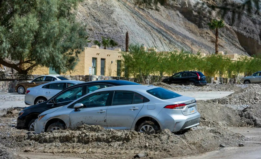
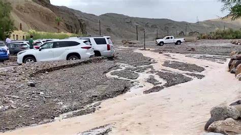
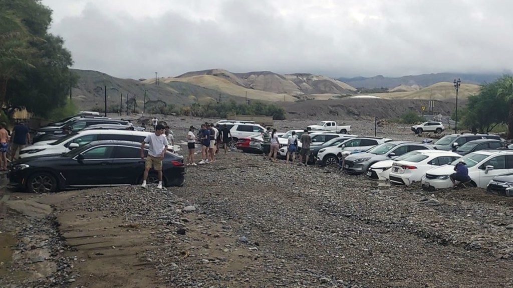
I have not done any significant road trips since I had driven across country, when moving from Venice Florida to Oregon, and then driving on up to my second home in Alaska. Knowing that COVID, politics, and inflation have significantly altered the “landscape”of travel, including how things are now done AND how much things cost, I was in for some pleasant and unpleasant surprises. I had made a reservation for a hotel in Sparks NV, anticipating it was about the halfway point. Previous to leaving, I had become quite puzzled by the routing that all of the map apps I had checked recommended (Google, AAA, iMaps ). We would be heading over and down to the east side of the park through the Nevada desert and entering the park via Route 373/127 to 190. The night before leaving, in the process of checking for any last minute information, I saw an ALERT that due to a massive flood in August, many of the park roads, even after two months, were still impassible and the park could not be entered from the California side. Hence the circuitous routing down through NV, also bypassing the northern and closest Nevada route # 374 entrance. This naturally added an extra 80-90 miles to the trip so Sparks was certainly NOT half way. I guess a few miles extra on the road is not much of an inconvenience since I was not one of those 1000 people stranded in the park with my car mired in the mud in August.

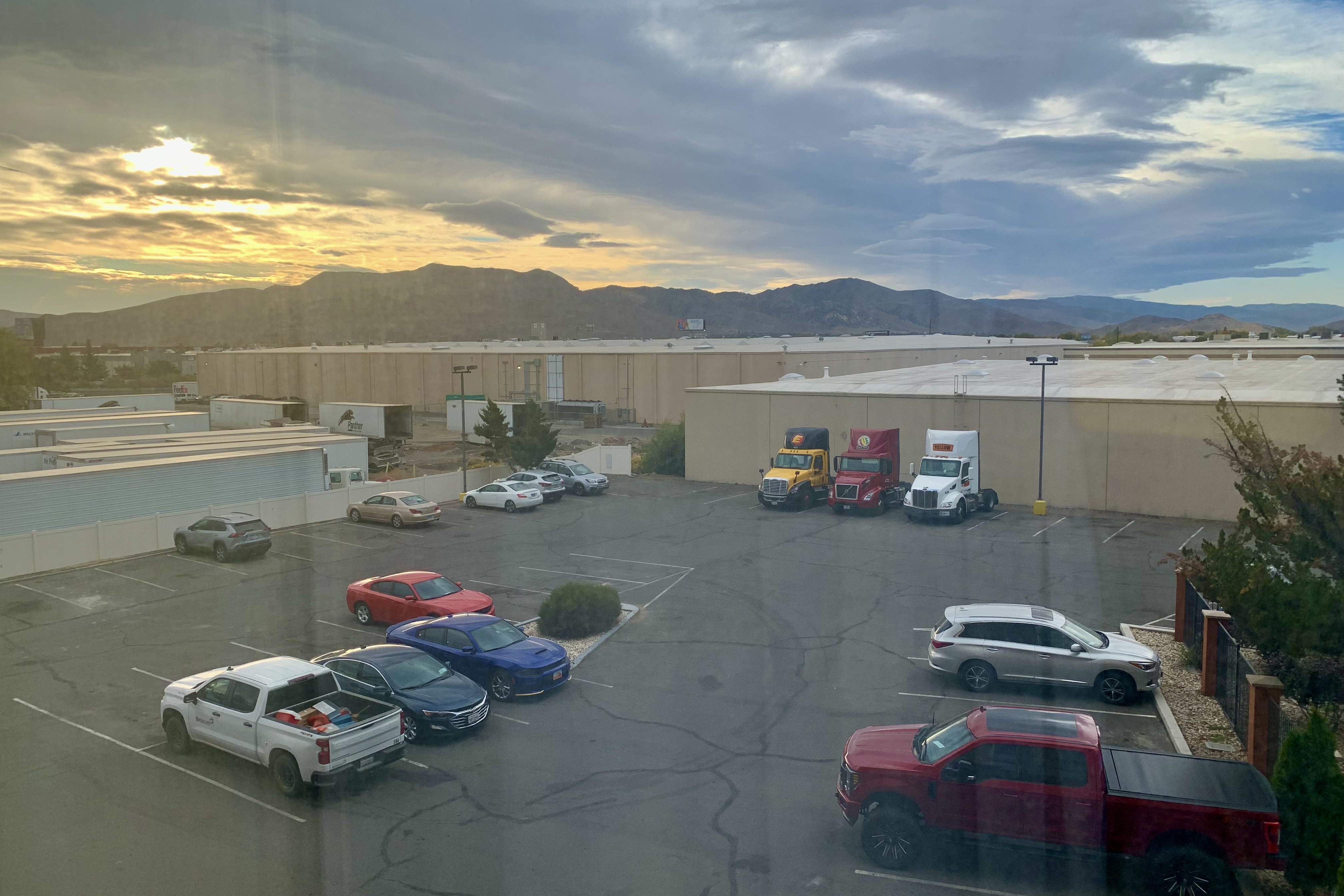
Driving day #1: The advent of the interstate road system allows drivers to tear on through the these corridors, getting a macro-view of the countryside. For many, a myriad of reasons make this a sensible choice. But I have often asked myself what am I missing out on in my rush to the “finish line.” Is not part of the joy of traveling the journey and not just the destination. So I often take all the back roads and avoid interstate travel as much as possible. Fortunately after the first 75 miles, our routing was not on the interstate corridor of I-5 with its massive volume of semi-truck traffic and on which most drivers preferring to go minimally 10-15 miles over the speed limit. Now I am not actually opposed to going over the speed limit but I don’t care to dole out my whole months retirement income on a speeding ticket so I keep to, at most, 4-7 mph over, so as to preserve my sanity. Of course even then, a fast approaching vehicles behind will find it necessary to ride my tail until the other cars in the other lanes are all done jockeying for their position to get around the pokey Subaru going 70 (Speed Limit 65mph) . I don’t find this as much on the backroads and thus I arrived in the Reno area with my nerves not so badly frayed since the trip was on the rural two lane highways through small towns. We had to succumb to the interstate near Reno, exiting at the Golden Nugget Hotel and Casino (which we definitely were not staying at) but we did not head towards that area as I would have anticipated, but turned left and were immediately in a warehouse district with a multitude of big tractor trailers on each side of this newly renovated Best Western Plus Sparks-Reno Hotel. I am curious as to how they were able to photograph the facility and not get any of the surrounds.


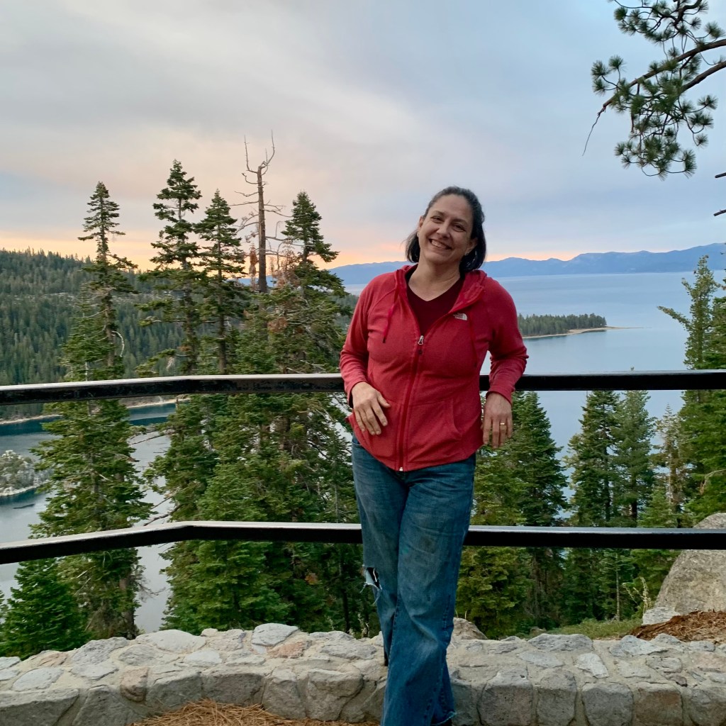
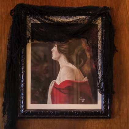
Tasia and I were not feeling motivated to either sit in our hotel room (which was actually quite nice) and admire the mural of the city of Reno on the wall (pasted above for you to enjoy) since visiting the city and casinos here was not on our dance card. Nor were we motivated to walk about and admire the big rigs in our neighborhood. So we set out for a late-ish afternoon 150 mile round trip drive to South Lake Tahoe. Having never been there, it seemed like a splendid idea but we were going to have to high tail it as we would barely make it down there before sunset. But that we did, and after a slow drive along the lake enjoying the towns and houses rimming the lake, we arrived at a high vista point with enough sunlight left to genuinely appreciate the beauty of this lake. It was definitely a worthwhile “side trip” to add on to a low mileage day (350). Given inflation, I was gritting my teeth having heard about the exorbitantly high California gas prices and it was time to fill the tank, and in a resort town no less. One of the pleasant surprises was that in most places it was actually cheeper than in our area of Southern Oregon. Of course cheeper does not mean cheap, but I found I was paying between $4.79-5.49. All of this is a prelude to my rationalization that it would not cost much to go on this boondoggle driving adventure.


Driving Day #2 : Avoiding interstate travel provides a lot of pleasure, experiencing some of the joys of the lesser roads traveled in todays world of traveling at stressful high speeds and weaving in and out between the massive piggy back trucks hauling all those Fed-Ex packages or Amazon prime purchases. So it was a pleasureful day of traveling from Sparks down to Death Valley and taking the time to explore the side “streets” of the typical highway bergs that existed before being cut off because of the rise of the limited access speedways. Its hard to fathom that the dying towns, the already deceased ghost towns, the dead lakes, and the abandoned mines which supported the towns and ghosts towns were thriving residential and commercial centers in earlier times.
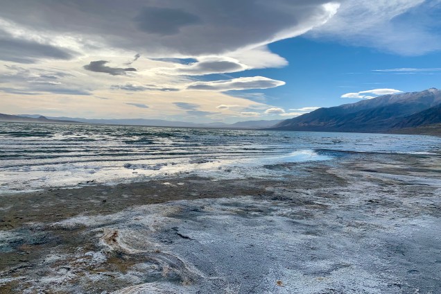
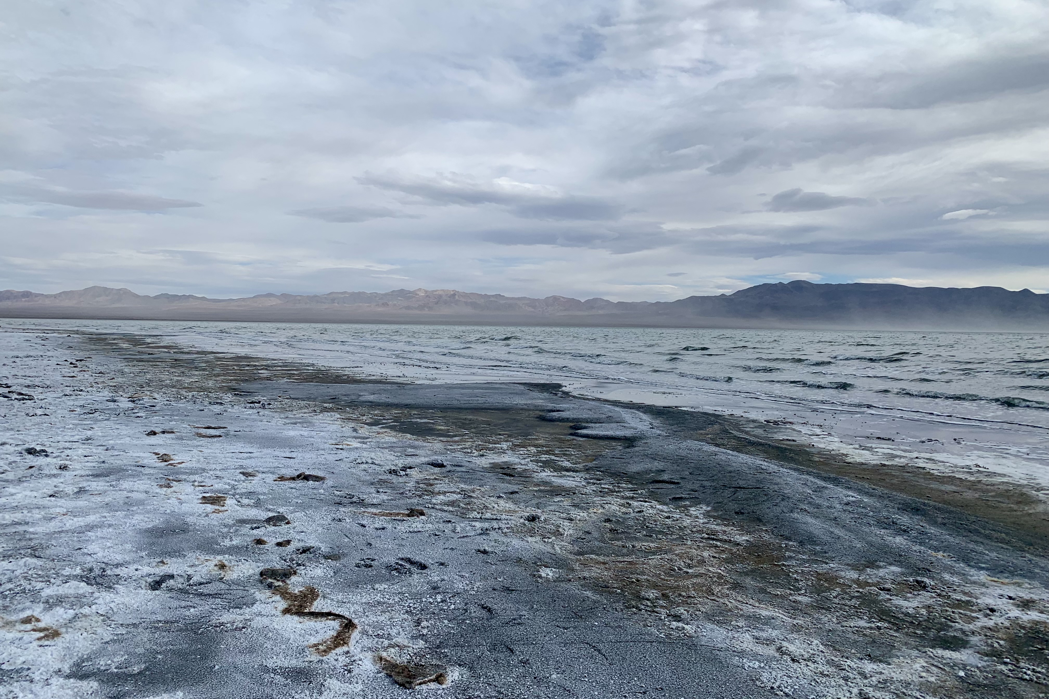
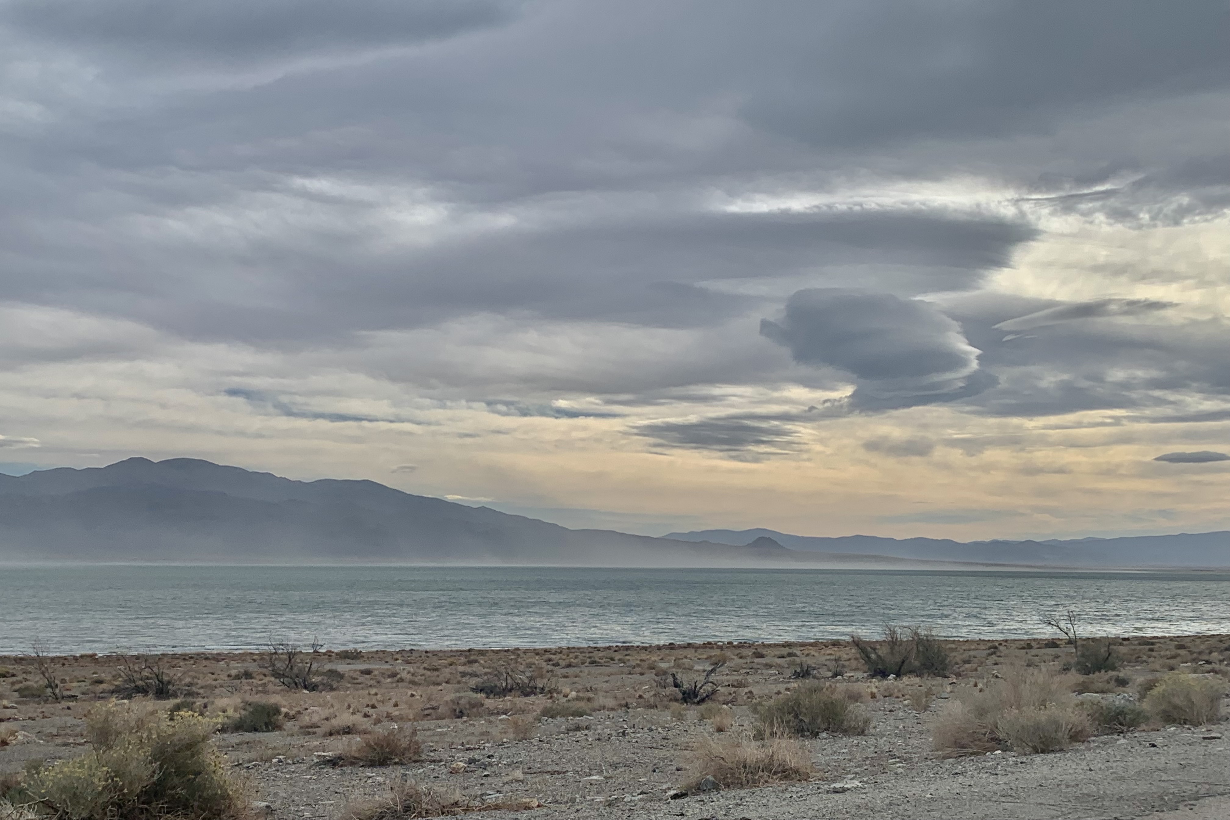
Driving down Highway 95, Walker Lake, a high desert lake, was a surreal sight in this arid desert scenery. It initially appeared to me as a mirage on the horizon as it came into view. The wind was brisk and a pulsating fog appeared on the steep rocky western shore of the lake. Upon driving closer, the mist rising off of it and the view of this ephemeral lake nestled between rugged mountains in this desert valley corridor, was quite enticing. Since I would soon need a break, I somewhat impulsively pulled off the highway at Tamarack Beach into the Walker Lake State Recreation Area. We clattered down the rutty gravel road with the dual purpose of using the outhouse ( always a crap shoot- pun intended- it was well maintained) and exploring the lakeshore. Thick slick muck covered with salt on the shoreline replaced what I thought would be a sandy beach and my shoes collected a good sample as I sunk in. I eventually proceeded to get the salty muck all over the floor of car, my jeans, my purse and anything else that got near those newly adorned trail shoes. From the lakeshore Walker Lake looked far less appealing when up close than it did from the highway. You would not know this or any of the following things from the government and local websites.


In case you are still eager to have a camping or a day outing to this lake on your next vacation, keep in mind a few of things. Timing is everything. I read that every summer the shores are infested with many many thousands of orb weaving spiders, vying for space on your campsite, intent upon attaching their spiral wheel-shaped webs too every available surface (i.e. plants, campers, picnic tables, you) onto which their sticky legs will attach. Guess they are the impatient sort because it seems this infestation is much more in keeping with the spirit of Halloween rather than infiltrating the area for summer vacationers. But since I was there the day after Halloween, I was mighty glad they vacationed in the summer. Since there are not many natural predators for the spiders anymore, with the disappearance of species needing a healthy lake, I can only imagine it will get even creepier.


This lake, is fed from the north by the Walker River but too much damming and water diversion for agriculture has taken its toll. It has lost 90% of its volume and is considered a terminal lake, meaning that the lake elevation is low and there are no natural outflows other than evaporation, aka a DEAD lake. Any water comes mostly from spring snowmelt running down from the Sierra Nevada. Because water levels have declined so dramatically, the total dissolved solid levels in Walker Lake have increased and salinity as well to the point where it can no longer support its native fish and wildlife populations. As agriculture thrives, the lake dies.
An environmental cleanup of Walker was undertaken about 10 years ago. After a removal action, a 6.5 mile fence was erected around the impact area and the northern part of the Hawthorn Army Depot. The fence is to keep unauthorized personnel out of the impact area of this historical munitions range on the land side and the second is to keep a wild horse herd from wandering onto Highway 95. So unless you are eager for the possibilities of a lake funeral, being trampled by wild horses or blown up by unexploded ordnance you might reconsider this designation.
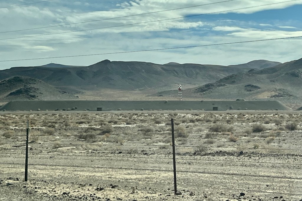
Shortly after being back on the road, we noticed that we were traveling through the Hawthorne Army Depot which stores war reserve ammunition to be used after the first 30 days of a major conflict (meaning the first thirty days are stored on ship or base) and the depot will resupply as needed. It is the largest such facility on earth. Established in 1930, the Hawthorne Army Depot continues to be a vital element to the storage, renovation and issuing of weapons, equipment and ammunition for all branches of the military. I found it a tad unnerving to know that on both side of the road there were munitions bunkers which I am sure are well secured and guarded but the barbed wire fence sure did not looked veery imposing.
Hawthorne Army Base 


Hawthorne Ordinance Bunkers 
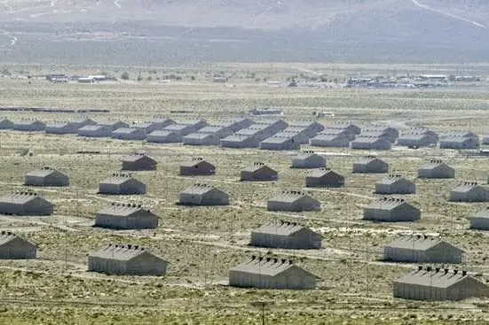
Layout of Babbit Housing
I was dumbfounded to discover that this munitions facility is managed by an independent contractor. Since it is run by civilian contractors, much of the land surrounding the depot is now deserted as the civilians and military personnel who once lived beside the post now have moved. Babbitt NV, a now-abandoned town established for military housing encompassed approximately 40 blocks and 584 duplexes by the end of World War II with all duplexes on the same 10 room plan, with 4 bedrooms, 2 bathrooms, 2 kitchens, and two living rooms. Was this perhaps the prelude to the cookie-cutter neighborhoods and the tract housing of Levittowns built after World War II for returning white veterans and their new families.

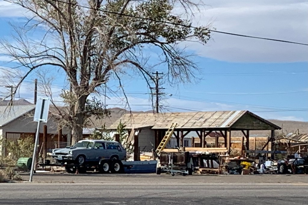
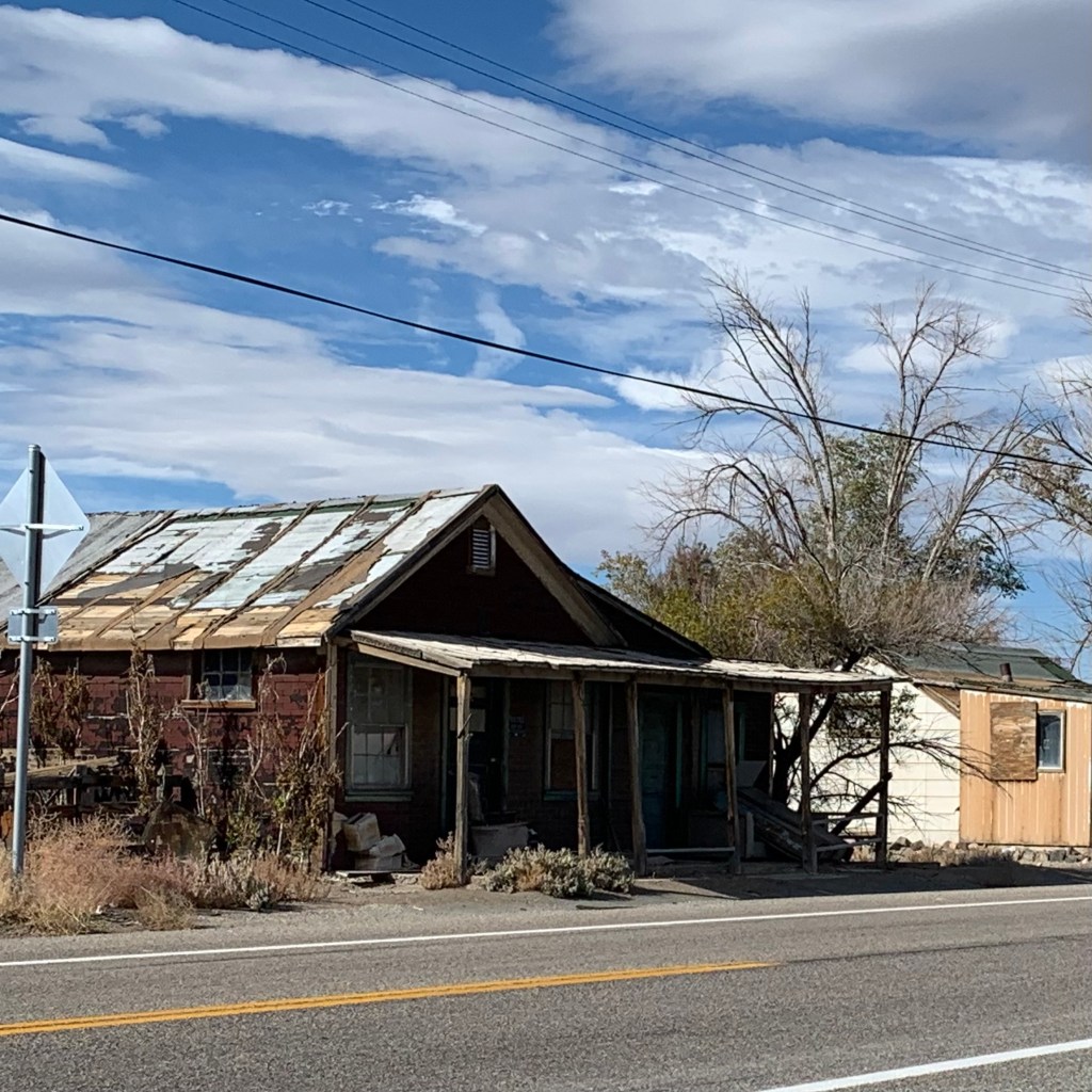
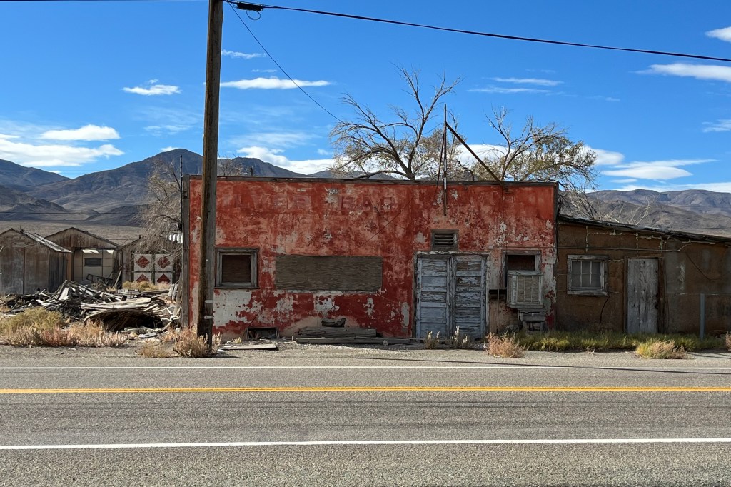

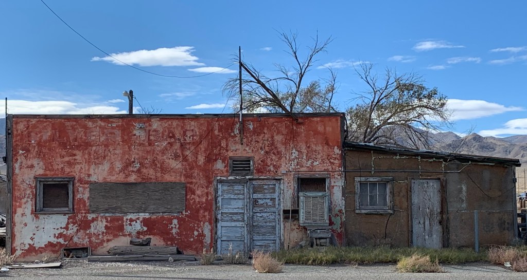
Our next adventure was the town of Luning. It’s main street – Plymire Street – is named after a long-time resident, Dr. Fred A. Plymire. After 20 years in Luning, Dr. Fred returned to California, retired there and died in 1929 at Napa State Hospital in “general paralysis of insane.” Hopefully Luning residents have fared much better, at least mentally if not economically than their patron. Luning had an active railroad loading facility for many years. Magnesium ore was trucked to Luning and transferred to railroad cars. We particularly admired the now shuttered Long Branch Saloon but were also very pleased to hear that, the news of import here was of their newly renovated public restrooms and the arrival of the internet! (Sorry, no photo of this very ordinary public restroom .) ON down the road was Coaldale, a former mining town, and is described as a true ghost town. Somehow, even though there are supposedly a few decayed structures in this true ghost town, it was about as visible for me as any ghost would be. Perhaps I blinked.
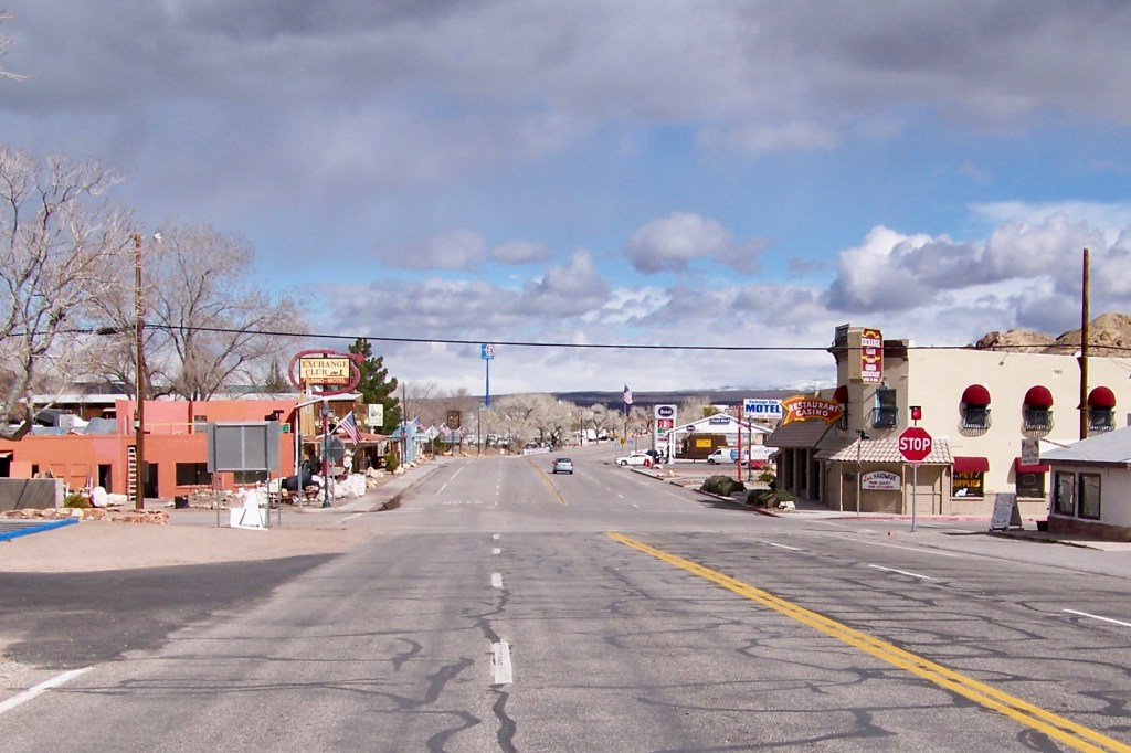
The true prize of a town on this route was Tonopah, significantly larger and a bit more prosperous looking. One of its claims is that because it’s so far from the bright lights of any major city, its night skies are considered among the best in the country for stargazing. We opted not to hang around to find out. But the true focal point here would be The Clown Motel, a Tonopah landmark and supposedly, it is quite well known, though I am not sure where! Now, if I had only known!!! It is definitely a must do should I ever return to this area or NOT. So should you decided to travel to this desolate area you just might want to spend the night here.

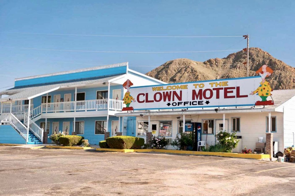
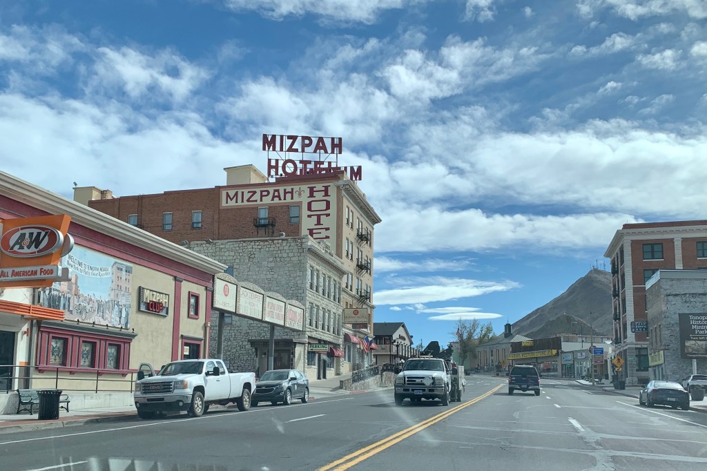
At some point (who knows when and by who) the Clown Motel was named “America’s Scariest Motel” because of its clown theme (scary, they are, to a kid for sure) and proximity to the Old Tonopah Cemetery. It is a well know fact (hmmm! to who?) that some of the murals in guest rooms will definitely give guests nightmares. Somewhere it states (https://www.tonopahnevada.com/clown-motel/ ) that The Clown Motel’s collection of clowns numbers 2,050! The other building of interest is the Mizpah Hotel. It was built in 1907 and has been restored to its former grandeur. If you choose to stay there, you might meet some spirits in this historic hotel, and preferably their resident ghost, the Lady in Red! The story goes that the hotel, which was voted the top haunted hotel in a 2011 USA Today Readers’ Choice awards, is haunted by the Lady in Red who was a prostitute that conducted her business with Mizpah patrons in the 1920s. A wealthy man supposedly killed her in a room on the fifth floor in a rageful fit when learning she was not his exclusively but had many many customers. Legend has it that the ghost of this lady roams the hotel to this day.

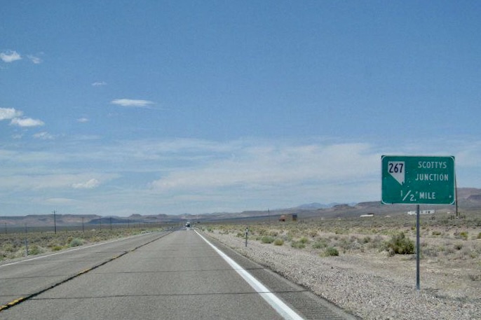
We breezed through Goldfield, Nevada (termed a”living ghost town”) and then on through Scotties Junction, a less than memorable place, and shortly we were traveling adjacent to an extensive alkali flat glistening in the sun (alkali flat, also called salina, or salt alat, a playa, or dried-out desert lake, that containing high concentrations of precipitated dry, salts ). This was “the trailer” for what we would be seeing in Death Valley.

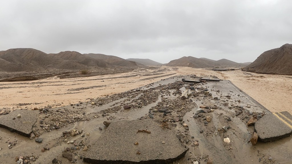
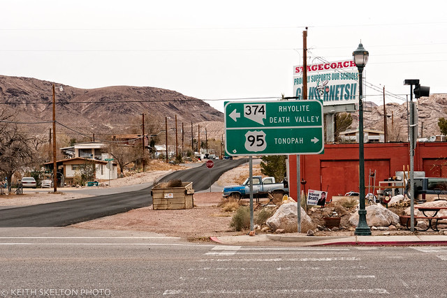
Located on the crossroads of Hwy. 95 and State Route 374, was the town of Beatty. The town considers itself “the Gateway to Death Valley National Park.” Not this year though. The August unprecedented amounts of rainfall (the park received 1.46 inches of rain at the Furnace Creek area) was about 75% of what the area typically gets in a year and more than has ever been recorded for the entire month of August. This Gateway town is likely suffering because with tourism one of its main business, it claim to be the Gateway is on hold, at least for the time with 374 closed. There definitely was none of the glitz nor the garishness I have seen at many national park gateway town and there was not anything that drew me to stay beyond the necessary pit stop and gas. I would not want to have my lodging there in Beatty and travel about 180 miles round trip to get to Furnace Creek and all the “not-to be missed”areas of the park. So unless you have a camper or plan to tent camp, your only other alternative for lodging near Death Valley is in the National Park at their very pricey hotels. We gassed up, got a few snacks and left Beatty behind, arriving 30 miles later at 373, the current Gateway to DVNP. Nothing remotely imposing here either. After another 25 miles through the Armagosa Desert and Valley, we arrived at route 190, the main thoroughfare through the park. It turned out to be an extraordinary travel day.
So much for the preface. Next chapter Death Valley National Park.
