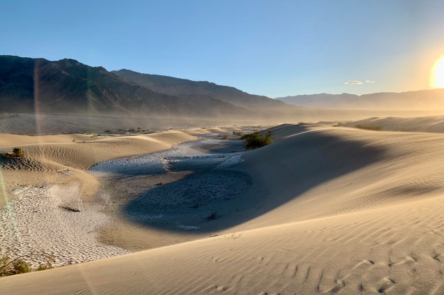
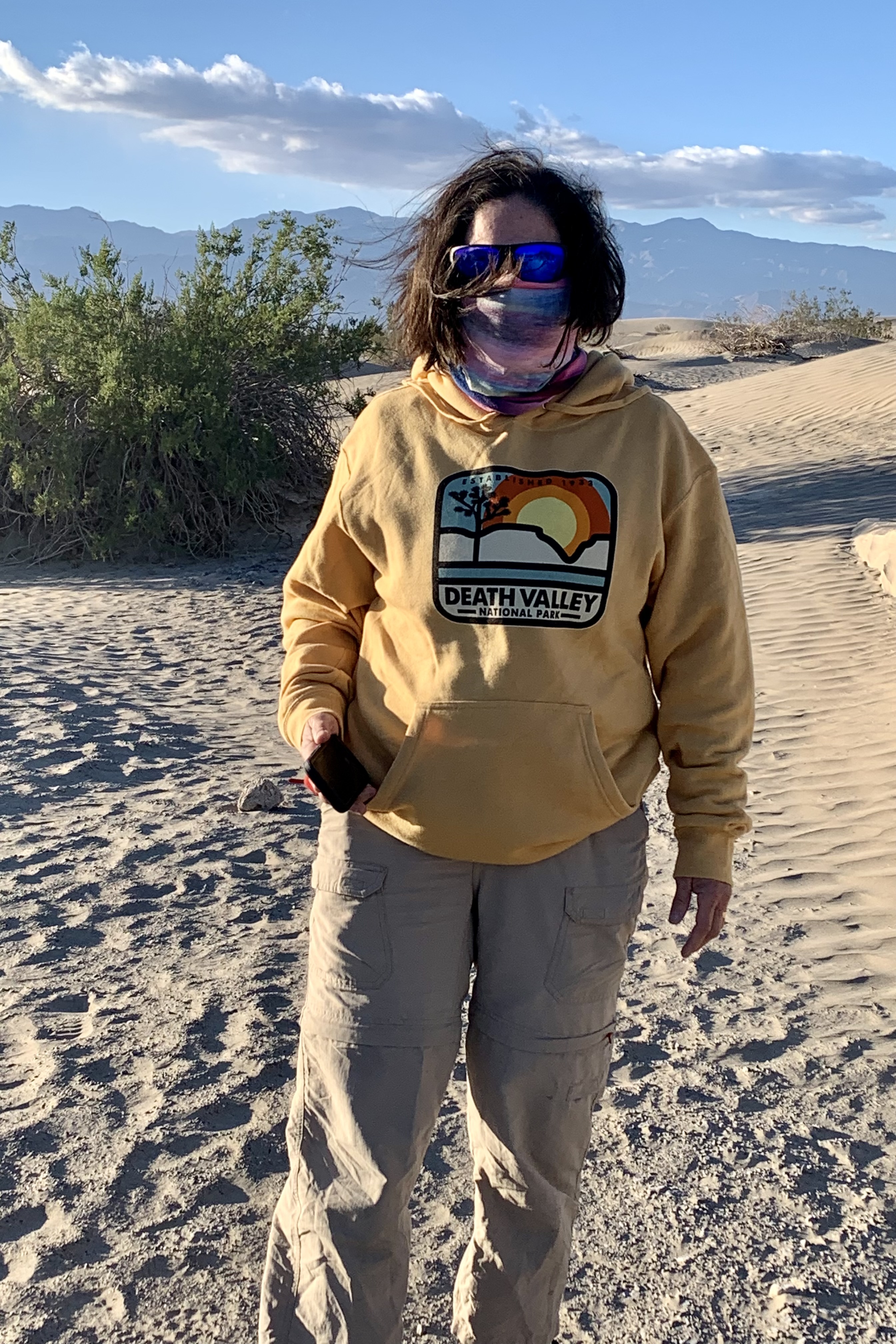
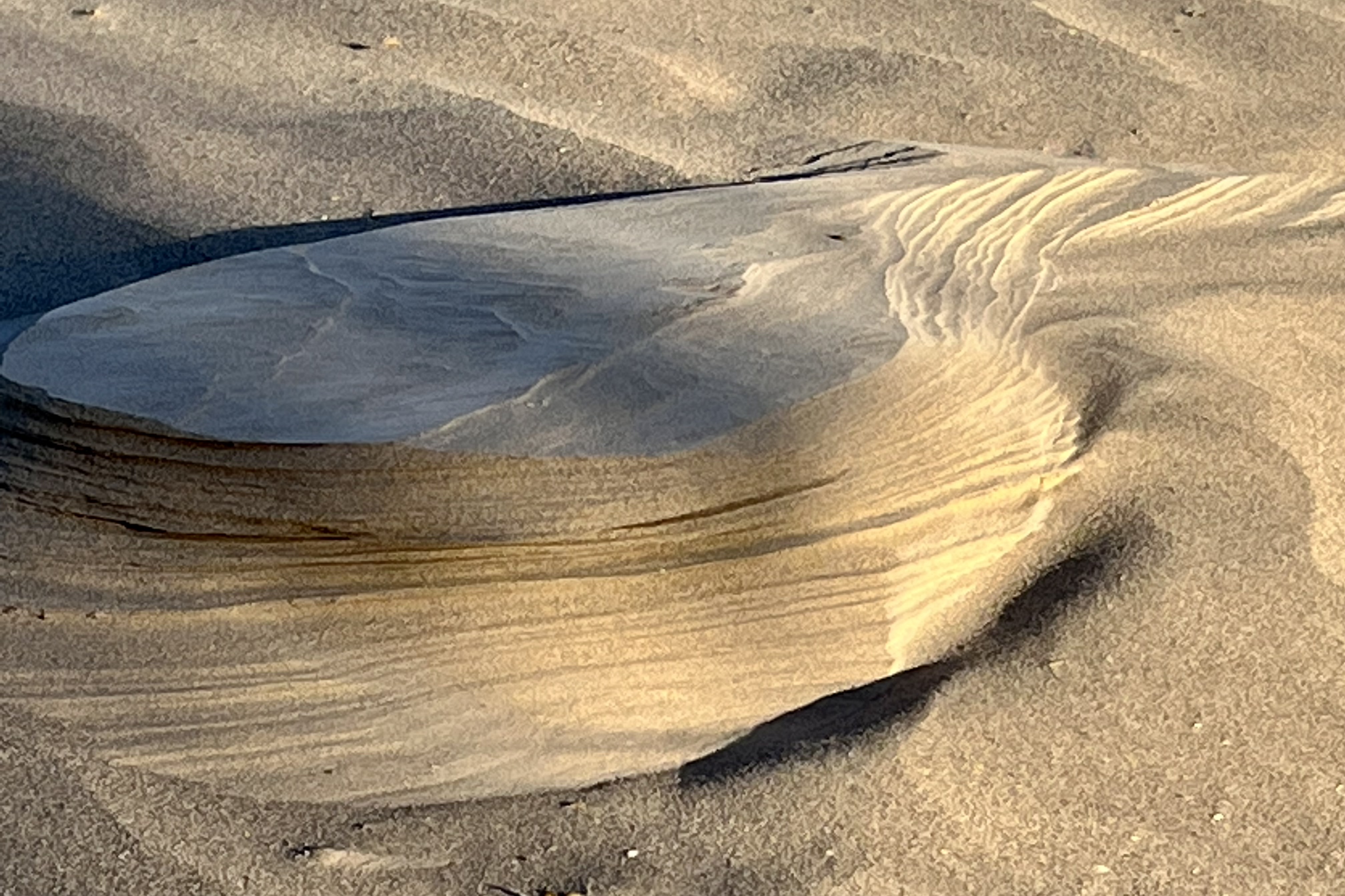
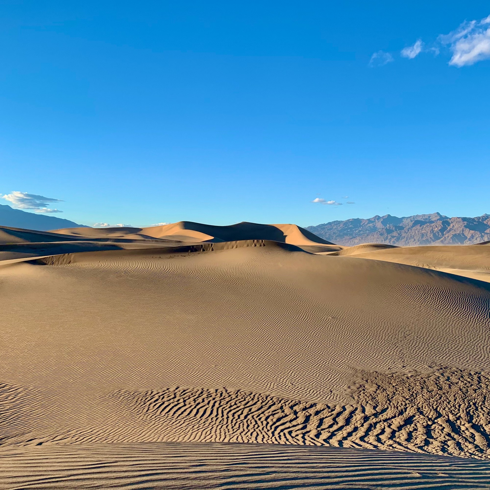
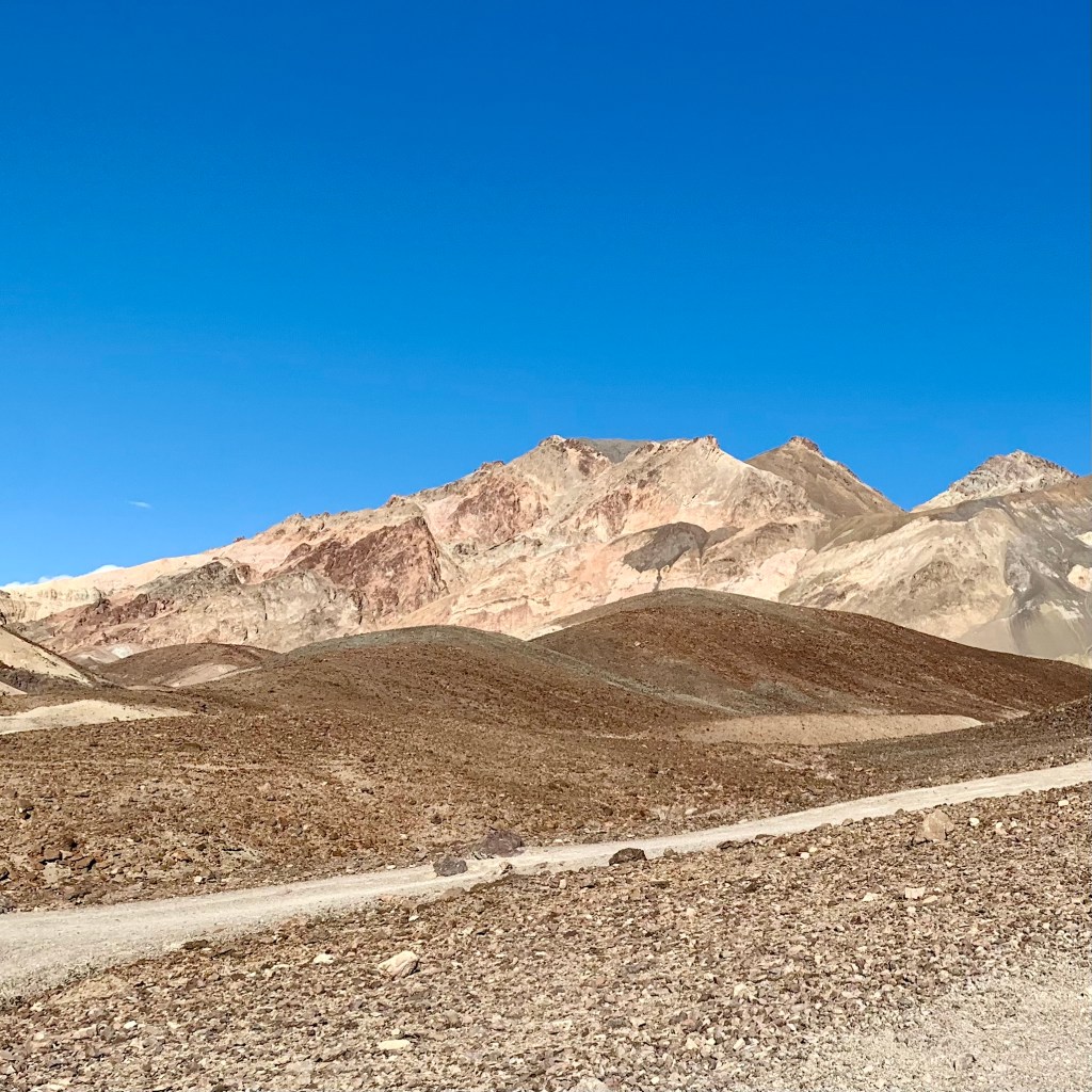
Climbing the Mesquite Flats Sand Dunes was not necessarily a must-do hike on our park itinerary but a visit of some form was a must. I know very little about “dune geography” but one can find crescent, linear and star shaped dunes here which could be readily recognized. Also of interest to me also was the fact that the dunes are named for the mesquite tree which dotted the dunes and that these trees are forced do a “ Twist and Grow” to avoid being buried alive. Perhaps this is the plant world’s slow motion rendition of what might be interpreted as frantic survival gesticulations whenever the “Twist and Shout” rock and roll hit from the early 60’s is played.
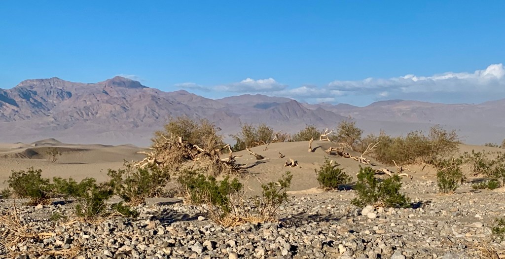
Having attempted sand dune hiking in the past, I had a hunch I did NOT want to have to work that hard and after climbing one of the dunes, that hunch was confirmed. I had no great need to be a masochist this afternoon. So after the heavy foot and calve workout needed to climb just one dune, and having spotted the highest dune (which is said to rises about 100 feet above valley floor ) and then when up there, on this adolescent dune, seeing an ostensibly endless sandbox with row upon row of dunes in the distance, I was satisfied. I did not have to do a roller coaster walk up and down the lower layers of shifting sands to reach that big “mother dune.”
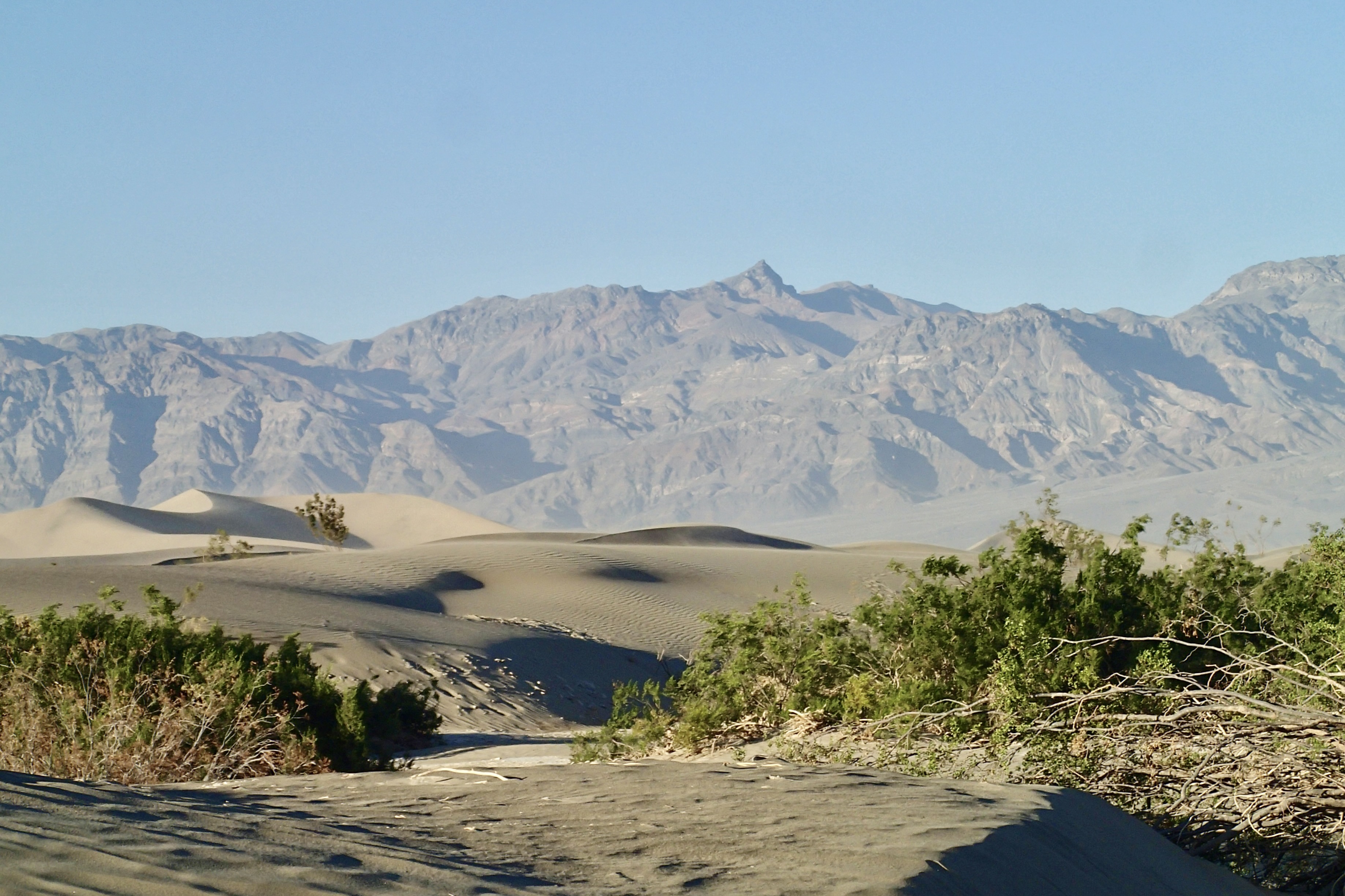


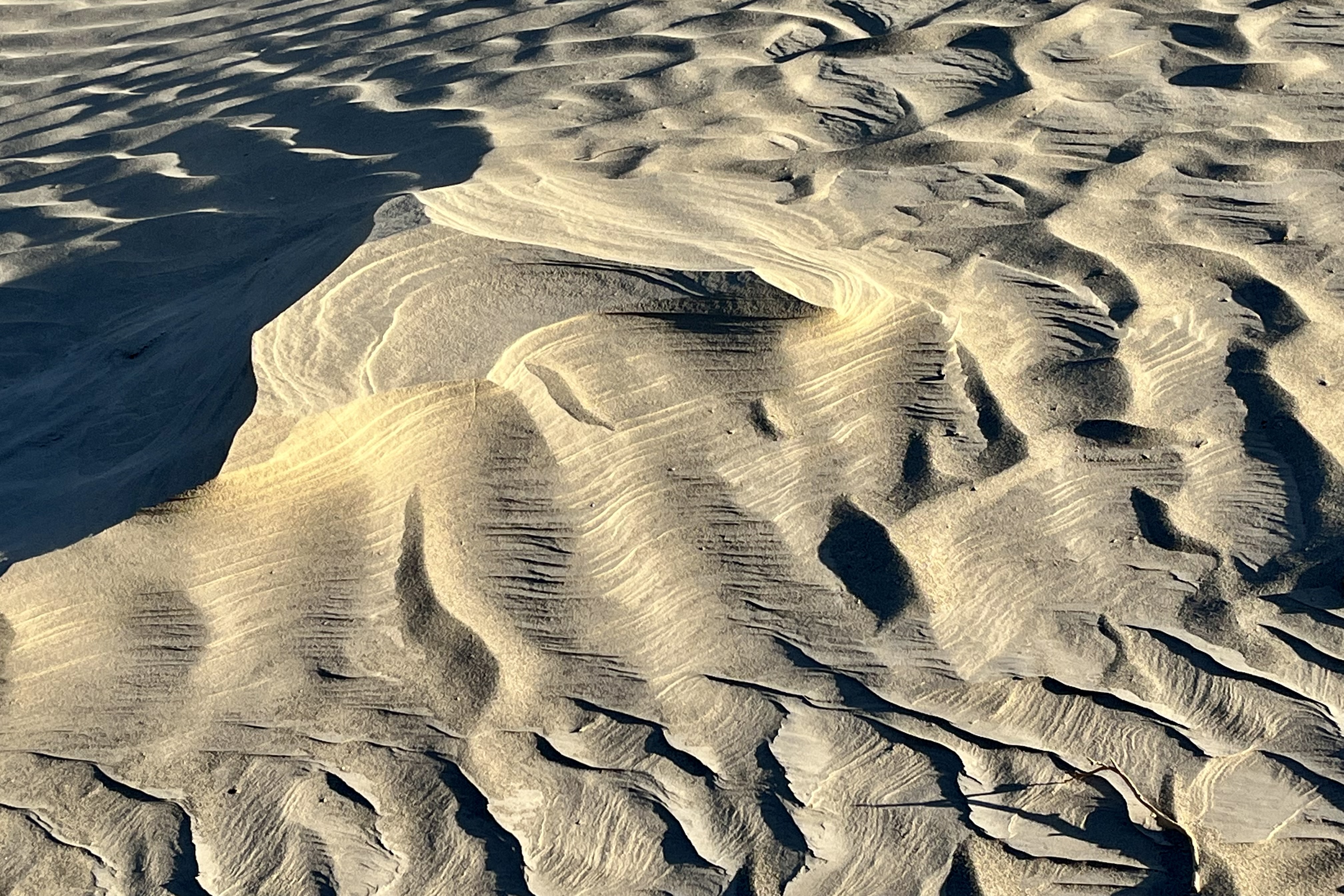
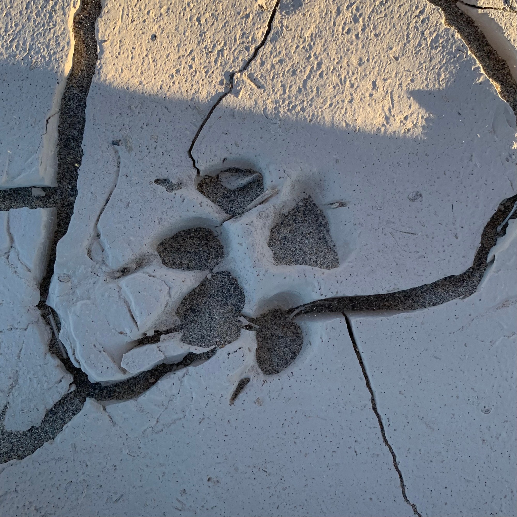
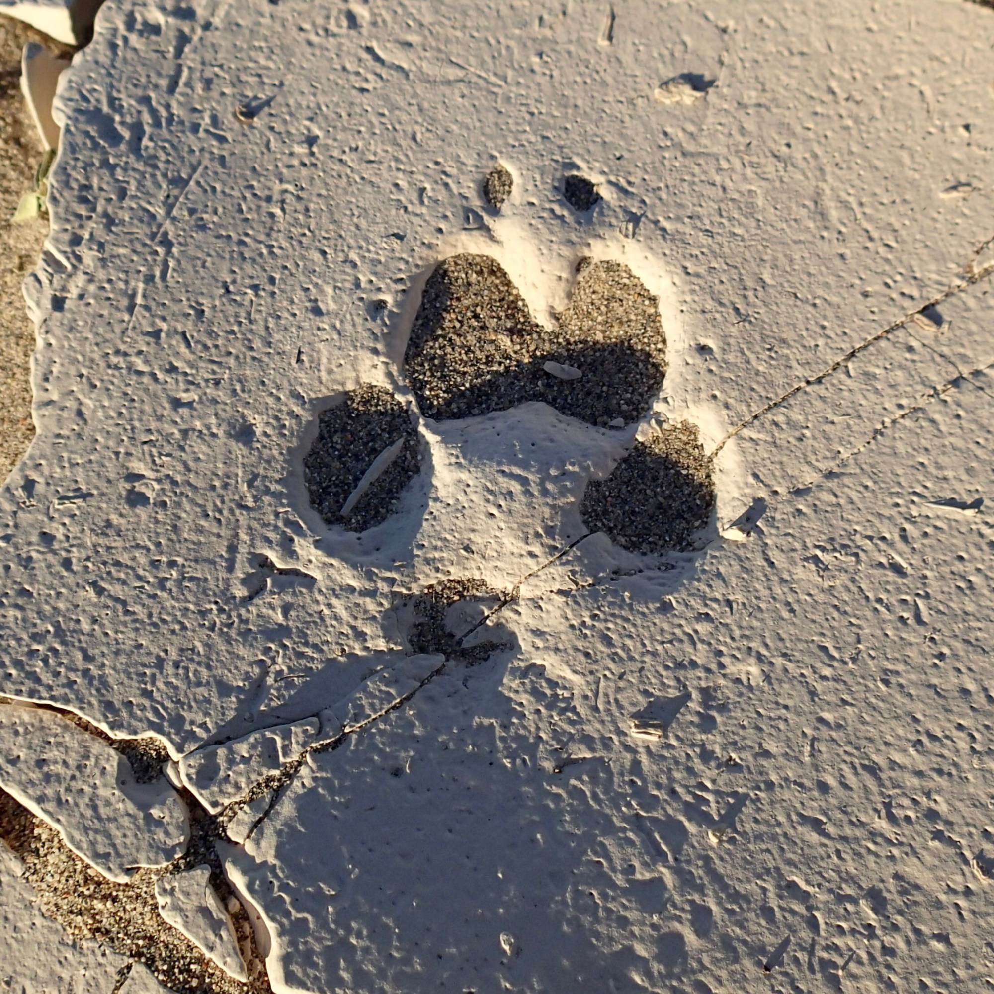
Another huge factor was the wind. In this undulating sea of sand, this day’s wind had the capacity to sandblast any exposed part of our bodies and I did not want to look like my face just had a chemical peel. Since there was no specific trail to follow and we could wander wherever our whim, or better stated, the wind took us, there was an area between two ridges of dunes in which the sand had dried and formed hard clay on the desert floor and was cracked in polygon shaped patterns. It was a great surface for a hike, and actually I found that it was a more interesting walk, exploring the multiplicity of shapes and patterns in this clay canvas, the surface pocked and pitted and littered with “shattered pottery shards. ” No hidden cameras were need to track the roaming habits of the area wildlife as many telltale tracks were cast in this sheet of sun baked earth.


Attention Star Wars Fans: Parts of Star Wars: Episode IV – A New Hope were filmed at the Mesquite Flat Sand Dunes. The Mesquite Flat Sand Dunes star as the deserts of Tattooine that R2-D2 and C-3PO crossed in this classic Star Wars film.

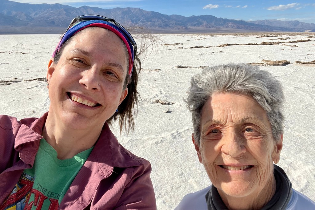
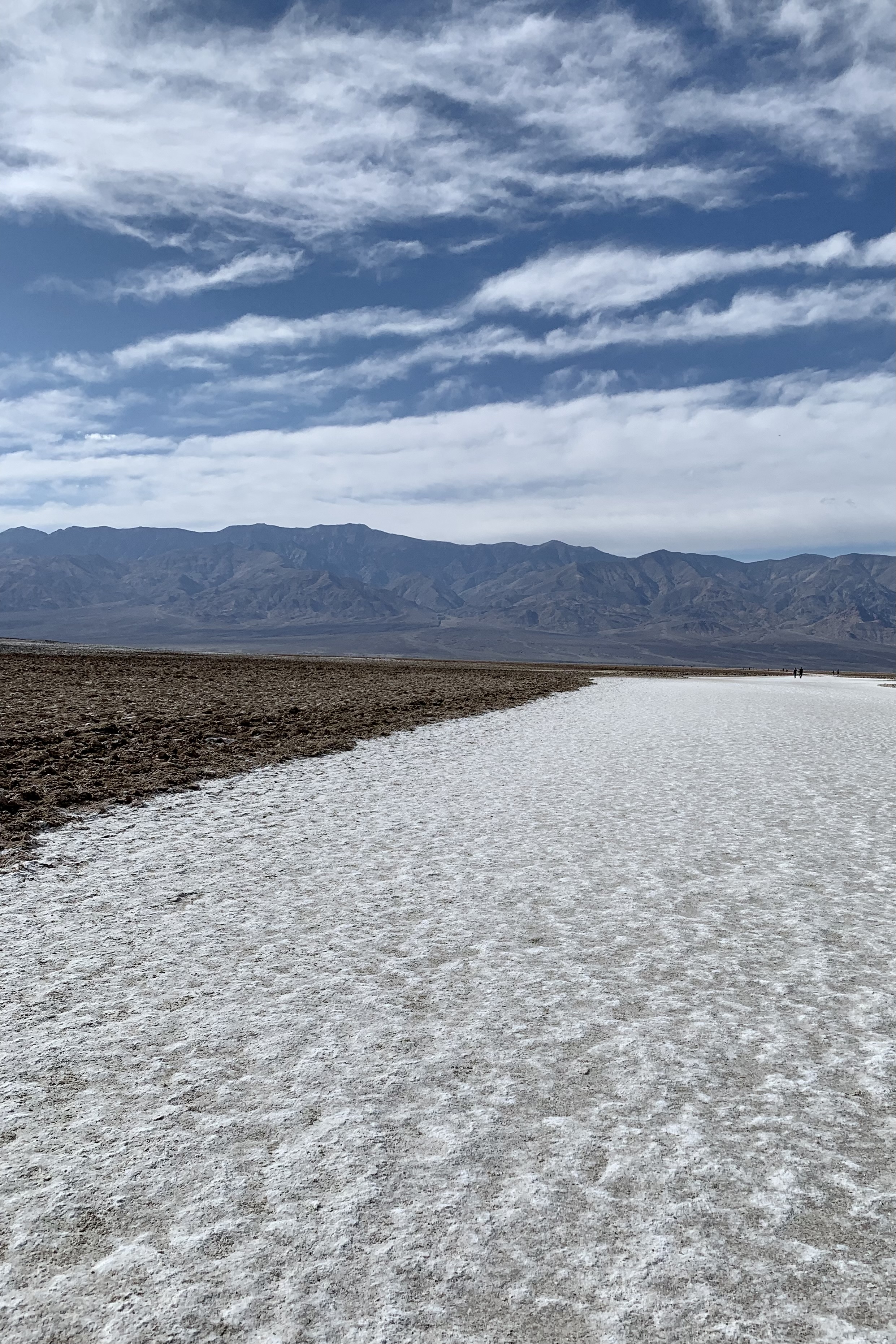
The Badwater Basin’s claim to fame is that of being the lowest point in North America, at a depth of 282 ft below sea level. We naturally had to do it just to say “have been there and done that” but I was not relishing the time of day nor the bevy of people I anticipated partaking in this must-do-hike on the Badwater Salt Flat.
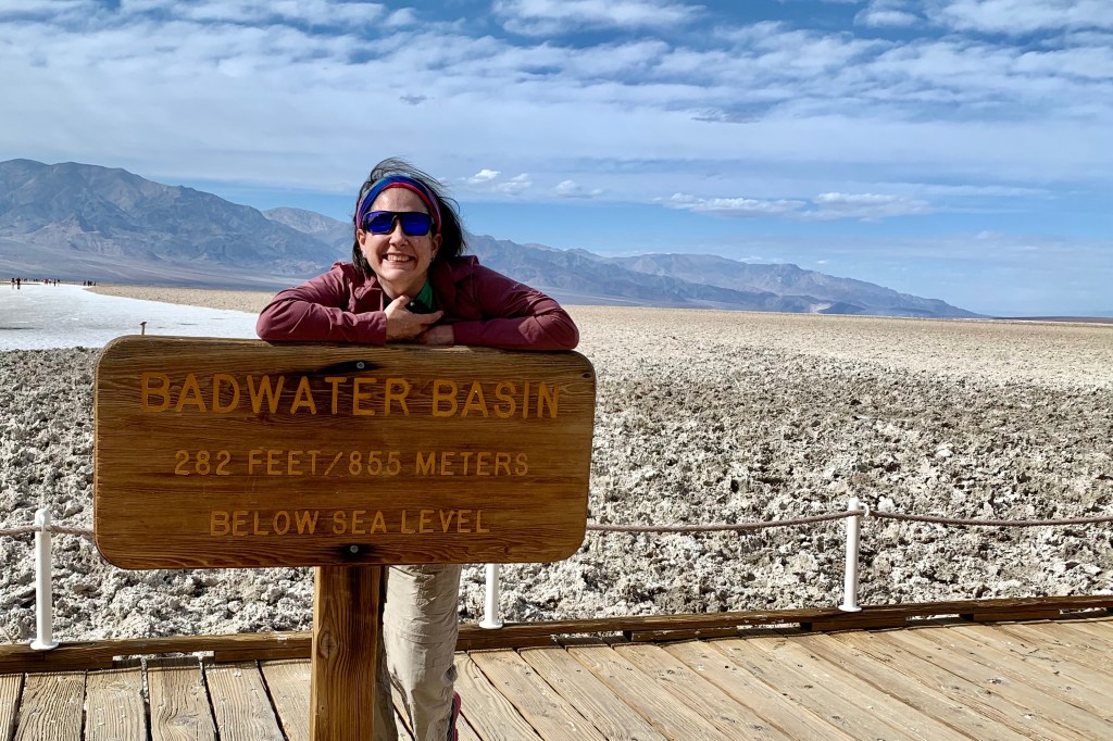
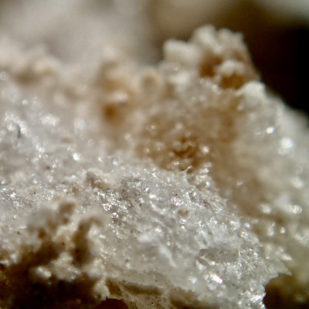
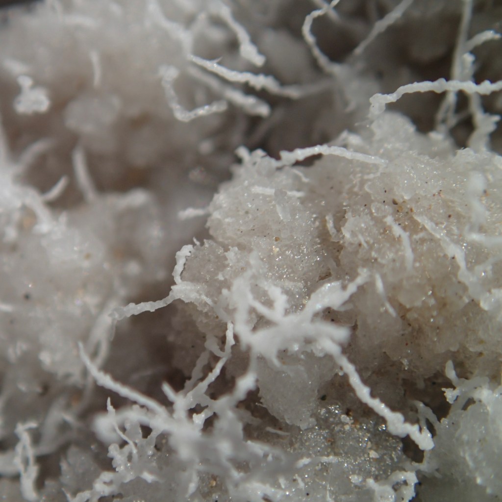
So far the park visitor population has been at this point quit low, seeing very few people on the roads or hikes. This rang true here as well. Though there was considerably more people at this easy to drive up to attraction and quite a few folks traversing these flats, I am sure, by high season standards, the sum would be considered paltry. The salt flats are composed primarily of sodium chloride, i.e. table salt, which I decided not to take any of it with me to sprinkle on my next meal as it appeared to be laced with mud in addition to some calcite, gypsum, and borax. Tasia’s pictures of the crystalline structure of the salt, peppered with calcite, gypsum, and borax made for some beautiful photographs.
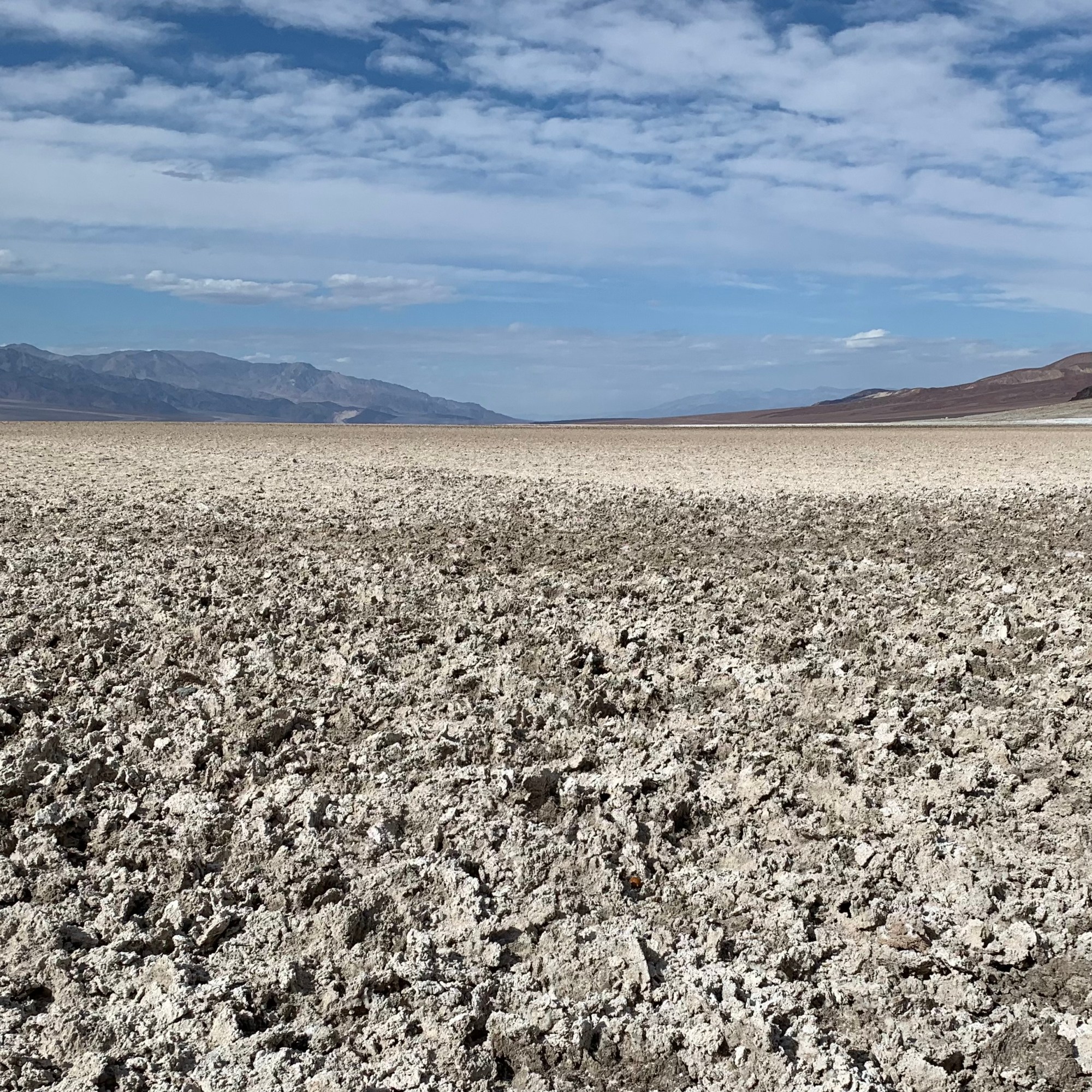
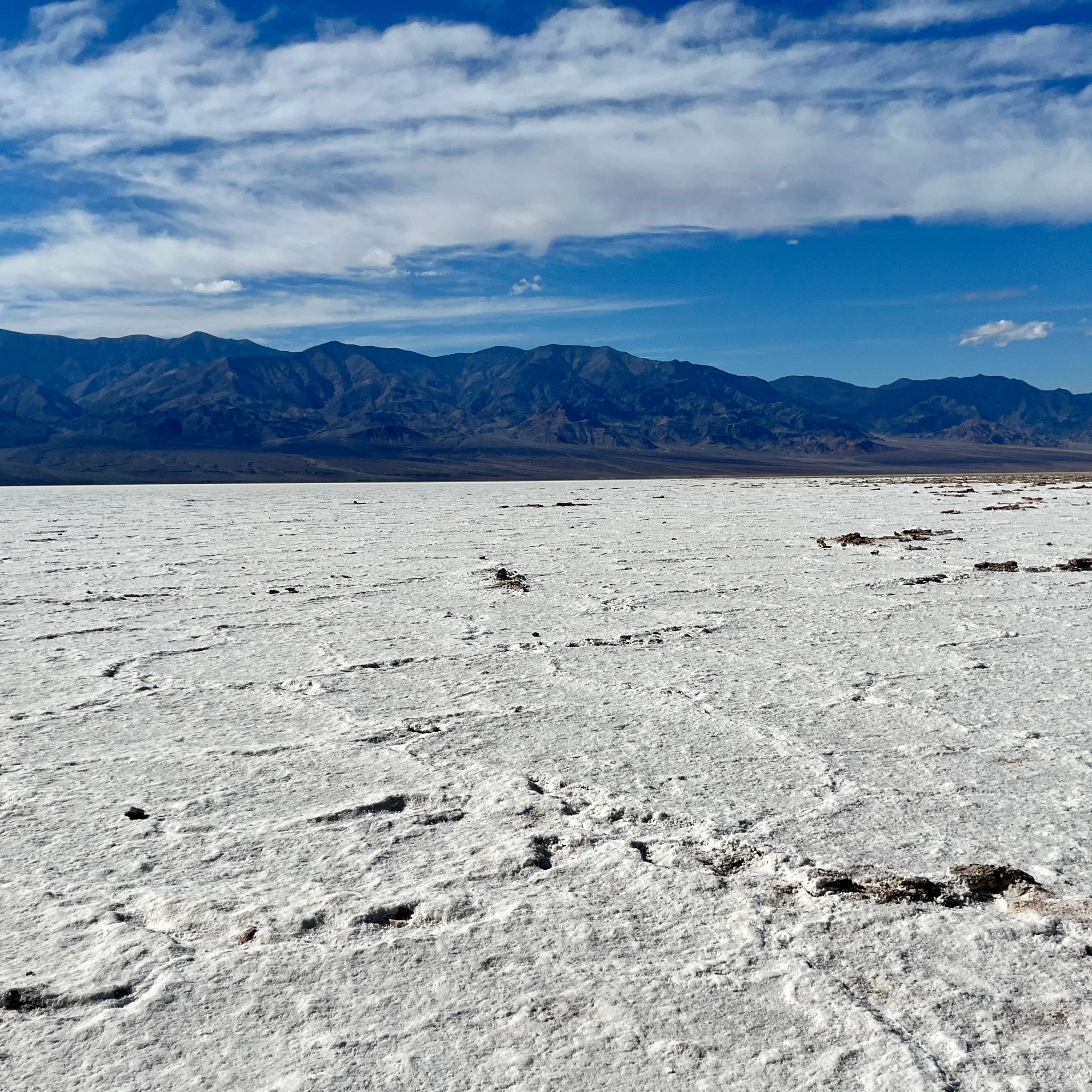


Historical lore floats the story that Badwater Basin earned its name when a mule refused to drink the water from the spring-fed pool which we could still see near the present-day boardwalk. I can’t blame that mule because I would not want to be drinking “bad” i.e. salty water. However the water is not truly “bad,” just very salty. Despite the high level of salinity, I was surprised to see organisms and salt tolerant plants thriving near there (though definitely not the oasis that we are told we deserve in the Inn at Death Valley literature.) Formerly a lake, Lake Manly, which evaporated 20,000 years ago, this area is replete with a great variety of intriguing geometric salt encrusted pentagons, hexagons, and octagons which form when groundwater rises up through the salt deposits and evaporates. It was an easy hike out and back on this smooth salt trail but much to my dismay even this surface is not safe from a graffiti generator.


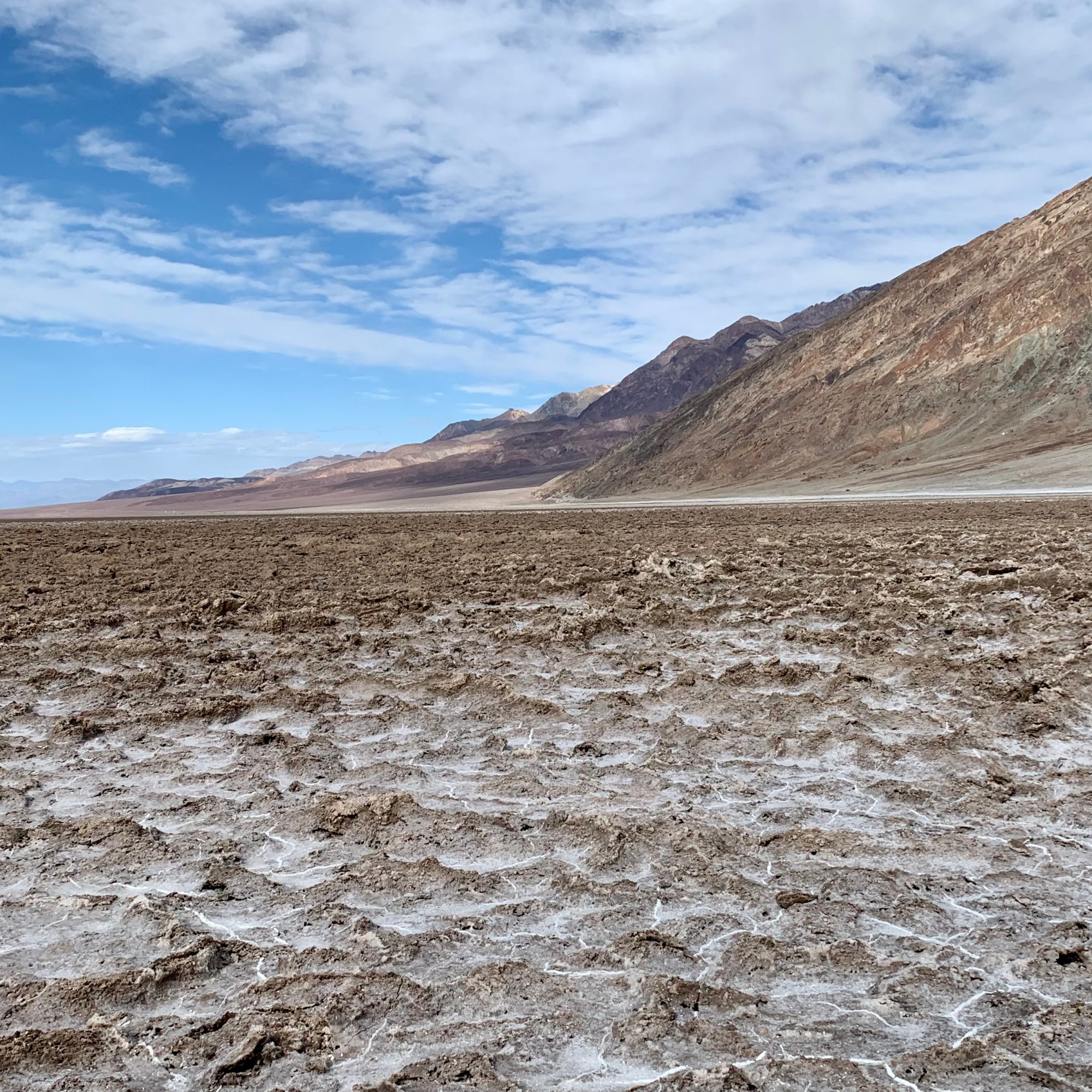
Devils Golf Course, in this vast salt pan of the valley, has been eroded by wind and rain into a sea of jagged salty muddy spires. It stated in a guidebook back in the ’30s that only the devil could play golf on such a surface.” I understand the devil metaphor as it is definitely one of the most hellish, forbidding and demonic “attractions” I have seen in Death Valley. The area is incredibly serrated so that this salt slab is extremely difficult or more likely impossible to walk on since the cones are craggy, barbed, spiked, scabrous and stick straight up. I chose each footfall gingerly, as I imagine lack of caution would result in a fall that would result in shredded skin on whatever body part made contact. Why the concept of “golf course” would emerge from any mind in this landscape behooves me to comprehend. In my wildest imagination, I hypothesized that a ludicrous possibility could be that a golf obsessed land developer actually was casing Death Valley National Park (DVNP) for a potential links there (which of course eventually happened at the Furnace Creek Area) !!!

It is definitely more otherworldly than the salt flats we traversed at Badwater ( with its miniature spires edging the well worn salt flat trail) but both are choice examples of the diversified terrains in Death Valley National Park. From a distance, the crystalline salt clusters look dazzling and delicate, but when touched I discovered that are hard and prickly. It reminded me of the jagged coral on reefs when snorkeling,

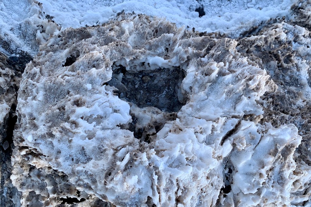

I was wondering what made these hardened mud salt encrusted spikes so much larger that those we saw at Badwater Basin. I learned that Badwater, being so low periodically floods, then dries. Devil’s Golf Course is several feet above flood level so there is not the eroding and the smoothing effects of flood waters or but I think it more interesting to think that perhaps Lucifer reigns over it protecting his territory. The pinnacles form when salty water rises up from underlying muds. The spires grow is quite slow (again a similarity to the growth patterns of coral) estimated at perhaps an inch in 35 years. Wind and rain continually sculpt the salty spires into fascinating shapes and they form fantastic, intricately detailed pinnacles. I don’t think many sculptures could replicate these intricate patterns.


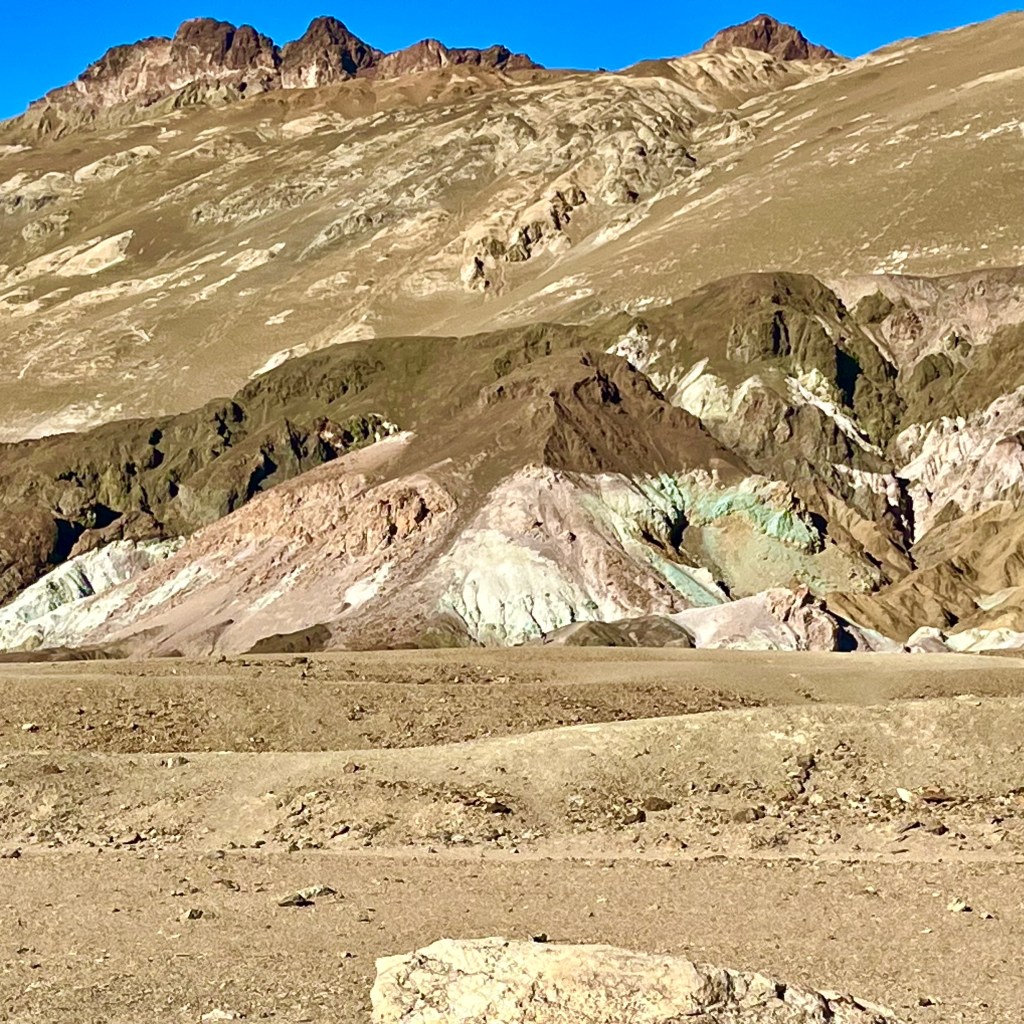
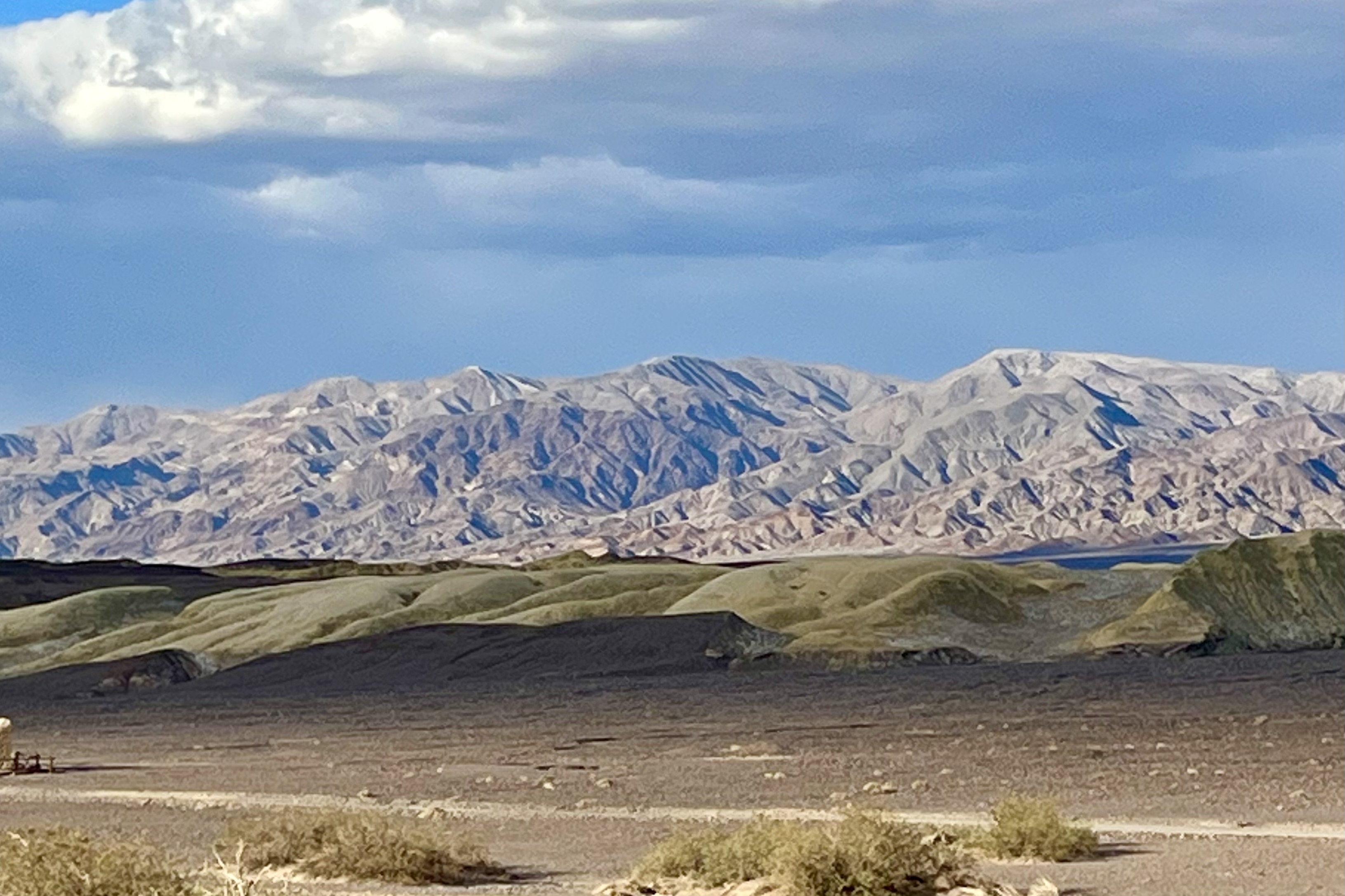
Artist’s Palette is a prismatic topography on the west face of the Black Mountains in the Armagosa range. It is famous for the natural color palette, when a very artistic Mother Nature creatively brushed the face of these rocks in pastel hues of mauve, rose, teal cornsilk, vanilla… or perhaps when Monet or one of the other Impressionists took a working vacation in Death Valley. The science however is less romantic. These colors are caused by the oxidation of different metals found in the rock formations with the compounds of iron leaching the reddish, pinks and yellow shades; the decomposition of mica yielding the greenish tints; and manganese minerals produce a lavender hue. This striking array of color is nestled into the surrounding mountains landscape which is dressed in hues of rose, ochre, and gold.
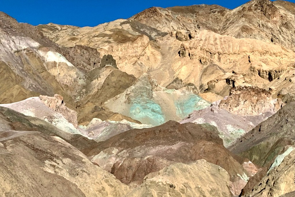
Artist’s Drive rises above Badwater Basin and then winds its way 9 miles through scenic canyons and hills. On one side, you get sweeping views into the white salt pan valley (which often appeared to me like a mirage of an elongated desert water hole) and on the other, views of the hills, delicately shaded. I enjoyed Artist’s Drive not only for it’s signature kaleidoscope array of colors but also I loved driving this narrow winding paved road through its dips and tight blind curves. This drive is definitely a trump card with its feel of riding a gentle roller coaster of dunks and hairpins. There’s not much vegetation along the drive other than an occasional creosote bush but its majesty and out-and-out otherworldly beauty made it yet another otherworldly site for the Star Wars filming of scenes from A New Hope.

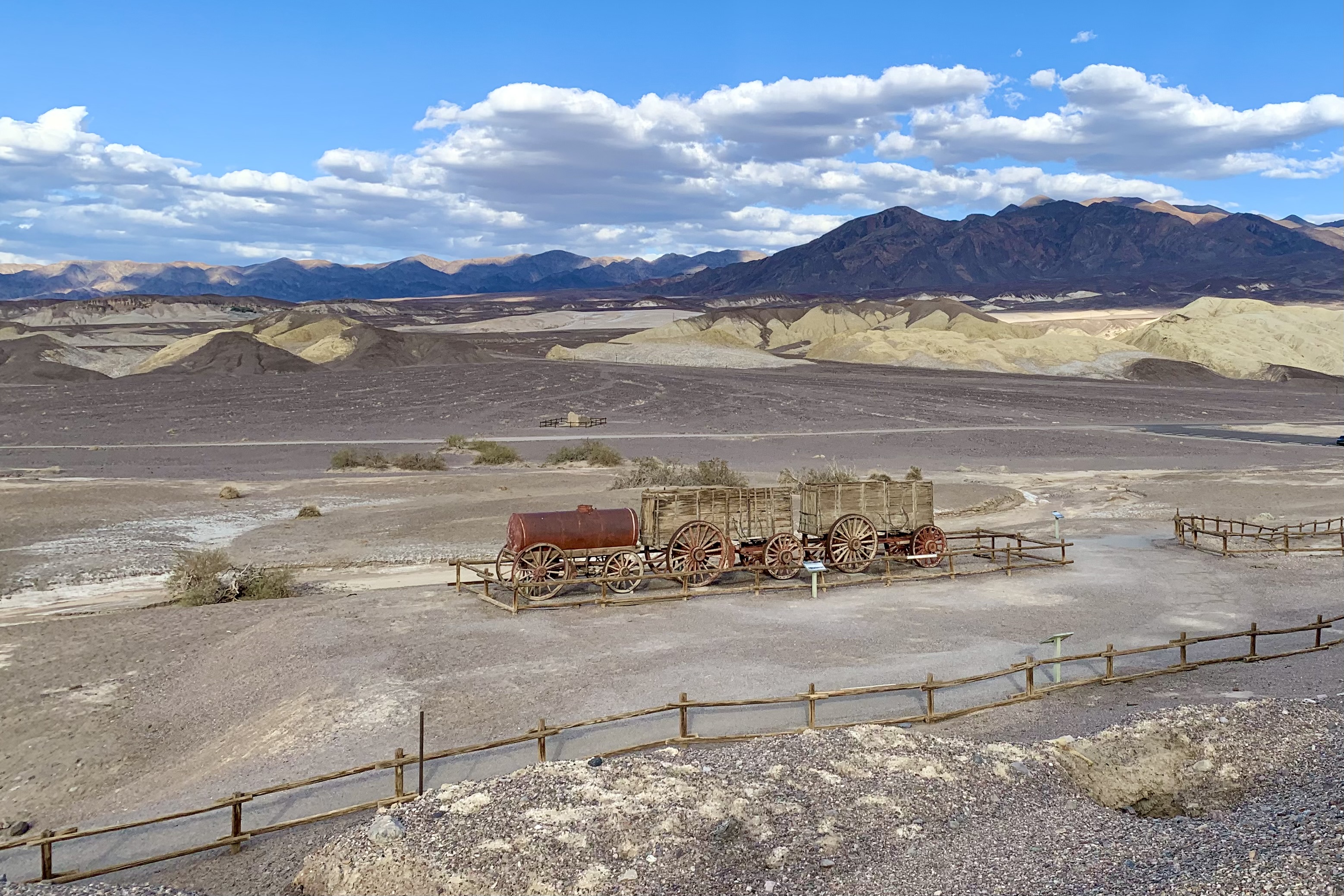
The Harmony Borax operation was big business in Death Valley. That was way back when, by some happenstance, a very clever person figured that a team of 20 mules, hitched to a double wagon, was a very efficient way to haul the mined borax on the long overland route, 165 miles to the town of Mojave. And down the road a very clever marketer floated the romantic image of the “20-mule team” (which persists to this day). I clearly remember the TV advertisements when I was just a kid in the 50’s, that became the symbol of the borax industry in this country. The round trip between Death Valley and Mojave took up to 30 days. I figure that those poor beast of burden plodded on through the desert averaging about 11 miles per day! At the Harmony Borax works, we took the paved loop interpretive trail where you can see adobe ruins and a 20-Mule Team wagon.
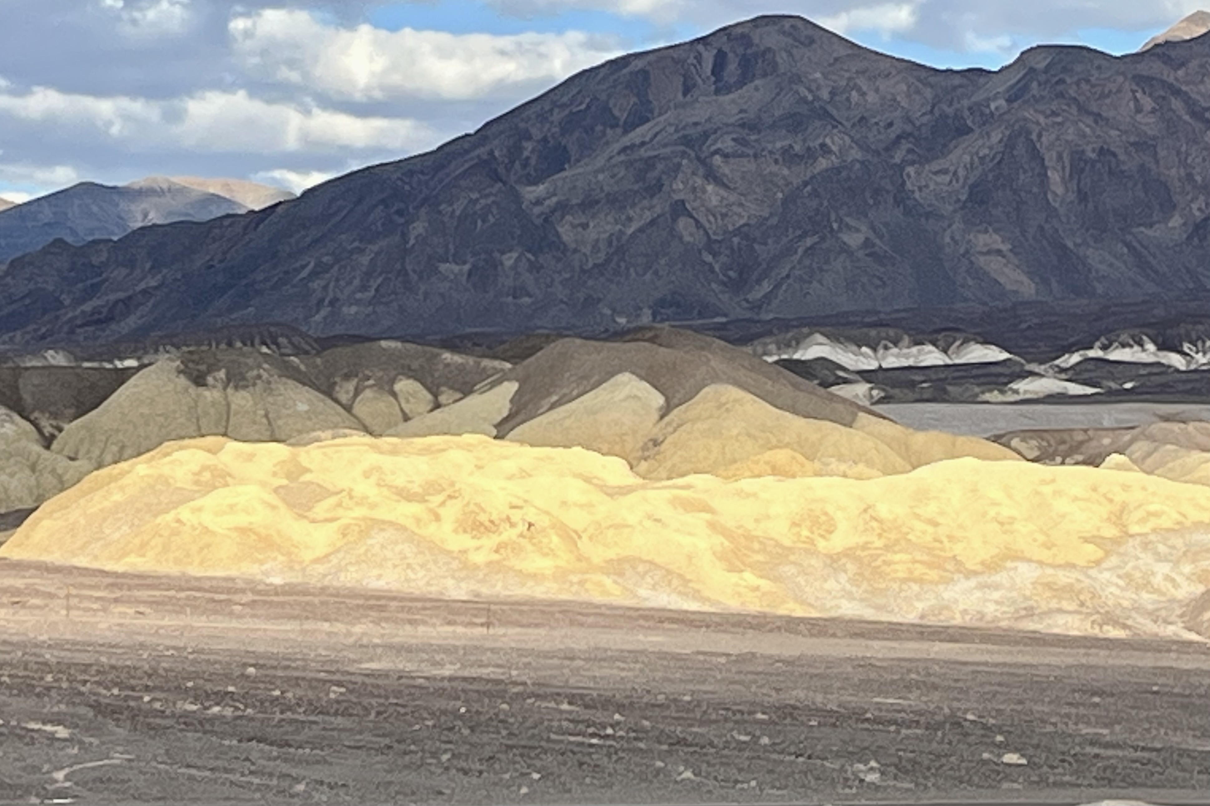
Before visiting the Harmony Borax Works we ended up inadvertently on a drive through Mustard Canyon, a dirt road in the middle of Death Valley which runs adjacent to the plain where Borax Crystals were collected. Mustard Canyon Road is lined with low-rise, yellowish, mustard-colored dirt and rock hills, colored by salt and oxidized minerals. This drive, though beautiful, was much more intense and anxiety producing than it need have been. It is very narrow road with many blind curves and since we had no idea it was one-way, Tasia was imagining that we would meeting a car head and meet our fate on every next blind curve. I offered to re-drive it once we knew it was one-way but she much preferred to live with her anxiety hang-over.

The 20 Mule Team Borax – Death Valley Days Classic TV Commercial https://www.youtube.com/watch?v=qC0H6mPyfZA
