 Tuesday July 23rd: It seems as if I have lost my knack for a quick camp break down. Of course I did choose to dawdled over my Starbucks Via and oatmeal — not exactly gourmet but on a sunny brisk 49 degree morning in the woods it was quite scrumptious. Though awake by 5:15 we were not on the road until 8:45. I wanted to stop by park information center and store but came to discover it did not open until 9:00 am. So it all worked out well since this was the only area in the park that had cell service and I could complete a couple of calls. The drive out on Cascade Loop Highway was a rerun of the lovely drive going in and then it was onward north to the border and British Columbia! I probably have used my speed control 90% of the time and been following the posted speed. When I checked my review mirror driving through the US border crossing towns of Lynden-Aldergrove, I saw those ominous flashing lights behind me – so I pulled over and so do the flashing lights!!! How ironic that I get pulled over for speeding the last day before I leave Florida, the east and southern embarkation point of my journey and just a couple of miles from home going 45 in a 30 mile zone AND here at the very border of this country in the western and northern most point before I cross into Canada, I get tagged for going 43 in a 25 mile zone. Now I have NOT changed my driving habits one iota so I would bet money that now that i am driving a bright orange Jeep, Lady Spitfire, I am a clay pigeon for cops. In neither case did I get ticketed fortunately (I imagine they don’t expect to find a gray-haired 74-year-old lady driving such a flashy car!) The officer did admit that the speed charge was quite abrupt and though I was slowing down I clearly didn’t slam on the brakes fast enough. So a few hundred yards ahead was the border and after all my fussing about getting the right rabies certificates for the dogs, the agent didn’t even bother to check them.


I got on the TransCanada Highway 1 east at Abbotsford to Cache Creek. Disappointingly, the first part of the drive, could have been any place USA (or Canada) except for a few more Tim Horton signs at interchanges. It was a limited access 4 lanes highway up to Hope BC. I “towed the line” not knowing if there was any wiggle room before police officer will stop one for a ticketing in BC. Thank goodness my speedometer could be switched over to kmh. There I split off heading to Cache Creek. Before long I was sailing along at 110 KM (legal) and the scenery started popping, mile after mile through the Cascade Mountains. Many mountain peaks rose 2000-3000 meters above this two lane well maintained road, climbing and descending and rounding many curves— beginning with the Fraser River of Fraser Canyon. Because of winter damage to so many of the roads, this day began the first of many delays for road repair. Fortunately none of delays lasted more than about 10 minutes.


The mountains seemed to have significantly more varying shades and appeared to be based more of sandstone than the US Cascades. As I drove farther north, the height of the range diminished and there was a wider valley and some minor peaks. The route followed the Fraser and Thompson rivers and I was quite taken aback when soon the vegetation in the area began to look more like desert with the temperatures in the low 90’s. This is not the British Columbia I envisioned. This whole area was arid desert with sagebrush and other typical desert vegetation. I later found out that Cache Creek had been described as the Arizona of Canada with hot dry arid summers cold dry winters. I enjoyed the views of the Canadian Pacific and Canadian National Railway tracks and could see many trains snaking their way through this valley.


I traveled via British Columbia Hwy 97 north to Clinton and headed down a 20 mile gravel road to Big Bar Lake Campground. I had made a campsite reservation without fully realizing the length of the gravel road. I soon realized after a bit of teeth jarring and fish-tailing, this road would not allow the speeds of an asphalt highway. The anticipated arrival was about 45 minutes later than I would have guesstimated. Try as I might to pick up the pace, it became harrowing on the curves and skiddish on the straight-a-ways, so I settled into the posted speed of 35mph give or take 10-15 mph faster. In fact I thought I did recklessly well by doing it in half-time. I was extremely grateful that I do not wear dentures as I am sure they would have been jarred loose on this washboard gravel road.


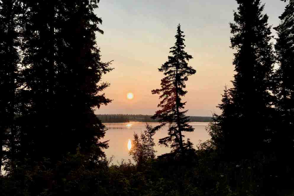
I thought I had a lake view campsite but the number I had written down was only a partial view (#12.) It was not a bad site but after setting everything up and having dinner (and battling the pest of the day in the form of mosquitos) I came to find out that I took the wrong tent site (the one I had a very hard time finding) and indeed should have been on the best lake side site. As nice as it was it wasn’t’ worth the effort of moving tent and all the gear! A sunset walk by the lake was a peadful and soulful way to wind down this day.
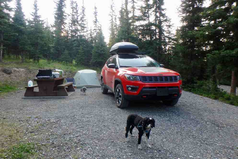


I quickly found out that sometimes the good old-fashioned paper maps and a hard copy of reservations and itineraries etc. is a very good idea. Since everything was on my computer and the documents only accessible through the Cloud from my iPhone or iPad, I was out of luck knowing where I should be when there was no service — which is most of the time in these nether regions I am traveling through. Nevertheless despite no lake view we slept well!!
