Deflating Tires, Corduroy Roads, and Powerful Pinwheels

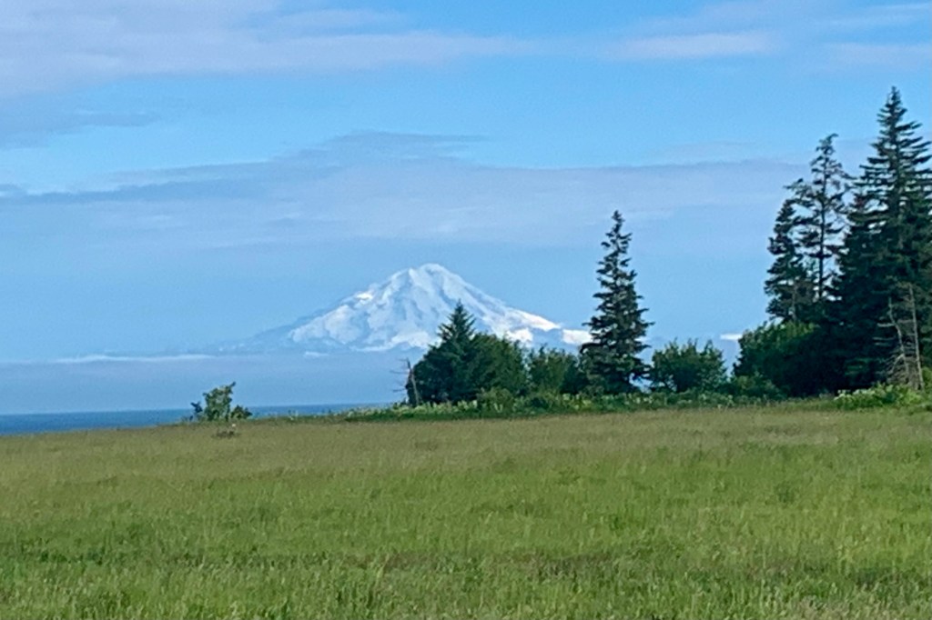
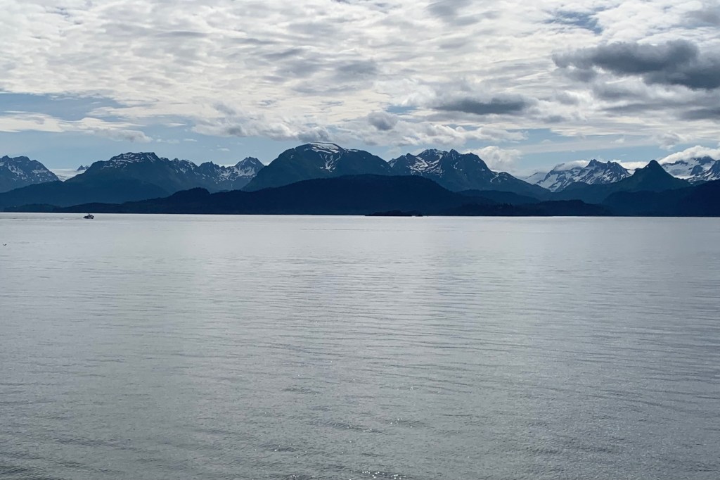
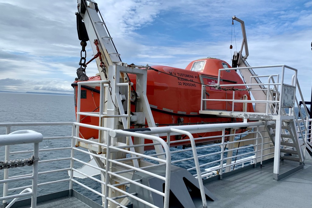
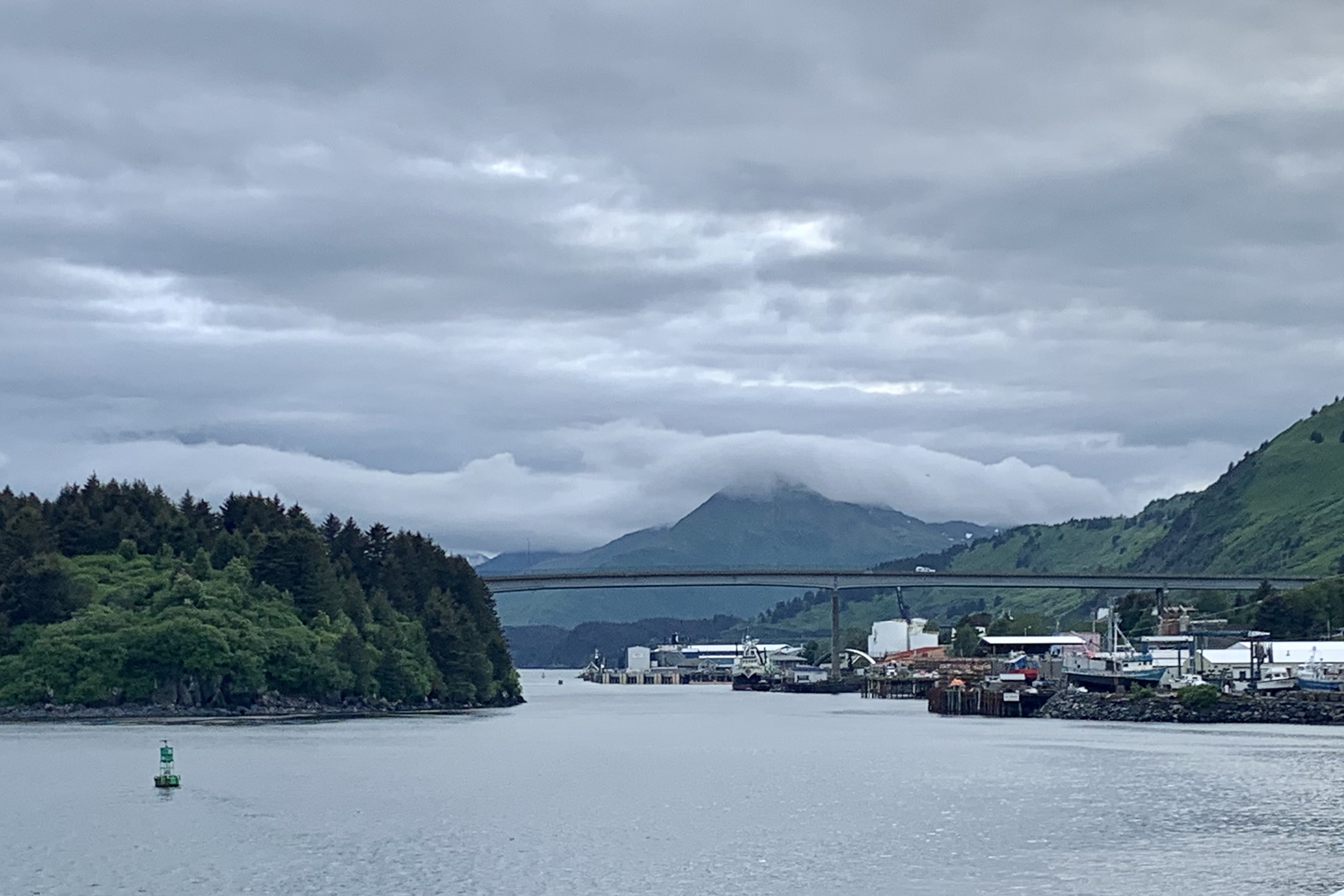
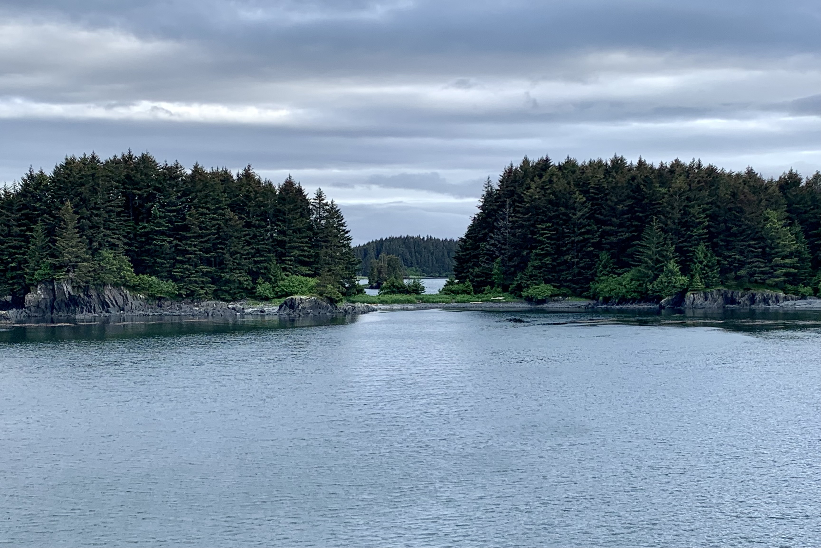
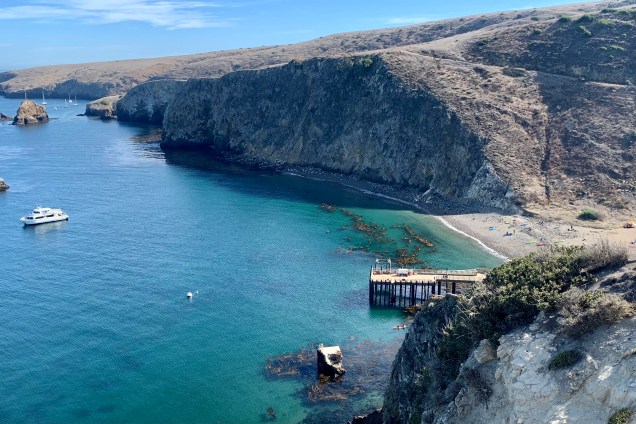
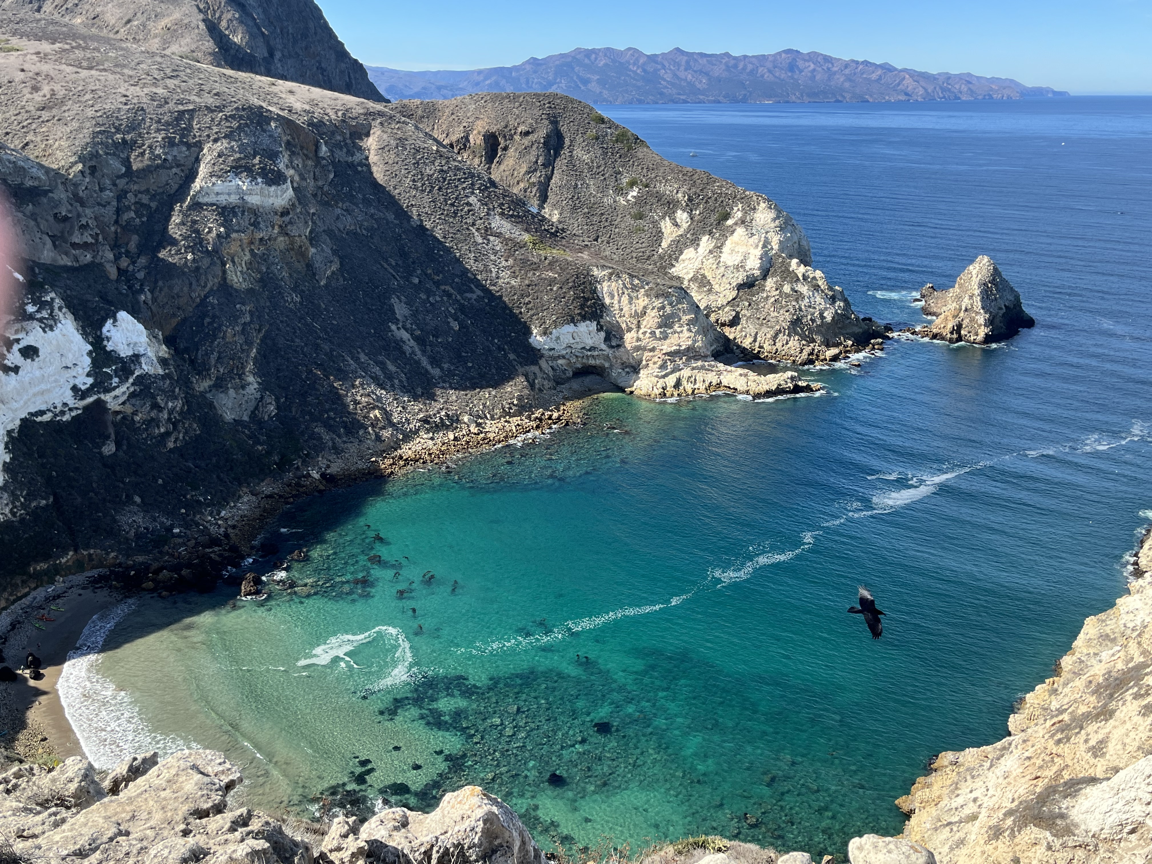
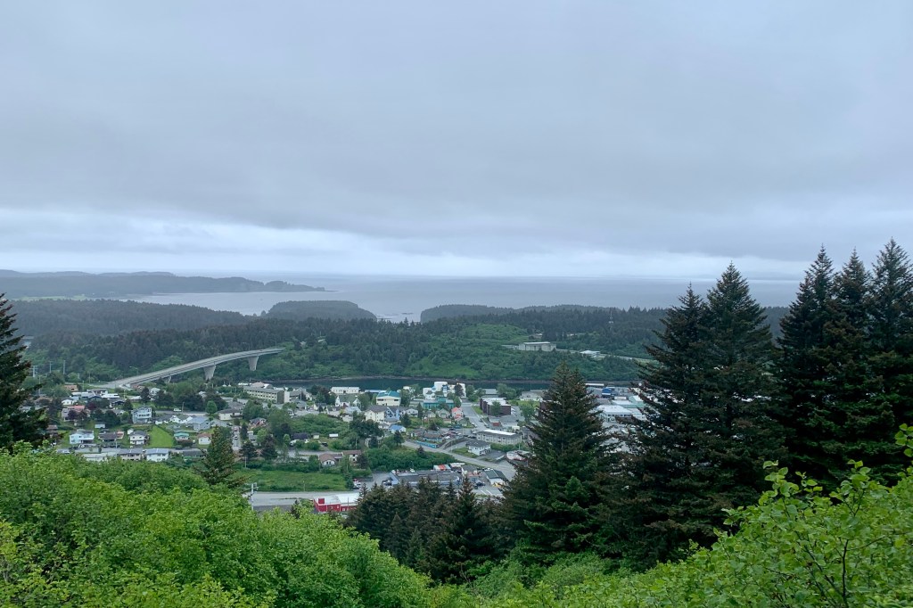
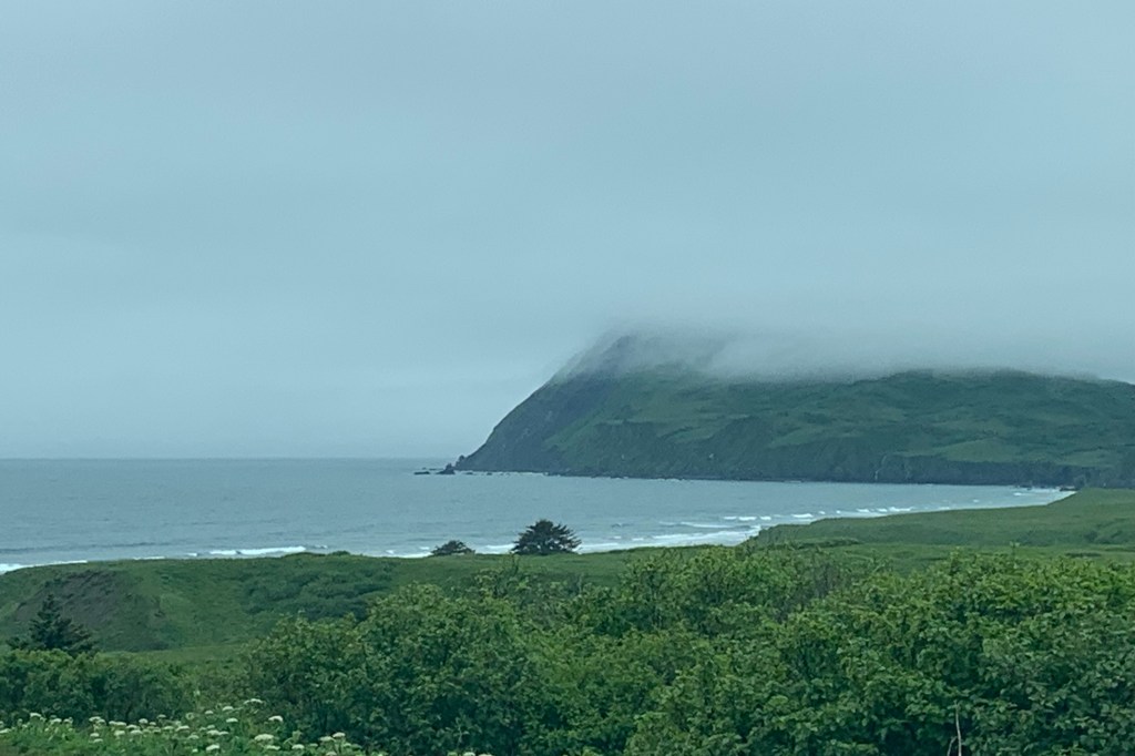
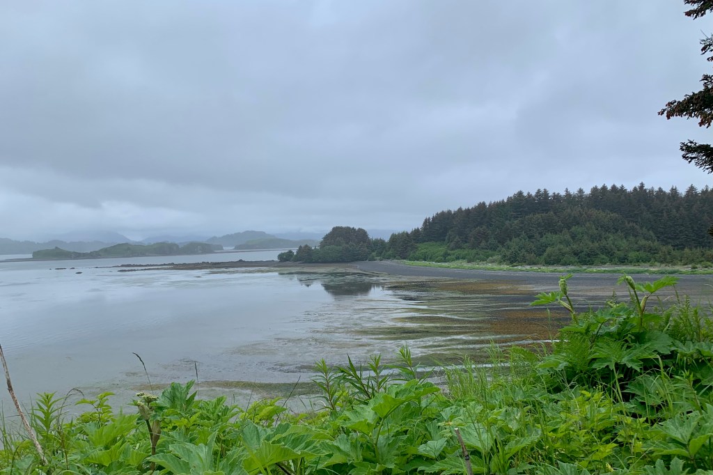
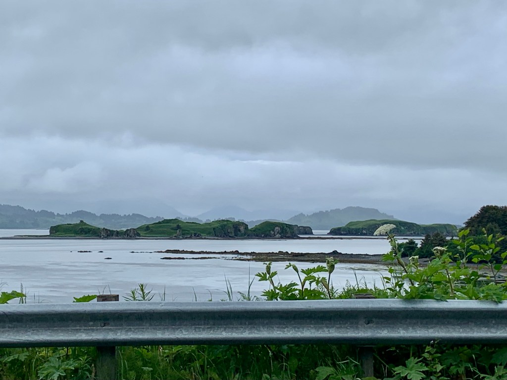
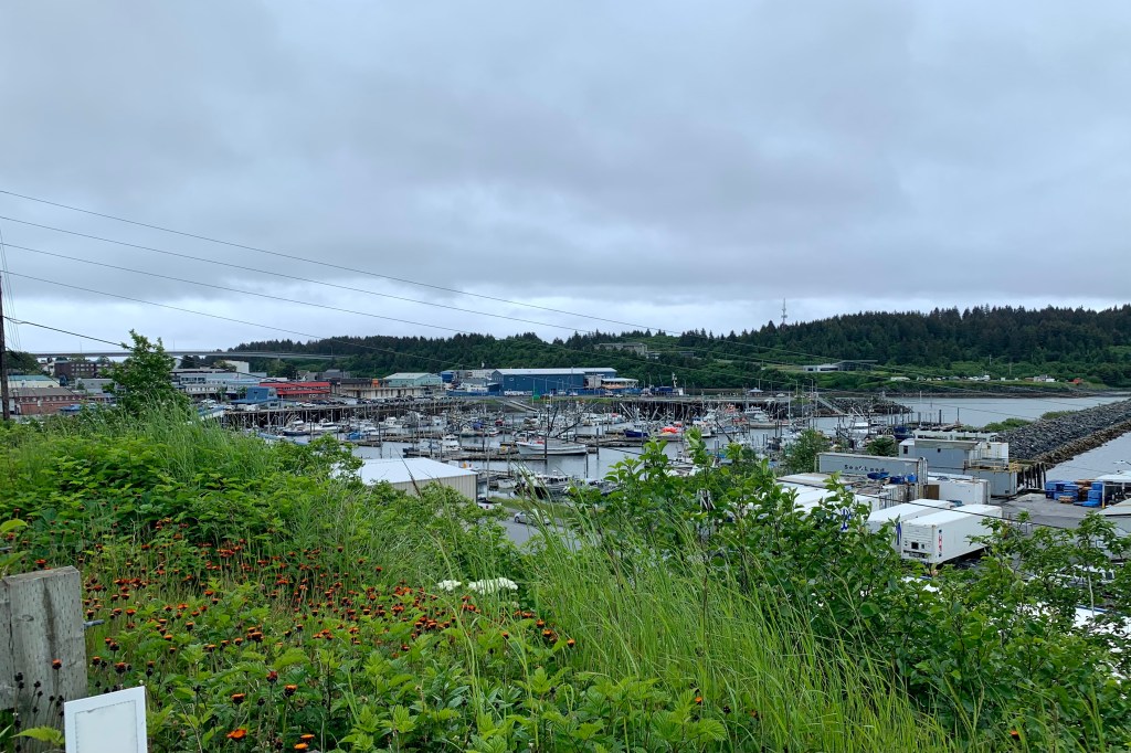
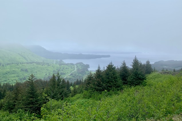
Upon drawing back the blackout curtains in my hotel room,  I was decidedly NOT shocked to see a pillow of gray clouds and mist hanging over the harbor and obscuring the harborscape and beyond. I had reserved a rental a car for one of the three days here. There was lest than 100 miles of public roadway in this island and at approximately $200.00  per day for a rental car, I thought a 3 day rental was definitely overkill. I anticipated taxing a taxi for any other needs. So  after helping myself to the  typical hotel complimentary breakfast bar, I headed out to the airport and had expected to pick up a Toyota Corolla Sedan (the least expensive car). But I was instead given a Ford Bronco to travel about in. I was definitely pleased by this switch! The script was to head to the farthest points on this very green and very wet island. The destination was Fossil Beach (aka Surfer’s Beach) and Pasagshak State Park on a paved (mostly that is) 35 mile drive over an undulating roadway, that initially hugged the coast with the views,  mostly shrouded  by fog, of Middle Bay and Kalsin Bay.

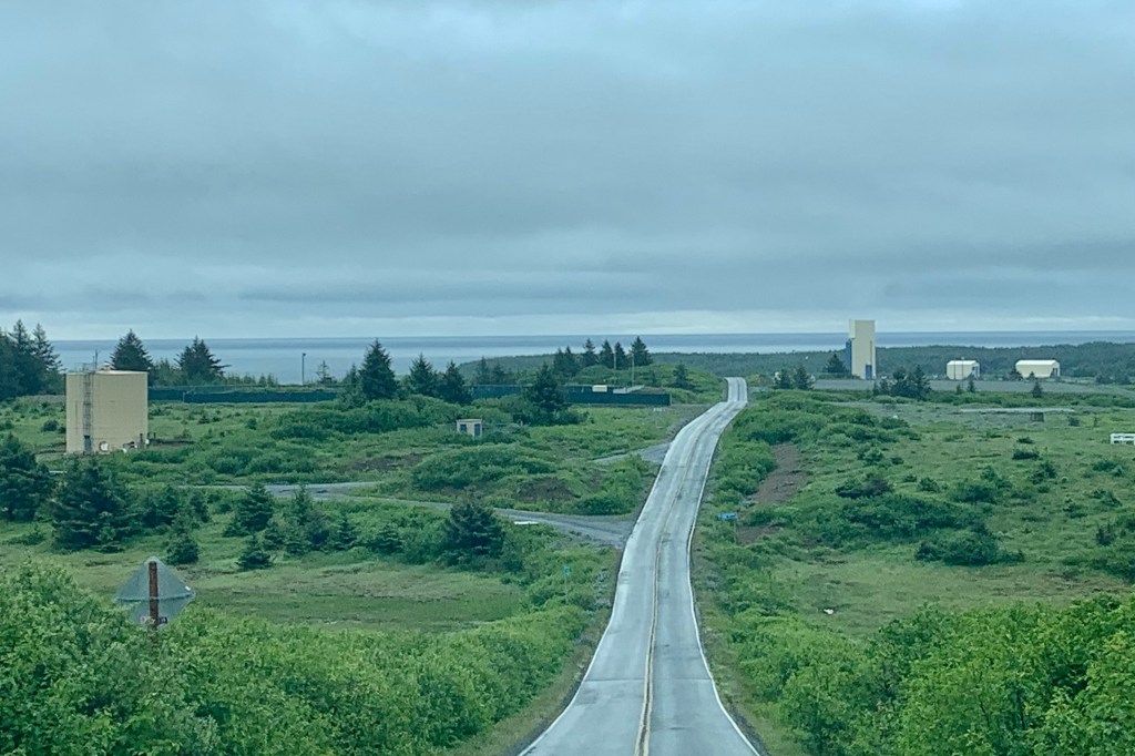
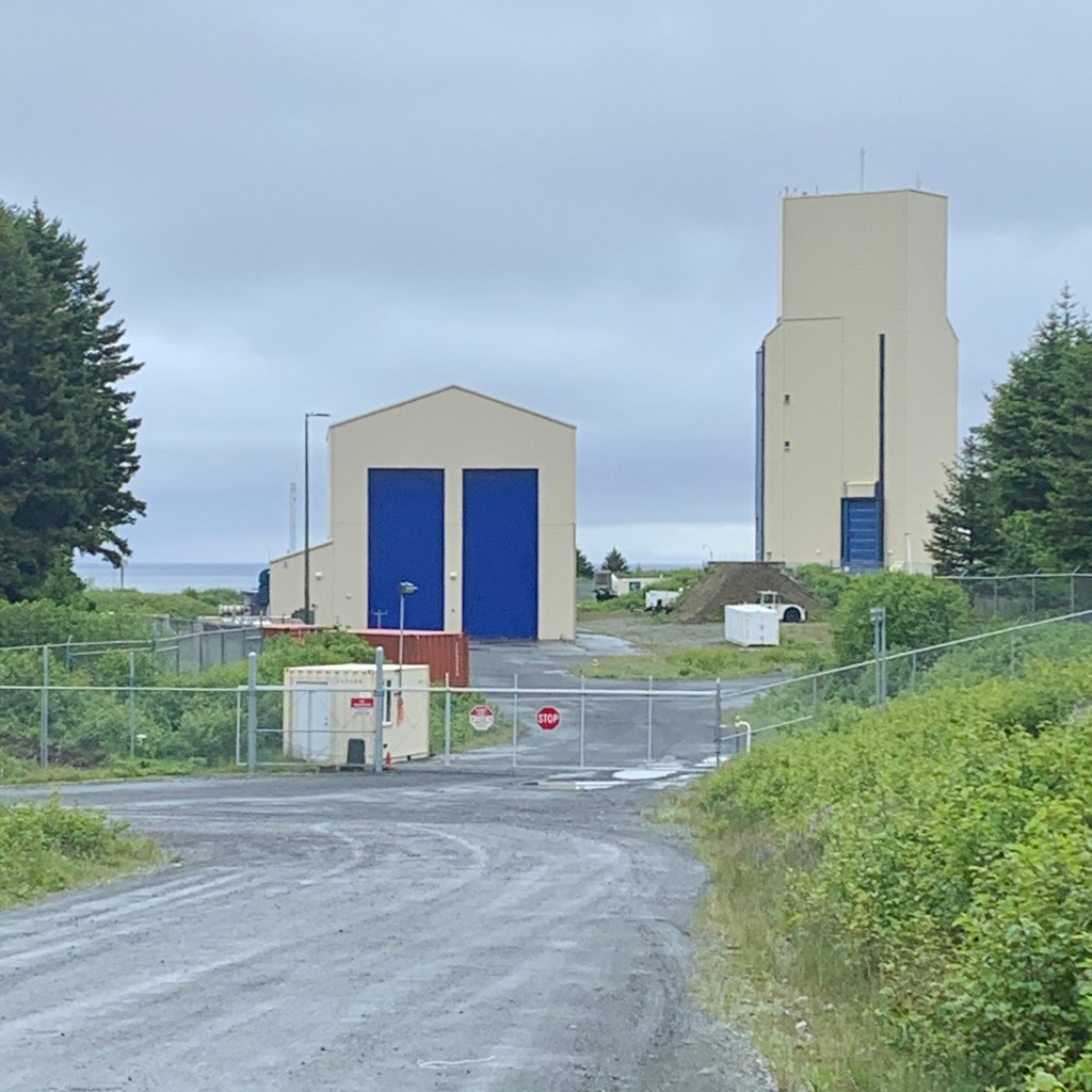
A surprise find (in all of the literature on Kodiak I never read about this) was  the Pacific Spaceport Complex – Alaska as I neared Fossil Beach. This is a dual-use commercial and military spaceport  for  sub-orbital and orbital launch vehicles providing  low-cost access to space for small- and light-lift vertical rockets and stratospheric balloons (perhaps Chinese?).

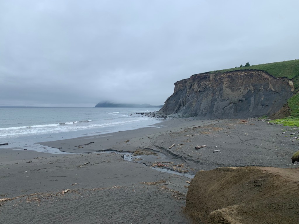
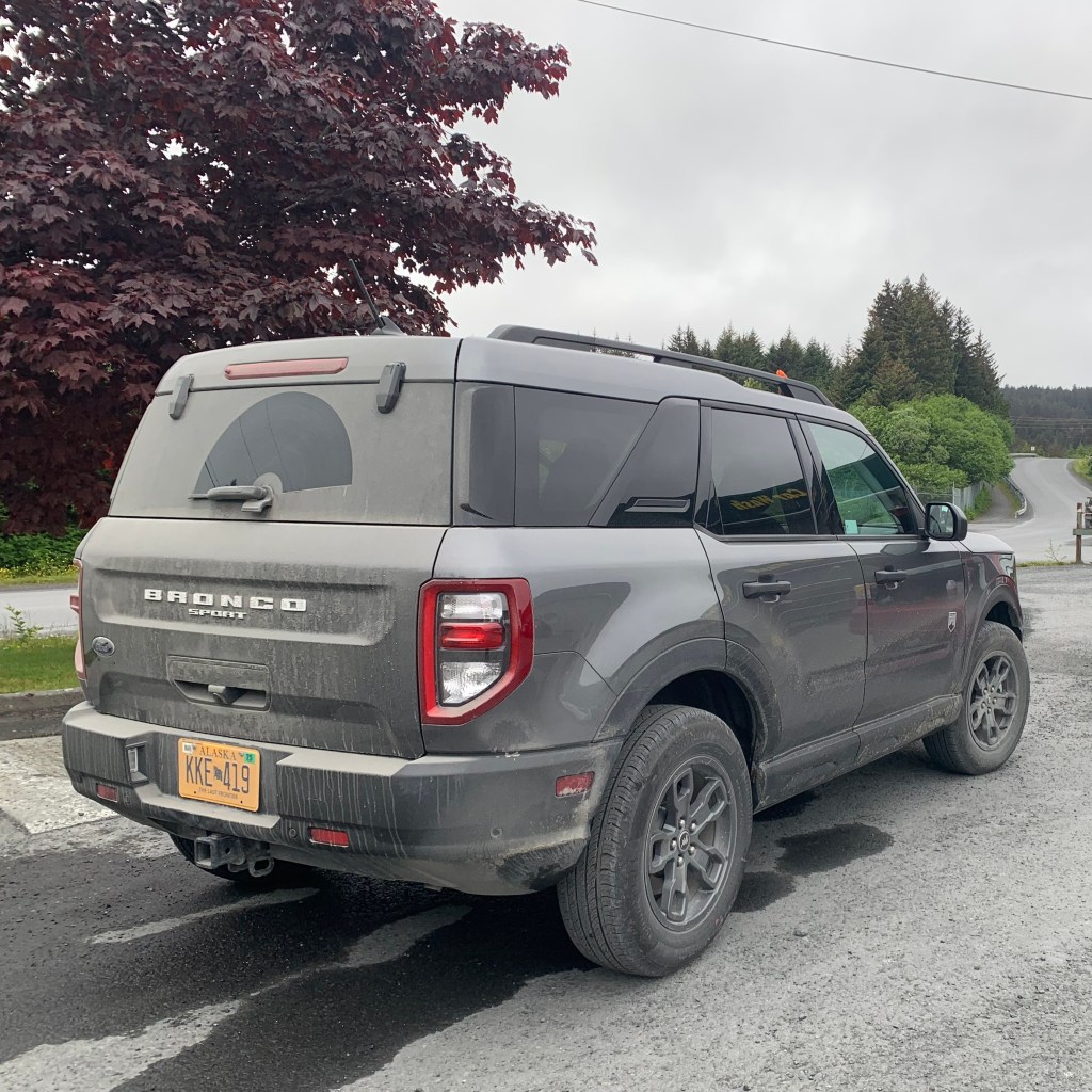
After passing the complex, following a directional arrow towards Fossil Beach, there was a gravel lane descending before me down to the beach. It was a muddy, rutty, mucky, potholed mess. This definitely would not have been suitable for a sedan but my heart quickened now that I had this 2023 Ford Bronco Sport for my vehicle. I surmised I could negotiate what appeared to be a road needing 4-wheel drive and a higher clearance.

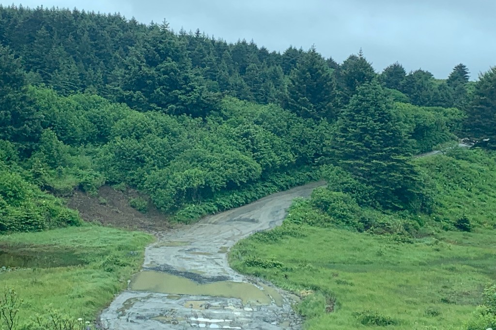
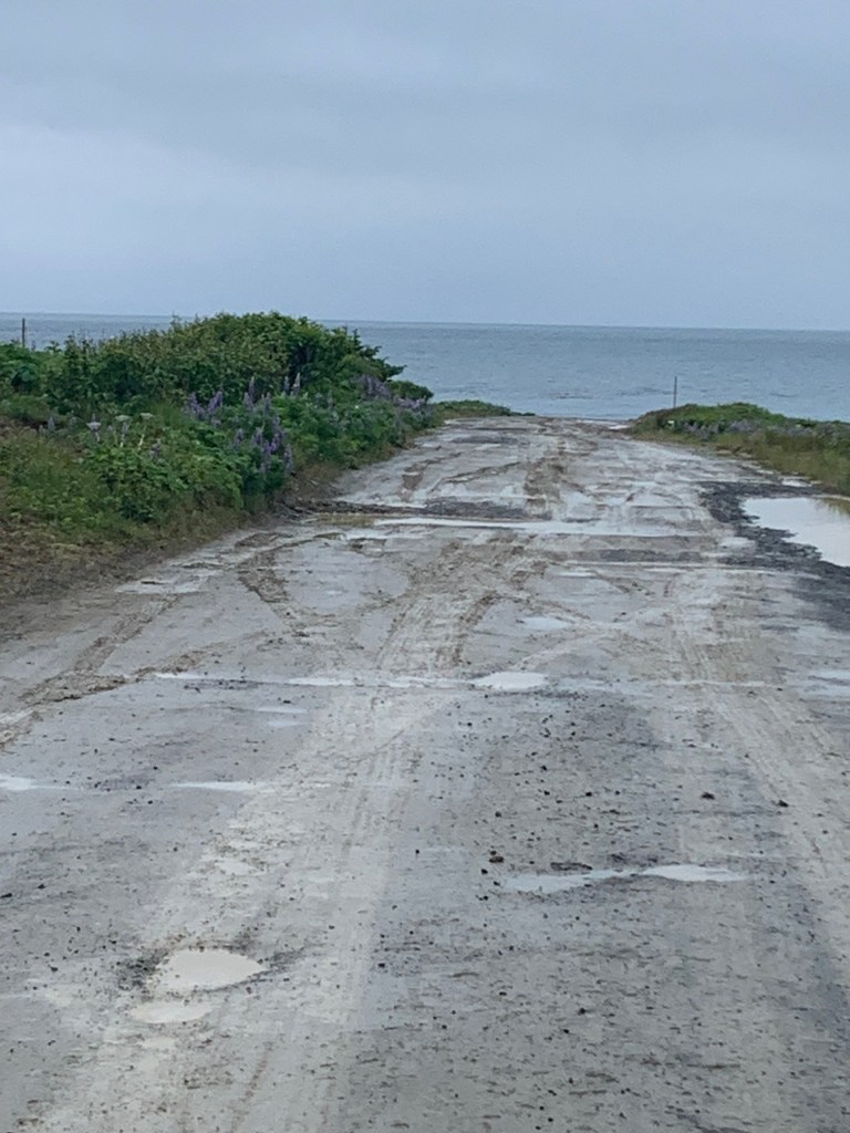
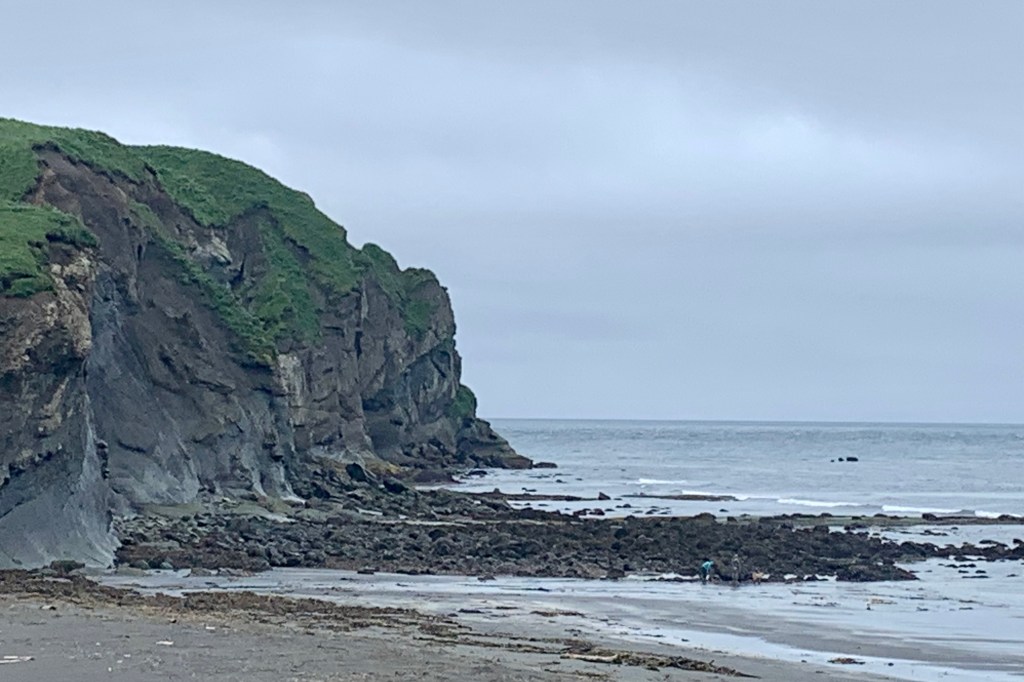
So with sweaty palms clutching the steering wheel,  I slowly bumped, bounced, dipped, splashed, slopped, mudded and carefully wove my way down this narrow gravel track. I didn’t bottom out but thought one might be able to swim in a couple of those potholes. My inner adventurer was quite satisfied at this point so I opted out of slipping and sliding down the slick wet clay paths to the beach via my two feet. I was not in much of a mood to search for fossils in the inclemency of surroundings. So it was off on the next adventure successfully snaking my way back up the mucky lane and on past the myriad of fishermen, fishing boats and recreational vehicles camped at the beaches along the way. I was not enticed to pop out of this trusty Bronco and join the passel of fisherman, standing there in the drizzle, anticipating their big catch of the salmon season.

So I headed back to the Chiniak Highway to visit Cape Chiniak. After 1/4 mile of a paved surface from the Pasagshak Road Junction,  my definition of highway, discussed in the previous post, had again to be revised. Behold, a washboard gravel road can also be  considered a highway here in Alaska. There are miles of these “cordurory highways”  (envision the  wale of your  corduroy slacks).  The speed and comfort of travel would be significantly compromised. So for approximately 13 miles at about 13mph  on this  washboarded  road surface of transverse ripples,  I  bump, bump, bumped along. Now I could have avoided the aggravating, rumbling, teeth-jarring jolts had I chosen to go 5mph or less but was certainly not willing to devote 5 hours of my day for this 25 mile round trip trek. I knew, having experimented on other gravel roads, that I could avoid most of the vibration at a higher speed of 20mph or more but was acutely aware it could become  a hazerdous “slippery” surface road should I have to brake for one of those famous Kodiak Bears, if one ran out into the middle of the road for photo op of me. So my rational  brain won out and I drove at an uncomfortable but safe speed, spraying mud (one upside of the rain is that it kept the  dust own) as I headed for Cape Chiniak. 

I never quite got to Cape Chiniak. What I perceived as near the end of this highway, and shortly after seeing a sign that read “State Road Maintenance Ends,” I came upon a  sanctioned creek/river crossing. for cars.

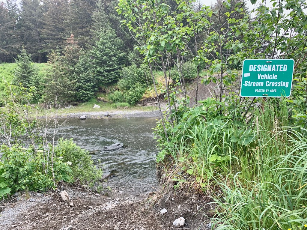
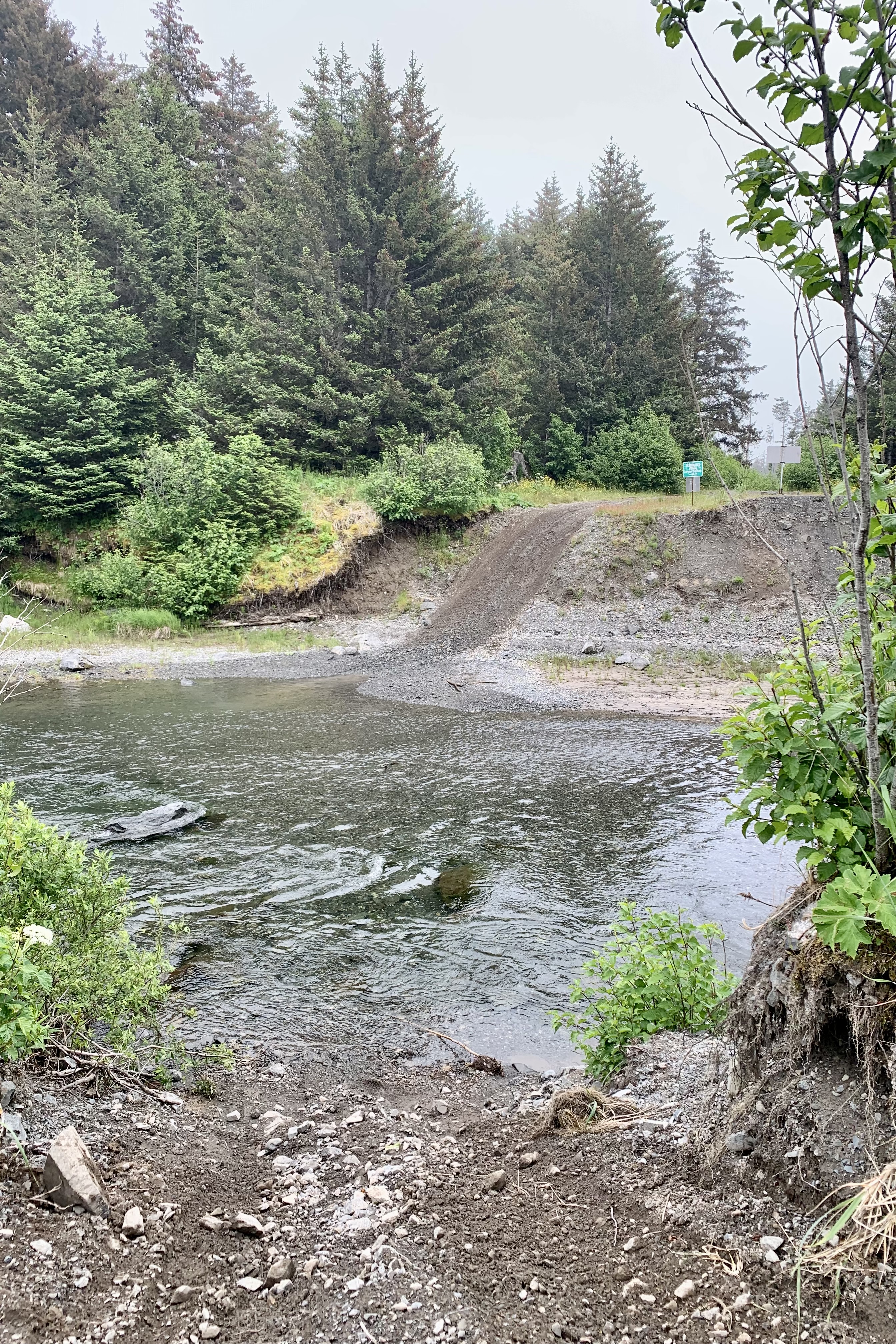
I found this problematic – there was no bridge. Do I ford it myself to test the water first or just barrel across in the Bronco with me at the helm? After some pondering , I determined that at some point perhaps my luck could run out since I am good at punishing the vehicles I drive, and I did not want either of us ending up down under (though the water  really did not look that deep).  So I passed on the opportunity to head out to the Cape riding the Bronco or on foot. I determined that, most likely, after what I have seen in my traverse of this island, it would not have been a truly unique vista , and since I was alone in the middle of nowhere with no one else around, I got back into the car and headed back towards the town of Kodiak. 

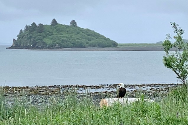
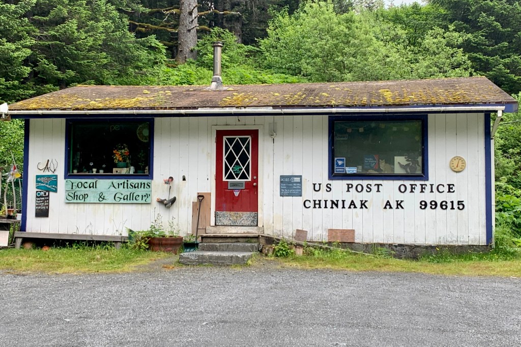
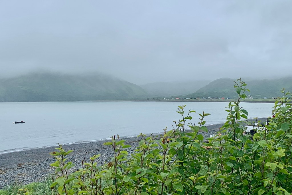
I thought I might explore the  tiny outpost of Chiniak on the way , which has a post office, elementary school, library and a population of around 50,   so headed up King Crab way towards the  library but soon decided that this was a bad idea as this road again look like it had the potential to wreck the suspension of the Bronco.  This scenic curvy highway along the shoreline though was a lovely drive though with views of Kalsin, Middle and Women’s  Bay. I even spotted a Bald Eagle enjoying the view of Kaslin Bay. I was quite happily cruising along,  back towards Kodiak to hopefully hike the Pillar Mountain Trail, when the low tire pressure light came on.  Ugh! Since I was only a few miles from the airport, I figured I could go by the rental desk and have it checked. Brilliantly, the guy who came out to check it out said  “Yep, it’s low!” as if the car computer would have fibbed to me. He pumped it up and a visual inspection did not reveal any nails, damage etc. Since it was a new vehicle with only 2000 miles on it, I decided to proceed with my itinerary. Fixed!

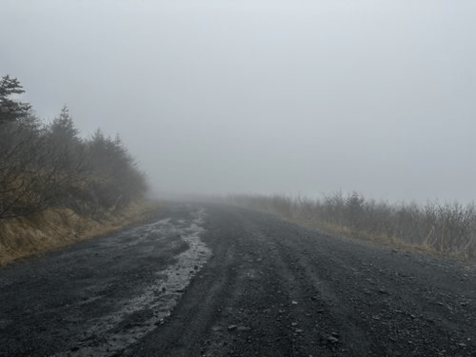
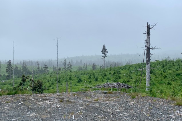
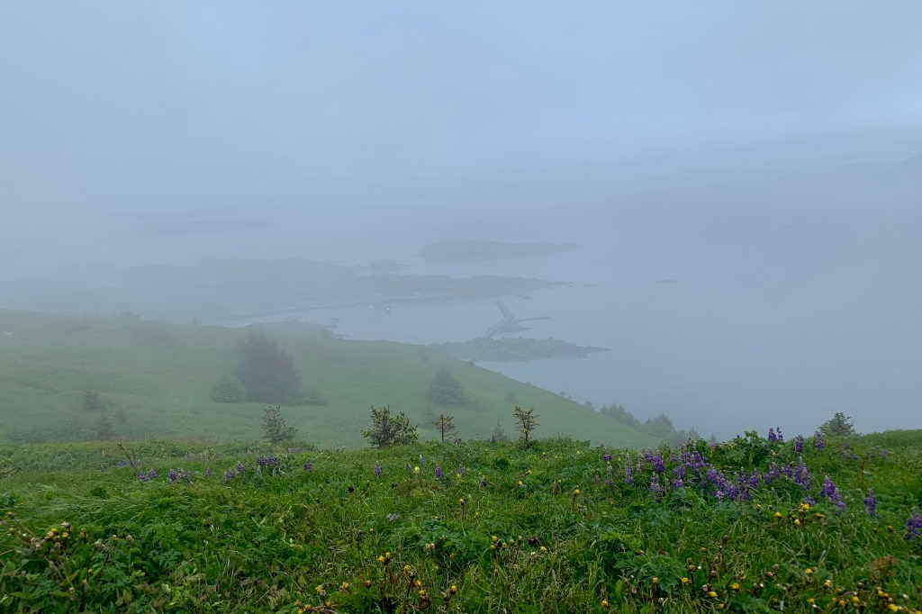
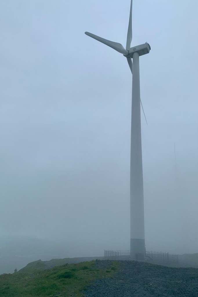
The weather was steadily deteriorating, getting windier, chillier, mistier and spattering rain, but not to be daunted, I continued on my search for the Pilllar Mountain Trailhead. It is a 2.9 mile  moderately challenging  trail with an estimate time of a couple hours to complete.  Alas, there was no trailhead signage to be found nor any signage or parking area. BUT it was a drivable road of gravel, scree and talus deposits and, given the weather , I decided I would drive it until it wasn’t any longer feasible.  Happily, I could pick my way up through the rocky terrain all the way to the summit. I patted myself on the pack for such a wise choice (though wussy by the normal standard I expect myself). There was a day when I would have been bull headed and try to follow my planned adventure of hoofing it up in misery. The wind turbines up top along with the mother nature’s wind and the spatter of rain resulted in about a five minute not particularly  enjoyable experience of taking in the views of Kodiak City, Chiniak Bay, and the interior of the island. I imagined that if I leaned  into the wind on this  blustery day it might have  held me up a little! 

It was about 2:30 in the afternoon and still lots of adventure to be had.  I headed towards the other end of the island  on really normal paved roads toward Fort Abercrombie and White Sands Beach. Much to my chagrin, the low tire pressure light comes on just as I was headed for the Fort Abercrombie Trail. NOT fixed! Not wanting to take any chances, I turned around and headed back to towards the  strip mall  section of Kodiak with its Walmart, Safeway, and gas station.  After much fussing around and back and forth phone calls, putting air in tire, another phone call, employees conferencing about what to do,  and waiting for someone else  to call me back, an employee was sent out to change the tire and put on the balloon spare. Fixed! I figured that is what they should have done in the first place but when only about three miles down the road at the  Fort Abercrombie entrance the low tire light went on again. Not fixed! I was quite aggravated! 

Back to the station, more phone calls, and an unsuccessful attempt to inflate the balloon, they decided to trade out the vehicle which, of course, would take a while as it needed to be prepped etc. I said I was driving the car back the three miles to the hotel (after a brief food shopping excursion into the Safeway for dinner, club soda,  and lunch food for the hikes tomorrow) and the trade out could happen there. By the time I got there the pressure had cropped from 26 to 14.  Well finally around six my new vehicle arrived, a Toyota Highlander , and I had absolutely no desire at this point to attempt any new adventures or drive another strange vehicle even though there is still plenty of light because the sun doesn’t set until around 11:00 pm.    Fortunately my hotel room was a mini suite with a kitchen and I heated my Safeway King Pao Chicken and stared at the rain from my port side balcony.

Watery Highways, Absentee Wildlife, and Spare Cruising

I am not sure how Kodiak Island made it onto my bucket list of things to see in Alaska this summer . Since this will be my last summer living in Soldotna AK I wanted to maximize my experience . In researching it, it seemed like would be a good fit for my venturesome self. The Discover Kodiak Visitor Guide states 

“It is filled with giant bears, spouting whales, extraordinary birds, and brightly colored salmon jumping from the rivers. The lush green summer months earn Kodiak Island the nickname, “The Emerald Isle”. Prepare yourself to realize that a place this incredible actually exists.” 

Additionally I could use the Alaska Marine Highway to get there, giving me a mini-preview of what the voyage from Skagway AK to Bellingham Washington would be like this fall.  So I created a magical itinerary for my three full days of adventure, enjoying what I imagined would be a quaint town with coffee shops, stores and restaurants; a drive out to Fossil Beach for some beach combing and then on to Cape Chiniak to explore; a hike up Pillar Mountain; a visit to  White Sands Beach and Fort Abercrombie State Park and time permitting a hike there; and an exploration of  both the North End and the Sound Trails on  Near Island. I wondered if it was a bit ambitious but was anticipating this getaway with much eagerness. 

The part of the brochure that I totally ignored in my imaginings was:

“Part of the charm of Kodiak is the unpredictable weather. The weather allows Kodiak to bloom into “The Emerald Isle”. It allows all of the things you come to see – the bears, whales, puffin, and salmon to thrive here. Summers can be perfection, but they can also be rainy, windy, and foggy with a side of overcast. Don’t worry though, you are visiting one of the world’s most exotic islands and your memories will not be about the weather.”

Now I am wise enough to have packed good rain gear, extra hiking shoes, and clothing after last summers incessant rain for two months on the Kenai Peninsula. But I was quite disappointed and disgruntled that all Kodiak did serve up was rain, wind, and fog, mist, and overcast with a temperature range of 45-49 degrees. It definitely dampened my spirits and my body. Sadly , the weather became the overarching memory of this excursion.

The journey began with a 90 minute drive from Soldotna to Homer. The weather was favorable, a cerulean sky, and I marveled at the view of the mountain across the Cook Inlet, visible with an early morning glow.

I had decided to park at the Homer airport, as I was winging it back, and take a taxi to the Alaska Maritime Highway Ferry Terminal at the end of the Homer Spit. I was astonished at how this 2 mile stretch of road, Homer Spit Road, became a massive parking lot for hundreds of cars, all manner of recreational vehicles, boat trailers, with “parking lot campsites”, ” and a few seafood restaurants and souvenir shops squeezed in. But, it all went seamlessly and I boarded the Tustumena with much ado made by the massive flock of seagulls wafting about. The covered gangway to board the ship definitely spares passengers from the chance bombardment of either the gulls or their excrement.

The Alaska Marine Highway

Highway: Merriam-Webster defines highway as “a public way especially a main direct road.” It commonly used for one connecting major towns or cities. I typically envision an interstate, freeway, main artery etc. usually paved and maintained. The visit to Kodiak require that I expand my vision of what a highway is! I had opted to take the Alaska Marine Highway from Homer to Kodiak – a 126.1 mile 9.5 hour “cruise” on the Tustumena, churning through the Gulf of Alaska at 11.27 knots miles per hour… definitely not an expressway at sea. This being a working car ferry, it brought back fond memories of the car ferry and ride we took across the Staits of Mackinac from Mackinaw City to St. Ignace before the Mackinac bridge was built…a journey that was spare, quite windy but short.

Since ”cruise” means a journey over water in a vessel, that this was thought NOT luxurious and NOT for you if you want a deluxe experience with entertainment and casinos, buffets, and a pool. It might be describe as “spare” accommodations but perfectly adequate to get from port to port on a limited budget. Since much of Alaska is boggy and remote, there are no highways connecting vast areas, so it is a boon for those who can’t afford the luxury of bush planes or float planes to more distant remote areas. So I joined the hikers, backpackers, families and fisherman for the day. I actually enjoy this as much or more than the fancy-dancy cruises I have been on being a backpacker and camper at the core for many years.. The partly sunny skies of Homer very soon gave way to the cloudy and misty skies in the Gulf and a stiff wind, so my vision of sitting out on deck, enjoying the open water teaming with wildlife and the scenery – mostly an occasional craggy glacier carved islands – was quelled.

The upside was that there were many options on the interior of the Tustumena to settle down in and while away the hours. I opted for a booth as home base with room to spread out, store my suitcase under the table, be proximate to a bathroom and the Coke machine, the common microwave, and the ice machine available for all. The many people who can sleep anywhere and at anytime could be found asleep in the lounges, on couches and chairs, the floor, in the deck in sleeping bags etc, . There were even public showers available but definitely not on my dance card that day. A dining room offered 3 meals but I opted to only have dinner as I brought lunch and snacks fearing the prices of food would be astronomical. But the prices were reasonable and food in the dining room was acceptable, though not exactly gourmet.

Overall this is a good opportunity to “unplug” as no wi-fi and minimal cell service is available. So the 9 hours actually passed quite quickly with reading, snacking, playing games on my iPad, dining, and often cruising the outside deck buffeted by the wind hoping to spot the acclaimed proliferation of wildlife to be seen. Here is my list of sightings: 0

I found cruising into the Kodiak Harbor was probably the most picturesque part of the days journey, given the narrow channel and lush  greenery on numerous rocky islets alongside; the bridge to Near Island spanning the channel; the fishing boats, boat yards and marine gear and services for all the commercial fisherman, cargo ships, cruise ships and passenger vessels, and recreational boats. The highly touted plethora of bald eagles, sea otters, and Steller sea lions, which are frequent visitors to the harbor,  chose this point in time to not be part of the non-existent welcoming committee. The town itself is a compact area next to the harbor dockage, spread out for about 4-5  blocks, and I could see the Compass Suites Hotel, which I had booked, on the hillside. With no welcoming committee or anyone to get guidance from, no taxis in the area, and an unsuccessful quest for a map in the Ferry office ( no detailed map exist  so I assume it is a given that everyone has google maps on there cell phone and that a paper map is an anachronism). I decided to hoof it, dragging my suitcase the few blocks and was very grateful to arrive at the hotel around 9:00 PM, settle into a very pleasant  room overlooking the harbor.

Cattish Foxes, Barking Lions, Flipper’s Cousins

Santa Barbara Channel Dolphin Super Pod

I had no idea what to expect when booking with Island Packers for a cruise to the island of Santa Cruz in Channel Islands National Park off the coast of California. My idea of “islands” is based mostly on my experiences in Florida, Hawaii, and the Bahamas with wide sandy beaches and swaying palms, ocean breezes, and balmy temperatures. As a “first-timer” to this park I had an inkling it would not be a typical Florida coastal island. Having been advised that there were no concessions, I packed a lunch, hiking poles, sun hat, a hoodie sweatshirt, and wore hiking boots, Perfect! Tasia and I arrived at Island Packers with plenty of time to spend money on hoodies, patches, and get the NP Passport stamped. Upon checking in at Island Packers, the person handling our reservations confirmed that we were spending 7 nights camping on Santa Cruz. Well that certainly was a surprise to me as my intention was to spend six hours. Seems I mistakingly (or perhaps a computer error since I don’t make mistakes like this) booked the following Saturday for our return. I only choked a little when she commented that she hoped she could be able to get us a seat on one of the retuning vessels that day. It would have been a rather chilly night sleeping under the stars in the campground with whiffs of the invasive blue and red gum trees (eucalyptus) which shade the campground; with a variety of nocturnal visitors including those adorable Island Foxes and other wild creatures such as Townsend’s big-eared bats, an island deer mouse or two (which carry deadly diseases); a spotted skunk, or a variety of lizards, snakes slithering about… My imagination was running wild when she triumphantly said there were seats on the 4:00pm return! I breathed a sigh of relief (though I love camping in my zippered up nylon Tent) and we were off shortly thereafter

Though the Island was the destination and I imagined it would be the highlight, the Island Packers Cruise was the most thrilling. I noticed with interest several oil rigs in Santa Barbara Channel and from some  brief research I found that drilling has ceased and the wells of platforms Grace, Gail and Habitat, which we could, see have been plugged. 

We were headed to Scorpion Anchorage and enjoying the ocean breezes on the upper deck when the captain announces that there was a pod of dolphins swimming alongside. To my astonishment they could be seen in front of, behind, and just about in every direction that I feasted my eyes on. There were hundreds of dolphins in this superpod. The sight of these dolphins speeding through the water was mesmerizing.  The traveling speed of the Islander Explorer is  usually  about 25 miles per hour and dolphins normal cruising speed is 3-6 miles per hour. But these marine mammals were swimming FAST in the wake of the vessel.. If they enjoy their wake surfing as much as I enjoyed wind surfing or water skiing they would be having a spectacular experience.

Swimming with dolphins is a very popular adventure seeking activity but I am quite sure I would have no desire to swim with this speeding herd of dolphin. It became evident that they were either taking performance enhancing drugs or have cleverly figured out that with the wake of the boat they can swim faster and use less energy to the cheers of the adoring crowd and perhaps feast on some hors d’oeuvres of churned up shrimp, herring, squid, or even a jelly-fish or two. Above us was the requisite scavenging of sea gulls. It definitely looked like these cousins of Flipper were having fun as they thrusted, jumped , dove and surfed the waves though that have yet to perfect the tricks of the famous TV star of the 60’s Flipper, i.e. her  trick of tail walking or perhaps launching herself in the air, twisting and halting mid-air… which would have nicely created a better photo op for their fan base of the moment. They were having a whale of a time in the midst of the more allusive humpback whales in the Santa Barbara Channel. Though numerous, the dolphin entertainment team was not as massive on our return trip, there also was an opportunity to see a  humpback whale spouting, breaching, slapping its fins and then deep diving.

Santa Cruz, the largest of the Channel Islands lies from 19-25 miles off the mainland coast between Ventura and Santa Barbara. Today the ferryboat ride was about an hour and a half dock to dock. Since the guesstimate was one hour the power need to pull all of those dolphins in its wake slowed it down!!!! Though it is much more likely that the captain slowed down so we could adore the dolphins. Once docked at Scorpion Ranch (which once was a sheep farm), we planned how we were to spend our limited time there. With only about six hours on the island there was barely time to experience the huge variety of activities available. 

First off we chose not to wait in the very long lines for the pit privies and perused the museum and learned of the history of ranching as the economic mainstay by the late 1800”s…and how the introduction of non-native flora and fauna had a devastating effect on the ecological dynamics. Fortunately the natural biodiversity is being restored with the stewardship of the NPS and Nature Conservancy. Only the eastern  24 percent is owned and managed by the National Park Service with the other 76% owned and managed by the Nature Conservancy.. Since this  is a nature reserve it is not a tourist trap with a plethora of gift shops or restaurants. You bring in your own food and pack out all of your trash. The most elegant of services is the outdoor latrine (though less elegant after the 149 people from the boat used them) and potable water available in the Scorpion Canyon campground. This definitely contributes to keeping the crowds down as well as the fact that there are no trash cans and you have to transport your own garbage. 

To my pleasant surprise Santa Cruz Island contained mountain; a large central valley/fault system; deep canyons with springs and streams; and many miles of craggy coastline cliffs, with sea caves, tidepools, and beaches (though not those wide sandy ones fringed by palms and perfect for building sand castle). It is rugged California at its finest. Though I would have loved to have several days to camp, snorkel in the kelp beds, swim, kayak the coast with its caves and tide-pools, the best choice for our visit was a hike on the craggy cliffs on the north side of the island overlooking the Santa Barbara Channel.  We chose the moderate hike to Potato Harbor. Planning to hike westerly, we first headed up the somewhat steep sandy trail to Cavern Point and encountered the  first of many magnificent vistas.  Once saturated with this raw beauty we  turned onto the North Bluff Trail  which took us all the way to Potato Harbor. 


Since it was only 5 miles round trip, we took our time to enjoy the absolutely breathtaking scenery the whole way, snapping photos and eating our packed in lunch overlooking Potato Harbor. I did not read anything about farming potatoes or wholesale potato importing on this island so after a bit of research I found it gets its name from its oval shape! Since there is no beach access at Potato Harbor, I contented myself with the surrounding beauty, a gentle ocean breeze, listening to the loud barks, growls, and grunts of the sea lions (which I could hear but not see on the rocky outcrops in the distance) and watching for and then spotting a whale blowing, jumping out of the water and slapping the surface with its pectoral fins. I certainly could not discern what species of whale this was as gray, blue, humpback, sperm, and pilot whales all live in these waters. This rocky coast line was gorgeous. We also saw ravens and dolphins. We opted to stay high on the cliffs for our return hike to take in a second round of this gorgeous coast. We hiked clockwise around Cavern Point, glad to be heading down on this steeper decent rather than up, and enjoying a good vista of Scorpion Anchorage below.

Once down to the Scorpion Harbor we had time to prowl around the rocky shore and relax in the picnic grove were we were payed a visit by this unique and adorable “island fox.”  We had been forewarned not to feed them but I get the feeling that they know people sitting at picnic tables consume food and often shed crumbs and it was not long before they showed their foxy faces and bushy tails. I thought at first I could be  seeing a large cat with a bushy tail, or perhaps a strange species of squirrel… but what a delight to see this fox species that is found only on Channel Islands  and nowhere else on earth. Guess they aren’t very good swimmers and able to make it to the mainland to proliferate. With a bit of time left before boarding for our return  trip to Ventura, we sat on the beach watching the swimmer and snorkelers calling it a day and shivering their way up the rocky gravely beach to return their gear and change out of there wet paraphernalia.  

This was basically the end of our National Parks Journey. After witnessing more dolphin dives on the return ride to Ventura, it was time plan the return route back to Oregon, a brief stop for brunch the following day at my nephew Eric’s place in Santa Barbara, a night at a motel north of Sacramento CA, and some dicey traveling through the pass on I-5 around Mt. Shasta

Dolphin Dives

Alien Jerky, a Very Tall Pyrometer, and “Blood Alley”

Leaving Death Valley National Park, we headed south on route 127 as with our destination Ventura California for a trip to Channel Islands National Park the next day.  Now, I do not ordinarily write blogs about a travel day which I anticipated would be tedious, boring, of very little interest to the reader… But this is an exception. What I did not know was that this route was the prime time route from “Tinseltown” to “Sin City ” or “The Strip” back to “Hollywood and Vine.” It was Friday afternoon and the Vegas-ites were headed to LA and the Lost Angels were on their way to Vegas, and we were mired in the muck of a major artery designed for traffic in 1934! But I am getting ahead of myself and there will be more on that down the road!!!

What we thought would be a rather dull driving day, making time and arriving in short order, did not play out that way.   Now ordinarily I would not consider Baker a place to be, to visit, to live in etc….  a town of 735 people, 215 households located in the Mojave desert. The only reason I can think of for its existence is that it is a pit stop when driving through a desert devoid of pit stops. But Baker has risen to the occasion by becoming the next great tourist trap and I am sure they hope a destination in itself. I must applaud Tasia for finding these breath stopping unique spectacles in downtown Baker. So if you have never been to Baker CA make sure you leave plenty of time (perhaps 5-10 minutes) to visit these two kitschy attractions there. 

# 1. Now I am not necessarily a fan of the world’s biggest things but my son Nick had quite the selection of photos of “biggest things,” so not to be outdone by him, I was all in on taking a little side trip through town. My photo probably does not do justice the World’s Tallest Thermometer (especially since it is growing out of my head) as it was not displaying it’s sizzling hot, egg frying maximum temperature of 134 but a mere 57 degrees. But 134 is there since that is the world’s hottest temperature ever recorded with Death Valley, which holds this record set on July 10,1913. In August 1995, the Baker thermometer recorded its highest temperature 127.

#2 We stumbled upon the Alien Fresh Jerky Store down the street from that super-sized thermometer and it is truly out-of-this world or perhaps I should say outlandish, with UFO’s and little green men decorating the exterior and parking lot of the shop. Strange? Quirky? Weird? Wacky?

If you are a fan of beef jerky or just into a cheesy establishment STOP! You might want to try such delights as Weed Killer Hot Beef Jerky, Abducted Cow Beef Jerky, Road Kill Original Beef Jerky, Space Cowboy Pepper Beef Jerky, Barbecue on the Moon Beef Jerky and Texas Style Ghost Pepper Beef Jerky. Now if you still have an appetite for jerky after perusing this partial menu of their offerings, you should perhaps consider upping your credit limit on the charge card you might wish to use. But even more exciting to think about is next to this market, the owner envisions construction of a UFO themed hotel. May the Aliens be with you!

An update on Hugly: after long boring days left in the hotel at Death Valley, Hugly was excited to be back on the road, watching for roadkill, and drinking an ice cold coke (I think Hugly is thinking about making some desert rat jerky). Now, after so much excitement, we just motored on through California, acquiescing to using Interstate 15 to Barstow but opted to exit and pick up a bit of old rout 66. From there, not so cautious Siri, using iMaps, routed us onto Pear Blossom Highway (US State Route 138). Now that sounded like a lovely name for a road through the Santa Clara Valley, along the Santa Clara River and perhaps through a lovely corridor of lovely pear orchards. (It’s name, Pearblossom, came from the multitude of local pear farms in Antelope Valley but few still exist today.) Tasia began reading about the surrounds and learned the stretch we were driving on was one of the most dangerous roads historically as it has been the location of numerous serious and fatal automobile accidents. Though it became clear that improvement have been made to the road, I breathed easier when we were through that heavily trafficked road filled with freight trucks and a multitude of LA’ers hitting the road most travelled and rushing to the slots and craps in Las Vegas.

That state of calm did not last long before we were routed onto State Route 126. Years ago, In February 1996, the Los Angeles Times published an article about the dangers of California 126, writing that “despite the beauty, to drive along the 126 is to flirt with mortality… especially on a “two-lane, six-mile segment of 126 known as ‘Blood Alley.’” with head on collisions common on this older, curvey, two lanes sections. Though the highway has since been improved in most areas, traffic fatalities are still quite common.

I was grateful to be pulling into Ventura around sunset but before checking into the hotel we decided to scout out the harbor area where we would be boarding for our Island Packer Cruise to Santa Cruz early the next morning. We arrived at Ventura Harbor in time to witness a magical sunset.