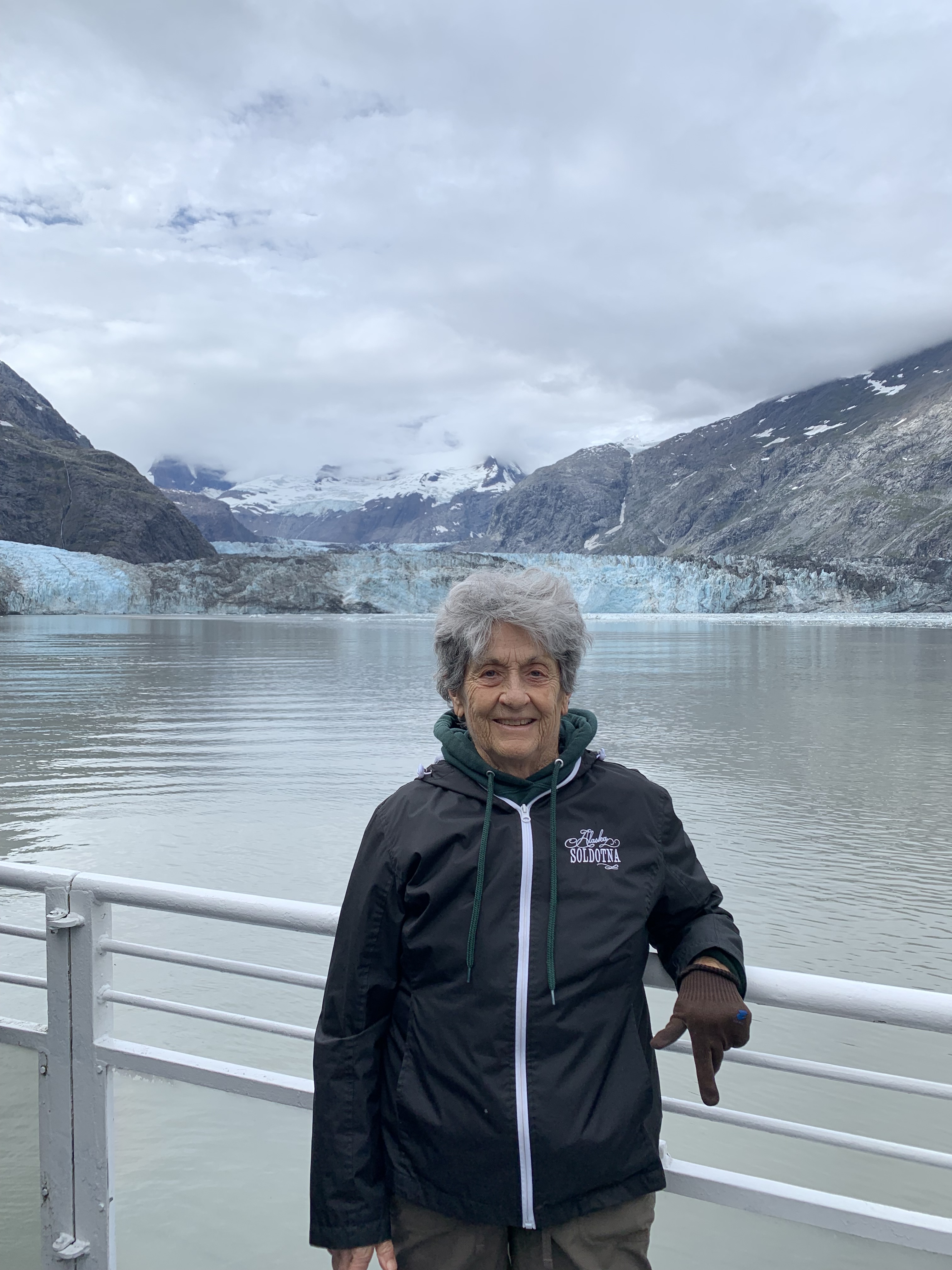
Standing on the dock, in the early morning brume, I was feeling a tad discouraged about this 8 hour cruise through Glacier Bay up to the John Hopkins Inlet. It was definitely a relief though when I noticed that the passenger count was far below the capacity that this high speed catamaran, colloquially named the “Day Boat, ” could accommodate. At least there would be less of a foray when patrons start jockeying for a berth on the railing. This chaotic scenario always occurs whenever the crew announces a sighting of wildlife, which always leads to a rush of the madding crowd from one side of the ship to another, from the inside cabin to the outside deck , and up the stairs to the viewing deck from downstairs. Far be it for me to buck the trend and, so that I could lead the rush of the cattle call crowd, I secured my “indoor station” by a window and quite proximate to the exit for the viewing deck.
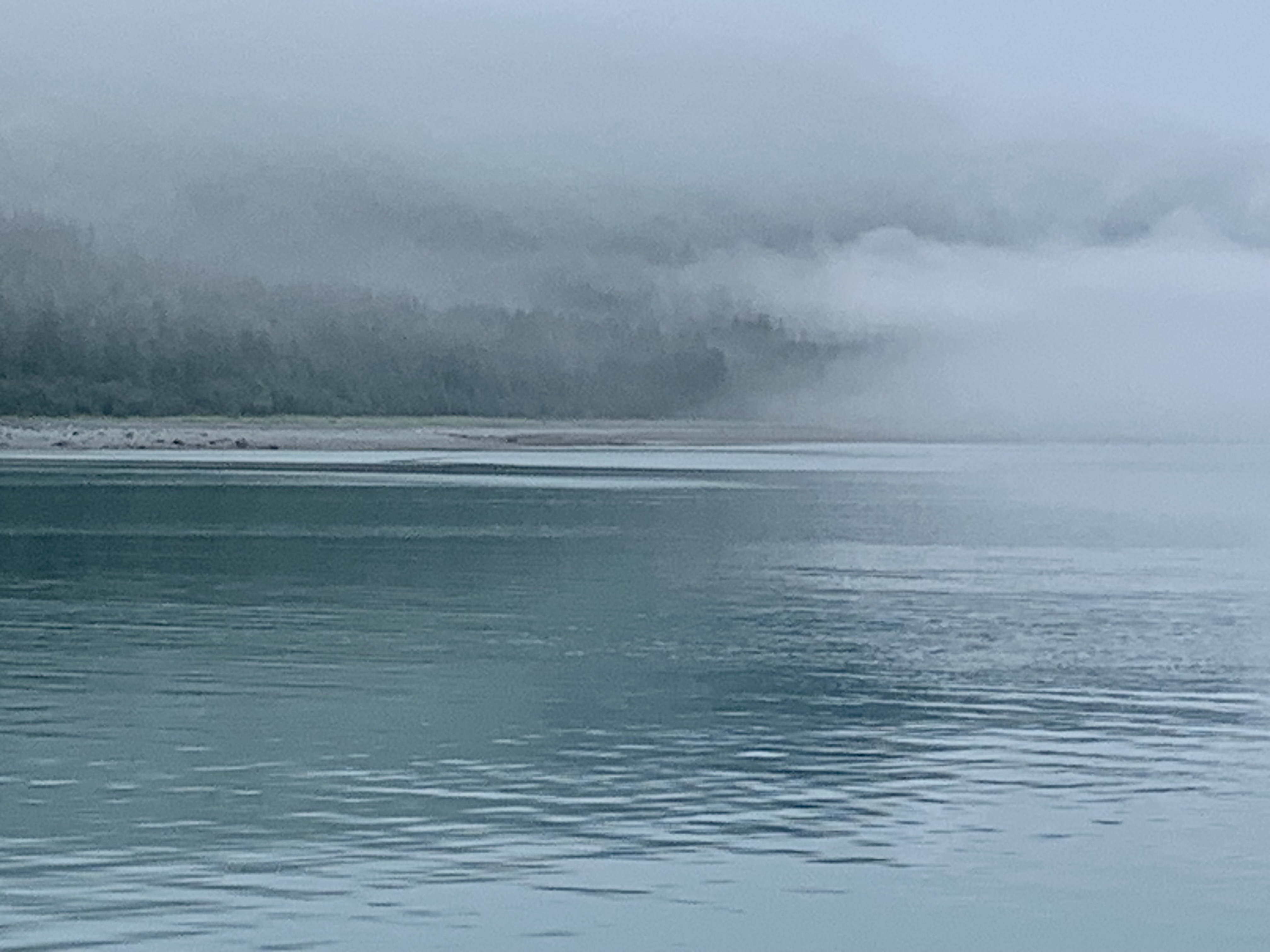
For the first couple of hours there was a myriad of photo ops of this dense fog ahead of us, the fog off to port side, the starboard side fog and the fog we left behind.
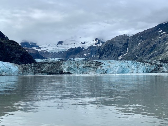
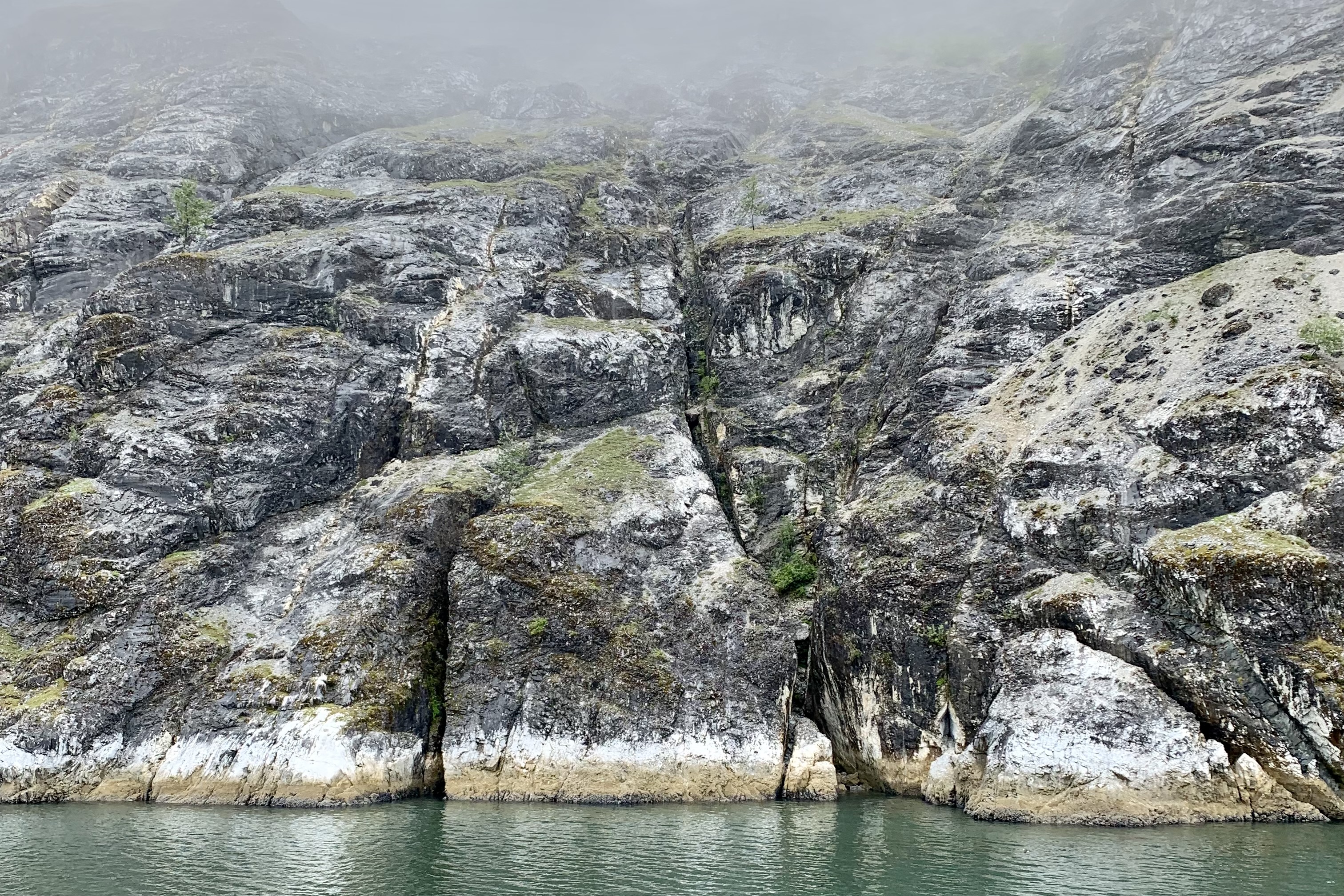
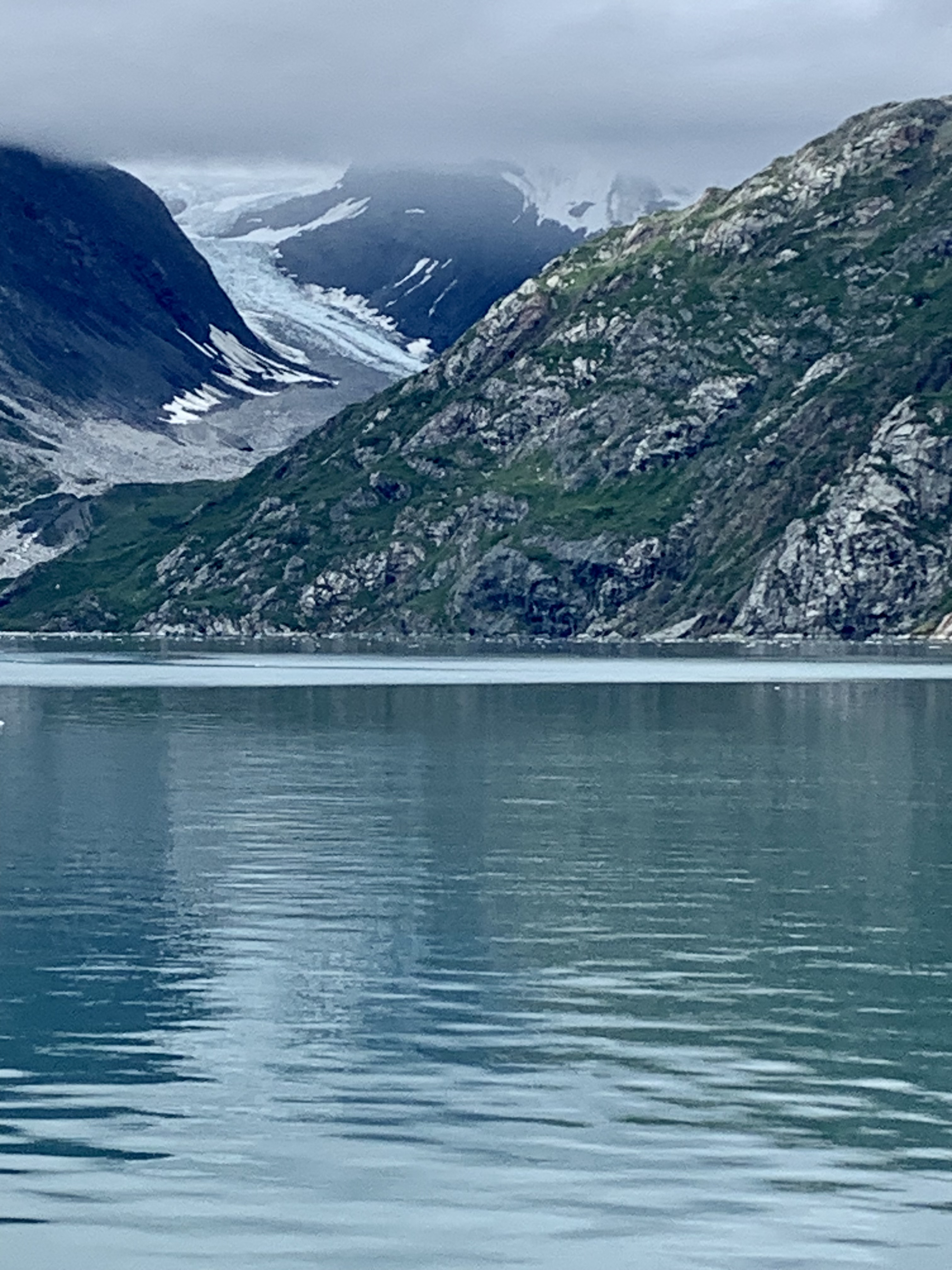
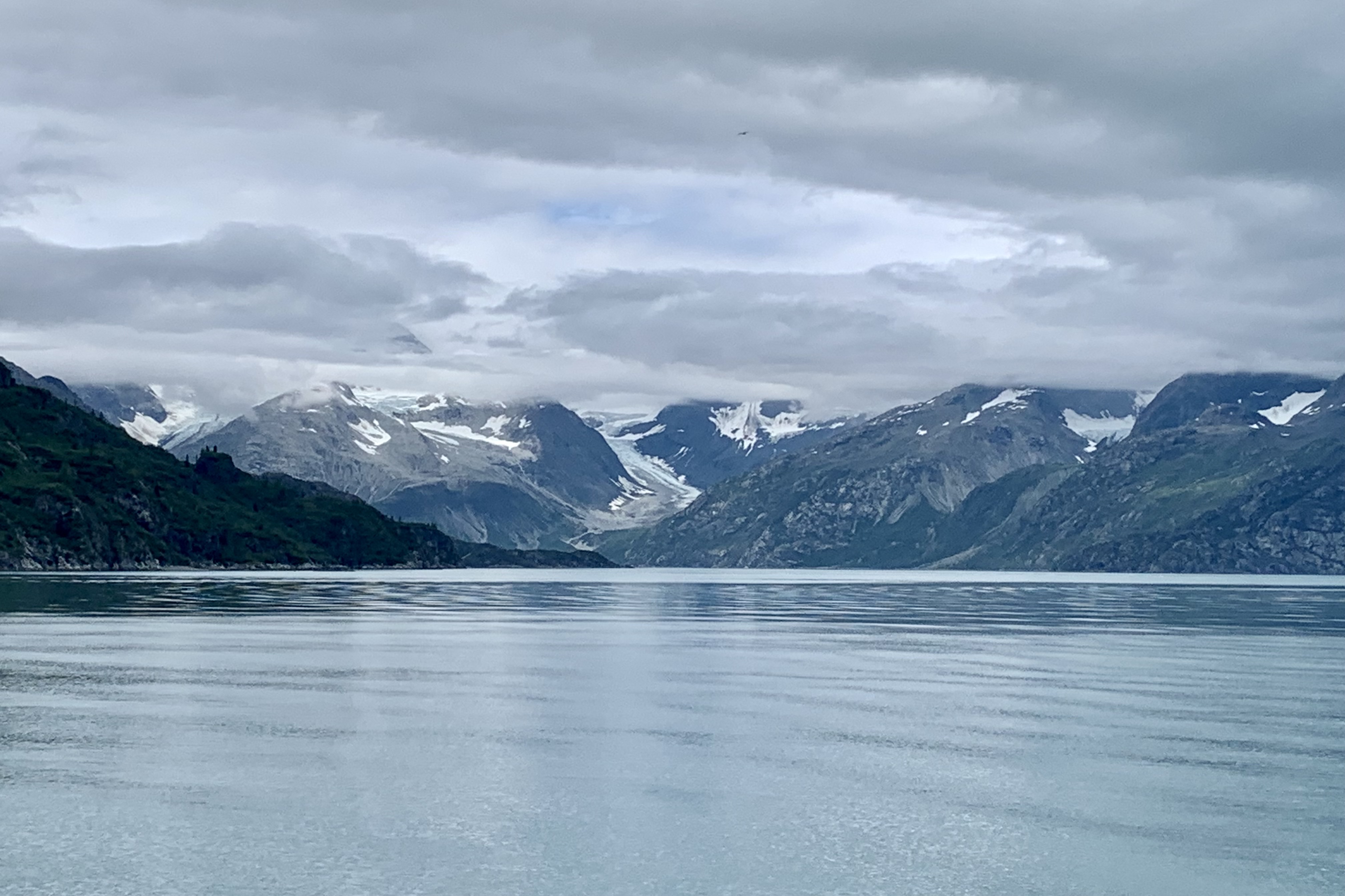
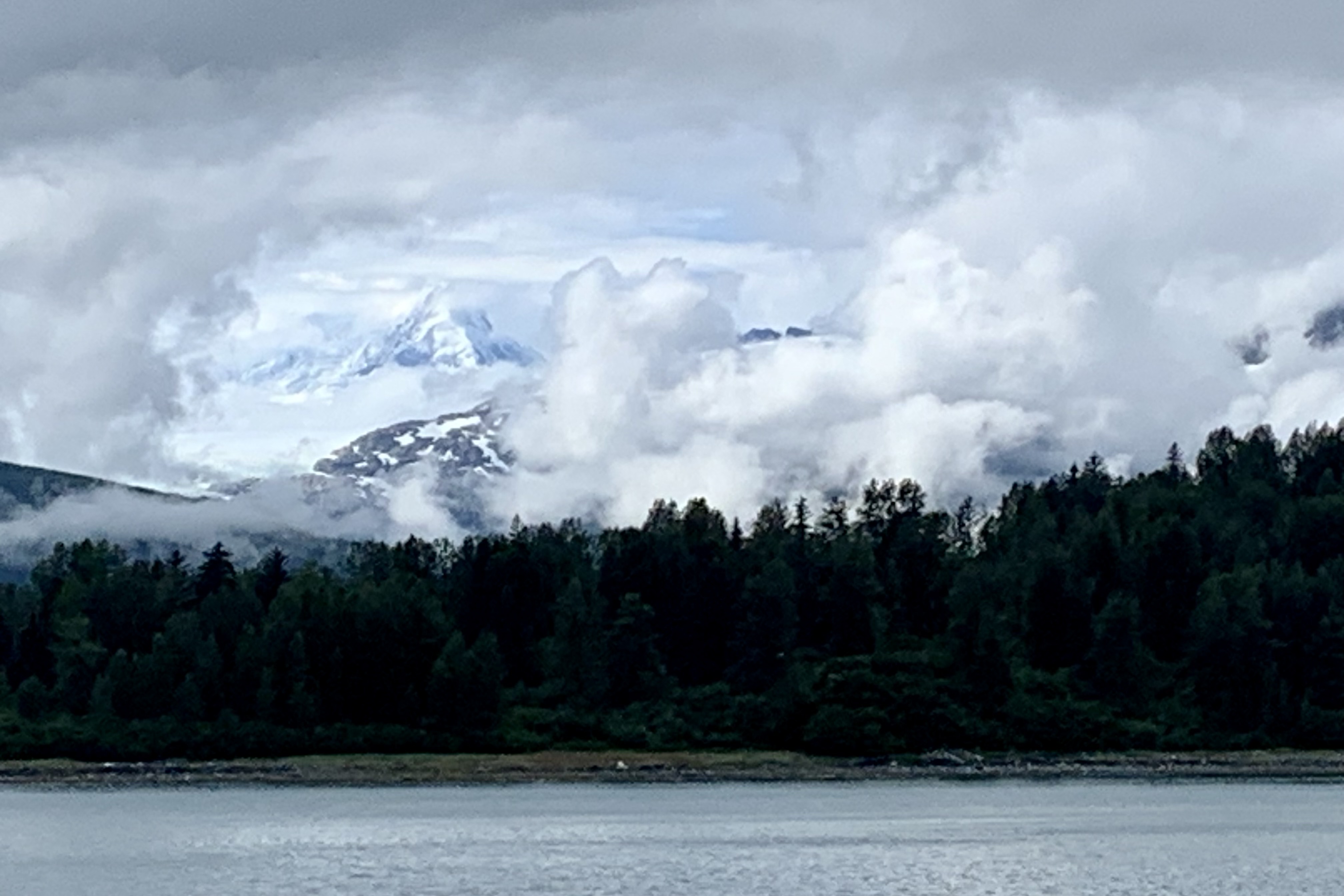
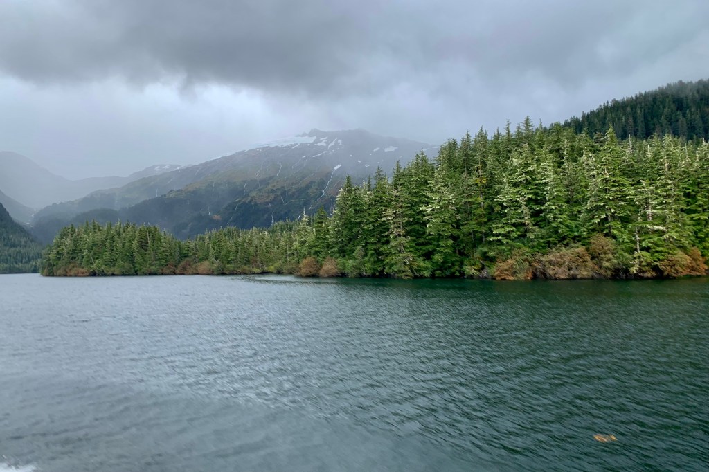
This gauzy scrim gradually began to lift and ascended upward enough so that we had a better chance of spotting wildlife in the air, on the waters, along the shores and on the rocky slopes of the islands in the bay. Currently the glaciers are now about 65 miles northwest of Bartlett Cove whereas 250 years ago Glacier Bay and Bartlett Cove were a massive river of ice so its was going to be quite a while before we reached the glacial area.
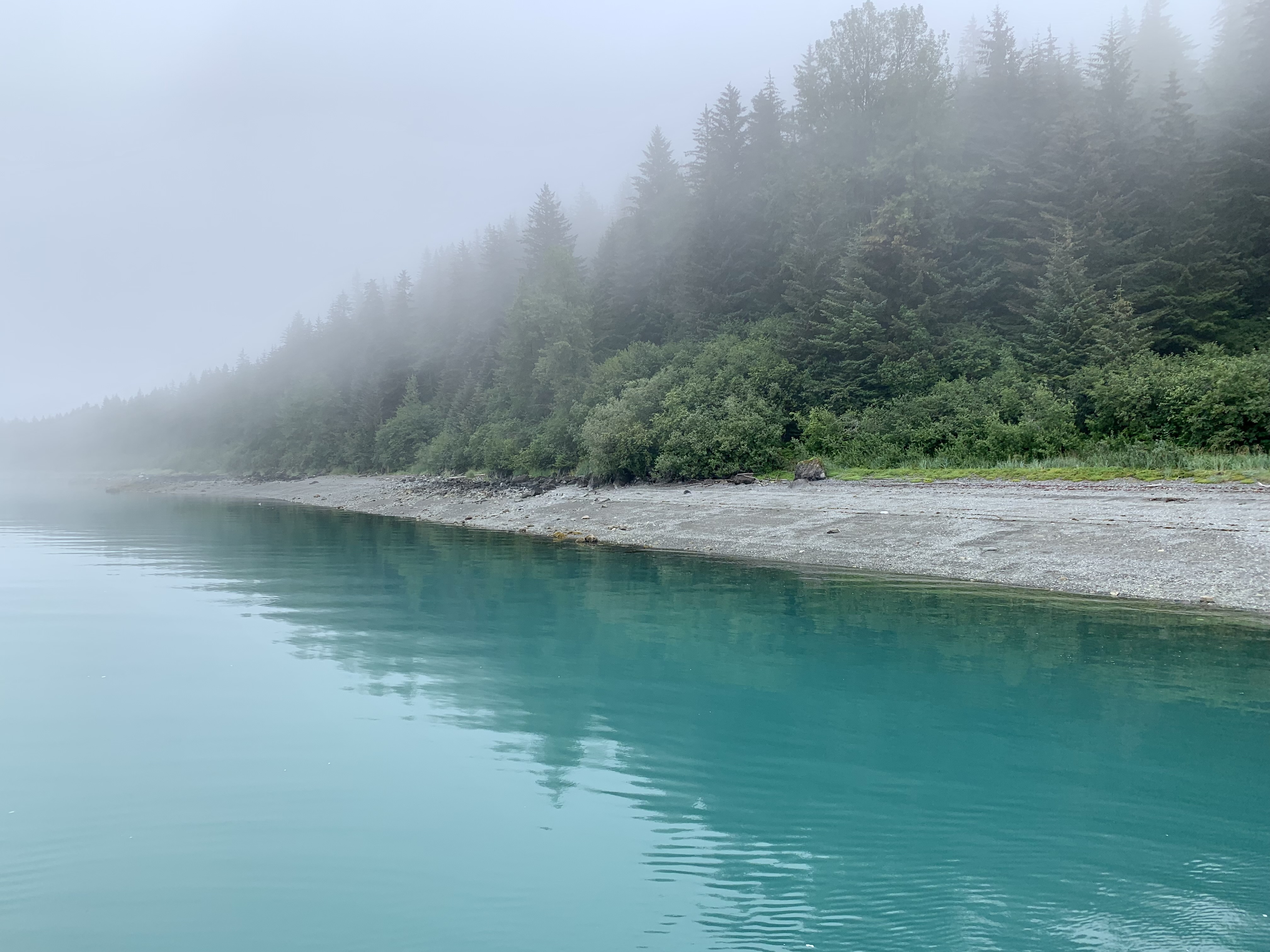
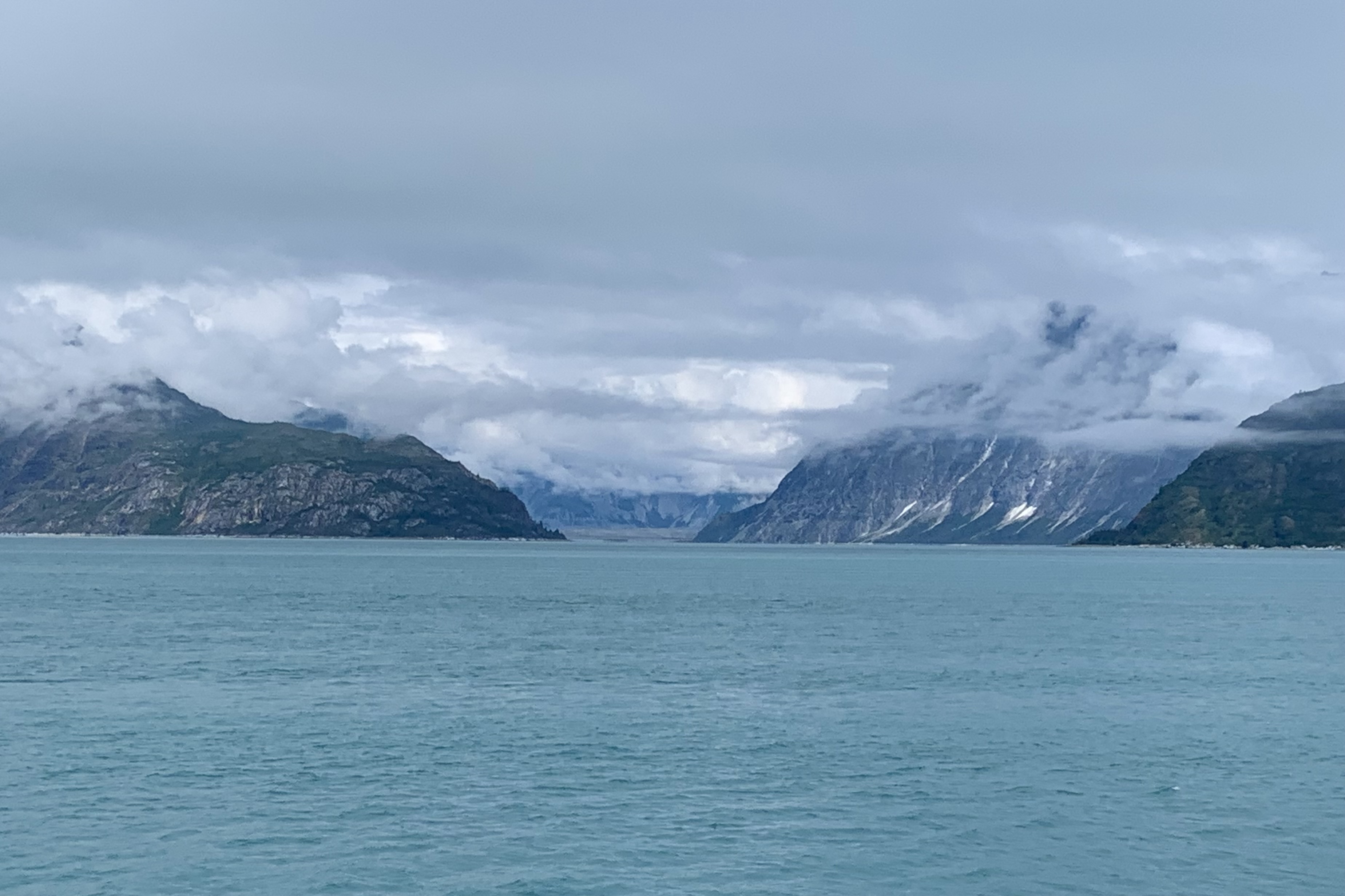
It seemed like we were just tugboating along – I surmised it was the heavy fog— but I came to realize that there are definite noise restriction and speed zone areas designated so as to protect all wildlife, but especially to protect the harbor seal and whales. This definitely is not an attractive area for the jet skiers of the world to congregate and hold a convention. I am all in on respecting the wild land, air, and sea creatures that we share this earth with and grateful for the quieter ride that exist because of the myriad of boating restrictions. Think about it. Would you relish a six foot long 250 pound harbor seal undulating like caterpillar through your living room or otters webstroking in your swimming pool. Perhaps we need to think a whole lot more about our roaring motors churning through their living room. This definitely made for a most pleasant three hour journey to get to the first glaciers. A National Park Service Ranger kept us informed about what we would be seeing (or not seeing) along the way as we moved from the rainforest area of Glacier Bay to the guano and lichen-encrusted rocky islands of the bay.
As we ferried along the captain would maneuver close to shores of Strawberry Island, the Marble Islands, and Tlingit Point for better animal sightings. By count birds far outnumber any other wildlife sightings. Thousands of seabirds nest on cliffs and rocky shores within the bay. I don’t have the patience or acuity of vision (or very good binoculars) to be a successful “birder.” but spotting the puffins and the Arctic terns was a treat. The Arctic tern is my hero and is famous for migration since it flies from its Arctic breeding grounds to the Antarctic and back again each year. They are the ultra ultra marathoners of the avian species. The shortest distance between these areas is 12,000 miles. I surmised, just like our human snowbirds traveling south in the winter, these terns seek perpetual summer and lots and lots daylight. The Tufted Puffins, often identified as “parrots of the sea” because of their bright coloring were not behaving like the adorable tufted puffins I’ve seen in the penguin exhibits at aquariums waddling . They were far too busy foraging for their own food, swimming, and steering them selves around with their web feet preparing for a dive for the fresh catch of the day. . Also spotted were Black-legged Kittiwake, Eagles, a variety of Gulls, especially Glaucous-winged Gull , which is basically a large white headed gull. They were plentiful on the Marble Islands. I took almost no photos because I do not possess one of those cameras with massive lenses especial designed for wildlife photography with their auto focus and zoom lenses and look like they weigh a ton. My 5 year old iPhone camera suffices but does’t do the job that these heavy behemoth expensive cameras do. I already have too many photos of unidentifiable minuscule blurred dots in the distance.
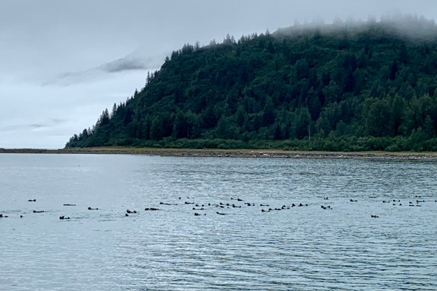
As far as spotting the large mammalia, a brown bear was seen sauntering around a beach on Tlingit Point, an occasional whale spouting or breaching in the distance, sea lions on the rocks but no proximate heart stopping encounters with the ship. Perhaps these Glacier Bay inhabitants too, just like many humans , prefer to hunker down on a foggy rainy day and thus opted out of putting on a show for the tourists encroaching into their habitat. I was especially enchanted by the “raft” of sea otters, churning through the water. I noticed their preferred swim stroke is by far the backstroke (mine too) and I spotted them in large numbers hanging tight with each other traveling in tandem. I wonder if it’s like a pace line in cycling where you cycle into the slipstream of another cyclist and let them “pull” you along. This was an “otter version” of the pace line.
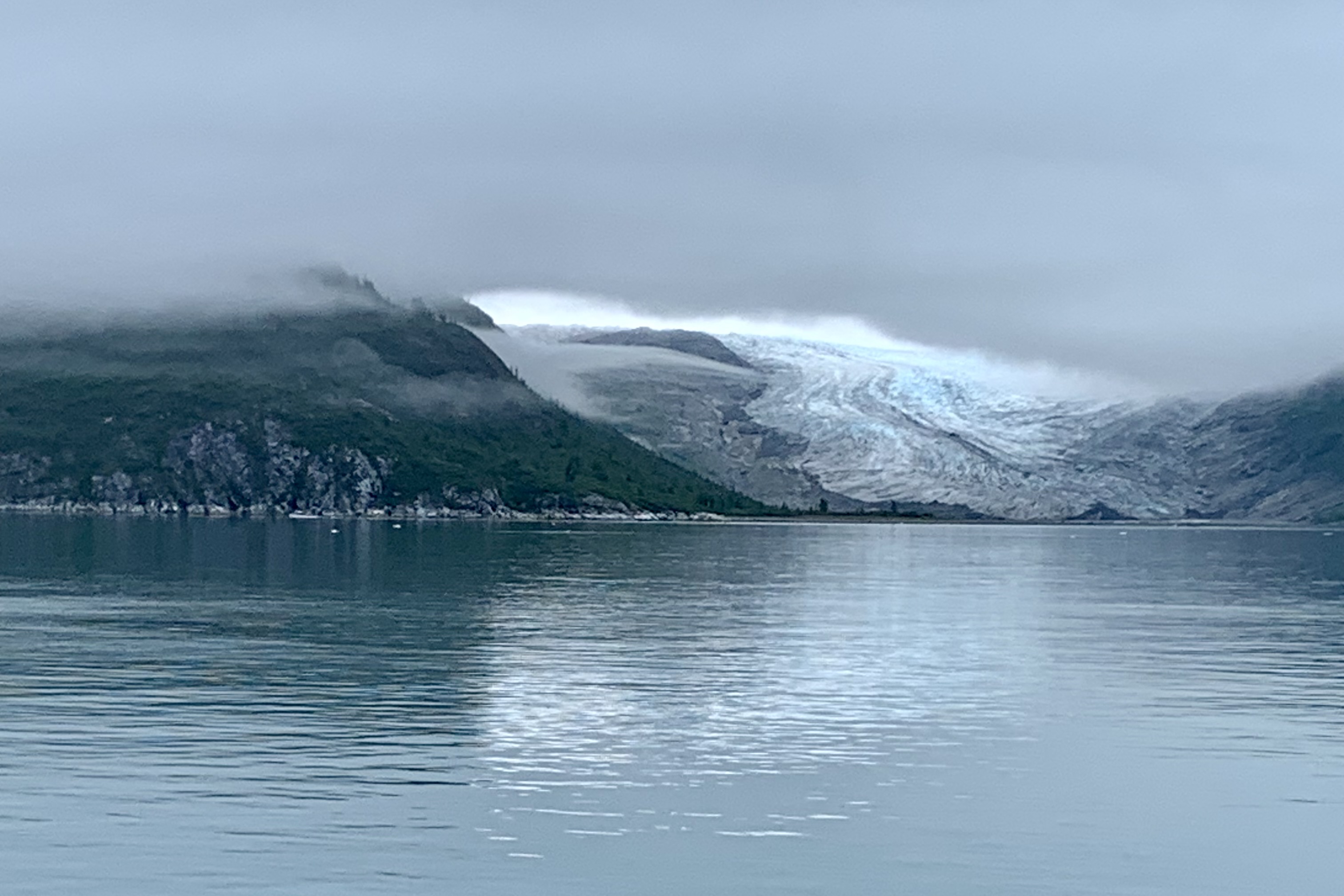
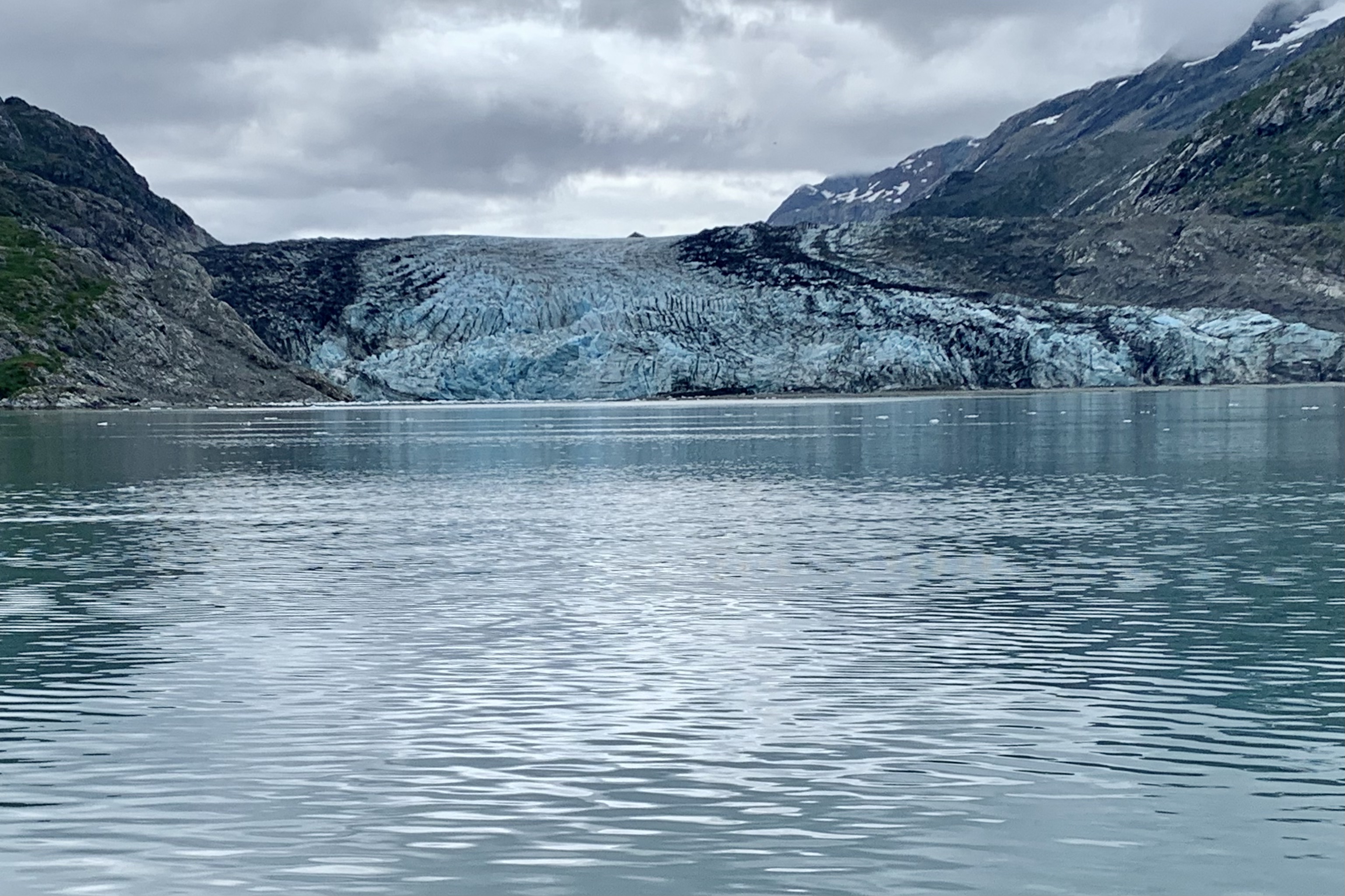
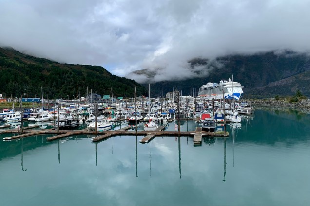
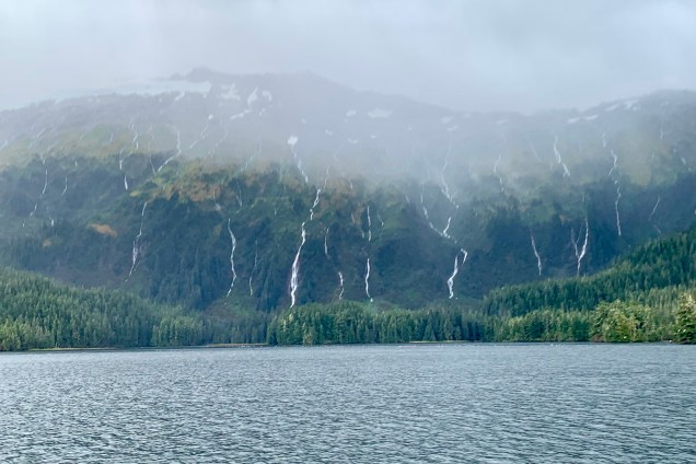
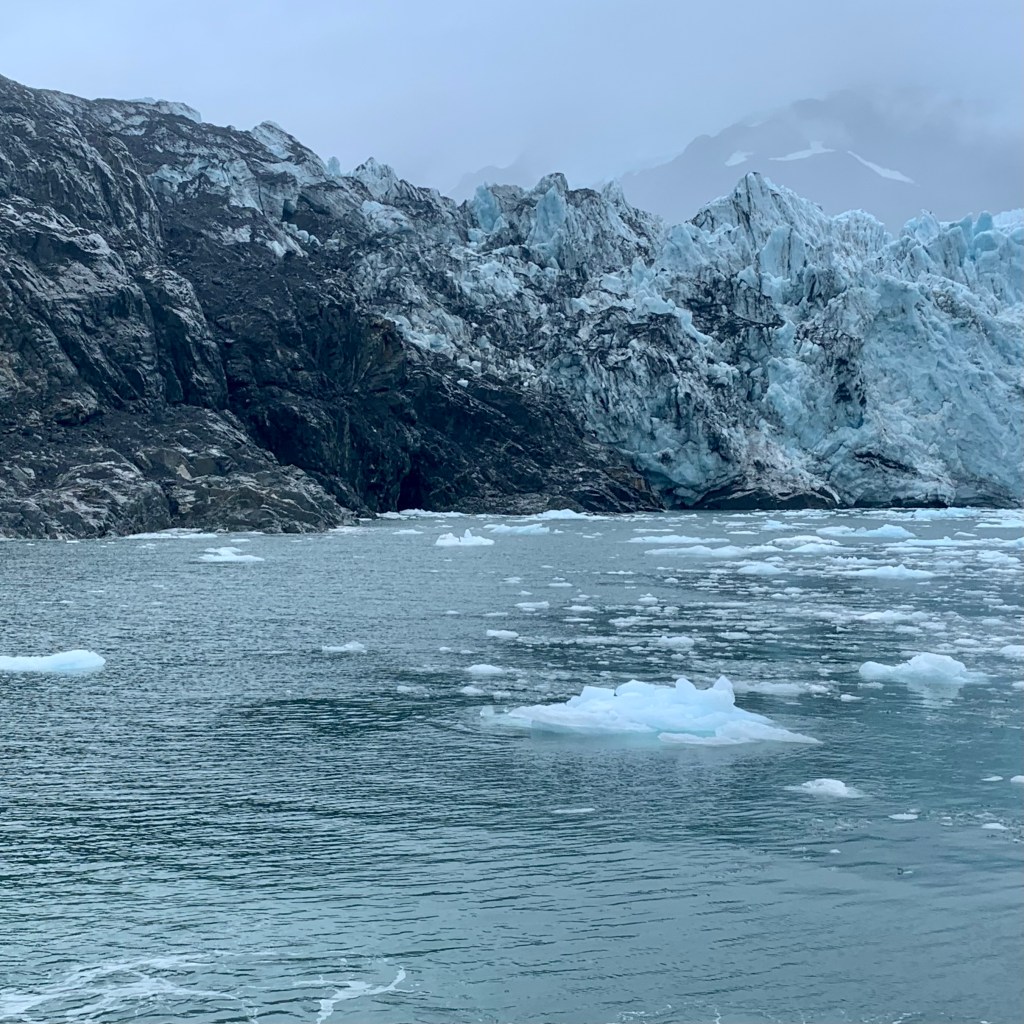
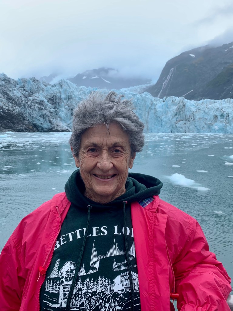
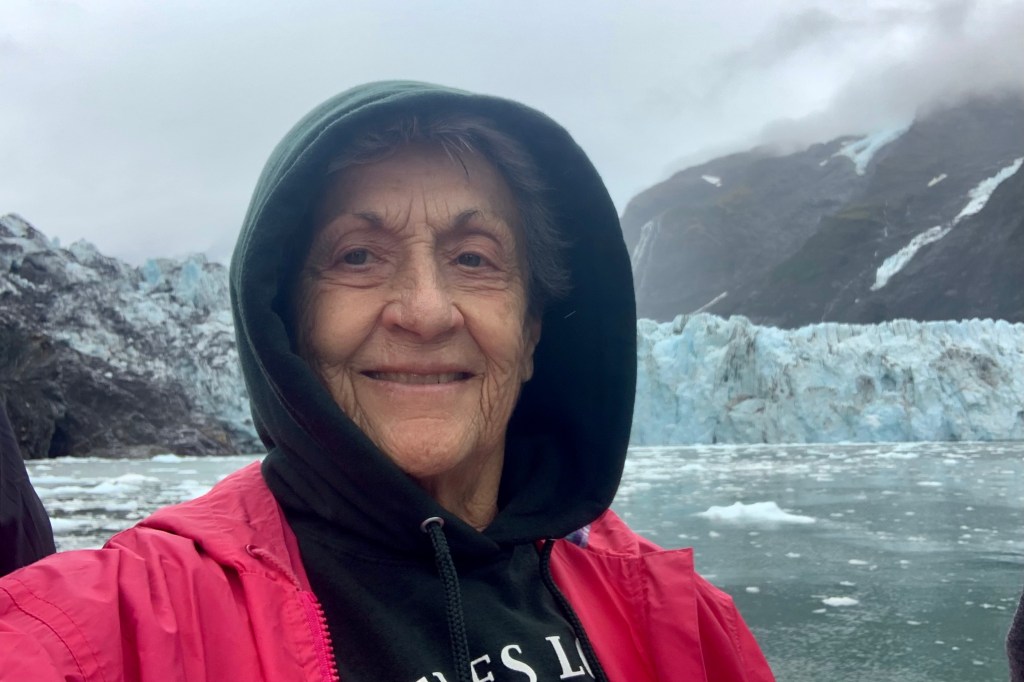
By now the fog had dispersed and though still totally overcast, we were motoring through the bergy bits and growlers (ice flows that aren’t behemoth enough to sink the Titanic) and soon we were seeing many tidewater glaciers crawling down the mountain crevices and ending at the sea, with the grandad being the John Hopkins Glacier at the end of the inlet. Though we were mooring around the John Hopkins Glacier and inlet for around 2.5 hours, at this time Glacier John was taking lunch and a siesta and was not calving.
Our lunch was provided “glacier -side, ” which was a classic school kid bag lunch of a Wonder Bread sandwich, chips, and a candy bar! Jupiter, the king of gods and the weather god, must have been in a more favorable mood for our return trip. It was under partly cloudy conditions, so the shore lines were more visible. This Sky Deity was in a imaginative space and fluffed up pillowy, sheetlike, fleecy, and diaphanous clouds to hug and drape the islands and thankfully not thunderheads or threatening clouds to churn and spin the waters around our trusty vessel.
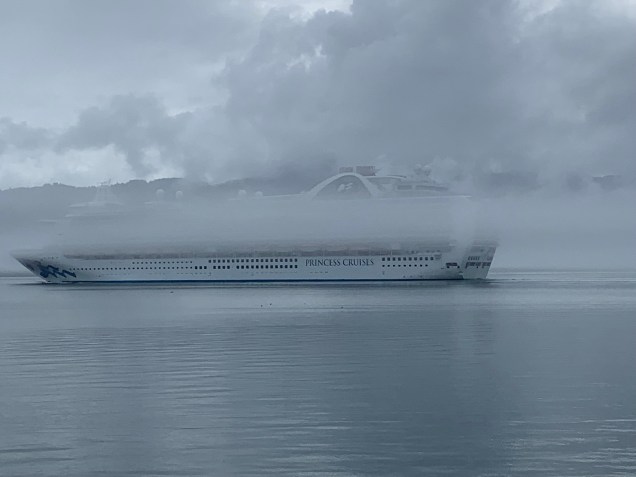
One of the VERY amusing things noted on our return was the huge Ruby Princess Cruise Ship along side and we all were laughing because those folks who paid for those high deck outside cabins were getting a great view of the fog!
Glacier Bay Lodge
It was quite a satisfying experience , definitely to be had before there are no more glaciers to ooh and awe about. . Additionally , I began to make the acquaintance of a number of couples who are “park baggers” like myself, hoping to visit all 63 National Parks in their lifetime. I am proud to say I have the most under my belt (52) of those I met but it was fun comparing favorites and numbers visited etc. After regrouping, I made my way to the dining room so as not to be the last in line again for a table and after be able to go to the Park Ranger presentation on this park.
A must do, in almost every brochure listing for an Alaskan holiday, is a glacier tour. Not to be outdone by all the other tourist, Teresa and I opted to outdo most of them by going on the 26 Glacier cruise out of Whittier for a second time, but now three years later (before and hopefully after Covid). Had I not had many halcyon moments on my first tour I might not have been too enthusiastic about a second but I was game as its was Teresa choice of adventure on her last day in Alaska and it would be quite different in foul weather… which I was already assuming would be the case as we made the reservations the day before. For Prince William Sound, the location of the tour, the climate is characterized as a coastal temperate rainforest and it has nearly 60 inches of rain annually and close to 300 inches of wintertime snows, That is an incredible amount of rainy days in this area. Well, my assumption was unfortunately correct and we had another gray, cloudy, rainy day. But I was nonplused by this fact and it would be a great reminder of what to expect when I returned to Oregon for the winter and its temperate rainforest climate.
But first a stop at the Begich, Boggs Visitor Center which was built in 1986 upon the terminal moraine left behind by Portage Glacier back in 1914. Portage Lake, which it overlooks, is deep enough to submerge the new 80 Story WTC 3 Building. Portage Glacier can no longer be viewed from here as it has retreated behind a mountain since the center was built. As recent as my trip three years ago there were still small ice floes i.e.baby bergs in Portage Lake whereas there are none today.
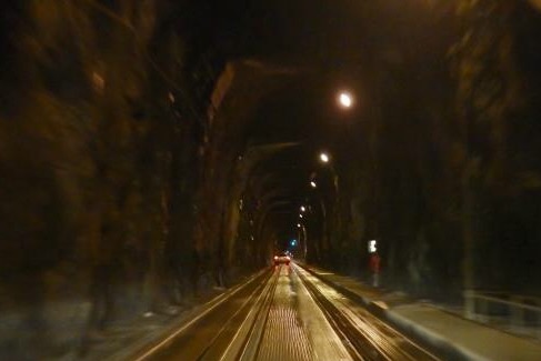
Unless arriving via cruise ship or some other sea worthy conveyance, a trip to Whittier begins with the adventure of a drive through a one-way, 2.5-mile tunnel, where the roadbed is railroad tracks! We paid the $13.00 fare for this privilege and then stood in line for the 10:30 opening of the tunnel to Whittier. You and of course your car are queued up in several waiting lanes for your turn to use the tunnel.
The Anton Anderson Memorial Tunnel (a politician and engineer who oversaw the tunnel projects), often called the Whittier Tunnel (I prefer this) after the town at its eastern terminus. This tunnel, with the long name to match its long mileage, is a dual-use highway and railroad tunnel that passes under Maynard Mountain. The tunnel flows towards Whittier on the half-hour, and back towards Anchorage on the hour: But trains have priority over other traffic. If there are no trains then cars, and then other vehicles like busses and trucks will go thru in a single lane over the train track.
Whittier TunnelWhittier Tunnel
Now I certainly was hoping that the schedule is computerized and that we were not at the mercy of a hungover button pusher who can’t keep their priorities straight this Saturday. The railroad tracks are slightly below the road surface so I would not worry about balancing my car on them (I am not very adroit at getting the car wheels on the track at a car wash so I can’t quite imagine what that would be like in a relatively dark tunnel.) The interior is exposed rock, and I read it contains several “safe-houses”, which are small buildings that are used in case of severe earthquakes, vehicle fires, or other emergencies. Thank goodness the ground under Mt Maynard choose not to tremble, fissure, crack, split, upheave or shake on this day.This 2.5 mile tunnel needs to be aired out with giant turbines between the scheduled crossings.
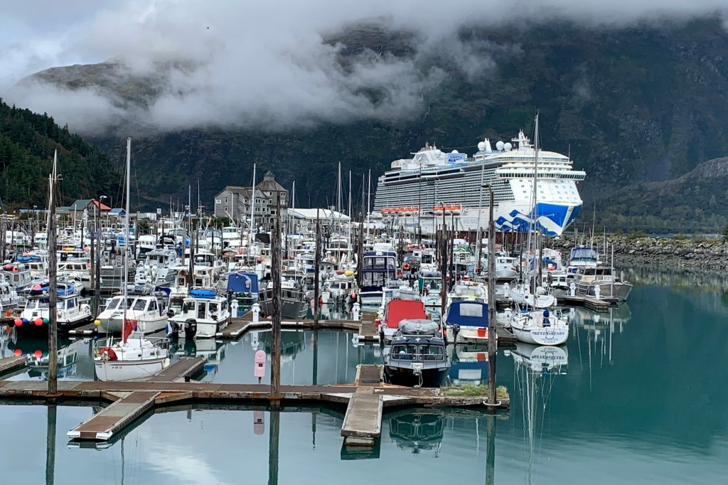
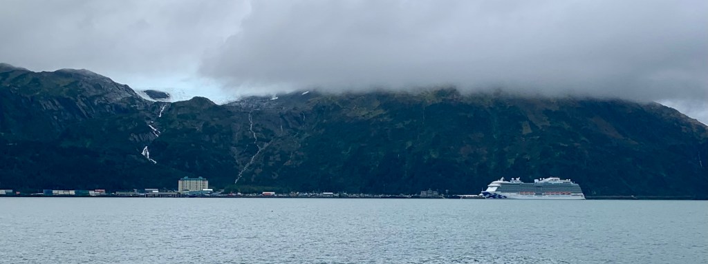
Once through the tunnel and just around the bend, I anticipated Whittier coming into view tucked in a valley of picturesque glaciers and mountains. However I was totally dumbstruck by the site of The Royal Princess Cruise Ship, a city unto itself with its 19 decks and a myriad of services including restaurants, spas, live theatre, movie theatre, fine arts gallery, shops, casinos, driving range, game lounge, retreat pool and bar, fitness center, fountain pool, plunge pool, sea view bar, sea walk, bistros, pastry shop, pizzeria, ice cream bar, wedding chapel, library, beauty salon, medical center… If one is a resident of this city anchored in the Whittier Harbor, these inhabitants don’t need to use the shops or services of Whittier. And this is probably true since, seeing the size of the ship I anticipated crowds in the town but that was not the case at all.
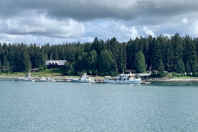
Following the recommendation of Phillips Cruises, we made sure to adhere to their recommended tunnel time. I soon realized this clearly is devised to give us an opportunity to peruse the shops in Whittier. However, Whittier isn’t what you’d expect of a typical, touristy cruise ship port, and waterfront town. There is nothing chichi about Whittier but its quite unadorned, unsophisticated, and on the edge of feeling like a mixed-use area, zoned commercial-industrial i.e. the cold war army port that it was circa WWII. Most businesses in Whittier are clustered along the small-boat harbor, where a combination of commercial fishing boats and pleasure vessels bob in the turquoise water. For me this is the most picturesque part of Whittier. The rest leaves me perplexed about the strangeness of this town.
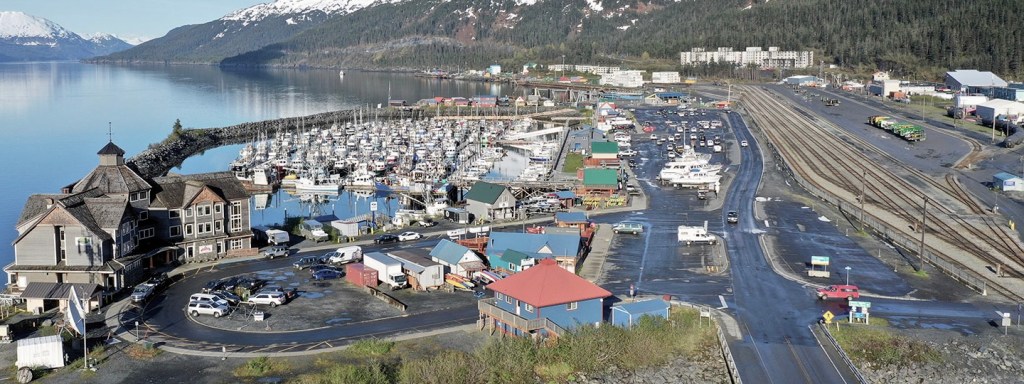
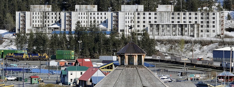
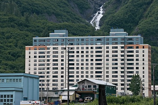
After we stood in line for our reserved tickets, we walked the harbor “strip” but other than a couple small shops, 3 or four cafes and ice cream shops we saw a rail yard, lots of parking lots, storefronts for activities and charter services, “historic” neglected military buildings, and the post WWII-era 14 story Hodge Building — now Begich Towers Condominium (described as an arcology) and the now abandoned Buckner Building (the slum of Whittier). These edifices look alien to me in this harbor and valley of rugged raw beauty. Begich houses the majority of Whittier’s population, local government, public services, businesses and schools. With most of the community and its services either inside of or connected to this condo building, residents are able to remain inside the building for long periods of time if the weather is inclement, or they simply do not want to leave. I doubt these apartments have fire places to cozy up by on those long dark frigid days.
The HarborBegich towers and Horsetail falls.Buckner BuildingThe “Princess City” Dwarfing the City of Whittier
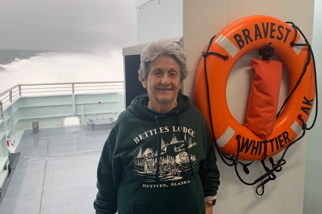
So after hoofing around the streets of Whittier we joined the jostling and shoving queue to board the M/V Bravest, the smaller of the two high speed catamarans.The upside here was that this was the overflow booking and this keel was not at capacity so less jostling down channel hopefully. It reminded me of the airplane boarding process where everyone congregates to be first in line even though all seats are reserved. We clearly did not need 1.5 hours to take in the town nor had I done enough research of potential hikes in the rain – or a change of clothes for the cruise if I got wet or muddy on hike).
We quickly found our seats at our reserved table in the interior of the vessel but gratefully did not have to share that table for 4 with anyone. I was a tad disappointed that we did not have a window table but as the day progressed those windows kept fogging over and those seated there had to keep the squeegee going constantly to de-fog them. Clearly the cabin was full of hot air and probably in more ways than one. Since there was plenty of access to the top and stern decks to get open views I knew I would be spending the bulk of my time out there. Shortly after the launch we were served a lunch of clilli or salmon chowder, chips and coleslaw while the boat made its way towards the glaciers. It was about an hours journey before we neared Esther Passage and passed the sea lion rookery. This narrow channel is navigated in the hopes of seeing the abundant wildlife in the area wildlife
Churning through Port Wells toward Esther Passage in Prince William Sound
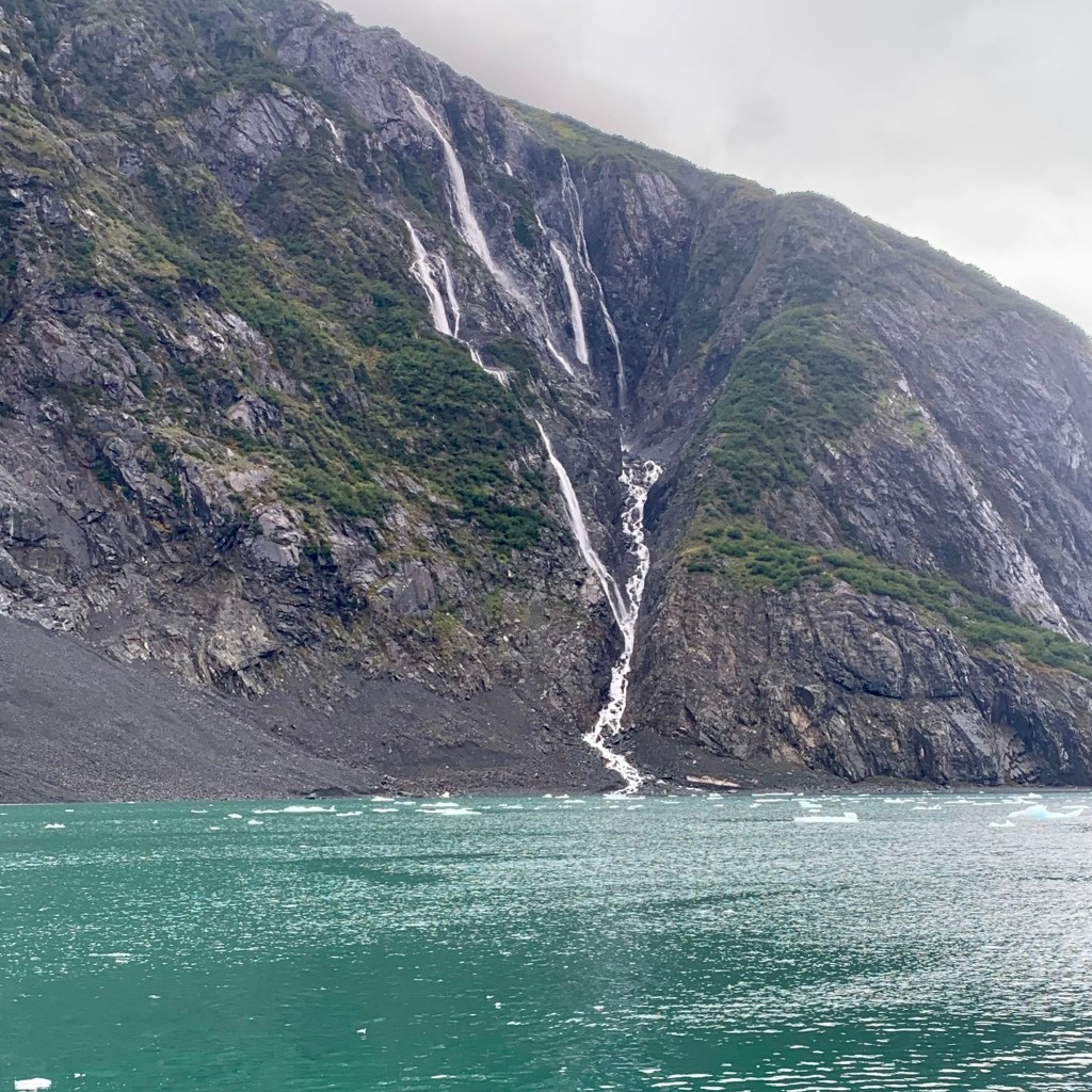
Port Wells to esther PassageSea LionsEsther Passage 7 Miles of Forest Lined ShoresEsther Passage – Narrow Waterfall-Filled
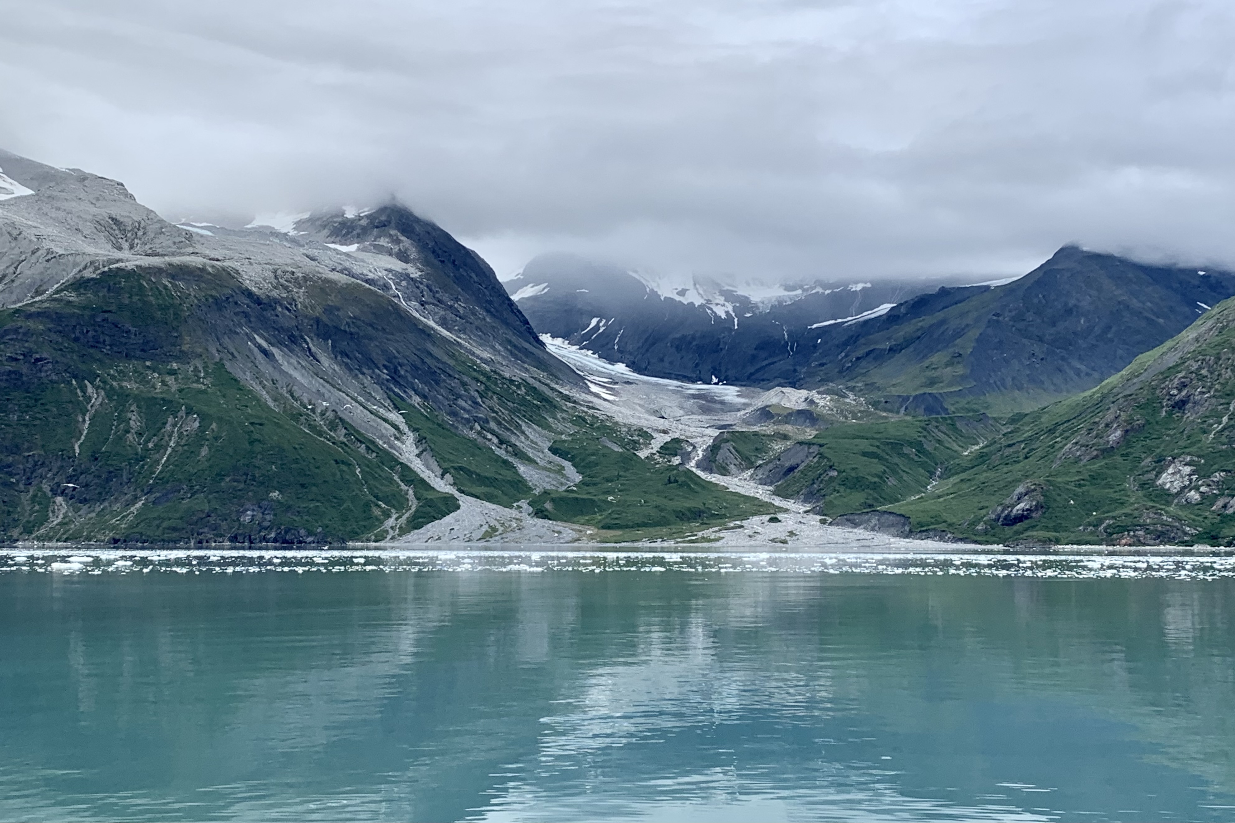
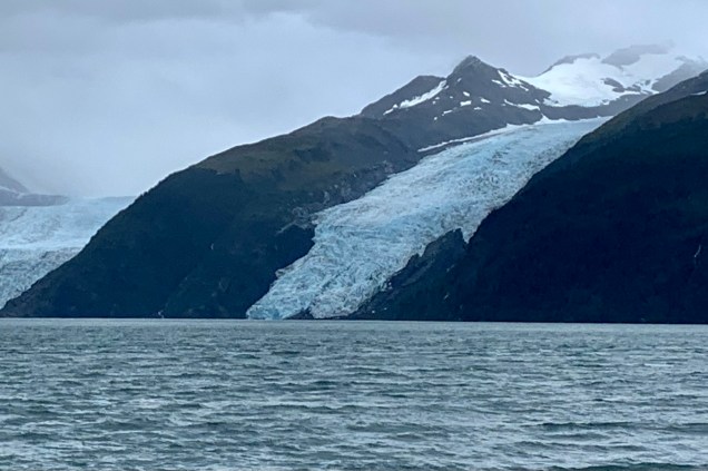
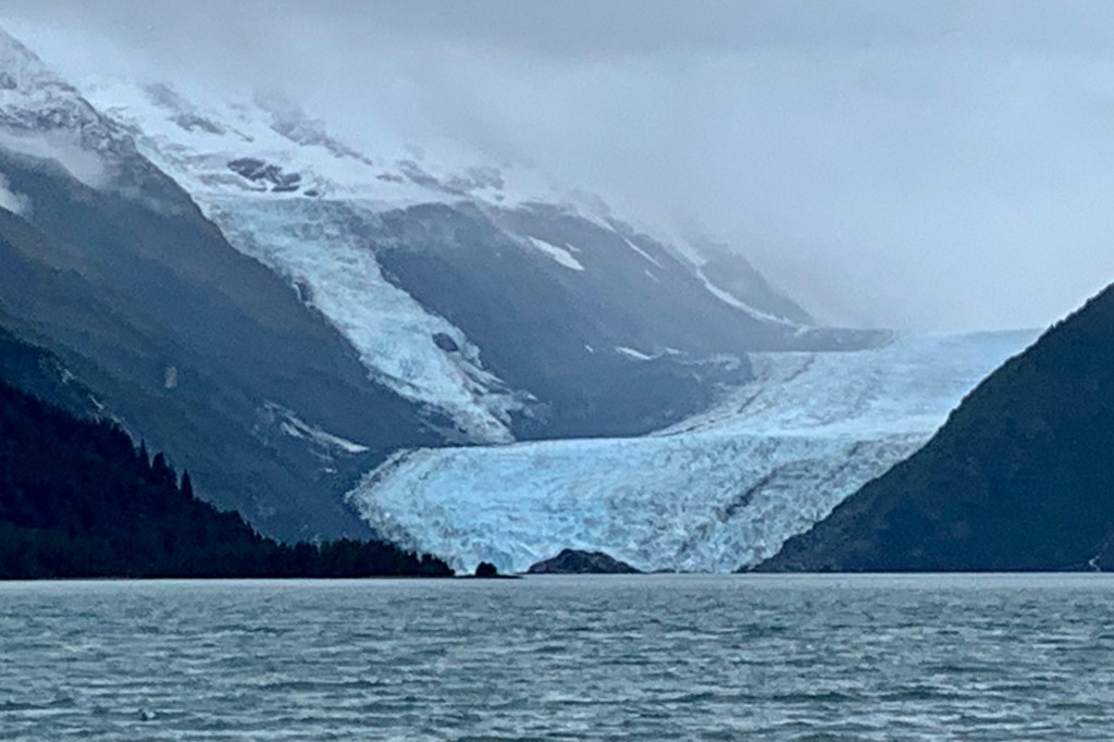
The world’s largest concentration of tidewater glaciers is in the Prince William Sound. Of the 100 plus glaciers in the area our cruise advertises the magic # 26 Glacier Cruise. Perhaps I could have better used a Magic Eight Ball to predict whether 26 would be the magic number of glaciers we would be beguiled, bewitched, captivated, enchanted, fascinated by and in wonderment of. The number 8 on the Magic Eight Ball was more accurate. Now I know weather conditions did play a role but my tally for this cruise of over 100 hundred miles was 5 tidewaters glaciers (meaning they move down the glacier valley until they end at the waters edge) and perhaps around 8 hanging or valley glaciers (originate high on the wall they descend only partly down to surface of main glacier.) As we headed in towards Harriman Ford I began to see what I gathered was valley or hanging glaciers high up on the mountain faces.
We were informed by the Captain, that due to stormy conditions in College Fjord, where glaciers are named for colleges such as Harvard or Yale, we would be bypassing that part of the cruise. I had no idea why anyone would choose to name glaciers after elite and very expensive eastern seaboard colleges in wilderness Alaska. The incongruence is astounding but I came to find out that College Fjord was discovered during the Harriman expedition (circa 1899) and the Harvard and Amherst professors on board named the glaciers in the fjord after New England Colleges. If I had my druthers I would rename them something more earthy and related to Alaskan plants and animals rather than elitist places almost as distant from Alaska as one can get in the USA. I doubt my ideas will get many votes but here goes: tundra, fireweed, salmonberry, goosetongue, partridgefoot, orca, moose, caribou, grizzly, humpback… I would add whale here but it looks like glaciers in Alaska have only first names.
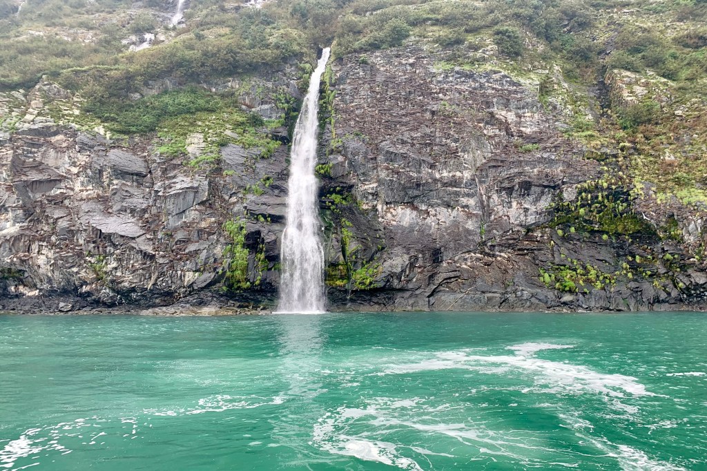
Cascades Glacier
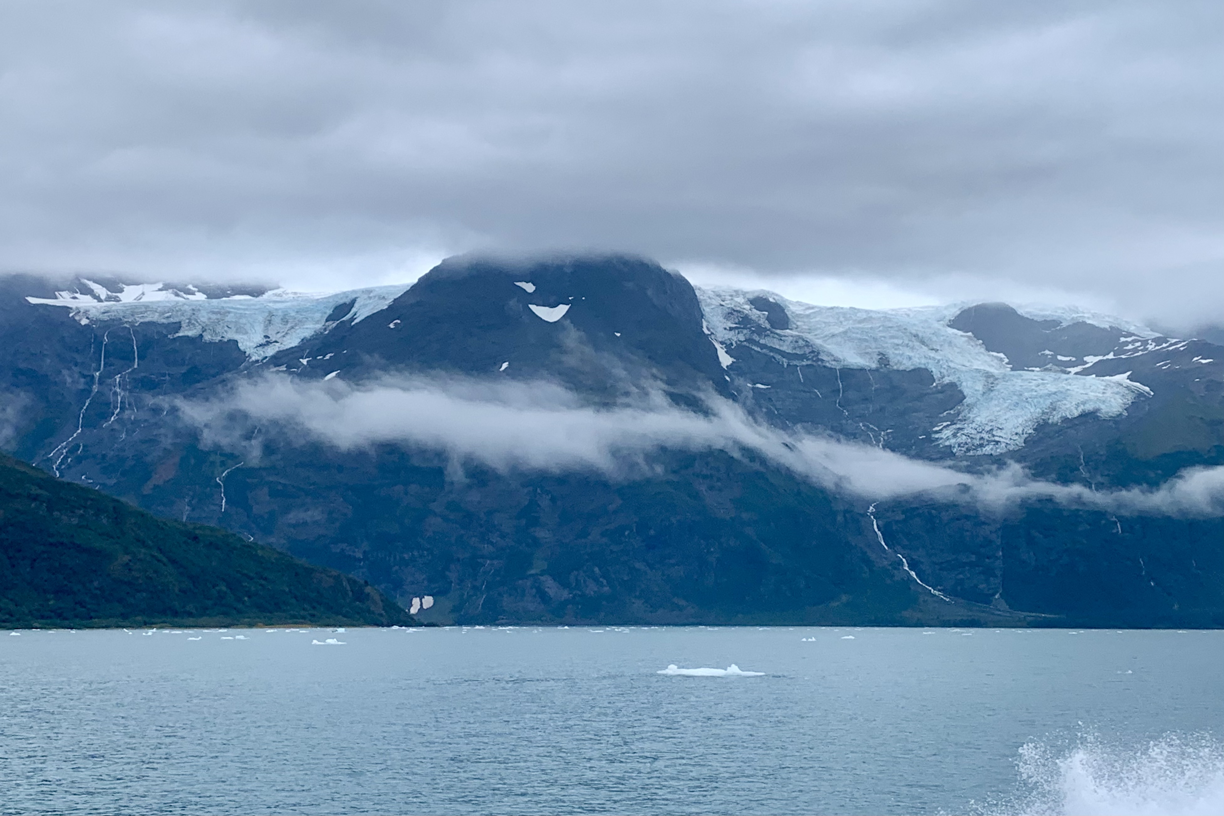
I stood on the outside decks most of the time, just gazing at this most astounding extraordinary scenery: the aegean blue waters (I checked out 144 shades of blue and this is best match 4e6e81 hex color code), brown and green forested hills and waterfalls, snow capped mountains and, ice fields and glaciers crawling down the mountain sides and valleys. I have heard that the tidewater glaciers have a language of their own and are prone to chattering as the get ready to calve. They crack, creak, roar, hiss, whisper and gurgle. Sadly though the chatter is a lamentable sign of these vanishing glorious massive ice floes. I love the “silent sport” of kayaking and was wistfully thinking my preference would to be doing this trip tucked into a small watercraft closer to the icy water and without the noise of the catamaran drowning out all but the loudest crackling.
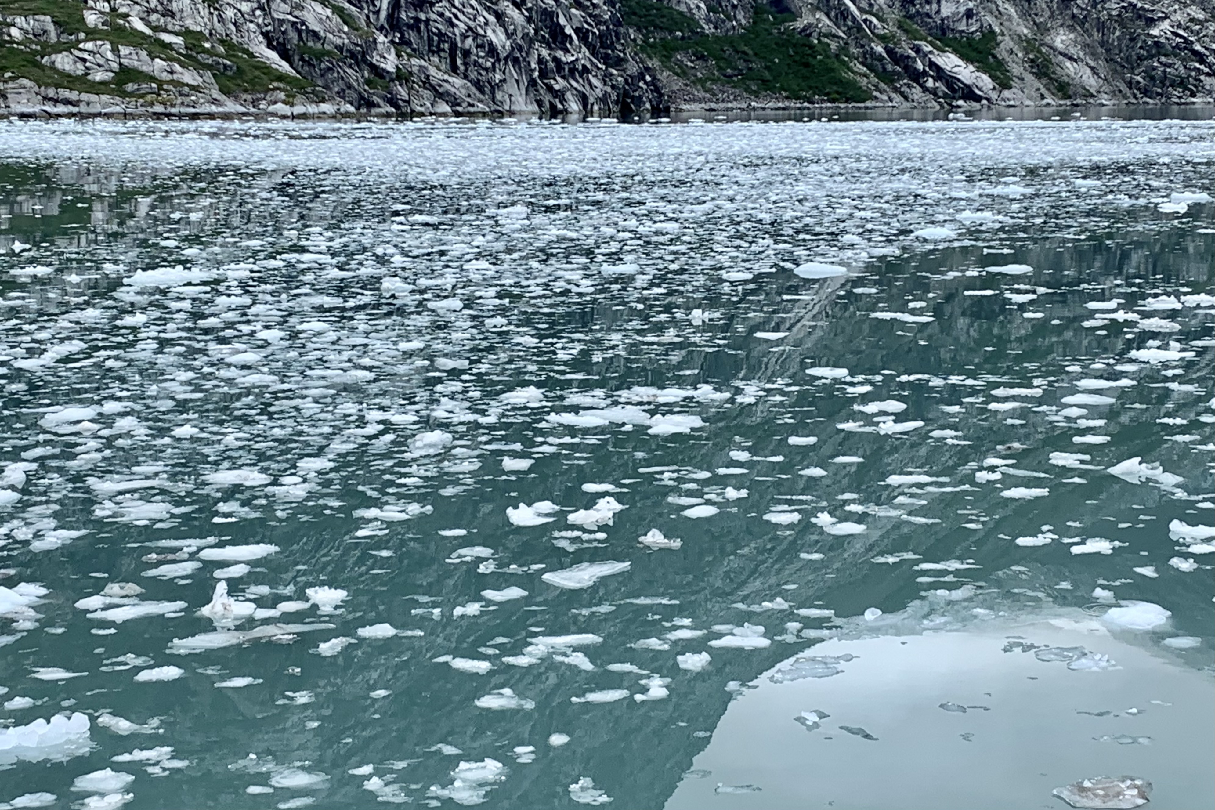
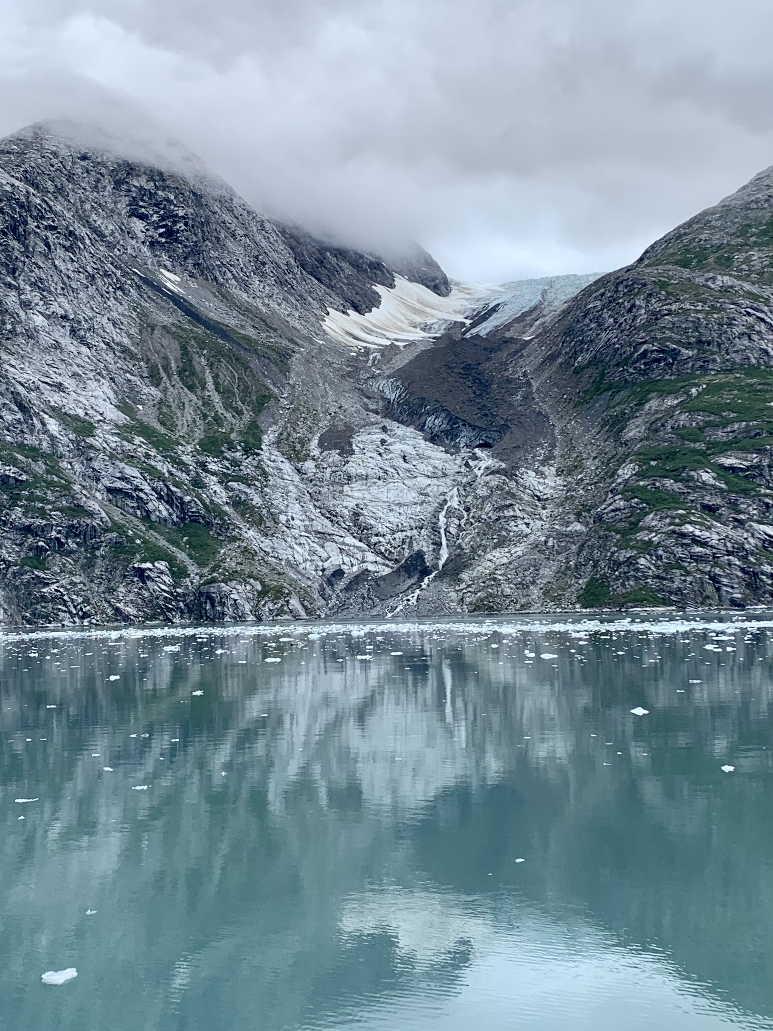
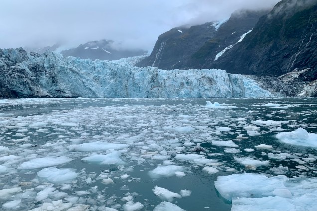
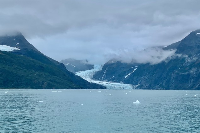
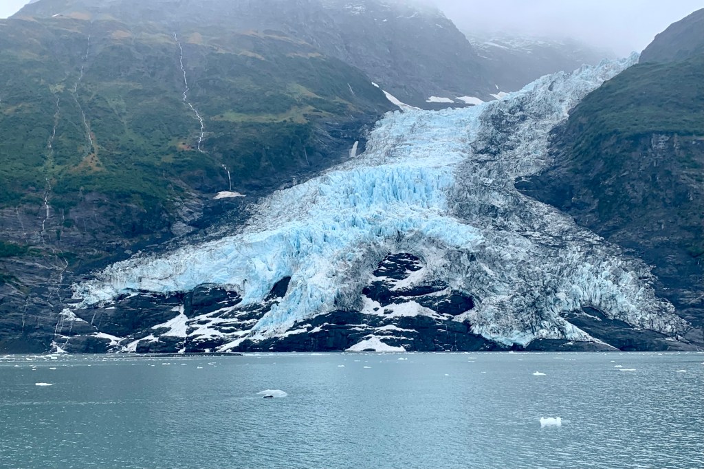
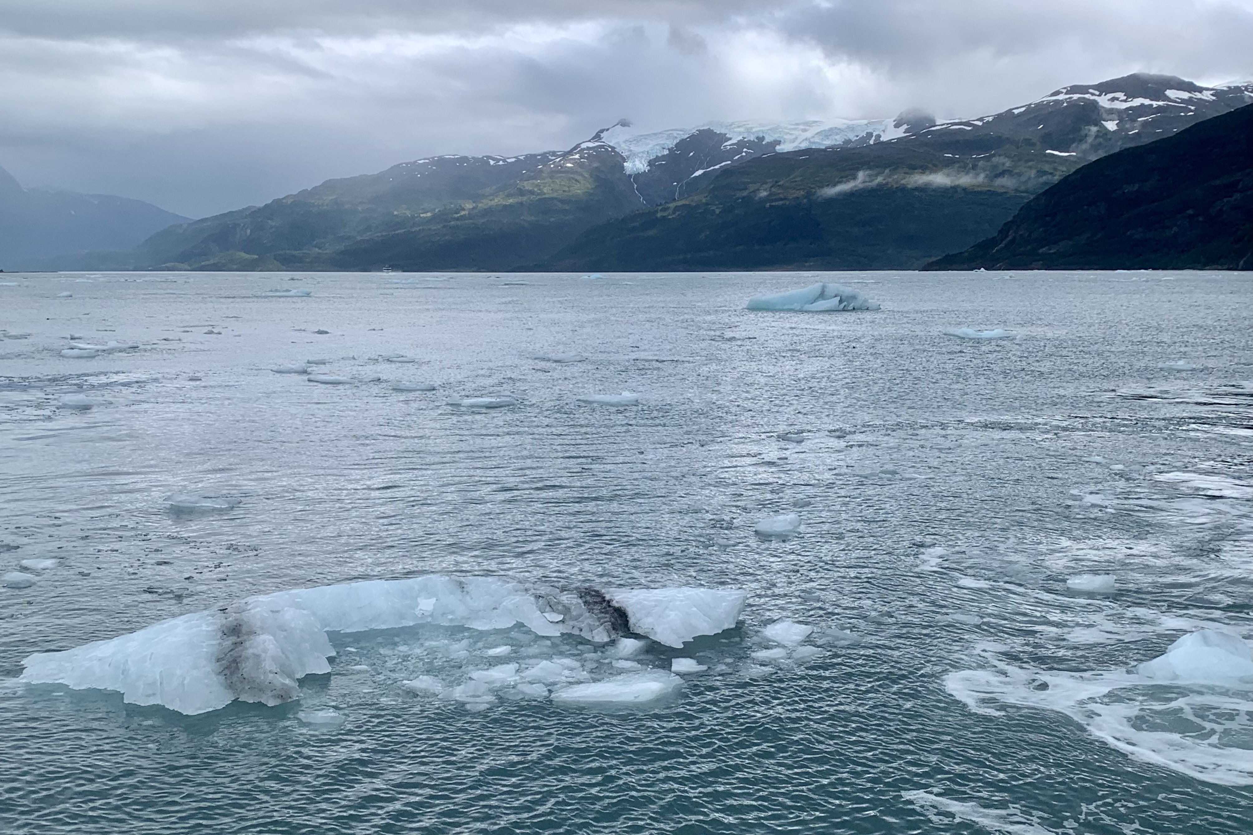
After drinking in the magnificence of the glaciers in this amphitheater of tidewater glaciers, we churned our way up Harriman Fjord along a river of frigid water flowing with burgy bits and growlers, the mountains fringed with hanging and valley glaciers on our way to Surprise glacier. This is a very active calving glacier (not the calving where a domestic bovine is giving birth to a calf). We were churning along among sculpted bergy bits (a bergy bit is a medium to large fragment of ice (hint iceberg) with its height usually more than three feet but less than 16 feet above sea level and its area is about the size of 1,076-3,229 square feet house) and growlers (not to be equated with the glass, ceramic, or stainless steel bottle (or jug) used to transport draft beer. ). In icebergs, trapped air escapes as it melts, it sometimes makes a sound like the growl of an animal, and that’s how growlers got their name. Growlers are smaller fragments of ice.
When we were within 1000 ft of Surprise Glacier, the captain idled the engine down as low as possible and kept rotating the boat so everyone could get better view and hear the calving. For most of our voyage the decks were relatively free but for all but the most adventurous of we human beings on this journey. Most (probably 80%) stayed inside to avoid the wind, chilly air and intermittent rain. BUT now the herd mentality set in and everyone donned their rain gear and a flock of bodies pushed and shoved their way out onto the fore and aft decks to get “the photo of the year” with themselves center stage. Clearly this was the moment everyone was waiting for. They rooted themself to their spot on the rail irregardless of the many others waiting for their moment. With a backdrop of Surprise Glacier and the brilliant blues in the fractures and crevasses, this was by far the best photo op and of course I too was one to briefly partake in this selfie-portrait movement and was not hesitant as ask strangers to snap a couple, making sure my head was in them. This is always a crap shoot because all photo takers are not created equal (notice I did not use the word photographer).
There was very little calving activity but I don’t think the “selfies and portrait gang” would have know since their back was to this mighty glacier as they posed and posed.This activity appeared to trump all of the other wonders of Price William Sound and when they were satisfied hurried back on into their cozier photo-shopped environment. To each his own, but for me just being in this natural amphitheater carved by mighty glaciers, with shimmering waterfalls cascading down the dark rock to the sea was the trump card. An aside: the most electrifying part of this for me was when I standing on the rear deck to avoid the masses, I was up against the railing. Suddenly with one quick maneuver (the captain revved the motor to turn the catamaran) and a geyser of bone-chilling water skyrocketed up and rained down upon my head, my hoodie and right down the back of my neck. Not to be daunted, I just put on my rain gear and toughed it out and took a selfie!
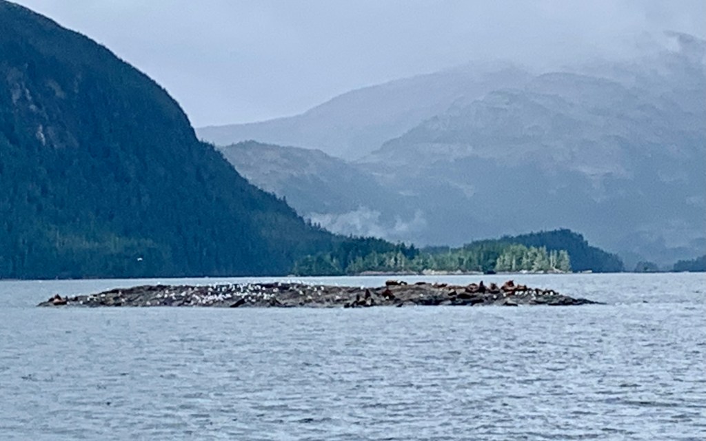
We were told that the Prince William Sound was abundant with wildlife and to watch for sea otters, harbor seals, sea lions, porpoise, humpback whales, mountain goats, black bears and migratory birds. I think since we were just about at the end of the season, all the wild creatures and critters (except for a few harbor seals on their little ice floe) were exhausted from performing for the multitude of tourists all summer and had just decided to rack their hat on this windy foggy drizzly day. There was one moment of excitement when on the return trip a black bear was sited scrambling up a rock face by Barry Glacier. The final “exhibit” in this “museum” of glaciers was the kittiwake rookery. When scoping the rookery (steep rocky cliffs with hanging vines and sparse greenery) on the return trip to Whittier, there were but a few. I saw two. The flock had moved on already, headed out to sea for the winter, with the breeding season over. And on that note it is time for me to move on as.
Black Bear Climbing Rock-face by Barry Glacier. Can you spot it? Helps to enlarge and zoom in.