The Thomas Lakes Rockslide Adventure

A great way to wake up in the morning, even more bracing than a strong cup of coffee, was a cleansing of the lower body in Prince Creek. It was just the right depth to sit in BRIEFLY! I was going on the assumption that the frigid water would paralyze any of the bacterial culprits causing body odors and they would just fall off and no longer be able to hang out and create odor. So I then numbly ate my oatmeal and we broke camp. We got the backpacks ready for an overnight out-and-back to Thomas Lakes which is situated in the Maroon Bells-Snowmass Wilderness in the Elk Range. We had chosen it given it was short very doable distance of 2.3 miles. Now this may seem almost laughable to a long distance thru hiker but given we were hiking with a sick dog, at times needing to be carried, my altitude sickness kicking inn, and Amara’s altitude headaches etc. it seems like a very viable choice for this trekking crew. It had only about 1600 feet of elevation, starting at 8600’ and campsites at around 10, 284’. Now I am beginning to realize that initial descriptions of trails are by no means on target. I have yet to do a hike where the mileage is right on its stated distance. The description stated this trail was 2.3 miles BUT my Garmin read 4.1 at our destination. We discovered that often the trailhead is NOT where one starts hiking a specific trail, but up where perhaps your destination branches of from another trail, at which point you are starting at 0. The same thing occurred on the Oh Be Joyful trek where we clocked in at 7.25 miles but according to the trail guide we would have been at Blue Lake (which we never got to) at 6.5. But I digress.
Needless to say our anticipation of a relatively easy to moderate hike did not exactly bear true. The altitude again was knocking the wind out of me. It felt somewhat akin to a moderate hangover, which is a bummer because my drinking days are long gone and I did all the right things to get ready for this trip. The trail itself was a moderate grade and relatively easy to negotiate initially. It ascended through a forest of aspen and oak and there were excellent views of the Elk Mountains in the distance. It slowly climbed, with expansive views of pastures and extensive fields and slopes of wildflowers and views of the Roaring Fork Valley. It was breathtaking. I was very happy taking my time one small step after the other and then a pause to drink in the scenery and of course take more than a few pictures.


The build up of the thunder heads was early this day as we had good views of Mount Sopris which was now draped in ominous black thunder storm clouds. We had put the rain covers on our packs at the start thank goodness. At about the point I thought we were almost there (still unaware that the distances didn’t start until we 1.8 miles in) it began to rain, and then continued to rain harder and harder. So we hauled out the rain ponchos and hunkered down in the woods perched on some boulders. I managed to get Kilt onto my lap under the poncho, a very challenging task given he had no clue as to what I was attempting to do and seemed to be fighting even though he was already quite rain-soaked. Simba looked like a very large drowned rat. It finally let up after about 15 minutes and we meandered on with the sun coming out intermittently.


We continued through groves of aspen and evergreen interspersed with meadows. The wildflowers continued to be prodigious and stunning so we spent a lot of time viewing and photographing them.Soon the trail became noticeably rockier and now was a rocky, rubbly high county trail of broken rock debris, more forested with fewer vistas. I can only think of the term talus to describe the path. It’s seemed that all the talus that has broken off of the mountains and adjacent cliffs was piled up to make the trail difficult, though most likely this was a naturally occurring process. The pieces of talus were of all sizes from tiny to huge boulders, or anywhere in between. I wasn’t scrambling or boulder hopping (would that I could) but was picking my way over the rocks to find firm footing, as some rocks would be loosely planted. I knew it would be easy to miss a step or twist an ankle or worse. It required a lot of focus in the midst of huffing and puffing. It was slow slow going and the distance of a mile felt like two or three.

We passed the first smaller emerald green Thomas Lake and knew we were only about .3 mile to the other Thomas Lake. The campsite is nestled beneath the twin peaks of Mt. Sopris just above the second Thomas Lake. It is a stunningly gorgeous emerald green timber lined lake. It was quiet and secluded at this point and it seemed like we were situated in a bowl, surrounded by lesser peaks across Thomas Lake which completed the circle. We chose campsite #2 as it was not too far down to the lake for resupplying our water. There were a couple large flat boulders which made great tables to prep and eat lunch and afterwards we set up camp, including for the first time an ultimate and safe wilderness hanging of the Ursack, our bulletproof Spectra fabric white bear bag. It was at least 20 feet up and out on a limb!!! That left us the afternoon to relax by this beautiful little mountain lake, read, ponder, and wade in the very cold bouldered bottom lake. It was a fun challenge stepping around onto boulders on the lake bottom – seeing if they were firmly planted, slick with algae, flat enough to step on and not tip me in for a shockingly cold dip.


Rain threatened off and on during the afternoon and dinner time brought a thunder shower. When the rain broke we quickly got the Jet Boil going for our “gourmet” bagged meals which I so lovingly created prior to this trip. Out biggest problem was impatience, not waiting long enough for the water to fully absorb so instead of pasta or rice a la dente we had many very crunchy rice and pasta meals! But often impatience was fueled by the threatening storms. Today was no exception because we soon needed to retreat to our tents due to more rain and the visitation of the dinner hour flies and mosquitos.
When trying to nod off around nine, all of a sudden there was a loud thunderous noise and it seemed like a very large loud bulldozer was going to come tearing through, massacring the forest and our campsite. Needless to say we were quite startled. When quiet fell upon us, we were able to deduce it was a large rockslide on one of the mountains encircling the lake. It definitely put me on edge a little, not knowing how close it was to us, but I wasn’t going to pack up my tent and hike out in the dark. That would be sure disaster. I heard two more lesser slides during the night.
The adventures of the night didn’t stop with the rockslide though. It continued to rain and rain. When it rains on the tent it is hard to tell how hard the rain is. It seems to magnify the intensity. But I had to pee badly and I had kept putting it off. But finally I had no choice by 1:00 am. I kept trying to fiddle with my rain cape and put it on but failed miserably. So I finally just climbed out and stepped in a “lake” of water up to my ankles My tent was sitting in a shallow lake. So after completing the task, I crawled back into the tent and had to strip off my soaked socks and pants as the legs were sopping. I finally was back in my bag and asleep by two, praying for no more adventures that night!
Though we had brought enough food to stay and extra day we opted for the hike out as everything was a wet muddy mess and covered with dirt, leaves, pine needles. There was no hope of drying things out as it dawned a chilly 50 degrees and was quite cloudy. The trail was somewhat muddy and slick in spots but surprisingly better than I anticipated. Before we left we were able to pin point where the thunderous rockslide was the night before. Everything had a different look now with the dark, threatening clouds and it had an entirely different beauty. One of Tasia’s challenges with Amara, to add to the enjoyment of the hike, was to find and photograph what looked like faces in the rocks, tree trunks, flowers etc. It was quite fun way to be more aware of so much of what we often do not pay attention to in our surroundings. Can you see the faces?


Fortunately we didn’t have to dive under our rain ponchos as we hiked out. I think a lot about what it must have been like for the pioneers of our country in their traverse to the West. I am hiking with great lightweight high tech equipment and still it can get quite uncomfortable. But hundreds of years ago with the conestoga wagons and everything that needed transporting being quite heavy, how incredibly arduous it must have been. I doubt they had time to enjoy the delicacy of the wildflowers. insects or a raindrop on a leaf.


Once back to the car, the next challenge would be finding a campsite in the Aspen area, not an easy task in the high season. A visit to the USFS Office in Carbondale revealed that there was no dispersed camping in the Aspen area as it was all private land and our best bet would be to head out east to a couple of National Forest Service Campgrounds up towards Independence Pass that don’t allow advanced reservation. We began to feel discouraged as the first one was full but a few miles up the road we came to Lost Man USFS Campground which was basically empty. We of course hurried the set-up as the regular afternoon storming was looming and it did not disappoint. Kili got soaked and then jumped into the tent, muddied feet of course, and walked and rolled on my sleeping bag. That is one thing every hiker and backpacker wants to keep dry at all cost – the sleeping envelope! When the rain let up Tasia managed to string one of my tarps up over the picnic table to have a dry place to eat our yet again JetBoil bagged meals! However, it is a good thing because I can’t imagine trying to prepare a gourmet meal in the drizzle. Would be quite a watery diluted menu. Rain forced us back into the tents by 7:30 for the night.

Our First Dispersed Camping Experience in the White River National Forest


After resupplying in Crested Butte we headed to Carbondale.We side tripped through Redstone, a very quaint and expensive historic small town on the Crystal River. The next trail we planned to backpack accessed on Forest Service Roads that are on mostly gravel – meaning washboard teeth jarring and kicking up lots of dust, driving 10-15 miles per hour. We did not have a good handle on where we were going to camp but given that we were going to be in the White River National Forest, dispersed camping was always an option. We scouted out the Thomas Lake Trailhead but it was too late to think of backpacking out and there was no camping at the trailhead. So we headed back down the dusty byway. We had seen several spots along the road that appeared suitable to pitch our tents and Prince Creek was close enough to the area we chose was a water source. We would have access to out car parked at least 150 from site and 100 feet from water source. Dispersed camping,for those who my not be familiar with the practice,  is the right to set up camp in any of the National Forest outside a designated campground,  unless otherwise prohibited in specific area. I think of it as half way between “car camping” in an established campground with toilet and water provide and backpacking. There are no services such as trash removal, no facilities such as toilets , purified water,  fire pits, or tables. Of course with backpacking one engages in dispersed camping with no access to car.  It was in a shady grove, there were few bugs, and there was a great very cold creek in which to take a river bath. Here is a glimpse of our last two kitchens and bathroom equipment,  the hanging of the bear bag, water purification, and the  frenzied dogs at dinner time.

It eventually became a joke but when Tasia half-heartedly made an attempt to hang a bear bag. They warn of bears in the area but there was not much of a danger in this area here so our other concern was rodents.)After stretching the line and attaching a bag quite low she suddenly realized she was hanging it in the most contraindicate spot i.e. by the tents. So it became the task at each campsite to take a bear bag picture.

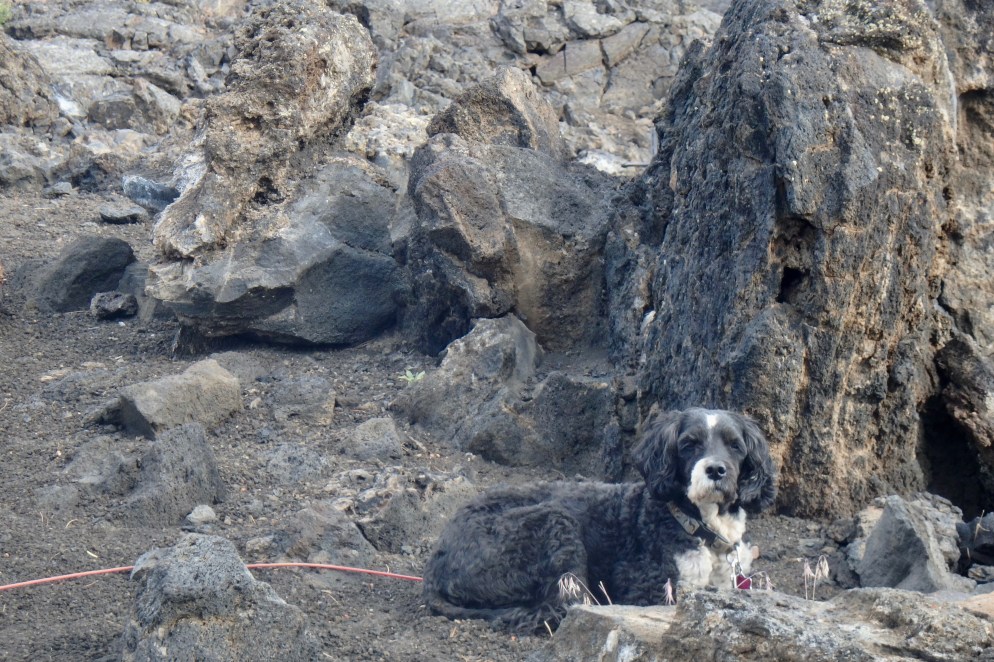
The two dogs have been incredible troopers given the many challenges encountered. Below are portraits of KILIMANJARO aka Kili, my sick dog during the backpacking adventures (who is now well), but he still hung in there with a little assistance and hand feeding by my awesome daughter Tasia.


Simba is not to be forgotten. Imagine, “Tiny Dog” as Tasia dubbed him, having to take ten steps for our one, leaping up on bolders that are more like short rocks to us, getting his belly wet fording creeks when it barely touches out toes. Kudos to this mighty little hiker.

Amara, twelve years of age was a great team member.  She trekked along , helped out with the dogs and was entirely engaged in the hike. Her mother, Tasia, would keep her engaged through such task as photography of wild flowers, finding faces to photograph in flowers, rocks, trees or any other object of nature that stood out. Portraits of Amara:


Tasia is a great photographer and we spent time by the creek photographing some of the simplest thing in our immediate surroundings including a clover leaf and clover flower,  a tree trunk, a mushroom, an abandoned bicycle with thistles growing into its wheel and chain, and  a strange nest in a globe hanging from the tree. If I take the time to pause and really look about me, there a a myriad of things to see.

It was a  quiet night with a brief rain burst.

The “Oh Be Joyful” and at Times Not So Joyful Hike

Though we had to eventually shift gears since we chose not to risk out lives on the 4-Pass Loop hike in the Maroon Bells, we proceed with the original plan for a shake-out hike on a moderate hike of 13.2 mile round trip: the “Oh-Be-Joyful to Blue Lake Trail in the Raggeds Wilderness Area, Gunnison National Forest. It could be accessed out of Crested Butte. So we basically just stuffed everything into the car wherever it would fit and set out on what we anticipated to be about three hours. Given the mountainous winding and mostly unpaved road, it was a much longer adventure. We arrived in Crested Butte, a bit of an upscale hiking/ski town, got ice etc, and proceeded on another gravel road with the destination being the Oh-Be-Joyful Campground. The driving instructions in the Trail Guide I was using said the road, Slate River Road, was suitable for low clearance 2W drive. I either forgot or never read the rest of the instructions because I started on down the access road to the camp and pretty soon realized that this was VERY likely a 4WD road. But I managed to get my rugged, and slightly abused, little Prius on down without getting hung up on a rock, buried in a whole, or tearing out anything on the bottom of the car. But I soon came to my senses about the next section which involved crossing the Slate River – which at this point, in the early summer runoff, is quite swift. I saw lots of vehicles crossing the 18-2 inch deep path but I was NOT even tempted. I did not want to to drown my car and see it floating down the Slate River. Surprised? Since it had a swift current and was knee high at points, I did not want to chance too many crossings myself and end up wet, hypothermic , and with perhaps something broken. There were campsites on both sides of the creek but is it was 4:00ish in the afternoon and all the ones on the side Priss Prius was on were taken. Some other campers said there were still few across the creek so Tasia decided to wade on across to investigate. Of course this meant abandoning Priss Prius and schlepping all the gear across. Recall! Everything was in total disarray. It would not have been such a challenge if we had had our packs set up for trekking and we would have had to cross with them to get to the trailhead anyhow. Definitely, it would mean far fewer trips for my “strong as an ox” daughter Tasia. But it was just too confusing and trying to sort and organize in the parking lot in the hot sun was less than ideal. I was beginning to think that this would not be “oh-be-joyful.” So Tasia need to transport everything across in at least 5 or 6 trips , through the very cold swiftly moving water. A kind young man named Ross asked us if we needed help and he took a couple loads across. I made one trip, carrying only myself! We were in a mostly shady site though the sites were spread out but not much private. So began camp-set up, rehydrating meals, organizing out pack and settling in for a cold night and hopefully good warm sleep. We soon discovered that this USFS campground, being easily accessible from Crested Butte, is a great spot that some of the younger outdoorsy but also party folks who like to gather for a lively campfire get-together frequent. The “company” kept arriving at least until midnight or one, driving, quite noisily, their trucks across the creek and of course slamming car doors. This was mildly annoying. But they soon earned themselves the nickname of “Hatchet Boys” as they were intermittently chop, chop, chopping and chopping some more logs for their fire. They were still chopping when I finally fell into a deeper sleep around 1:00 am. Since there is usually something that is in the surroundings when camping to disturb the tranquility of the evening, we dubbed that night i “the night of the hatchet boys. ” This again was not an “oh-be-joyful” night.

We were up and after our Italian Roast Via and oatmeal, packed up and were ready to hike out about 10:00. Prior to leaving, it of course involved at least 2-3 trips back across the swift cold creek for Tasia with things we did not need and for things we had forgotten! But our “practice backpack” had commenced. The hike was tougher than I had anticipated. It was already a bit hot in the sun and the dogs wanted to stop and rest every time there was shade.

At first, there were also quite a few people as it is a popular day hike. I was relatively comfortable with my pack’s weight and kept trudging along but could already tell that the altitude was going to kick my butt. I hiked a lot at home, carried a heavier pack for longer distances BUT Florida is sea level and there is NO way to train there for altitude. Even spending several days prior to this at altitudes between Denver at 5280 and Aspen at 8000’ didn’t noticeably help. I began feeling mildly nauseas. It is very humbling when I think of myself as an Ironman athlete still, to be so untrained after all my training. We started at the trailhead at 8,960’ and the backpacked up to 11,075’ for a gain of 2115 ft. It certainly sounded reasonable in the description, but I was beginning to wonder how long it would take me to huff and off my way up. I didn’t doubt I would make it but it was more a matter of when. I was not in an “oh-be-joyful” space right then. The valley however that we were ascending was awash with wildflowers, waterfalls, the Oh Be Joyful Creek, stands of timber providing needs shade, and views of many peaks: Hancock, Oh Be Joyful, Alfey Peak and Purple Mountain. With needing to ascend slow, slow, and steady I did have the time to really revel in the beauty.

The trail had moderate grades so that was quite manageable. By the end of mile three Kili, who was still quite under the wether, started refusing to walk. Kili was not at all “oh-be-joyful.” He has not been eating much, it was getting hot, he too seemed to have some level of response to the altitude. So generous and loving Tasia started carrying this 22 lb. sick doggie up the mountain.

We stopped by the Slate River for lunch and we all felt a bit revived after a needed break. I was feeling a bit joyful now. Kili perked up again and walked on his own. Simba was doing a great job and only had to be carried across deeper streams and when he decided it was time for him to take a break in the shade so as to move him ahead a bit. Some of the next challenges included deadfall with several trees blocking the trail that we would have to climb over. Not joyful, but challenging. The first higher water crossing wasn’t too difficult. I consider anything that will lap over my boots a high water crossing of which we only had one where we removed the boots and used our camp/water shoes. The less deep but more challenging water to negotiate was a meadow that had many creeks of runoff and bordered on marsh. Trying to find a trail for ourselves and the dogs through this maze of little creeks was like walking a maze. Even the dogs, who do not like water or swimming , did pretty well picking their way through though at times Tasia did carry them. Kili took a pretty good dunk once and Amara had to pull him out of the water hole.


The trail continued to get steeper entering the woods and I became more nauseous and found the breathing more and more difficult. Amara had an altitude headache. So came Tasia to the rescue. She is my “oh-be-joyful” champion. She carried her pack up a steep 1/4 mile and then returned twice to take Amara’s and mine up this steep section. By now we were all tired and had gone more mileage than the guide indicated, so we hike on a bit further and then saw an open meadow in a basin facing Oh-Be-Joyful Peak. We joyfully decided this was far enough since the last half mile to Blue Lake was steep and quite difficult. We would set camp here in the meadow on top of an abandoned marmot town. There was a creek close as a water source. So camp got set, meals got re-hydrated with boiling water (love that JetBoil), water got purified (Steri Pens are great) and we had some peaceful moments watching the waning of this day. The night was dubbed the “night of the wind” which had a lovely time dancing with our tents.

The next morning was beautiful and there was something so serene about waking and looking out of the tent in this basin filled with wild flowers, permeated with rushing creeks and watrfalls, and seeing these jagged peaks and ridges soaring into the sky. After packing up we decided to leave our packs and hike to Blue Lake. The trail was difficult to find and follow so we shortly nixed that plan and began hiking out about 11:00. It definitely is a lot easier doing the hike in reverse – though going downhill has its own pitfalls and we still needed to take it slow and steady. The one good surprise was that the area of deadfall had been cleared at some point the day we hiked up so no awkward crawls over felled trees. We joyfully arrived at the Oh Be Joyful Camp and decided the sensible thing was to stat there another night. We set up camp in a more shaded spot. This was dubbed the night of the not so joyful “deluge of mosquitos and flies.” After eating we hibernated in our tents. At least the “hatchet boys” were not still in the campground and we slept peacefully.

In the midst of our breaking camp the very gracious young man who we had met arrival day came over and offered to take us and all of our gear across the river in his truck. We cautioned that we were not quite ready but he said he did not mind waiting. So once all packed up we loaded up and were across the river in no time. Tasia did not have to play sherpa and freeze her feet. Everything got pried into the car and we were off on the next adventure.

Difficult Campground and Other Difficulties in Aspen Colorado

Breaking camp on July 4th was the order of business for the morning and then traveling on down to Difficult Campground outside of Aspen CO in Rocky Mountains’ Sawatch Range and Elk Mountains. Difficult Campground is along the Roaring Fork River at an elevation just a little below 8000’ above sea level. I had thought it was only 80-90 miles but turns out it was 180 miles and 4-5 hour drive.  I had taken my time breaking camp as I didn’t think I had to drive so far. Of course the first order was to hope the car held together on the 22 miles of washboard road out but I didn’t mind taking it easy as the vistas are beautiful and I remembered to dodge the deer. Again I chose mostly two lane roads and they were for the most part winding and curving up and down the mountains. I love that kind of driving. The route took me over Independence Pass and the Continental Divide. Those choices leave few option for supplies but managed to pick up the few things I would need and there were gas stations open. So many stores were closed though for the Fourth. I arrived at Difficult Campground, in good order, three miles east of Aspen. I am not quite sure why it is called “Difficult” – there is no Difficult River running trough it, there is no difficult road to get to it, the campsites are not difficult to find or set up, there are plenty of vault toilets and water spigots which are not difficult to find or walk to…. I had pictured something much more primitive and Rocky mountain-ish by the name. But there may have been a day years ago when it was perhaps quite difficult to get to. I plan on hiking the “Difficult Trail” the next day so I will see.

Again my timing was perfect. Just got the tent laid out and the rainstorm started to move in. It fortunately did not come ranting and slashing in and I was able to get the tent set up ant rainfly over it before we got too wet. About 15 minutes later it was over and the intense sun at this higher altitude dried everything up quickly. And so began our simple routine of setting up my cot, laying out the sleeping bag, getting the boys beds, a chair, finding water etc. I keep talking about a cooking a simple meal. This is usually some kind of flavored rice packet, into which I throw dehydrated peppers, freeze dried chicken and powder cheese or a meal of bean and rice. Breakfast is always oatmeal with powdered milk and freezer dried blueberries. So after dinner, I set the fire. The dogs, at that moment, decide it is their bedtime and go to the tent. I usually find one asleep on my cot and they definitely moan and groan when I move them, put on their coats (in the mid 40’s) at night and put them in their doggie beds.

Another dawn and I decided I would go into Aspen to get the Forest Service office to inquire about dispersed camping in the areas we were planning to hike. Traffic has seemed no more or less than what I would expect in a tourist area. But I definitely wasn’t prepared for the vast number pf people already in town by 9:00 am. I followed the signs for information as Siri would only give me directions to the USPS instead of USFS. The not so very informed information provider told me I would have to go to a town 28 miles and a 45 minute drive away. So I headed out towards towards Carbondale but within a few block, low and behold a USFS office right in the middle of Aspen. Being informed is probably better than walking into something blindly (my normal approach is to dive in the deep end) so this last statement is new found wisdom. So I talked to the man at the USFS desk and he strongly advised against us doing the hike as the passes still required cramp-ons and ice axes to negotiate. It had never occurred to me that due to the very heavy snow falls this past winter, my dream hike would be buried in snow. Of course there was this very small daredevil voice urging me to not give up yet…but picture an older adult with asthma, a twelve year old who has not walked much more than a couple miles at one shot, a “tiny dog,” and a dog that seemed quite under the weather — all depending on my daughter Tasia to be the guide, cook, pack animal, and emergency sherpa – transporting everyone’s packs and the dogs across very icy sections. So I accepted that the 4-Pass Loop in the Maroon Bell was a NOT. Drove around, feeling quite disappointed, but was amazed at the rock formations and just then understanding why this mountainous area is called the Maroon Bells. I think I am finally a grown up that has moved into a more calm place of acceptance. Years back I would have been sobbing hysterically if I couldn’t do what my heart was set on doing. Finally picked up the supplies I needed and head back to camp after parking in town and checking email and texts before I headed back to the no cell zone. There is a strong part of me that would like to be more unplugged but can’t quite get there yet.

When I selected my campsite on line it was the only available one. And though it is nice and relatively private, it is not shaded once the sun comes up over the mountains and stay in full sun until it dips back below the ridges on the West. It was HOT and though the car said 88 degrees the sun at the 7908’ is intense and felt like a furnace . Spent time re-arranging and re-packing the car in preparation for picking up my daughter Tasia and granddaughter Amara in Denver with the dogs resting in the tiny shade spot we had. However Kili has not been himself, for several days. He was very lethargic, not eating much of anything, and panting excessively so I decided to put him into the air conditioned car, drive as far into town as I needed to get cell service. I called a couple vets and I was able to get an appointment at the Aspen Animal Hospital the next morning, as it was already at 4:00 in the afternoon. I also took the time to make some telephone calls so dogs could be in air-conditioned car. The afternoon rain set in just as we were getting back to camp but the upside was that it cooled the temperature down to 73 degrees. After dinner I finally decided to try at least of mile of the Difficult Trail. Well the trail was not that difficult, unless I suppose you can’t walk a few feet without getting winded or are unable to negotiate stepping up on few rocks. The crossing of the Roaring Fork River had potential to be difficult but was not difficult because there was a sturdy bridge. I did it in Crocs though I really don’t recommend hiking in CROCS.

I had to stay organized (that is a challenge in small Not-So-Pretty Priss Prius) with way too much gear in tow, break camp and be at the Aspen Animal Hospital at 10:00. Two hours later and $700.00 poorer the diagnosis was gastroenteritis and we left with pills and a still very lethargic panting anemic dog who had lost 3 pounds in the last month. I never would have anticipated how much I would worry about these dogs. But the are my best buds!!! So I finally was off to Denver at 12:30. I stopped in Silverthorne and checked into LaQuinta, mostly so i could unload a bunch of gear so as to fit Tasia’s and Amara and their gear in the car. Also set up the “charging station” so all the techie stuff would be up and running for he backpacking. Of course I got stuck in the rush hour traffic getting to DIA for a 5:30 arrival. It was a happy happy re-union though I just about fell over when I saw the massive suitcase that Tasia had that would need to be squeezed into my pint sized Prius. But I know Tasia can work magic when it comes to packing gear into a car and it worked quite well (of course I had not yet told her that I had stored a bunch of stuff in the hotel room in Silverthorne that would also have to be pried into a place in the car. It was a peaceful and happy evening after a trip to Target for a few last minute items. An so the next phase of this journey, backpacking, was about to begin.