Organ Pipe Cactus National Monument


In contrast to Joshua tree my arrival at Organ Pipe Cactus National Monument campground was not so smooth . The day was pretty much like most of travel days: break camp (and I made my goal of 9:00 am); gas up; return any necessary messages or phone calls when in cell range; and stop and get ice and expensive lunch meat to feed Kili, the dog with no appetite. Then, on I traveled across the desert. I was moving from bear country into rattlesnake territory. It is about 55 years since I studied geography and I probably killed all the brain cells that stored that learning with all the college drinking and partying. I mention that because I wish I had more knowledge of the land, the geology and the vegetation zones and what I was observing as I travel eastward. Even with all my travels in the US, much has been on interstates and I never keenly observed on a micro scale the geology and vegetation along the way.  I always thought of desert as relatively flat and boring. But It was extremely fascinating as I drove on east to see the changes in the desert scape from the Mojave to the Sonoran The predominant color was in the tan-gold spectrum with the desert sands reminding me of spun taffy.  The mountains at a distance seemed void of vegetation, quite dark and empty, but closer up they were dotted with varying shades of grey vegetation. I avoid all highways on the way down to Organ Pipe and came through a variety of small decaying towns. What took me aback the most was upon traveling down 72 towards Gila bend,  just out of Vicksburg, I passed a couple of huge farms with cattle feed lots in this area where no amount of hay could possibly be grown to feed the cattle. There were huge walls of hay stacks on the farms as well as truckloads of hay on the road being brought in. There were what I call “cowports” with fans, akin to a carports for cows – huge long rows of covered feed stall. To see that whole operation in the middle of the desert when it was 97 degrees at the end of October, was upsetting for me. It seems inhumane. But I am not a cow and really have no idea how a cow experiences this. But I don’t like it! Much of the route also had open range and many signs warning about watching out for livestock. I was extremely saddened to see a dead cow by the roadside. I have seen deer, all sorts of smaller animals, alligators but never a dead cow. Along the same route there were aqueducts to bring the water down for irrigation the desert. I can’t imagine how much of a waste of water that is (even if food is being grown) because of the high evaporation rate in the hot arid region. As I got further and further south the temperature climbed to 99 degrees and the last 80 miles of the road to Organ Pipe was a straight shot. A new presence was two border control stops – mostly for the traffic heading north from down south Mexico way. The other difference was the often placed signs of warning about illegal immigrants and smugglers.

I decided however I did not need to be fearful – as most of those who know me and know historically the risks i have taken I began to notice more and more Saguaro cactus, at first, few and far between. The reminded me of sentries posted to guard the way. As I got closer the “head” count was higher but they all still seemed like lone sentinels standing there quite stalwart and some quite imposing with their multiple arms.


I arrived at the campground in good order at the Twin Peaks campground and proceed to find a campsite as this is a no reservation park. It is a quite large but ver nice campground with real plumbing and solar hot water showers.

IMG_3184

All was on track until I made a turn into the lane for a campsite and cut the corner quite close, not seeing two tall curbs that just happened to inexplicably plant themselves in front of my wheel. Well my powerful Prius just jumped right up on them and hung herself there and could not plow right on over like perhaps a 4WD could. NOW WHAT? After conferring for quite a while with a camper nearby, I decided it best to call AAA and request service out here in the middle of the desert about 80 miles from someplace. I got it arranged much to my relief. In the meantime I set up camp – not on my chosen site, but on the one nearest the car. Shortly. the camp host, John, came by and spent a while surveying the predicament Pretty Priss Prius got into. He decided to call the park rangers. Of course by now it is pitch dark out. While waiting, along came Border Control. They patrol the area as the park is only 4 miles from the Mexico Border. They didn’t have any new ideas. But then my hero, the park ranger, guns and all showed up and he and John were able to remove the plastic molding which was what was the real cause of the hang up. Once removed they were able to jockey they car out from the curbs. So we pulled the car into the closet site and decided to wait till morning. By now it was an hour and a half since I called AAA so I called to cancel but within 5 minutes this huge tow truck is straining up the narrow camp roads. I had him, as best he could, check out the car to see if he could spot any other damage and it seems okay so I bade him farewell.


What is really mazing to me is that there is good cell phone reception here and this is extremely rare in any national park or monument .Then it occurred to me that they want people to be able to call if they encounter or spot any smugglers or illegal imigrants seeking entry. 

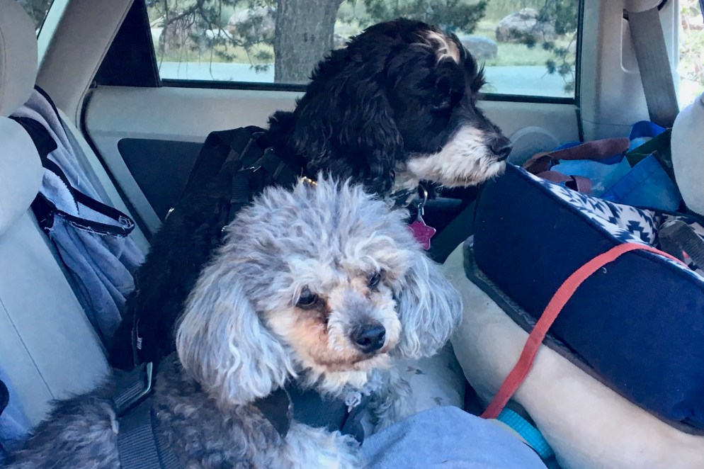
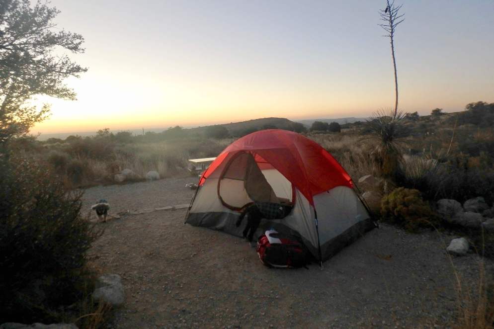
With that negotiated I still had not had any dinner and camp was not fully set up. So I pushed on and finally settled into the tent. Well Kili was panting and prowling! It was windy and the tent kept flapping and he wanted to investigate the noise. It was so dry as well that I thought he might be thirsty so we got out of the tent for a drink and to survey the land. I puy the water into the tent but that was not were it belong so back out it went. This went on three times until I just decided to ignore him. Of course Simba joined in the scene as well.

We awoke to a beautiful clear cool morning and after coffee i decided to take a 3 mile walk on the Palo Verde Trail with he dogs on, believe -it-or-not, a dog friendly trail and it was a nice trail as well.

When we got back an hour later I discover food paper litter all over the campsite. The Ravens has gotten into the cooler and extricated and consumed the lunch meat, cheese, pea pods, apple, and got the package with my allergy medicines ripped open though the viles were intact. Since it was now getting warmer and there was no shade on this site at all I decided I would move my site (yes I am a glutton for punishment) across the way as there was a “ramada,” a shaded roof for the picnic table area. It was not actually too hard of a chore as we were just going across the way and one site up.

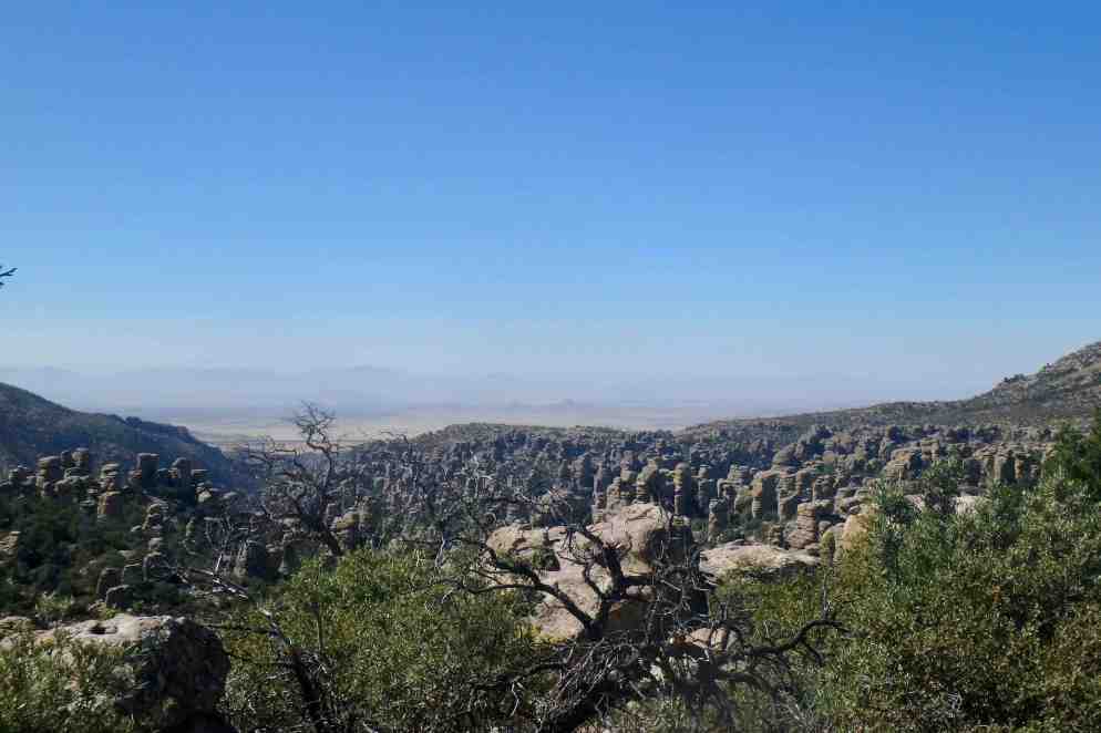
With the heat rising, I decide the day would best be spent taking a couple of the interpretive driving ours to better experience and see the desert up close (as if it was close enough the previous night the I ran into a Cholla and it deposit one of its thorns about a 1/2 inch deep into my leg. I soon learned that there are very few stands of organ pipe in the us. Ii loves the sun and southerly slopes and can’t tolerate the sub freezing temperatures of the desert north of Mexico. The highlight drive was the Ajo Mountain Drive and it was truly an amazing scenic drive, through the Diablo Mountains to the base of the Ajo Mountains with majestic specimens of Organ Pipe and Saguaro Cactus which reflect the magnificence of the Sonoran. It was a washboard gravel road (I had not abused Now Not-so-Pretty Priss Prius enough to date, so we jiggled and shook, wound and dipped our way through this 21 mile stretch which seemed fitting given the, harsh, primitive nature of the landscape with a huge population of surge, organ pipe cactus,  mesquite, palo verde, jojoba, and a couple of my favorites— the chain fruit cholla and the teddy bear cholla. The organ pipe cactus is human friendly and has an abnormal growth out of the center called a crest. It is quite intricate as you can see below.They are beautify shimmering in the sunlight but filled with tiny hooked barbs. They are intriguing but dangerous as they quit adroitly hook into you clothing or shoe. it is often called jumping cholla and I can attest to how readily it attacks by the number of times it settled in me and on the dogs. . I need to carry tweezers because I have carelessly gotten to close to these little hitchhikers.


I found that so fascinating that I headed for a couple of other scenic drives. The next was the drive the both the North Puerto Blanco with views of the Ajo Valley and Pinkley Peak and South Puerto Blanco to Sento Basin. The southern part of this loop road was also a washboard and probably the most interesting thing on this route to me was views of the border fence, as the road parallels the US Mexico border for a few miles.The presence of border control vehicles was duly noticed. After about eight miles I opted to turn around since I would not be able to complete the loop. Pretty Priss Prius wasn’t up to it after her mishap the night before. She has finally come to he conclusion that she is not a 4WD vehicle and to complete it, one needs 4WD.

So we headed back up to do the North Puerto Blanco until Pretty Priss was prohibited from going on. But, first a stop in Lukeville, the US border town. I needed to get ice and hoped to get some lunch meat etc. to replace the foods the ravens looted that morning. I should have guessed but this was the only stop in town and there was no real food. I toyed with the idea then of taking a little side trip into Mexico but then thought better of it. I drove onto the northern section was much more scenic with views of the mountains, valleys and very dense fields of sugar and organ pipe.cactus.

After that I head to camp. I had hope it had cooled down a bit and the sun was low enough tolerate being outside. It was actually quite pleasant though still quite warm. The evening was uneventful and quiet. After a beautiful sunset, I enjoyed the stars twinkling peacefully in the dark clear clean dry night sky.

Simba wanted to get up for the sunrise so I crawled out of the tent, got my morning coffee going, and was able to download the newspaper (though I kind of regretted it as I have ignored the news for several days). But Simba cuddle on my lap and we welcomed the bright and beautiful sun as it peaked over the horizon. The color show before the rise was quite beautiful s well. Kili was fascinated by the Ravens waiting for an opportune moment and the Gambel’s quail flitting about in the under brush.Today was a moving on day so I dismantle our home and was ready to head out by nine. It was so sad though as I could tell Kili was not liking all of this routine of spending a couple nights and moving on. He went and laid down right in the middle of the empty tent pad and campsite. I had to coax him into the car.

OLYMPUS DIGITAL CAMERA

OLYMPUS DIGITAL CAMERA

Joshua Tree National Park and the Carrizo Plain National Monument

Saturday was departure day and I was heading down to LA to visit my nephew Eric and his 10 month old son Clark – my first great nephew. I also had the additional task of returning to the Tom Bradley International Terminal at LAX to retrieve my passport left behind when returning from Australia. If you read my earlier blog you know how much i dislike LAX. But the only way to get it back was to pick it upon in person. So breaking camp was a slow process as things were still muddy wet and I have, of course, way to much stuff because there was room in the car for it! So I poked out of Pinnacles about 10:30 and headed south. I had to succumb to interstate driving as it was the only practical way to get there before sundown. I did not want to be negotiating the LA freeway system after dark.

However, looking at the map when leaving I spotted another potential adventure. I saw the Carrizo Plain National Monument on the map and since I have seen some quite splendid National Monument already on this trip, I had Siri devise a route on local roads to it. This also would help me avoid some of the freeways.The plain, sitting between the Caliente Range and the Tembler Range, is a drainage basin with the water draining to Soda Lake. During the dry season the water entirely evaporates and what is left is a salt encrusted lake basin. It was a well chosen adventure as the plain is the largest single native grassland remains in California at 50 miles long and at times 15 miles wide. The surrounding mountains have their own unique look and color and were dressed out in shades of maize, goldenrod, desert sand, almond and brown. Soda Lake Road was paved for a bit but then the route turned into a washboard cattle-guarded stone throwing gravel road. But I am always up for the challenge and we jounced on through the pain, marveling at magical landscapes of the of the natural world. Every day I am thankful for these national parks and monuments for the beauty and unique natural settings they preserve.

I do not know how I would have managed the spiderweb of LA freeways without dear Siri. I was aghast at the volume of traffic on Saturday afternoon. The highways were packed and often bumper to bumper 6-7 lanes across. I was staying at the good old dog friendly Motel 6 in Van Nuys. Even this very spare motel with its very spare rooms was $98.00. But I have a distaste for spending $200.00 or exorbitant pet fees to pop in, sleep, and pop out again in the am. I began to have my doubts though when there was a guard for the parking lot and warning signs saying no guest allowed in rooms unless registered. It was across the street from a huge beer manufacturing plant, and there was a spot in the parking lot designated for police car. But all was quiet, room decent and clean and free wi-fi! Didn’t need much more. Besides if I had too much luxury it would spoil me for my camping adventures.

The next national park stop was to be Joshua Tree. But first was a visit with my nephew and first grand nephew Clark We had a lovely brunch with Eric and Allison and even Kili and Simba got along with their dogs. True to the bad habits Simba adopted while in Oregon (i.e. peeing on Tasia’s carpet) he managed to present a healthy poop in the middle of the entry way, only to be discovered when baby Clark crawled over there to examine it. Because the family was under the weather we left about 12:30 and headed to LAX for my passport.

That went very smooth until I could not find my car in the lot across from the International Terminal. Now I had noted it was on level 4 row E but somehow I went in a different entrance and ended up in a different garage. Thanks to imaps the spot was marked and I could wind may way back to the correct garage. I then was able to adeptly negotiate the maze of freeways heading east from LAX to Joshua Tree National Park. In the process of getting there I continued to feel that disdain that I have for most freeways and it wasn’t much different here. As I tried to appreciate the backdrop for these communities, the mountains and hills of the environs of LA, I can’t help but be distracted by the power lines, multitude of signs, and sheer number of chain stores and fast food places which are carbon copied from interchange to interchange. Granted some communities try to make their chain stores fit into the landscape of the area and do a relatively decent job but it still is a challenge to be able to look beyond the back of the cement adobe and sand colored buildings with their registered bright colored trademark signs and appreciate the setting.I arrived around 5:00 at Joshua Tree and encountered a landscape quite unlike any other I had seen.

I stopped at the visitors center and got a map and discovered on the map that the campground I had reserved was another 10 miles down the road. By now I was in the desert with an elevation of 3000 feet. Things looked quite barren and bleak at first glance but I headed on toward 29 Palms Oasis. We were now in rattlesnake territory rather than bear territory. I easily found the campground and immediately fell in love with the area. The rock formations were incredible and unlike any I had seen before and the campsites were nested within the protection of massive boulder. I was definitely at this point a very happy camper and camp setup was easy and accomplished before dark. I had great enthusiasm for tomorrows adventures. The first thing I learned however was the Joshua Tree is not a tree or a cactus but a monocot which is similar in structure to grasses and have a slow growth cycle (one inch a year) . To me that was fascinating.

Given the anticipated high temperatures and lack of shade in the desert ,I knew this would be a scenic driving day. The dogs and I took a early morning walk before the heat began to build up then it was off in the car. I had not anticipated how large this national park are would be so I knew I had no desire to do the whole circumference of the park. So we headed back to the West Entrance Station and cruised from there. I knew I wanted to head through the Hidden Valley area and on up towards the Keys View at 5185 feet. It was a beautiful view of the valley, surrounding San Bernadino Mountains and desert. I later learned that one could observe the St. Andreas Fault in the valley below but wasn’t aware of that up top. I was a suburb view of the valley and of course a great little opportunity for a short walk with the dogs. Yes, there was a 1/4 mile path they could be on! Just as we were thinking about moving on up pulled a full busload of tourist, so rather than be engorged by this mass of people, we headed back on down to the flats.

OLYMPUS DIGITAL CAMERA
Hidden Valley

Visiting the Cholla Cactus Garden and Ocotillo Patch in the Pinto Basin seemed interesting so we head out the Pinto Basin Road toward the Cottonwood Visitors Center. What became quite fascinating was being aware that two deserts, the Mojave and Colorado (part of the larger Sonoran), transition in the middle of the park and though there is a great biodiversity in this transition zone you can see the in the northwestern Mojave give way to the Colorado in the southeastern reaches. The Joshua Tree is unique to the Mojave and is mixed in with pinyon, juniper, scrub oak, yucca and prickly pear. They thrive in this moist cooler higher elevation than of the Mojave I could observe the gradual changing to the vegetation as I moved southeast into the more arid climate of the Colorado, I began seeing the dominant vegetation was the creosote bush, ocotillo, palo verde and the infamous jumping cholla cactus (teddy bear cholla). There was very little wildlife to observe as it was the heat of the day and few flowers as it is the waning season even in the desert.

IMG_3116


I spotted a patch of cholla cactus as I drove along and stopped to take some pictures. I had not yet fully understood their reputation but I ended up with a couple off cholla hitchhikers embedding in my crocks and had a horrible time getting them out and not lacerating my fingers or have them poking through the sole into my foot. So when I reached the cholla garden I was super cautious as their barbs are viscous . The ocotillo patch was minimal but became interesting as it appeared to be a cactus but is not. And and up closer look, from a very rough woody textured bark, revealed tiny leaves budding all up and down its stalks. Though from a distance it appears dead, it can be very much alive just waiting for the rains. Our tour ended down at Cottonwood Springs were I went up a sandy gravely incline better to observe the Palm Oasis and managed to loose my footing on the sand surface and take a beautiful skid ending with some vivid road rash on my left thigh. Another lesson in not wearing the correct shoe for the activity.

One of the most fun activities was to observe the myriad of stacked boulder throughout the park, with joints formed horizontally and vertically, resulting in piles of angular granite blocks. Over time, they weathered and eroded and scattered across the desert. Ones imagination can run wild and I could find all kind of faces and objects in the rock formations. The rest of the stay was peaceful with a beautiful sunset walk, dark starlit skies, and a night in my cozy tent with my canine buddies.


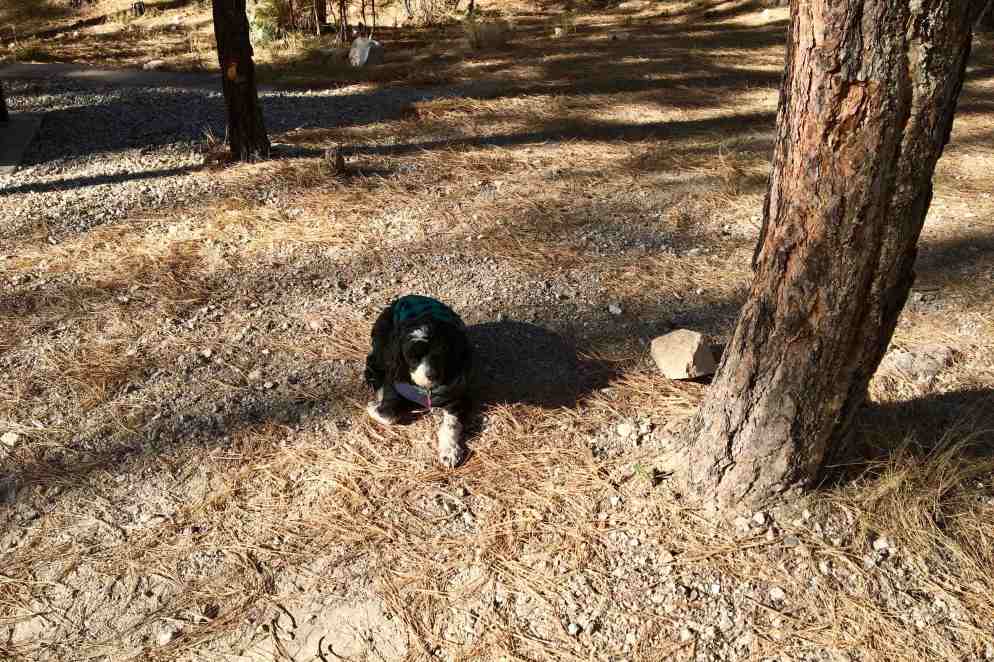
After breaking camp the journey down to Organ Pipe Cactus National Monument commenced. Kili, unlike myself, does not do well with change.  And so began his pattern of finding a spot on the campsite to rest and resist leaving. even when all spaced and cleared away.

Sequoia and Kings Canyon – A Day Trip

Having planned to stay in the area three nights, I had a whole day to spend relaxing. But a bit of “driving madness” took over and I decided that a day trip to Sequoia and Kings Canyon National Parks would be a great days outing. They were east across the San Joanquin Valley and it was a bright clear day. Of course this would also satisfy my bent on eventually visiting all the National Parks in the new few years. I thought I might “bag” a couple more and get the lay of the land and answer the question of whether I would want to return someday and backpack through them. I think some observers might say this has become an obsession of mine. Especially since this is no easy drive or straight shot across, but lots of hills and low-rise mountains to negotiate. There was fantastic scenery for most of the drive, but with stops etc., it took almost four hours.

My mood began to plunge as I could observe, the closer we got, a huge bank of clouds seemed to be settled in over the Sequoia National Park in the Sierra Nevadas. My hope was that it would be the early afternoon storms accumulating and they would dump their load and things would clear out. I stopped at the Foothills Visitors Center for mapsI took a some pictures at the first couple of pullouts in Sequoia National Park at around 2000 ft elevation and then began ascending about 5000 feet from the foothills, up the Generals Highway.


IMG_2960IMG_2965I hit a wall of fog that was dense and made for treacherous driving on this park road that was extremely winding and curving up the mountain. It probably can go without saying but I will say it anyway, I never saw any more of the canyon that I spent four hours getting too. One positive thing I can say about the fog is, it quelled my vista hopping and prevented me from taking 1000 pictures over the several mile drive.

The main positive experience was seeing the gargantuan Sequoias reaching for the heavens. I felt so diminutive in this grove of elders and was grateful to be able to take the Big Trees Trail through the Giant Forest and gaze at the General Sherman, the worlds largest living tree. As the weather was so miserable and cold, I felt ok leaving the dogs in the car for the 30 minutes. There is something so awe inspiring about these massive hulking stout giants – many of which have survived fires and everything else mother nature has shown at them. To me it would be an egregious crime to allow logging and cutting of these grand old guardian of the forest.


At the northern end of Sequoia National Park I had to make a decision . Should I be rational and turn left and head back to Pinnacles NP or should I choose the irrational and hope that by driving down into Kings Canyon, one of the deepest canyons in the US, the shroud of fog might be high enough that the lower reaches of the canyon would be visible. I bet on the absence of that gray scrim and that I might get a glimpse of the canyon walls. I new Kings Canyon also had some of the largest tree in the world. It was now 5 o’clock and I would have about 1 1/2 hours daylight for the 60 mile round d trip. I knew if I did not go I would be very disappointed in my self now that I was there so I headed east. The first stop was at the majestic General Grant sequoia, looming 267.4 feet up into the fog. It is noted as being the third largest living thing in the world. It was another giant ancient guardian of the forest . Then Another short but quite spiritual path circled this grove with numerous large relatives of the general residing. I was the road again and as I lost elevation and started going down, down, down the canyon, the walls began to appear and soon there were good views of the canyon and the South Fork of the Kings River.

I am sure with the sunlight to highlight its land forms it would be quite a bit more spectacular but with the grayness and the sky darkening, the walls seem lifeless and devoid of the lively shading and shadows created by the sunlight. But never-the-less it was a wonderful adventure and of course one that took until dark settled in to reach the bottom and the dead end of the road. So I had another exciting driving adventure coming out of the canyon on this very dark, relatively narrow winding and curving road. There was an occasional car on the road so I didn’t feel totally alone out there. By the time I reached the exit it was now 7:30 and I had minimally a three and a half hour drive back, if I took some interstates so I succumbed to expediency and the desire to be home by 11:00. It was Friday evening and a bit of a shock to pull into the campground, see a full sign, and then wind my way back to my campsite, seeing every site occupied. On the he previous 2 days I was there, it was probably only 20% occupied. I can’t say that it was noisy but there was a generalized low murmur of voices about. I missed the total quiet and solitude of the previous days.

Pinnacles National Park

Leaving family is never easy but it was time to head on back to Florida after being itinerant for 4 month and having logged almost 8000 miles of travel on an intensely active and varied journey. With a home sitting empty and several appointments on the November docket, I set out on Wednesday, October 18th. Though I had intended to leave a bit earlier, a trip to Oakland CA with my granddaughter Amara to visit my two granddaughters who live in Oakland took precedence. Since Amara wanted time with her cousins I chose to do the round trip from Ashland rather than going solo and heading on down through California with a visit en route. The plan was to return via a more southern route and hopefully avoid those cold nights in the tent I experienced in September last year when traveling through Lassen and Yosemite in California and Mesa Verde in Colorado. I had a two day frantic packing affair, including getting the car top carrier on; making decisions about which of my precious t-shirts I was going to leave and which to take (after all I really don’t need all 20 back in Florida where another 100 probably are rotting away in my absence); stocking up on camp food as if there were no stores along the way that i would come across on this journey (might this be called hoarding?); getting the car washed so it would look awesome on the dusty gravel roads I always manage to find; and most importantly getting to Starbucks for the Via!!! I then proceeded to poke my way out of town. I was at least an hour and fifteen minutes beyond my original goal. In most cases that would not make a difference, but I was heading to Pinnacles National Park and I did not relish the idea of setting up camp in the dark. Now I was pushing it.

I headed right back down the route I had followed on the week-end. My endeavor still is to avoid as many interstates as possible but there is no easy route through central CA that would get me there in any kind of timely fashion. Good old Siri suggested a couple of routes avoiding the interstate which would each take 12-13 hours. No thank you! I will tolerate the highway. The northern California selection of the drive from the state line through the Shasta Trinity National Forest and on down past Shasta Lake I must admit is scenic and lovely but once I hit Redding any semblance of enjoyment and appreciating the surroundings was a NOT! I all over again began to experience that hatred of Interstate with the fast moving cars darting in and out of traffic, the enormous number of enormous truck, the myriad of signs on very tall “stilts” so as to seen 5 miles back, the backsides of the small, medium and very large box stores, and fast food, and more fast food and gas, gas, gas! AND on this day there was a great pall of gray smaze/smoke hanging over the Coastal Ranges and Sierra Nevada Mountain Ranges on both side of the San Joaquin Valley. Some certainly was from the massive number of wildfires in CA. But the observing of it casted a very sombre tone to think that so much particulate matter from the cities, highways and farms affects so much of the grandeur of our country swell as plants, animals and humans

So I poked (well actually sped) on down Interstate 5 with pit stops just about every hour ( I had to speed to make up for these!) . I was trying to stay well hydrated and my body certainly was doing a great job of trying to dehydrate me. And of course there were the stops for three very short walks for the dogs. I was not in a patient place and by mid afternoon I knew I’d be setting up camp by headlight (assuming I could angle the car in a fashion to accomplish this. So i pathetically endured the drive but opted to head through Sacramento rather than back through Oakland. I hit my good old fashion and very endearing two lane roads at about the 400 mile mark. It took 400 miles of stress, smoke, piggy-back truckloads of garlic, back ups around cities, monotonous dry yellow fields of hay, etc, to get there.

IMG_2881

I still had about 90 miles to go but happily settled into a less frantic drive along the San Luis Reservoir and into the Diablo Range. Sunset was a panoply on pinks, purples and oranges and was very soothing and settling after the many tedious hours on the interstate. I managed to drive into Pinnacles around 7:30 and there was almost no ambient light so it was very dark and wonderful for star gazing. My car lights on bright however interrupted this dark space as the darkness didn’t make it easy to find the campsite, Somehow I had it in my head I was in campsite 86. The sign pointed to site 1-83 to the left and 84 + straight ahead. I could not find #86 and kept looping around feeling crazy while almost hitting two deer, dodging bunny rabbits, and shining my bright headlights into many campsites . All of the sites so far had signs on the primary road. Finally, after many turn arounds I decided to re-check my site number and came to discover it was 68, which had definitely passed at least thrice. Thank goodness it wasn’t 86 as the next morning i discovered it was in a loop of RV’S which appeared to be side-by side in a very open “parking” lot. Site 68 was very private, set in its own little “cul-de-sac with a long driveway leading into a nice little dining area and further in, past the bear box, was a partially fenced area for the tent surrounded by vegetation. I discovered in the morning the fence purposeful as without it I might have wandered out of the tent in the night and fell off a 15 foot ridge. It might also serve the very useful purpose of keeping deer and other critters from settling into our tent home.

it was not as challenging as I though setting upon the tent and all my luxury items since I was car camping . I could aim the car lights into the bedroom area and proceeded on. I decided to take a walk with the dogs to find a restroom and headed out to the right when I go to number 83 – the last one in this area with no luck I headed back and started out the other way. Of course it was not but 25 feet down from my site and set far enough back to not be noticed while driving my loopdy-loops. Since I was after hours there was no ranger handing out park maps. Interestingly this park seems to be on the honor system and at the entrance directs one to go to the information center and park store to pay fees,

I was under the impression that since I was close to 500 miles further south and not up in the high Sierra’s It would not be too chilly at night. I was expecting perhaps 50-55. I pretty much knew this was not the case as I settled into the tent and felt chilled. I actually had a couple of bouts of shivering in my sleeping bag, I checked the car thermostat in the morning said 39 degrees. With numb hands tried to open the S’Buck’s Via and light the Jet Boil. The canister was empty. Disaster was striking. Of course if this is the worst disaster I ever experience I am truly fortunate. I managed to get a new canister screwed on with my very numb fingers. Finally after all he fussing around I had a hot cup of coffee and was then willing to feed the dogs.who were of course cocooning in the tent and not silly enough to be out in the cold.

It was a lovely morning, though chilly, and after breakfast and a three mile walk around the campground, I decided to head over to the other side of the park SINCE THE DOGS ARE NOT WELCOME ON ANY OF THE HIKING TRAILS IN ANY NATIONAL PARK . The main road in the park does not go through so it is a 60 mile drive to get to the west entrance. I found the drive to be a great adventure as I was on a twisty, windy, hilly, dipping and twisting two lane highway with very little traffic. The scenery was varyingly beautiful and a clear sky provided excellent vistas of the near and distant mountains. The hills around were an array of domes, and at times peaks and pyramids, many extremely smooth and others dotted with chaparral and other scrub trees I kept imagining a great pile of gold, tan and brown velvet material having been laid upon this land and what resulted was graceful folds, curves, and shadows, on domes of many sizes. The road wove up and down like a roller coaster and at times I could see vast fields of vegetable in the valley below. At one pullout on a ridge above the valley I sighted a couple Condors soaring on the updrafts in the distance. This park is a release site for the condor which was listed as an endangered species. The rest of the time I am quite sure birds I saw of about the same size were turkey vultures! The beauty of backroads for me is that I feel so much more a part of the land. I can just pull off to the side and get an upfront and personal feel of the land around me, check out what is really growing that I had observed from a distance, and even touch the rich soils of these irrigated valleys. I don’t often see such vast fields of a variety of crops, all in different stages of growth. I was fascinated to be able to observe a field where busloads of pickers had been hired ,trucks with port-a-johns were on site, and hundreds of box loads of what appeared broccoli. This was so refreshing after the hundreds of miles of very arid bland cropland in central California. However, during along it was clear there is a lot of political controversy regarding water use and access. One sign I often spotted focused on the hypothetical question of “Is growing food a waste of water”.

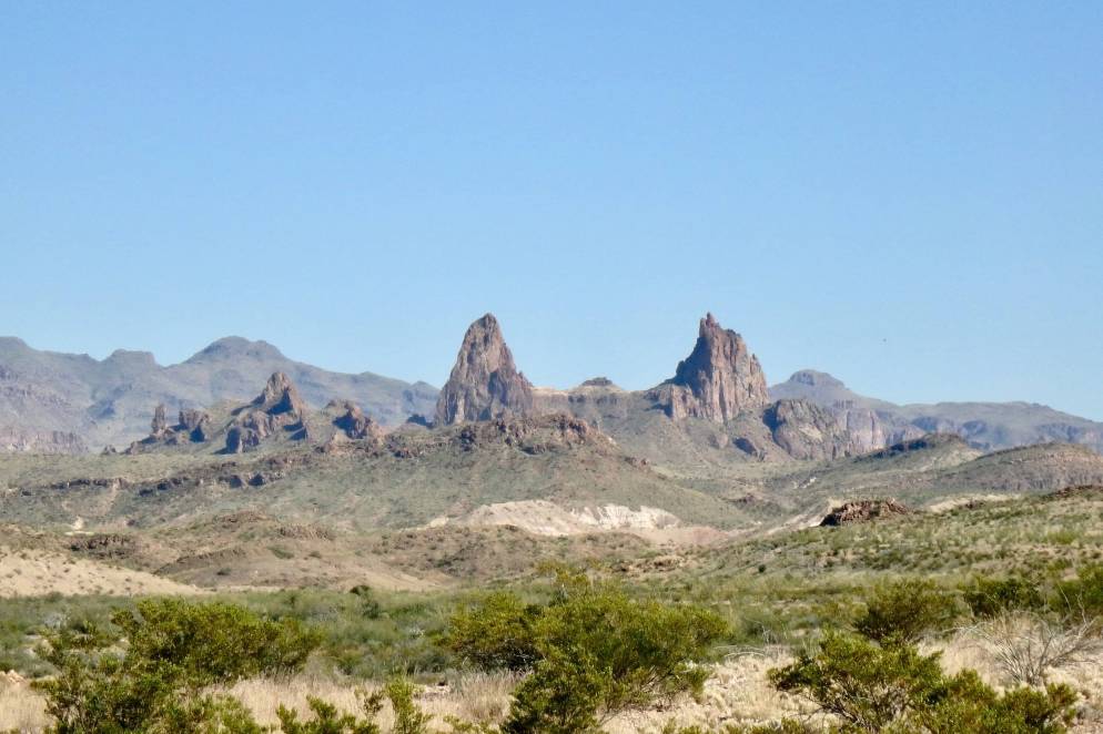
CA 146, the road into the park was very narrow and winding and at times one lane. It is not a road for the faint heart. But that made it even more of an adventure and is fitting in this protected wilderness. Pinnacle National Park is one of the newest parks though it was a National Monument previously It became a park in 2013. Like so many of the parks it has a beauty all its own and the major landform from which it gets it name is a series of spires, ramparts and crags that are in direct contrast to the smooth golden rolling foothills in much of the park and surrounding area. The dogs and I were going to have a picnic lunch in the day use area just below the massive vault of spires but had to kept it brief as it was hot and full sun with no shaded tables to be found. So after appreciating the beauty of the spires which we were quite close and readily accessible (not so on east campground side), it was back on the roller coaster road home.

IMG_2935IMG_2936

“Home” becomes anyplace we decided to park our head for the night. I was relieved that this night was a toasty 46 degrees though there was a downpour in the middle of the night and everything was damp and wet. Fortunately I had not left much outside as this is bear country and things were either in the car or the bear box.