Flashing Lights, Construction & Gravel Roads in Scenic British Columbia

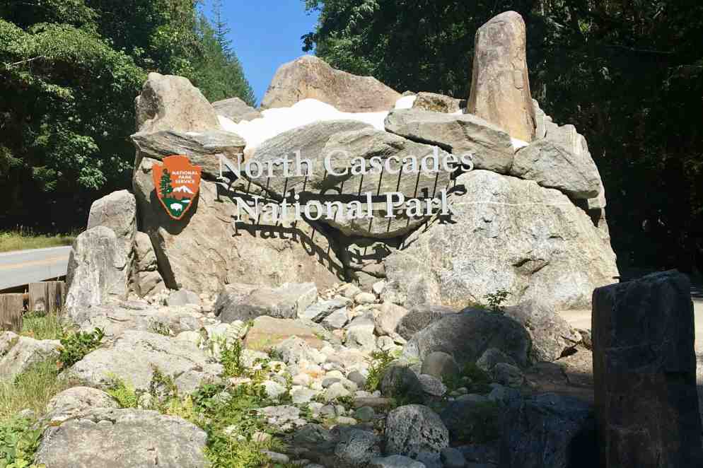
IMG_5978Tuesday July 23rd:  It seems as if I have lost my knack for a quick camp break down.  Of course I did choose to dawdled over my Starbucks Via and oatmeal — not exactly gourmet but on a sunny brisk 49 degree morning in the woods it was quite scrumptious.  Though awake by 5:15 we were not on the road until 8:45.  I wanted to stop by park information center and store but came to discover it did not open until 9:00 am. So it all worked out well since this was the only area in the park that had cell service and I could complete a couple of calls.   The drive out on Cascade Loop Highway was a rerun of the lovely drive going in and then it was onward north to the border and British Columbia!  I probably have used my speed control 90% of the time and been following the posted speed. When I checked my review mirror driving through the US border crossing towns of Lynden-Aldergrove, I saw those ominous flashing lights behind me –  so I pulled over and so do the flashing lights!!!  How ironic that I get pulled over for speeding the last day before I leave Florida, the east and southern embarkation point of my journey and just a couple of miles from home going 45 in a 30 mile zone AND here at the very border of this country in the western and northern most point before I cross into Canada, I get tagged for going 43 in a 25 mile zone. Now I have NOT changed my driving habits one iota so I would bet money that now that i am driving a bright orange Jeep, Lady Spitfire, I  am a clay pigeon for cops. In neither case did I get ticketed fortunately (I imagine they don’t expect to find a gray-haired 74-year-old lady driving such a flashy car!) The officer did admit that the speed charge was quite abrupt and though I was slowing down I clearly didn’t slam on the brakes fast enough.  So a few hundred yards ahead was the border and after all my fussing about getting the right rabies certificates for the dogs, the agent didn’t even bother to check them.  

I got on the TransCanada Highway 1 east at Abbotsford to Cache Creek.   Disappointingly,  the first part of the drive, could have been any place USA (or Canada) except for a few more Tim Horton signs at interchanges. It was a limited access 4 lanes highway up to Hope BC. I “towed the line” not knowing if there was any wiggle room before police officer will stop one for a ticketing in BC. Thank goodness my speedometer could be switched over to kmh. There I split off heading to Cache Creek. Before long I was sailing along at 110 KM (legal) and the scenery started popping, mile after mile through the Cascade Mountains. Many mountain peaks rose 2000-3000 meters above this two lane well maintained road, climbing and descending and rounding many curves— beginning with the Fraser River of Fraser Canyon.  Because of winter damage to so many of the roads, this day began the first of many delays for road repair. Fortunately none of delays lasted more than about 10 minutes.

The mountains seemed to have significantly more varying shades and appeared to be  based more of sandstone than the US Cascades.   As I drove farther north, the height of the range diminished and there was a wider valley and some minor peaks. The route followed the Fraser and Thompson rivers and I was quite taken aback when soon the vegetation in the area began to look more like desert with the temperatures in the low 90’s.  This is not the British Columbia I envisioned. This whole area was arid desert with sagebrush and other typical desert vegetation.  I later found out that Cache Creek had been described as the  Arizona of Canada with hot dry arid summers cold dry winters. I enjoyed the views of the Canadian Pacific and Canadian National Railway tracks and could see many trains snaking their way through this valley.

I traveled via British Columbia Hwy 97 north to Clinton and headed down a 20 mile gravel road to Big Bar Lake Campground.  I had made a campsite reservation without fully realizing the length of the gravel road. I soon realized after a bit of teeth jarring and fish-tailing, this road  would not allow the speeds of an asphalt  highway.  The anticipated arrival was  about 45 minutes later than I would have guesstimated. Try as I might to pick up the pace, it became harrowing on the curves and skiddish on the straight-a-ways, so I settled into the posted speed of 35mph give or take 10-15 mph faster. In fact I thought I did recklessly well by doing it in half-time.  I was extremely grateful that I do not wear dentures as I am sure they would have been  jarred loose on this washboard gravel road.

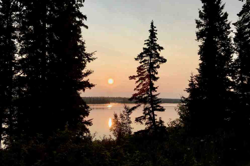
I thought I had a lake view campsite but the number I had written down was only a partial view (#12.)  It was not a bad site but after setting everything up and having dinner (and battling the pest of the day in the form of mosquitos) I came to find out that I took the wrong tent site (the one I had a very hard time finding) and indeed should have been on the best  lake side site.  As nice as it was it wasn’t’ worth the effort of moving tent and all the gear! A sunset walk by the lake was a peadful and soulful way to wind down this day. 
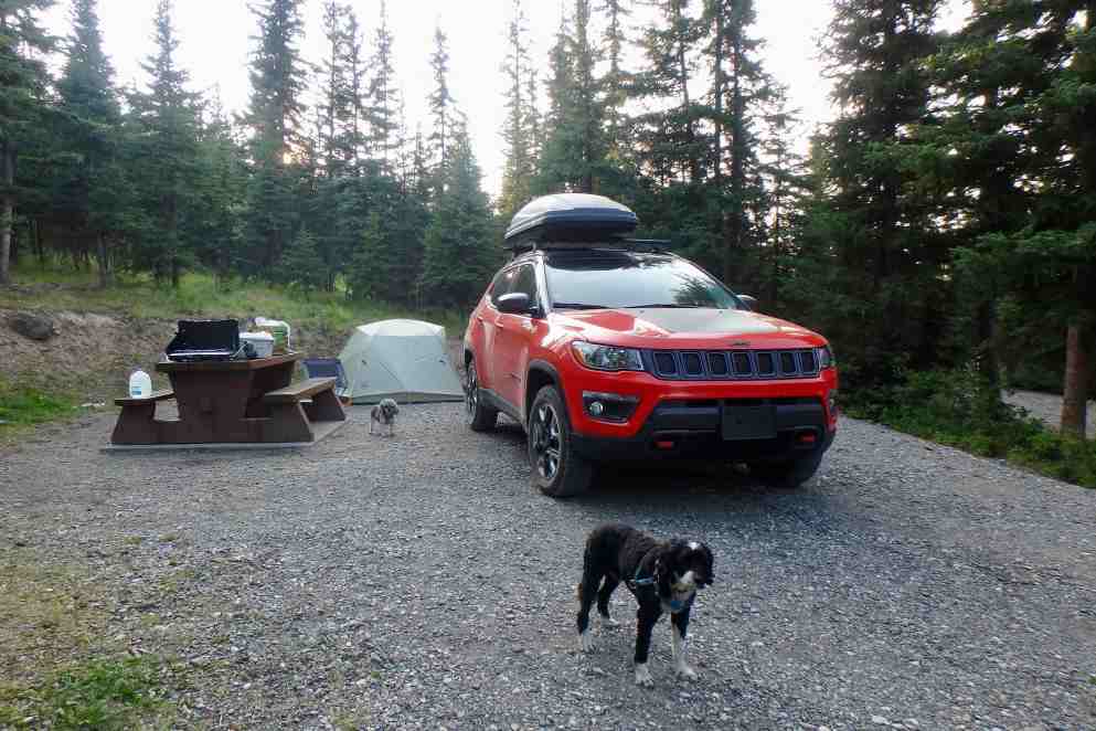
OLYMPUS DIGITAL CAMERA

I quickly found out that sometimes the good old-fashioned paper maps and a hard copy of reservations and itineraries etc. is a very good idea.   Since everything was on my computer and the documents only accessible through the Cloud from my iPhone or iPad, I was out of luck knowing where I should be when there was no service — which is most of the time in these nether regions I am traveling through.  Nevertheless despite no lake view we slept well!! 
Alaska Bound: From the Rogue Valley to North Cascades National Park

IMG_5954Day #1: It was time to begin the next leg of the moving to Oregon and Alaska  odyssey,  So on Sunday July 22 I headed out of the very smokey Rogue Valley of Southern Oregon with the final destination to be Soldatna Alaska.  I planned on taking 10 days to arrive there and to camp all but 2 of the nights.  IMG_5908 2 Adopting what I deemed a sound rational plan, I chose not to leave for the first night’s stay at the LaQuinta in Vancouver Washington until mid-afternoon. My first major stop was to be in the North Cascades National Park on Monday, to set up for the first day of this camping adventure through British Columbia and Yukon Territory. It had been 9 months since I pitched a tent and this one was new.  So I decided to get the repetitive driving routine section out of the way on Sunday, having traversed I-5 to Portland many times.  I wanted to  enjoy a brisk morning walk (it always dumbfounds me that it can be in the 50’s in the am and push upwards of 100 during the day on the east side of the Siskiyou’s in Ashland OR) and have more time with family.  So I finally got on the road by 2:30 in the afternoon for the five hour drive to north of Portland (which would of course be closer to six with gas and pee breaks and a stop to nourish and shoot up my diabetic dog). My logic would be less traffic and trucks on the road on Sunday.  That may have well been true if I could compare it to Monday, but traveling up the I-5 corridor through Oregon was no leisurely Sunday drive. Plenty of traffic, trucks and traffic jams.
IMG_5928Since the drive from Southern Oregon to and through Portland has been undertaken many times, it remained expedient to follow the path of the major highway designers, which is usually the path of least resistance — but also least interesting. The mountains of southern Oregon for first 100 miles are striking but the landscape was shrouded in smoke from the high number of forest fires in southern Oregon.  It was almost as if a scrim had been lifted at Exit 138 and I drove out of the smokey mist into blue sky and sunshine. I motored on through the relatively flat valley with not much ado and only had to start vice gripping the wheel when driving through Portland.  The traffic was fast (10 + over limit) with numerous tight curves and bridges.  Not much chance to even glance at Portlands modern city scape.  Portland is touted as a very desirable location and progressive city but it also comes with its expressways, traffic jams and many of the not so desirable features of a metropolis areas. Not far beyond was Vancouver WA and the bed for the night, arriving at 8:30 pm.

Day 2   Monday July 23:  Yesterday and this morning was the preface to this tale or perhaps the act before the main event but the journey finally really began when I exited the I-5 and headed up 535 to the North Cascades. Getting out of the motel was quite swift (had lots of practice last month crossing the country) but the surprise I awoke to was not so swift.  Crawling out of bed I noticed Kili sleeping on the other queen bed, something he never does. Looking a bit beyond the bed, there  was a pile of poop on the rug.  Poor guy had an accident and was probably disoriented  in he dark and got onto the wrong bed.  Clearly this dog does not travel well in some ways.  He had hijacked my quesadilla at lunch when I got up to get a club soda and it had onions on it – so I guess this was my “fault” for not guarding my food better from a dog who wants anything but real dog food!

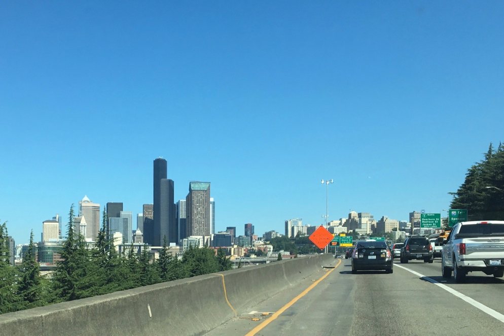
By now you can pretty much guess my feelings and reactions to the  trip from Vancouver Washington  trough Seattle on I-5.  Traffic moves very fast and then barely moves at all – repeat TIME and time again. Siri keeps telling me which is the fastest route (I am not sure why Siri thinks I am always interested in the fastest route but then I guess she is not programed to be my personal assistant!) for a minute here or there really would not make a huge difference on this trip.  She actually advised that going trough Seattle on I-5 might be a minute or two faster than the eastern loop skirting around the city  So I figured crawling through Seattle would be a whole lot better than  crawling around the outskirts which I imagined would look like every other suburban interchange.  Besides, perhaps I cold catch a glimpse of the now ancient (but refurbished) Space Needle built for the 1962 World’s Fair.It was so famous when it opened and became an icon of the Pacific Northwest.  I was pretty shocked to find the road 5 lanes wide as in my mind Seattle was a sleepier town when I was last through there about 20 + years go…long before Starbuck’s AND Amazon were mega corps calling this city home.  In my mind, it is a huge modern city filled with shiny skyscrapers which now dwarf the iconic needle.  Somehow what does not fit in with my conception of the Pacific North West. 

I was finally delighted to be motoring down a narrow corridor of towering pine trees,  briefly interrupted by small towns and farms . Gratefully the traffic was light and we were at our campsite by 2:30 in North Cascades National Park. 

IMG_5930Setting up camp was relatively  smooth, new tent and all.  My Big Agnes Copper Spur – lightweight backpackers tent for three is just about perfect for 1 adult, two dogs a teddy bear and all of my STUFF – which of course I would not be needing if I was backpacking. I had a well shade spacious campsite in Newhalem campground loop C. There were definitely fewer tents that RV’s since these campgrounds do not have electric and water at the sites. Sadly there were many areas here and in the park that were hard hit by the mountain pine beetle and I observed a high level of tree mortality through out the area. I had read that it was impacting trees at higher and higher elevations as a result of global warming. The mountains sides appear ghostly with trees often still holding on to there needle, now gray and lifeless. 

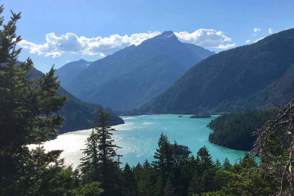
 I decided to drive the highway through the Cascades  and the Ross Lake National Recreation Area. It was a hot July day (in the high 80’s) but It was  a lovely drive on route 20 and I was quite excited to be in the mountains with craggy peaks and the grandeur and majesty I was envisioning. One thing that was most noticeable was the massive hydroelectric projects and the resulting lakes and reservoirs. There were three major dams en route including the Gorge, Diablo and the Ross Dams. There were some beautiful views of the Ross Lake and Diablo Lake and the Sourdough Mountains – the shimmering lakes sported an electric turquoise hue offset by the deep green of the surrounding forests.

I was wondering if this would be yet another one of those dam building projects that, as a result of disrupting the natural flow of the rivers and  thus preventing  salmon and other species from reaching their spawning ground, might someday be the target of another one of the movement that is targeted tor dismantling to save species. 

Back at the campground,  forested with Western Red cedar, and Douglas fir trees, and near the Skagit River,  I began the challenge  of re-acquainting myself with all my camping equipment and food stuffs that I had packed weeks before-prior to the move from Florida and also managing the bees, mosquitoes and flies. It was mostly bees but they were not as noxious as I had anticipated upon their arrival.  They mostly sought moisture and as long as I minded my own business they did not bother this human that much. A quick dinner and nice walk around the campgrounds loop topped off the day.  

Gem of the Mountains to River of the West

Day # 8 June 25, 2018  The state name “Idaho” was derived from a Shoshone language term meaning “the sun comes from the mountains” or “gem of the mountains”. The word “Oregon” would mean something like “River of the West” in Shoshone.  I had never heard of Shoshone Falls on the Snake River but when driving into Twin Falls, Idaho the previous evening, I stopped at a pullout on a bridge over the Snake River. The view was lovely, showing the deep cut canyon created by the Snake River over many eons. 

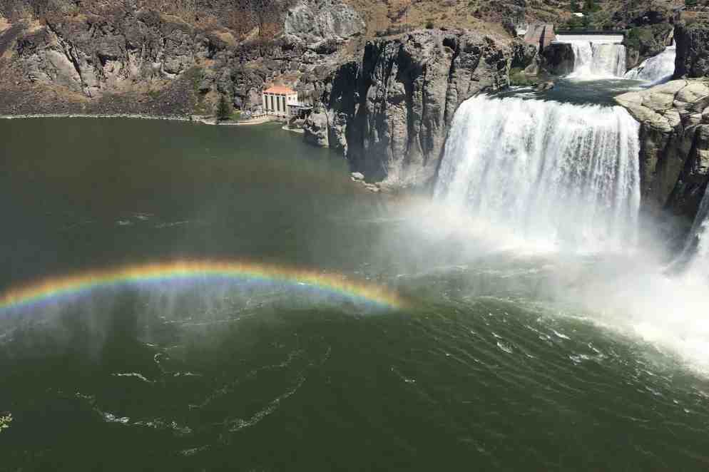
The next  morning, since the town was named Twin Falls, I thought it might be an interesting aside before I got on my own Oregon Trail (riding in my quite comfortable Jeep).  Access was via a very steep narrow winding road. There was an entrance fee of three dollar paid  to the person at a tiny ramshackled entrance booth, with the receipt being one of those tiny pink raffle tickets.  I was beginning to question my choice. But after a couple additional curves I found myself in a lovely park with rolling green grass shaded areas to lounge on, overlooking Shoshone Falls. The falls were ragingly beautiful, the highest 212 feet  and 1000 feet wide. The cooling mist flying through the air spawned dancing rainbows.IMG_5493

Sometimes it is called the “Niagara of the West,” and though strikingly beautiful, it didn’t have the same power and thunderous energy I experienced from Niagara Falls, I especially enjoyed our walk on the asphalt trails as it was quite dog friendly though I can’t say that my charges were very impressed. 

By the time I was  back on the road it was past noon and the next historic site on my trail west was the Hagerman Fossil Beds National Monument Bluffs (most famous for Hagerman Horse , a zebra like ancestor of today’s horse).   Fossil sites are found in the bluffs that rise 600 feet above the Snake River and were exposed 15000 years ago. Access was not available to sites.

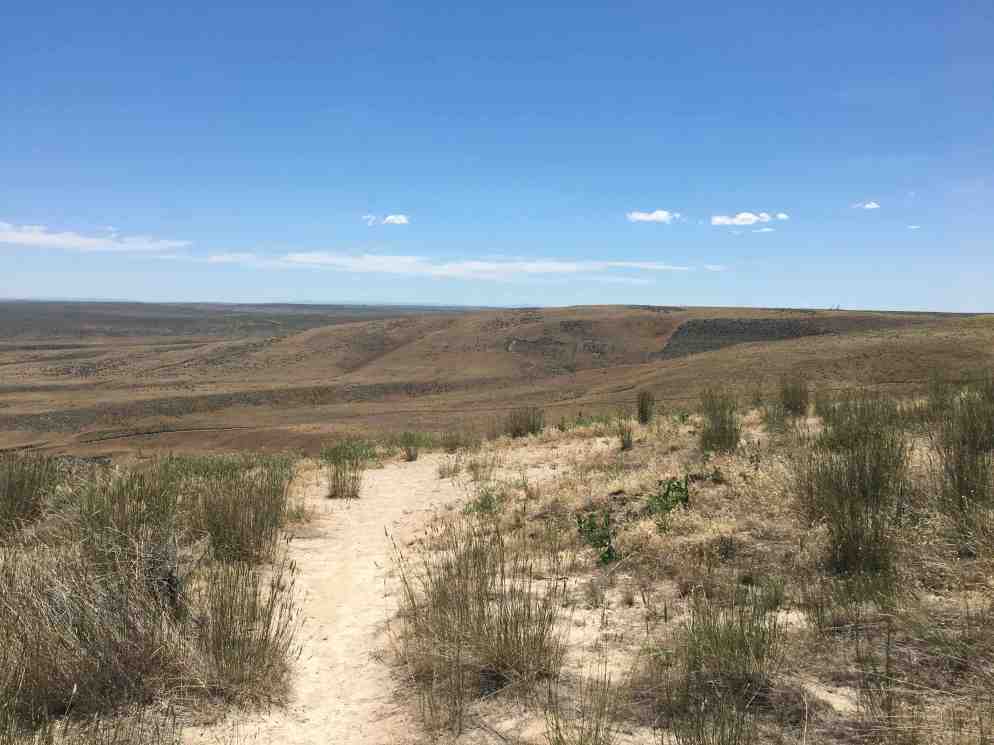
For me, I felt it is important to take the time to ponder both the geological, historical and human endeavors of the areas traversed. There, within this monument area and in the Hagerman Valley, are  several well preserved segments of the Oregon Trail. I have a much deeper regard and awe for those who settled our land when I experienced the “hostility” of the land I was walking and driving on. The most strenuous task for me is to climb into my Jeep when every inch of ground they gained was with backbreaking toil.

IMG_5512 I am grateful that the National Park Service has preserved the legacy of this trail and tells its stories. I would like to get into a rant about what we did to the Native Americans here and/or how spoiled and entitled we Americans are but I will spare you that and save my energy, and stay in the place of awe and wonder of this land.

Its was now time to begin the final stretch to my landing spot in Ashland Oregon. Nightfall was outside of Boise Idaho where we bedded down at the LQ. 

Day #9 June 26, 2018  The final push was quite uneventful though the terrain was of many hues and consisted of hills, mountains, valleys, pine and fur forest, and desert.  This  area of southern Oregon, the eastern and southern parts of the state, east of the Cascade Range and south of the Blue Mountains, is high desert. The high desert is very dry and arid in the summer, but it resembles temperate rain forest in the winter.  So I was anticipating hot and dry weather. There are few direct routes through the mountains, so I opted for the southerly route through Burns and Klamath Falls. The only scenic stop I chose to make was along Lake Abert.  I seemed as if was shrinking and disappearing. 

I found out that is a large, shallow, alkali lake and over the last few years has shrunk 90%. It was somewhat of an ethereal site but I am sure with its disappearance all forms of life within Oregon’s only salt water lake have disappeared too. A few hours later I was grateful to hug my daughter, granddaughter and son-in-law, and be at one of my soon to be new residences in their home. It was good to be off the road and have three days to regroup  after 8 motels, a multitude of catch-as-catch-can meals, many gallons of gas (for this I miss my Prius) and 3521 miles of driving.

The Grand Tetons (Large Teats)

Day # 7 June 24, 2018  The destination for the next day was Twin Falls Idaho and clearly the best route was through Grand Teton National Park.  The most common explanation is that “Grand Teton” means “large teat” or “large nipple” in French, named by either French-Canadian or Iroquois members of an expedition led by Donald McKenzie of the North West Company.

The plains gradually gave way to multicolored and layered sandstones ridges and on up onto the Teton range and once again crossing the continental divide.  Since I have at least 3-4 pictures of me at sign post on the continental divide (me in picture with sign), I stopped to do my obligatory selfie.  In perusing through my picture I found a picture of the sign (I was not in it) and a picture of me with the divide area in the background (but no sign in it). I am trying to recollect what kind of disconnect I had there. 

Having backpacked and hiked there 4-5 years ago, as I gradually elevated into the Teton range I had a couple of very vivid memories. Today was a gorgeous day with a vivid blue sky and billowy cumulus clouds. On my first trip the extremely menacing massive violent black thunderheads and lightning and driving wind and rain blanketed the entire Teton Range, peaks and valley. I vice gripped the wheel and drove on through, very disappointed not to be setting foot in this NP.  The next trip was backpacking with my daughter Tasia, son-in-law Steve and granddaughter Amara.  We had some lovely sunny weather for a small option of this trip and some dry hiking, but our overnight at Bear Paw Lake involved hunkering down in our tents riding out the thunderstorms. The all night drizzle did no favors for one like myself who must exit the tent, cold rain and thunder storms aside, to pee and often with the damp and rain more than once. You haven’t really lived fully until you experience a  butt shower of cold rain in the middle of the night.  I had tried those female urinals to use in the tent previously and you might guess I ended up peeing all over my sleeping bag.  The storms weren’t as wild and intense as I experienced the first trip  but on a fair show and drenched us.

I was excited to re-visit theses ruggedly majestic massive escarpments dressed with lodgepole pine forests,  ice flows, snowpack and lakes – minus foothills but surrounded by sagebrush flats and wet meadows. Given the need to get out to Oregon, I didn’t take much time to explore the park this year but just meandering through in with my puppies in Lady Spitfire made my heart happy. It was a beautiful sunny day and how grateful I am to be able to revel in this beauty. Motoring on into trendy Jackson Hole brought on an entirely different feeling — with the throngs of people, expensive shops, enticements for extreme adventure and traffic jams. It felt like a rude welcome to a more realistic world of today’s day and age. 

Soon I was leaving Wyoming and on into Idaho. It was approaching dinner time and traveling with a diabetic dog requires some accommodation. So I off ramped into a truck stop and proceed to have them dine at the Spitfire Truck and Doggie Cafe, and arriving in Twin Falls around 8:30 PM. I make note of the time because I am usually the one to arrive earlier in the day and get the best parking spot to access my room.  I am always amazed to see the packed parking lot when I take the dogs out at night one last time. Now I was for a change one of the later arrivals.