Ten Thousand Smokes, Sapphire Tarns, and Crystal Lakes  

Valley of Ten Thousand Smokes

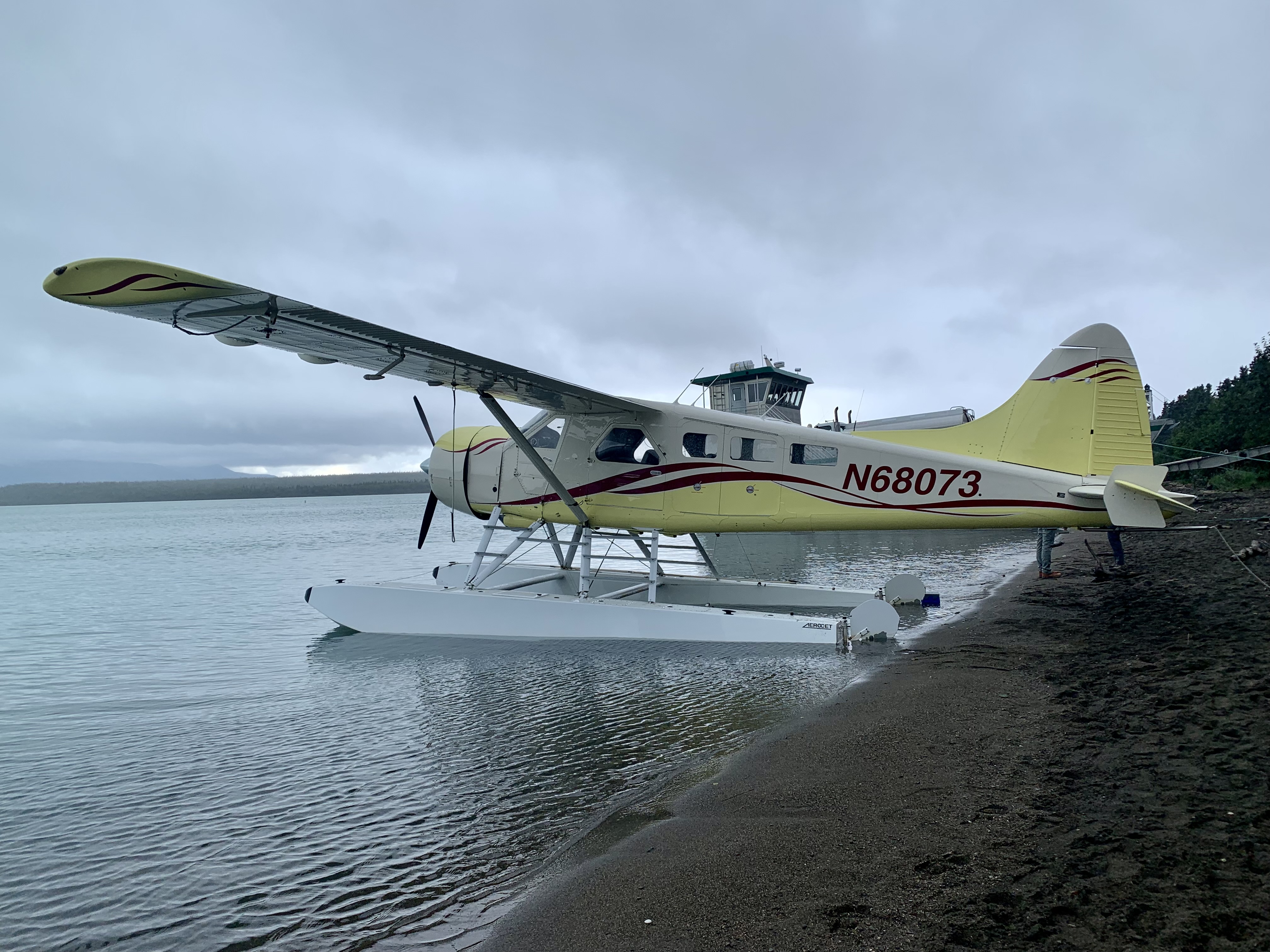
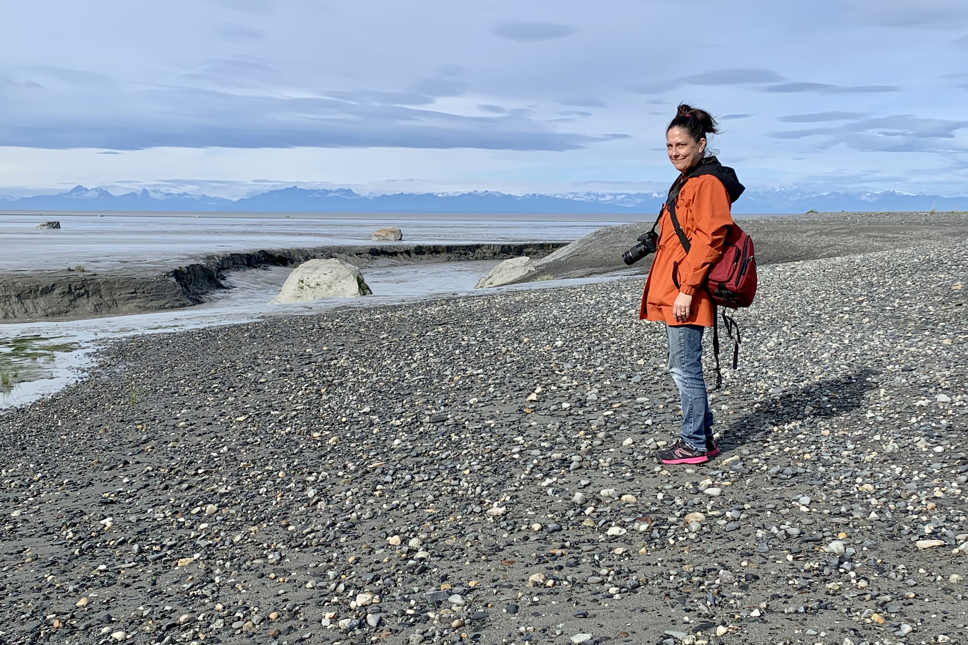
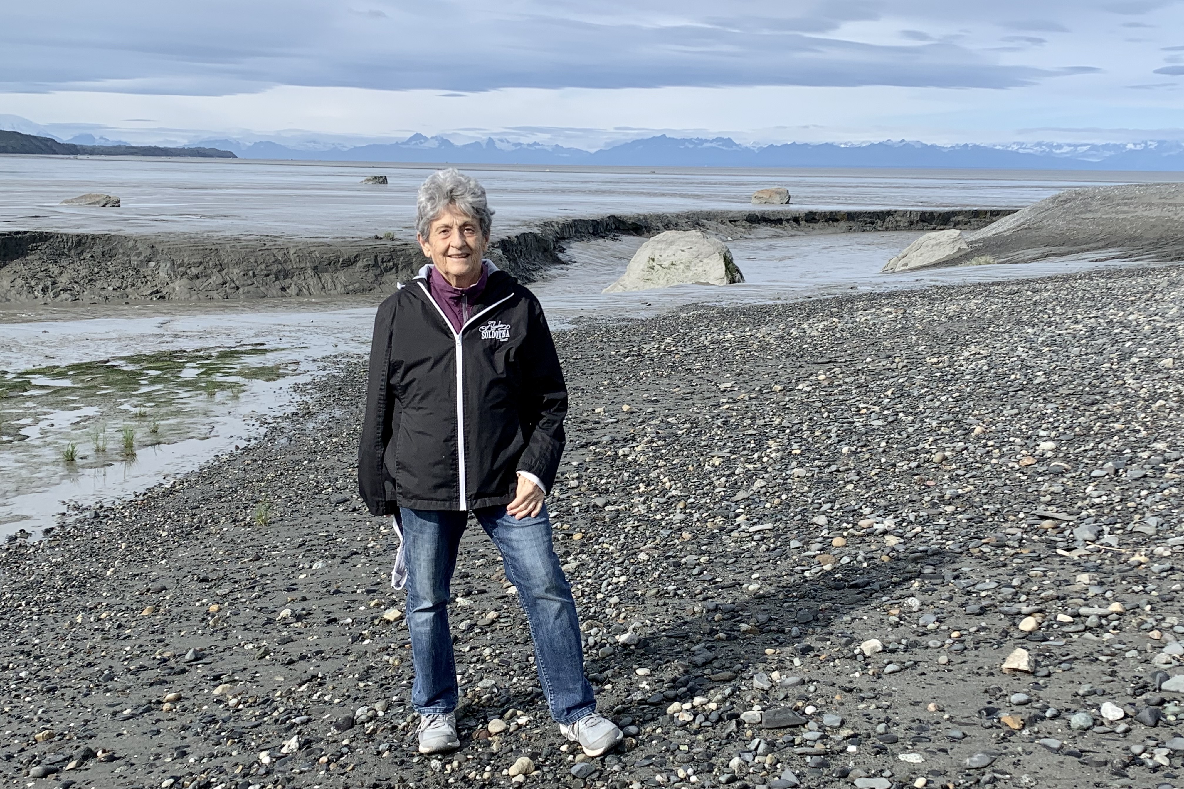
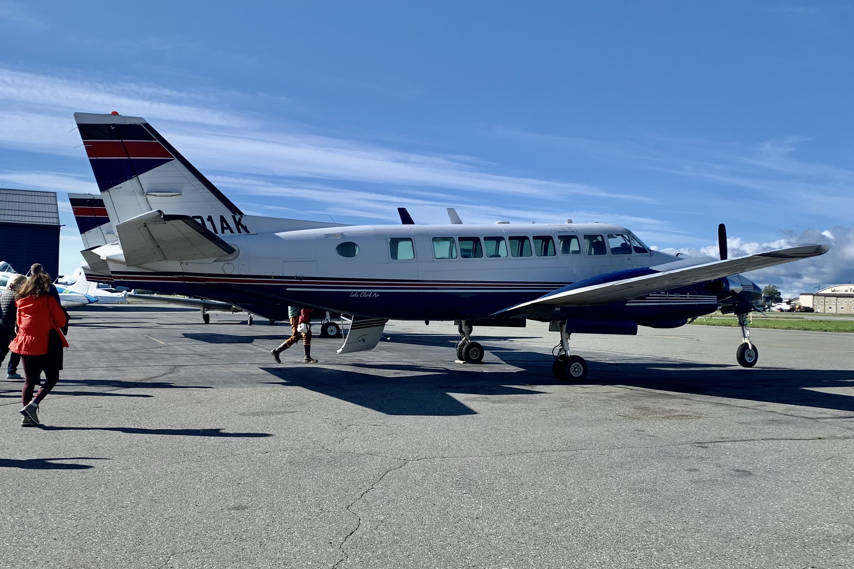
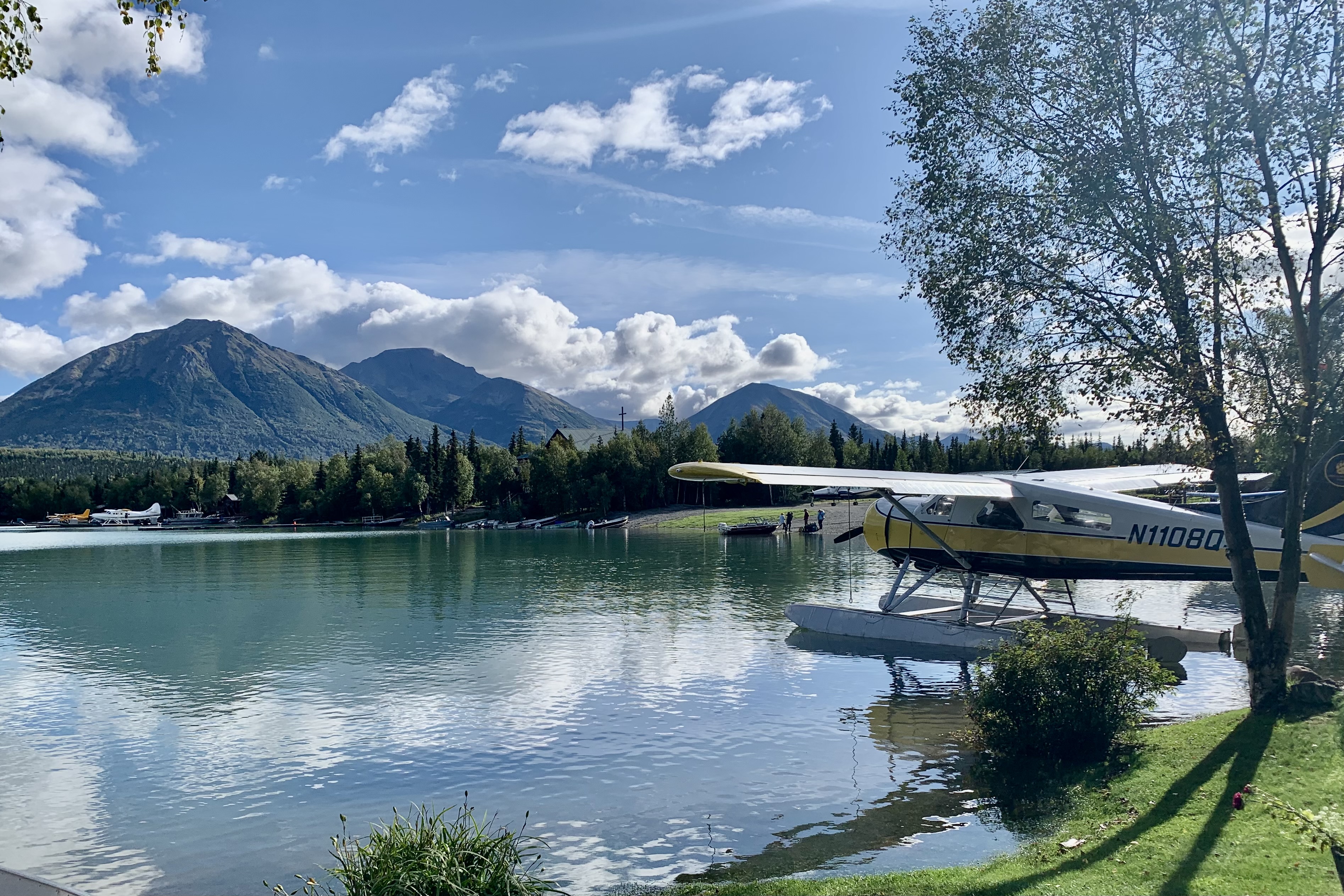
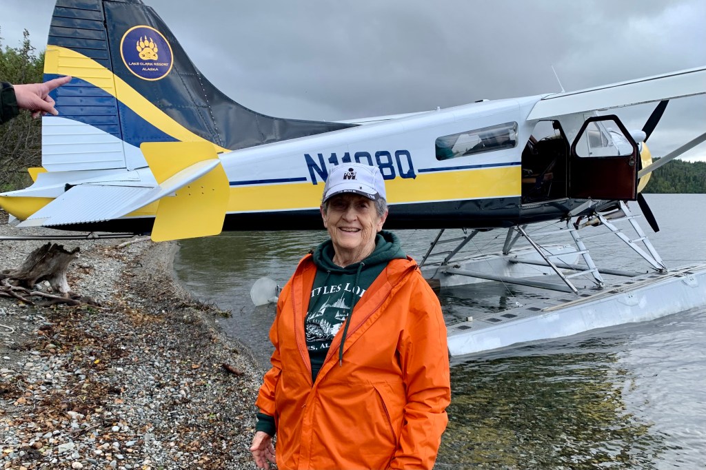
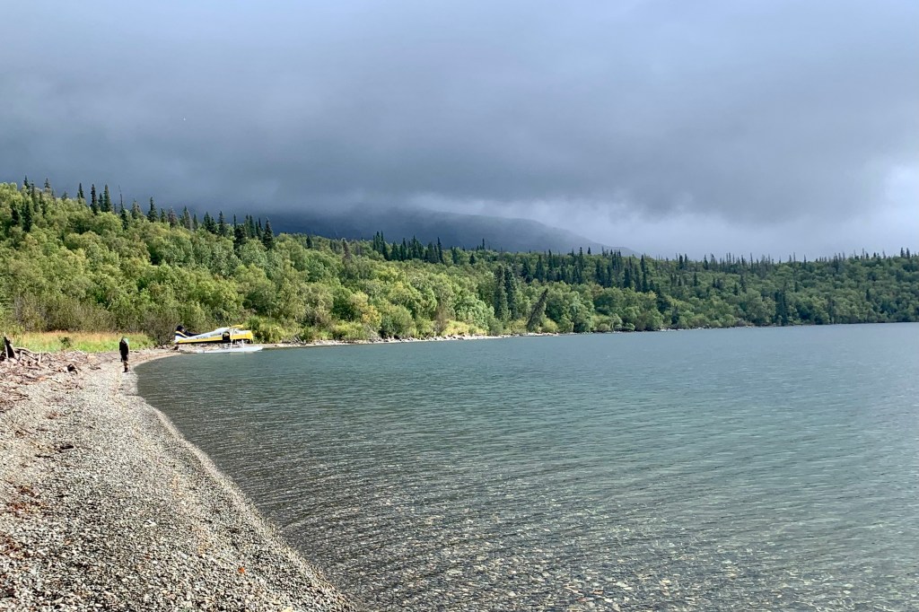
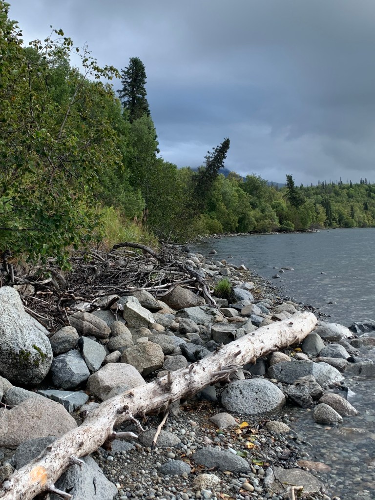
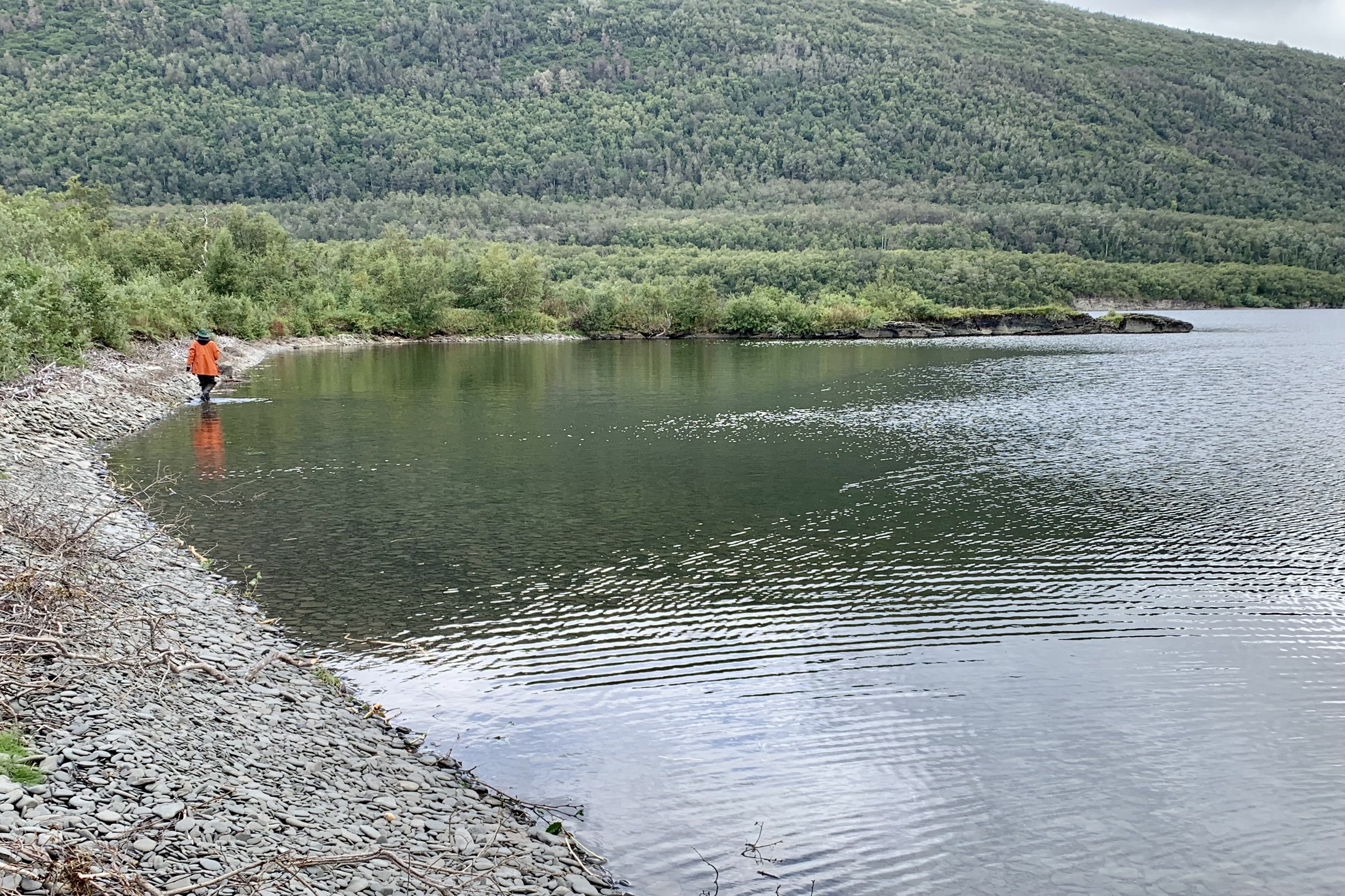
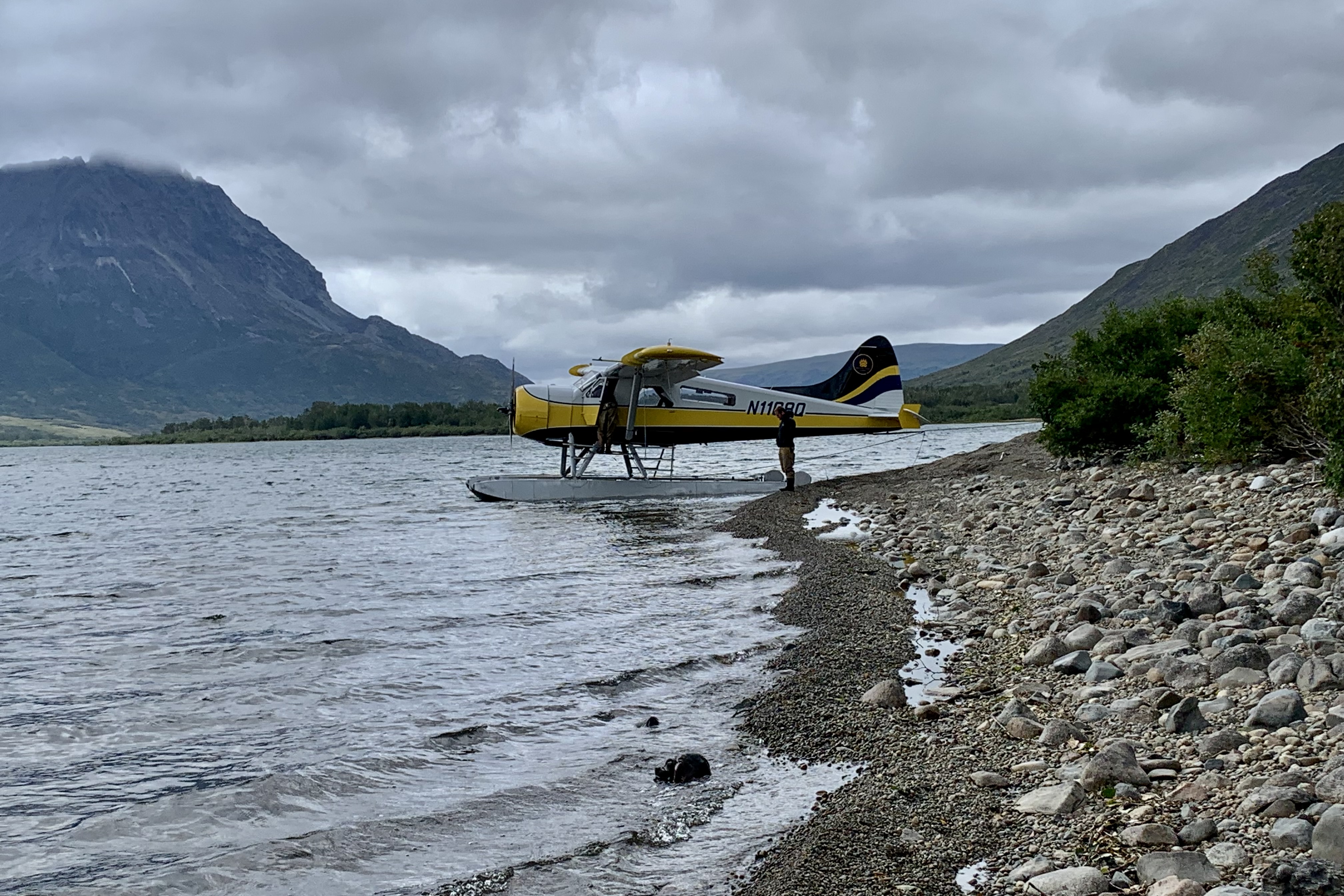
Our second day of flightseeing was filled with exhilarating  explorations of forest rimmed crystal lakes, vast areas of tundra, and a volcanic-ash covered valley. On day 3 we were heading back to Katmai Park and Preserve  to explore some of its remote mountain lakes. The first order of business of course is “dressing out.” The less then delightful Alaska weather that I experienced over the summer was cool and rainy and all of our pilots and guides corroborated that this was indeed the case as well at Clark and Katmai. This weather pattern was continuing to shroud Alaska with rain, fog, mist, and the area remained cloaked in clouds.  The end result of this is the lake water levels are elevated  and in most cases have lipped the available beach. Thus, not having any feline genes to rely on , I found getting out and off of a float plane is not particularly a graceful activity as I no longer can claim to be lithe and spry. Stepping off the floats onto unstable beaches can be quite hazardous if one cares about having dry feet.  So this was the day we were to don the hip waders for our lake outings. Though they felt quite clunky, now I  could just plunk my feet down  into the water and prance up onto the stony shore. 

Since I hate to be cold and wet I definitely chose to over-pack including an extra raincoat, extra  socks, a warm hat, and gloves, shoes and of course water. I skipped the sun screen. Bet you can figure out why! I was already wearing long underwear, hiking pants and shirt, a hoodie,  and rain pants and rain jacket. I was well insulated and cocooned for whatever the weather gods might hurl, toss, heave, or sling our way and imagined I could be mistaken for a teletubby .

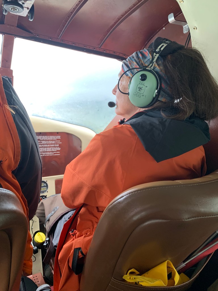
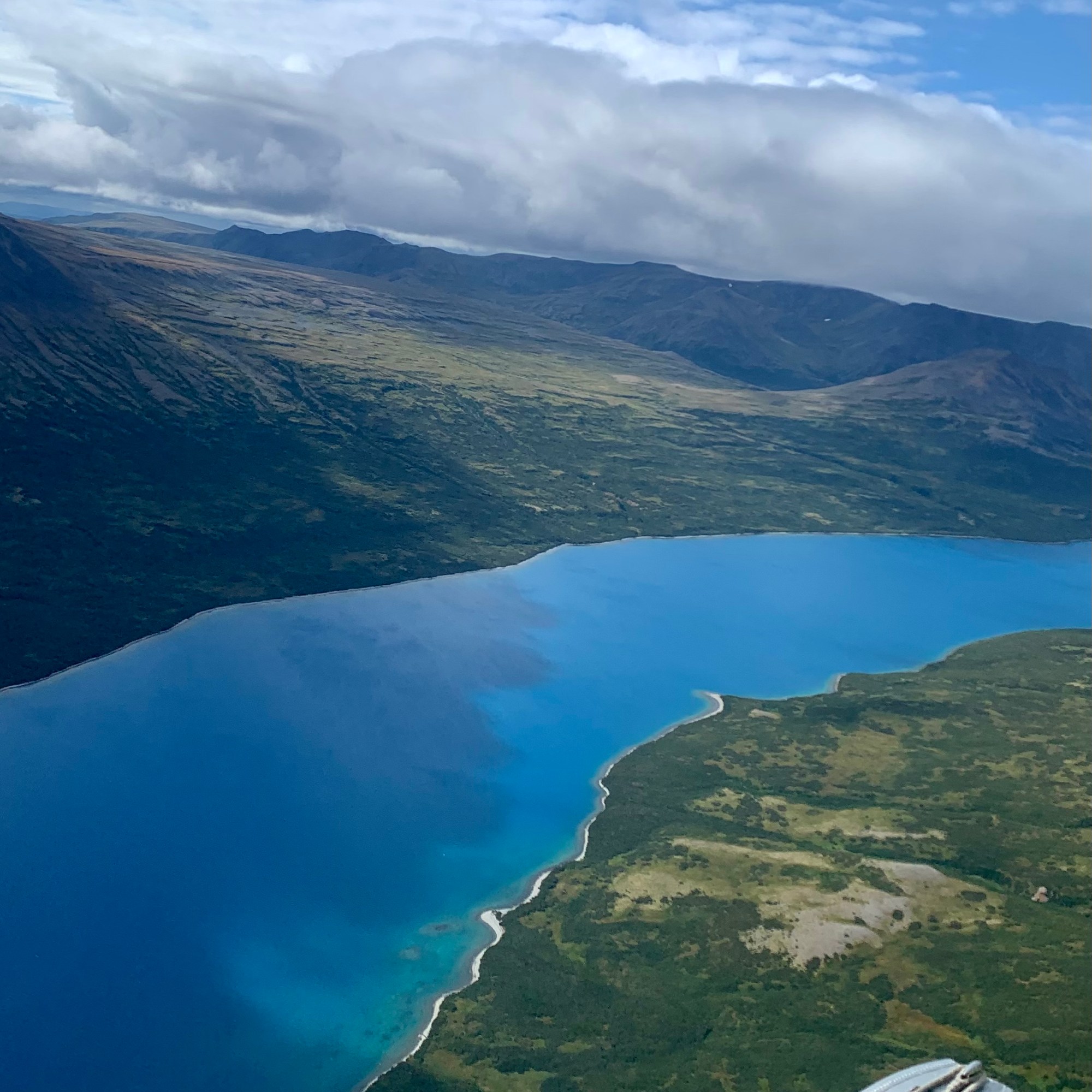
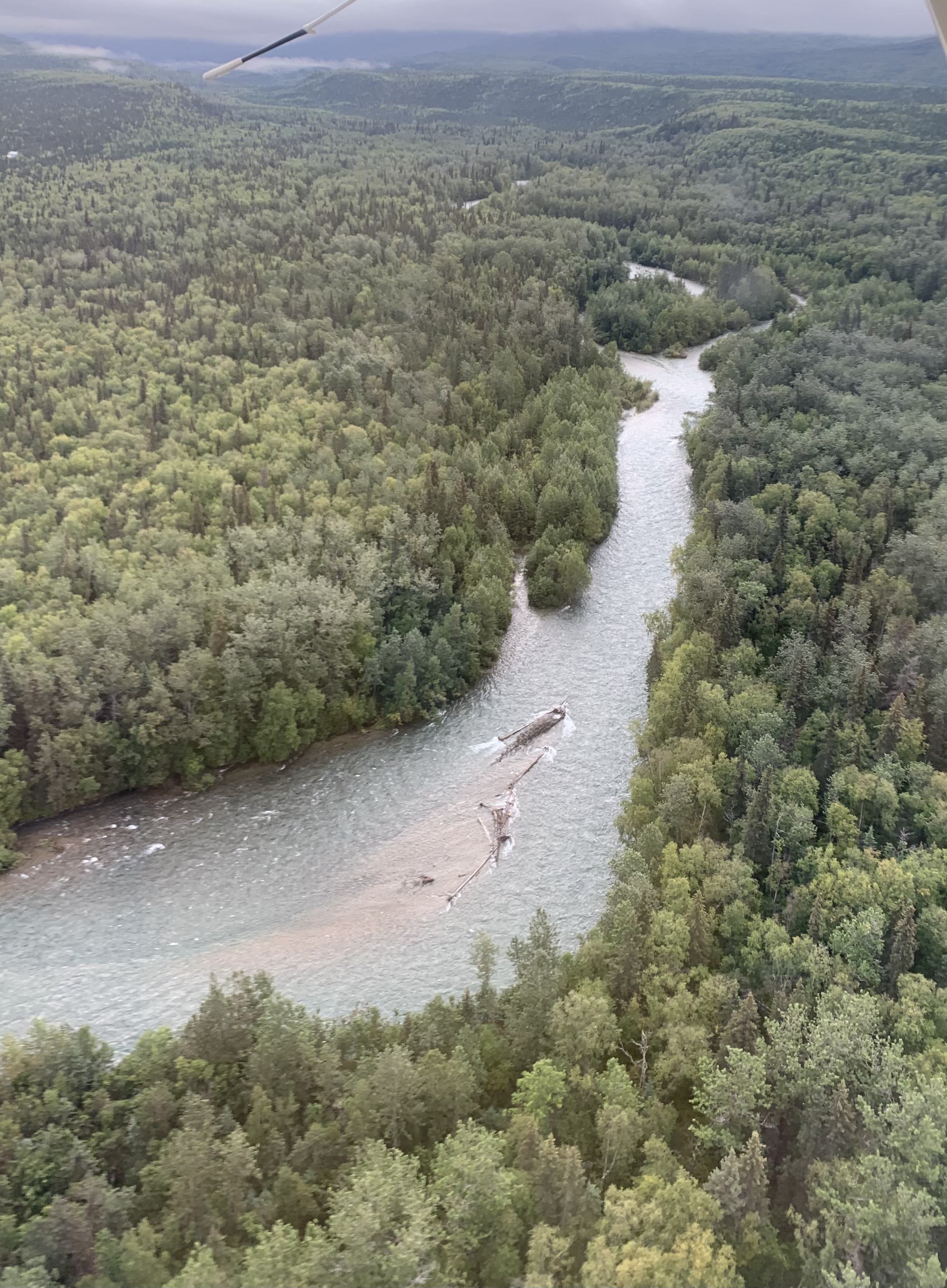
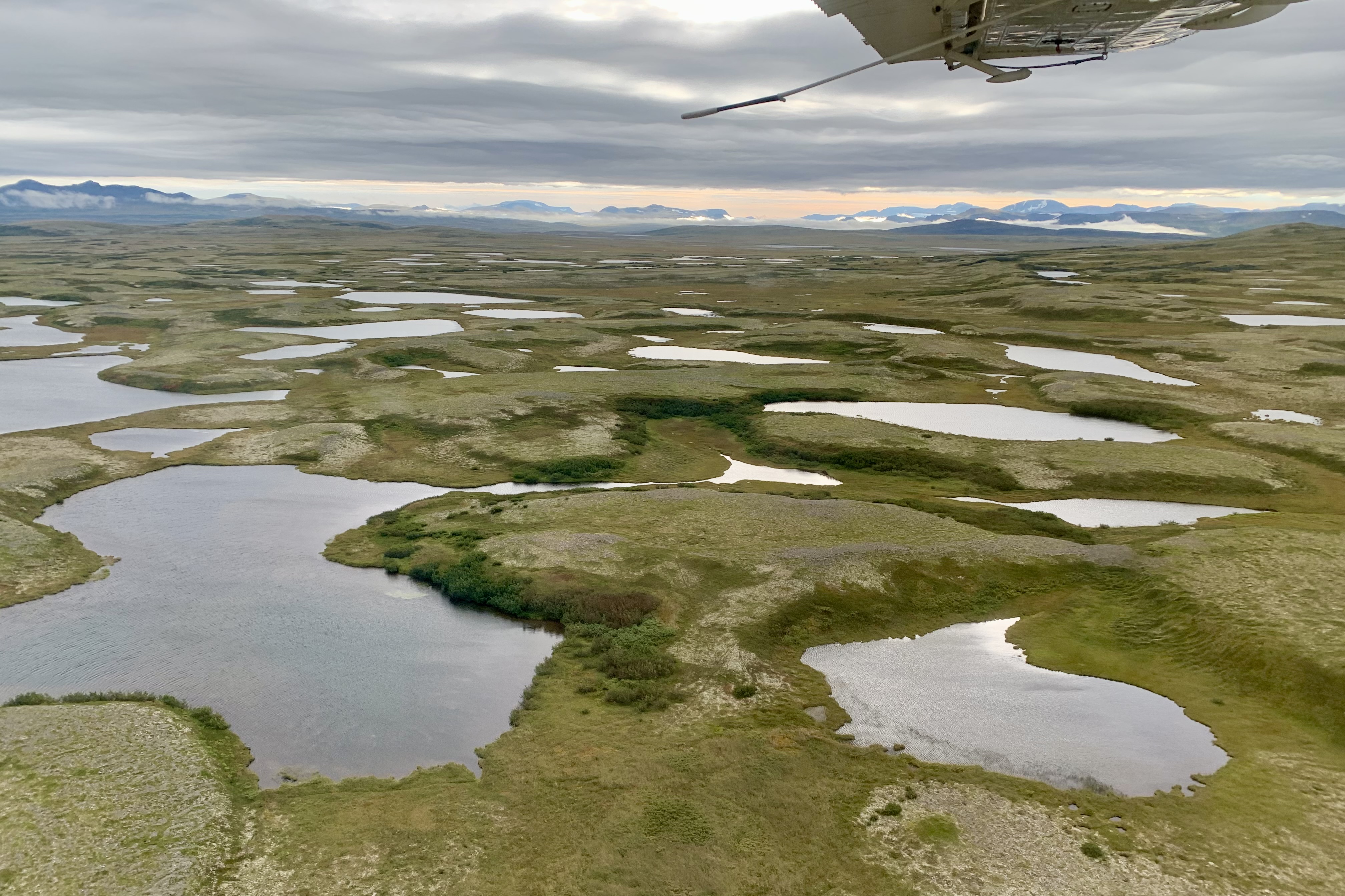
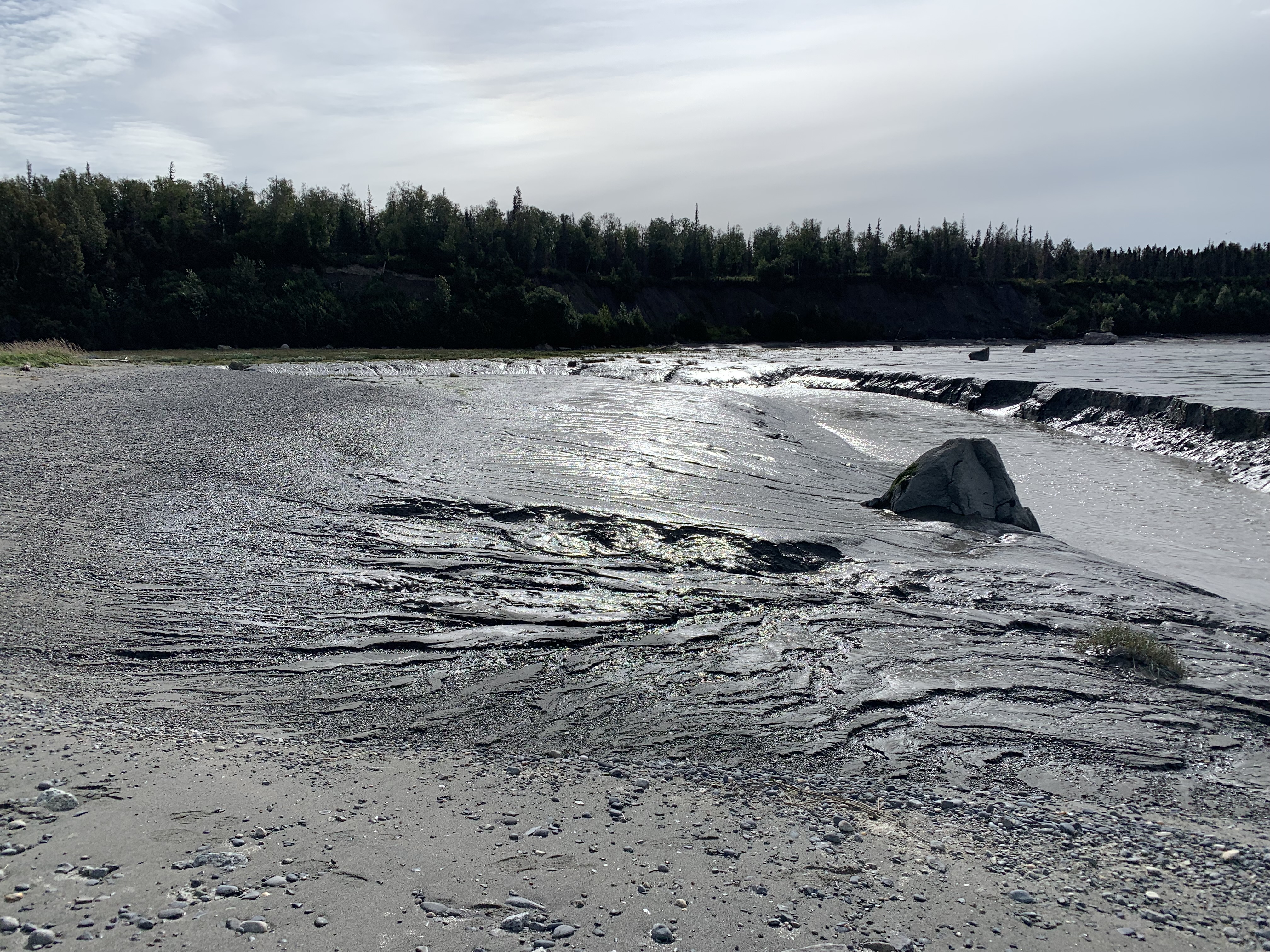
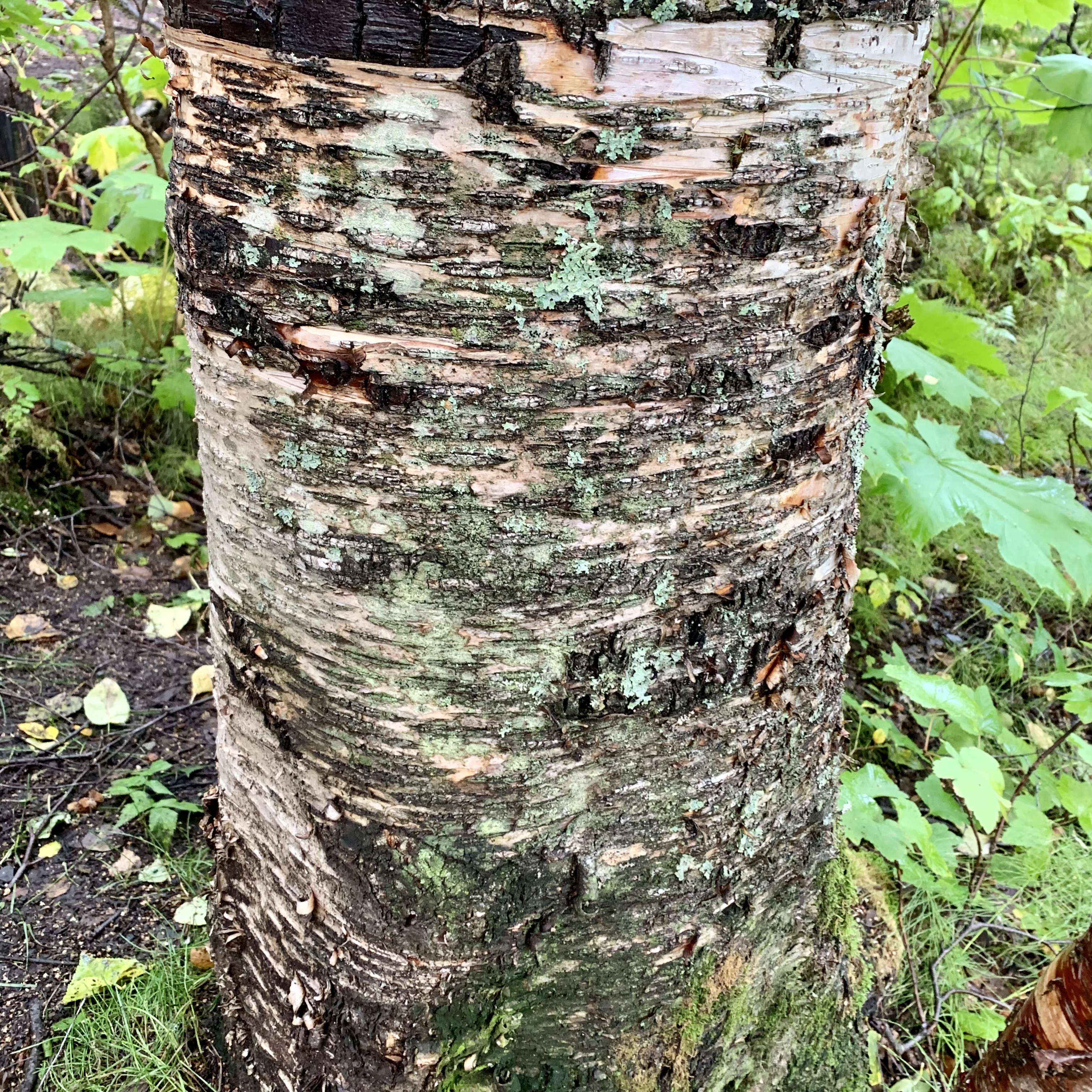
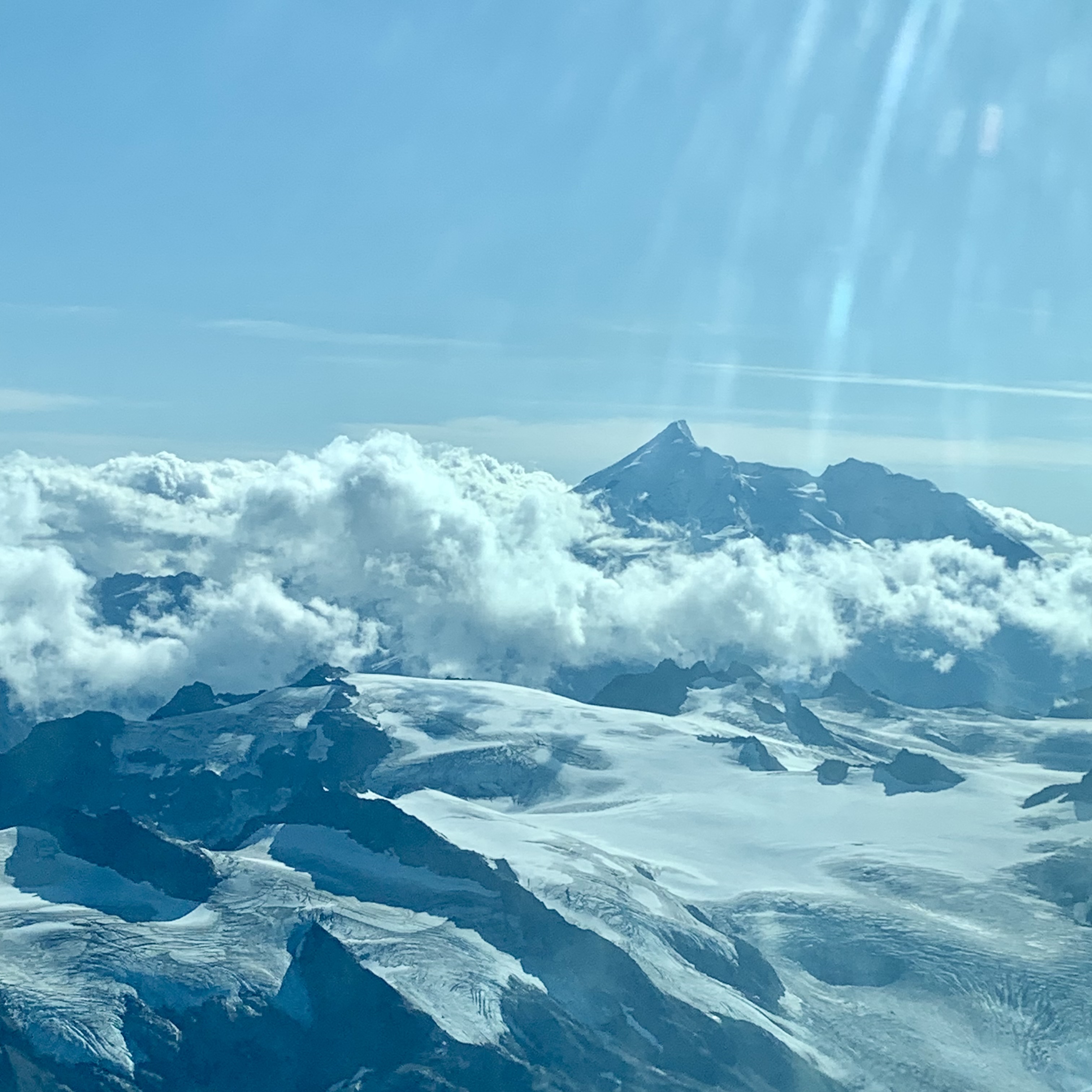
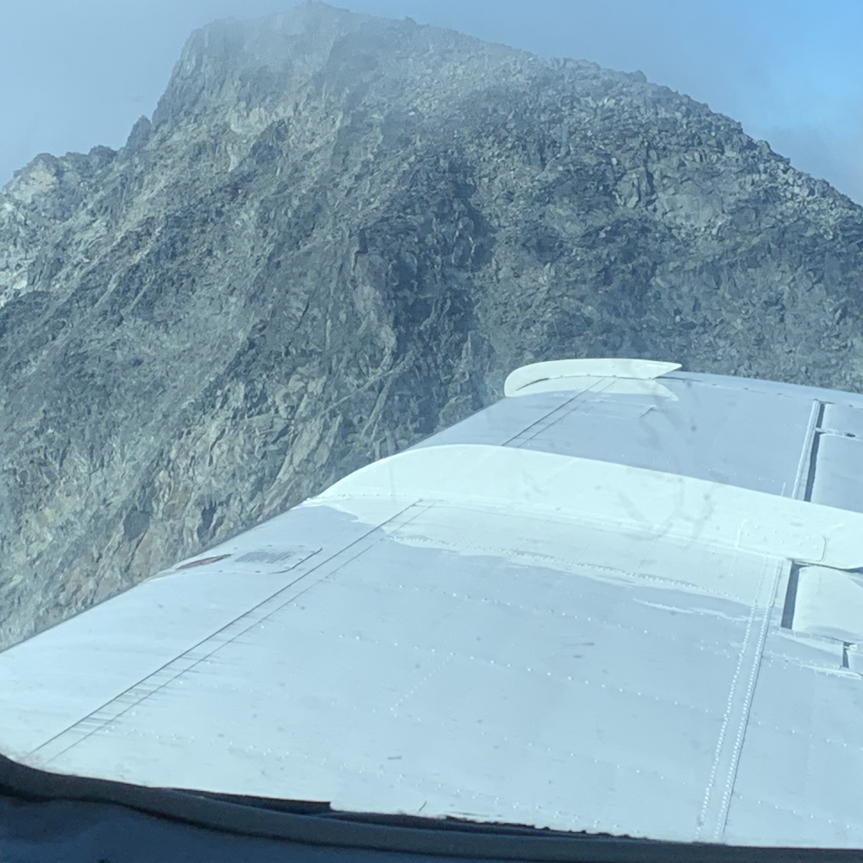
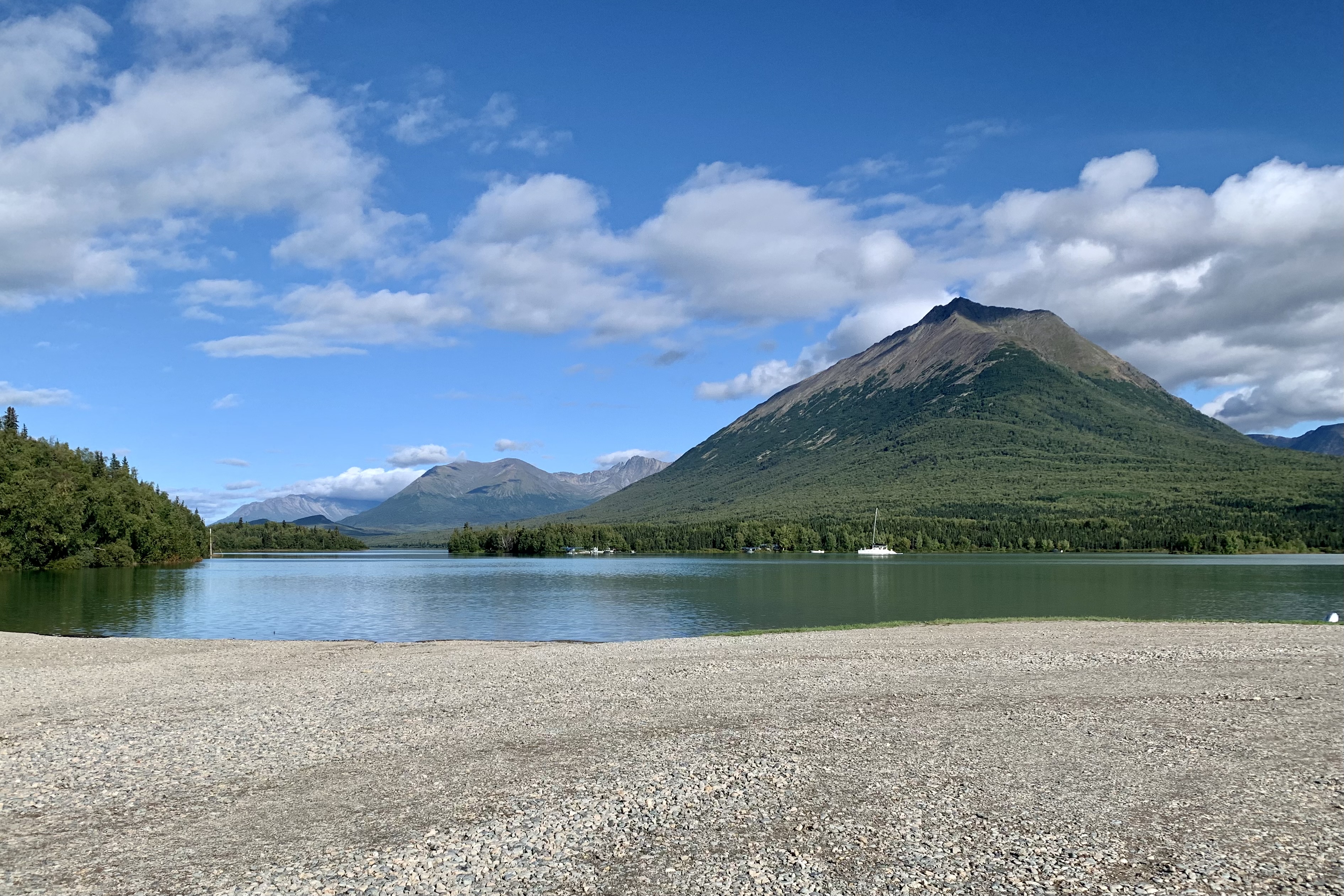
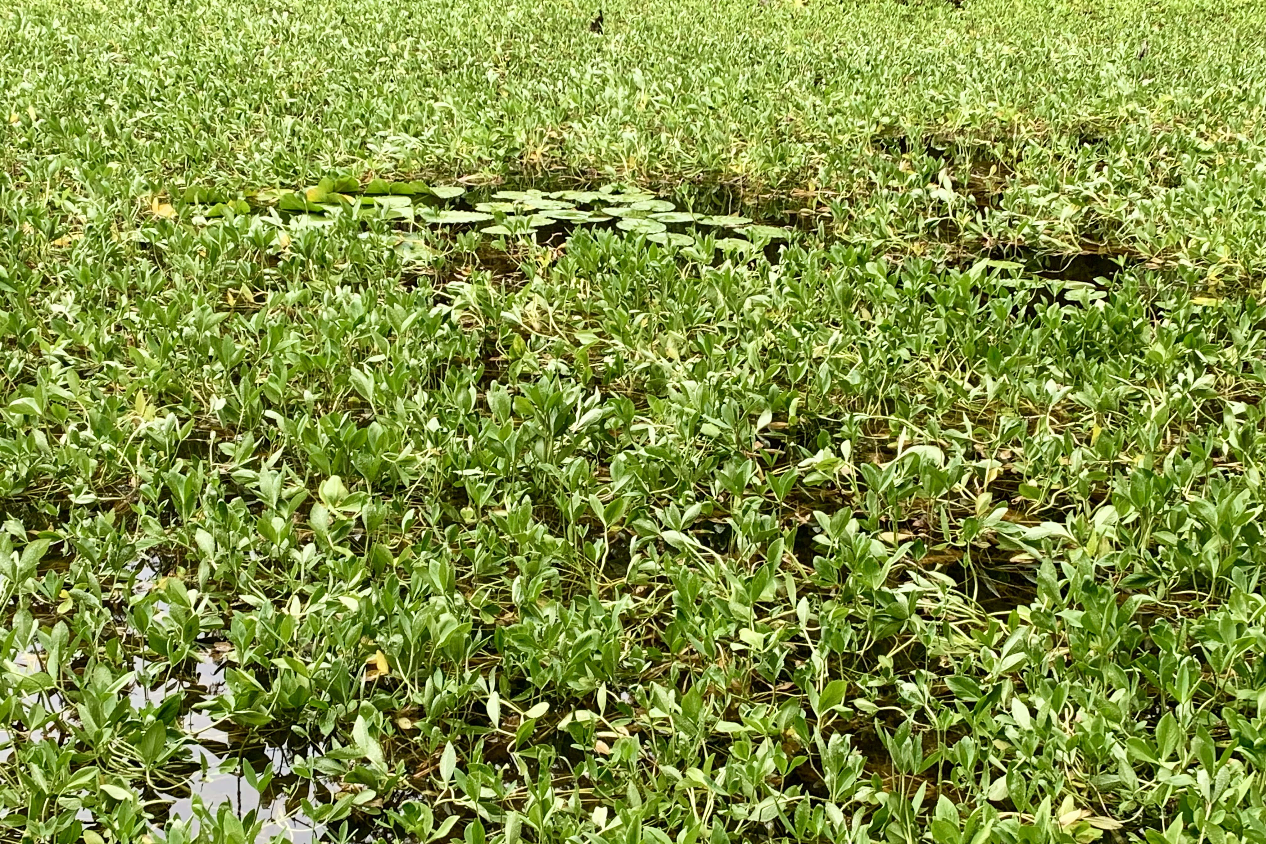
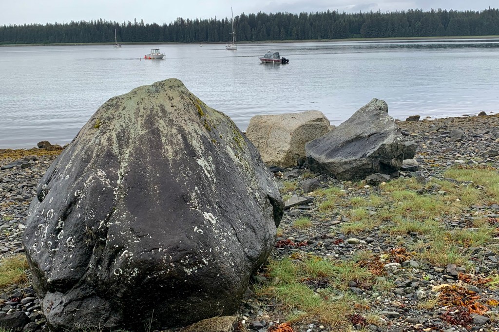
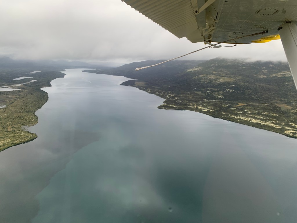
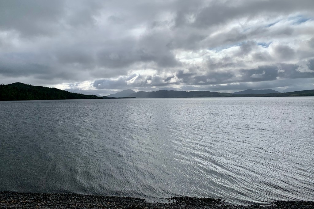
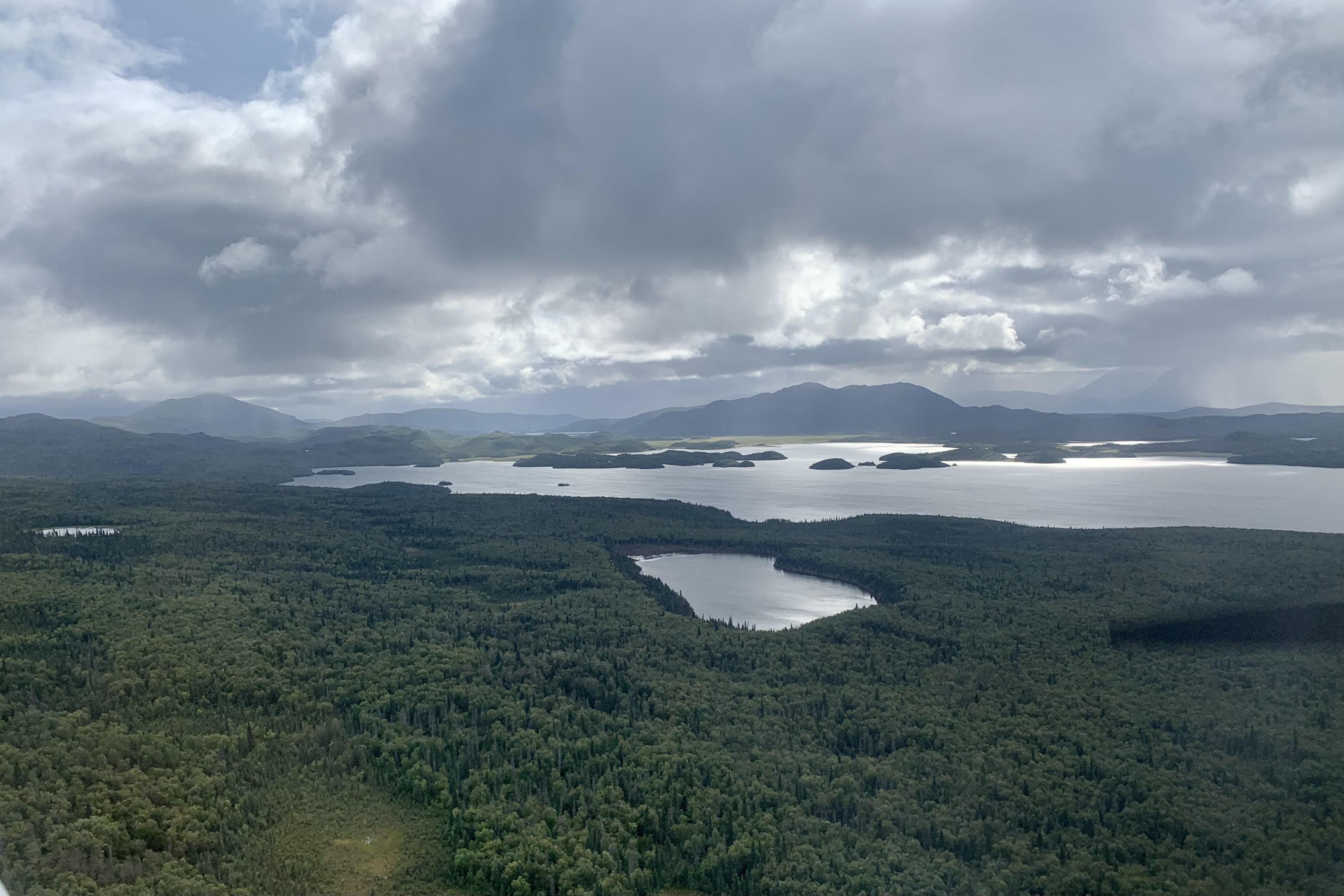
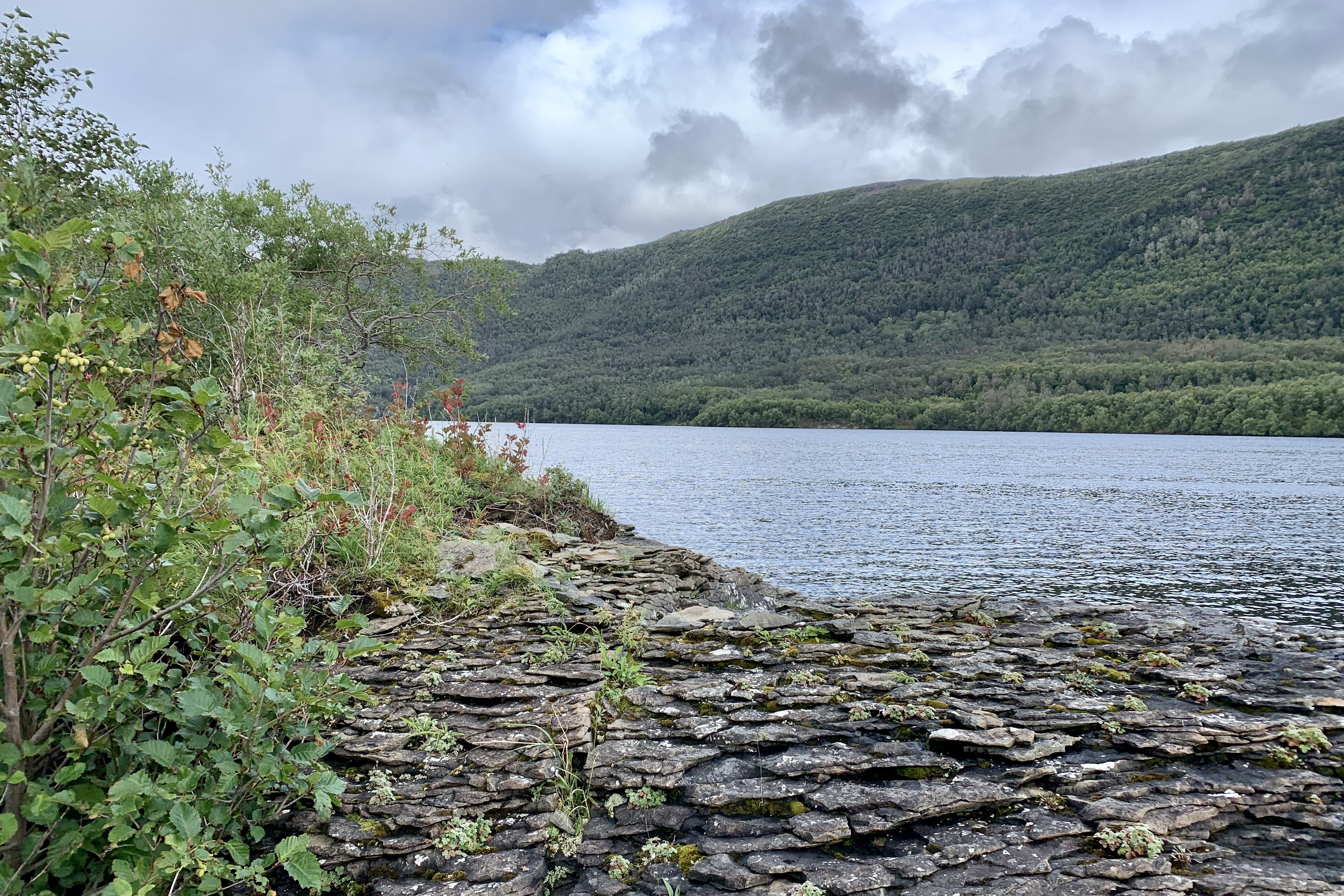
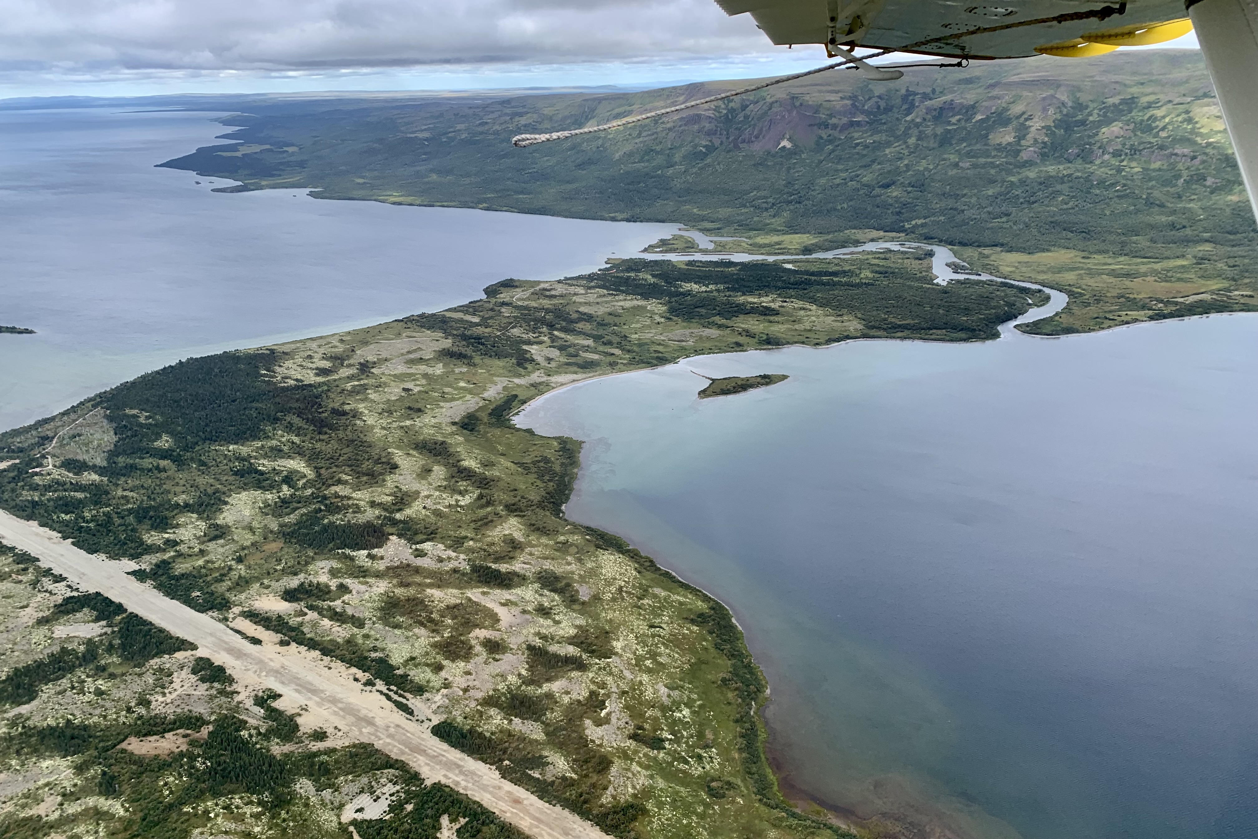
Once airborne, and with Tasia as “copilot, ” the aerial view of the landscape below was of breathtaking diverse wilderness. An extensive agglomeration of crystal clear lake accessible by float plane. We wove our way south from Lake Clark buzzing over Lower Tazimina Lake, Lake Iliamna , Moraine Creek, Battle Lake, Nonvianuk Lake, and Coville Lake to our fist landing at on Grosvenor Lake. This lake is fed by glacier meltwater as it was carved out in the Ice Age by glaciers on the run and is surrounded by spruce and birch forrest. On a sunny day it would be an azure blue but this day it had a chilling steel gray hue and I definitely was not enticed to take a swim.

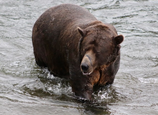
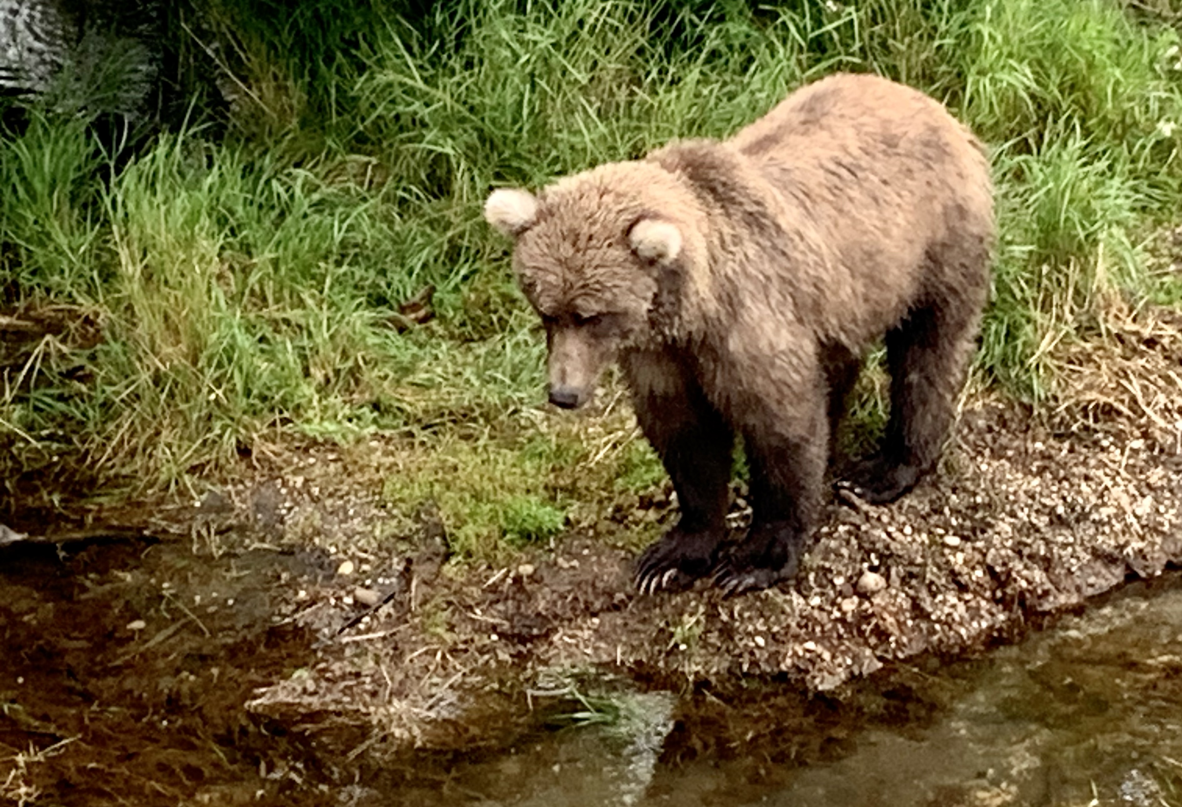
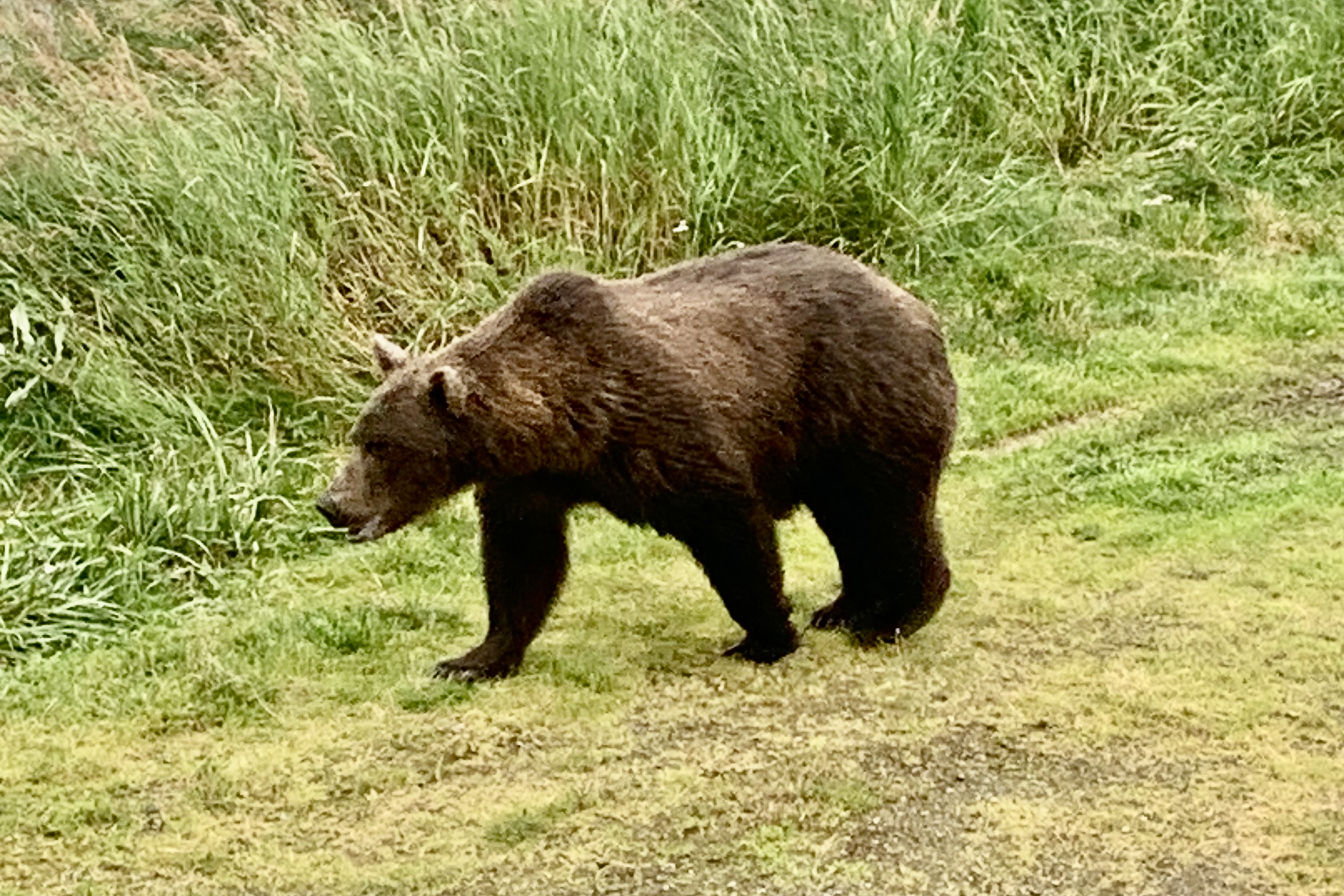
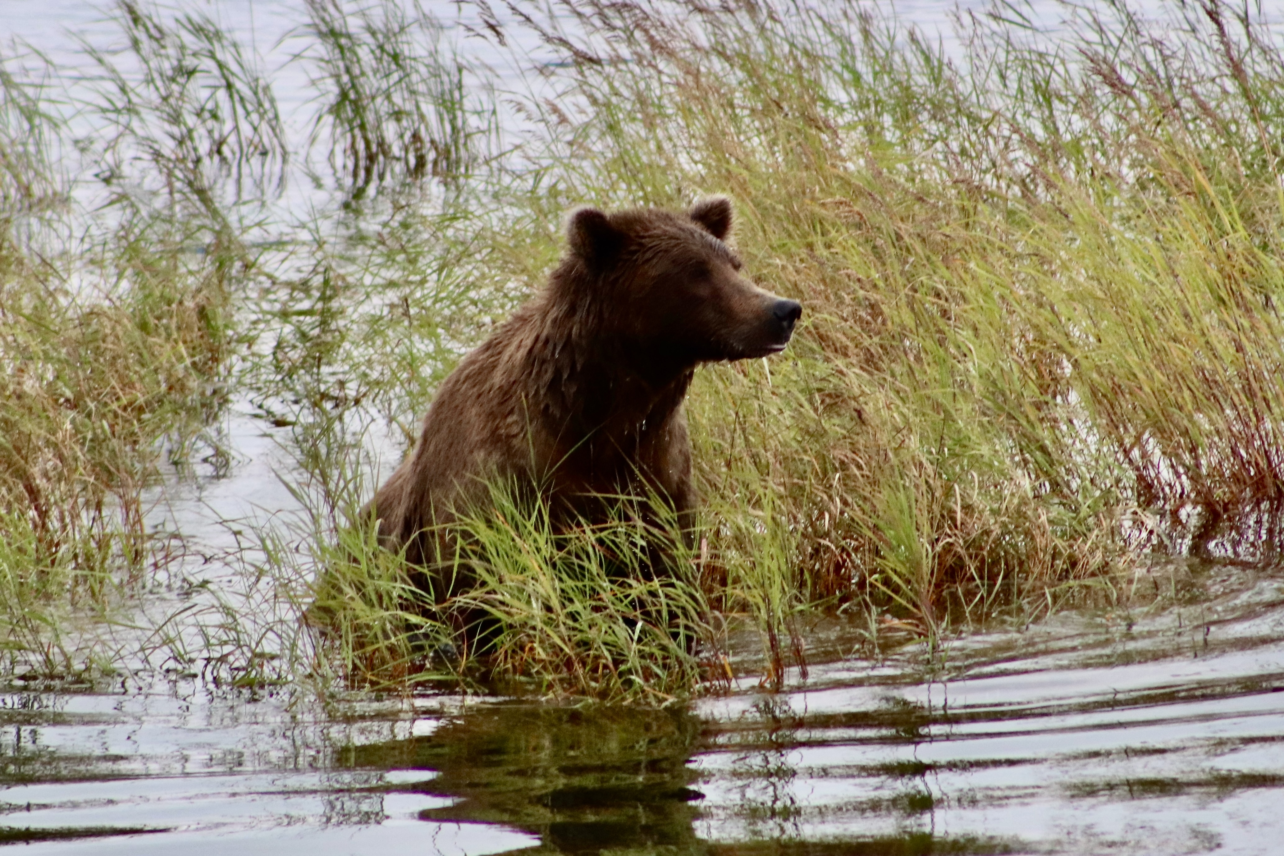
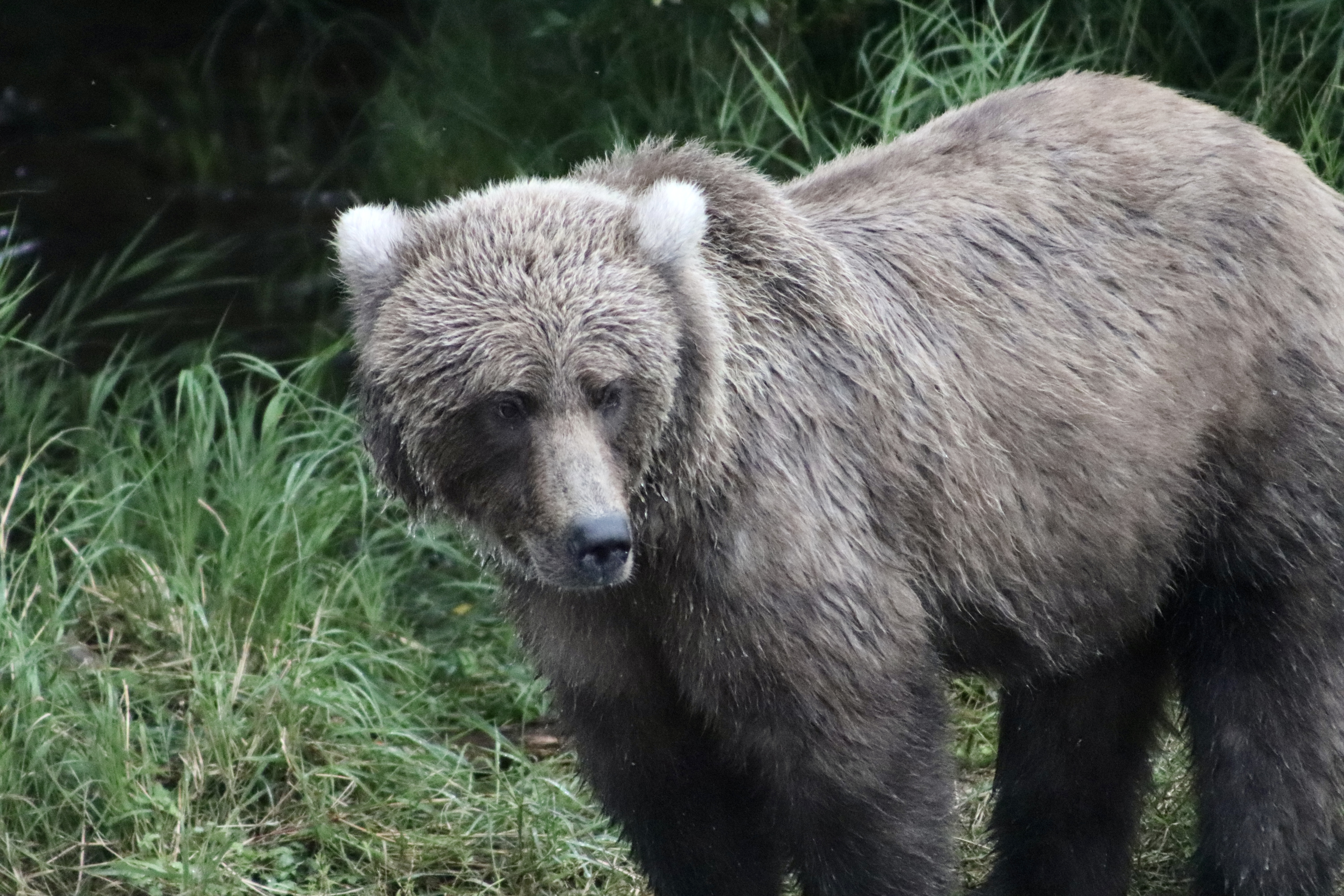
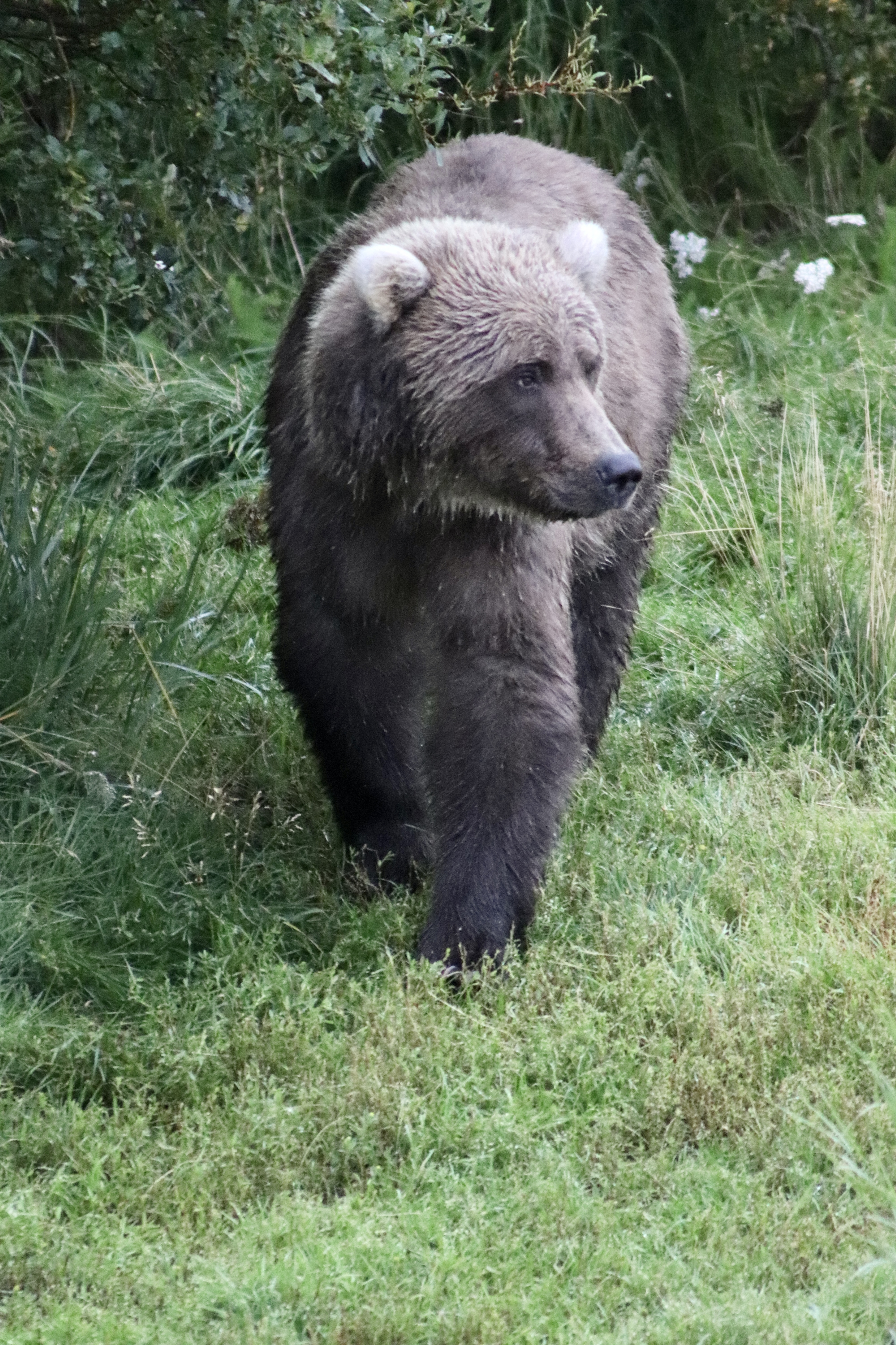
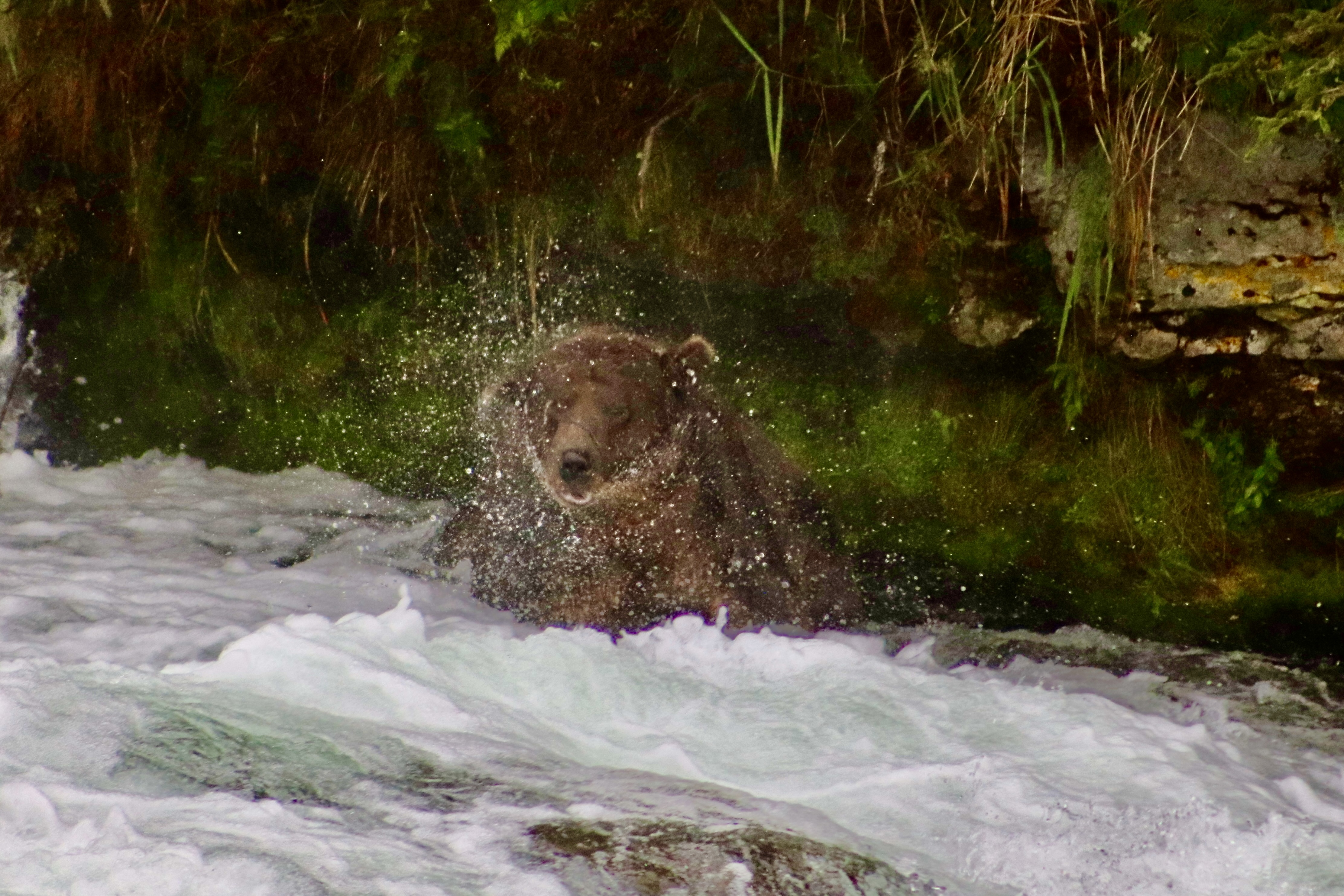
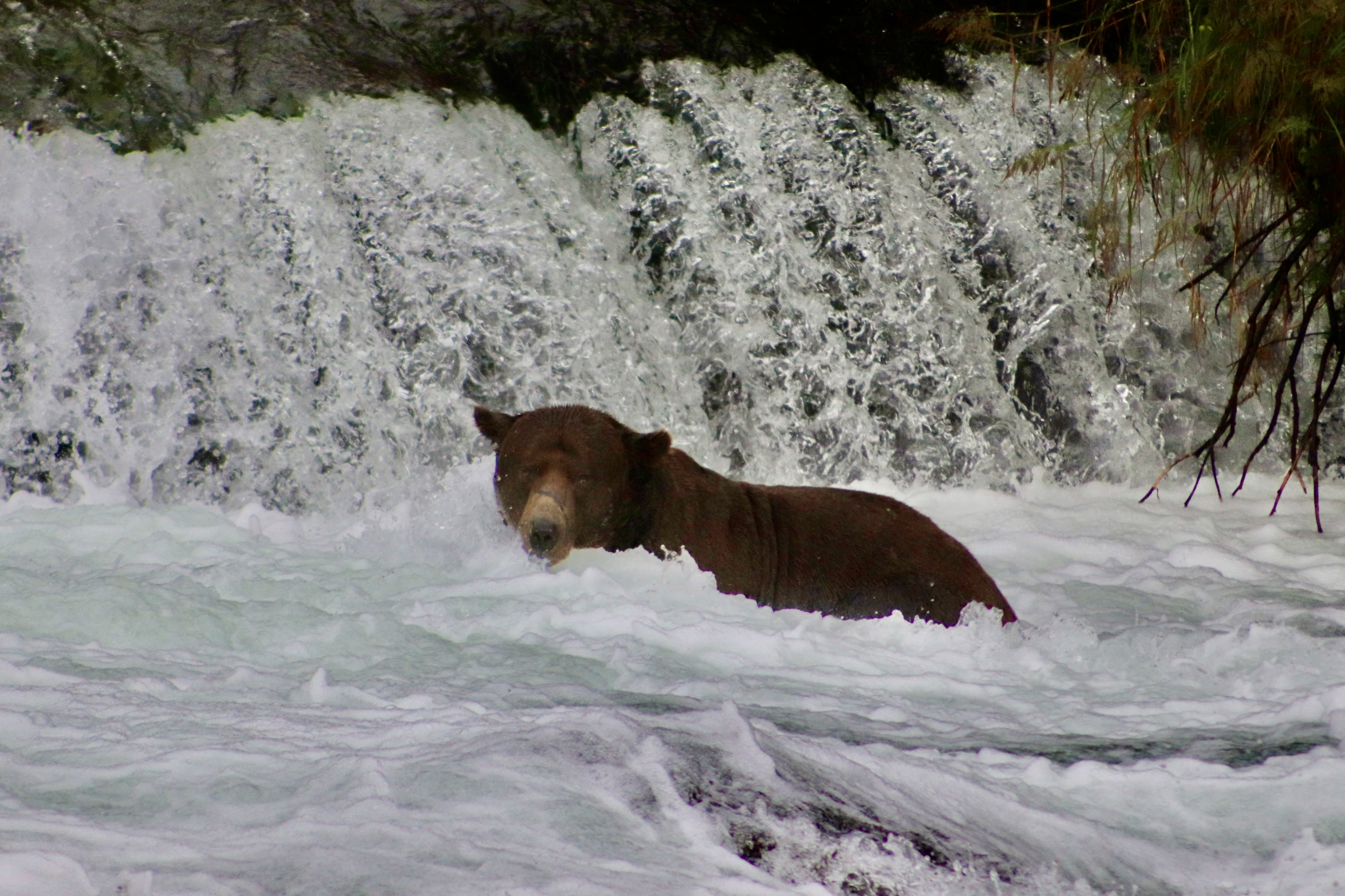
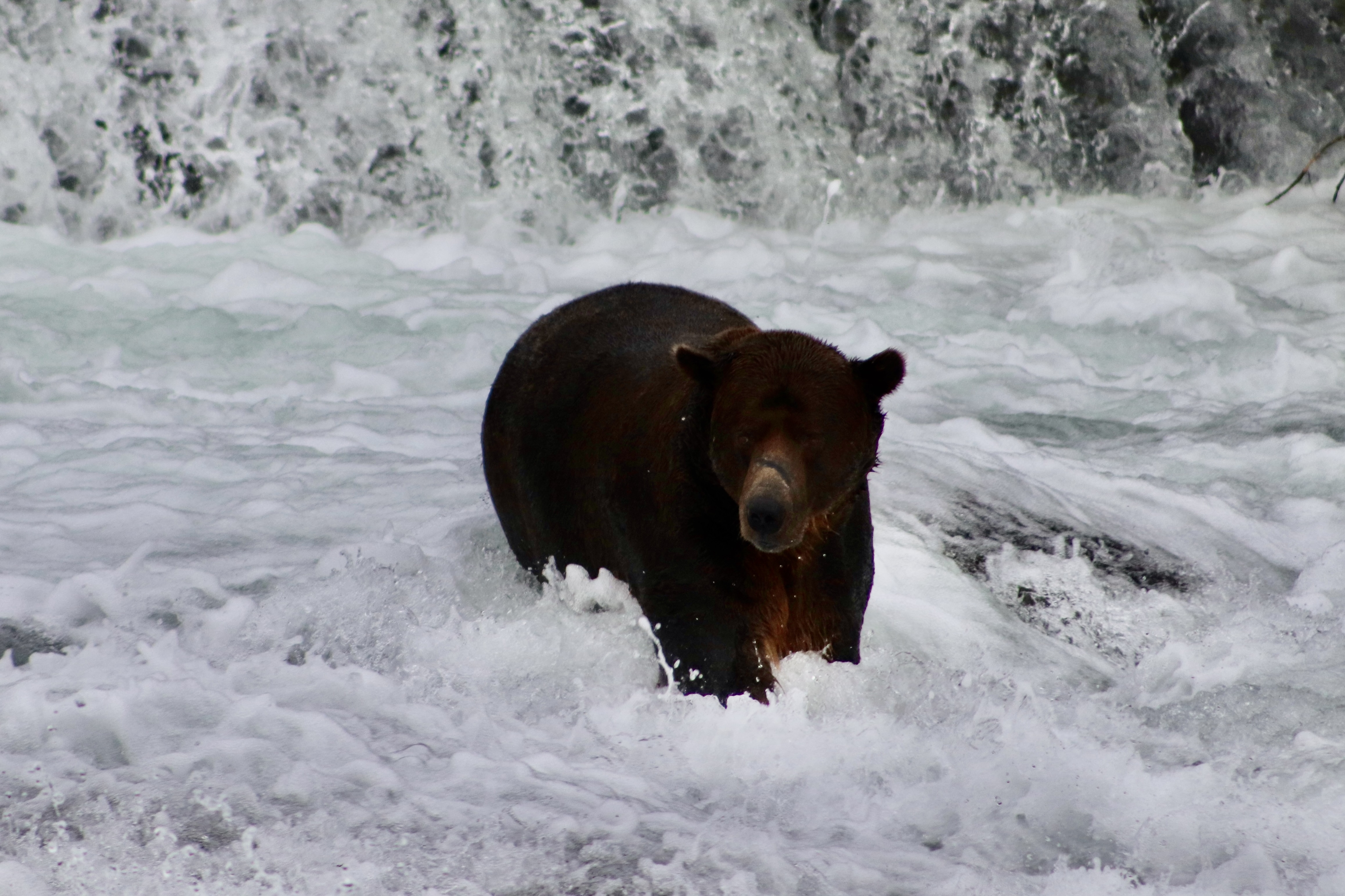
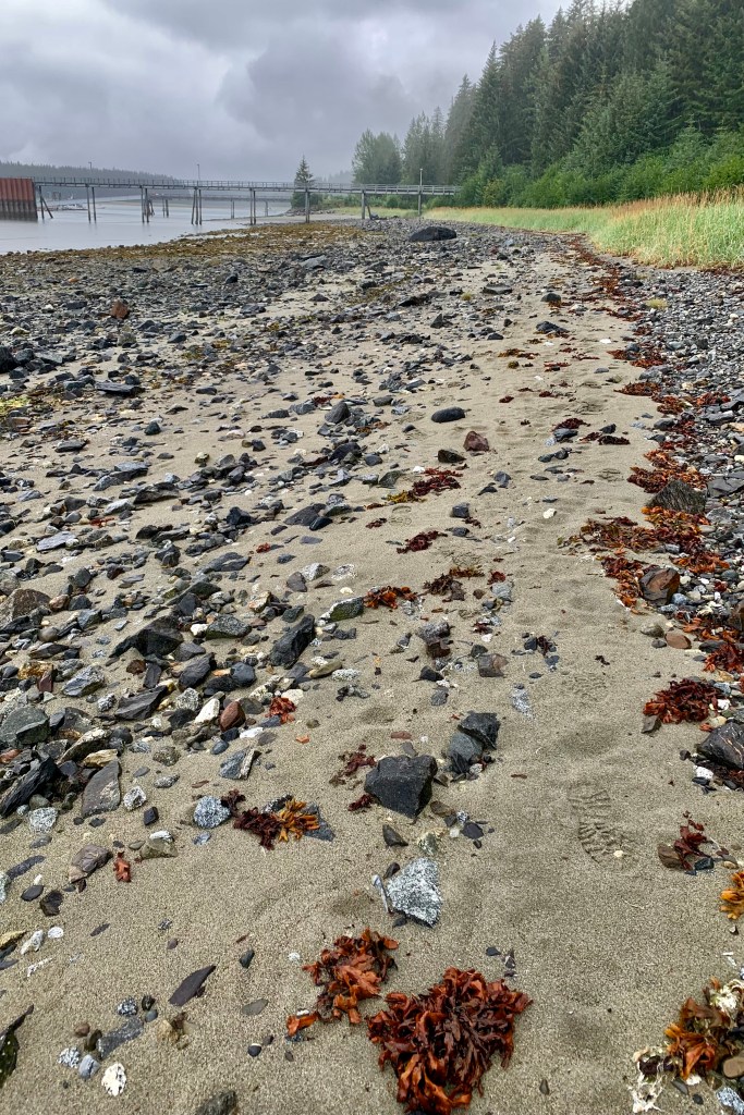
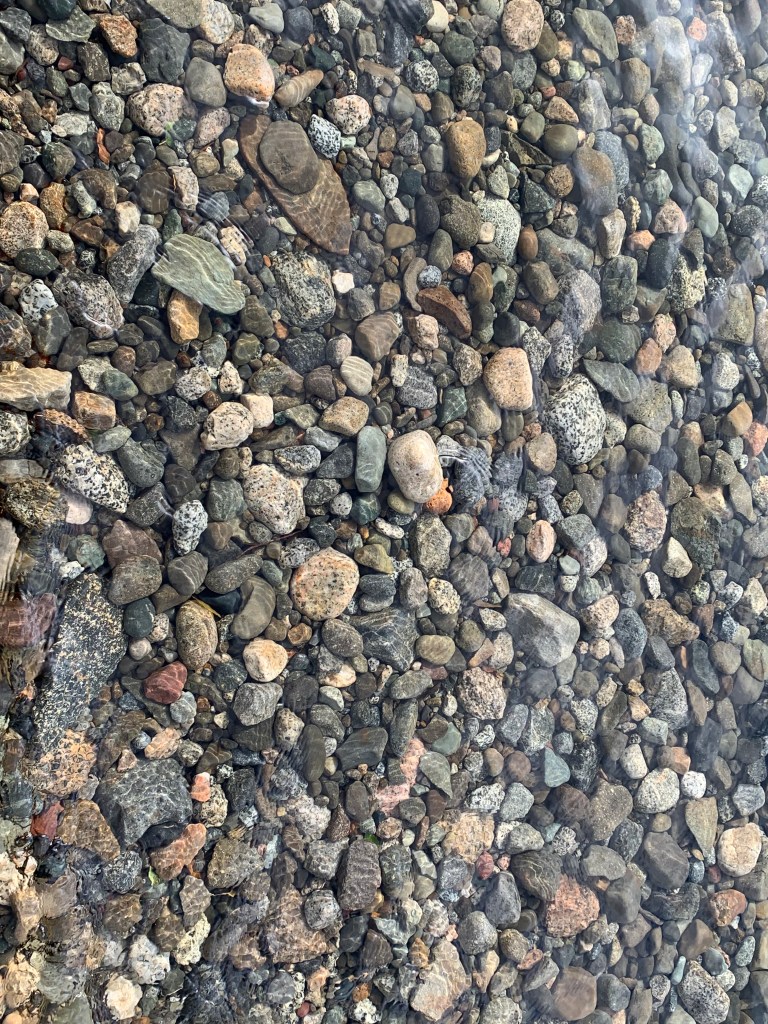
The beach of this lipping full lake consisted  of a deep loose layer of mostly pebbles and small stones which when walking shifted beneath my feet. It seemed a bit precarious as I walked on the stones or waded at waters edge and gingerly negotiated this unstable terrain proximate to the icy water in the clunky waders. As I approached a fellow adventurer, he asked me if I had noticed the bear tracks. My mind then had this vivid picture of experiencing an accidental dunk only to right my dripping self and come face to face with a bear. It’s easy to forget that these lakes are also bear territory and we are the interlopers and I image definitely not welcome unless the bear is particularly hungry.

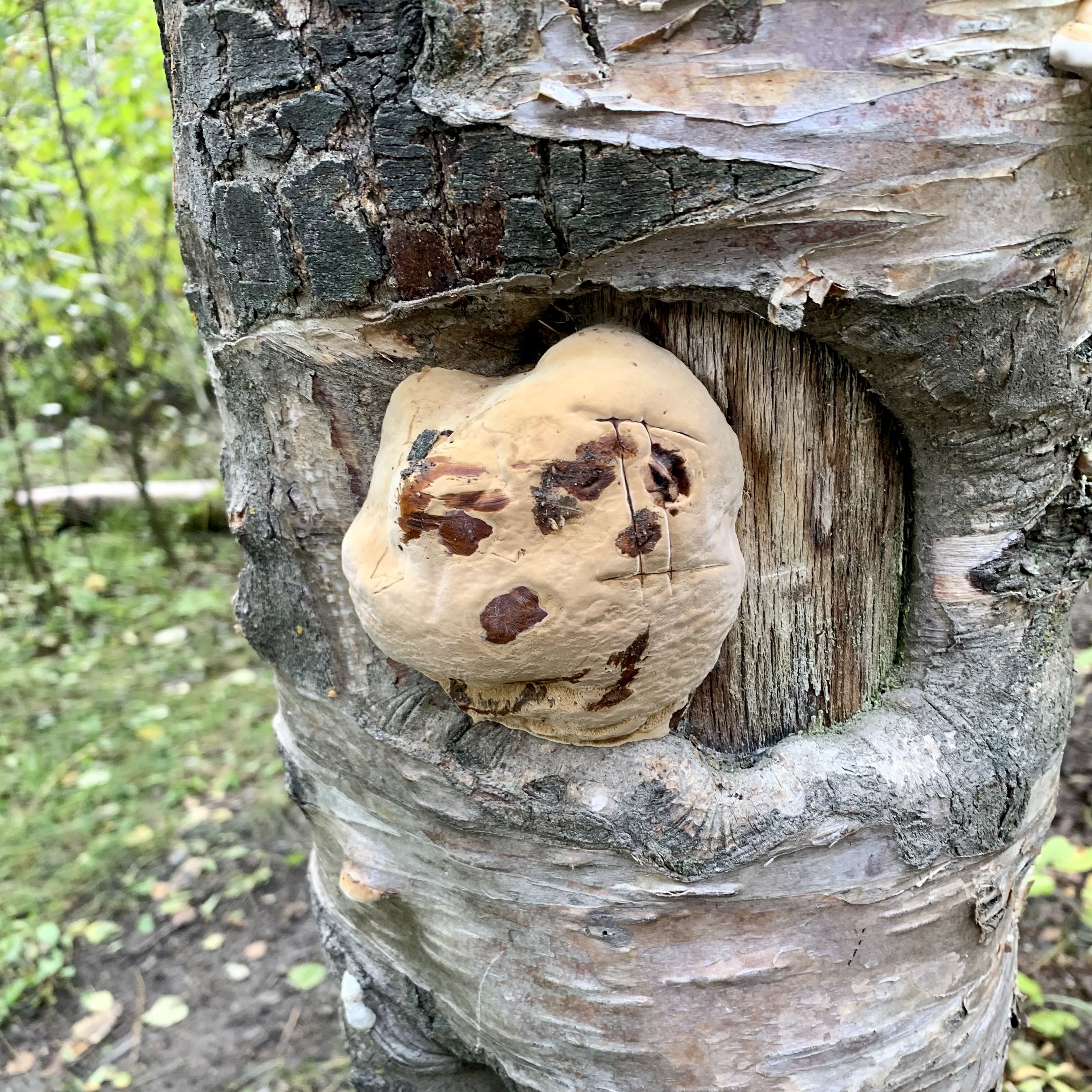
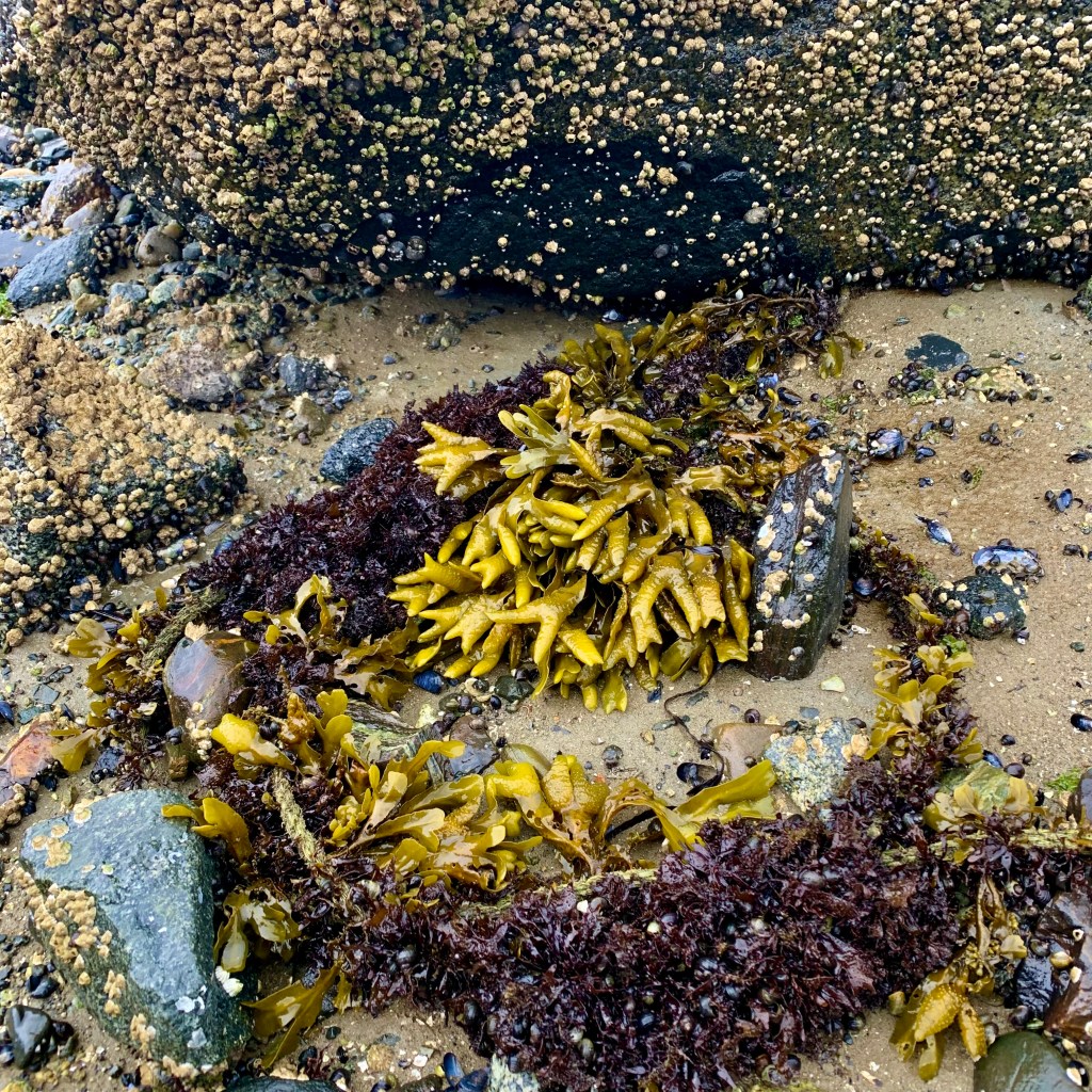
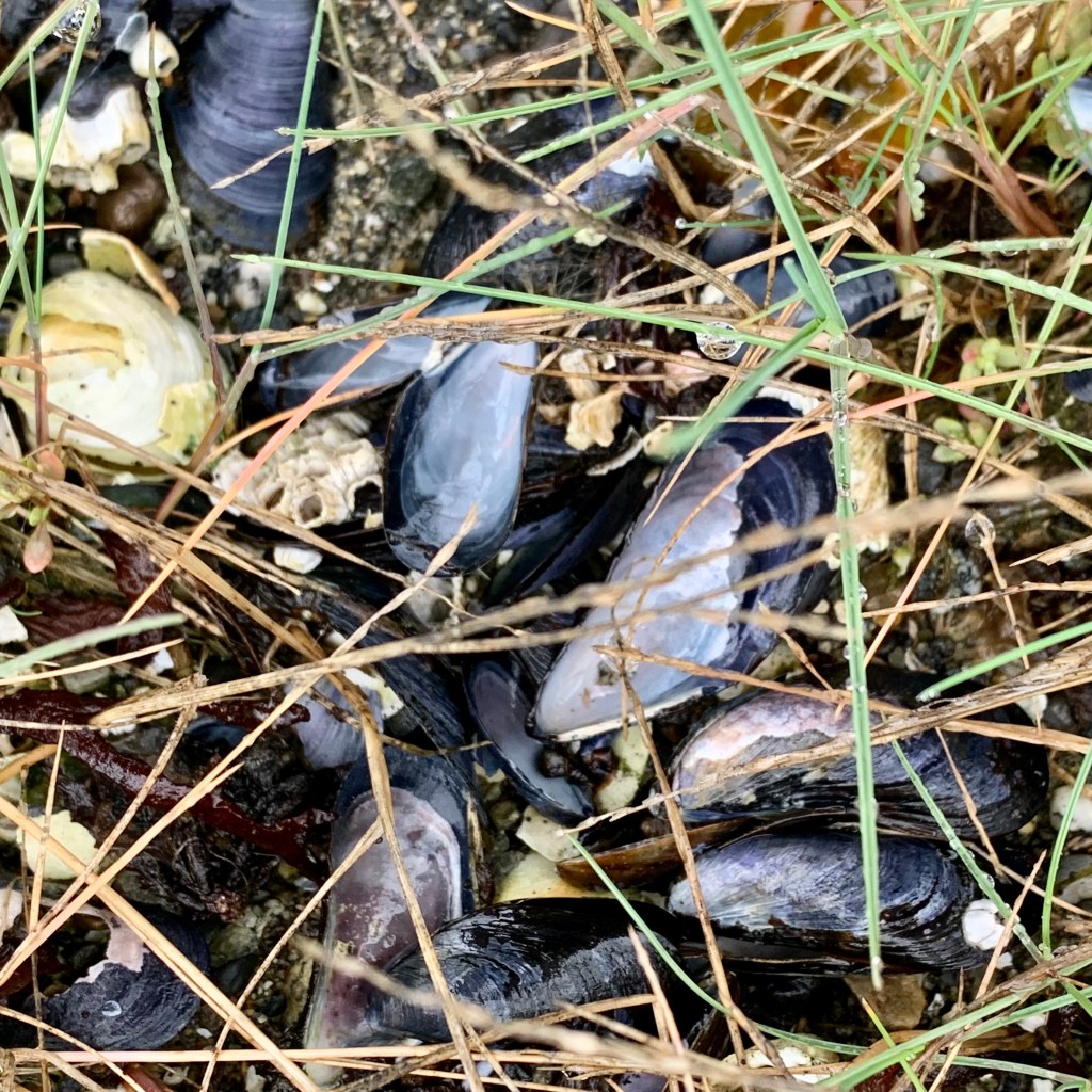
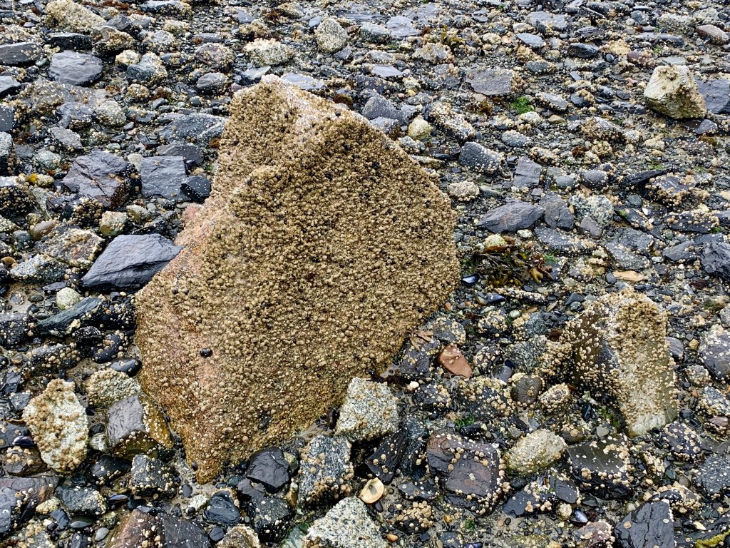
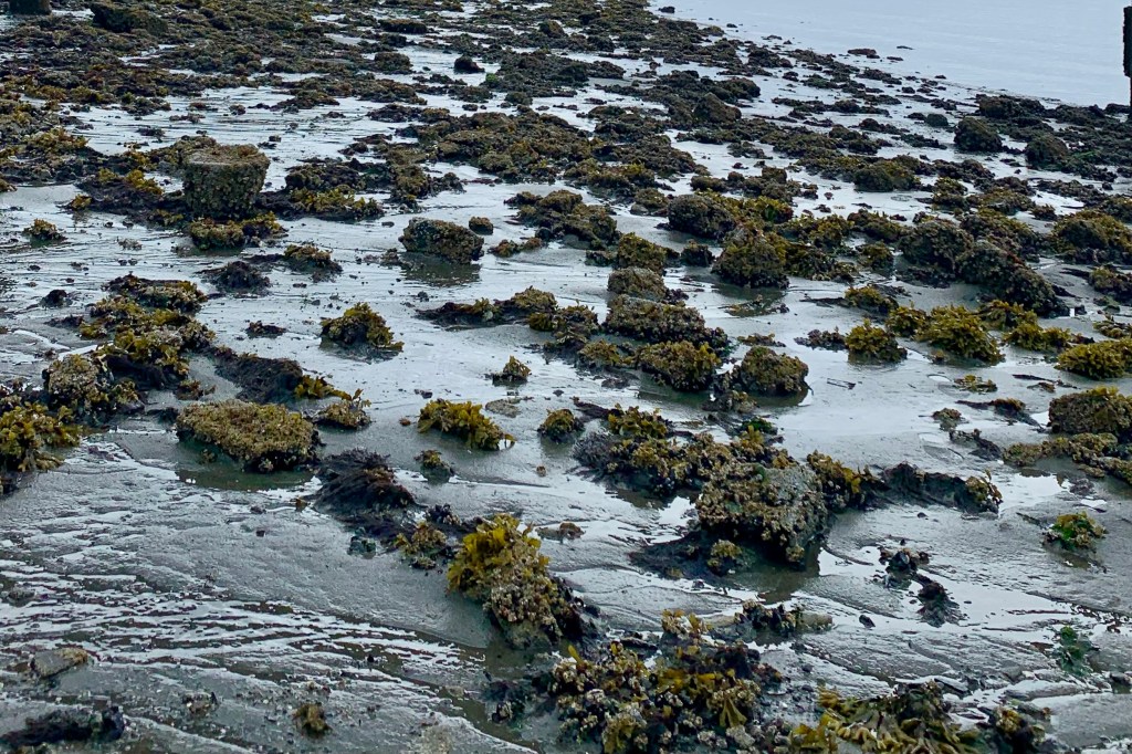
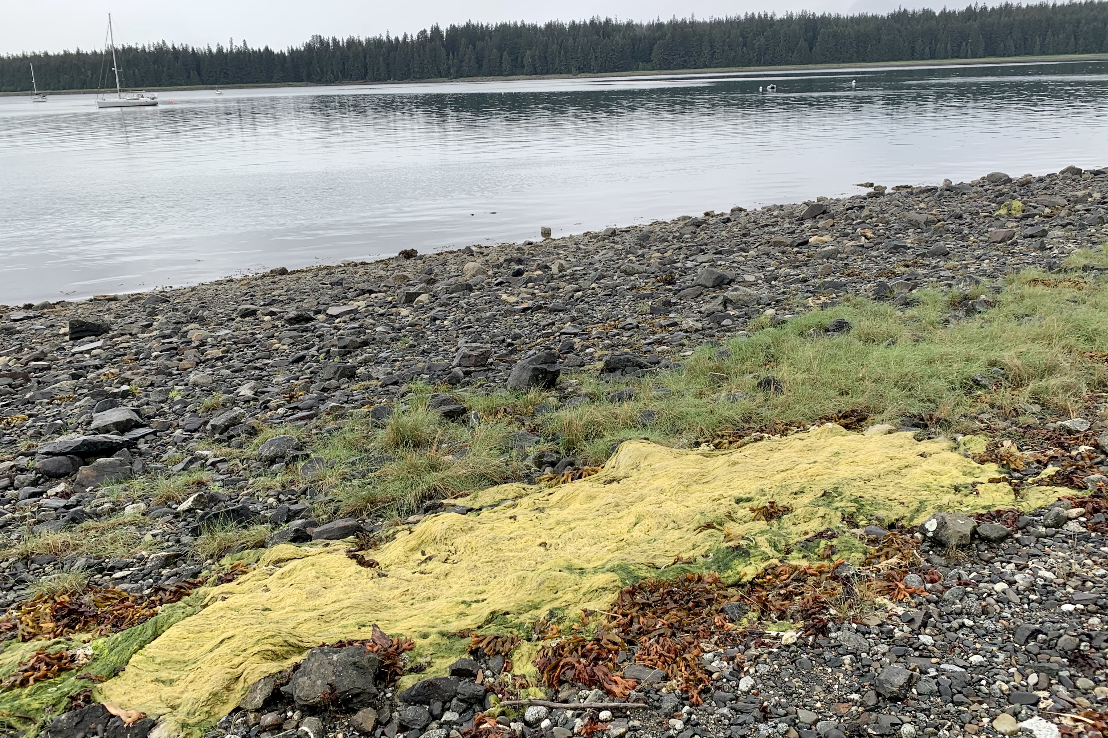
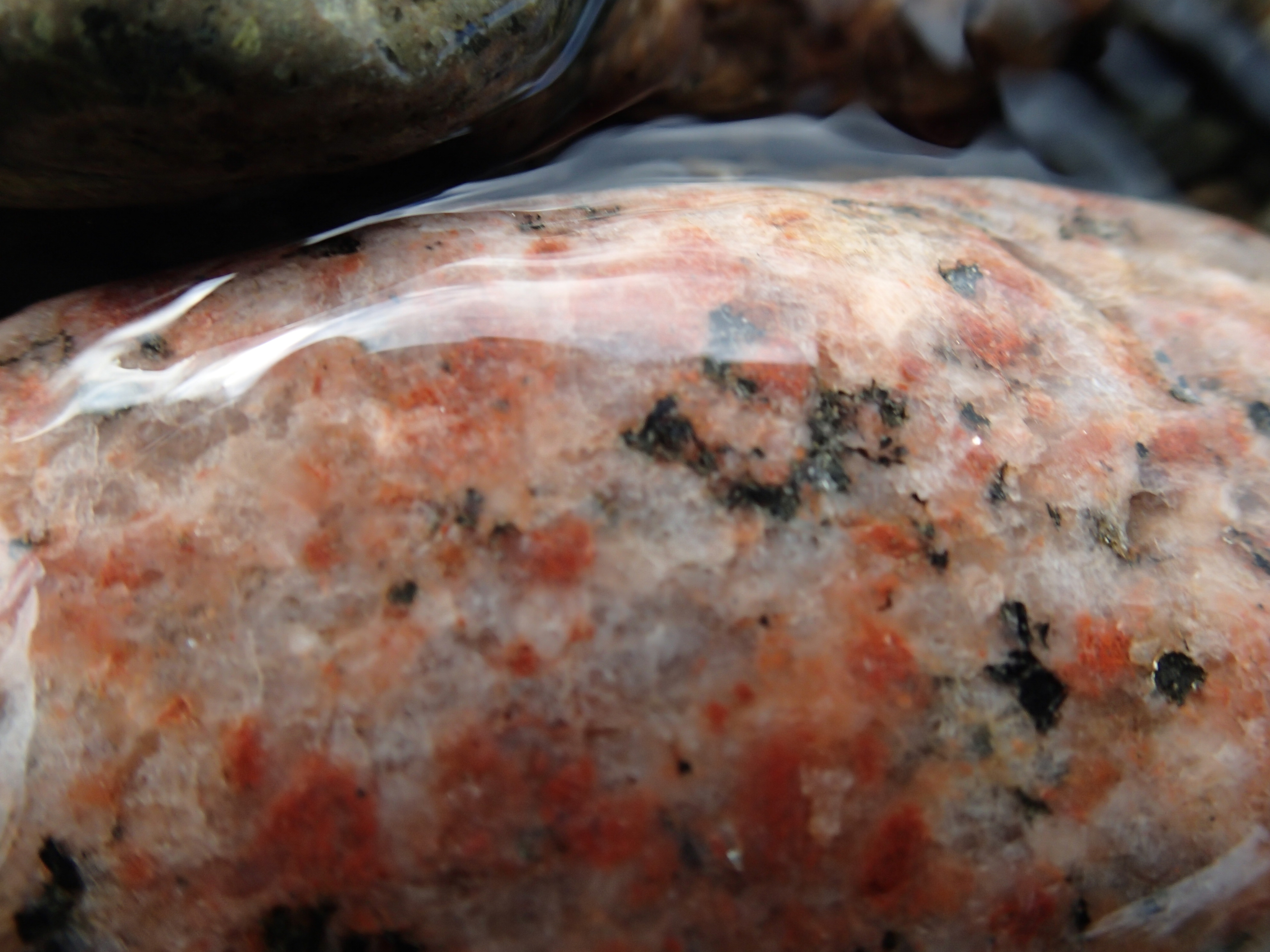
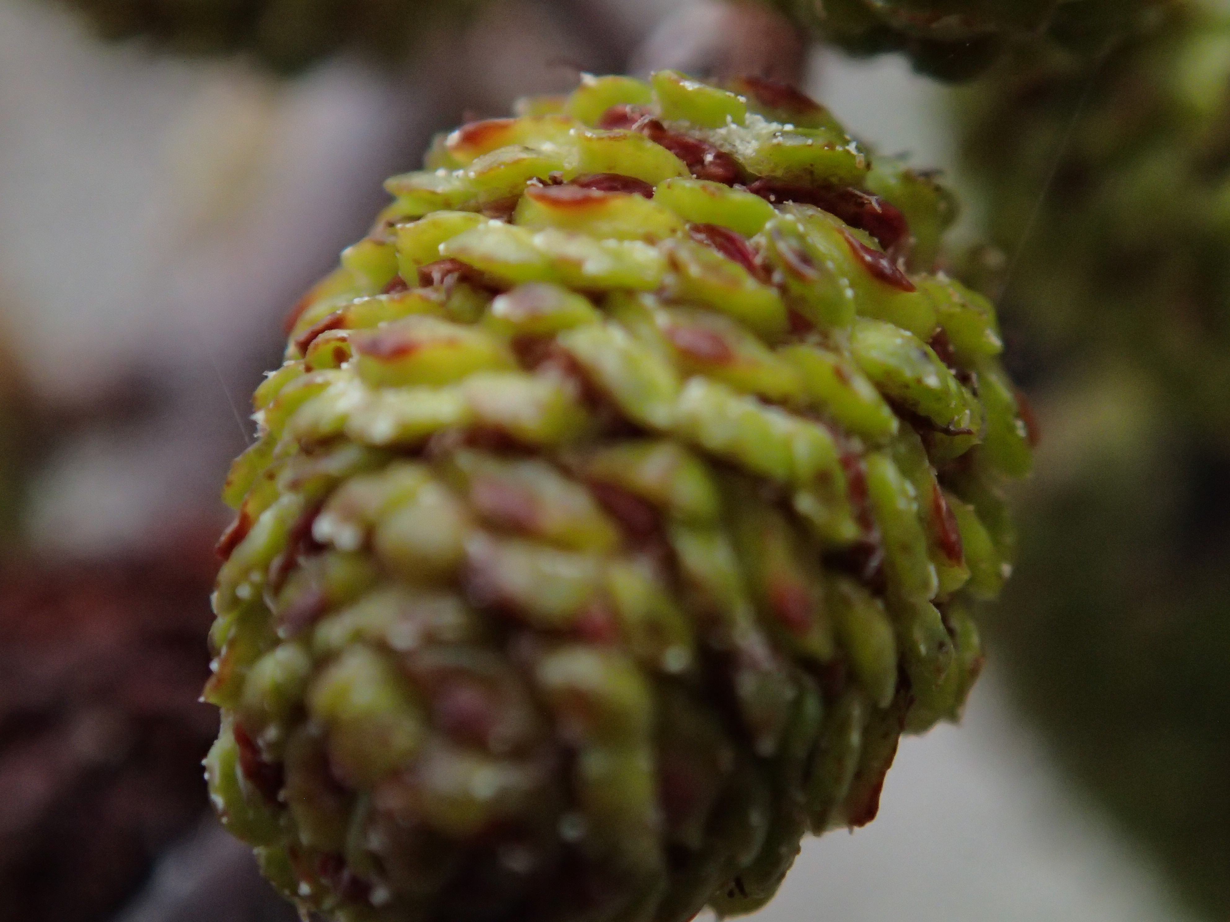
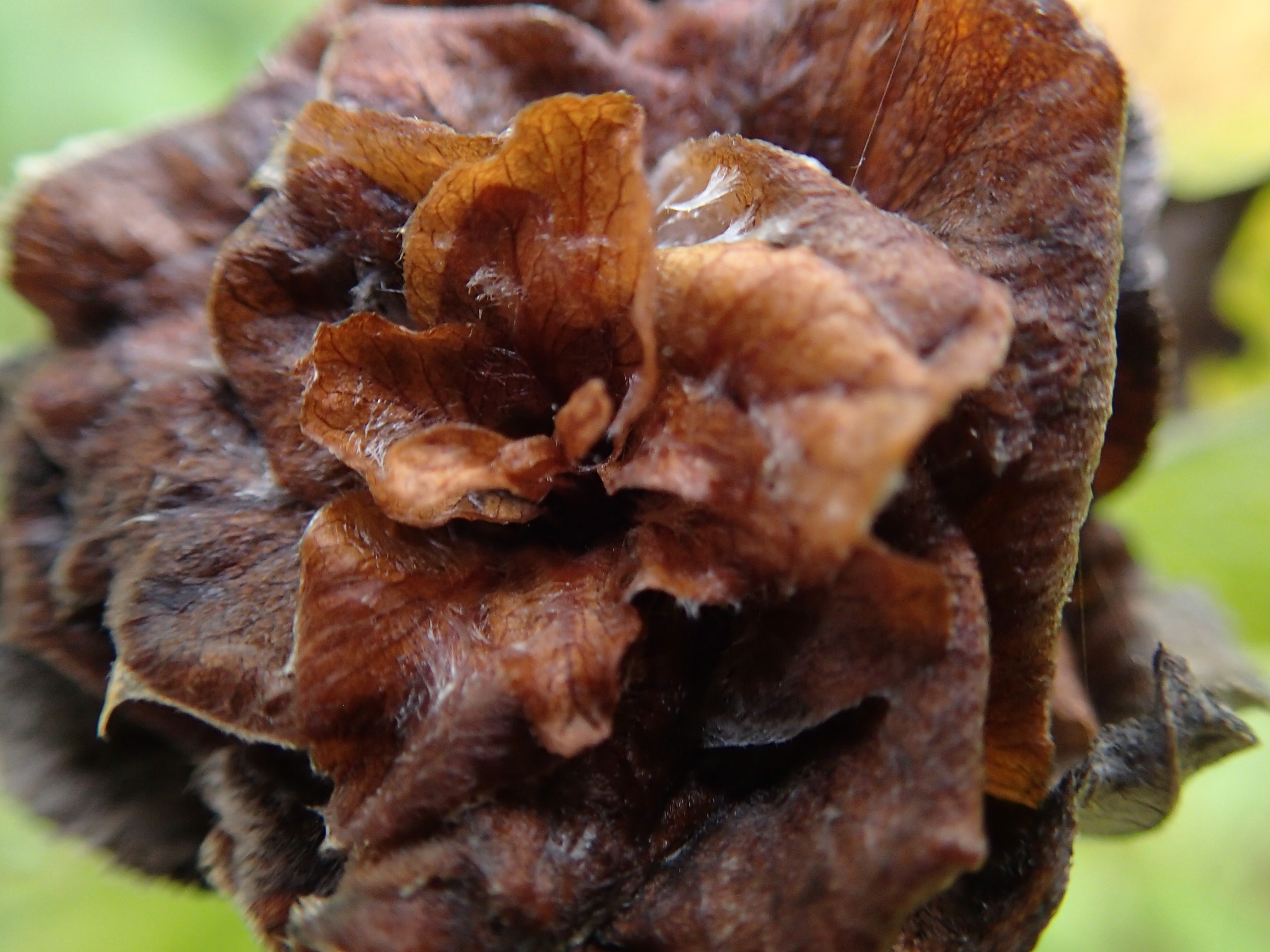
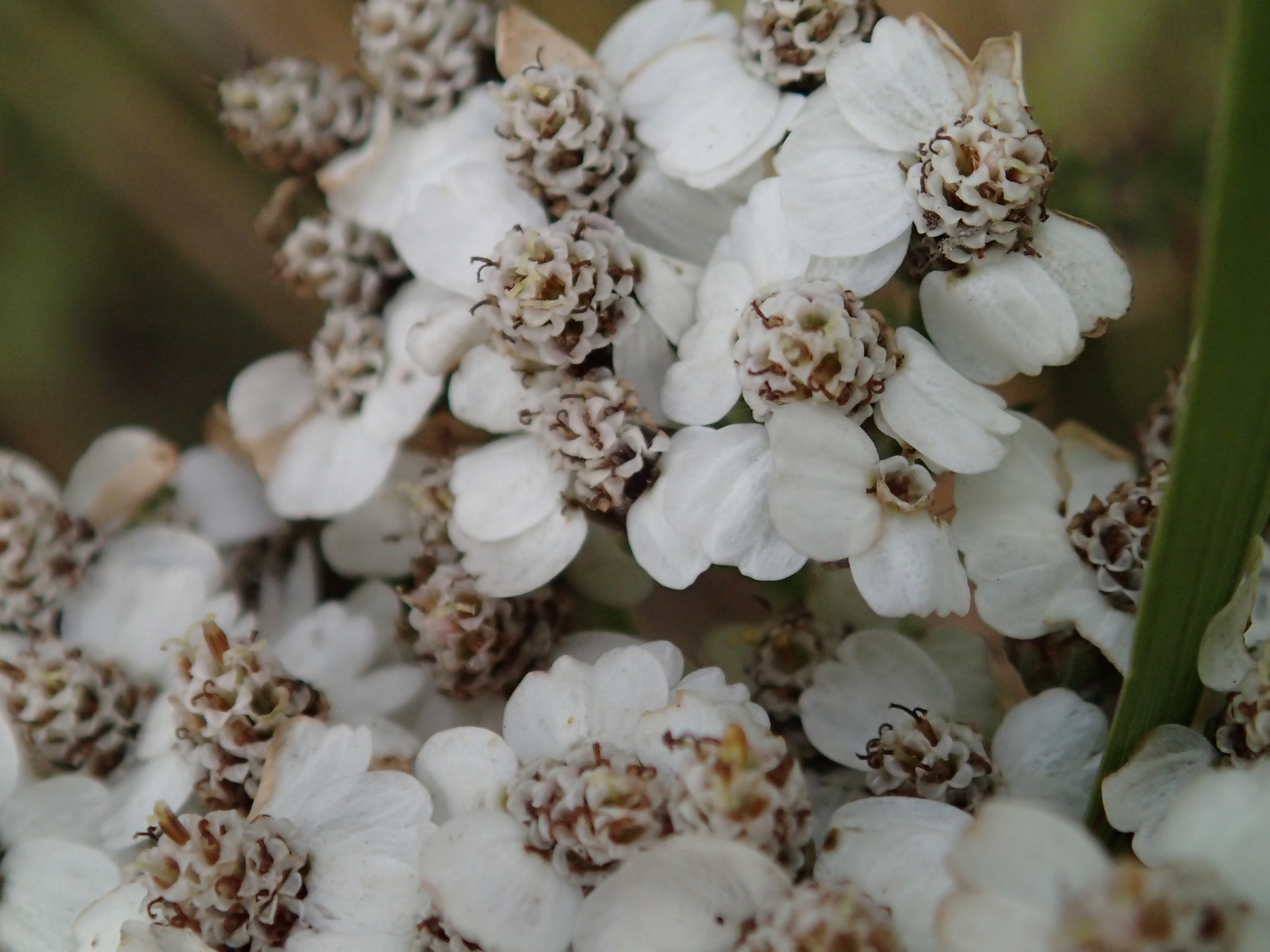
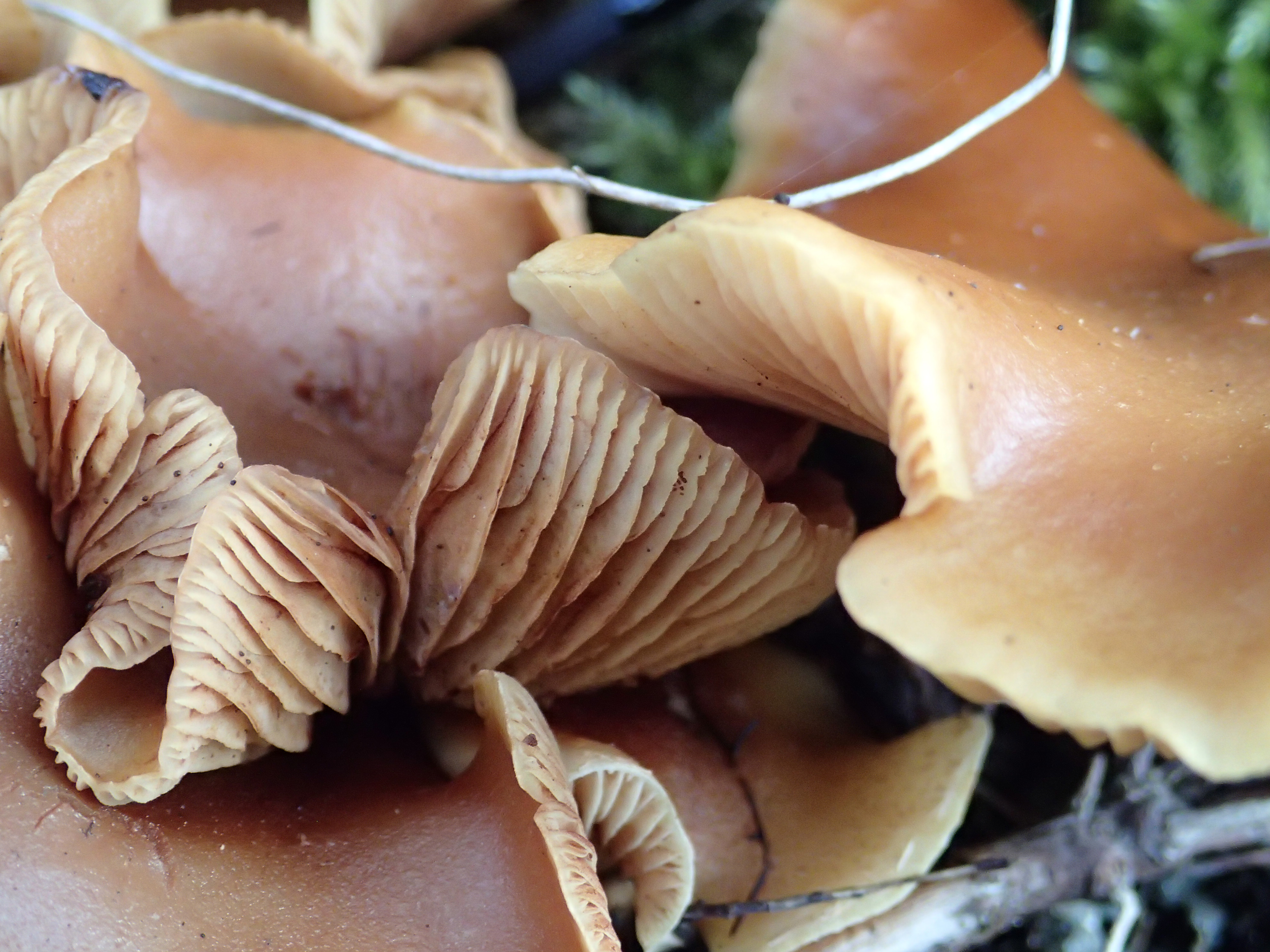
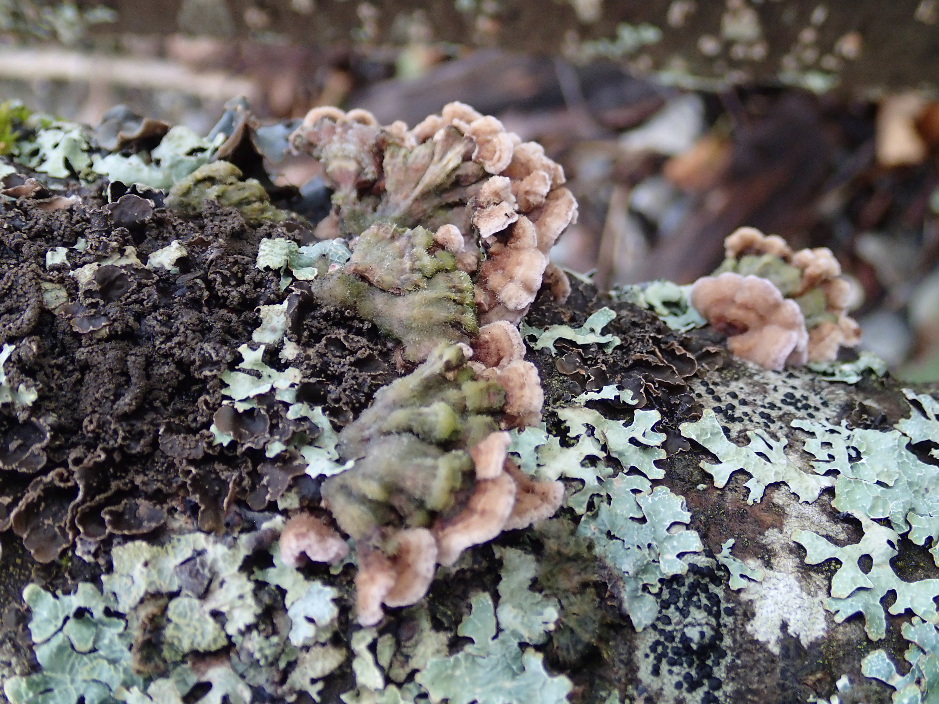
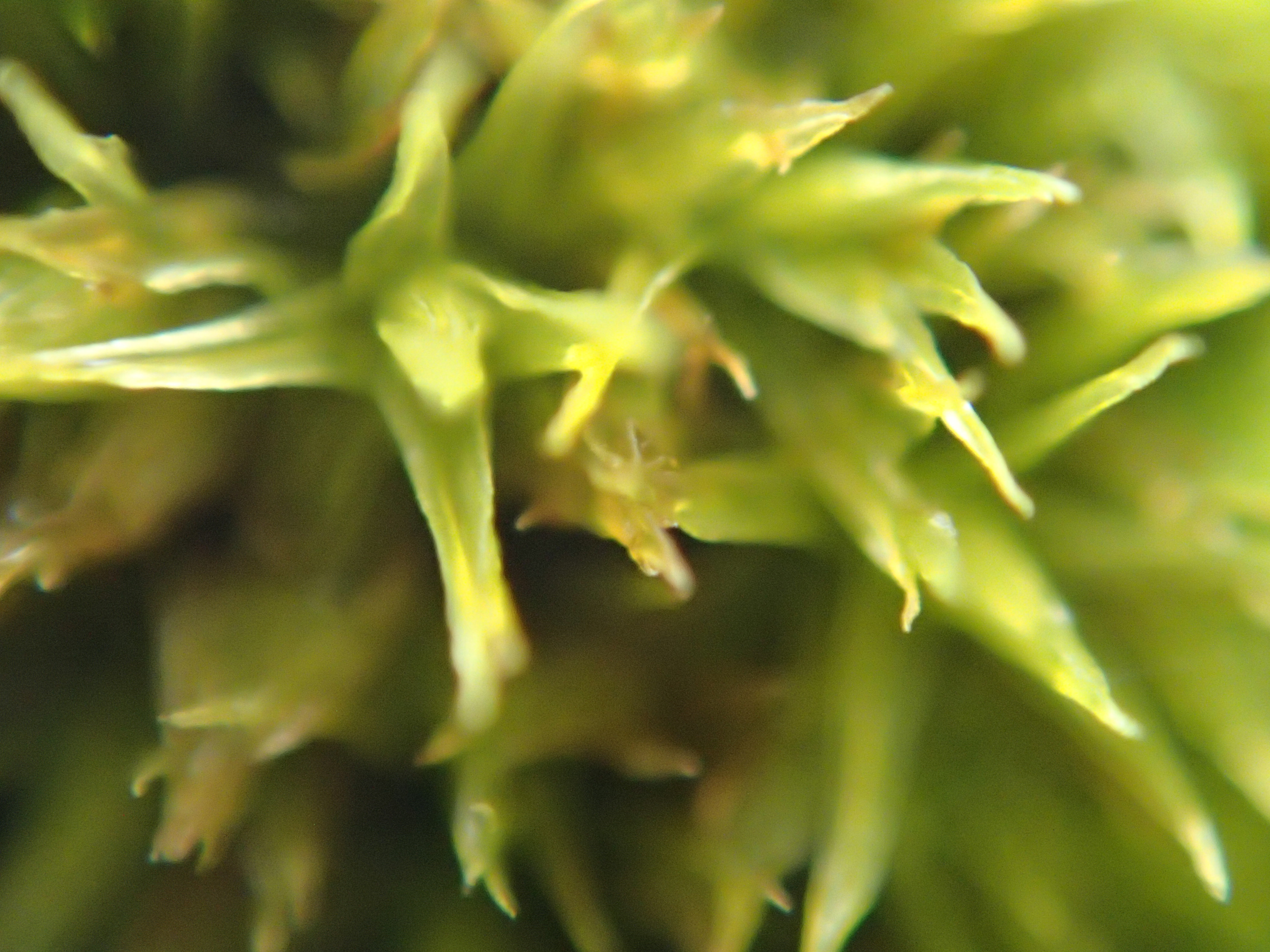
In exploring the beach, I tend to view things  from a macrovision perspective of the surrounds and my daughter Tasia, avid explorer, photographer and artist has a keen eye for seeing things from a distance and envisioning their amazing beauty, which others might well regard as beach detritus. Her photographs below reveal an incredible beauty of the vibrant life, death and colors of the beach including a salmon jaw, fungi, stones, flora, cones…

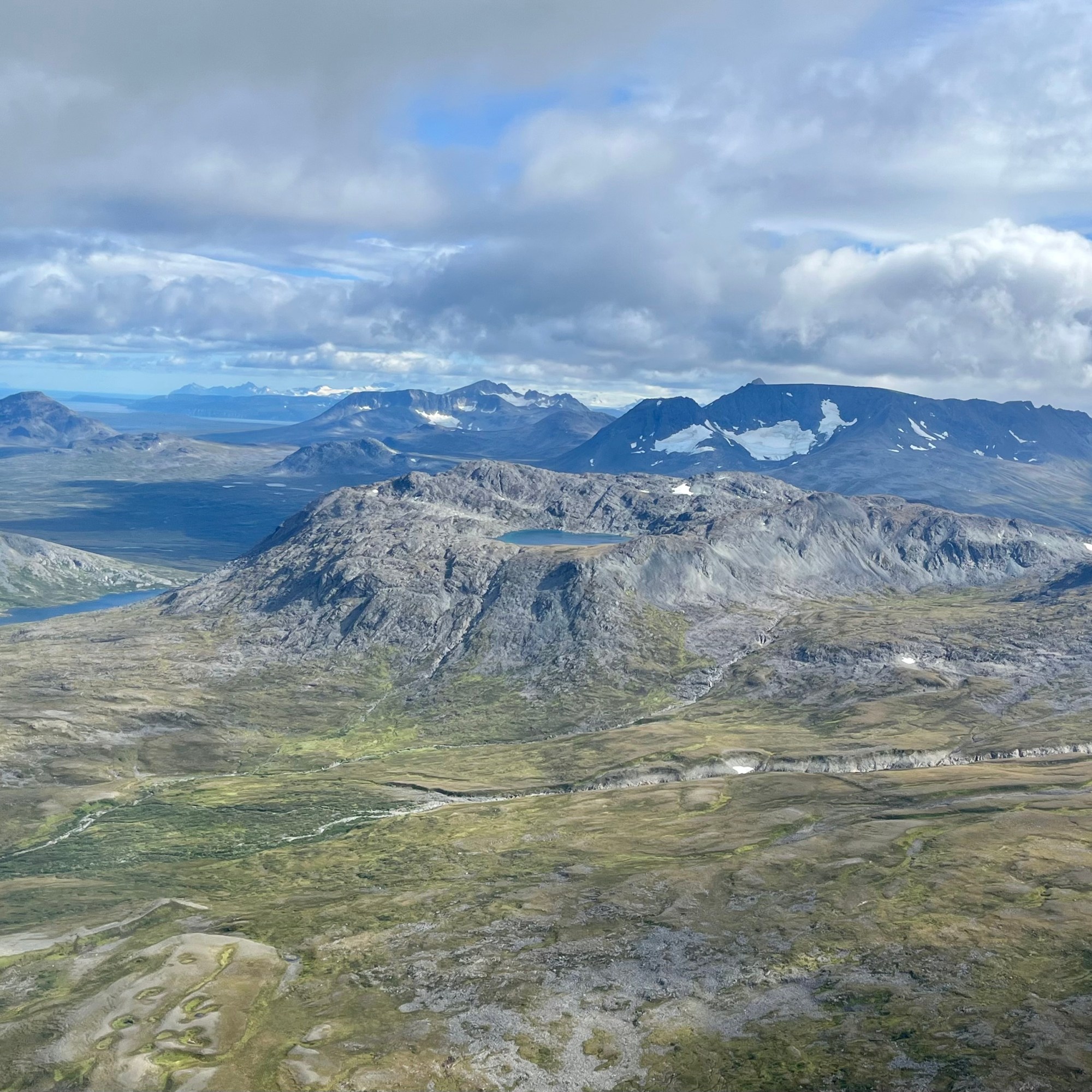
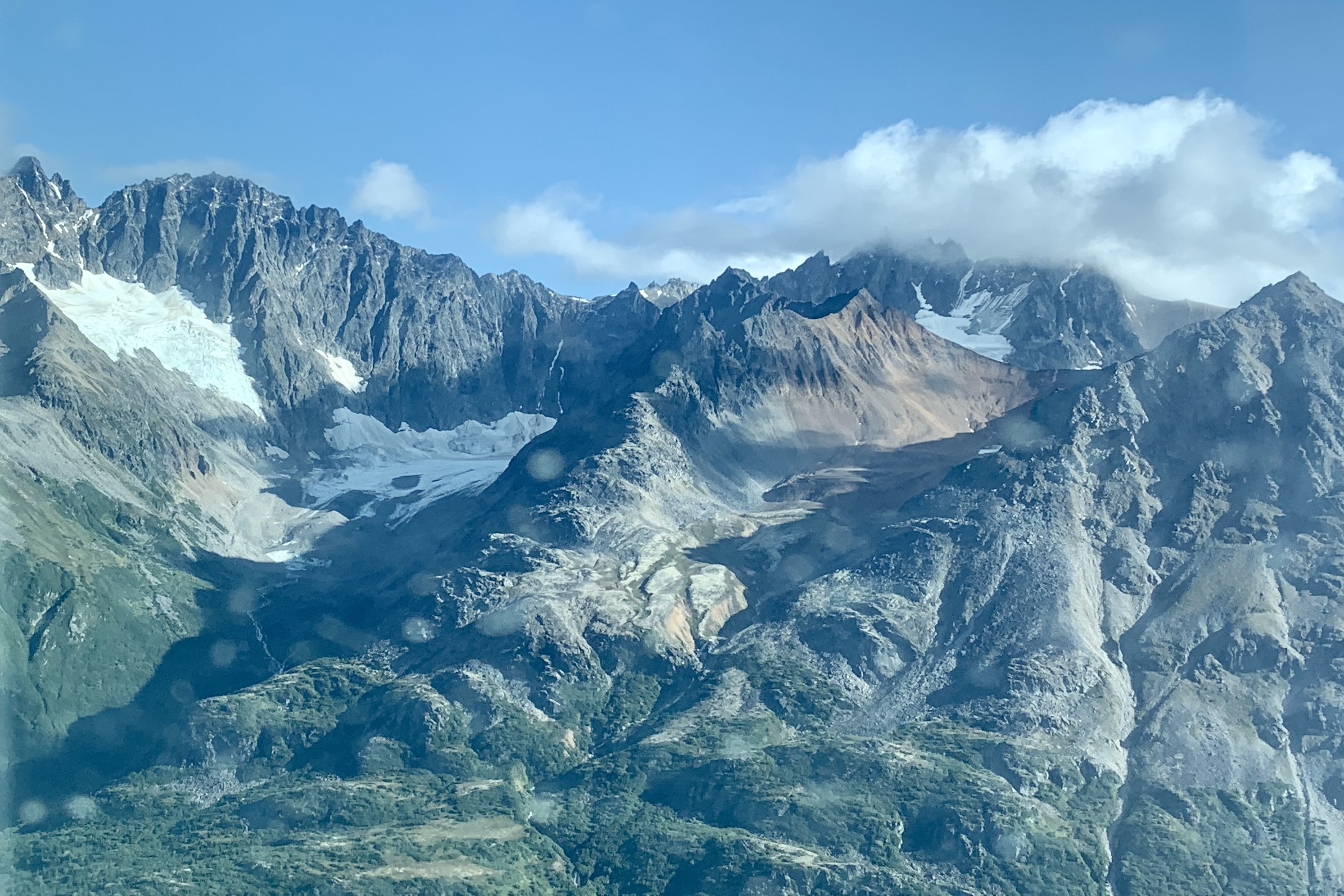
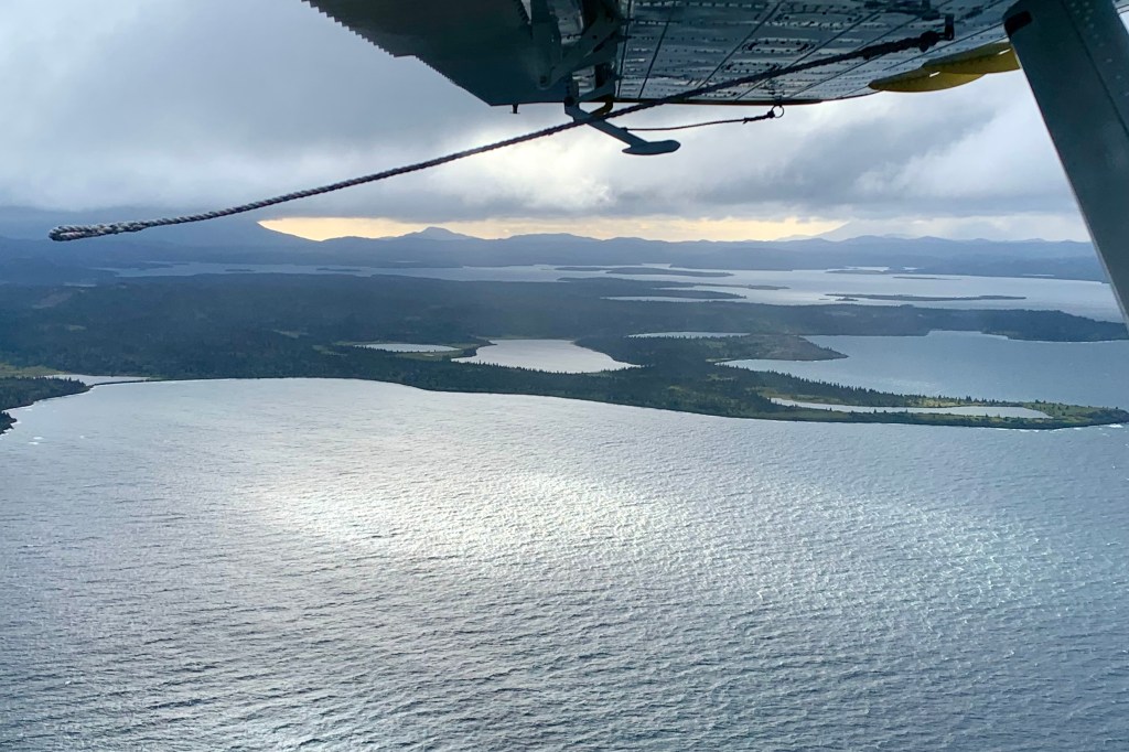
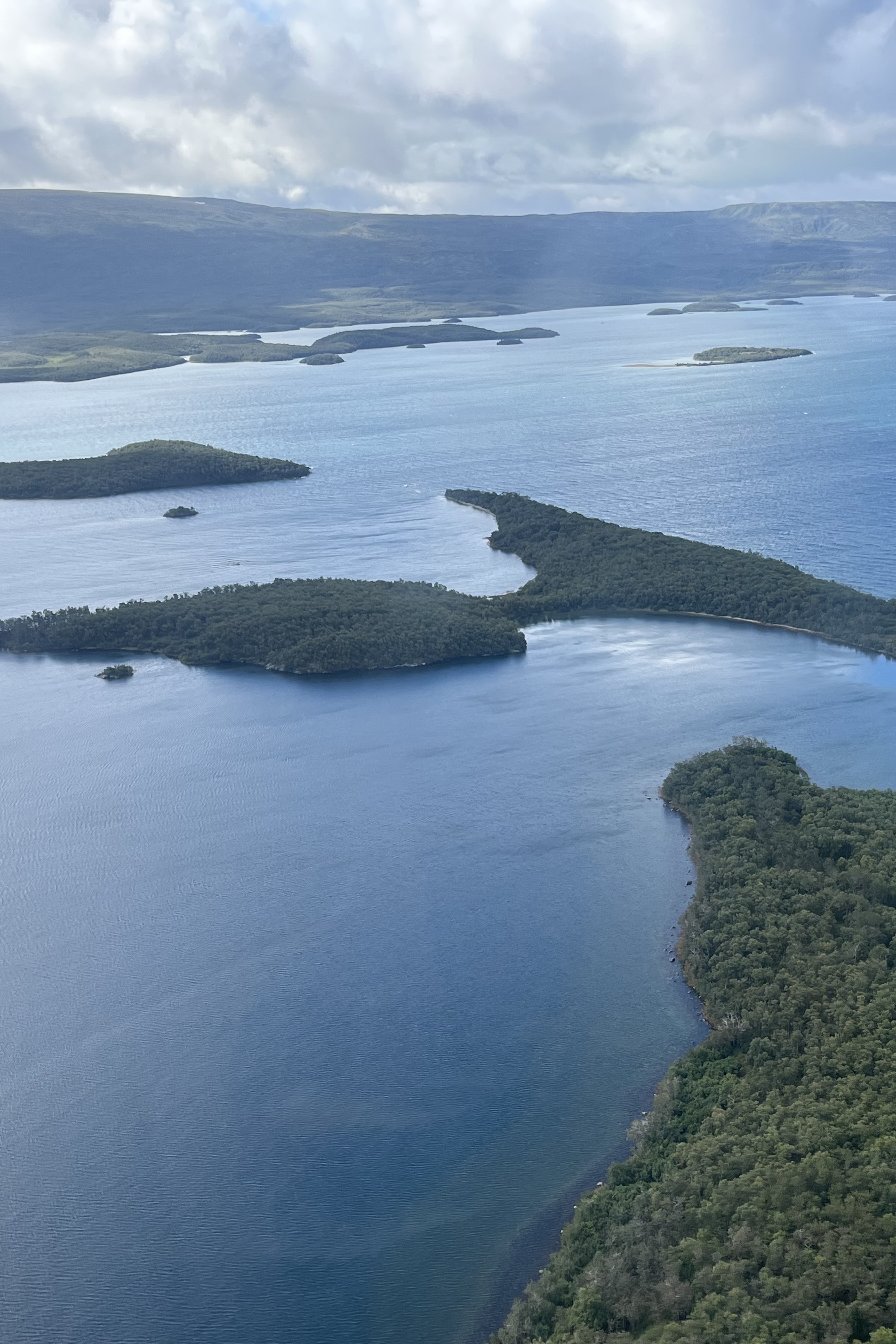
After exploring this classic stony freshwater lake beach, we were winging our way south towards and over the Bay of Islands which is a labyrinth of rocky islets, rugged cliffs, dense forests and interior lakes. This is yet another area of pristine wilderness mostly untouched by humans due to its remoteness and lack of accessibility except by boat or seaplane and of course bear territory.

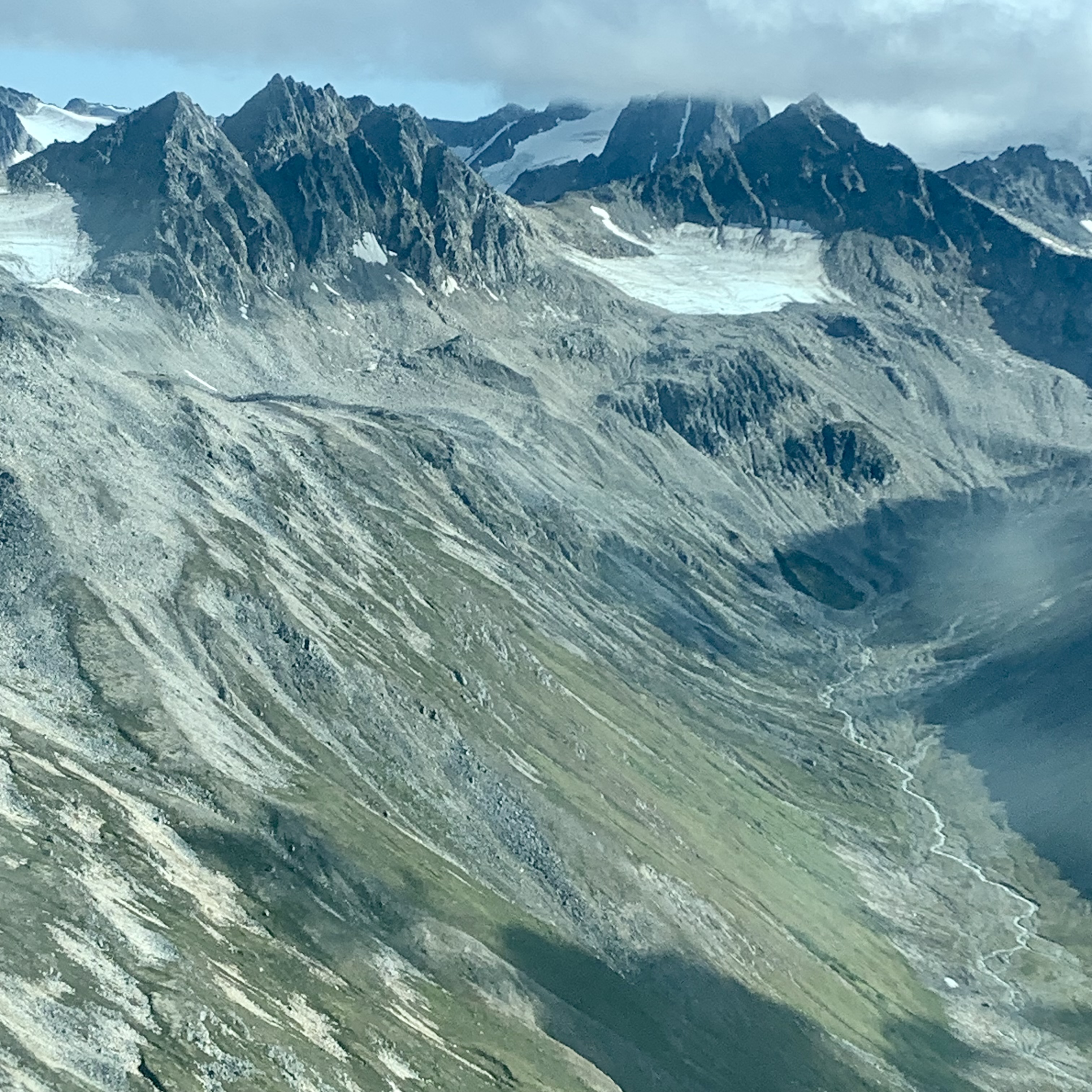
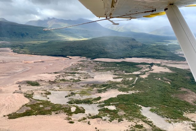
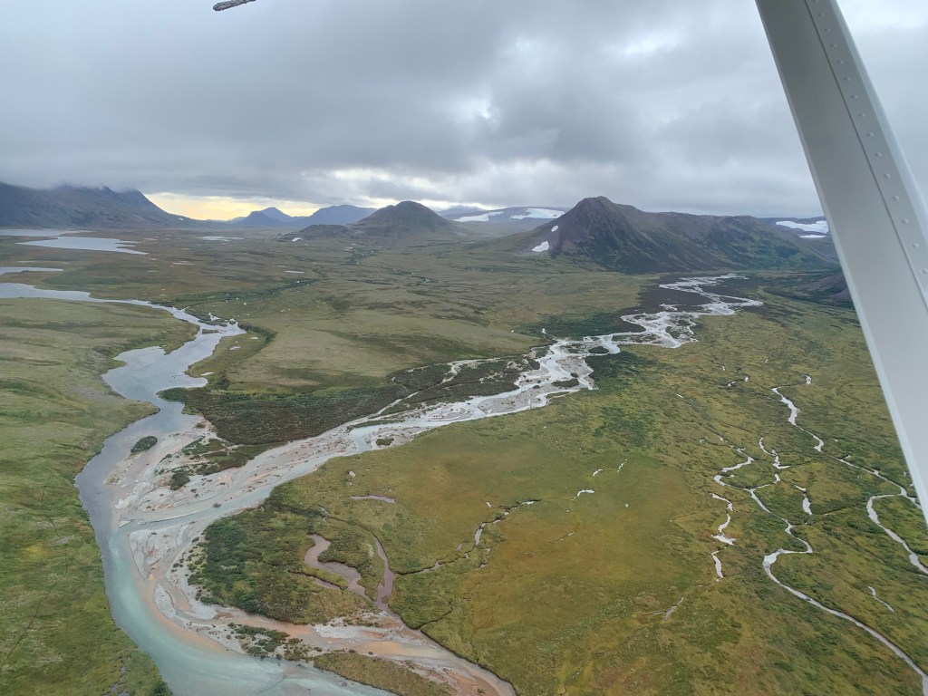
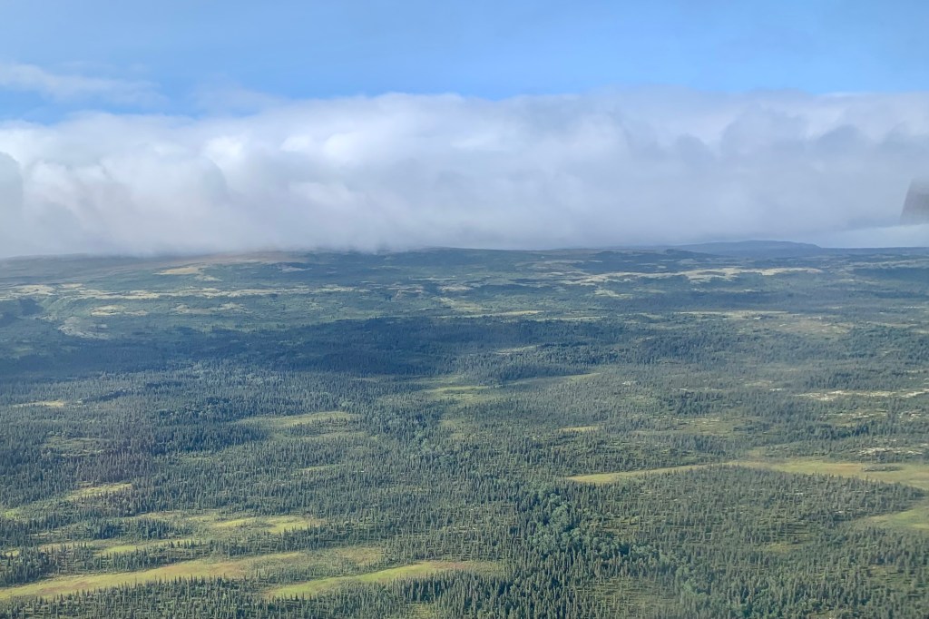
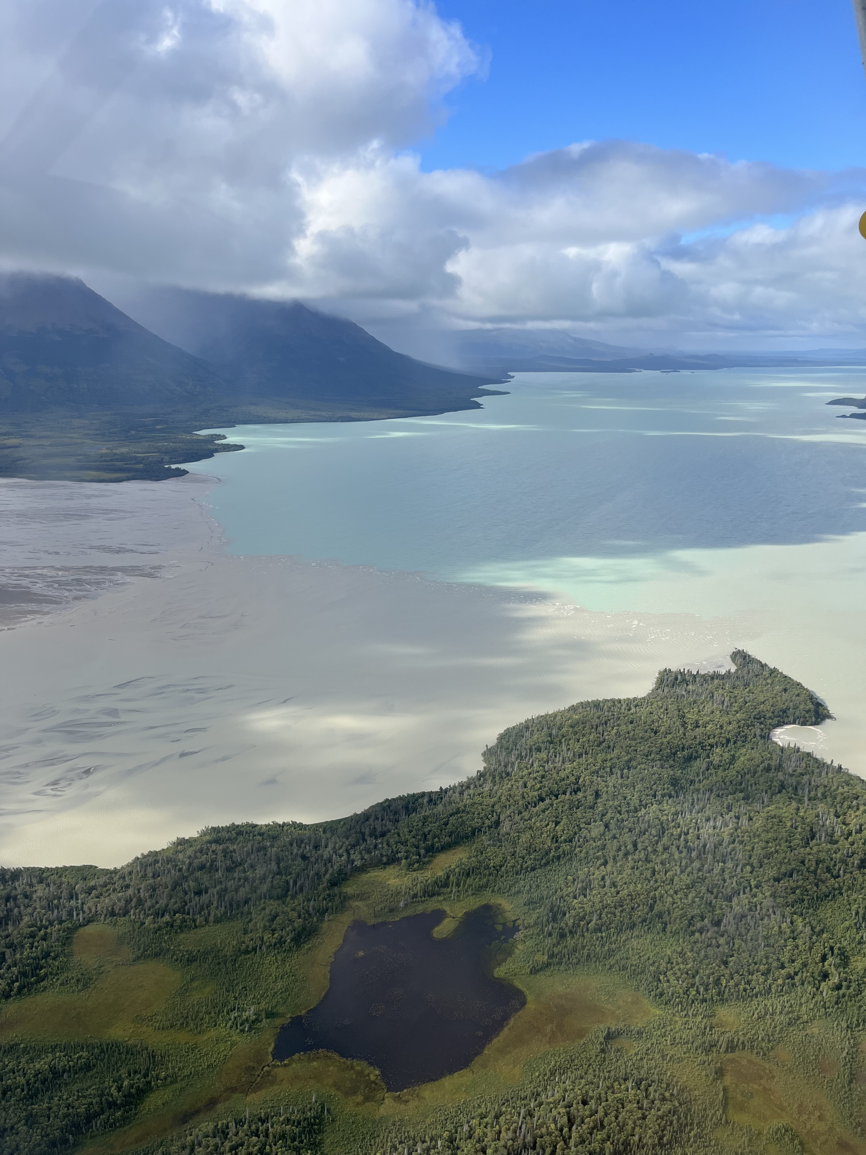
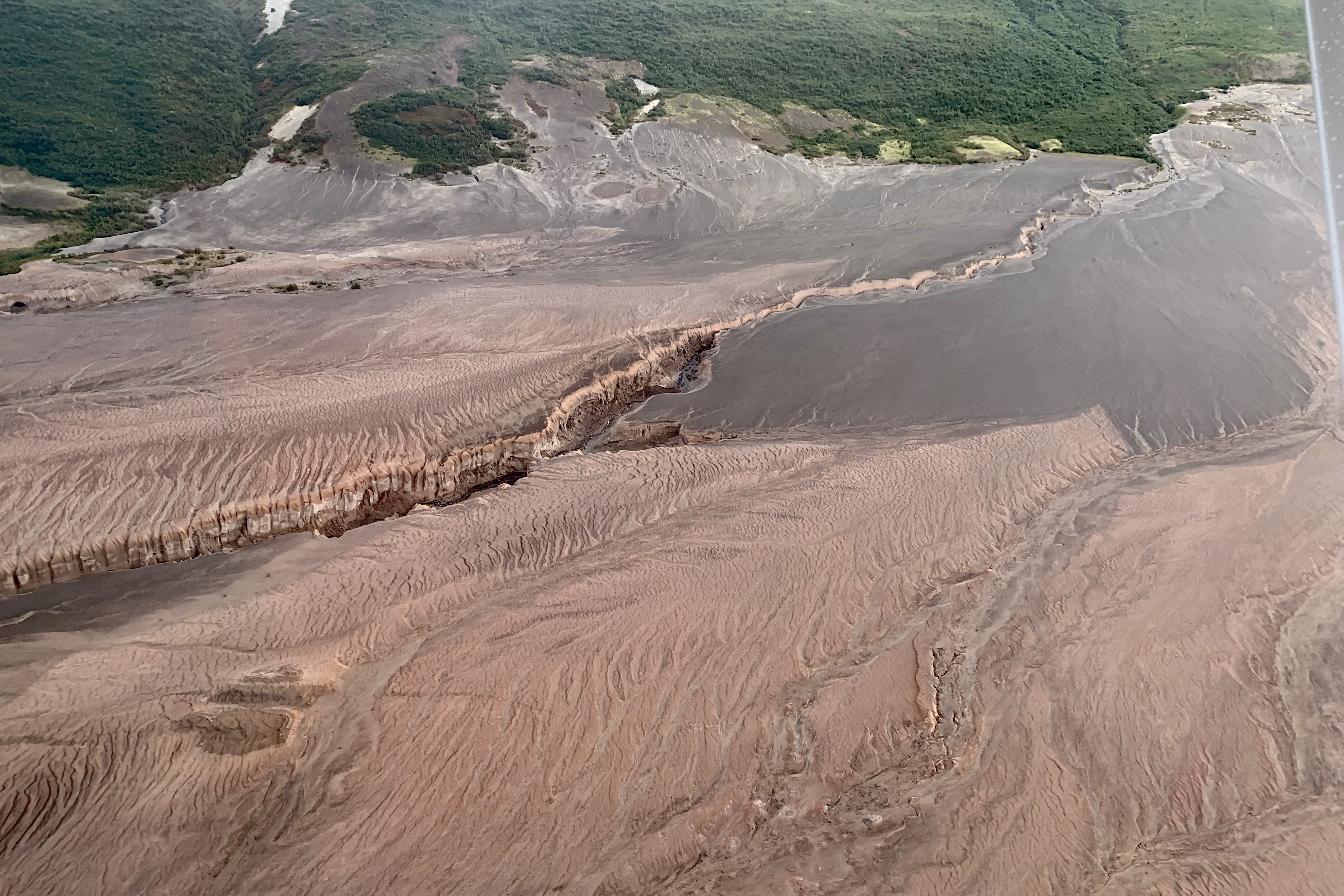
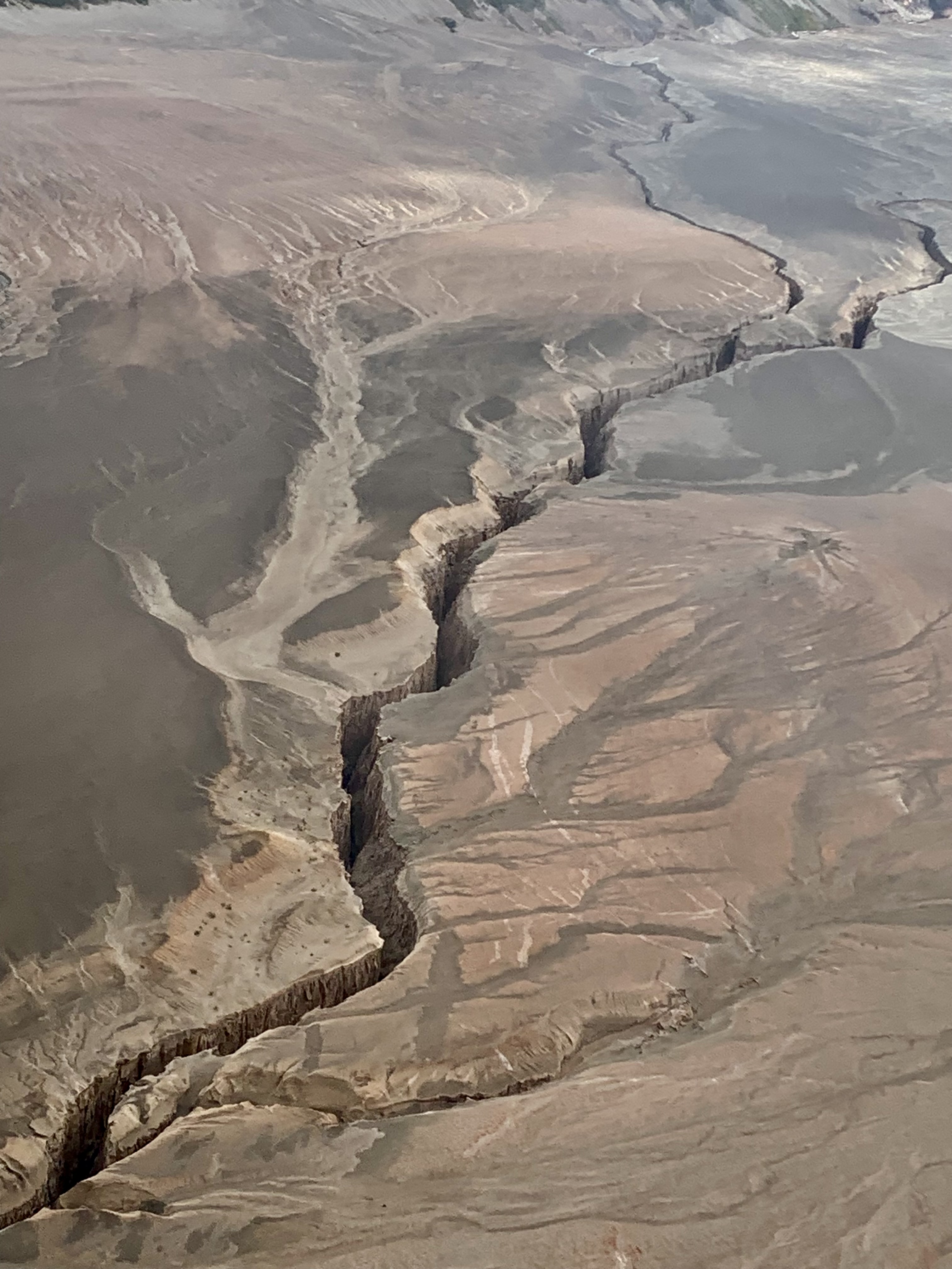
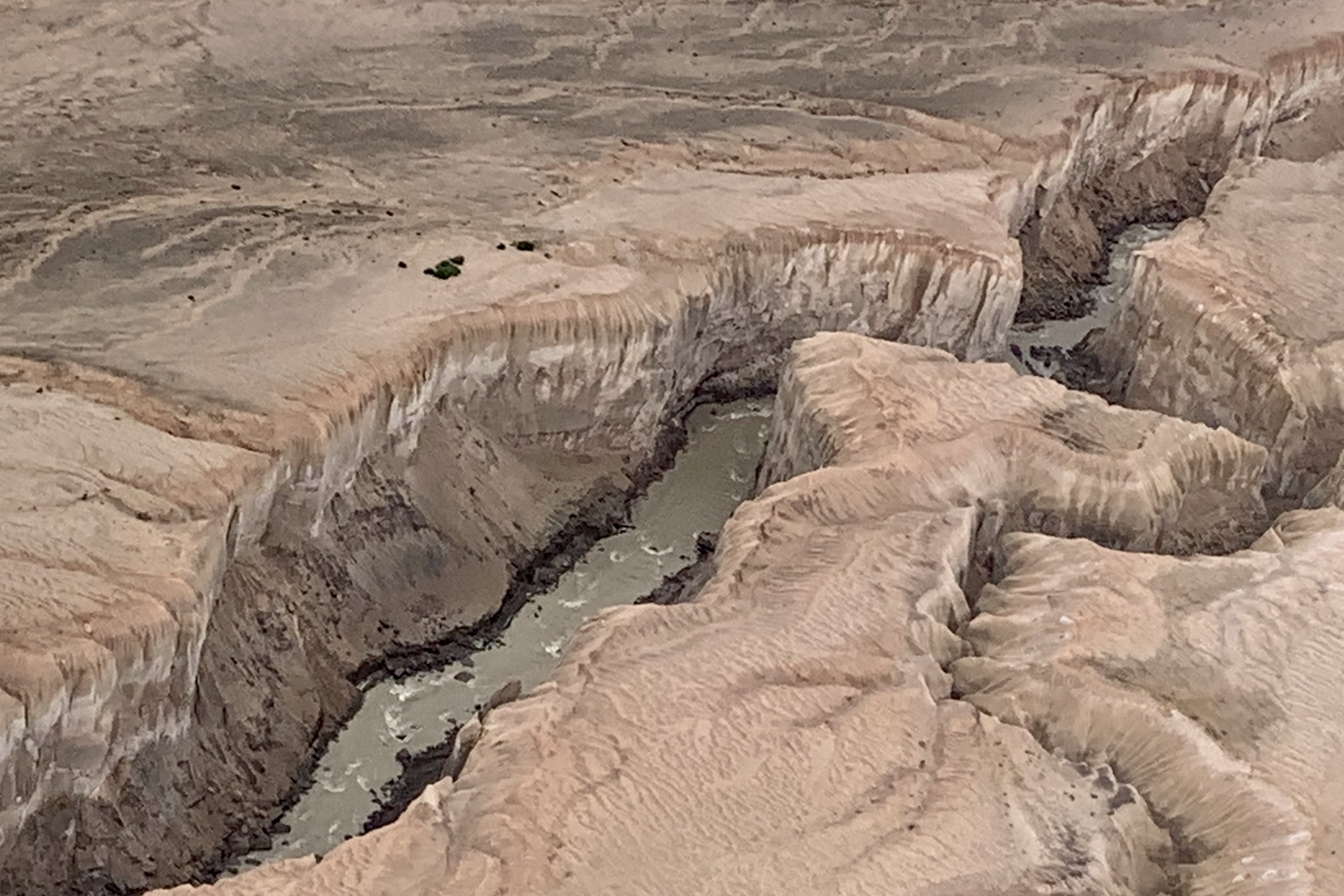
As we traveled farther south, the landscape began to change dramatically from the lush verdant greens and the blues and grays of the clear lakes to a stark and eerily beautiful other worldly landscape of volcanic ash and magma. The Valley of Ten Thousand Smokes was created by a fast moving current of hot gasses and volcanic matter in 1912. It was the largest eruption of the 20th century and 30 times the volume of magma from the Mt St. Helen eruption that many of us recall as so devastating. Its name stems from the steam and gases emitted over time by the hot volcanic ash and has nothing to do with the Alaskan native’s smoking habits. This is a vast expanse of ash-covered terrain in a palette of many hues from very light tans , varying shades of gray, brown, rust, desert sand, buff, taupe… The area is threaded with ash covered plains, steam vents, fumaroles, and hot springs and somewhat resembles a lunar landscape. The meltwater channels, springs, streams and creeks have cut deep gorges into the deep lava ash. These streams and channels in the Valley, however, carry very high loads of glacial flour, silt, sand, and pumice giving the water often a milky hue and if I were hiking down there , it would not be potable source to refill my water bottle. Delightfully we also evidenced the capacity for our earth to regenerate as plants and wildlife are returning to this very inhospitable environment. As a hiker, gazing down at this otherworldly terrain, I had a yearning to be able to perhaps experience the Valley first-hand though I imagine it would be quite a demanding experience to hike this terrain. If I find mud, protruding roots and tripping rocks challenging in the forest, I can imagine that walking on volcanic ash would be like walking on sand dunes or a loose sandy beach. As I pictured myself sinking in to this unstable surface, kicking up poofs of dust and fine particles with each footfall , I quickly told my asthmatic lungs and my hip joints that I would not when back at the lodge hire a guide to lead me on a hike.

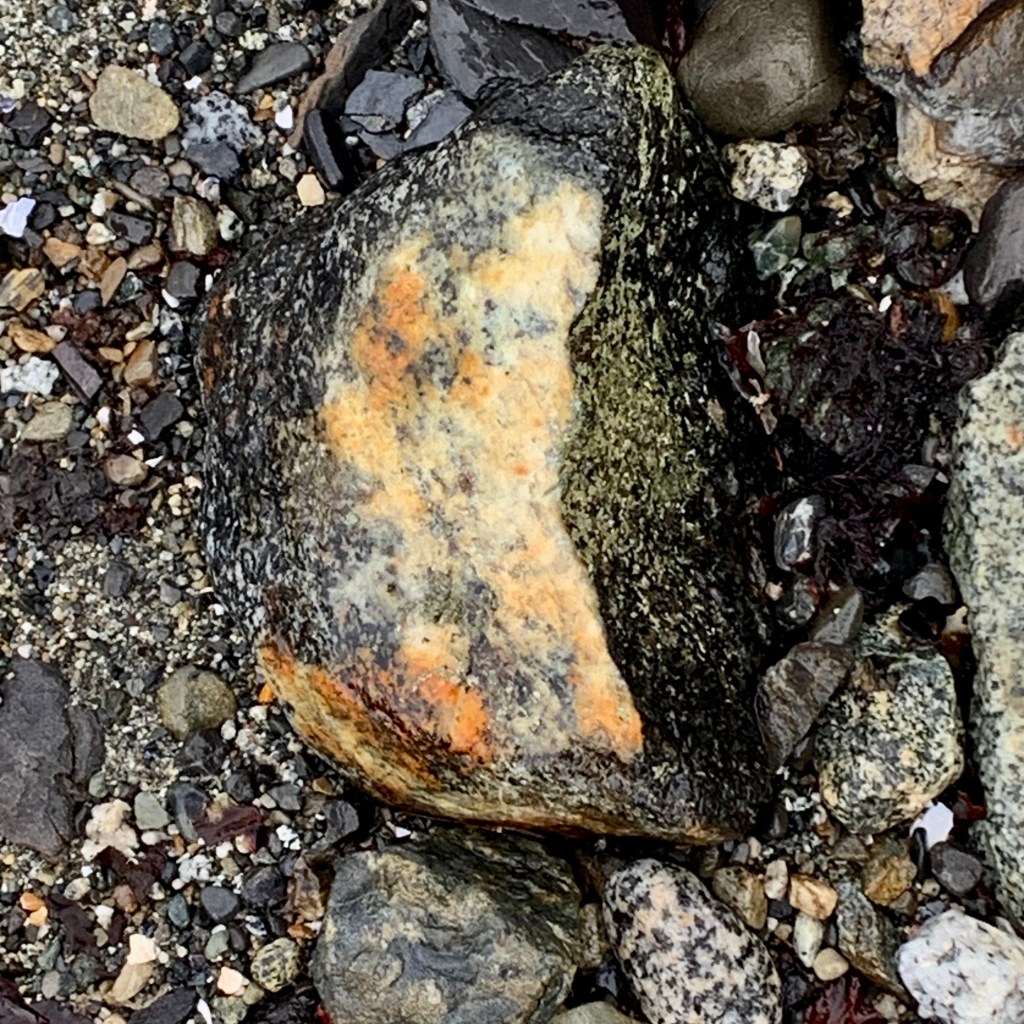
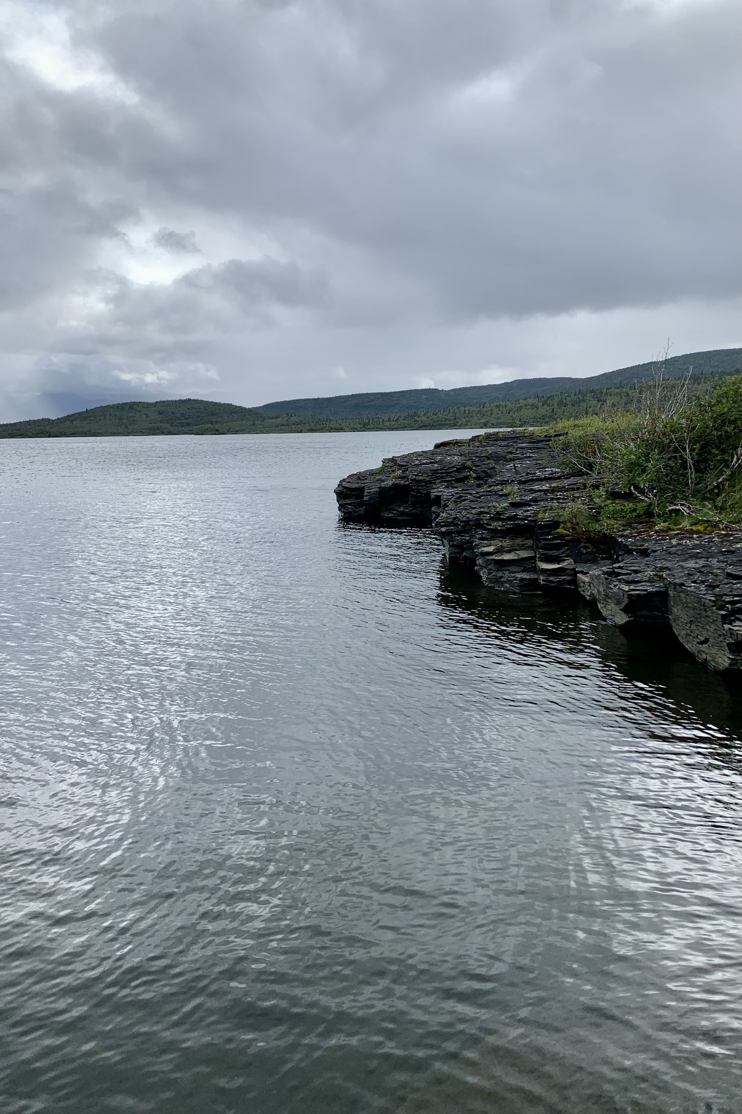
How fortunate I felt to be able to experience the phenomenal variety and beauty of this raw wilderness area and it being just a small array of the magnificence of our earth. No need for psilocybin or magic mushrooms to feel the euphoria of breathing in the awesome beauty around. We headed back north over a varied terrain including the Savoneski River area and landed on an island that was in the middle of “no name lake” (our guide did not know it’s name, my camera did not recognize it, and the park maps did think it important enough to put a name on its map, and thus clearly I do not know its name). What was unique here was the evidence of volcanic rock ledges. The rocks display a distinct layered structure, resembling stacks of ragged edged pancakes. These ledges are composed primarily after the volcano erupts and and lets loose from it’s vents or fissures many layers of lava, pumice, and ash. Volcanic rocks form when the hot oozy sticky molten lava starts charging and slithering down the slope and gets chilly as it is no longer hanging out in its very hot pressure cooker . Voila we have igneous rocks (I remember this from my geology badge in Girl Scouts).

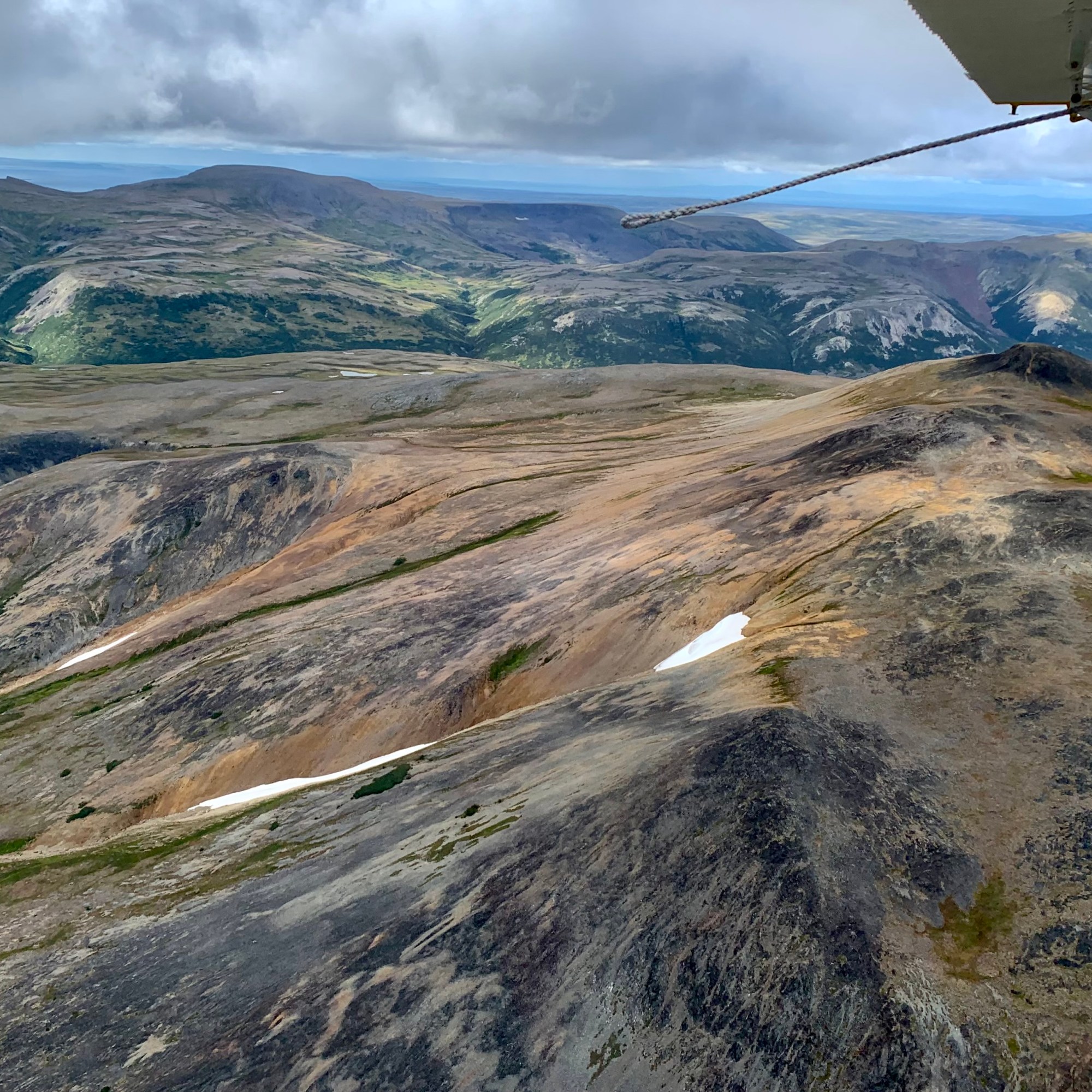
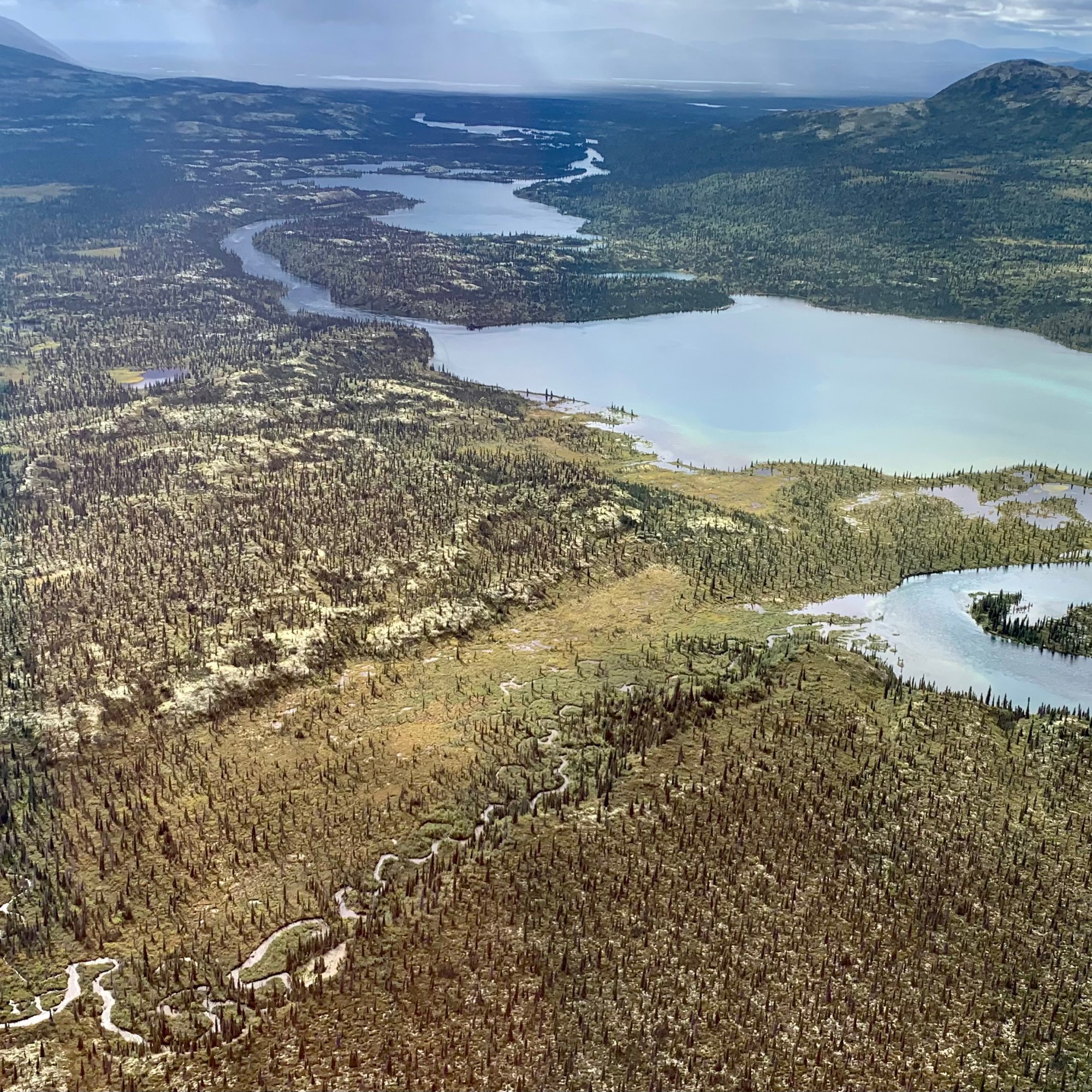
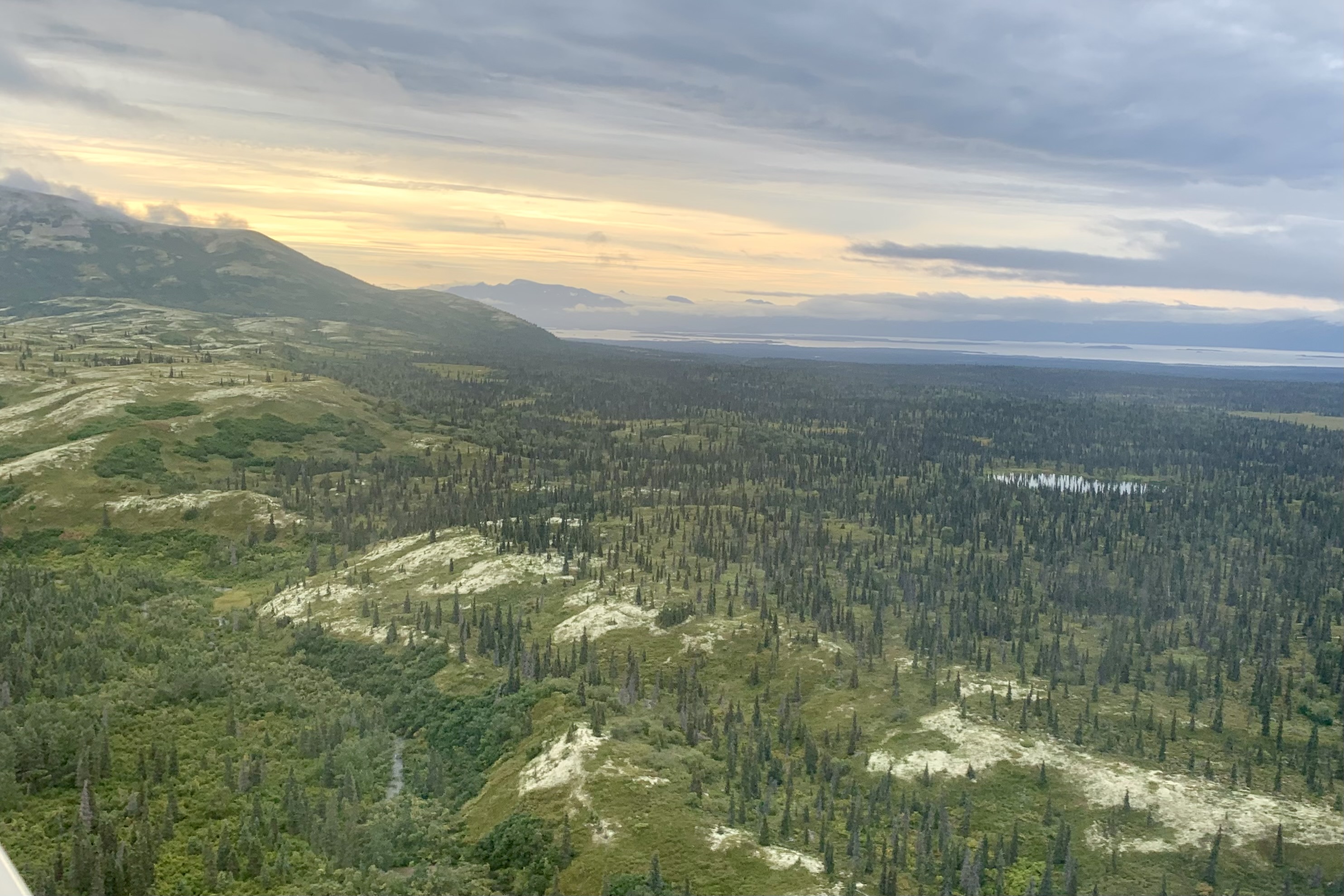
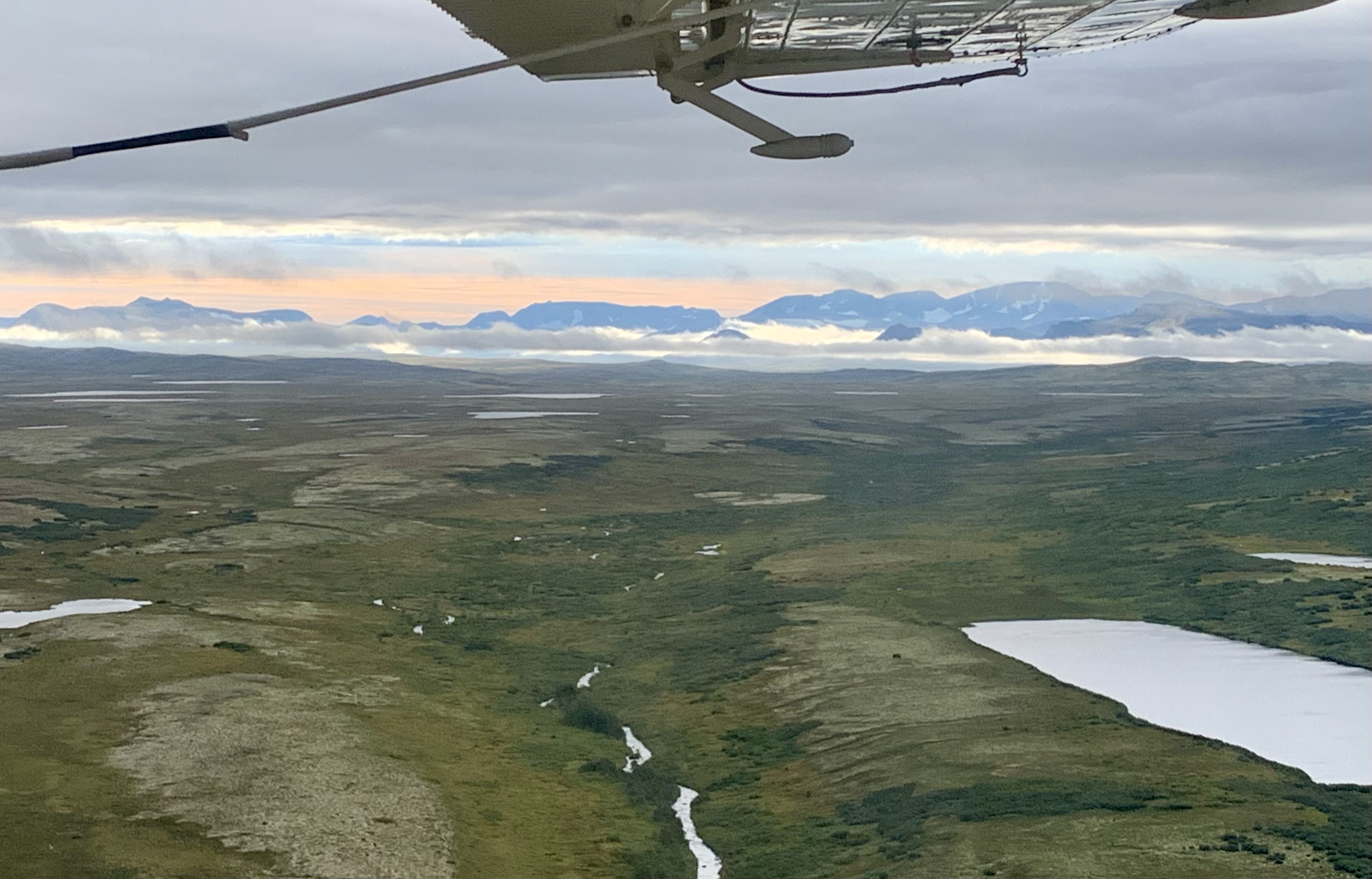
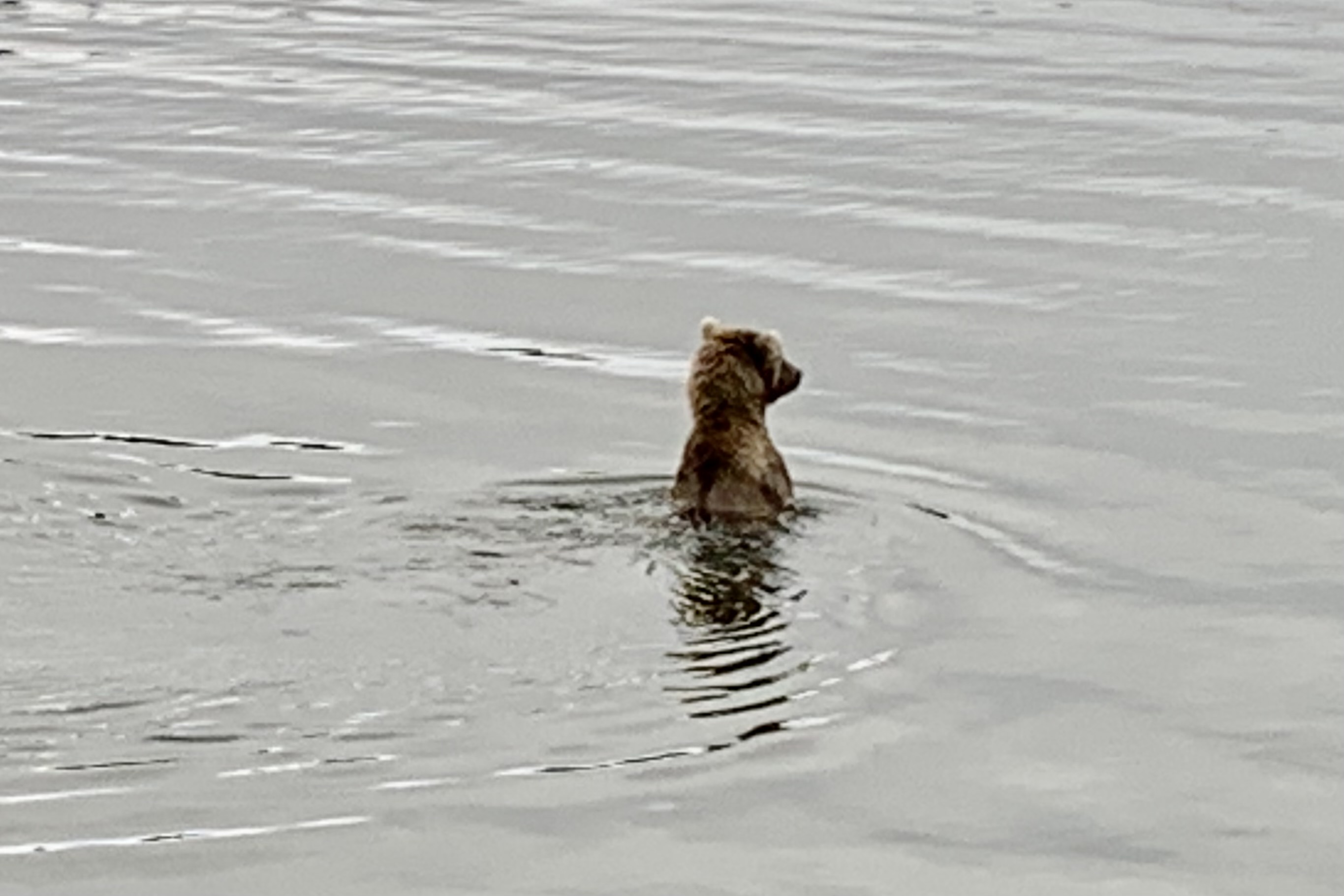
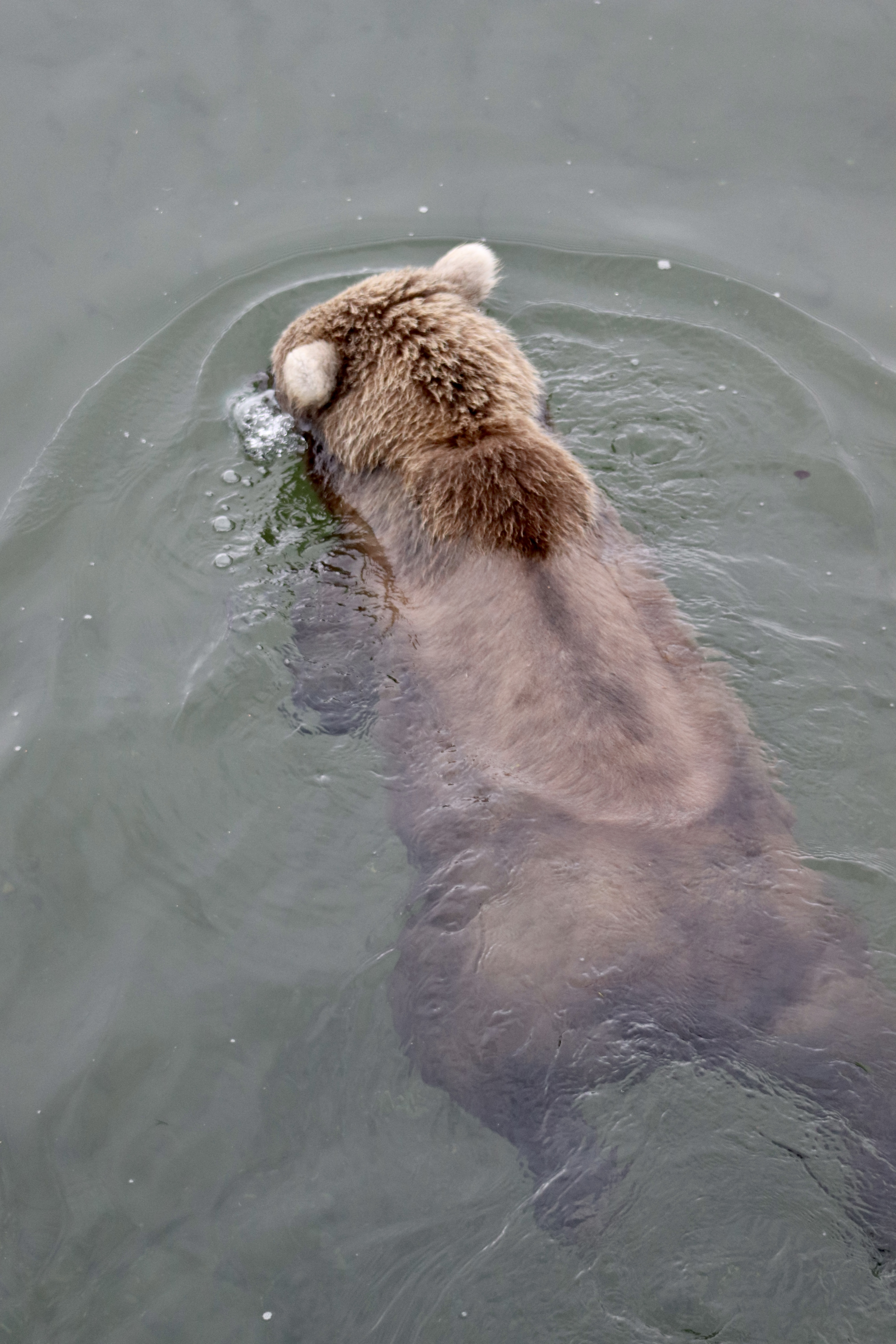
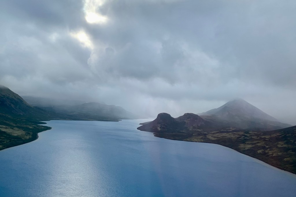
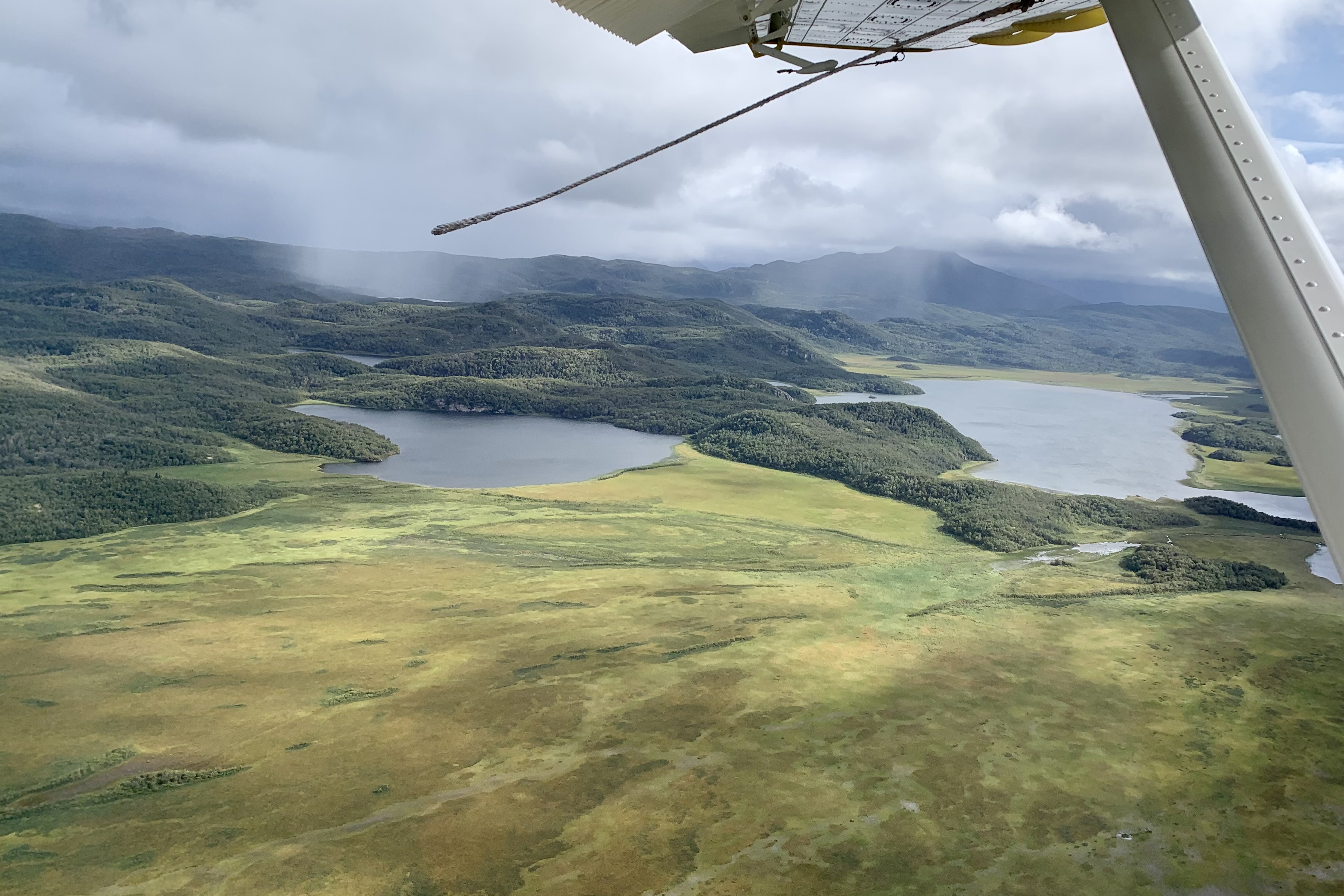
Drifting north back over Lake Grosvenor we were viewing the cold treeless tundra with its low-lying vegetation and the extensive network of lakes, large and small, that were excavated by glaciers on the run eons ago. Purportedly they are teaming with wildlife (otters, seals, bears and moose) but on this day none were seen out there fishing, swimming or sunbathing on the shores. Many of the lakes can be recreational and a fisherman’s paradise IF one can afford to get to them. This thankfully helps keep this wilderness relatively pristine. Additionally, I was beginning to notice that fall was starting to creep into the areas of the tundra, with some browning and yellowing visible.

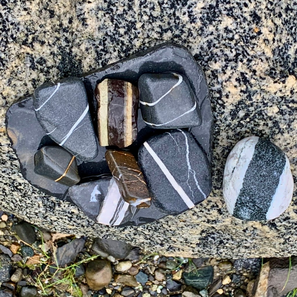
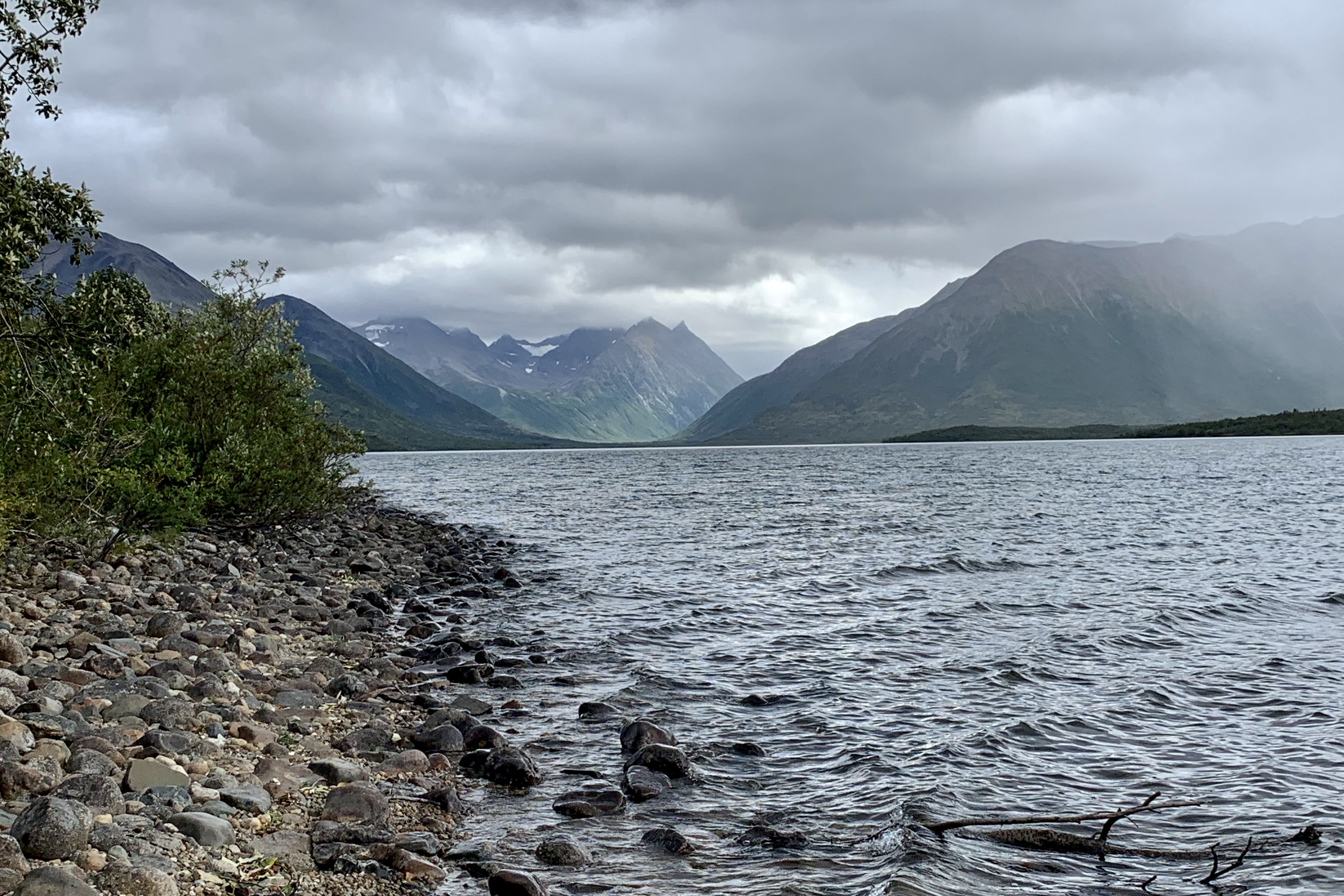
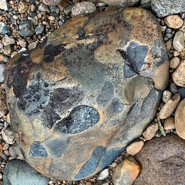
The final descent for our float plane today was a smooth touchdown on a choppy Lake Kulik. I was beginning to notice the lakes beaches we were visiting were of very similar composition until on this beach I began to notice the exquisite array of conglomerates rocks. I imagine that the glaciation in the Ice Age transported pebbles and rocks which eventually became compacted and cemented over times.

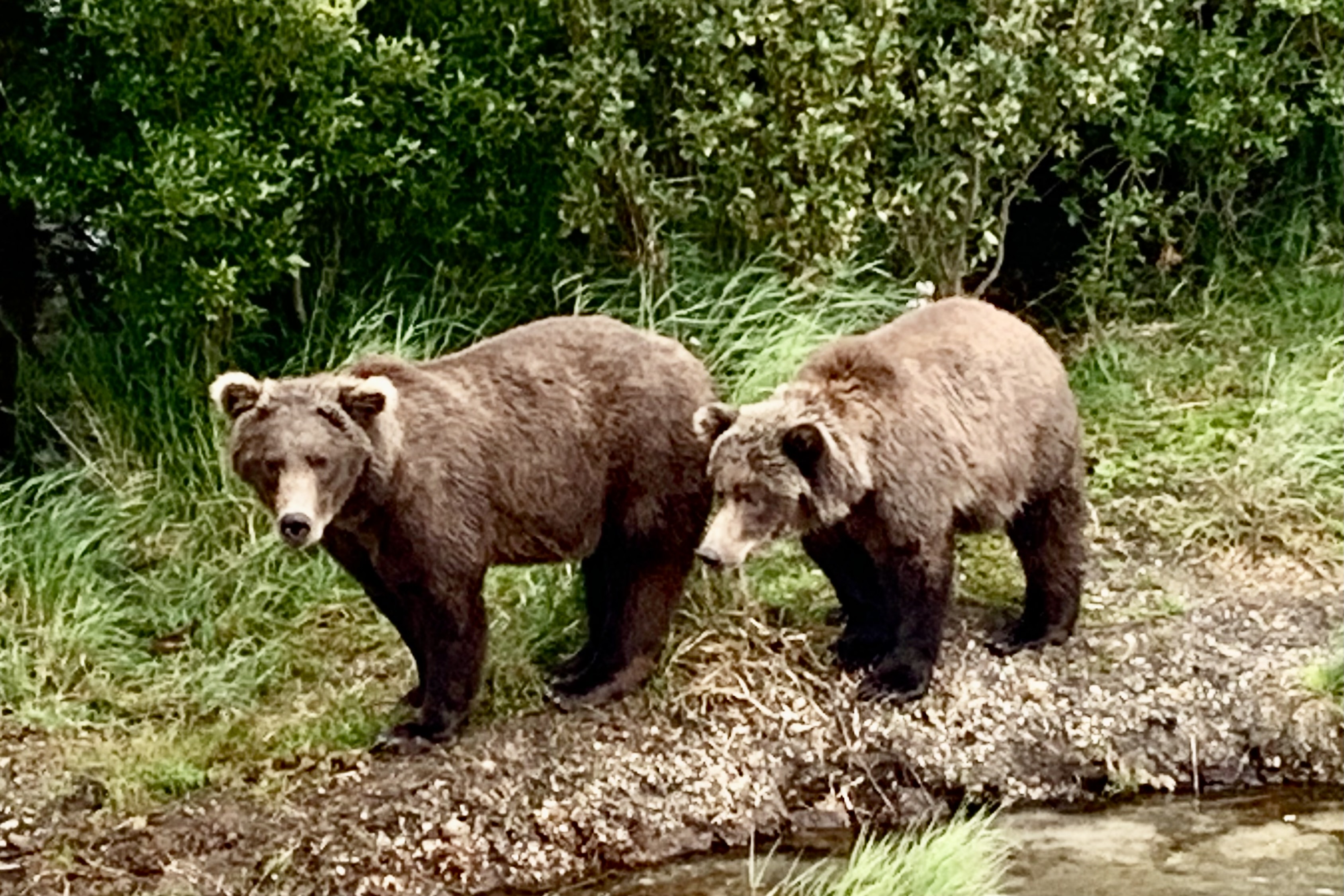
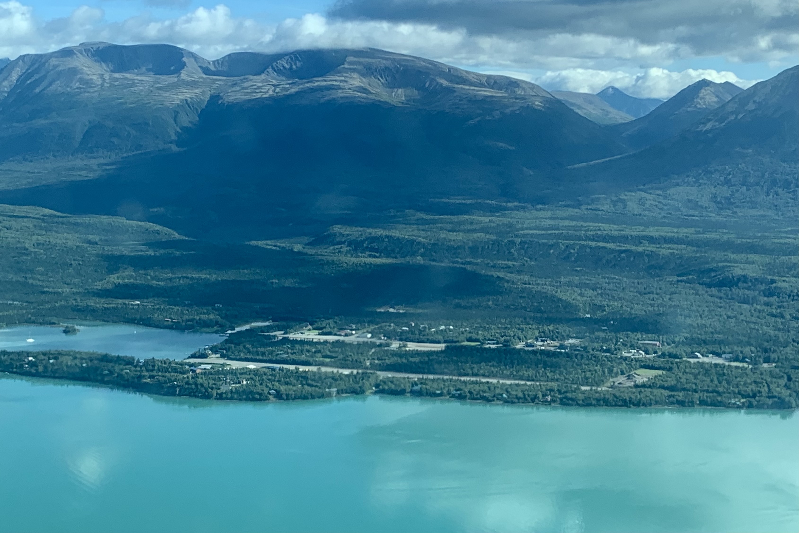
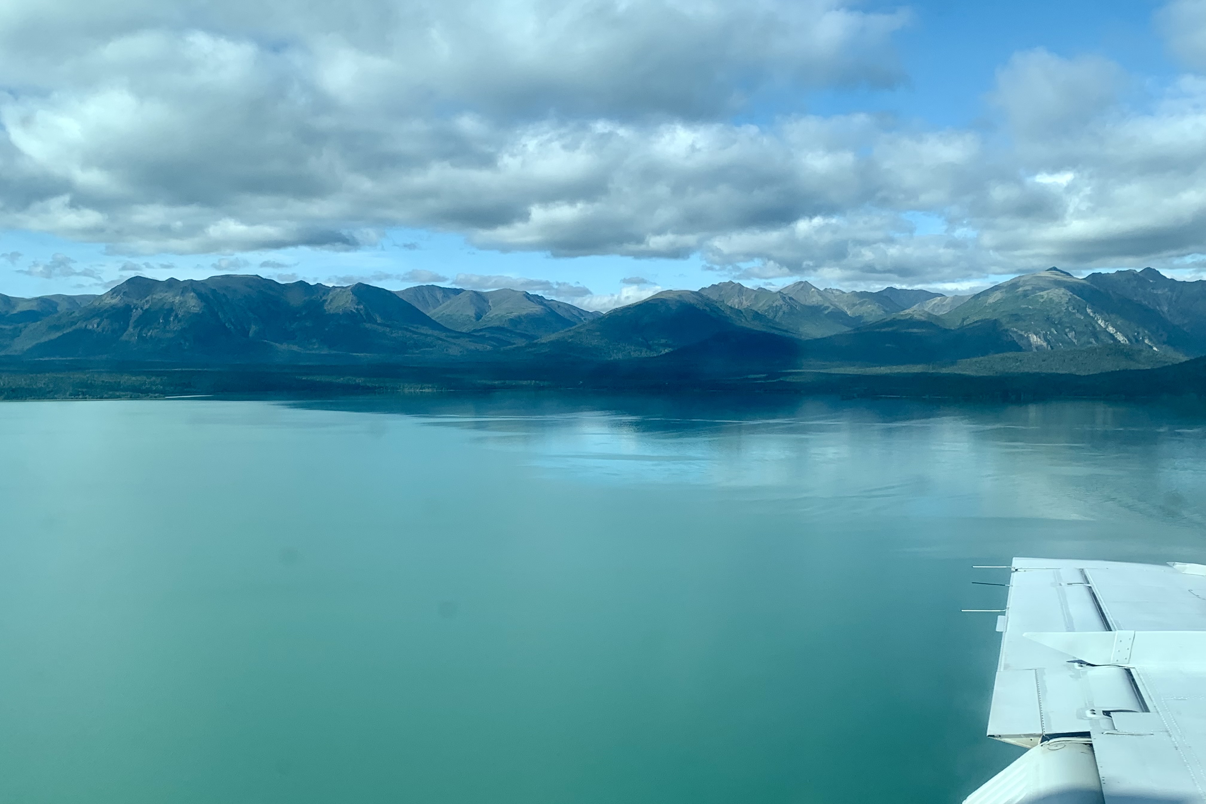
Soon it was time to get airborne. Every take off and landing gives me an adrenaline charge. I can’t say that I am fearful but there is a bit of edginess as I am sitting right behind the pilot and watching how far we have yet to get airborne before the end of the lake. Same for the landing as the pilots definitely don’t want to land too far distant from their selected landing spot. Taxiing an aircraft around like a car on the water is definitely not the preferred mode of getting from touchdown to the beach. The path heading back to Port Alsworth cruised over more stunning vistas. Though there was not on todays journey the heightened energy of being ten feet away from a grizzly bear, the excursion was thoroughly enjoyable and satisfying.

#32 Chunk, #747, and Other Fat Bears

CHUNK

Our second day was the day that was, for me, the most highly anticipated of all of the adventures awaiting us. We would take a float plane over to Brooks Camp at Katmai National Park and Preserve where we would spend the day bear viewing and photographing some of those notorious Brown Bears (grizzlies) pigging out on salmon in preparation for a winter of hibernation and generally hanging out in their natural environment.

Heading South out of Port Alsworth in our float plane of the day, despite it being a relatively cloudy day, the cloud cover was high enough and we were definitely flying low enough to have excellent vistas . Heading out of Port Alsworth we were soon winging our way over the Newhalen River and Lake Iliamna, the largest lake in Alaska (77 miles long and 22 miles wide). The boreal forest of spruce and birch and the alpine tundra and in this area had a stark beauty with it’s colorful low-lying shrubs, mosses and lichen; areas of marshes, bogs, mossy terrain worthy of championship status , and lakes I would best describe as a waterlogged masterpiece of an earthscape.

Arriving at Brooks camp around 11:00, upon exiting the plane , we were advised to not head to the park headquarters via the beach trail because of a grizzly, loitering on the beach enjoying the lake vista. Once we completed the orientation at the headquarters, used the restroom facilities, and consumed our sack lunches which were prepared per our order the previous evening, we made our way to boardwalk platforms for our first up close and though not too personal encounter with some of ursine residents of of Katmai. Since this is almost the end of the season feeding frenzy, the number of bears was considerably less than in the peak months of July and August. The upside of this is that the number of human non-residents interlopers is quite low and thus no massive lines and long waits to be on the platforms enjoying the bears. Our guide said that at times in the summer there is a 3 hour wait and time-limits to be on the viewing platforms. We thoroughly enjoyed observing the bears swimming, dunking, water-walking, scavenging, submerging, and even doing a little bit of fishing in the area. By this time most of the bears have reached a high enough level of fat stores to see them through the winter hibernation and are heading into the forest to much on berries and other forest delicacies for the minerals and other nutrients they need as well.

Perhaps you have heard of the grizzlies of Katmai. The Fat Bear Week celebration has made the national news and is a fun way to celebrate the end of the season of gorging on salmon. There is high concentration of salmon in the falls area so it draws a large number of bears to it. In direct contrast to the human beauty contests which prize leanness and minimal body fat, we are celebrating these bears success to hopefully ensure their survival over the winter. People get to vote for their favorite chubby bear who has packed on the pounds before their long winter nap. Why do we as humans not celebrate our accomplishment when we pack on the pounds whether on a vacation or just have been enjoying the plentitude of food be it gourmet or fast food.

As I watched these bears such words as cute, adorable, playful came to mind but had of course needed to remind my self of the lethality that they pose if I were to jump down and try to pet or swim with the bears like I swam with the dolphins.  By the way, though at times I take significant personal risks, this DID NOT enter my mind as a real possibility. Soon it was time to hike the one mile trail up to Brooks Falls where the iconic picture of bears feeding is Brook Falls is taken.

Here again, at Brooks Falls there were only a few bears but it definitely just as satisfying as if there had been a dozen plus. I have two favorites which both have been winners in the past. Chunk (#32) and #747.

Chunk is a very large adult male and quite the bully. He has a very impressive  scar across his muzzle so he is easily recognizable. I had read that Chunk is consistently one of the largest and, definitely from my observation, the most dominant bears at the falls and that was the case on  this day. It has been estimated that he tips the scales  at 1,200 lbs before the lazy days of winter. He was determined to have sole proprietorship of the falls this day. He would chase off any other bear hoping to join the salmon feast. He frequently occupies  probably the best fishing spots mid-stream and occupied  the same spot and another one closer to the shore for the extent of time we observed him. Despite his fishing skills, he resolutely  challenged  any other bear who wished to also enjoy a prime fishing spot.. The uncanny part of this is that he did not seem to be too interested in serious fishing (he did not catch a the salmon during my observation period) despite watching many salmon leaping up the falls to reach their spawning ground, but was playfully performing for the spectator by making a pretense at it all the while playing “I am king of the castle…” He did some spectacular belly flops in his faux fishing regime.

Chunk

#747

#747 is know as the  largest bear to inhabit the Brooks River and charmed the masses in 2020 to vote him the winner of chunkiest of the chunky. Thus he is quite stocky and recognizable by his size, more “dainty” short muzzle, ragged ear and a dark brown coat. It has been said that the has quite  assertive disposition and he has been  at the top of the hierarchy at Brooks Falls.

Bears establish a hierarchy and the most dominant bears get  the best fishing spots. But Chunk had the upper hand this day. Like our human counterparts, size alone can be  intimidating and  bears  like 747’s with its size alone will find most bears to yielding  their space to a behemoth like 747. I find it curious that on this day Chunk was the heir to the throne at least for today . I definitely will vote for Chunk if he becomes one of the elected contestants in fat bear week.

Though I was dazzled by the star bears, there were many other who were just going on doing what bears do best…fish!!! Of course these bears are quite habituated to having a paying audience . Though there is no entrance fee, to get to Katmai one must shell out considerable dollars as it is only accessible by float planes or boats. At times, I would swear these massive “teddies” were putting on a show but most likely they were just being their cute growly selves swimming, slogging and prancing about.

I definitely hated to depart but but it was time to make the return flight back to Port Elsworth  on Lake Clark.  We were supposed to flight-see the Valley of Ten Thousand Smokes but it was fogged in and the weather was deteriorating so we flew directly back to the Lodge with the landscape below partially shrouded with fog. and hauntingly beautiful.

The wind -up to this peak life experience was a beautiful sunset of pastel hues over Lake Clark.

Nature’s Skyscrapers, Liquid Turquoise, and Amphibious Planes

Most adventures that I blog include the task of getting there. Sometimes it is a tedious repetitive activity to be endured and other times it’s a stand alone episode. An so I begin the story of the latest venture in my quest to visit all of the National Parks in the USA, and in this case Lake Clark NP and Katmai NP (#53 and #54). My daughter, Tasia flew into Kenai AK and we spent three days packing up my household goods into a very tall U-Box to be shipped to Oregon and I bade farewell to my Alaska Homestead feeling more relief rather than sadness. Part of the “grande finale” of living on the Kenai for 5 summers was taking the time to comb Kenai Beach and the beach at Captain Cook State Recreation Area with Tasia, an avid rock and fossil connoisseur. The beach is littered with immense boulders that were dropped by melting glaciers. They dot the beach and mud flats offshore. A clutter, tumble and tangle of of colored rocks, of varying shades of red, green, yellow, clear, black and granite carpet the beach. The 50-60 foot eroded cliffs and the walled “canyons” that cut through the mudflats near the river outlet add a raw beauty to this area. The view of Aleutian Range of mountains across Cook Inlet is breathtaking and at that point, I did not know with a couple days I would be circling those behemoths in a float plane. This was a fitting preface for the explorations awaiting us.

We headed up to Anchorage the night before as it was a holiday week-end and I had an immense fear of a major accident closing the Sterling Highway, the only road off the Kenai Peninsula and not being able to get to Merrill Field in Anchorage for a departure the following afternoon. The next morning after one night in a shabby hotel (seems to be more and more of them since COVID all over the place.) We discussed our options for the day until our appointed arrival time at Merrill Field. Having no interest in the Anchorage city scape or shopping ops, we chose to hike the trail to Thunderbird Falls north of Anchorage. The one-mile undulating trail to Thunderbird Falls traverses a lichen and fungi enriched birch forest along the Eklutna River canyon with steep cliffs on both sides of the gorge to a deck with views of this 200-foot waterfall. The view of the falls from the overlook was not particularly impressive in my mind because the platform is quite a distance away. There was no keen sense of the power of the water cascading over the falls but it was a lovely hike.

Our more adventure spirits took us down a side trail into the canyon, hopefully to the base of the falls. It was a suitably muddy, tripping root, somewhat steep traverse . What a downer at the bottom as I would have had to climb into the frigid rushing water making my way upstream on the slick rocks to the get close enough to the base of the falls to experience the chilly spray of Thunderbird Creek or get a unlimited view of the entire cascade. Camera zooms definitely create the illusion in my photo of one being in the spray zone of the falls. Since this hike was not a time trial to be annotated in a log book but a leisurely stroll, taking time to appreciate and to explore nature’s passion for multifarious life forms was pure pleasure. The fungi on and the array of hues of the birch trunks along the trail was enchanting

After a picnic lunch at Mirror-Edmonds Lakes Park, we headed to Merrill Field and the Lake Clark Air terminal. How grateful I was that I didn’t have to deal with Ted Stevens International Airport and its massive parking mess. Merrill field is the primary field for small private wheel-equipped aircraft and the thus home base for Lake Clark Air Service which is the airline based in Port Alsworth, Alaska providing transportation for our tour to remote areas of Katmai and Lake Clark National Park and Preserve.  Unlike most airlines when checking in for flights, on theses small aircraft they not only weigh your bags but weigh you as well. I hate to be weighed let alone in public and often refuse to be weighed at a doctors office. In this instance, rather than trying to shed anything that would weigh me in heavier, I was grateful to hang onto boots, purse and anything else that would camouflage my actual weight. Their terminal was impressive and I was fervently hoping that their pilots and planes were equally impressive.

Once aboard our largest aircraft for the trip, a nine seater, the flight took us over the Cook Inlet, with views of its oil platforms and the bays and estuaries of the western shore of Cook Inlet. I was beginning to anticipate that this was going to be the bulk of the aerial view for this trip. Though they have their own unique beauty and can be stunning, I was ready for new aerial vistas and not a rerun of those ones I experienced last year. Then almost like a bolt out of the blue we were headed towards Lake Clark Pass , so named because it is a pass through the Aleutian Range from Cook Inlet to Lake Clark and which I understand now is the primary aviation route between Anchorage and the western part of Alaska. We were flying between and over towering snow-covered peaks. I have no idea how wide and at points narrow this pass is but it seems deceptively close at time as if our wings were close to brushing the jagged edges of the faces of cliffs. We experienced vista after vista of snow covered peaks, pillows of clouds , curling white ribbons of water cutting into knife-edge crevasses in the rock faces, and ice tongues crawling there way downslope

Coming out of the pass my eyes feasted on the amazing  spectacle of the glacier-fed turquoise water of Lake Clark and the  low green rolling hills surrounding it, with the village of Port Alsworth coming into view below. Soon we were in a quick decent  approaching one of the two  parallel, gravel thousand-foot-long runways. We skidded to a halt kicking up a cloud of dust to announce our arrival. What an auspicious beginning to a week-long adventure into the mostly untamed wilderness of these  Alaska parks. 

I was not sure what to expect when booking our stay at Lake Clark Farm Lodge. What we got far surpassed what I had anticipated. We settled into our cozy cabin fronting the Lake and I gazed at the float planes parked right outside our door. Had I  expected the quality of the Ritz-Carlton, I would have been sorely disappointed and probably would have much to complain about.  But rooms were adequate, cozy, warm and had decent Keurig coffee pods instead of those lame hotel packets that brew very mildly caffeinated brown water.  But everything else was first-rate. The meals were of exceptional high quality, elegantly served in a rustic dining room with several flights of stairs to climb to reach the main lodge, thus working up an appetite. 

And this was just Day One of of a full week of exploring Lake Clark and Katmai National P arks.

Tlingit Tales, Sucking Mud, and Black Water

The Glacier Bay Lodge is beautifully sited. Hiking trails lead from the lodge along the bay and into the woods. This was departure day and what a shock it was to awaken, part the curtains, and see a sky, though still mostly cloudy, in which I spotted a couple of blue openings… so I determined I would attempt the remainder of the various hikes near the lodge, which included the Forrest Trail and  Beach Trail.  After the fiasco of the Bartlett River Trail the previous day, I did not want to venture too far off from seeking DRY shelter., even if it was to pop into a strangers tent in the campground. I was totally over getting soaked.

The ritzy Forrest Trail included two viewing decks and a boardwalk part of the way and I hate to admit that it was a quite a  relief this morning to not be drenched nor to have to monitor every single foot footfall into puddles, root crevices, and craggy  rocks, lest I twist an ankle or massacre any other part of my porous skeleton.  This trail was a well “ manicured and sanitized” version of the Bartlett River Trail…beauty abounded with minimal puddles and minus the serrated  rocks and so many snagging roots. Of course my ordinary preference and inclination would be a tougher trail but, after yesterday, I finally came to the conclusion that not every hiking adventure needs to be a Mt. Everest endeavor. Maybe the story isn’t as dramatic but perhaps I am getting to a point in life after 8 decades where everything I do does not have to be high intensity, the toughest, or a crescendo to the top tier of an endeavor. 

The birdsong was beautiful and the black water ponds a window of life below and a mirror for life above. Their dark colored tea-stained appearance in this mossy glen led me to whimsically imagine the black water as a repository of mossy stories from other eras. The trail ended at the campground so I meandered through that area, scouting future possibilities. I doubt I will ever return to take advantage of these wonderful sites nestle in the between the spruce and alder, lichen, fungi, ferns, and carpets of moss.

I had intended to return by the identified beach trail but realized that, though you could get views the water and the beach from it, it was NOT on the beach.  So I blazed my own trail through the rocks, seaweed, shells, and sand with a very light mist adding a sparkle  to a delightful morning… with temperatures around 60. Guess that thought about everything didn’t have to be high intensity and thus taking the easier road had already vanished.  This is not a Florida Beach, Long Island or the Jersey Shore type of beach. There were areas of coarse sand but mostly a mixtures of pebbles, gravel, shells, larger rocks and an occasional boulder, a variety of smooth stones of various colors… a beautiful mosaic or countless textures, vibrant colors and a myriad of natures detritus. I love striding barefoot on a beach but had no urge to ditch my shoes and scurry barefoot here. The tide was low so here was a variety of sea weeds washed ashore, wet and glistening, tangled, ribbon-like and splayed out across the shells and rocks adding to the ambience of this coastal edge . I spotted shells included clams, mussels, barnacles, scallops but no conch as these tropical mollusks do not inhabit frigid waters. .

To dip or not to dip my toes into Glacier Bay. Typically the beach’s edge is a mixture of water and sand and when stepped upon one’s foot might sink in a few inches. But at every beach I have visited in Alaska, the shoreline is a quicksand like substance I call “sucking mud” composed of sand, water and clay mixture. It behaves like quicksand and will eagerly gulp and swallow a boot or shoe that is loosely attached to your person. How far it might quaff me down I chose not to test. Soon it would be time to return to my room with the task at hand to pack up and to check out by noon though the only flight out of Gustavus wasn’t until 5:30. 

As I tread this fascinating mosaic of the shore, my mind wandered to one of my beloved classics , Anne Morrow Lindberg’s “A Gift from the Sea. ” Like this author, exploring the shore brings me peace, solitude and contentment of my mind and soul. What a fitting way to close out the hiking portion of my visit to Glacier Bay.

What to do with the three and one half hours before the shuttle to the airport in Gustavus departed. I meandered out to the dock and discovered a Glacier Bay National Park sign and had the good fortune to have a couple a folks meandering there as well and was able to get my traditional photo in front of the park sign which I have been doing since I had my first national park visit to Great Smokey Mountains National Park when I was 11 (guess I was not as important to fully capture as my brother and sister and the road were.)

Since I had not had an opportunity to visit the Tribal house of the Huna  (my priority usually is to beat up my body with physical endeavors), when a member of the Huna Clan,  a subgroup of the Tlingit people,  would be present to share their story, I headed there. I was mesmerized  by  the carved totems outside and the carved pillars on the interior. Owen, a craggy old gent, was the Huna representative and had been intricately involved in the carvings in this Ancestral House which opened in 2017. He took the time to share the story of each pillar. I regret that I can not remember accurately so much of the lore he described in the totems and walls of the of Tuna Shuka Hit, the Huna Ancestor’s House.

There were  4 totems representing a story of  the 4 clans. The tribal lore is fascinating.  In the tribal tradition, the stories  can only be told by a tribal member. They are not written but passed through the generations via the oral tradition, so I would not be recording his tales nor recounting these tales to you. His concern, as so many members of indigenous groups concur,  is the disaffection of the young people for the traditional in favor of the wider world brought to them through the internet. 

I had a difficult time not being incensed when, earlier in the trip I heard the story of the alienation of the Huna by US government. Typically, for many many decades the US government had no regard for Indigenous Americans and their cultural practices, and in this instance the Alaskan Native Clans. The relationship between the Huna and the National Park Service was fraught with animosity in the early years when the Glacier Bay National Monument was established.  Laws and regulations implement by the government, without collaboration of the Huna,  led to restriction of the Huna land use, regulating what land they could access, what they could harvest and resources they could gather. The tensions have eased and regulations revised and the building of this tribal hut has been one way to foster a much stronger relationship and connection  between the two. After I had left Owen and was on my way home I had wished that I had the thoughtfulness to express my sorrow about the how my government had treated his ancestors. It is a very important gathering place today for reconnection with preserving oral history and other traditions, music, dances, and the sharing their heritage with visitors today.

CHOOKANEIDI (GLACIER BEAR)

There are four clans That are represented here. The above is the CHOOKANEIDI Clan (Glacier Bear) and part of the eagle/wolf moiety. Also part of the eagle/wolf moiety is the KAAGWAANTAAN Clan (Wolf/Bear). The third totem is WOOSHKEETAN (Whale).The fourth totem is the T’AKDEINTAAN Clan (Raven). Don’t go and update Wikipedia based on my less than educated guess as source material is not consistent across most of what I read.

KAAGWAANTAAN (WOLF )

The symbols on the walls and totems  are a beautiful example  of Northwest Coast Indigenous art. I find it a stunning  unique artistic style of  flowing lines and bold colors and containing many ovoid and U-shapes that represent various elements such as eyes, mouths, or spirit beings. The deep connection with nature and the spiritual world you can see  reflected in their symbols that are used in their art.  

T’AKDEINTAAN (RAVEN)

From animals like eagles and bears to intricate geometric patterns, each symbol tells a story and represents aspects of their culture and beliefs. Each totem tells a story of its clan. These  Tlingit symbols differ from symbols used in other Indigenous cultures due to their focus on animals and natural elements, the intricate formline designs, their use in telling the Tlingit story  and clan identification, and their connection to spirituality. These symbols serve as a visual representation of their deep connection to the land and their ancestors.

WOOSHKEETAN (WHALE/SHARK)

It was by now time top board the bus to Gustavus Airport and make the trip back to home on the Kenai Peninsula in reverse: a quick leap to Juneau, aviating to Anchorage, a trudge to find my car out in the farthest reaches of long term parkingalone at midnight, and on to the motel so as not to travel half the night back to Soldotna. But there was one last bus stop on the way out at the park entrance for another photo op with the other park sign.