
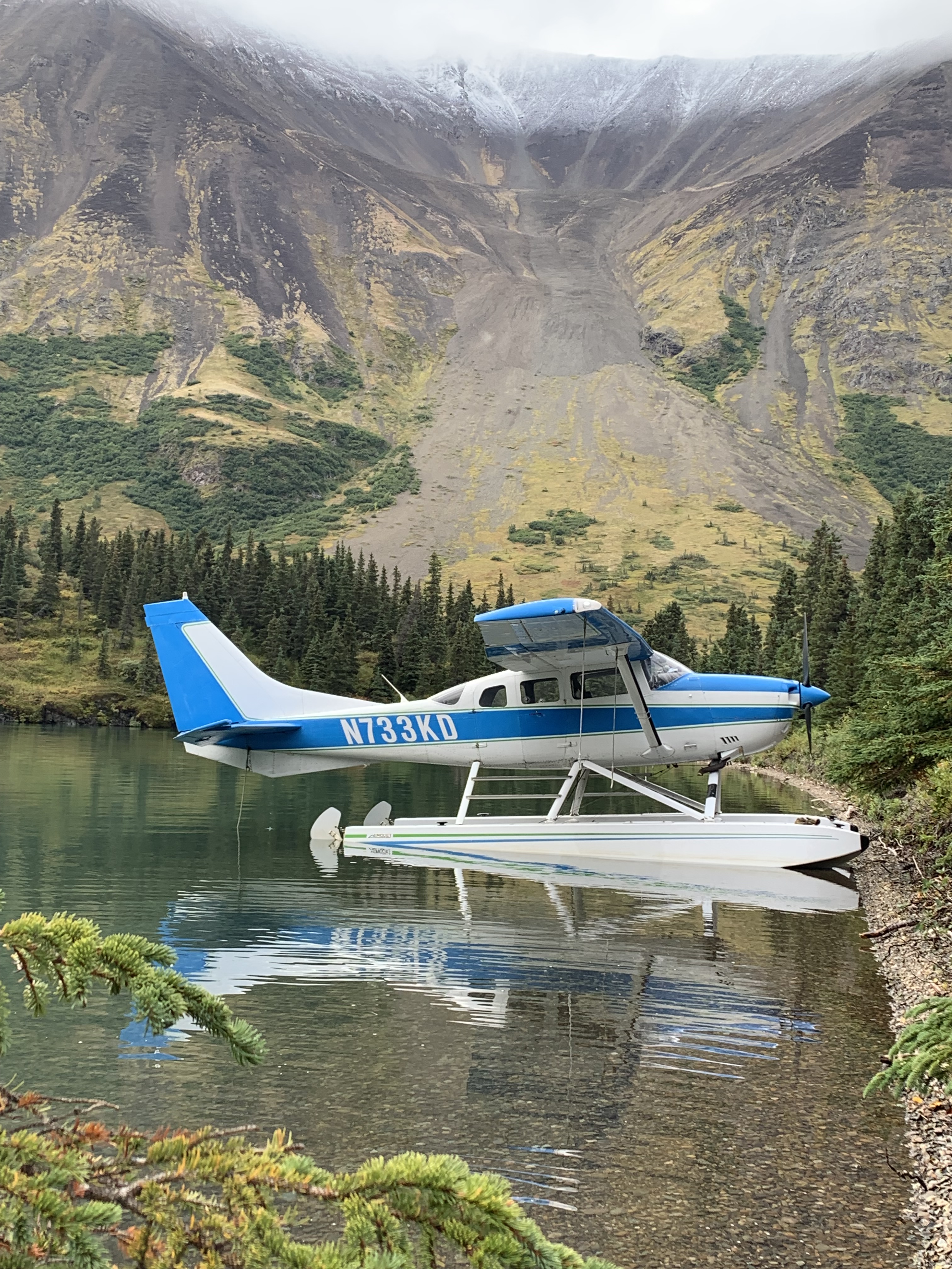
Our days adventure was branded as the Fire and Ice Tour. The geography of Lake Clark National Park was the focus of it and we were soon winging our way in a Cessna 206 (dubbed the sports utility vehicle of the air) over some of Lake Clark National Park and Preserve’s extremely rugged and breathtaking landscapes. The Aleutian Range of mountains is within what is known as the “Pacific Ring of Fire” which is a horseshoe shape belt of high tectonic activity (volcanic eruptions and earthquakes) that extends 25,00 miles around many of the landmasses bordering the Pacific Ocean. Mt. Redoubt and Mt. Iliamna are active stratovolcanos within Lake Clark NP .
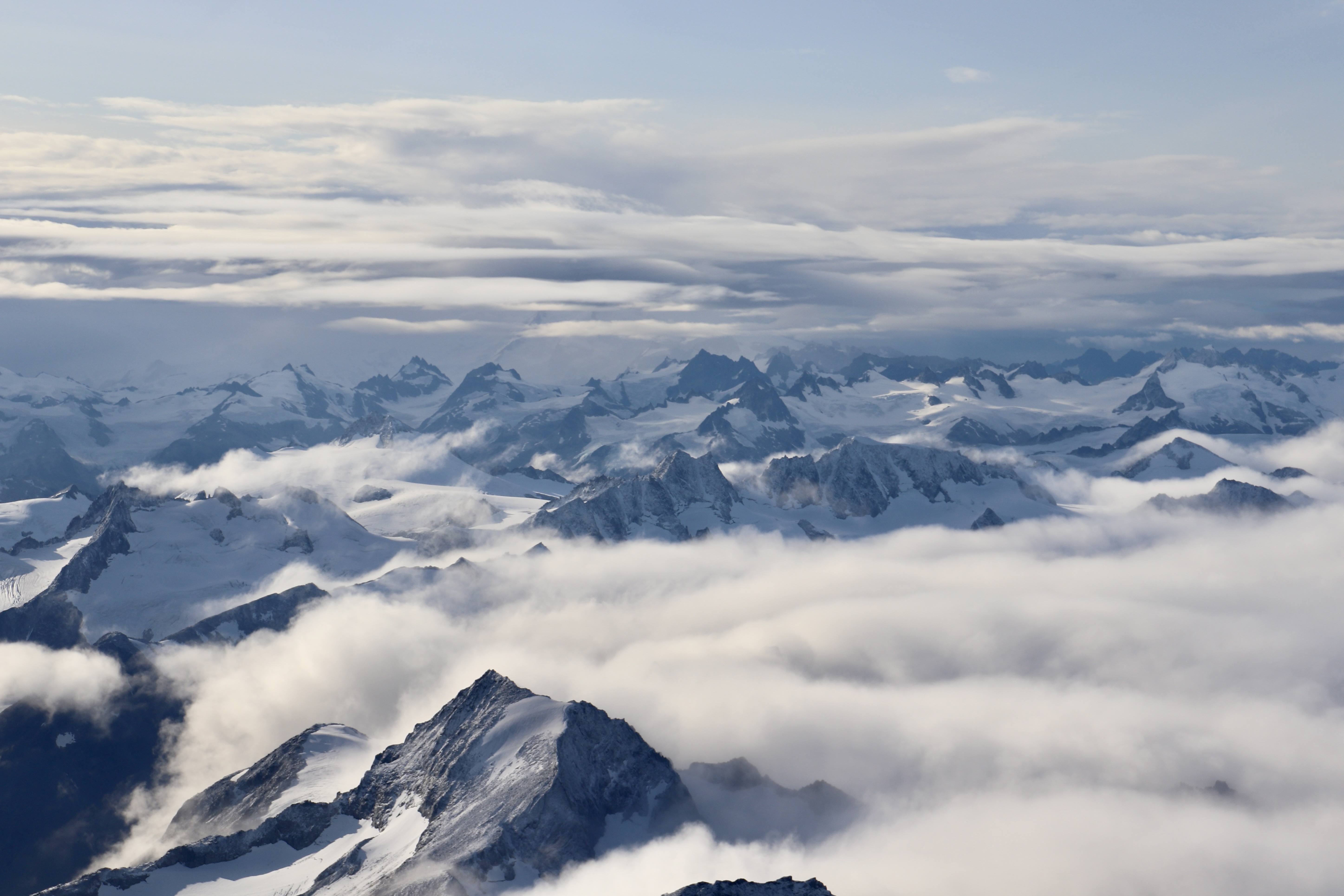
Ascending above the clouds, what a splendorous sight it was to see the jagged mountain peaks punching through the billowing clouds. It evoked such a wonder and amazement. What a sharp contrast between these jagged, sharp, angular unyielding summits and the wispy, pillowy and cumulous clouds about.


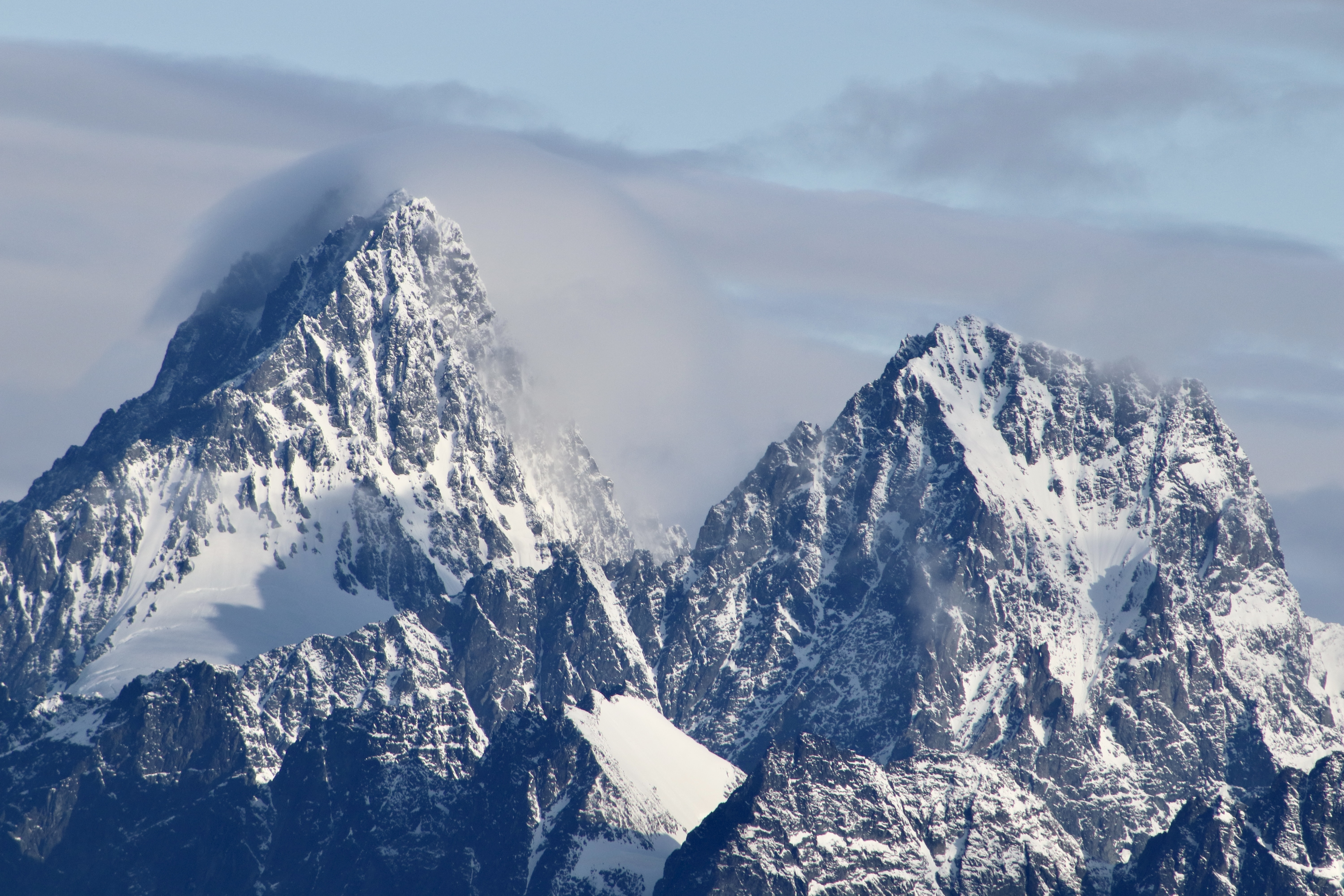
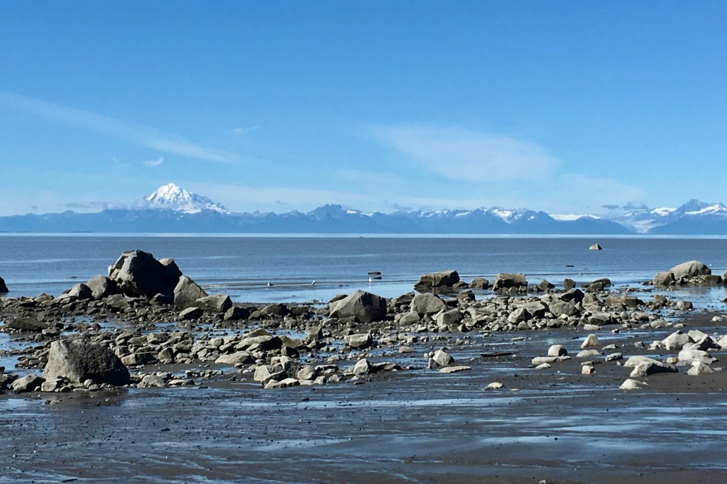
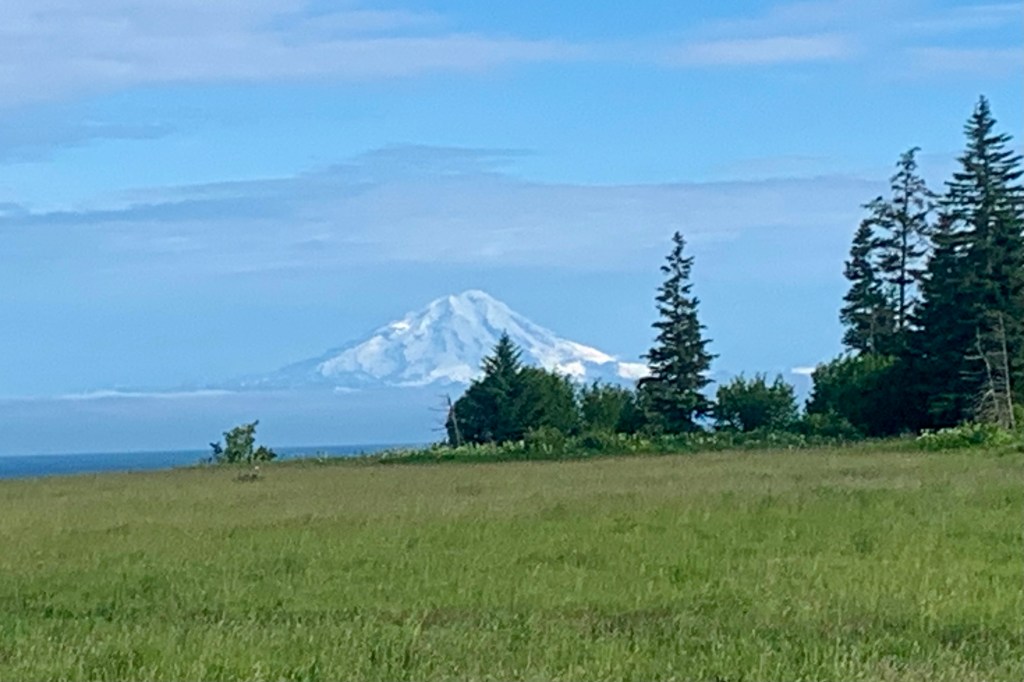
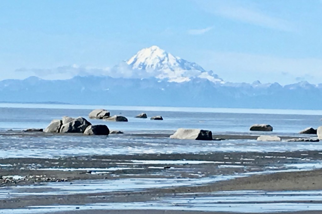
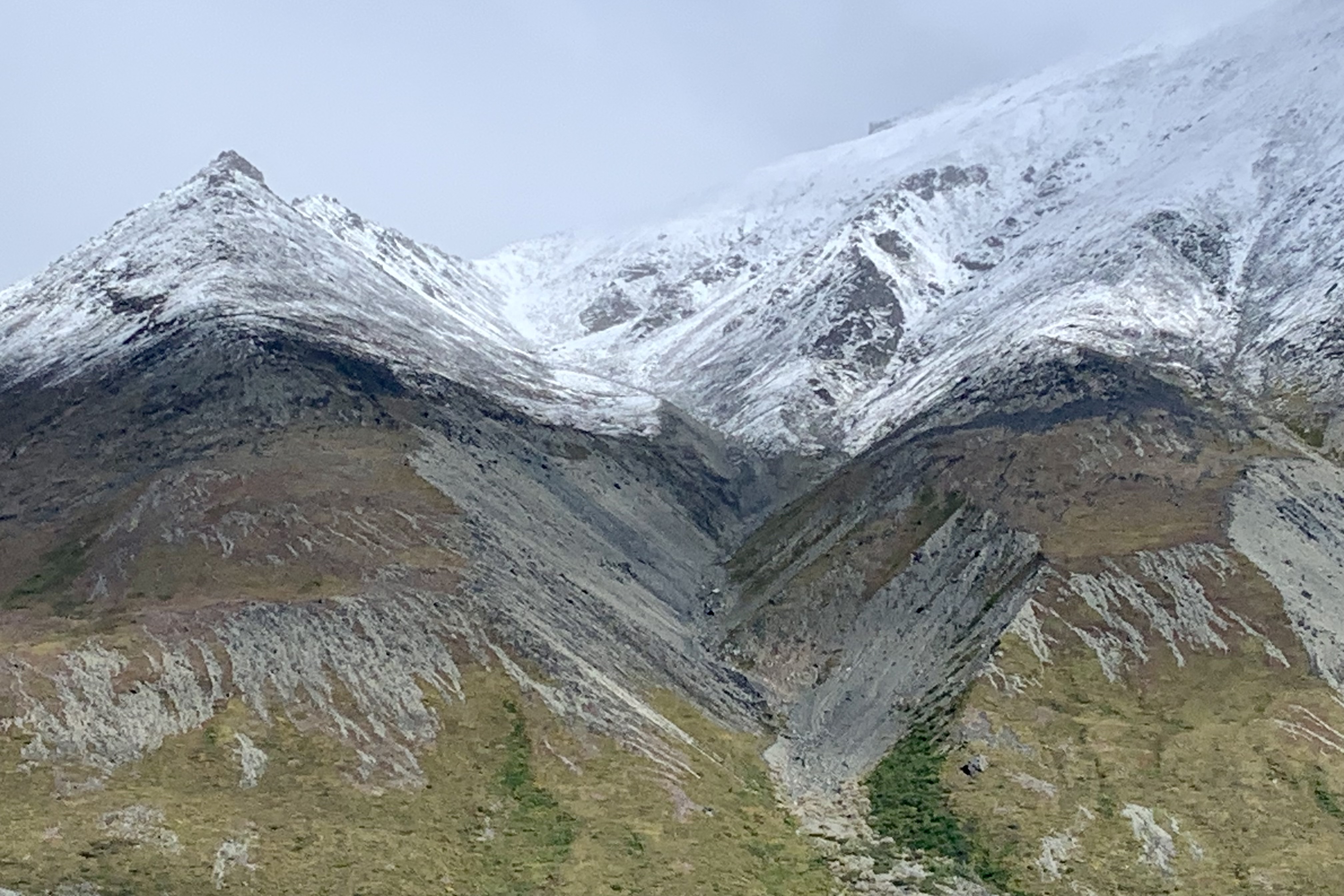
Not too long into this flight our pilot pointed out Mt. Redoubt, an active stratovolcano which has erupted many times in recent history, the most recent in 2009 and the highest peak in the Aleutian Range at 10,197 feet . Mt. Redoubt is an ubiquitous sight as it can be seen from the Kenai peninsula where I have a home. It boldly presents itself in the distance on a sunny clear day as it majestically stands in the distance . At times when I have travelled the Sterling Highway south towards Homer or north towards Captain Cook State Park, despite being 50 miles across the Cook Inlet, Mt. Redoubt’s massiveness makes it appear to be just a jot across the inlet.
Circling around Mount Redoubt was the goal, but unfortunately the clouds were accumulating on its summit and far side, enveloping the mountain, so our pilot bailed on that plan. Redoubt from this aerial standpoint speaks magnificence and grandness and it is an altogether different experience than from the ground. Our next destination was Mt. Iliamna but its affinity to the cumulous clouded us out as well.
Soon we were headed for Portage Lake and, though I did not ask the question, I wanted to ask where the Fire was on this Fire and Ice excursion. Now a reckless part of me would have loved to see some action from those volcanoes (maybe a small fire) but the sensible brain knows that wishing for a spewing of lava is pure insanity as an eruption from this type of volcano is not runny and oozy like those in Hawaii but like popcorn popping though, not so light and fluffy with the size ranging from boulders to ash.

On this trip I was sitting in the co-pilot seat and though it became somewhat of a joke at first it was also a necessity. I needed a booster seat so I could see over the instrument panel. They came up with a flotation cushion which was definitely a help but after the first flightseeing go round I chose to abandon that decision. It was still a reach to get a good view over the instrument panel and I wasn’t able to really take in the landscape as I wanted . So after our Portage Lake exploration and a visit to the bushatory, I opted for the second and only other row seat. Exploration at Portage was limited due to high water levels and minimal beach


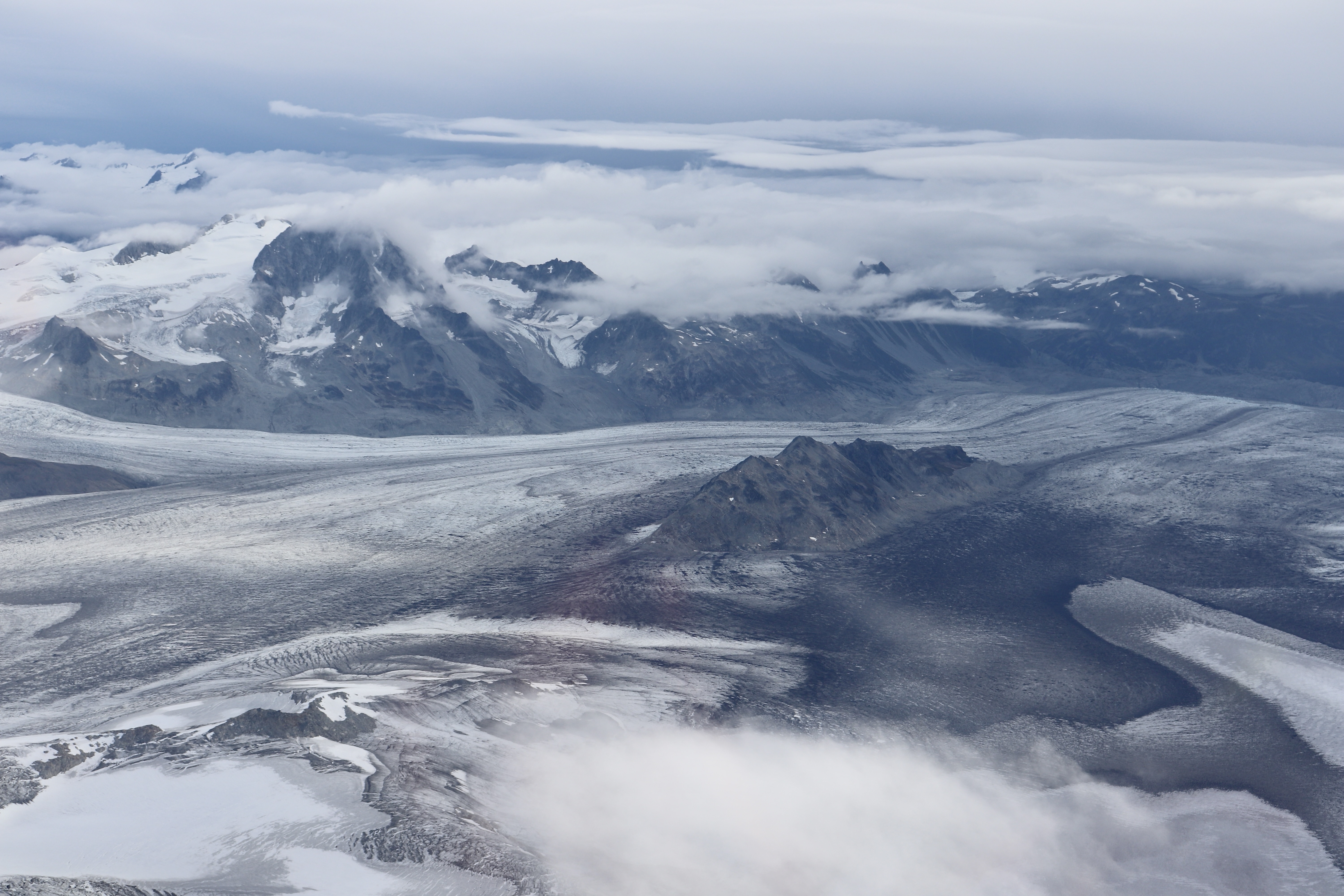
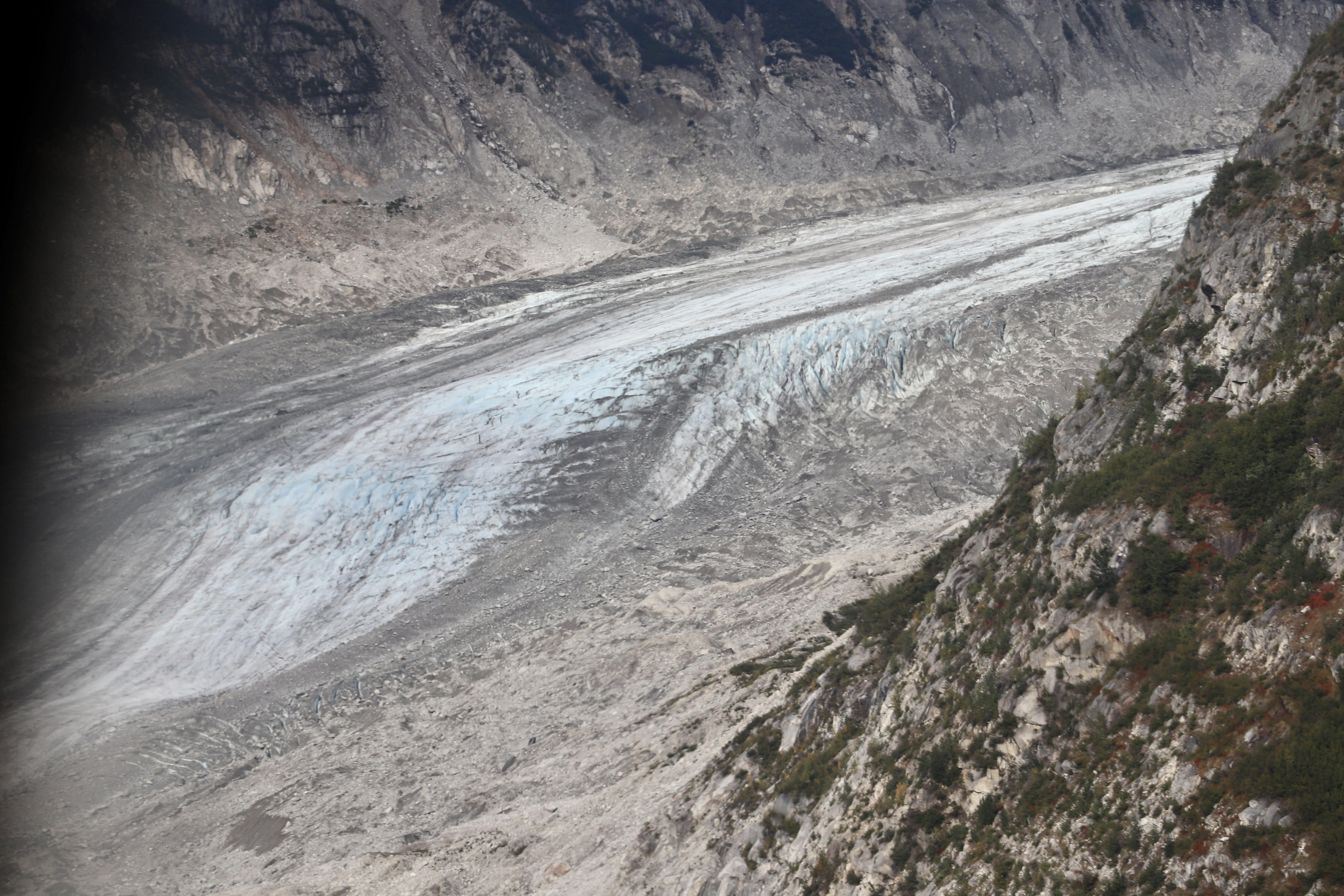
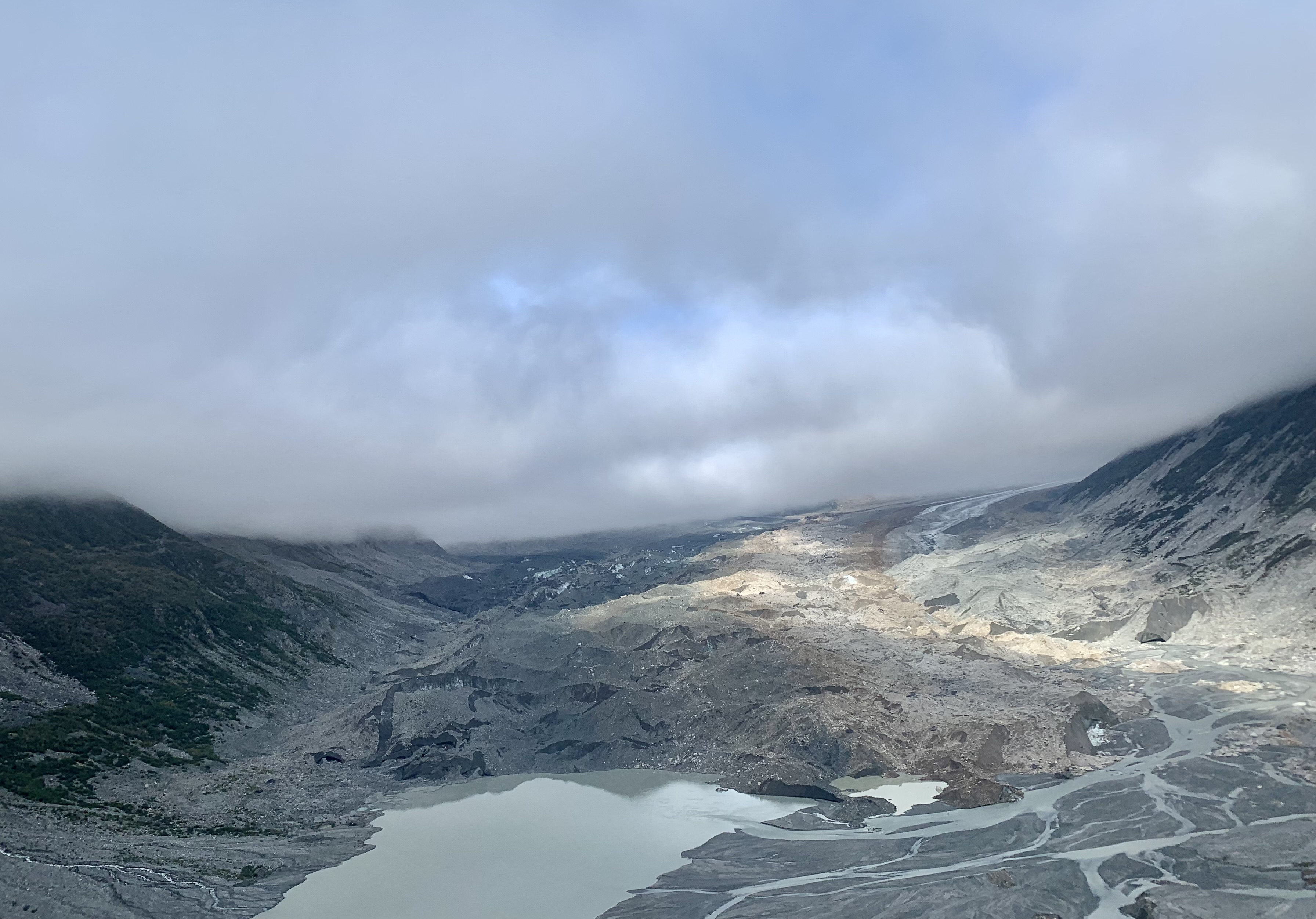
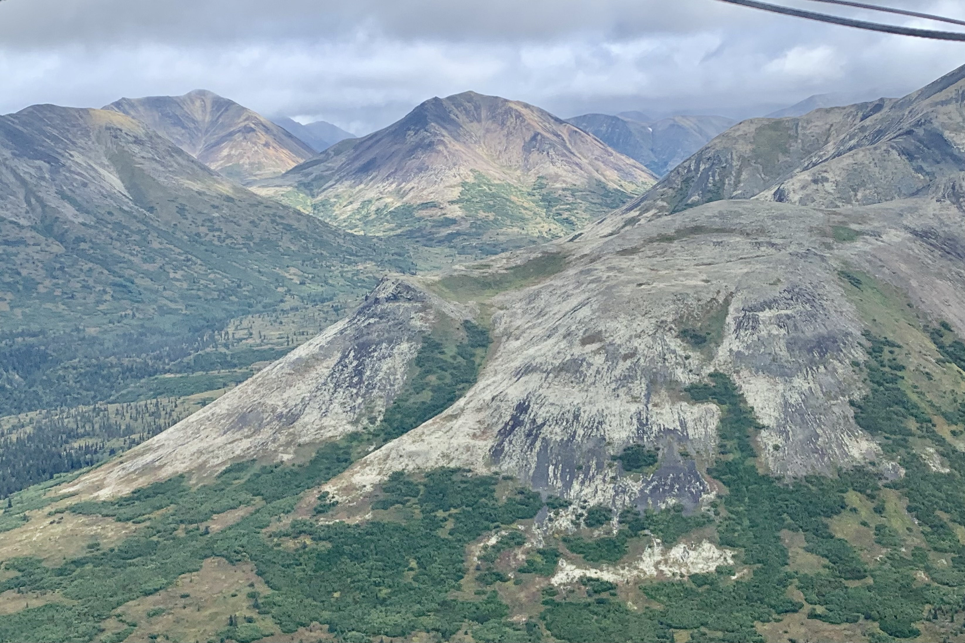
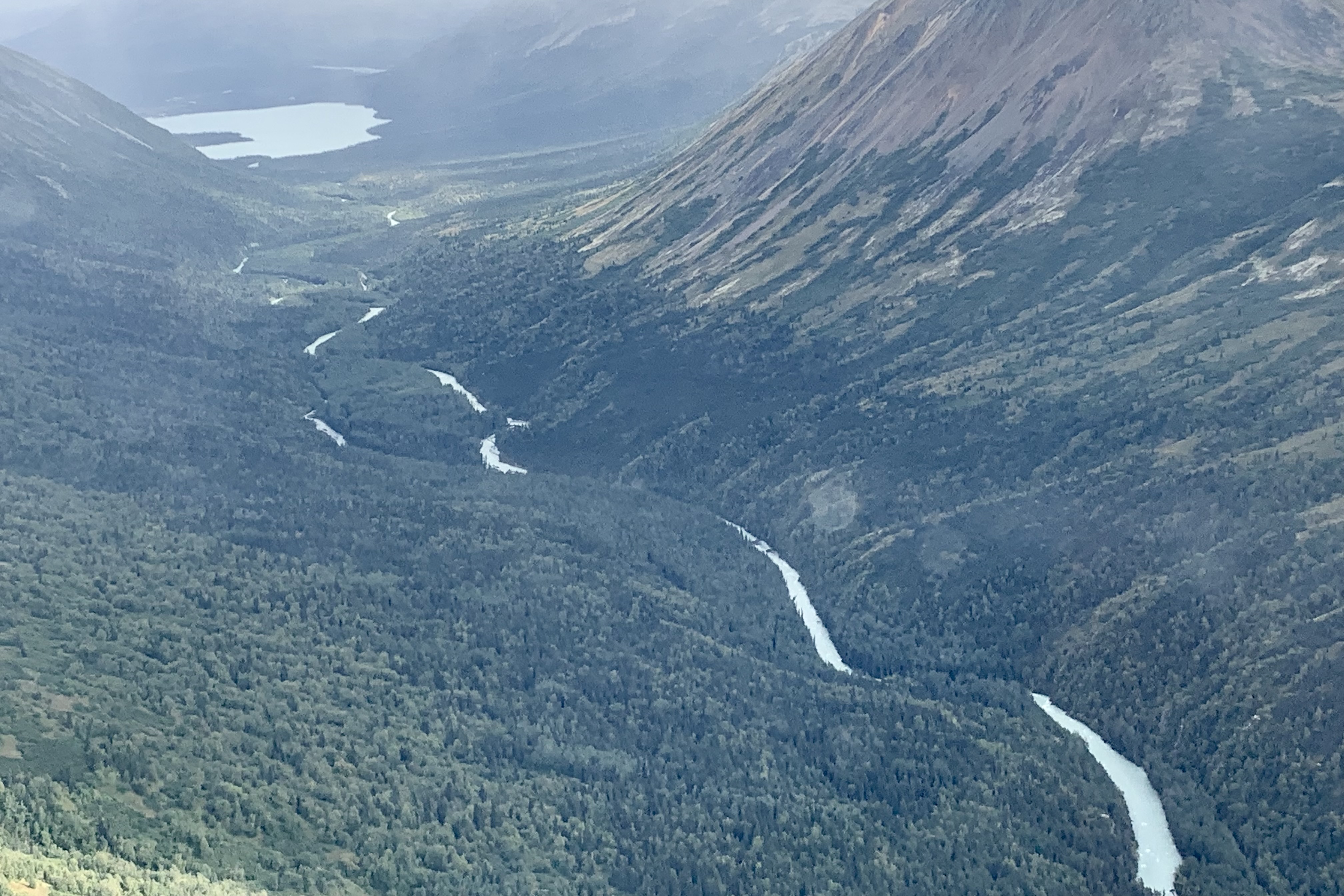
Once airborne we were headed towards the north end of the Lake Clark Pass to the glaciated area around Summit Lake and the Tlikakila River, a national wild river, and its tributaries in the Chigmit Mountains. The massive Tanaina Glacier, a valley glacier that extends many miles, feeds the Tlikakil River, a major source of water flowing into Lake Clark . There is definitely a tendency on my part to romanticize glaciers, the blue-white ice that is jagged and etched with crevasses, ice caves, and seracs. Visually “superimposed” on the rugged mountainous backdrop this is a very dramatic mass of ice that is a mosaic of colors , textures, shapes but treacherous to walk on.


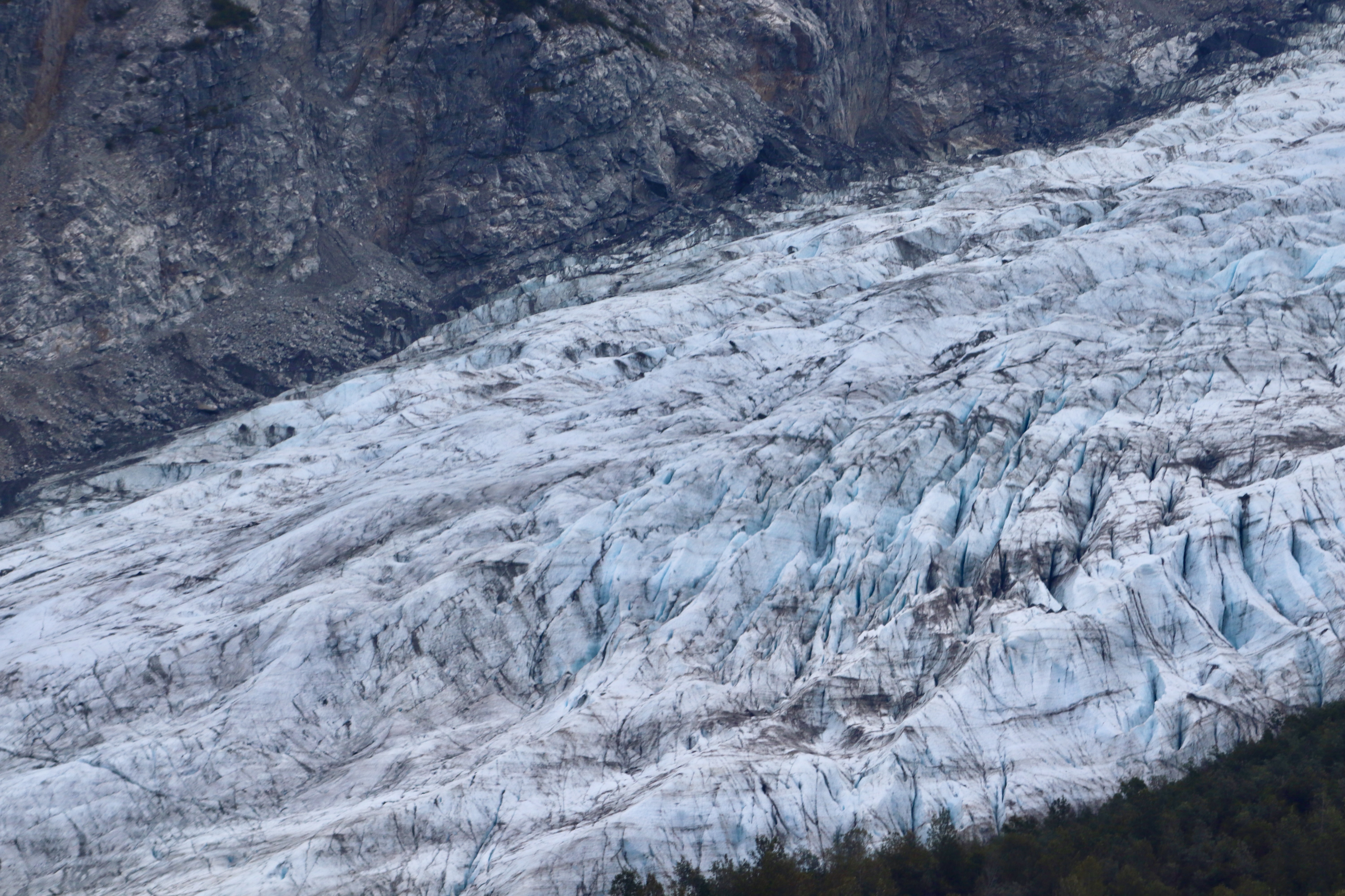
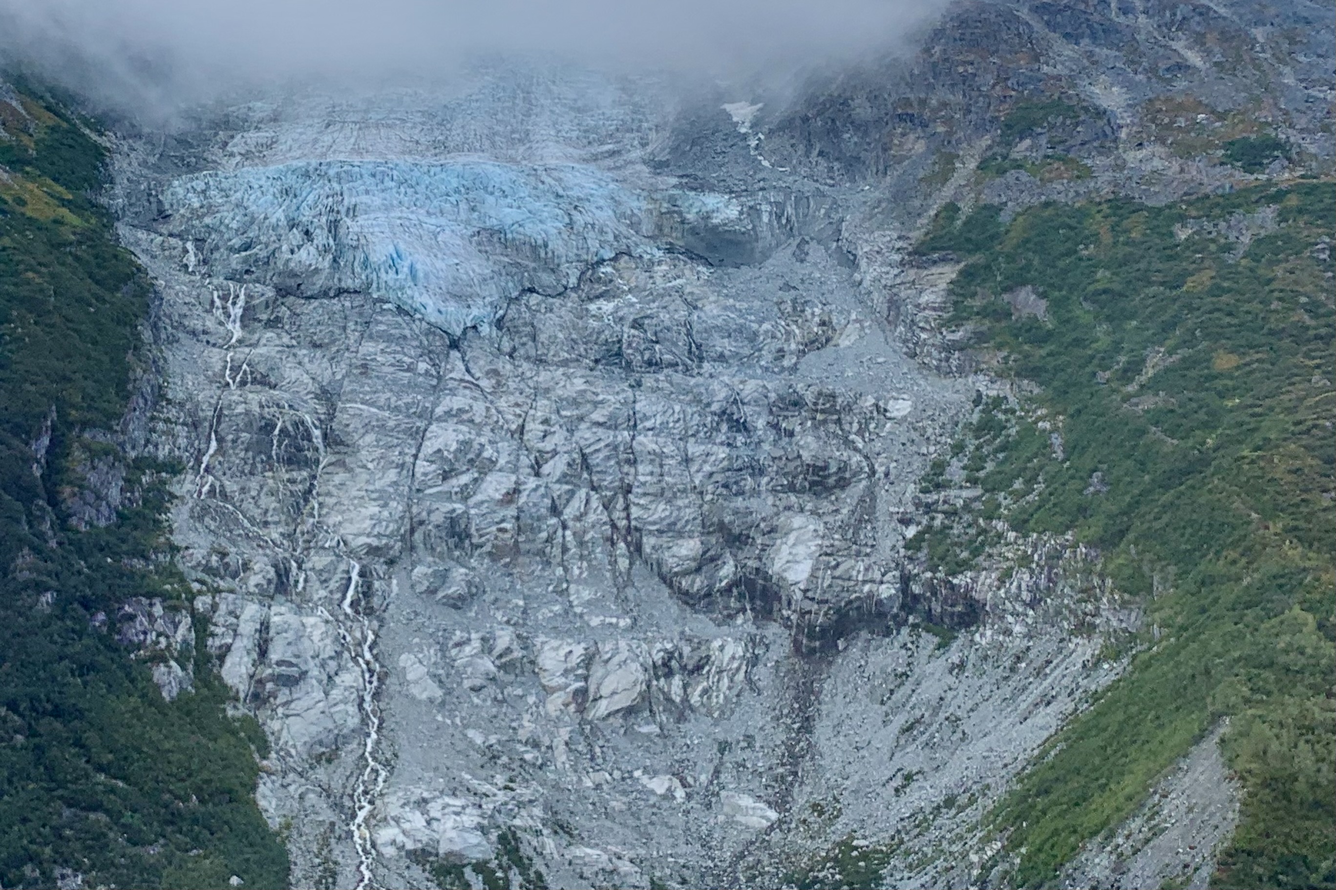
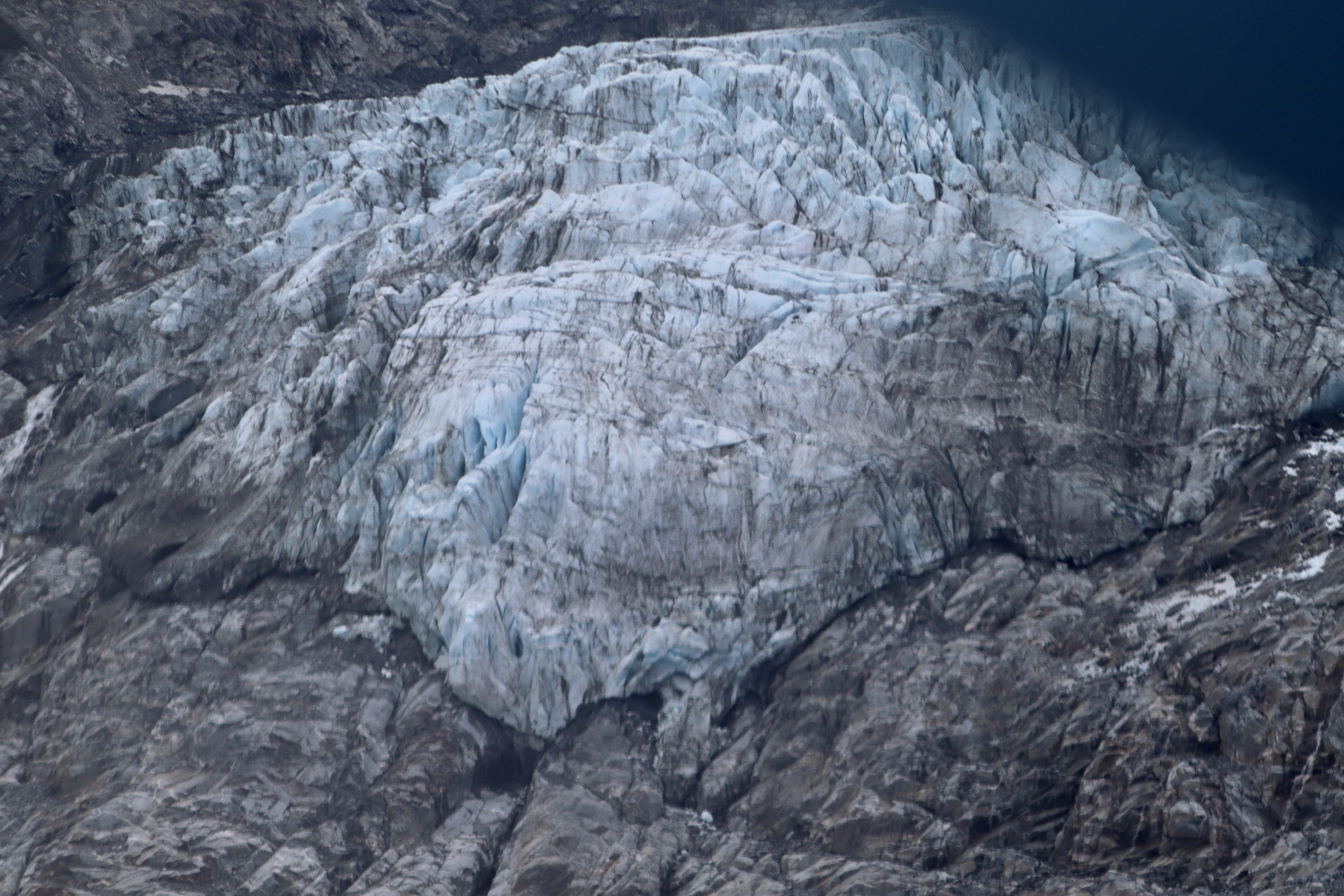

Many of these frozen rivers (valley glaciers) we saw snaking through the valleys and many of the ones we were viewing contain a fair amount amount of rock and debris that it devours as it slowly scours the surrounding terrain when moving down the valley. Additionally a lot of pollutants, dirt and dust is picked up from the surrounding terrain and becomes embedded causing the dirty streaks of various colors. I was thinking they definitely could use a dust up of fresh snow. Appearing static from above, it is difficult to imagine that they are a grinding machine, ever so slowly marching down the valley (though actually there are some glaciers that go down galloping).

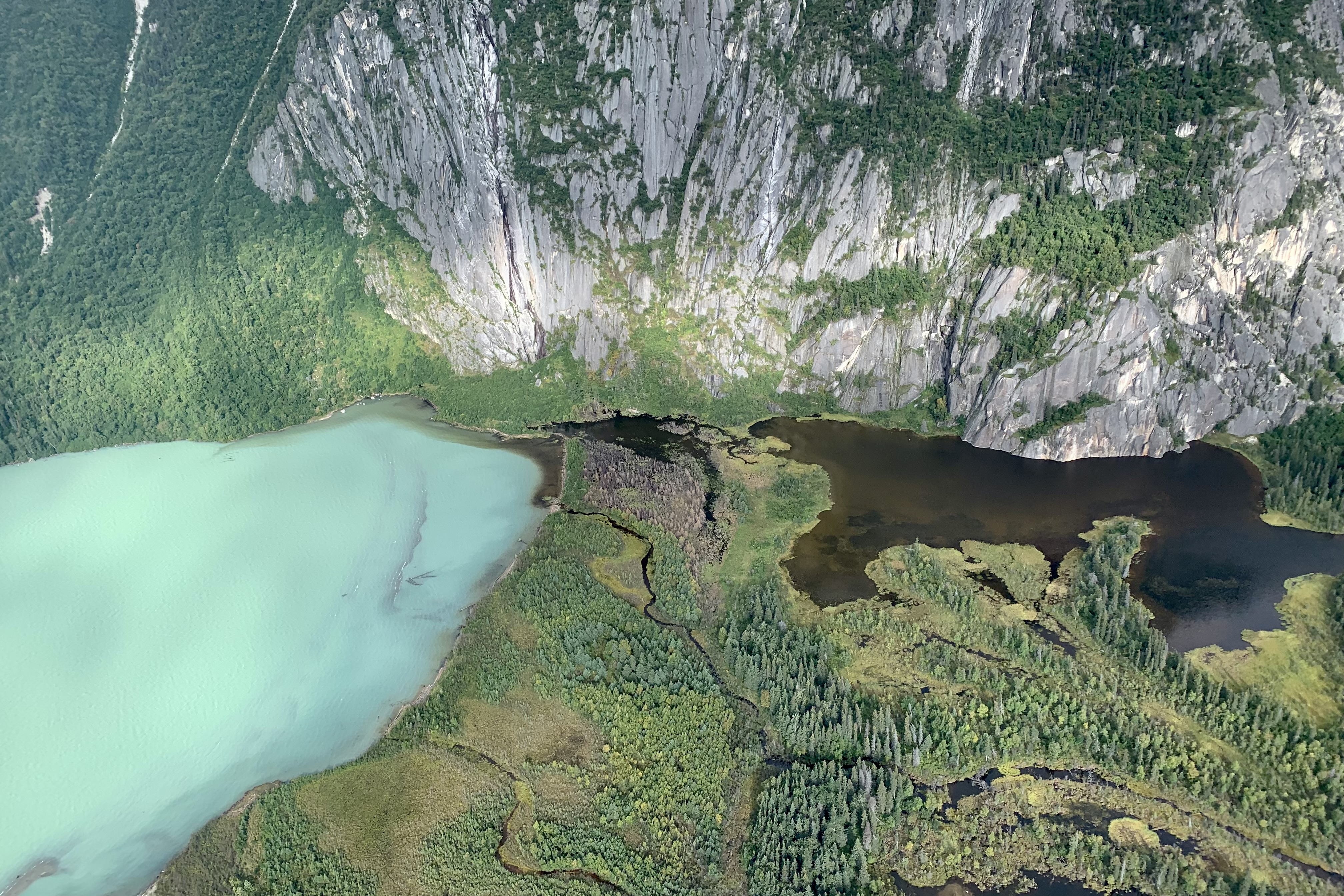
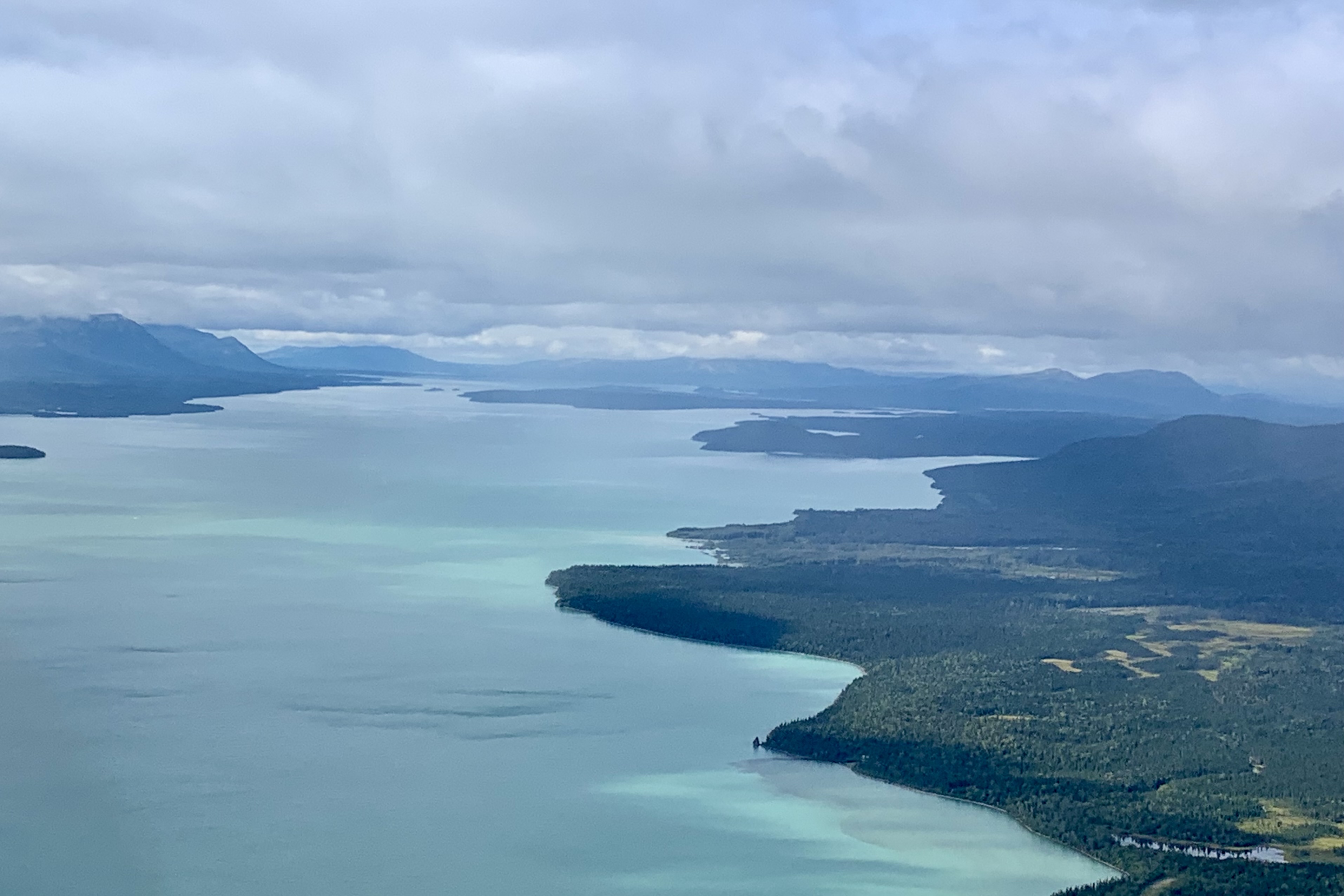
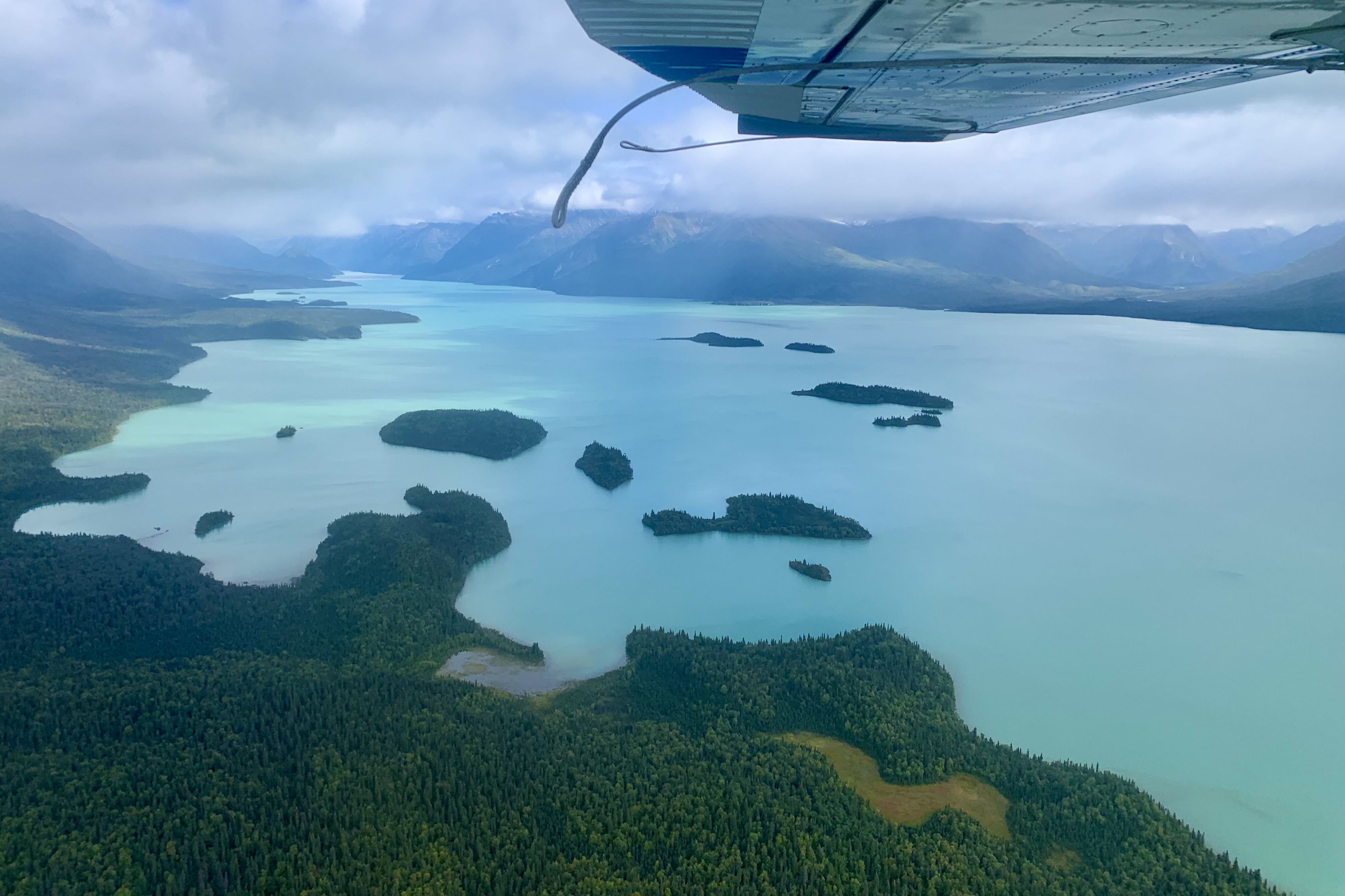
This was a day of criss-crossing the Chigmit Mountains and eventually we headed west towards Kijik Lake, re- crossing Lake Clark, which is always a treat with views of it’s aquamarine blue waters.


We were soon “water skiing” on the surface of Kijik lake and our lunch destination. Our guide must have sensed my unasked question “Where’s the fire?” on this Fire and Ice Tour.” As we were settling into our chairs to enjoy our sack lunches, he appeared with a bunch of kindling and proceeded to build a “boy scout” teepee fire” with very wet twig. Well it wasn’t exactly a roaring success but it did keep away any of the pesky flying insects that had an invested interest in visiting us. Though I probably would have jokingly whined about the lack of fire, it removed any possibility that I could successfully do so.
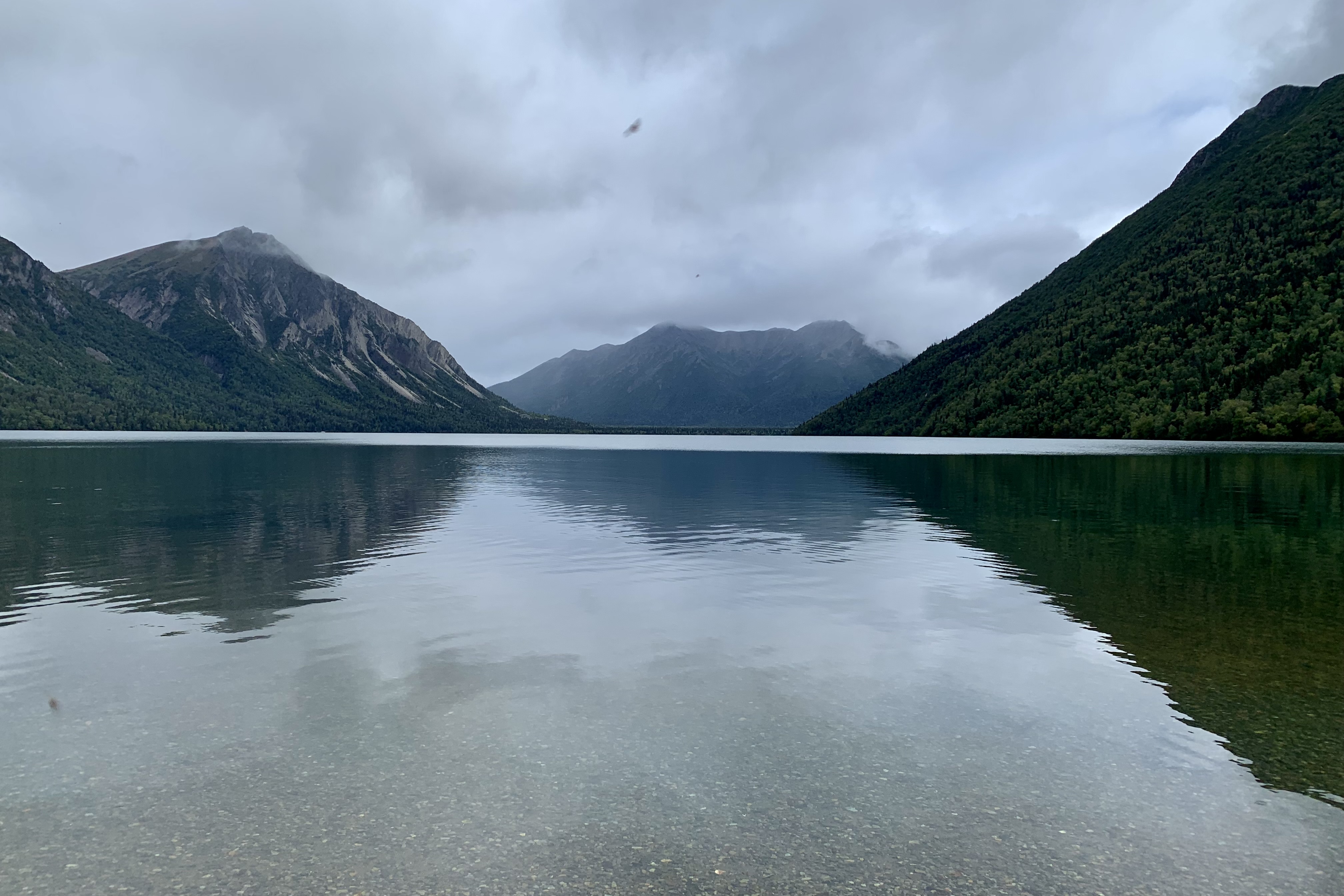


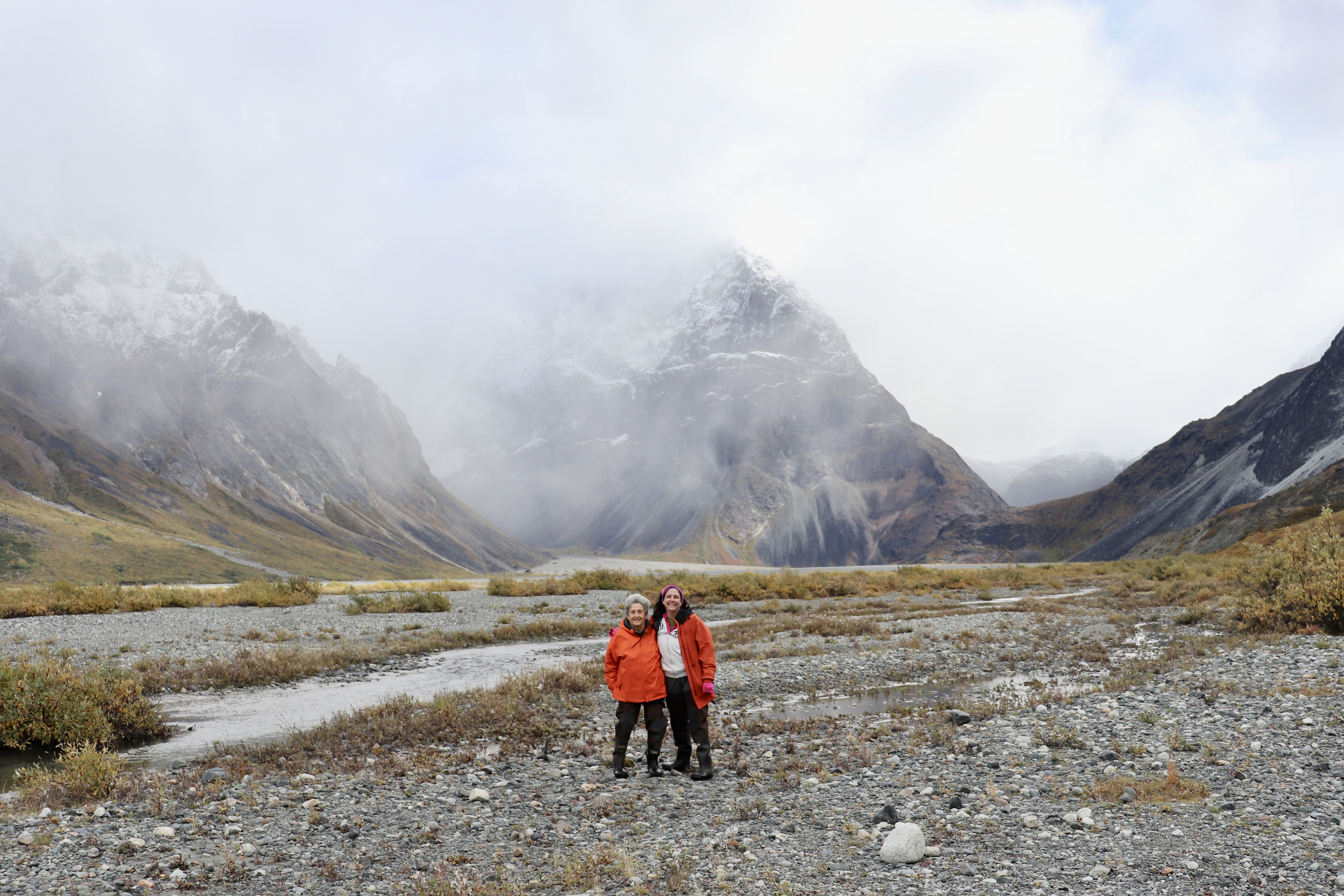
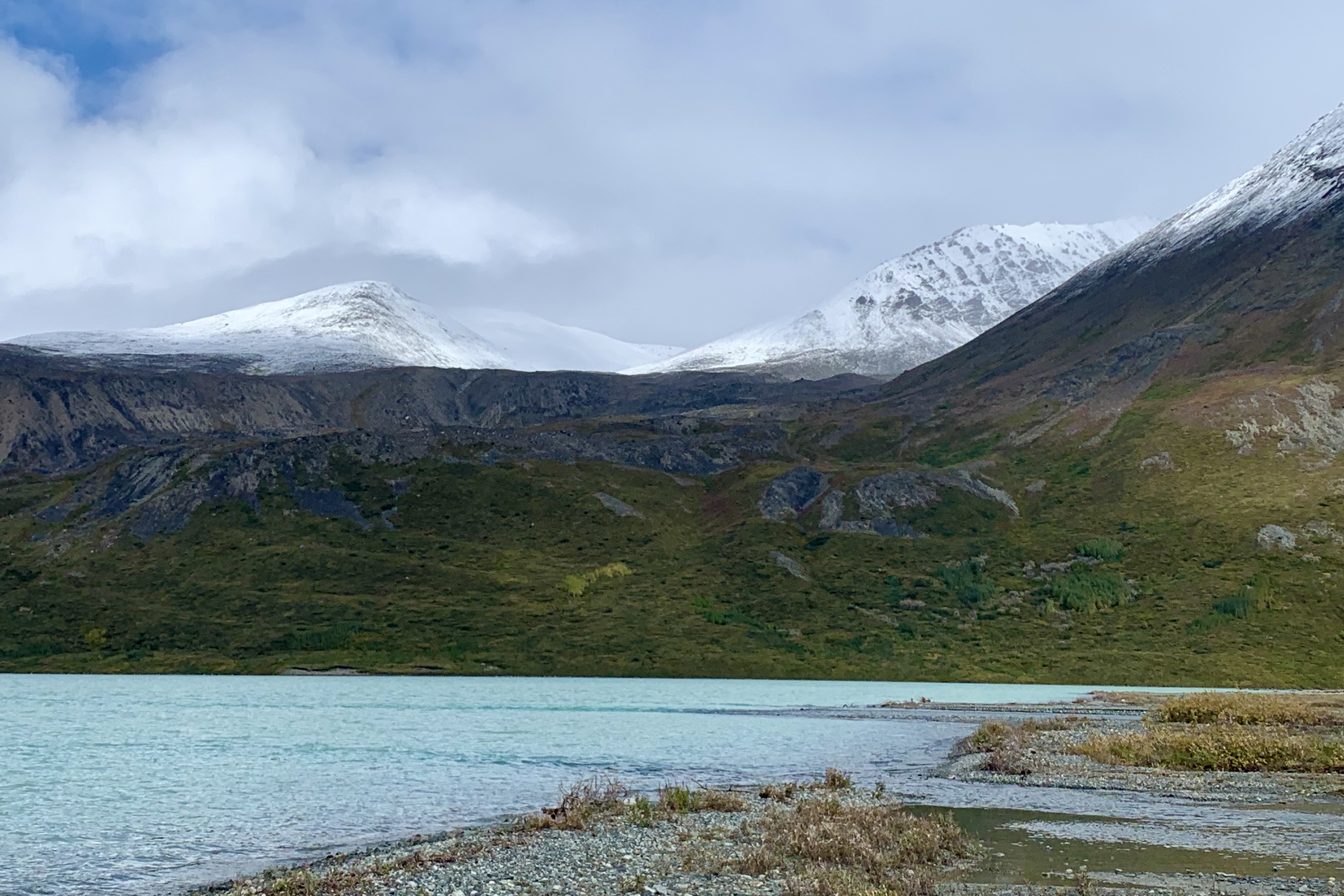
After a not so rousing fire experience, we headed north upon the Kijik River Valley over the beautiful watershed area of Twin Lakes, Turquoise Lake, and Telaquana Lake. Our landing destination was Turquoise Lake which is guarded by 8,000 foot high snowy peaks and Telaquana Mountain to the east and primarily tundra to the west. However on this day it was not quite the famous turquoise that is used in describing it’s allure as the brilliance depends on the absorption and scattering of sun light as it is reflected off “glacial flour” suspended in the water. There was an absence of sun for this visitation! Since the lake is at relatively high elevation, the vegetation was sparse and it was quite chilly out. This was our first lake where we could actually do a walk about and we made our way up through the channels of glacier runoff. These meltwater streams cut many shallow channel through this stony “beach” feeding into Turquoise Lake.


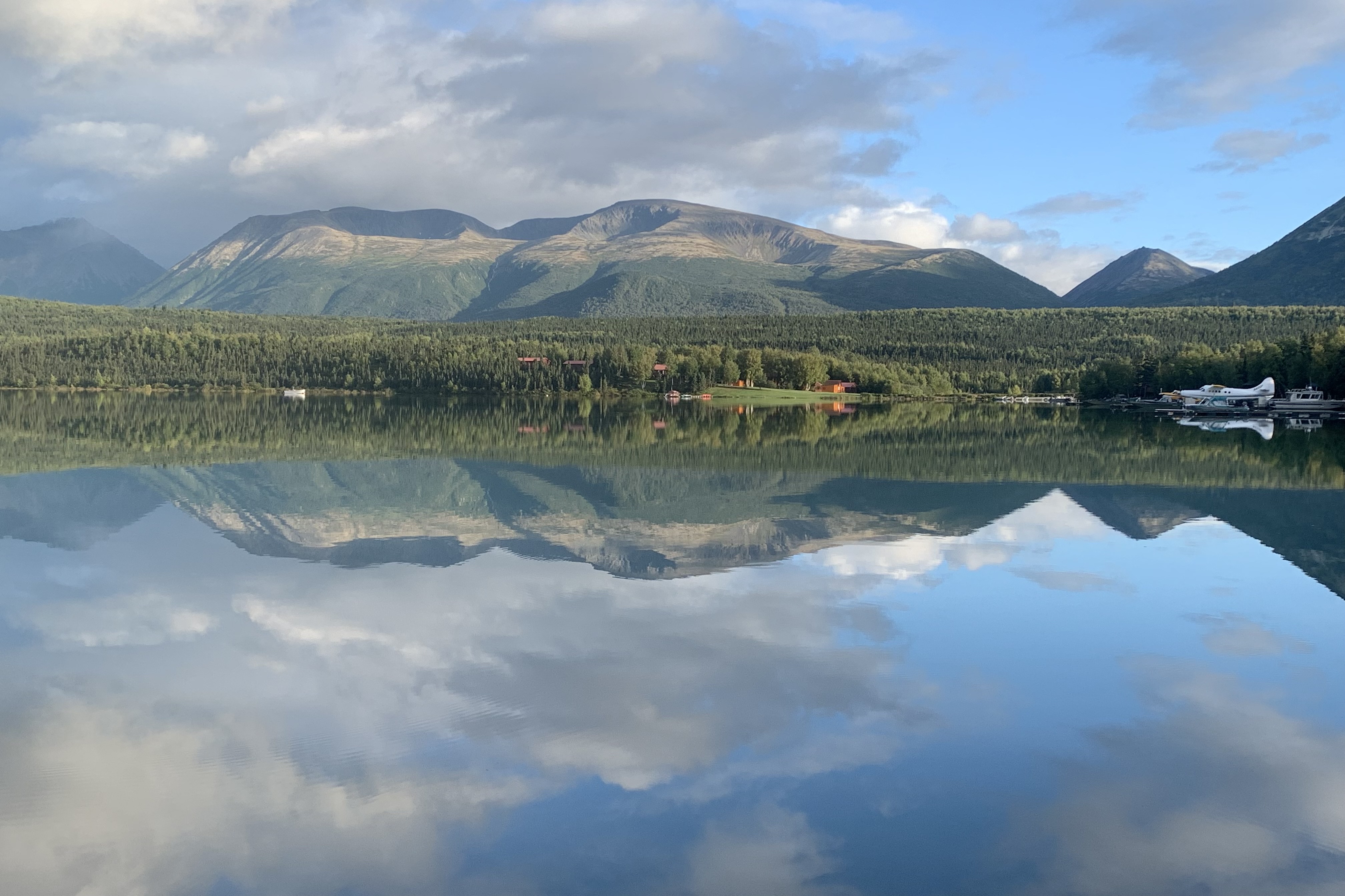
I would have loved to wander that area and head up towards the glaciers but time and weather dictated our return to the Lake Clark area. Nearing Port Alsworth we spotted a moose in a small lake below. Our pilot circled lower and as we returned back over this lake for our photograph of the moose it not so obligingly dove under the water leaving the mud trail pictured below. “Home ” for the evening at our accommodations, Lake Clark Farm Lodge, was always a peaceful and serene experience enhanced by the stunning reflections on the Lake and a rainbow over the far mountains,.


You have experienced Alaska as no other! I hope when all of your travels are over, that you share with as many people as possible. I love riding along with you. Thanks!
LikeLike
I wonder what all of the glaciers will look like after 50 more years of global warming? Thanks for all of the beautiful pictures of your journey.
LikeLike