
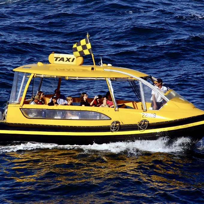
No Uber or Lift drivers or taxi cabs there. Not even a water taxi. An article I read stated one would need to hire an air taxi to get to both Gates of the Arctic and Kobuk Valley National Parks. Now, when I hear the word taxi, I conjure up pictures of a gaudy Yellow Cab, the driver laying on the horn, idling in a massive traffic gridlock on New York City Streets (or Chicago Streets etc.…). Hiring an “air taxi” in Alaska is not exactly like hailing a cab on a busy street corner. Perhaps that writer was misled by the term “Gates of the Arctic,” picturing something more akin to Gateway Arch National Park or the Golden Gate Bridge. As an aside, be it known up front (in case you are anticipating an awesome photo), that there are no actual gates in Gates of the Arctic National Park.

In deciding how to visit these parks, I knew I would most likely have to come in by plane, our rather multiple planes and thus quite expensive. Actually, it is possible to access the park by hiking in from the rugged Dalton Highway – the closest road to the Gates of the Arctic boundary, but a hike in this remote and challenging landscape could not be taken lightly and definitely not for either the feint of heart or novice hiker. Probably a fair amount of bushwhacking, several cans of bear repellent, and orienteering skills would be in order as well. Once in, there would be no roads or trails, campsites, visitor centers, public facilities or lights.


Another way to explore Gates of the Arctic, would be by floating one of its six wild rivers: John River, Noatak River, Kobuk River, Alatna River, Tinyaguk River, and Koyukuk River. Of course this would also require being flown in with ones inflatable raft or canoe. In years gone by, I might have considered one of those options, chance taker and reckless adventurer that I have been, but at some point my rational sobersided self took over and I opted for the definitely more sedate approach to my latest park chaser adventure.
An other consideration when traveling in this remote area…is to look at Air Miles vs. Road Miles vs. River Miles. In the early days of pioneering Alaska, about the only mode of travel would have been by river. As I gazed down at the rivers snaking and slithering about the tundra, it would have been a very long and roundabout journey. Once the Dalton was built it was almost a “strait” shot north but getting anywhere else wouldn’t involve “off-roading.” So with the advent of bush planes and float planes this wilderness became much more accessible.and the shortest route for point A to Point B.

Back to my issue: So why not use the classic tried and true, good old fashioned term BUSH PLANE, for that is its destination: the BUSH (defined as a large uncleared or sparsely settled area such as in Arctic tundra, usually scrub-covered or forested). A bush airplane is used to provide passenger and flight services to remote, undeveloped areas, such as the Alaskan tundra, the African bush or savanna, Amazon rainforest or the Australian Outback. So I took a BUSH PLANE, getting to this dramatic landscape, with its endless space, wetlands, rivers, and serrated peaks, it’s remoteness and isolation. This has been described as nature at its wildest.
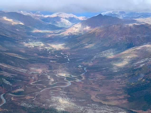
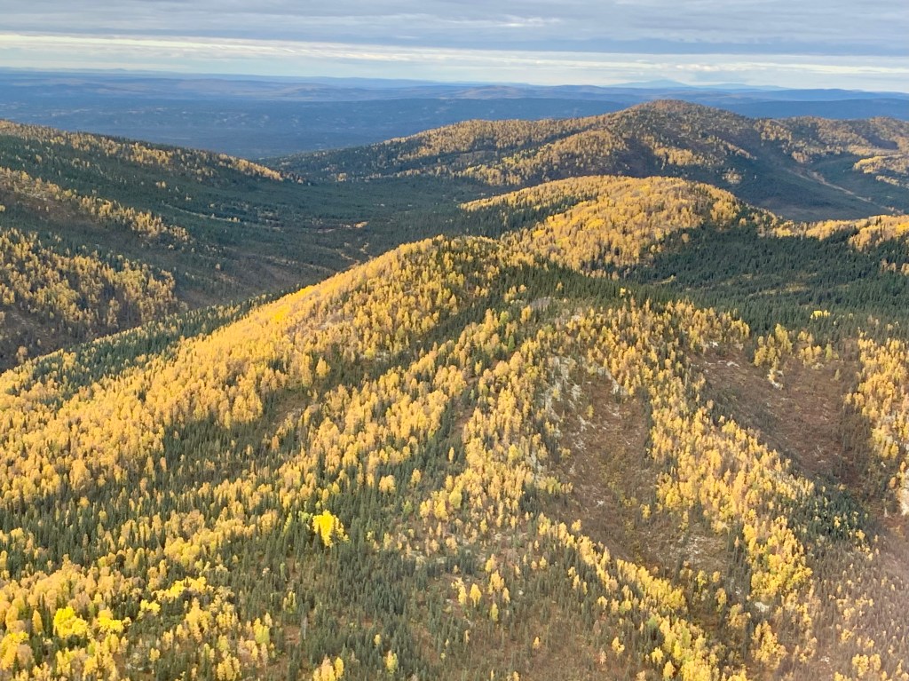
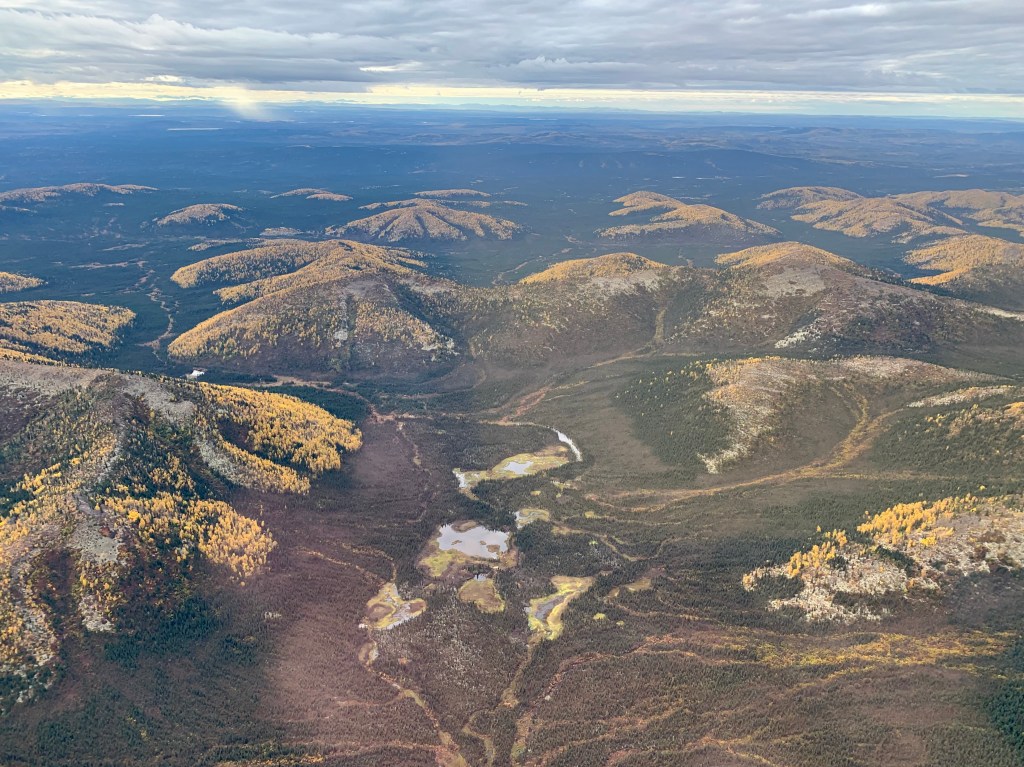
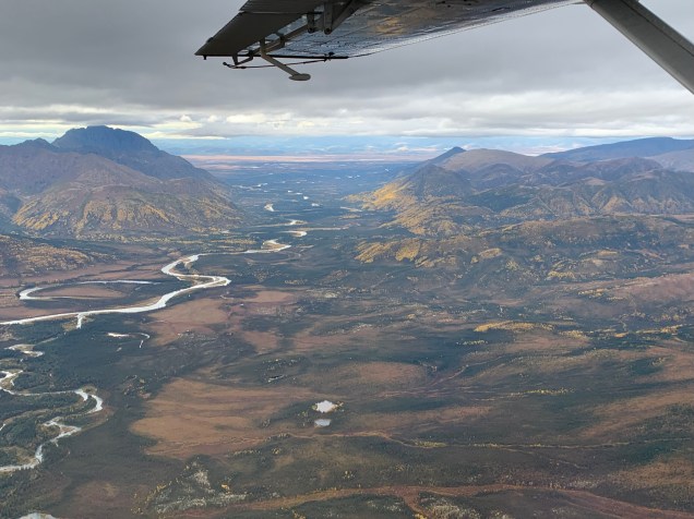
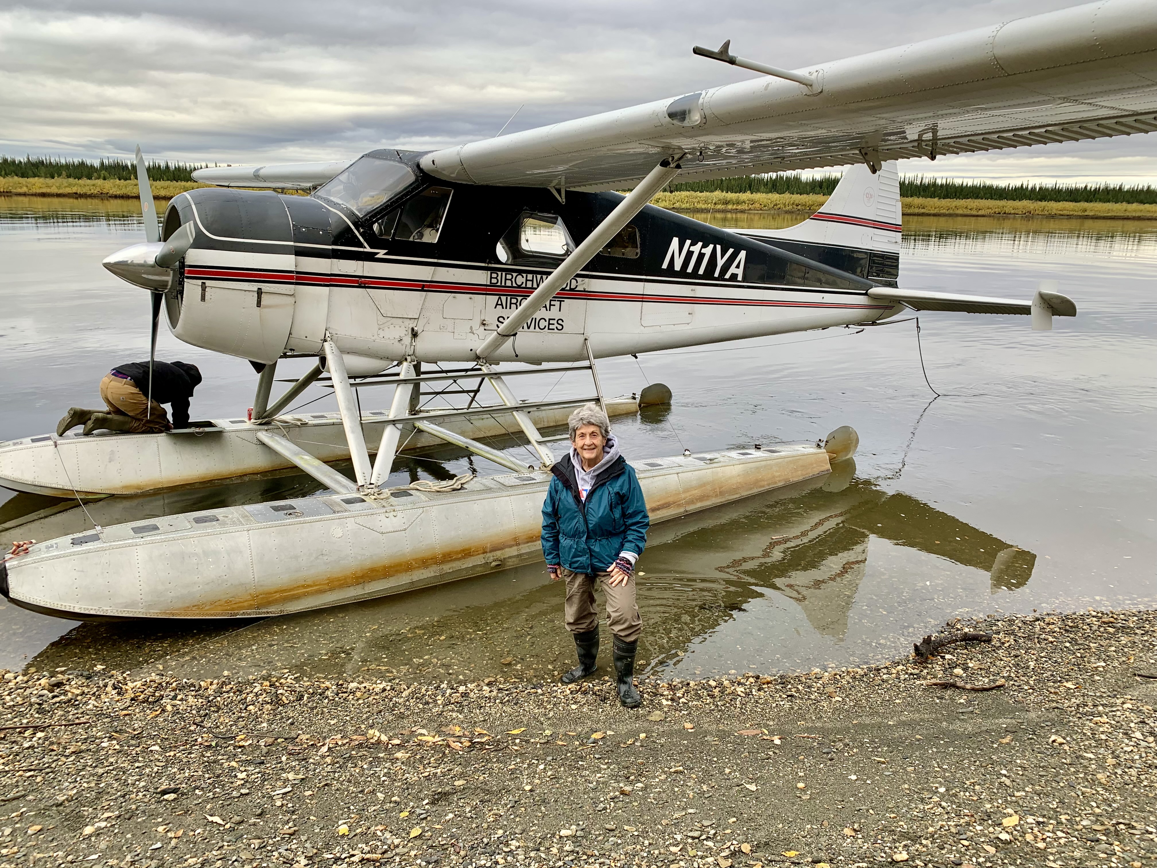
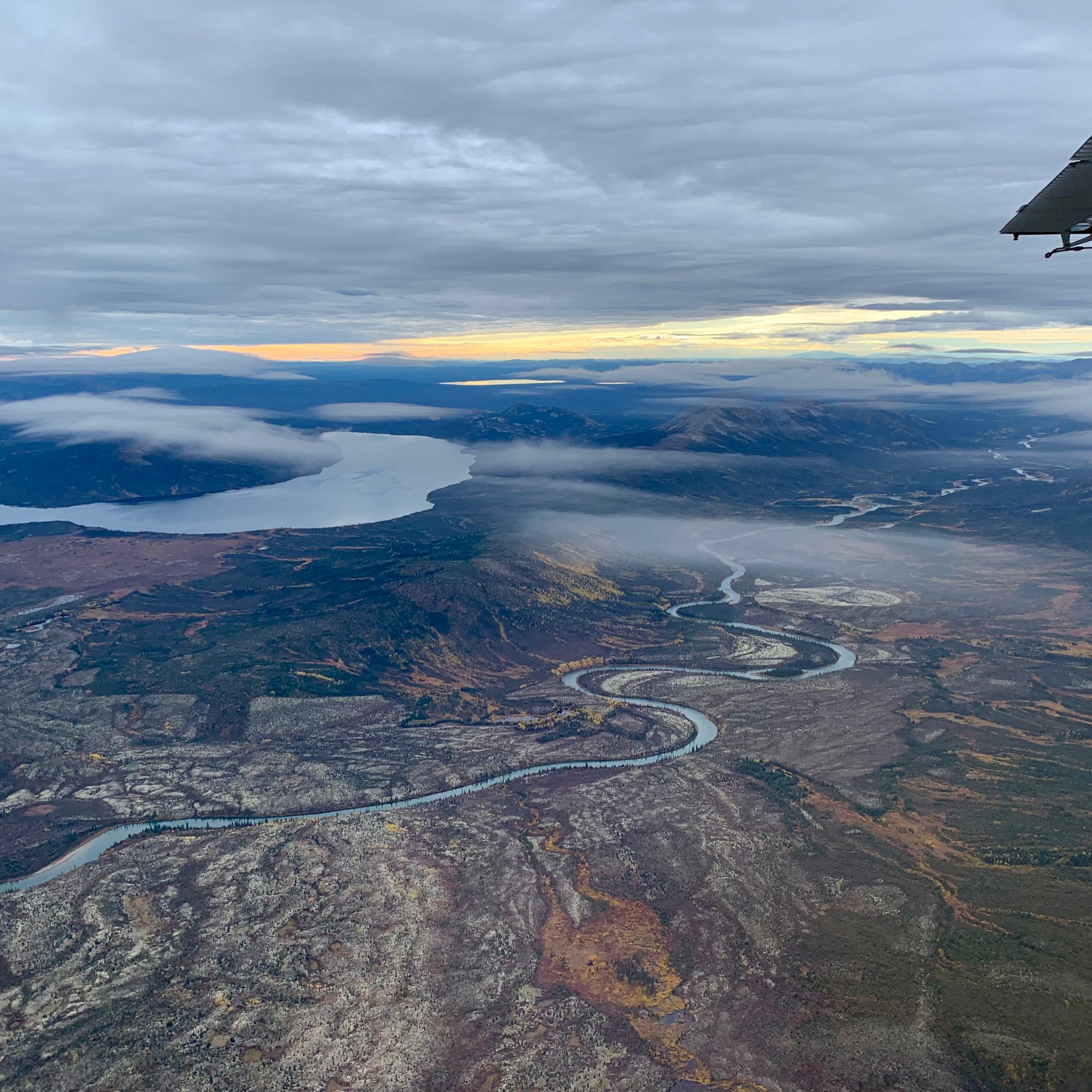
The morning of our planned park hopping expedition out of Bettles by bush plane to both Kobuk Valley National Park and Gates of the Arctic National Park was fraught with anxiety. The weather did not look promising as there was significant cloud cover in the area of Bettles. Though I am usually that pollyanna-ish sort of person, it had been an extremely wet summer with record rainfall in many areas of Alaska, so I was beginning to feel despondent. I was astonished when our pilot gave us the thumbs up and our flight seeing adventure was a “GO.” Seems the weather up farther north in the Brooks Range was considerably better so it wasn’t long before Kris, Rob, Teresa and I were climbing aboard our floatplane a DeHavilIand DHC-2 (which in this case, I maintain is my bush plane atop two pontoons under the fuselage). Now, I learned that this was an aircraft that was preferred by bush pilots but also it was a relatively old aircraft. The manufacturing of this craft ceased in 1967 so even if ours was the latest model it would be 55 years old. Now I definitely would not drive a 55 year old car. And since I was not about to give up this flight, I transposed my chronological body age at 55 years onto this aircraft’s age at 55 and determined that it would be an awesome safe ride since I was well tuned and healthy and did my first triathlon at 55 and my last Ironman at 69. Age isn’t everything. It still had lots of life and miles to fly. I only doubted this analogy once when the engine stalled out ( my adrenaline went into overdrive), though the pilot had it rectified long before I finished my Hail Mary. Our very accomplished pilot kept us flying as low as safety permitted, given the air currents and clouds. What an incredible montage the land gifted us with as we floated over its profuse wetlands, serpentine rivers, deep valleys, mosaic of trees, shrubs and low tundra vegetation, and rugged mountains.


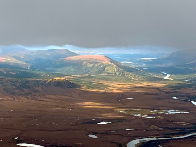
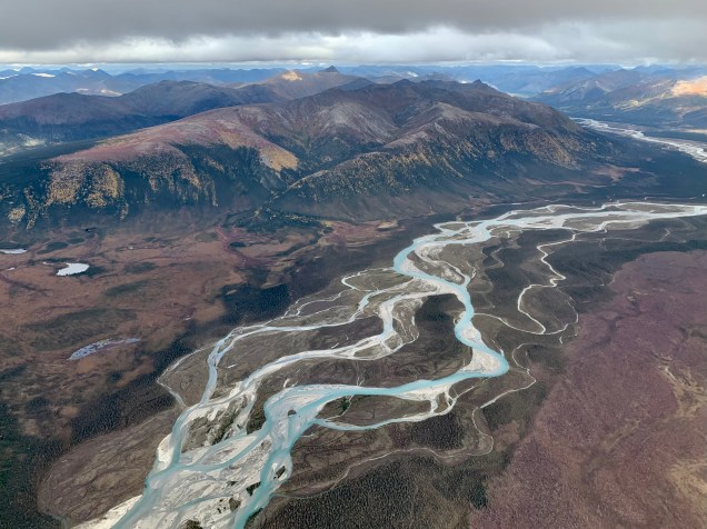
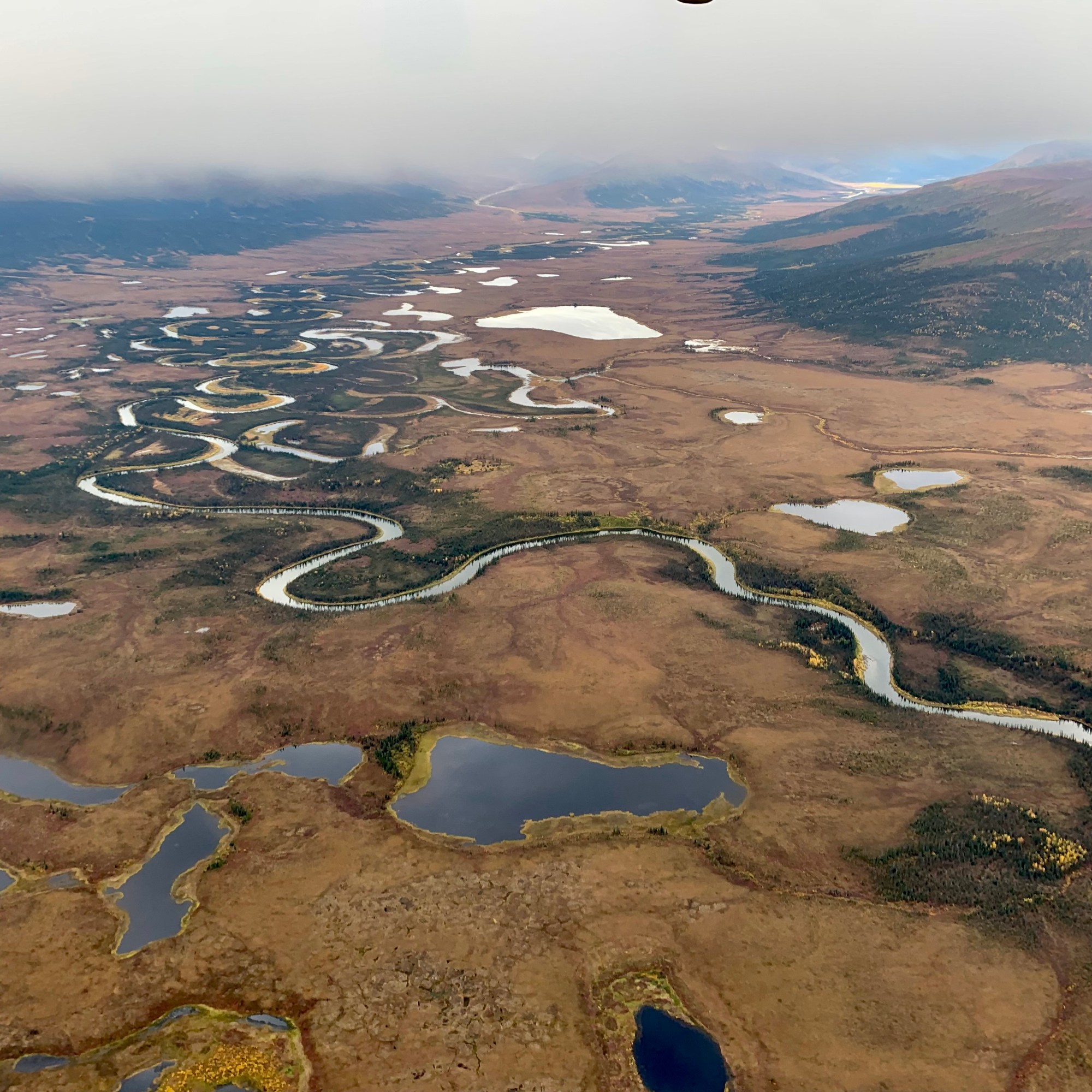
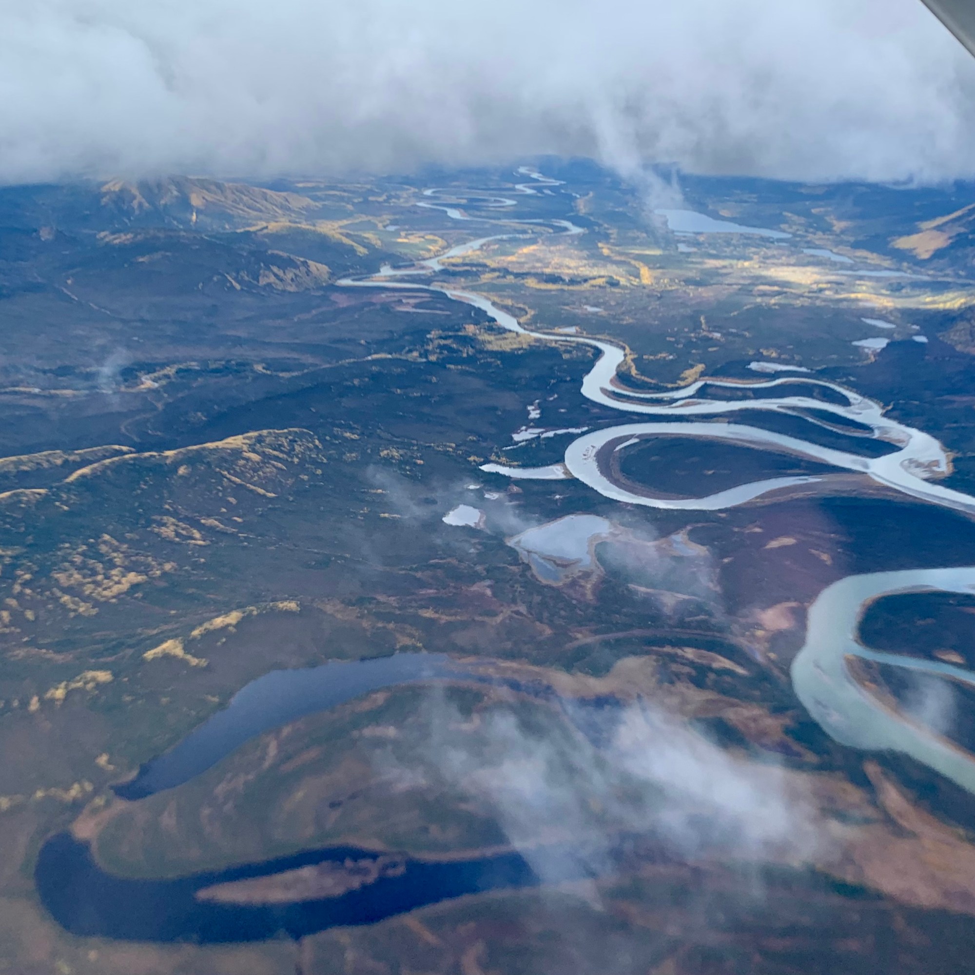
We flew over Gates of the Arctic NP on the way to our first landing at Kobuk Valley NP. Gates of the Arctic NP is oft described as a true pristine wilderness, the final frontier of modern civilization. In this vast landscape (8 million acres), there’re no roads running through it (yet) or trails other than those blazed by caribou migrations. Thus it is no surprise to learn that it is both the northernmost and the least visited of the 63 national parks with 7362 visits in 2021 (ironically, the second fewest visitors is the southernmost America Samoa National Park in a remote part of the South Pacific, 14.3 degrees south of equator with 8,495 recreation visits).
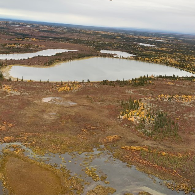
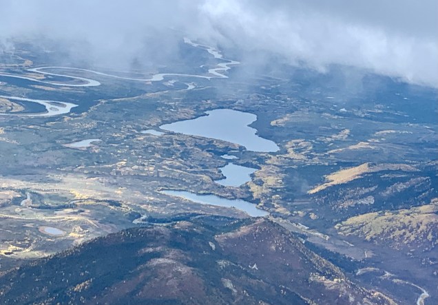
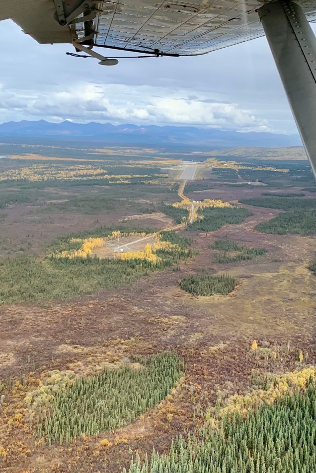
This true wonderland (nothing akin to Fantasyland or Tomorrowland “a la Disney”) is almost the farthest north you can go in the U.S. and I almost made the mistake of thinking this is unhabitable and thus uninhabited. Not so, as we saw several isolated villages and their gravel airstrips and learned that this land has been occupied by the Inuit people through the ages. Several tribes continue living within it. They survive by living in this land as indigenous people have done for thousands of years, sharing the landscape with the caribou, wolves, grizzly bears and those big shaggy musk oxen (and bush plane cargo deliveries). So I sat back and feasted my eyes on the the jagged peaks, gentle valleys, wild rivers, numerous lakes seen below:
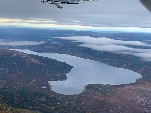


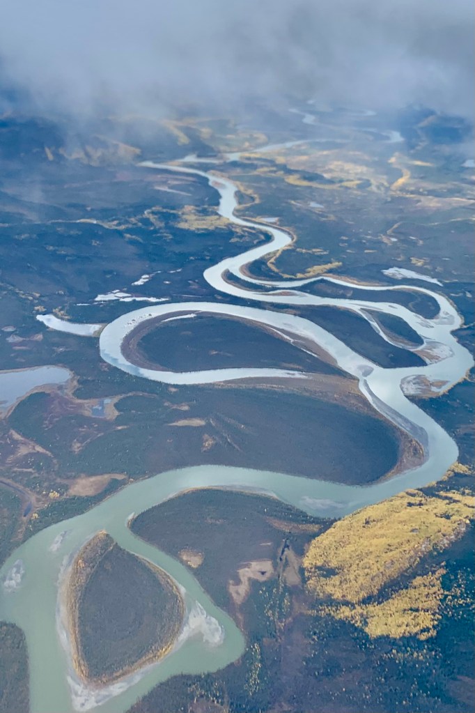
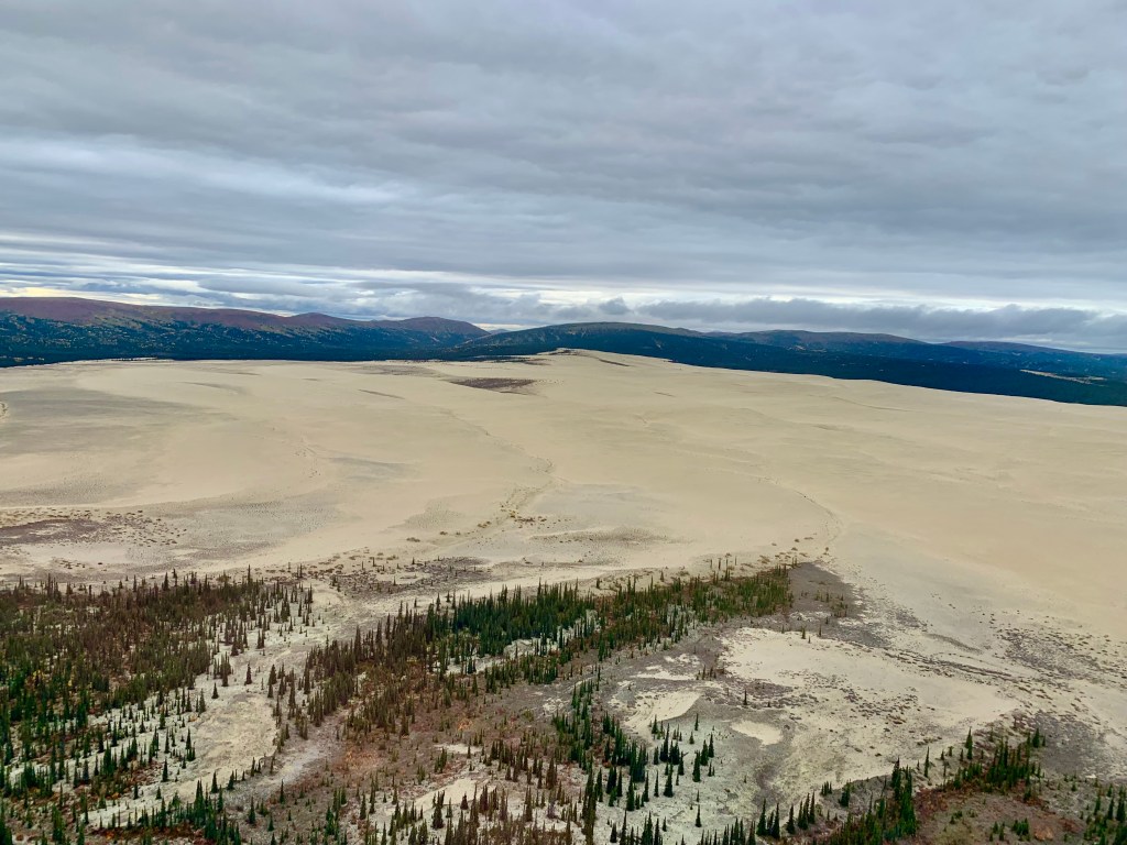
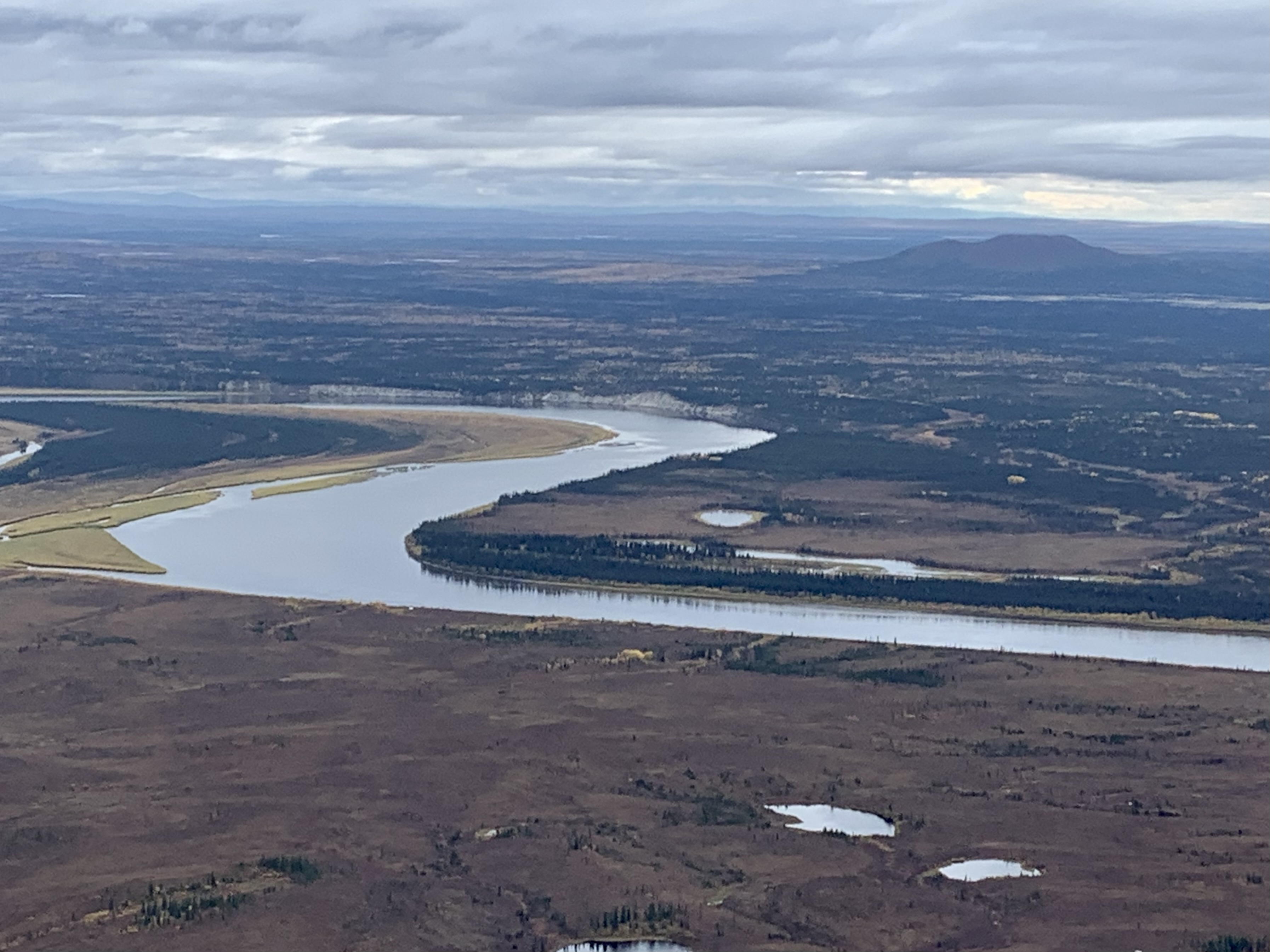
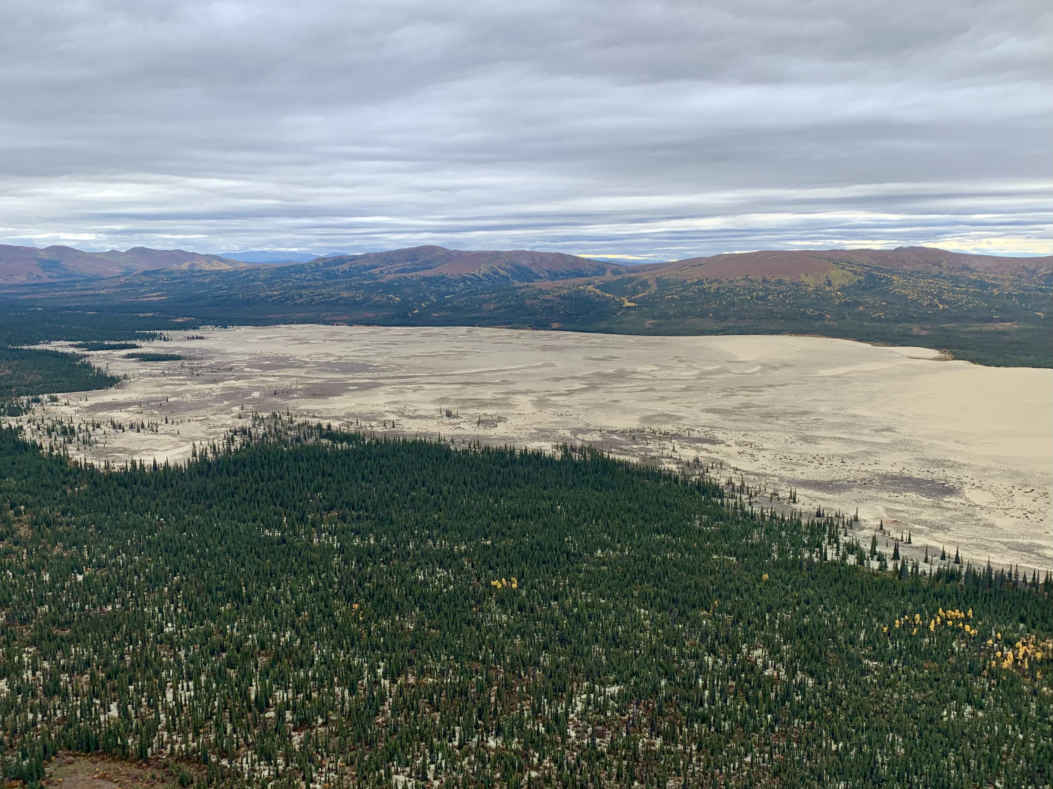
Kobuk Valley National Park has slightly more visitor (#3 @11,540 recreation visits in 2021). Here also, there are no roads, campgrounds or entrance gates for this 1.75 million-acre expanse. The meandering Kobuk River creates beautifully curved patterns visible from the air. It would have been most exciting to have seen some of the half a million caribou which migrate through this park crossing, 2x a year, the Kobuk River and and the Great Kobuk Sand Dunes in the middle of the Artic… I was hopeful because they migrate late August to October but the they don’t migrate when the director calls “roll it!” on command Disneyesque style. I thought I had visited all of the national parks that featured sand dunes (White Sands NP, Great Sand Dunes NP, Indiana Dunes NP). So it was amazing to see the Great Kobuk Sand Dunes, formed from retreating glacier deposits and winds sweeping sand from the sandbars of the Kobuk River. Three sets of dunes cover more than 20,000 acres, with drifts upwards of 100 feet high. I had not anticipated a wind swept desert in middle of these wetlands but this is the largest active, high-latitude, dune field on earth. A significant swath of this area has now been stabilized by vegetation and comprises the southern portion of Kobuk Valley.

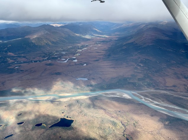
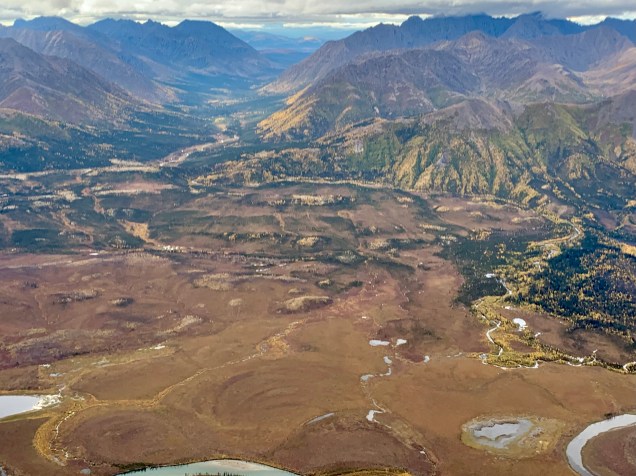
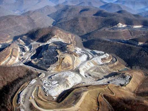
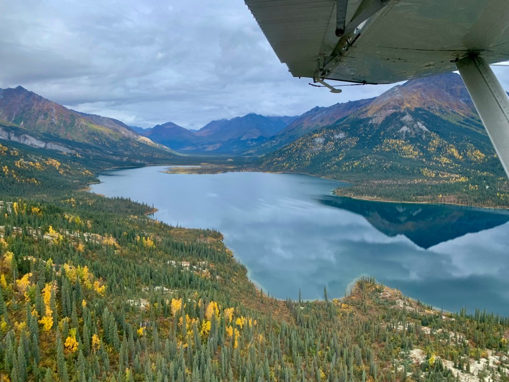
The flight seeing adventure continued as we wove our way back to a lake landing on Walker Lake in Gates of the Artic NP. As I continued to gaze at what is basically a pristine wilderness pictured below , the topic of the Ambler Road Project was brought up by our pilot as he was pointing out mines in the area.
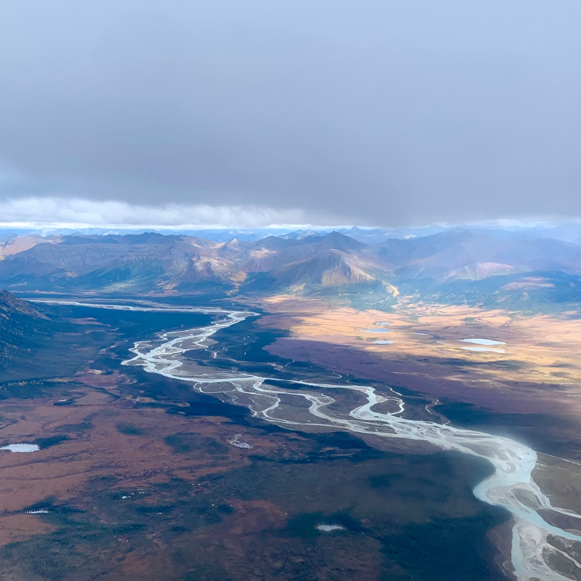


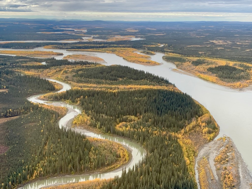
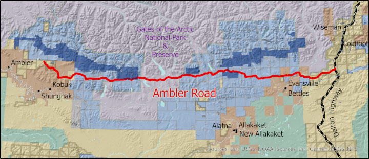
For example, the Alatna River was identified during our flight and is a federally designated wild and scenic river partially contained within the boundaries of Gates of the Arctic National Park, Alaska. It has been described as a mellow river, a gorgeously beautiful river, a wildly meandering river, with the scenery ranging from mountain peaks to hilly boreal forest. Lake Anirak, is a Native Alaskan language means “place to go out” and is located in the Ambler Lowland of Northwest Artic Borough amongst the abundance of other villages, lakes, and rivers. I mention these because I wonder if there will be the same (positive or negative) outcomes with the building and completion of the Ambler Road Project in the southern Brooks Range.
Gates of the Arctic National Park and Preserve was to be managed “to maintain the wild and undeveloped character of the area… to provide continued opportunities, including reasonable access, for mountain climbing, mountaineering, and other wilderness recreational activities.” How is this road compatible with maintaining its wildness whether it is within the park boundaries or in the vicinity? But the rational side to myself also can understand our current dilemma with supply chain issues and that the political instability and distortionary trade practices in the world today pose an increasing threat to disrupt America’s critical minerals supply chain—with domestic development as the solution. For those not interested in the environmental politics of Alaska and this project skip ahead as more details on this project follow.
This proposal is for the construction and operation of an approximately 200-mile long all-season controlled-access industrial road connecting the Ambler Mining District with the Dalton Highway and across a portion of Gates of the Arctic NP. I was immediately horrified envisioning the potential environmental, social and economic impacts upon wildlife, fish, and their habitat, and rural and traditional lifestyles including subsistence activities. I researched it a bit and a 50-year Right-of-Way permit for the full length of the Ambler Road was signed by NPS, BLM, and AIDEA in January of 2021 under the Trump administration. But in May 2022 the U.S. District Court for Alaska remanded the project approval to the BLM to conduct additional analysis stating the Trump administration’s review did not properly consult with tribal governments or consider subsistence and cultural concerns.
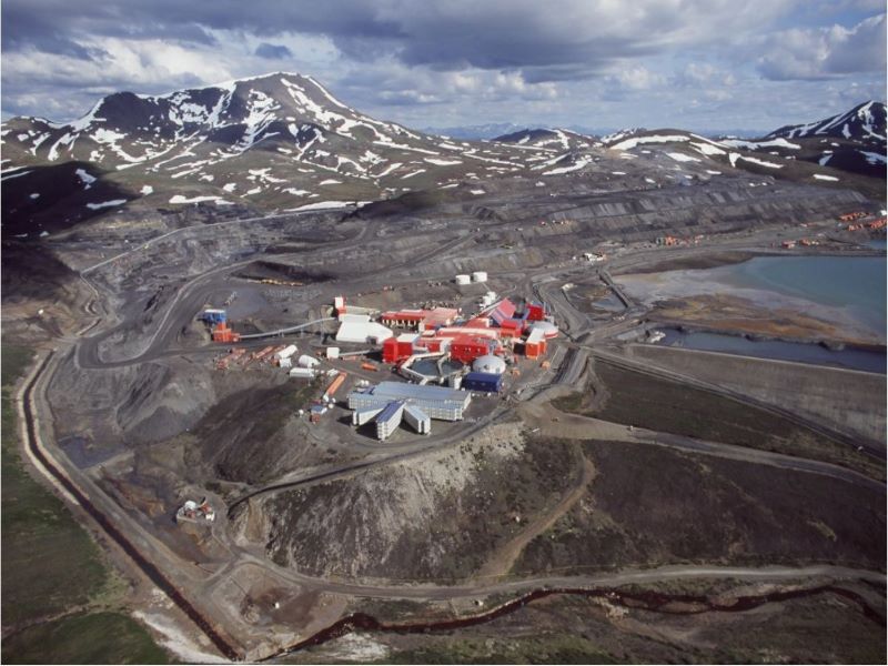
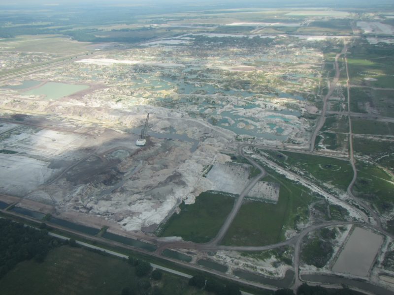
I considering the impact that production like this will have, I can clearly picture the material sites, massive amounts of equipment, construction camps for outside workers, frequent overflights and long-term maintenance camps, airstrips, drilling, fiber optic and radio communications lines, guard stations etc. which would all be needed to maintain this project’s restricted-access toll road with public access prohibited and irrevocably harming this remarkable landscape. We have all seen and oft experienced what similar operations like this (i.e. in AK the Red Dog Mine, phosphates in Florida, logging in Oregon, mining in West Virginia…) have wrecked on our land with toxic levels of waste, coal and metallurgical dust, erosion and wastewater discharge.

My understand is the road is to be built to enable commercial development of mines that would produce copper and other metals and transport them more cheaply. A prospectus anticipated this Arctic operation to reach 10,000 tons/day of material, with annual yields of Copper at 125 million pounds, zinc at 152 million pounds, lead at 24 million pounds, gold at 29,000 ounces, and silver at 2.5 million ounces. It is touted for its prospective copper-zinc mineral belt with deposits of cobalt, germanium, gallium, arsenic, palladium, lead, gold, silver, and platinum. These elements are essential for our nation’s tech-focused economy and military effectiveness from smart phones and solar panels to electric vehicles and airplanes. But it also opens up the area for future projects and roads to access other minerals and metals. Right now, this project appears to align with current federal policy to identify new sources of critical minerals, increasing activity at all levels of the supply chain (exploration, mining, concentration, and separation) and streamline the leasing and permitting processes to expedite the exploration and production of critical minerals. My internal “jury ” is out so in the meantime I refocused …

Since this was an issue which would have no resolution in the near future, I continued to gaze on the land below and to be awestruck by the geography of this area. Soon we were approaching Walker Lake for our picnic In Gates of the Arctic NP. It’s almost too much to take in, that there I was in this rugged, wet, and wild part of Alaska above the Arctic Circle, sitting on a rocky beach eating a turkey and cheese wrap and drinking a diet coke. The majestic and the ordinary entwined.


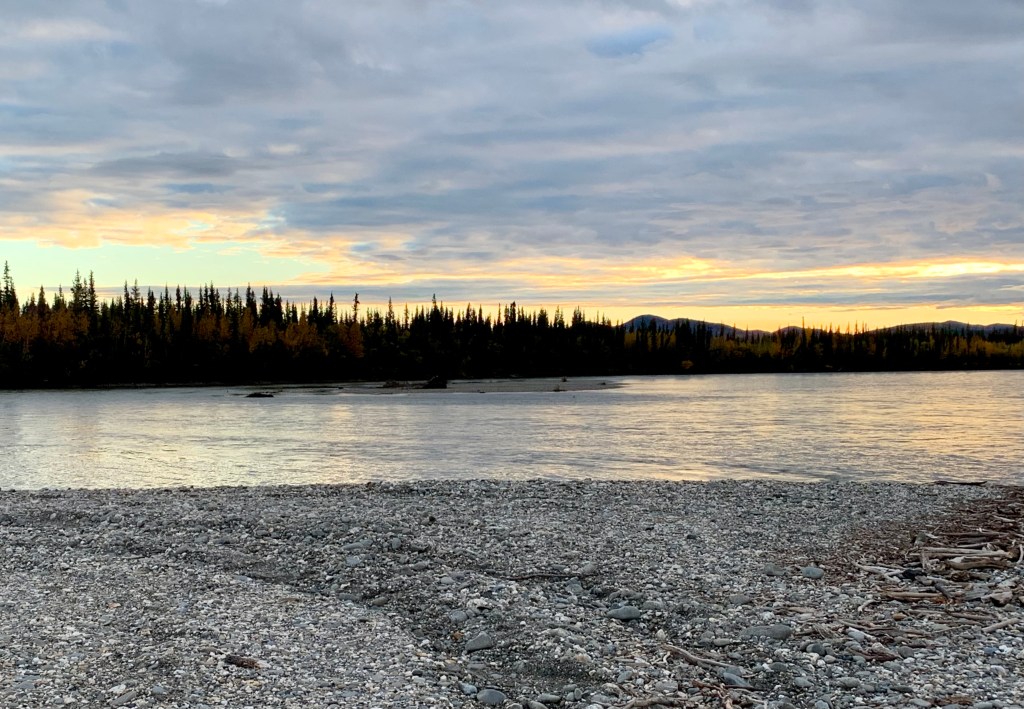
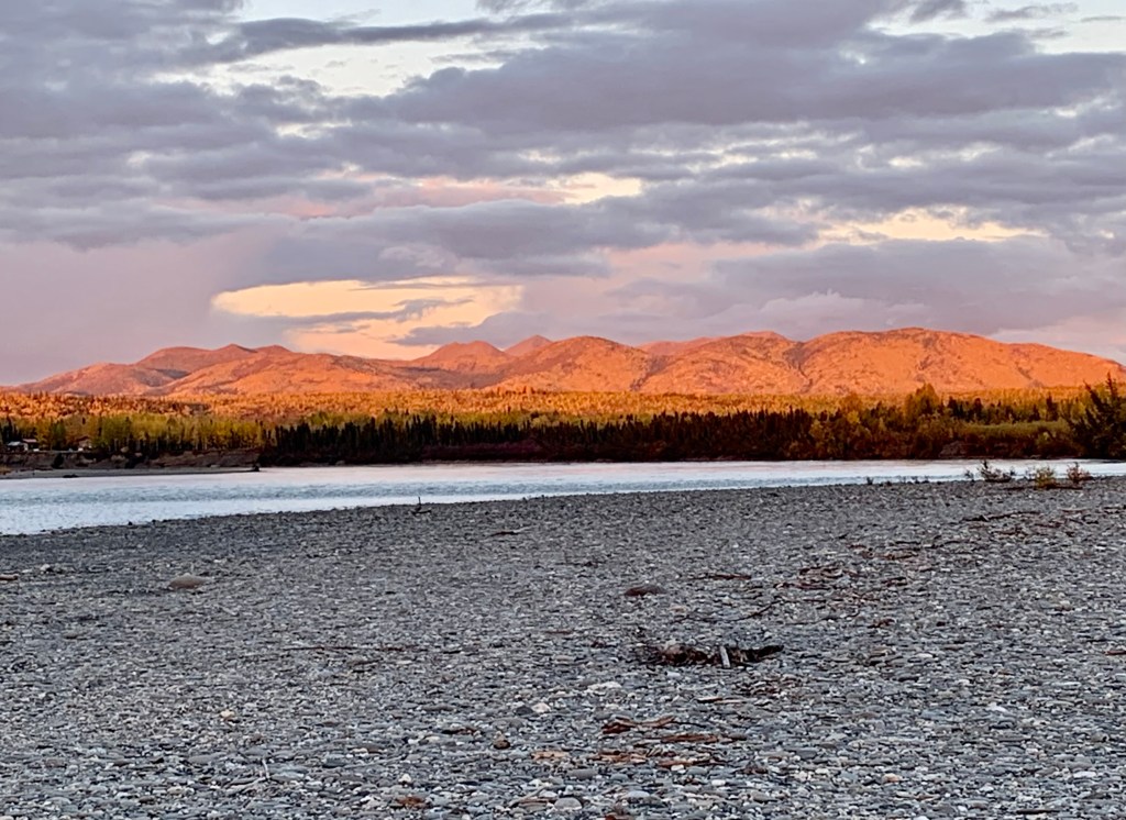
After exploring the shore for a while (making note of the bear tracks) it was time for our flight back to Bettles, flying quite low with hopes of spotting bear or moose. I must admit I was quite unnerved when it appeared to me that we were going to skim the tree tops. I kept reiterating to myself that this is an experienced pilot and he knows the size and whereabouts of his pontoons as I know the whereabouts of my fenders when I drive a car. Disappointingly, the local bear and moose residents did not show up for the “directors” on stage call. Later, after dinner, to top off an almost perfect day, there was a bonfire on the banks of the Koyukuk River and a brilliant sunset to meditatively end this extraordinary experience.


As always your observations and story telling take me right there. I hope they don’t ruin Alaska with government and corporate destruction on this beautiful land. We need to make due with what we already have and what we waste. As always, thanks for sharing. Diann
LikeLike
Really amazing photos! A great adventure. I was very interested to read about the dunes of Alaska- not exactly like Union Pier I guess.
LikeLike
Wonderful travel log I read with coffee this morning, very interesting. Thank you
LikeLike